1/31/2015
Topic:
Between the coast and ABDSP
rockhopper
|
Surf,
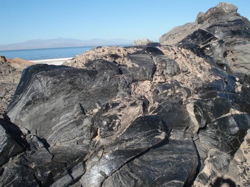
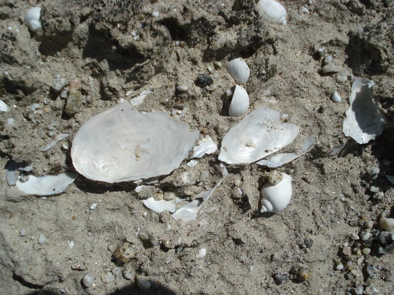
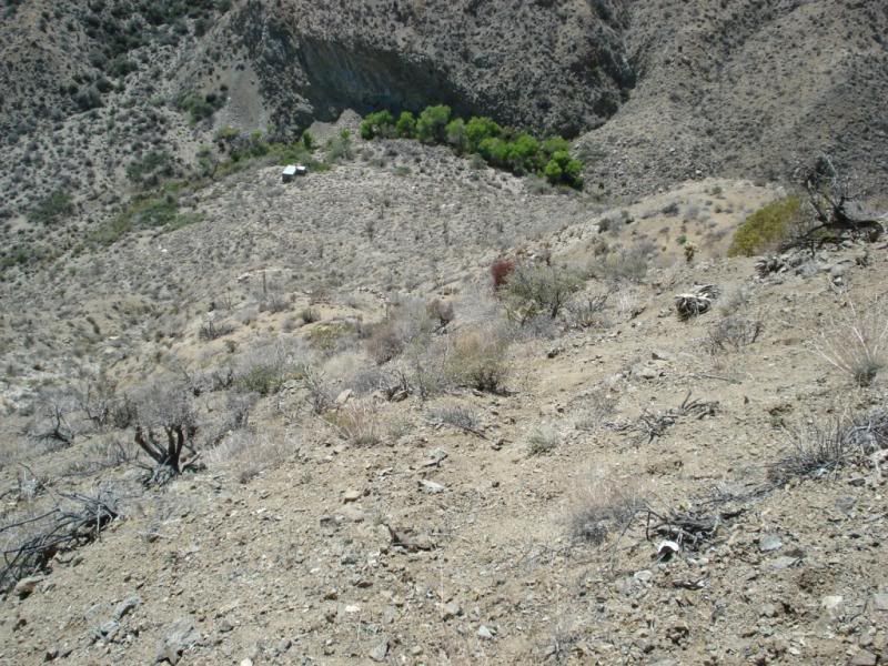
Yes inland Carlsbad and Encinitas areas. I was really surprised to see shell midden dumps over 4 miles from the ocean.
Anyway I am really looking forward to heading back out to the desert soon! Bush wacking and sawing through 80 year old brush near the coast is hard on the body ( scraps ,brusies , pokes in the face ). I figure I have a good 5 to 10 years of off/on trail hiking left in me before I switch to trail or open cross country only. funny,just a few more miles inland and the deer open up the open spaces with their trails and the going is a lot easier.
btw I will try to keep my post closer to the ABDSP area
Cheers |
1/31/2015
Topic:
Google Earth Pro is now free
rockhopper
|
Thanks, I saved as a favorite and will download later. Is it higher resolution ? |
2/2/2015
Topic:
Between the coast and ABDSP
rockhopper
|
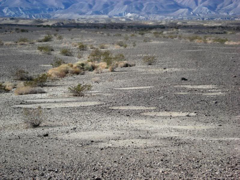
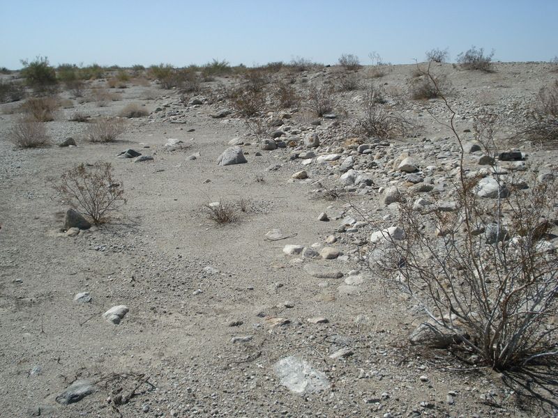
Haha. No I don't usually carry a large tape measure when I hike. I went back to a gulley I had previously been in to measure the depth below the surface to the shell middens and or artifacts exposed on the side of the gulley for a paper I am writing. The photos were from a series of mini-hikes within a 10 sq. mile area. |
2/4/2015
Topic:
Between the coast and ABDSP
rockhopper
|
Jim (ziphius) wrote:
Off-trail 'whacking' is so much fun, though I would resist cutting vegetation if it is going to establish new trails where none are desired by the local fauna. You ever run into marine mammal bones in these sites? Some sites are marked by vertebral discs of large whales. I recall stumbling across one on the Channel Islands, a big white disc a few feet away from a human skull. The archaeologists at the island were not amused when I reported the site to them, as they thought I was trampling through important cultural sites, when I was simply trying to count sea lions as part of my job. Now when I see something, I don't report it. 
Hi Jim,
I would say 90% of my bushwhacking is clearing out overgrown trails from the past. Every so often after busting through thick foliage I come across a worn in trail chest high deep near a ridge pass. As far as marine mammal bones. Yes, on occasion on the sides of gullies, some about 20 feet below the surface in exposed ancient fire pits. How long ago? Tough to say without carbon dating. All of the sites are not reported to anyone. Most are just photo'd with occasional piece cleaned off , photo'd and hid in a bush for the next generation. The gully washes change from year to year. After the rains, the runoff is concentrated in the gullies and sites vanish and are washed away from their resting place.
I'll be heading out to the desert next new moon for some hot springing/stargazing/hiking. Can't wait!
Cheers
edited by rockhopper on 2/4/2015
edited by rockhopper on 2/4/2015 |
2/19/2015
Topic:
The Impossible Railroad
rockhopper
|
Nice pictures and report Daren. Those railroad builders were tough! Bringing a rail line into San Diego when they said it couldn't be done was like putting a man on the moon back then.. Looks like they are permanently damaging the line for good on purpose :-o |
2/26/2015
Topic:
Missing Hiker
rockhopper
|
That news report has an error. The hiker started hiking the PCT heading south in Anza not Anza Borrego.
http://www.cbs8.com/story/28199875/search-for-missing-hiker-after-gear-found-abandoned-in-east-county
Then this:
http://www.utsandiego.com/news/2015/feb/25/missing-hiker-pacific-crest-trail-search/
Know the area well. My brother and I hiked that section of the PCT years back. Off trail hiking, well you all know what that's like. Hope they find the guy.
Edit to update: Search called off during storm Sat-Mon March 2nd
edited by rockhopper on 2/26/2015
edited by rockhopper on 2/28/2015 |
3/1/2015
Topic:
Missing Hiker
rockhopper
|
Nolan and Daren,
I guess I am guilty. I dump my pack all the time every few hours of solo hiking and leave it while I take a walk around for a short time to scout the area for potential camp spots, photograph, scan the earth for mountain Lion tracks, Arrowheads, Catch a cell tower signal ( a big zip most of the time) , and generally survey the area. The next day, after a tidy base camp is made, I leave camp with most of the gear in the tent and head off for a long day hike. This only applies to No Bear areas. Don't ask!
Re: Missing hiker. The search party general consensus is that he dumped his pack to search for a cell signal. So they have been checking around all peaks nearby. It's storming and snowing in the area as I write this. Hope he made it out. I think he went down canyon searching for water. You need a flip out saw.
Edit: News reports say his gear was found near a Buddhist Temple, other news reports say his gear was 5 miles from the temple. Chris Sylvia was supposed to show at Campo on the 24th. On the 24th his abandoned gear on the PCT was discovered by hikers.
edited by rockhopper on 3/1/2015
edited by rockhopper on 3/1/2015 |
3/2/2015
Topic:
Missing Hiker
rockhopper
|
Tom,
Thanks for the heads up on the Satelite phone. With all the off trail and out of cell phone range solo hiking I do I need to look into that, although I still push all my thoughts of the modern age away when solo hiking and only focus on each step taken in the sake of self preservation.
I still think the hiker went low in search of water. It hadn't rained all month when he went on the hike. Search to continue this week. I might head out, if the wife lets me. |
3/12/2015
Topic:
Henderson Canyon road at peak
rockhopper
|
Very colorful. Thanks for sharing! |
3/18/2015
Topic:
Picto Hunting and Pepperwood Trail
rockhopper
|
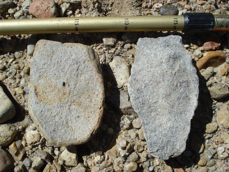
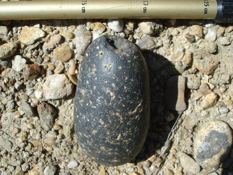
Tommy,
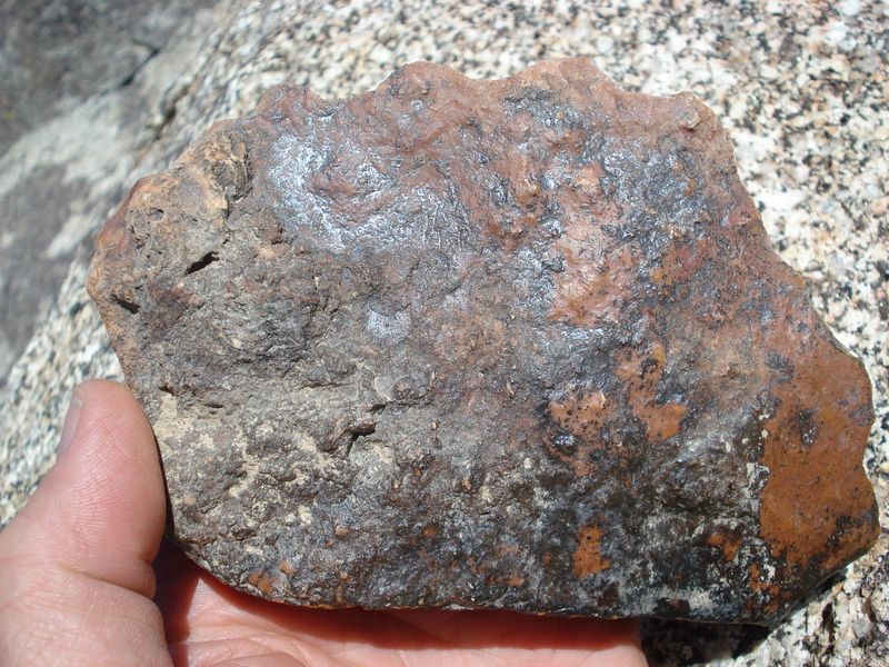
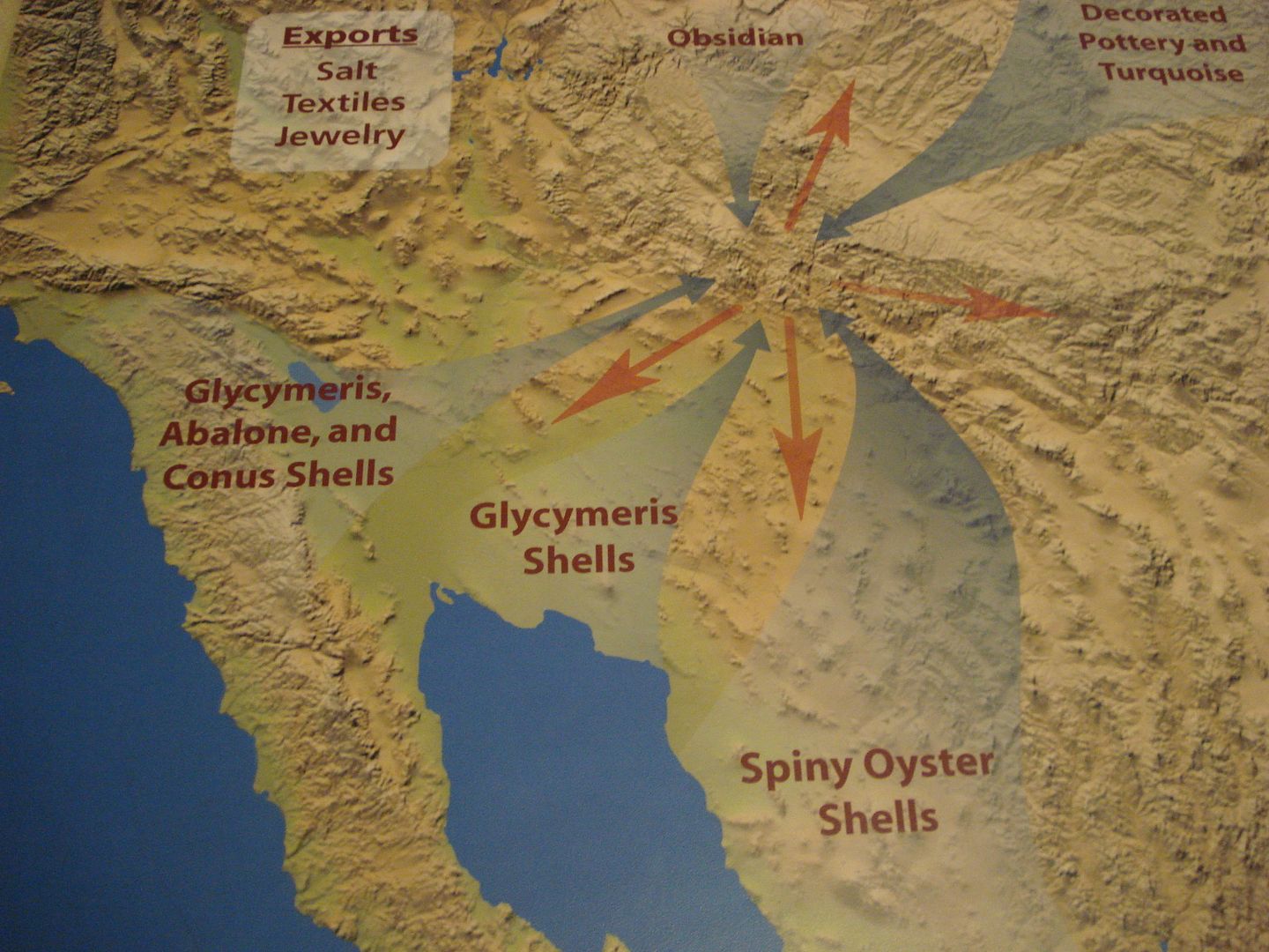
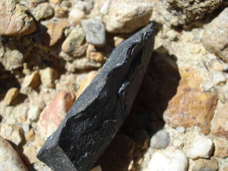
Pretty sure the obsidian came from the obsidian butte or red island area. When ancient Lake Cahuilla was full, the obsidian source was covered so they must have stored the "black glass" elsewhere. It was traded all the way to the coast.
Found this among obsidian flakes about 4 miles from the coast recently even though there is no local source

edited by rockhopper on 3/18/2015 |
4/2/2015
Topic:
Carrizo Gorge wildflowers
rockhopper
|
Nice trip and photos. I like pick no.2 the best.
Cheers |
4/8/2015
Topic:
Spring Break 2015 Week 1
rockhopper
|
Nice photos! Nice small game arrow point pick up. Wonder what they were hunting? Rabbit? |
4/16/2015
Topic:
Escalante: the staircase: trip 2
rockhopper
|
Nice family trip. Great photos. I need to get out there. I'm heading to Colorado tomorrow to visit family. Maybe a side trip? |
4/27/2015
Topic:
Old Aerial Photo Site
rockhopper
|
Thanks for sharing! |
5/6/2015
Topic:
Inner Pasture / Spring Break Week 2
rockhopper
|
Nice trip and great photos. Looking forward to getting back out there! |
5/16/2015
Topic:
Cuyamacas Day Hike
rockhopper
|
Neat Day hike. I love the area. I see they got about 2" of rain on Fri. Even Borrego got about 1/2" . Hope to head out next week! |
5/21/2015
Topic:
Bighorn Sheep Count 2015 Volunteers Needed !!
rockhopper
|
Incredible creatures they are. I'll mark this post as the time nears. I have my schedule pretty full during the summer. Good luck counting and hope numbers are holding or better up If I can't go this year. |
5/21/2015
Topic:
Ancient Lake Cahuilla shore line trip May 2015
rockhopper
|
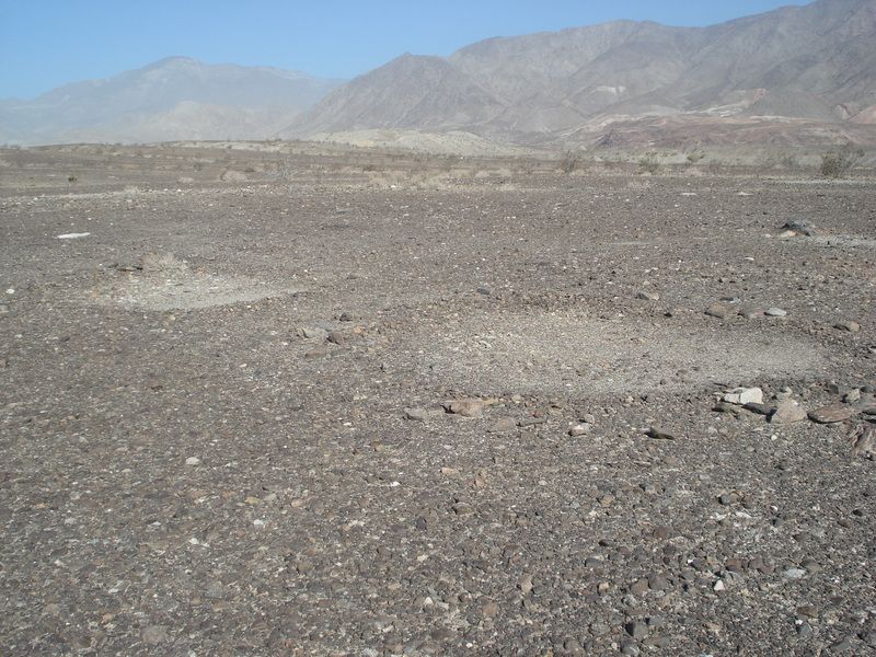
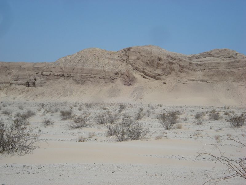
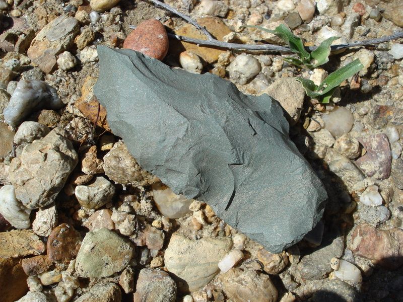
Got a chance to make a quick mid week run from the coast out to the desert after the latest rain. Camped out off S22 near the county line. The new moon made some fantastic star gazing! The next day I made my way to a section of the ancient lake Cahuilla I have never been too. About 2 miles north of this site I visited in prior years.
Here is the shore line today. Last full lake fill 400 years ago +/- ??
Shells below shore line from last full lake fill.
Some sleeping circles near the old shore line.
edited by rockhopper on 5/21/2015
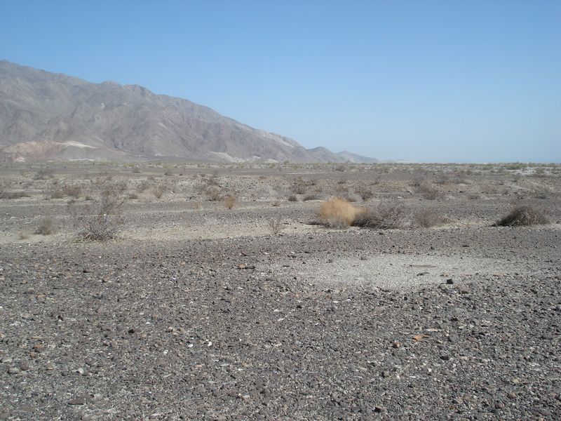
Old trail set back from shore line about 100 feet.
Chippings near sleeping circles.
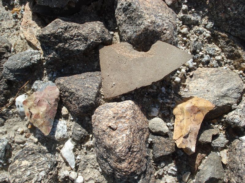
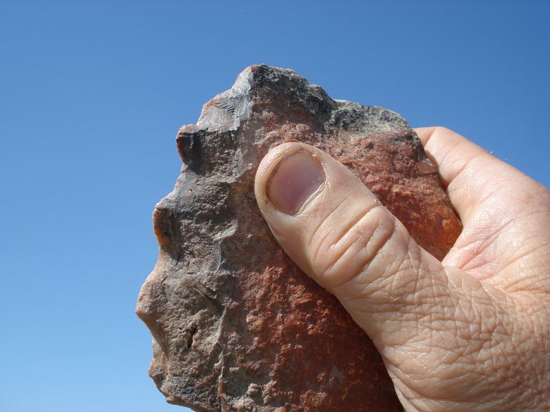
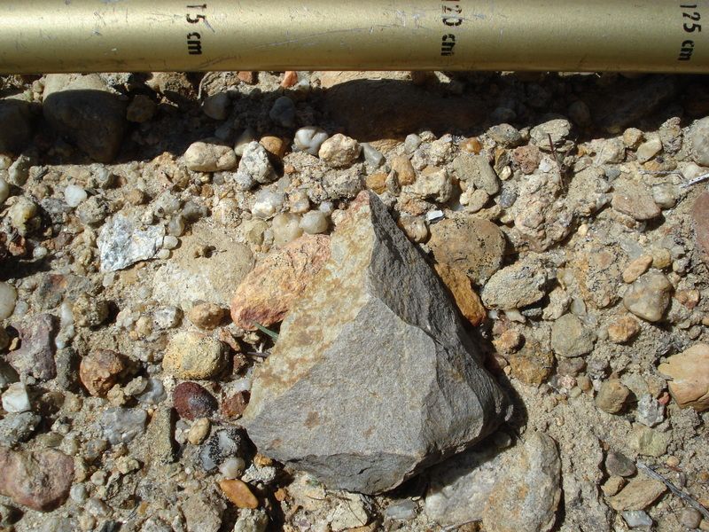
Spotted this laying on the surface. Interesting in that a laver of caliche and or travertine covered a portion of the stone tool and also patina after manufacture. Appears very old. Hid in bush for next traveler 100 years from now. :-)
Same stone tool, other side. Large mammal meat cutter? Appears very old est. 500-1000 years?? Older??
Passed this fault along S22. That bluff is about 100 feet high. Pacific plate meet North American plate. Yikes!
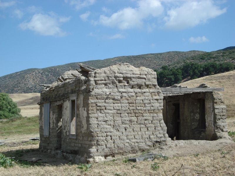
Heading back, stopped at the old adobe ranch house ( circa 1849 ) at Warner's ranch off S2 along the Butter field stage route. PS you can catch a glimpse of it on west bound S2 nearing Hwy 79. If you blink you will miss it. Cheers!
Edit to post pics. Thanks Daren!
edited by rockhopper on 5/21/2015
edited by rockhopper on 5/21/2015
edited by rockhopper on 5/21/2015
edited by rockhopper on 5/21/2015
edited by rockhopper on 5/21/2015 |
6/1/2015
Topic:
A few familiar places we enjoyed in May
rockhopper
|
Fun trips. Your kids will be "explorers" for the rest of there lives no doubt! Nice to see the May rain in the desert. |
6/1/2015
Topic:
Carrizo Gorge Wilderness Backpack
rockhopper
|
Great photo log! The winds in May are right on schedule. I watched the dust devils marching across the Borrego valley from Clark Lake (dry) 2 weeks ago, but the mornings were still and calm. |
6/1/2015
Topic:
Coyote Canyon camping
rockhopper
|
Only did the Borrego valley up Coyote Canyon to Anza full route one time back in the 1990's in 4x4. The last climb out of the canyon up to Anza was a super tough boulder filled washed out steep climb as I remember. I have some old slides some where??No 2WD SUV's. No joke! Thanks for the update. I intend to hike a portion of the route someday.... |
6/14/2015
Topic:
Santa Rosa Traverse in One Day-unsupported
rockhopper
|
Epic Trip! I can't imagine a one long day push through all that. You guys must be Navy Seals or you need to enlist NOW! It would take me at least 2-3 days, a full pack with a saw and about 16 quarts of Auga. We went as far as Rabbit peak and back in one day and my legs were trembling when we made it back to our truck in the dark. We each ate a full pizza and downed a pitcher of beer each! Also came down from Torro peak to a saddle at a native trail crossing and back up. I need to fill that gap including Dawns peak someday!
Hope you found Daren's trail busting effort. BTW thanks for bush wacking and clearing the ridge trail.
Regards
Paul |
6/14/2015
Topic:
from rockhouse ruins to cactus springs trail
rockhopper
|
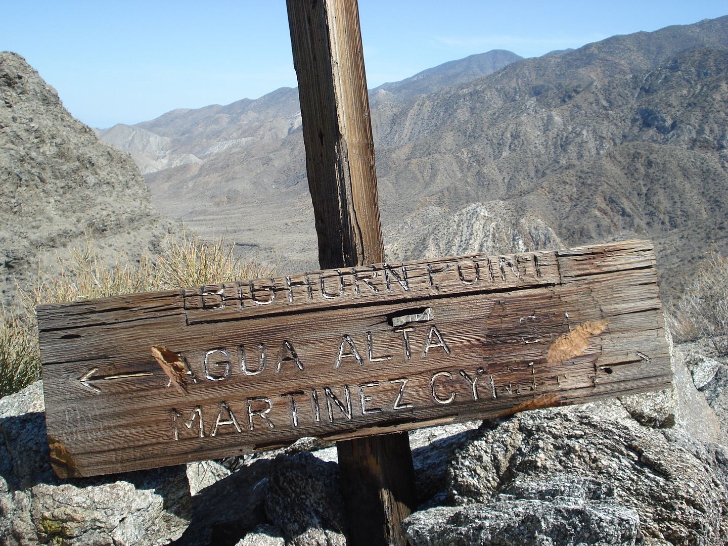
Welcome! I might be interested if we make it a winter trip after the rains cause we are gonna need it. I am really familiar with the Old Santa Rosa Indian Ruins area as well as Cactus spring trail from Martinez Canyon to Hwy 74. I have hiked the Cactus spring trail about 5 times and there has always been flowing water at Horse Thief creek but that does little good unless you travel from the Hwy 74 direction. Not so much water at Cactus spring and Agua Alta spring unless after a big winter. The running dry creeks after the rains is your best bet or you will be hauling Gallons of water in your pack.
Daren is right, there are several ancient trails heading from the Old Santa Rosa Indian Ruin rock circles up and over toward Martinez canyon and Cactus spring trail. Rarely traveled, over grown and almost unrecognizable BUT there are un-eroded sections that are in perfect shape still to this day! Mostly on the ridges. You will find them littered with pot shards from pot drops and you will know you are on the right path.
BTW alternate route would be SRIR and out Martinez canyon
Keep posting and again welcome!
Regards
Paul
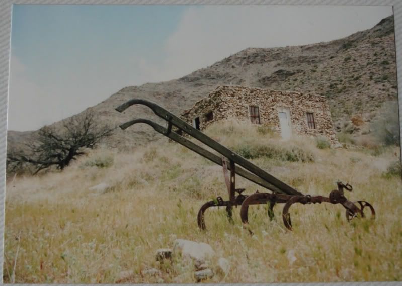
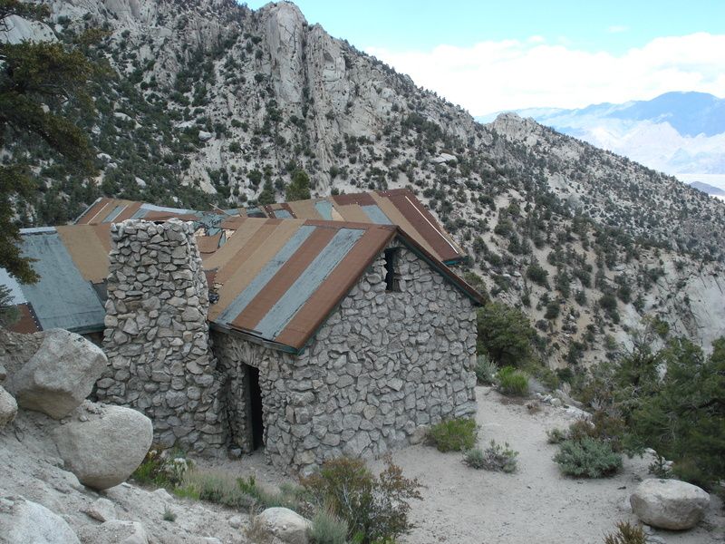
Climbing out of Martinez canyon toward the Cactus spring trail. Jack Miller 1925 Rock Cabin below.
Day tripin in Martinez canyon in wetter times. Brought my friend along. She was amused. hehe
Horse Thief creek has always had water year round for my wanderings.
edited by rockhopper on 6/14/2015
edited by rockhopper on 6/16/2015 |
6/14/2015
Topic:
Borrego Springs 1965
rockhopper
|
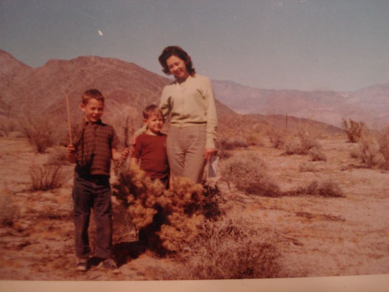
Wow time flies. 50 years ago! Found some old photos from 1965 going through my Dad's stuff. He is 86 and still with us thankfully, just helping to organize his place. Anyway don't know if this was our first trip there. Dad used to take us to the desert every winter. That's my little brother and my Mom (r.i.p.). Who knew I would still be hiking the area for 50 years. I hope for another 30!
Cheers!
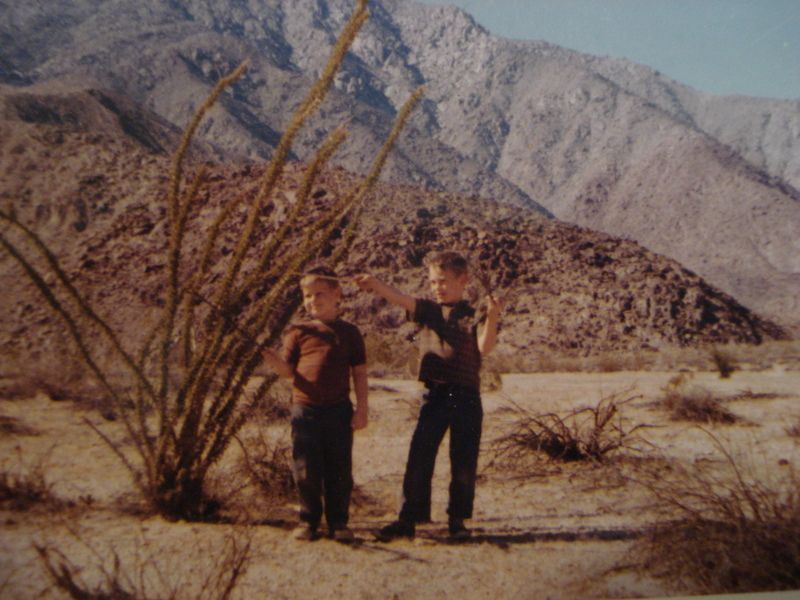
Neat stone tool spotted from my latest trip in May 2015. Mastadon meat cutter??? Left in a bush for the next traveler.
edited by rockhopper on 6/14/2015
edited by rockhopper on 6/16/2015 |
6/20/2015
Topic:
Santa Rosa Traverse in One Day-unsupported
rockhopper
|
IH,
To add: Having the buddy system really worked well for you guys going through the thick overgrown brush. I like the way you were communicating within earshot. "Over here........ maybe" hehe . Going solo would be double frustrating aka Daren. How far apart did you guys get when bust through the thicket? Narrow window of the season to hike is right. Too cold, too windy, too hot. Today the valley floor is expected to reach 120F!!
Cheers. Again awesome hike! |
7/3/2015
Topic:
Rocky Basin Lakes 7 Day Backpack in the Sierras
rockhopper
|
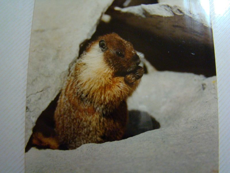
Great sierra trip. I really enjoy the B&W photos. I hiked the Cottonwood pass to Rocky Basin lakes back in 1986. Hiked to nearby Funston lake , it was frozen over and climbed Mt Langley, my first 14k peak. Thanks for the Bear and Marmot memories. A Marmot stole my eyeglass leather case while gazing across the Sierras. |
7/23/2015
Topic:
Perseid meteor shower this weekend
rockhopper
|
Hey guys, I read the meteor shower is peaking around August 13. The wife wants to go North to visit relatives at the peak. I thought I was going to be soaking in the hot springs at night in central Cali but our other friends cancelled. Now working on plan B. Hoping for high pressure and clear night for all. I am afraid my next Desert days will need to wait till the highs drop below 85. I know, I know I fail at high temps. You guys are tough! GLTA |
7/26/2015
Topic:
Blair Valley
rockhopper
|
Neat report. Been in that part of the park many times myself. You are correct, during a period in history, when a member of the tribe passed, his or her posessions were broken and scattered. You will see the broken decorative pottery bits and broken arrow heads around the burial mound sites. Great pics! |
8/14/2015
Topic:
Is Fingertail Spring Dry?
rockhopper
|
Nice pics. I gotta check out more of that area out some day. Great vista points of the "great" Salton sink / San Andreas zone. I know you can see Mexico and Arid-zona on a bone clear day. |
8/19/2015
Topic:
Anza-Borrego Desert Photo Contest 2015
rockhopper
|
Thanks for posting. Enjoyed the 2014 pictures. Some excellent ones!
I will submit some photos for 2015 |
9/5/2015
Topic:
Drone use in the Park
rockhopper
|
It's a BIG park, but.... I wouldn't want one flying around me out on a peaceful desert adventure.
On the other hand, with a park permit, they might be useful for wildlife, archeological and geological research. |
9/30/2015
Topic:
South West Road Trip
rockhopper
|
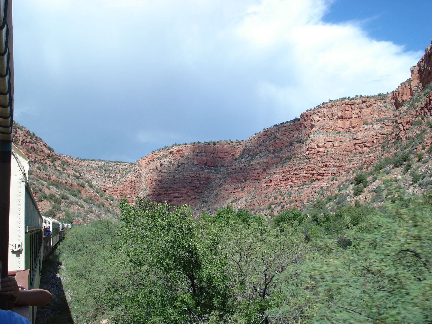
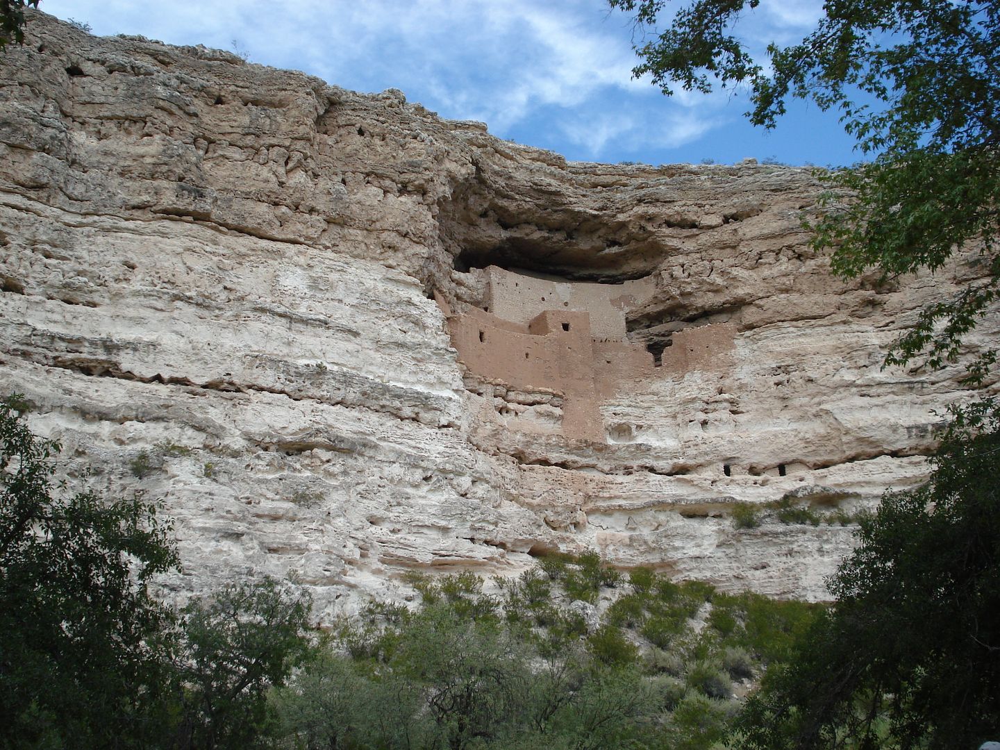
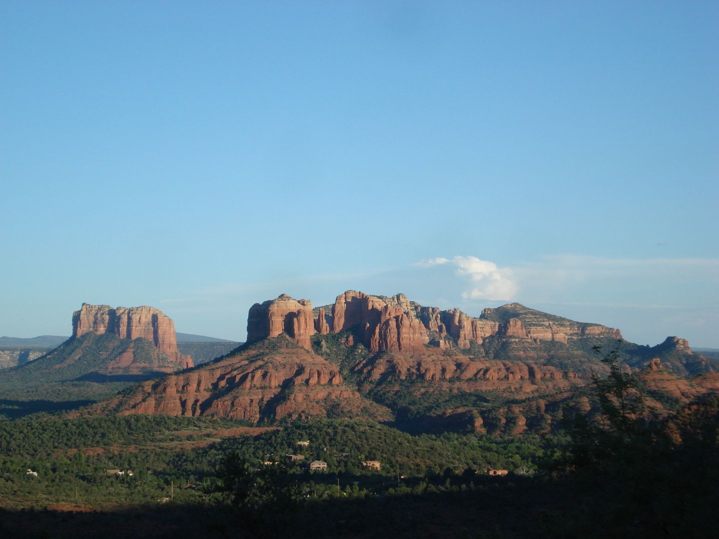
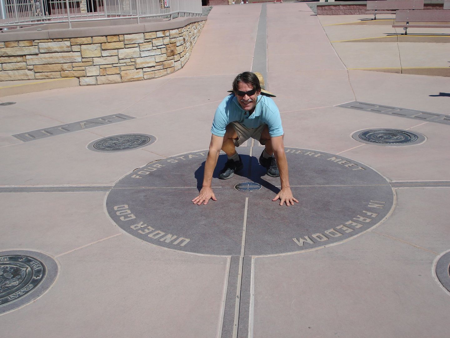
The wife and I managed to take off some time for a six state road trip through "Indian country" Put close to 2400 miles on the Tundra on and off road over 10 days. Some random pics.
Verde Valley AZ. train ride.
Pueblen cliff dwellings along Verde river AZ
Sedona AZ always neat place to hang out.
Pre- Columbian trade routes
On the Road through Navajo and Hopi lands
Furthest point near continental divide. Pagosa springs CO for a much needed soak!
Wife took a pic. at Four corners. Let's see, right foot in UT, left foot in CO...
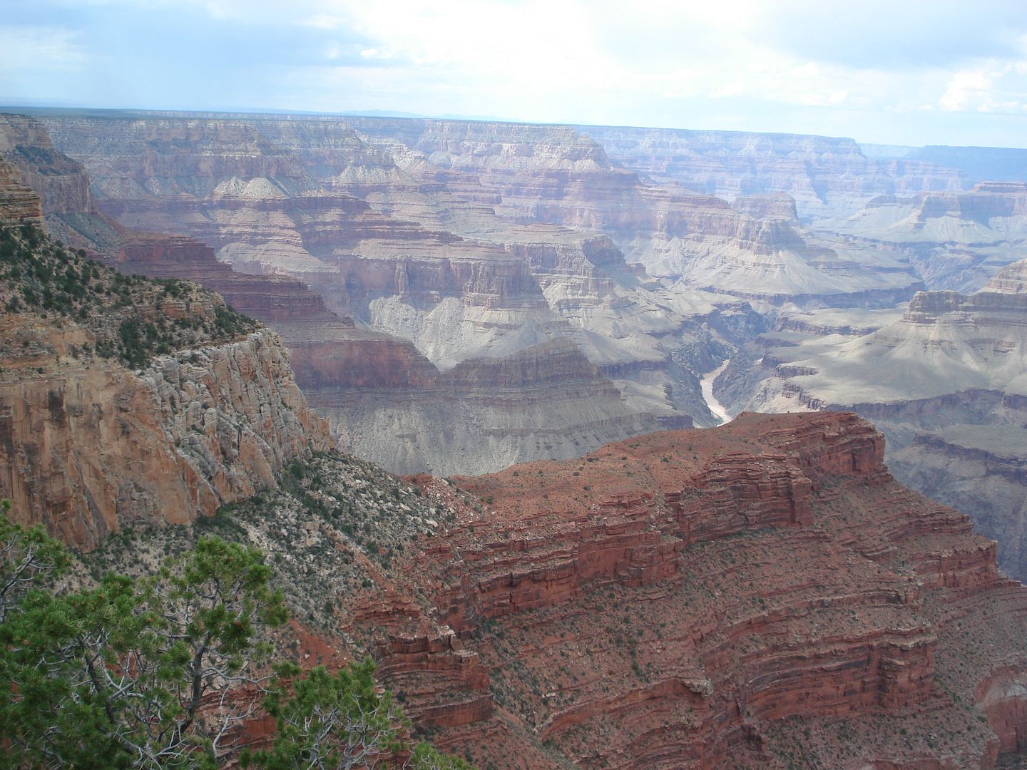
Grand canyon stop. The basement rock down at the river is over 1.8 Billion years old. Got rained on Hard about an hour after this pic was taken.
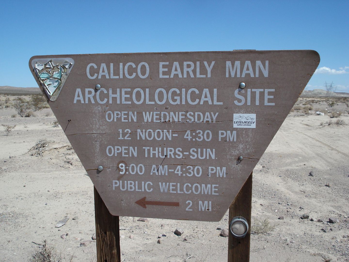
Early man site. My camera was full by this point by basically at site of an ancient fresh water lake in the Mojave desert. Stone tools dated back in strata 100,000 years in age. The site is highly controversial to say the least. Very interesting though. You can Google it for more info and pictures.
All in all a great trip. looking forward to heading back out into the "Low" deserts in cooler temps.
Cheers!
edited by rockhopper on 9/30/2015
edited by rockhopper on 9/30/2015
edited by rockhopper on 9/30/2015 |
10/1/2015
Topic:
South West Road Trip
rockhopper
|
Daren: Yeah, the BIG canyon is pretty cool. It's out right incredible!
Hikerdmb: Our first time in Pagosa springs. Very, very nice place. My wife got a room up grade at no extra charge. The newer suites were 10x better! The Hot springs are some of the best I've had the pleasure of soaking in.
Florian: The Verde Valley train was just a fantastic 4 hour trip up and back. Highly recommended. It was my first time. They have open cars also for the photographers in the bunch. Also real knowledgeable guides speaking of the history, geology, animals, plants, etc of the valley/ canyon riding along in each train car. I would do it once a month if I lived in AZ.
Some more pics.
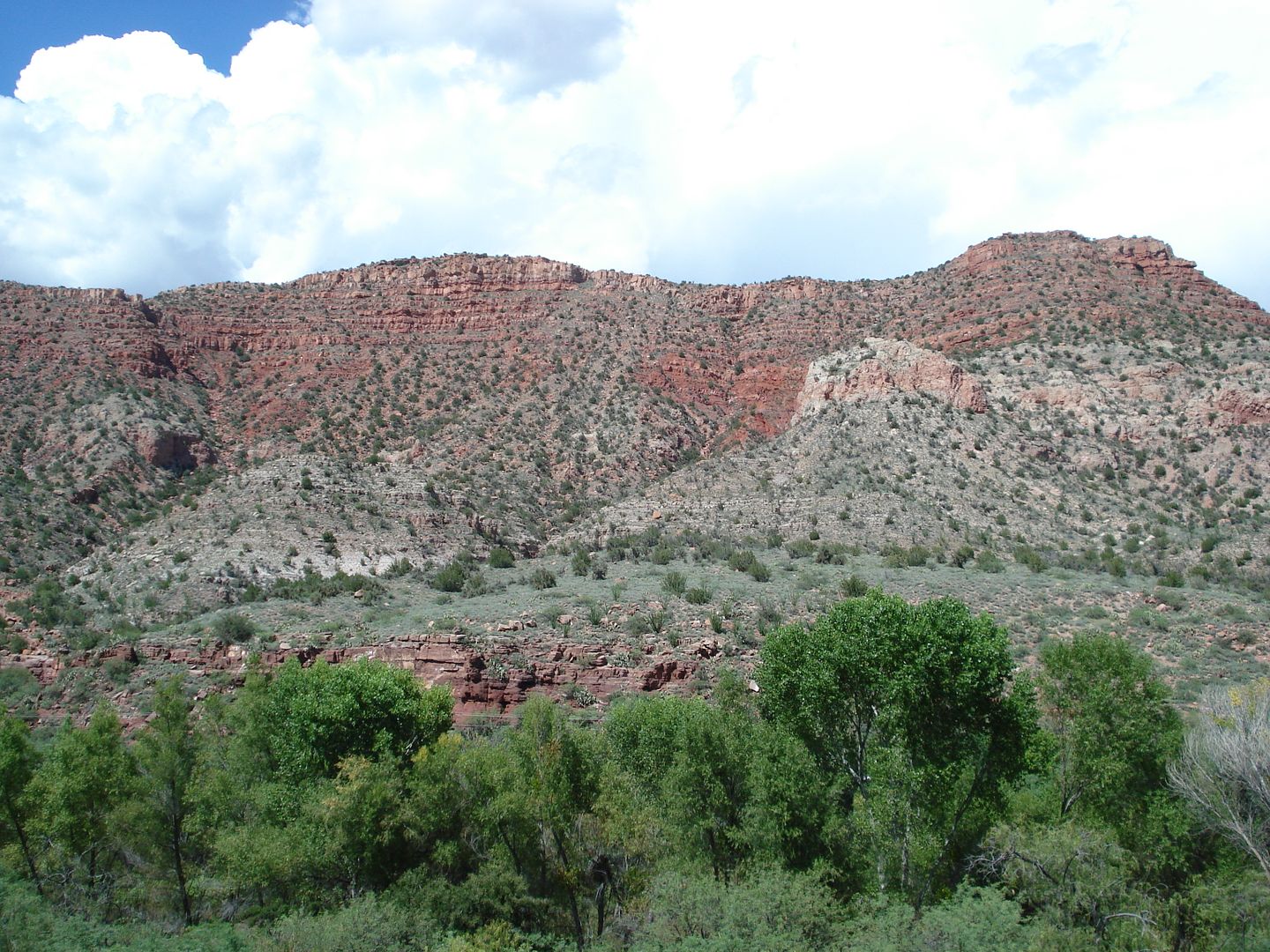
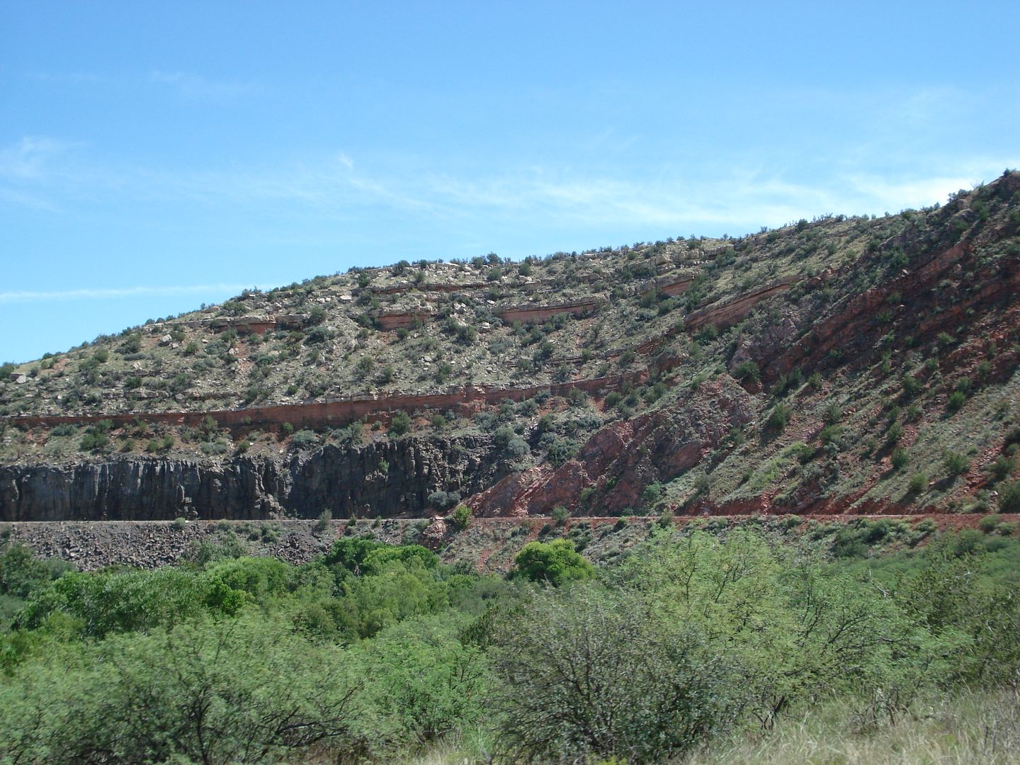
200-300 million year old rock strata. The same rock layers and color seen at the Grand Canyon over 100 miles away.
edited by rockhopper on 10/1/2015
edited by rockhopper on 10/3/2015 |
10/4/2015
Topic:
Mammoth footprints
rockhopper
|
Florian,
I have and old map of ABDSP and shows " Dinosaur tracks" near the area you are describing. I went looking and never found anything. I sure others will chime in. I do have a relative who lives in Borrego Springs full time who is a member of the paleo / fossil hunting group. He said any significant finds are buried and hidden. Only to be un-earthed for the scientific community to view and study. Bummer, as I would just take only photos anyway. |
10/11/2015
Topic:
McCain Valley / In-Ko-Pah Mts Last 2 months
rockhopper
|
Excellent photos and great report. I need to get out in that area sometime. btw it was 95 deg in inland Encinitas on Sat. 10-10-15. |
10/12/2015
Topic:
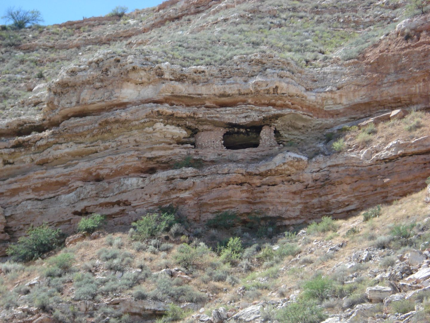
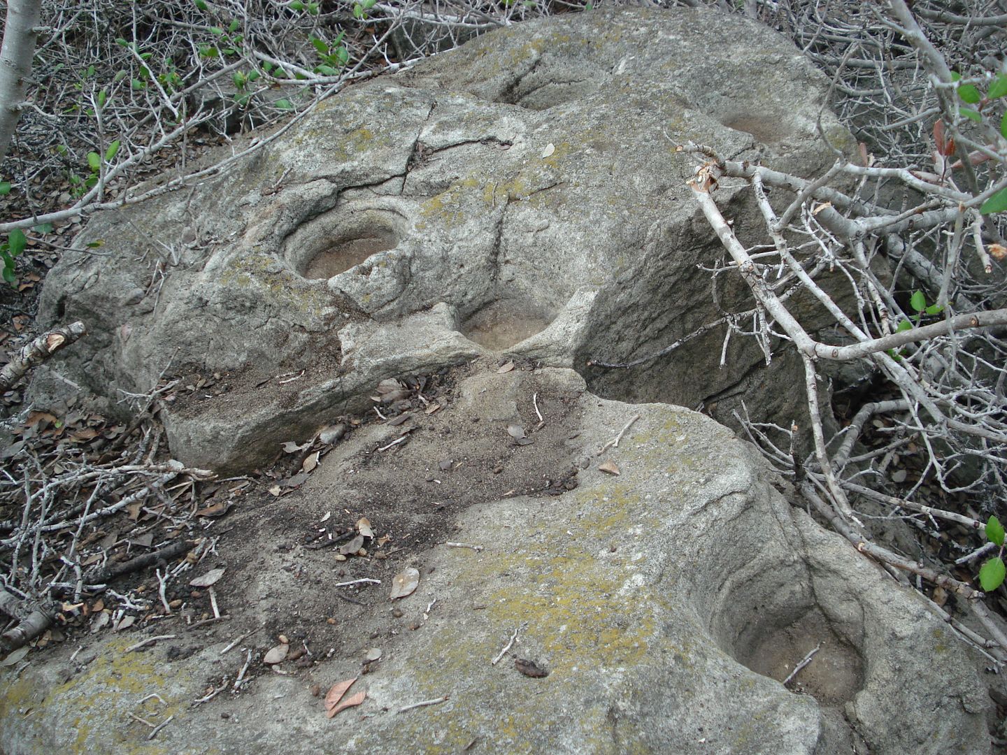
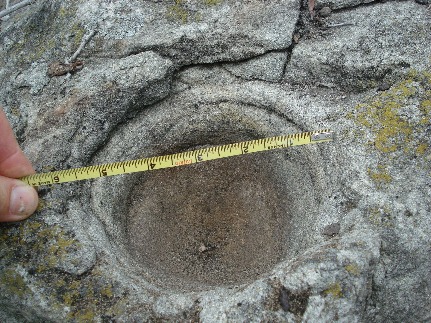
Local Ramblings 50mi outside ABDSP
rockhopper
|
Found these grinding rocks on a local hike last week about 2.5 miles from my house. I brought my camera out this time. They are located about 2 miles from the ocean under heavy over growth. They were probably known about by the old timers in the area, but I "discovered" them again while cutting a trail through the scrub oak along a ridge line along a old forgotten trail. btw it was 94 deg at the coast!
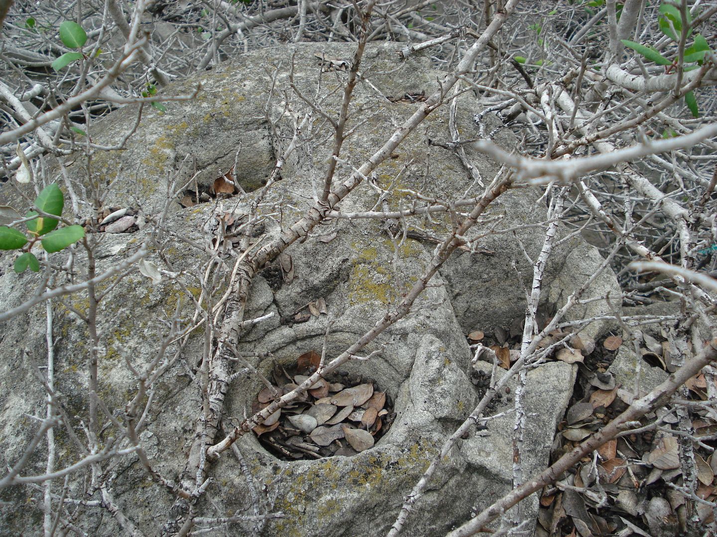
Grinding holes cleaned out. I covered them back up with leaves and branches and are completely hidden again :-)
Also note rock eroded away from grinding hole. Old!
Some you tube clips,
https://www.youtube.com/watch?v=-huTCN6Nojc
https://www.youtube.com/watch?v=ksDDzuMVNGU
https://www.youtube.com/watch?v=4PrX6TySP9I
edited by rockhopper on 10/12/2015
edited by rockhopper on 10/12/2015
edited by rockhopper on 10/12/2015
edited by rockhopper on 10/12/2015 |
10/13/2015
Topic:
Local Ramblings 50mi outside ABDSP
rockhopper
|
Jim,
Yes, rock is a "hard" sandstone but softer than the usual granite. Most of the rock slabs have took a tumble down the slope so some of the grind hole are now on near vertical rock faces. The last youtube video shows that and gives a clue to its age? My guess is pre-Columbian?? Anyway it was a neat find in a area with a lot of shell dumps, fire hearths and rock chippings.
Cheers |
10/13/2015
Topic:
Local Ramblings 50mi outside ABDSP
rockhopper
|
Jim
Theories of lack of classic points. Well, IMHO vegetation! As opposed to the wide open desert areas. Also consider 90% of the coastal areas have been bulldozed and developed and 99% of the remaining pre-Spanish contact evidence is buried or submerged off shore and beneath lagoons. I did locate a stone tool chipping area and a few arrow head points about 4 miles from the coast so they are still out there but like finding a needle in a haystack.
tommy750
yes I think of the coast to desert as "our" park |
10/22/2015
Topic:
The Year in Archaeology Oct 22nd 2015 at the ABDSP
rockhopper
|
Daren,
Sounds like a neat event Wish I could make it, but have some commitments to make. Maybe next time. Thanks for the heads up.o
btw Was the fourm page chronology acting a little wonkey or was it just my c'puter
Cheers |
10/22/2015
Topic:
BORREGO DAYS DESERT FESTIVAL - OCT 23-25th
rockhopper
|
Have a fun trip in rock house canyon. Look forward to your trip report and your stellar photography. Temps in the 80's.Perfect! |
11/13/2015
Topic:
San Ysidro - East approach
rockhopper
|
Haven't done that route, but going up will be the easy part, coming down will be challenging especially with evening shadows coming. I would use hiking poles for sure. Long pants , long shirt also. Enjoy! |
11/13/2015
Topic:
Santa Rosas expedition partner wanted, Dec. 20-24
rockhopper
|
Sounds interesting. Do you have a Google earth route plotted to share? I too know the area pretty well having explored the Martinez canyon area from the bottom and coming down the cactus spring trail over a half a dozen times. Wet years are the best. Which way up the canyon are you going after you arrive at the Jack Miller rock house cabin? The n/w fork is an absolute bitch. Don't ask. If it was me I would base camp at the rock house or Auga Alta spring and go day trippn' with a day pack.
Martinez canyon 1993 El Nino
edited by rockhopper on 11/13/2015 |
11/14/2015
Topic:
Santa Rosas / Rockhouse Canyon 4 Day Backpack
rockhopper
|
Nice photos as always. I'm not worthy! Nice to see the spring flowing. Good work. And nice arrow point find. Good eye to spot that one. What elevation did you find it? How far east from the Santa Rosa ridge line do you go?
Cheers.
btw Enjoy Martinez canyon |
11/14/2015
Topic:
Santa Rosas expedition partner wanted, Dec. 20-24
rockhopper
|
The Wife has plans leading up to Christmas so I am out. I will be heading out to the Cactus spring trail area after the Jan/Feb/March rains. Probably pack in from the top N. end and through Agua Alta Canyon and Martinez Canyon. I may come up from the bottom end too if Martinez creek is flowing. I came across a previously unknown (to me) Native American site covered with over growth in the area that I would like to spend more time to photo. Have a safe trip and take plenty of photos!
Jack Miller rock house from same trip
edited by rockhopper on 11/14/2015 |
11/19/2015
Topic:
Combs Peak Hike
rockhopper
|
Neat T.R. and photos. Hey,that is the area where the "Lost hiker" went missing along that section of the PCT earlier this year. |
11/21/2015
Topic:
Neat Ancient Lake Cahuilla animation video
rockhopper
|
Saw this on youtube. Looks like the fingers of the fresh water lake went further west during the earlier "fills". That would explain some of the traces of travertine on some of the rocks and rock tools noted above the last high water stand. Most likely due to land upheaval and subsidence. Question tough to solve. How many fresh water fills of the ancient lake during past history. Post a guess :-)
https://www.youtube.com/watch?v=4RHu2h5CF9s |
11/30/2015
Topic:
Martinez and Agua Alta Canyons Backpack
rockhopper
|
Great loop trek! Please post more photos. Did you find the sections of the Indian trial heading down from Agua Alta trail? I have an old topo showing that trail also. I tried going up to Agua Alta spring from the bottom on that route years ago but was low on water and had to turn back. Good to see you guys using the cactus spring trail. It needs more traffic to keep it recognizable. I was just there last season, Cactus Spring trail / Jack miller cabin / Auga Alta spring. The trail they say is over 1000 years old and is cut wast deep as it heads over the pass towards Pinyon valley.
btw Jack Miller built a road to his cabin up the canyon in the 1920's with a Buick with additional wheels bolted on the back! The road was in constant need of repair after the floods. Also, it was his second Cabin. The first one was down stream a bit and was washed away. You could still see remenets of the old cabin about 20 years ago as I remember.
Sign off the trail on a ridge on my last hike
edited by rockhopper on 11/30/2015
edited by rockhopper on 11/30/2015
edited by rockhopper on 11/30/2015 |
11/30/2015
Topic:
Martinez and Agua Alta Canyons Backpack
rockhopper
|
Daren, how did that water taste? Hope you are ok. Thanks for maintaining the "springs". Future travelers will be grateful. I will be heading out there again this season. Probably after the new year / rains?
Here's a pic of Jack Millers road heading toward Martinez canyon taken a few years back. This shot is aimed down toward the Coachella valley.
This might be part of Jack Millers car? Can anyone I.D? He supposedly drove a modified Buick up and down the "road"
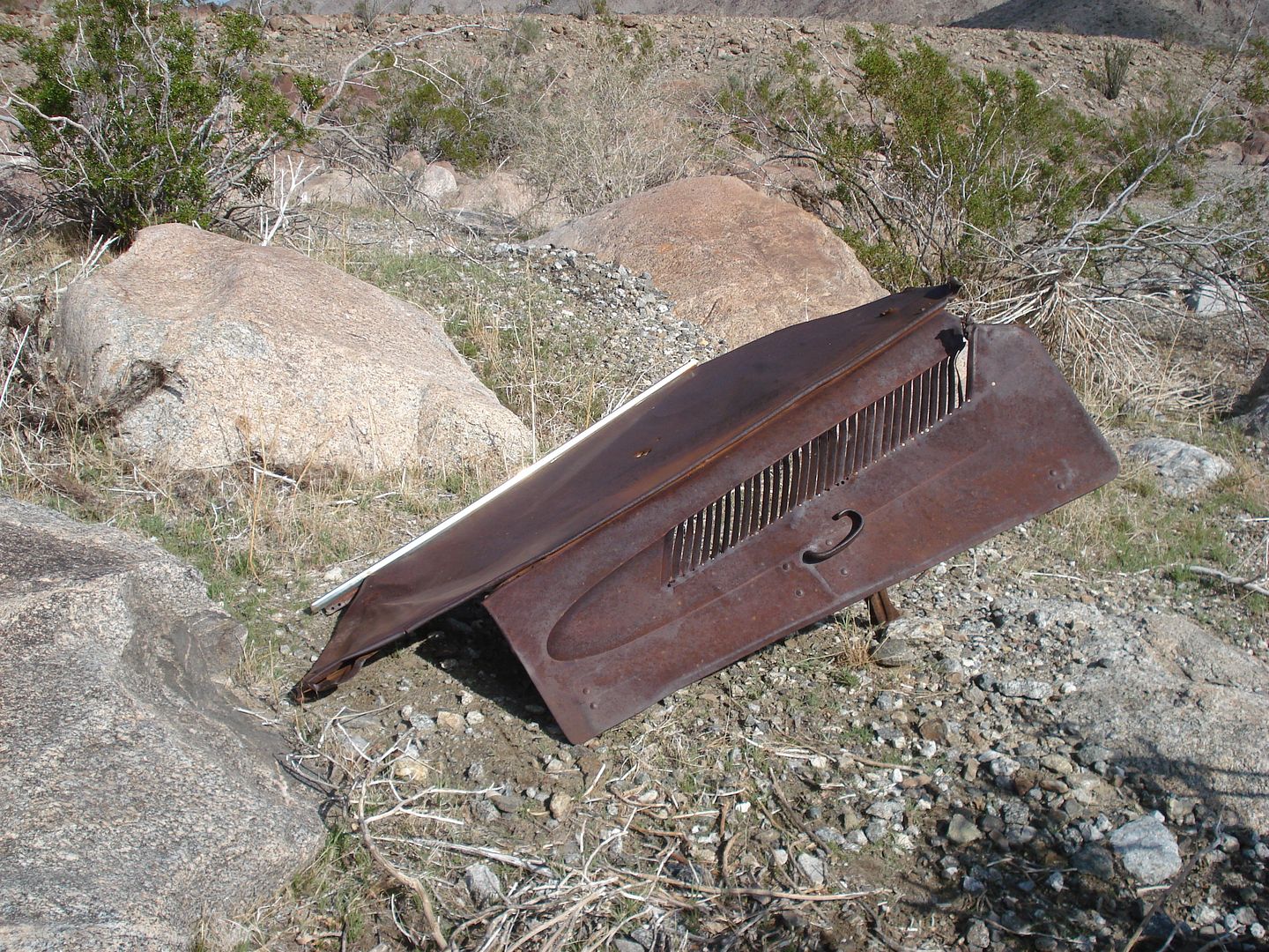
edited by rockhopper on 11/30/2015
edited by rockhopper on 11/30/2015 |
12/13/2015
Topic:
Tabletop/Trestle/Mortero Palms/Dos Cabezas Spring
rockhopper
|
Here kitty, kitty. I've seen a few cats in the wild but I'm sure they have seen me more. I've thrown rocks at "something moving slowly" in the bush a few times at nite. If the photos are what I think they are, I don't think a my 3" knife will be enough! Yikes! Look forward to your trip pics! |
12/13/2015
Topic:
Hiker rescued in Rock house canyon 12-13-15
rockhopper
|
No sleeping bag?
http://www.sandiegouniontribune.com/news/2015/dec/13/former-marine-hiker-lost-rockhouse-canyon/
edited by rockhopper on 12/13/2015 |
12/14/2015
Topic:
Cactus spring trail to Martinez Canyon Rock House
rockhopper
|
Yep, that's me! Glad you guys were the next post. That's awesome. You guys did a great loop trip, rarely taken.
If we do get the MEGA wet Winter the weather bugs are predicting and Martinez creek is flowing lots of clean water I would like to base camp at the cabin site ( outside ) and do the trail up and over to Rock house canyon in Feb/Mar/April.
"poco water now" |
12/14/2015
Topic:
Hiker rescued in Rock house canyon 12-13-15
rockhopper
|
Hiker 404? Good thing he got rescued before the storm. Brrrrrrrr
edited by rockhopper on 12/14/2015 |
12/21/2015
Topic:
3 Day Backpack through Vallecito, Canebrake and IP
rockhopper
|
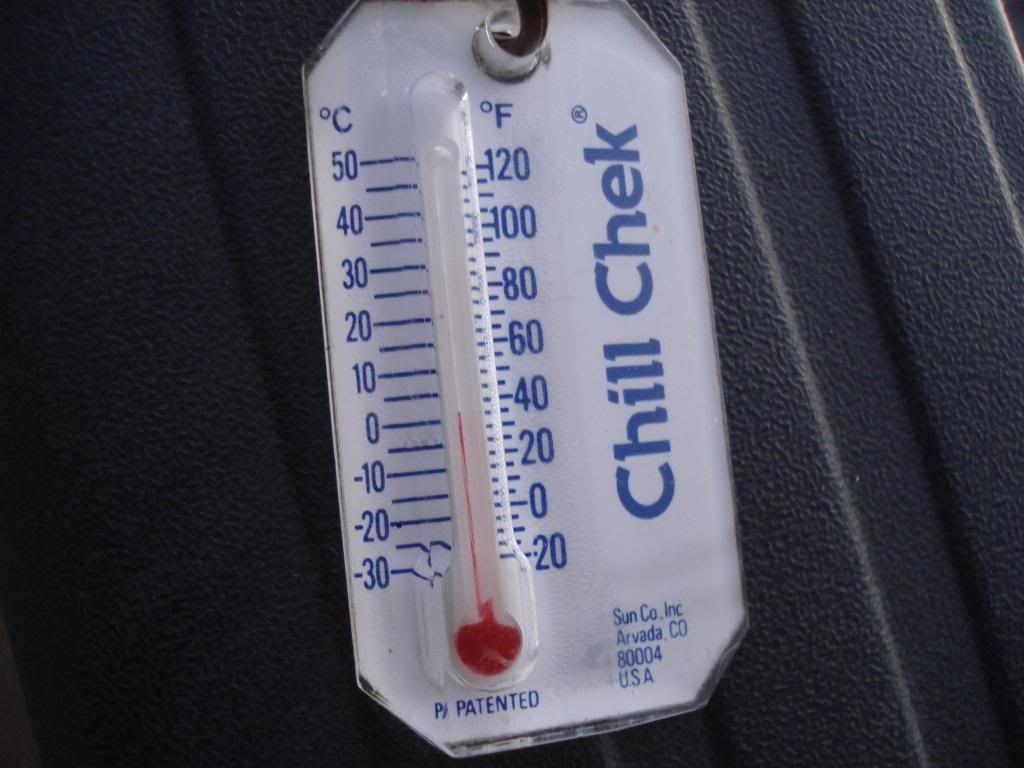
Nice photos and trip report. Did you have a thermometer? That's the money shot. Ha! I like the pic of your mitten holding the ice chunk! That makes it official, winter is here in ABDSP! Also great pictos in cave photo. Thanks for sharing.
Cheers |
12/21/2015
Topic:
3 Day Backpack through Vallecito, Canebrake and IP
rockhopper
|
Jim, I take this one out camping during the winter with me just because I want to know how cold it is when I emerge from my sleeping bag. hehe. Weighs like a few grams.
edited by rockhopper on 12/21/2015 |
12/29/2015
Topic:
Cattlemans Shack and Valley of the Moon
rockhopper
|
Those cattle men were tough! The geology in that area is pretty neat with the weathered granite. Thanks for sharing. |
1/27/2016
Topic:
Anza Borrego Site Redo
rockhopper
|
Thanks for your efforts. For some reason I cannot log on using Widows 10 on my lap top. Works fine on my Windows 7 PC. |
2/1/2016
Topic:
Pinyon Wash Overnight
rockhopper
|
Looks like you had great weather. Nice photos. Thanks for sharing. |
2/9/2016
Topic:
Villager Peak trailhead vandalism
rockhopper
|
Oh no! Hope they catch the devil bastard(s). Man what a way to end a grueling hike. Maybe they knew each other in Borrego and was some sort of retaliation? I've parked there many times. I have left my ol' pick up parked for up to 2 weeks at a wilderness trail head. Only problem I ever had was critters chewing up my wiring harness. |
2/16/2016
Topic:
Hapaha Flat and Harper Valley
rockhopper
|
I like that last shot. Looks tight! Nice trip for the family. |
2/25/2016
Topic:
Palm Mesa High Point and nearby benchmarks
rockhopper
|
Looks like a neat X-country hike. The morteros look very old. Welcome to the fourm! |
2/28/2016
Topic:
Stone Tools
rockhopper
|
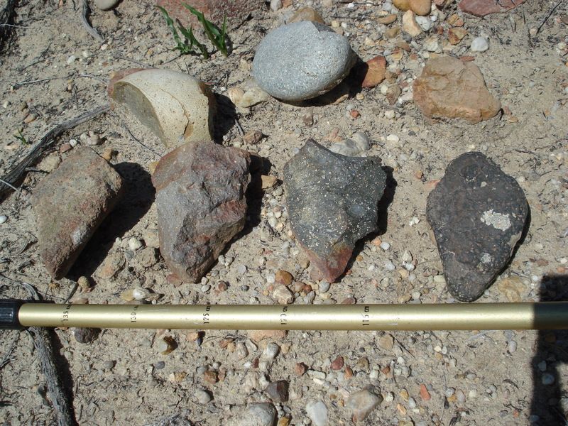
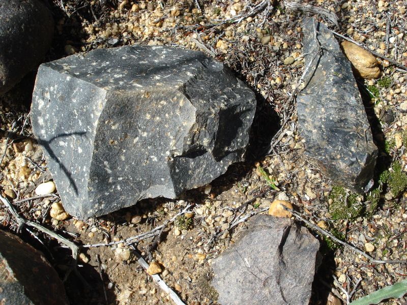
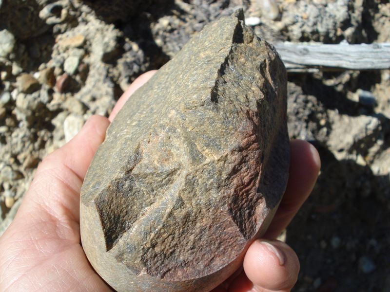
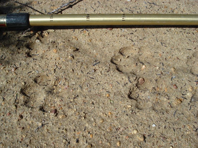
I Finally got out to a local hill to photo some crude stone tools I have seen over the years at a local hiking spot. The area is hard to get to ( bush wacking). I have never seen any other foot prints out here other than my own and the wild life. There is a bob cat that I have been trying to photo. I hope I don't get flamed because the area is out side ABDSP by a few dozen miles. Anyway, there are crude stone tools and chipping all over the hill side at a spot over looking the mountians, streams and a primary native American trail. The site is on an other old native trail I had to re-cut through the estimated 80-100 years old brush. Morteros are nearby. Basically I grouped them up to photo and then put back in their resting places :-)
Rough Points are about 4" long. The middle ones look more recent. The end ones look very weathered .The left one has a caliche/ travertine coating. Age? Old!
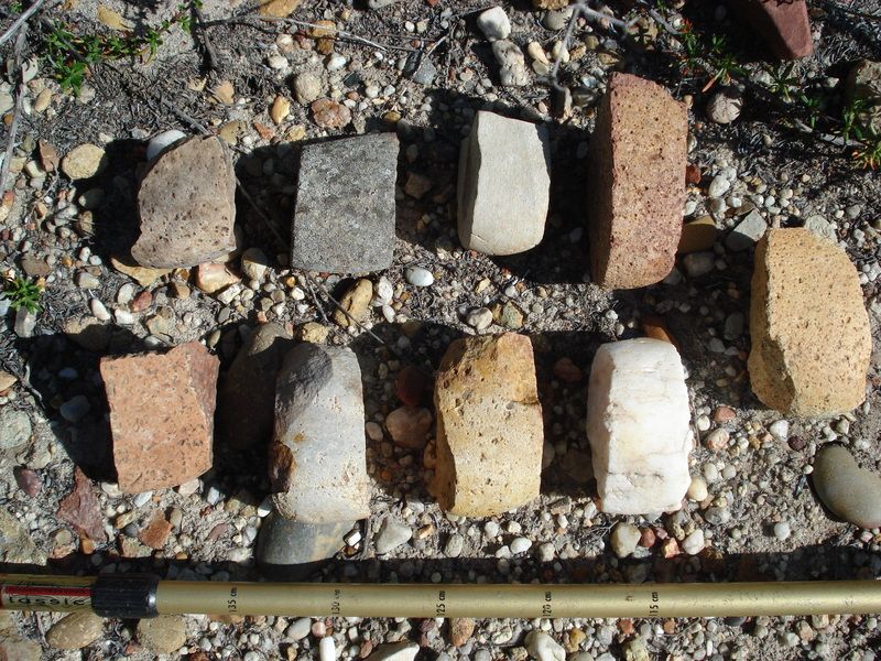
These were abundant. All where 1.5" to 2" in width and about 3" long. Stone clubs? Again gathered for a group shot and put back.
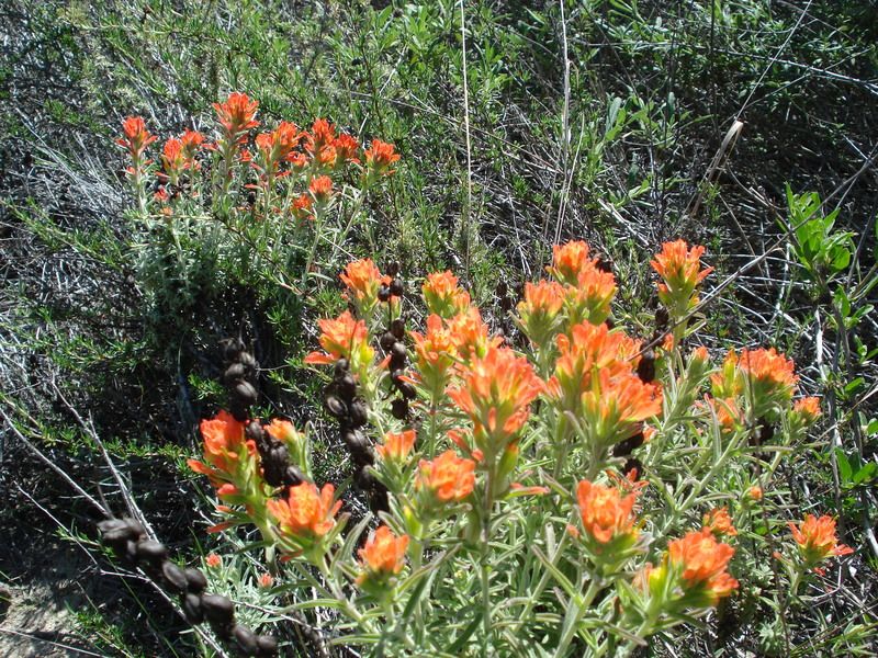
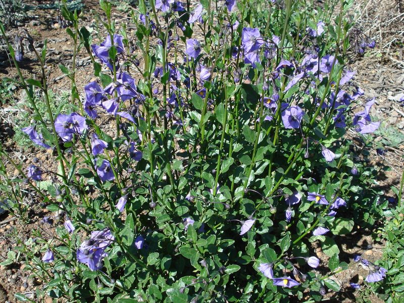
The local flowers think it's spring time and are coming out early.
Cheers
Rockhopper
edited by rockhopper on 2/28/2016 |
2/29/2016
Topic:
Stone Tools
rockhopper
|
Ziphius: Yes these are very crude stone tools that most hikers would not even notice. But I did! Yes there is a beautiful bob cat that I have seen once in the area but escaped my view before I could photo. I see his/her tracks frequently. I am going to share some more odd ball crude stone tool picture when I visit the area again. I did see two fine point projectile points nearby but most are large crude stone tool jobs.
Surf: Thanks for the kind words.
edited by rockhopper on 3/2/2016 |
3/12/2016
Topic:
Stone Tools 2.0
rockhopper
|
Hello all,
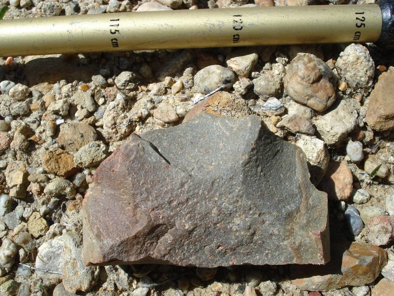
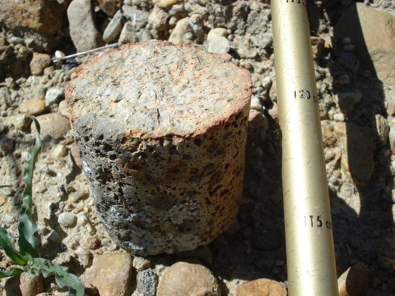
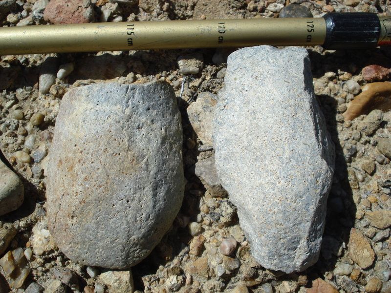
Back to my local hiking spot to take some more photos and photo some more stone tools scattered through out the area as I mentioned in my previous post. Again like before, all were just laying around on the surface, gathered to photo and put back in their resting places. I just wanted to add to the data base for those who are interested. Most are crude stone tools along with some finer made points.
Point made from Green Andesite as the obsidian source is far away.
Typical chippings found all over "The hill" over looking a ancient native American trail.
Some crude scrapers.
A perfect wheel/ roller.
Some worn scoopers.
More odds and ends.
Tool for arrow manufacture? Tool for stick and bow fire starter?
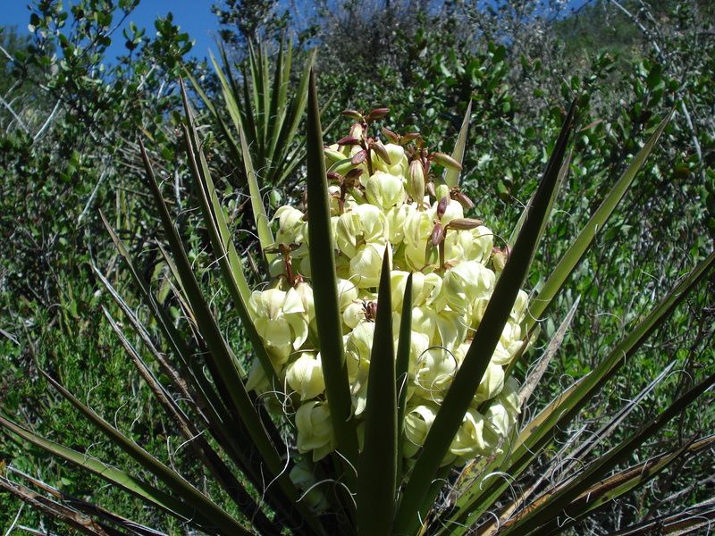
Blooms in the back country
My elusive Bob Cat friend.
Cheers
edited by rockhopper on 3/12/2016 |
3/13/2016
Topic:
Stone Tools 2.0
rockhopper
|
Ziphius
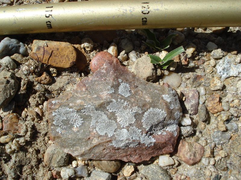
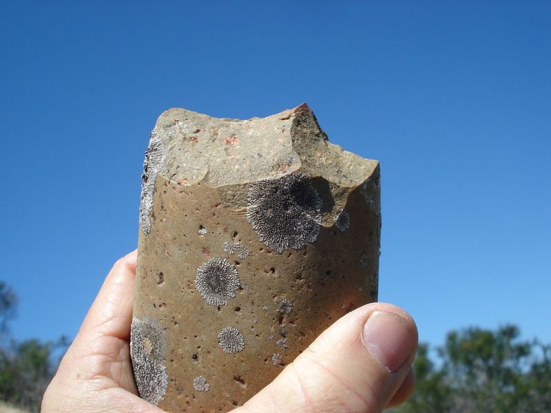
The material is the same as in photo 12. I belive it is Ryholite. Others please chime in. The dark material is found in cobbles in the stream beds as it does not occur in the local terrain. I know the Ryholite was from lava flows millions of years ago from an area on mainland Mexico when San Diego county ( Pacific plate ) was in alignment with what is now Mexico many miles south. Yes, the lichens are pretty neat. Sitting there a long time. |
3/29/2016
Topic:
Domelands in the Coyote Mountains Wilderness
rockhopper
|
Surf, Neat report and photos. Driven by many a time looking at the Coyote Mountians but on my way elsewhere. Need to check it out. BTW you are right our ABDSP has been many things in the past. Inland sea, wetter, colder, forests,etc...... |
4/10/2016
Topic:
Hiking to the top of Viejas Mountain
rockhopper
|
I too do local hikes in preparation for a greater goal. My first and only time on Whitney was in back in 1987. It's a great hike. We climbed it from the west side coming up from the Kern river basin after coming over Shepard pass from the north. Climbed Mt Tyndall and Mt Williamson two other 14 teeners also. So when we summit Whitney, here are these 5 Germans speaking German and all smoking cigarettes. Go figure? |
4/11/2016
Topic:
Hiking to the top of Viejas Mountain
rockhopper
|
Agree, Langley is a great hike. Just barely over 14,000 ft. When I solo'd it, there was no one there, anywhere up , at the top or down so it's a pretty empty peak but right next door (south) of Whitney. I have a great shot of Whitney from Langley but need to scan it. I'll hunt thru my piles of stuff. BTW we never did hiking permits for anything back then. Just fishing permits. :-) |
4/15/2016
Topic:
Hiking to the top of Viejas Mountain
rockhopper
|
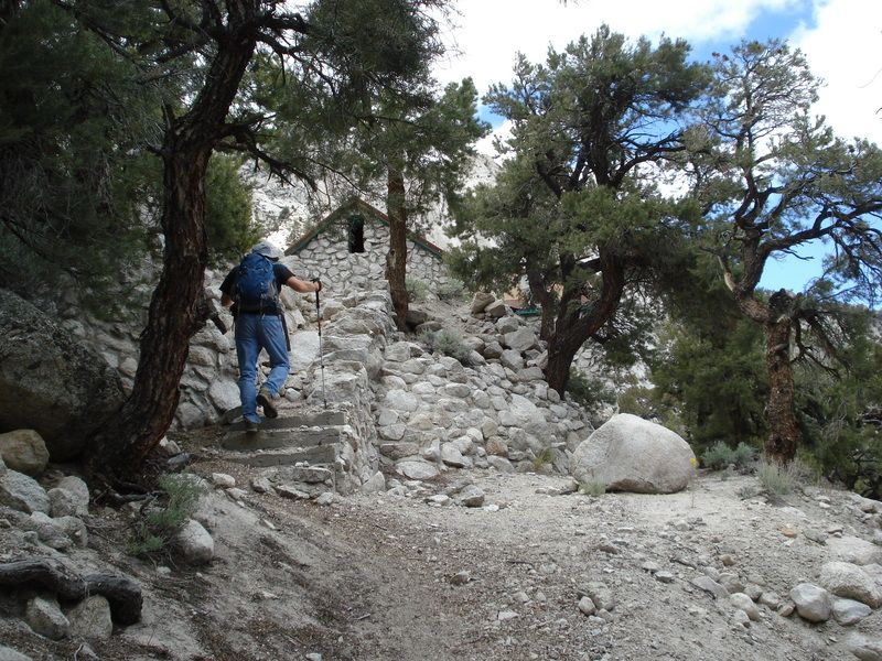
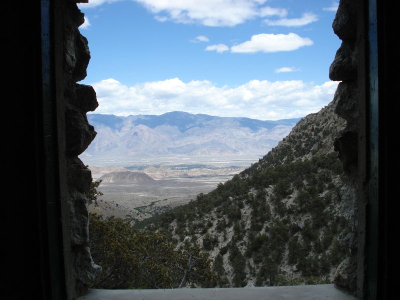
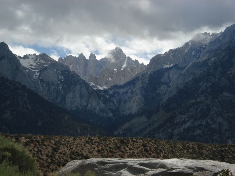
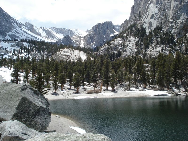
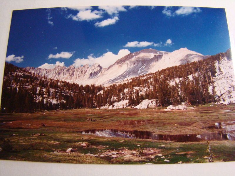
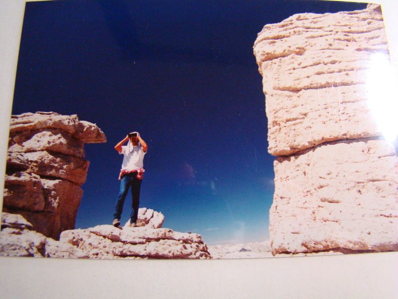
Hi Surf,
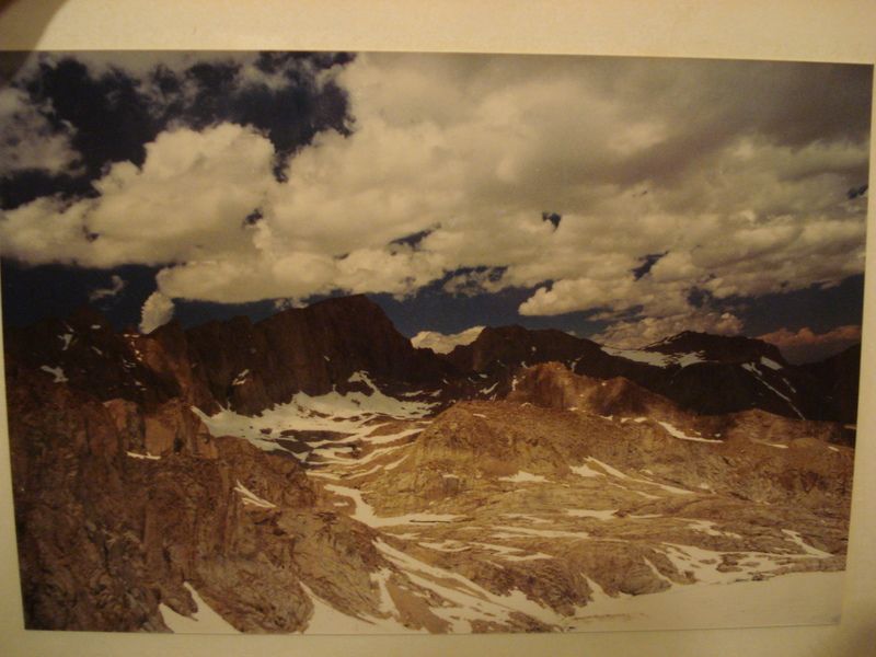
I found the pics! From June 1986. I climbed Whitney the following year in 1987.
Photo taken from Mt Langley elev.14,042 ft. looking at Mt Whitney elev. 14,505 ft. , Mt Tyndall elev. 14,025 ft. and Mt Williamson elev. 14,494 ft beyond a scant 11 feet lower than Whitney!
Cheers

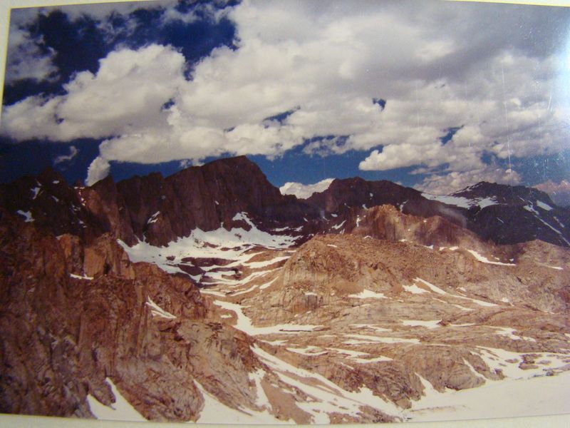
Photo taken from Arc Pass looking north at Mt Whitney
edited by rockhopper on 4/15/2016 |
4/17/2016
Topic:
Jacumba and Table Mountain Exploration
rockhopper
|
Jacumba / I-8 route is a very old coast to desert trail used my many over the centuries. Only fresh water source during seasonal changes. Great TR and nice Truck photo! |
4/18/2016
Topic:
Getting Married in the Valley of the Moon.
rockhopper
|
Wow! Congratulations. Nice thing is that you can always go back and it will always stay the same! |
4/26/2016
Topic:
Peak 6582
rockhopper
|
Congrats! Still need to do that one. Near by Rabbit peak still ranks as one of my all time toughest day hikes. I think I would do a two hike to Dawns peak also. "11 liters of water" Thanks for the tip. BTW good thing no body stepped on that rattler.
btw I just notice your leg damage. Was that thru the pants? No way you wore shorts right?
edited by rockhopper on 4/26/2016
edited by rockhopper on 4/28/2016 |
4/29/2016
Topic:
Moving to the desert
rockhopper
|
Welcome to the fourm and welcome back to your old desert friend ABDSP and surrounding area. We have family in Borrego going back to the 70's and we still find new places to explore. Borrego springs is one of a few "Dark sky" communities. Enjoy the nites too! My first trip in Borrego area was back in the 60's after a large earthquake near El Centro. The pavement on the 78 near Ocotillo was full "fresh" cracks. |
5/2/2016
Topic:
Santa Rosa Mnts / Martinez Canyon 12 Day Backpack
rockhopper
|
Nice expedition trip and great photography! I really like the sunrise over the Salton sea pic. Did you know of the plane crash site or just stumble upon it? Looks like it was on the ridge. Missed it by that much...Nice there was a little snow for water but cold at nite. Did you guys measure the low temps in the am? Nice arrowhead too! |
5/8/2016
Topic:
Santa Rosa Mnts / Martinez Canyon 12 Day Backpack
rockhopper
|
I think Gary will remember his sleeping pad next time. Heck, I bring two! I must be getting old. |
5/22/2016
Topic:
Rockhouse Cyn Wildflower Blooms in May
rockhopper
|
Great color and B&W photos! I really like photo #3 color. Don't believe I've seen that one. Really like that pic of Clark lakebed.Nice quartz arrow point! |
6/6/2016
Topic:
Canebrake Valley 3 Day BP
rockhopper
|
What a huge rarely travel area in the county. You could spend weeks looking around in that valley. Need to get out there some day!
Great trail report and photos. Wow 6 points in one trip! Rabbit and bird hunting points? |
6/6/2016
Topic:
5-25th thru 5-28th mini road trip to cool off
rockhopper
|
OK, so my brother calls me up and says "I want to check out this rock house on this USGS map in the Owens valley up on Tuttle creek" I know this is a little outside ABDSP so I hope I don't get flamed but we at least started in San Diego county. The cut off low was still holding on and low temps were still in the 30's down low. Below zero above 14,000 ft. Years ago I spotted a jet black glossy about 3" arrow head in the valley. None this trip.
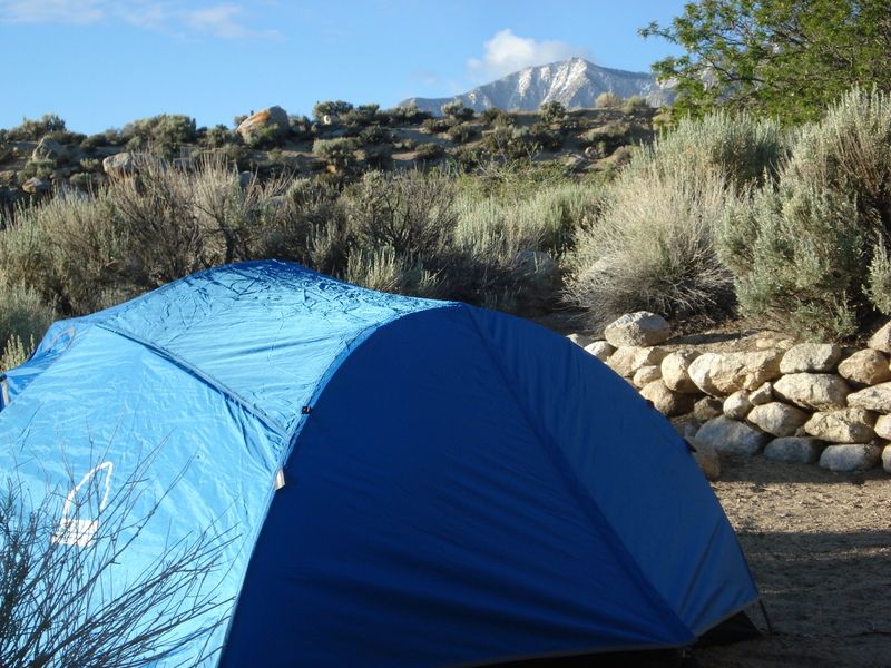
Lone Pine peak
Rock house in view
My Brother satisfying his obsession with the tiny black square on the USGS topo map.
Owens valley view from rock hose
The next day we hiked up lone pine creek. Mt Whitney in the clouds.
Lone pine lake with the Whitney trail beyond still covered in ice and snow. We saw few climbers heading up. Some looked well prepared. Some did not.
The next day we drove thru historic Keller. The old abandoned "End of the line" trail depot from the 1880's Cerro Gordo Silver boom.
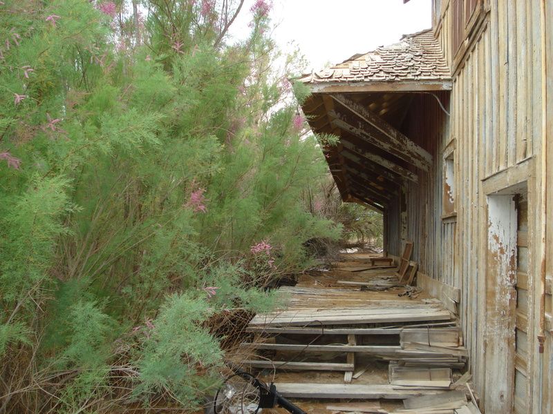
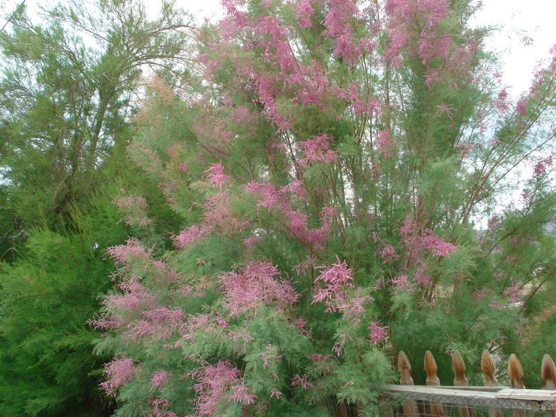
Tamarisk in full bloom. :-)
edited by rockhopper on 6/6/2016
edited by rockhopper on 6/6/2016
edited by rockhopper on 6/6/2016
edited by rockhopper on 6/6/2016 |
6/6/2016
Topic:
5-25th thru 5-28th mini road trip to cool off
rockhopper
|
ziphius wrote:
Nice trip rockhopper. What is the guess on the last dates of occupation of the 'little black square'? Anything interesting inside?
Thanks ziphius, The locals told us that the rock house was built in the 1960's or 70's as a spiritual retreat. Today it is completely empty inside with a concrete floor and pit and alter on the North side. We saw other hikers going up as we were heading down so I guess it's visited frequently. Not so great as a shelter as the wind howls thru all of the openings. |
6/8/2016
Topic:
5-25th thru 5-28th mini road trip to cool off
rockhopper
|
dsefcik wrote:
Cool, I am heading out next week to backpack for a week in Kern Plateau area, hope there is some snow still left....no pics of the cabin inside or such?
Daren,
I am out in Desert Hot springs soaking ( 79 degree to 105 degree high ) I will post more pictures when I return to the Mother Ship computer.
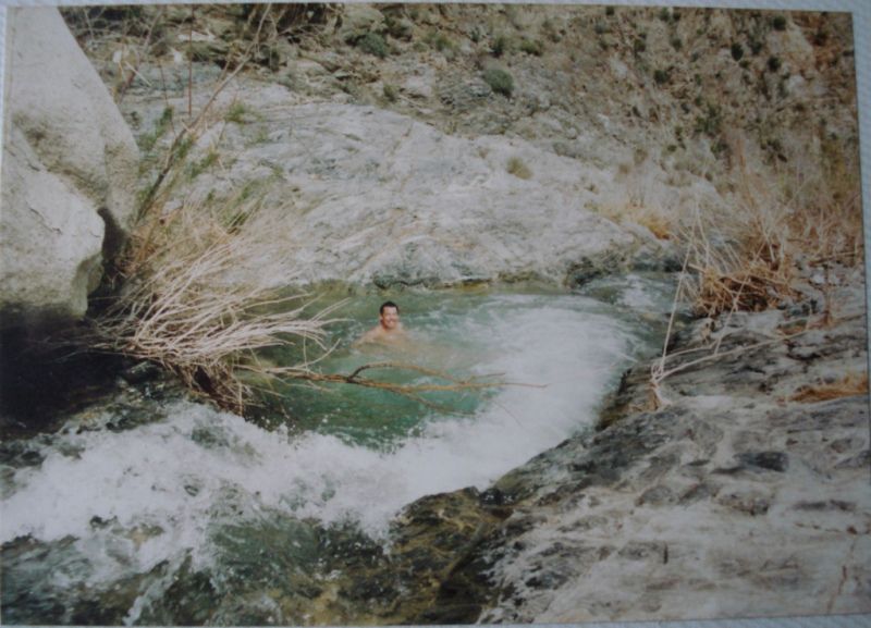
I'm back for the desert. We soaked in the Lithium hot springs at night.
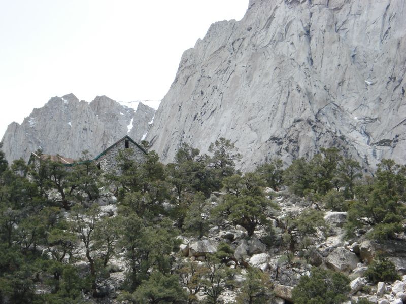
Here are some more pics from the Sierra trip.
The "rock house"
View to the west with my Brother
North view
Inyo mtns view to the east
Inside of the rock house. Nice of somebody to leave the rocking chair. :-)
edited by rockhopper on 6/12/2016
edited by rockhopper on 6/12/2016 |
6/8/2016
Topic:
5-25th thru 5-28th mini road trip to cool off
rockhopper
|
surfponto wrote:
Sierras are truly spectacular. Thank for sharing
Surf,
Thanks, I am always inspired with a Sierra trip :-) |
6/8/2016
Topic:
Proposed closures in ABSP, read and act now
rockhopper
|
Hmmm, A few bad apples causing this perhaps? |
6/12/2016
Topic:
To the top of El Cajon Mountain aka "The Beast"
rockhopper
|
Congratulations! That is one tough hike. Only 2 of 3 of us made the whole trip to the top of El Cajon Mtn and back. Our friends feet hurt so bad after about 3 miles in that he had to turn back. My Brother and I were too fired up and said "See ya later" and continued on to the summit.
Did you start at Wild Cat Canyon?
Looks like you will be in great condition for your Whitney trip.
btw I posted some more Sierra pics in my post below for your motivation :-)
edited by rockhopper on 6/12/2016
edited by rockhopper on 6/12/2016 |
7/2/2016
Topic:
A trip to the past
rockhopper
|
500 million years of exposed geology in our Salton trough rift zone. The oldest rock being on top of the Santa Rosa mountians being the pre - historic ocean bottom metamorphic rocks of the Cambrian period. Amazing! |
7/10/2016
Topic:
Canebrake Valley 3 Day BP
rockhopper
|
Roryborealis wrote:
This was found in Pedras Grandes on a leaf of a plant about 2 feet above ground. Literally lifted it as it grew. I wish I had a shot of that! I believe it's a dart, but not for sure.

That's incredible! |
7/24/2016
Topic:
7 Day Backpack in the Sierras
rockhopper
|
Looks like a great trip. We could spend the rest of our lives hiking the Sierras and see different places. I love the whole range. |
9/5/2016
Topic:
The Santa Rosas Sawmill Trail (Sort Of)
rockhopper
|
Great trail report! I remember the old cabin before it burned down. 20 years ago?? I might have some old film pictures buried some where. It's nice to get up and in the shade of the pines this time of year. I see Borrego Springs dipped into the 90's this week. Yeah!
Thanks for sharing.
edited by rockhopper on 9/5/2016 |
9/21/2016
Topic:
In Ko Pah Explorations and Monitoring
rockhopper
|
Nice trip report. Nice arrow point find also. Age guess of the arrow point? I also really like the Yucca / blue sky pic a lot!
btw I have also seen those incluse pottery edges and on face of pottery also. Age guess?
edited by rockhopper on 9/21/2016 |
10/4/2016
Topic:
Pottery Sherds Galore
rockhopper
|
I've seen areas like that. Grazing cattle in the past probably liked the ancient camping areas also. Further reducing the sherd sizes. |
10/4/2016
Topic:
Mount Whitney
rockhopper
|
Congratulations! Your training surely helped. The mighty Sierras are truly awesome. Hard to believe I have been visiting them for close to 50 years.
Here are some photos of "photos" from the past.
Mt Whiney summit with my friend 29 years ago.
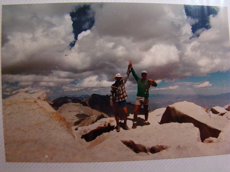
the thief who stole my binocular case.
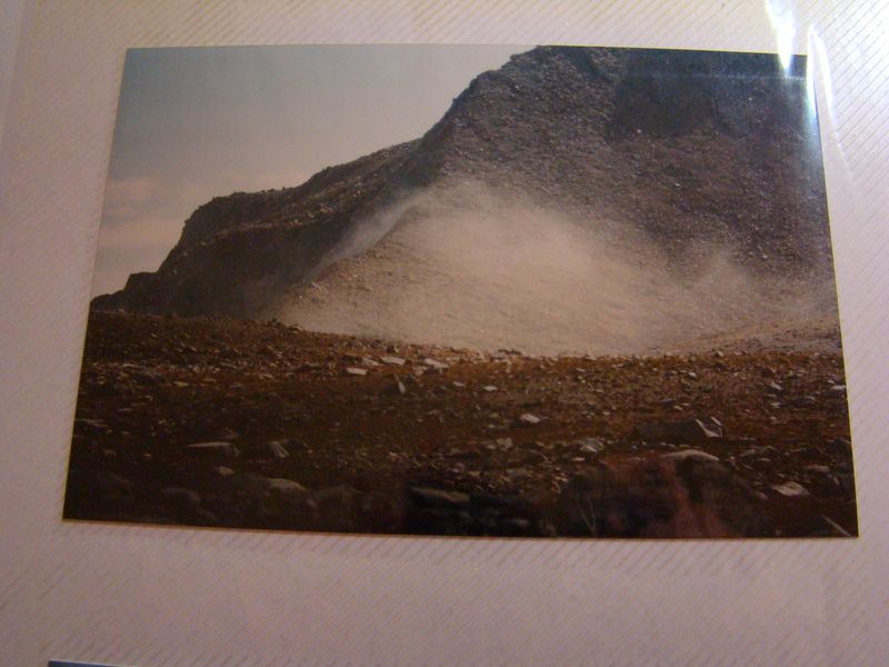
We also climbed Mt Tyndall while we were on our trip.
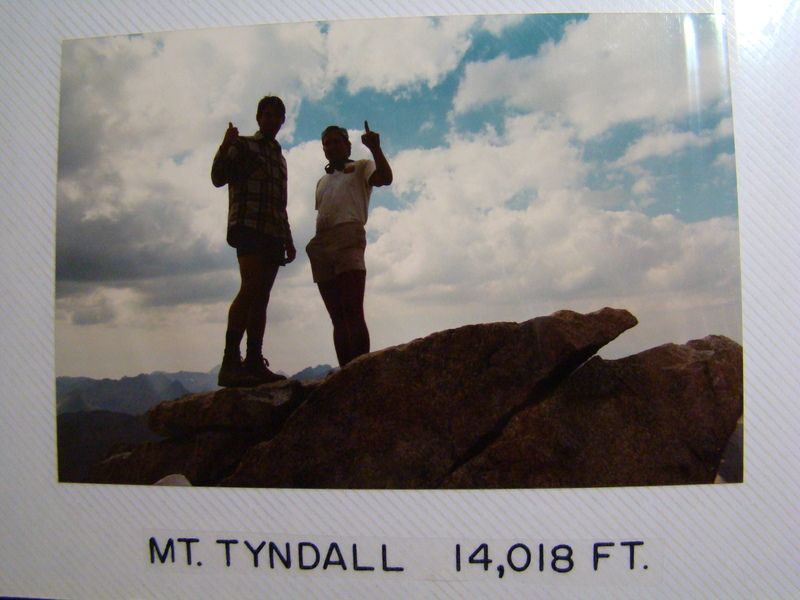
Landslide dust from Earthquake.
Mt Langley climb from the West.
Near the Mt Langley summit 30 years ago.
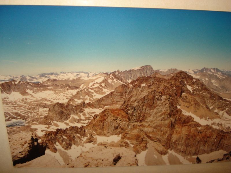
Mt Whitney from Arc pass near Mt.Langley.
Mt Whitney from Mt Langley summit.
Cheers!
edited by rockhopper on 10/4/2016
edited by rockhopper on 10/4/2016
edited by rockhopper on 10/4/2016
edited by rockhopper on 10/4/2016 |
10/17/2016
Topic:
Spanish sword found at Fish Creek Wash?
rockhopper
|
Robert
Can't really help you with the Spanish sword find, although I am sure there are countless metal objects buried out near and around the Salton sink / overland trails leading from Yuma toward San Diego, Temecula, White water, etc., etc from the many expeditions over the past hundreds of years of Spanish exploration.
Regarding the "lost ship", (I would add lost ship's) Many ships have navigated up the Colorado river in the past with many getting stuck and abandoned. It is possible the a shallow draft ship such as the pearl ship could row/sail into Lake Cahuilla (Blake sea) if they were extremely lucky and timing was perfect in that the Colorado river was entering the Sea of Cortez and the Salton trough concurrently. The sea was "filled" around 1600 according to the experts and dry by 1700 so the timing of 1615 is right. I have read over the years that the ship had been plundered years ago and the timbers were even hauled off to build corrals, etc. National Geographic went out and found little.
The Native Americans used boats for transportation of goods, fishing around the lake thousands of years ago during fills with fishing villages around the shore line. Many sites still are visible today. When the lake was in decline ( todays current level +/-) obsidian from Red Hill was exposed and available for trading and use.
Good luck! BTW excellent article you wrote.
A great source of countless hours of reading on this subject is on Wikipedia
https://en.wikipedia.org/wiki/Lost_Ship_of_the_Desert
edited by rockhopper on 10/17/2016
edited by rockhopper on 10/17/2016
edited by rockhopper on 10/17/2016
edited by rockhopper on 10/18/2016 |
10/31/2016
Topic:
Bahia de Los Angeles Road Trip
rockhopper
|
Thanks for the memories! Great trip report and photos. The picto graphs were neat find. My friends and I spent a lot of time in Baja in the 1970's thru the 1990's also. Hey living here in San Diego I was on vacation and didn't even know it and Baja was our other "backyard".! hehe. Baja was like going back in time. I'll add some pics for fun.
This trip was from the 90's
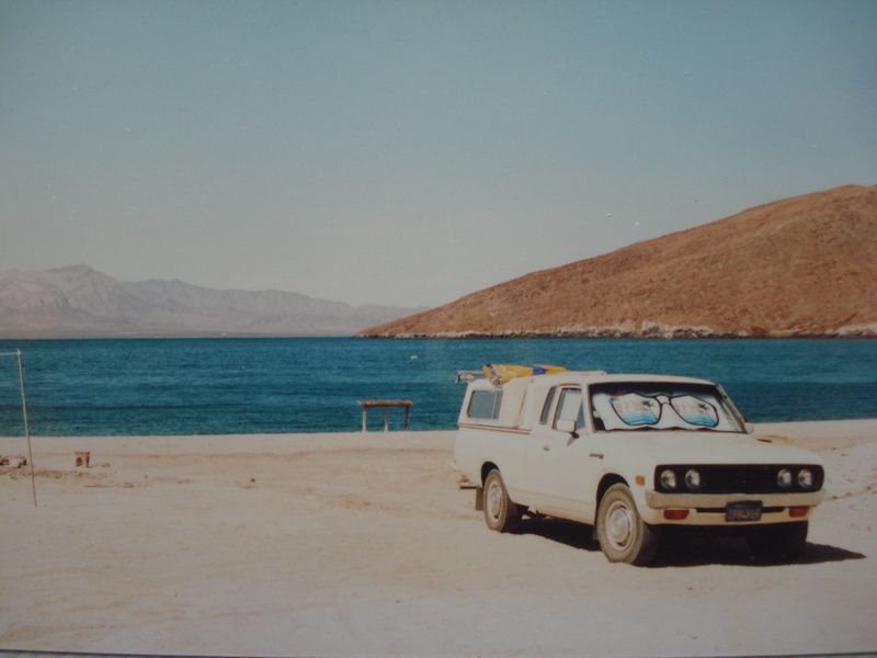
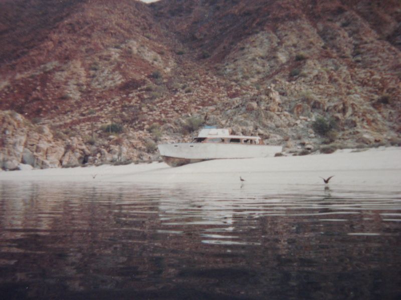

edited by rockhopper on 10/31/2016 |
11/16/2016
Topic:
animal trails vs old Indian Trails
rockhopper
|
I think IH pretty much summed it up. Old native American trails are more directional and more logical following ridge lines or paths towards saddles or water sources. Of course the animals came first, the natives just refined the trails much to the animals delight. In heavy brush areas following deer or coyote trails is the only way to go ( along with a folding saw) as the well groomed old native American trails have been grown over. Many times I have been hiking through ( read sawing through) heavy brush only to pop out onto an ancient native trail system with pot shards and stone chippings preserved within a perimeter of growth. BTW I am sure I made a few deer very happy by clearing out a jammed up section of deer trail. Hehe |
11/16/2016
Topic:
animal trails vs old Indian Trails
rockhopper
|
Looks like a classic Native American trail on a ridge line. Used by both now! |
11/16/2016
Topic:
June Wash marker
rockhopper
|
I'll have to forward this to my friend in the paleo department at the ADBSP head quarters. Looks like a archeological off set marker?? |
11/16/2016
Topic:
Curious Coyote
rockhopper
|
I Always enjoy the wild life photos. And a big Welcome !! |
11/18/2016
Topic:
Election Backpack
rockhopper
|
Sounds like a great trip. Nice photo log. And cheers for anyone that wanted MR. T.
That was one heck of a political enema! |
11/18/2016
Topic:
rock circles, rock alignments
rockhopper
|
There is plenty of info on Google. The rock circles I most encounter are old native camping sites. I still pitch a tent on them and try to channel the native American spirits. I think they say " Shut up and go to bed " ;-).
Sleeping circles near the edge of Lake Cahuilla
edited by rockhopper on 11/18/2016
edited by rockhopper on 12/22/2016 |
11/23/2016
Topic:
Wind tower collapses in Ocotillo
rockhopper
|
Strange, very strange. I would love to see the failure report. |
12/6/2016
Topic:
Carrizo Gorge Railway - Does the Saga Ever End?
rockhopper
|
Would be great if a Billionaire came along and made it happen again. Well, just because. |
12/22/2016
Topic:
rock circles, rock alignments
rockhopper
|
I guess I mean there are all kinds of rock circles?.....?
I've seen the spoke pebble wheels in the desert sand and close to the coast, but assumed they were a old hundred years old or so. Although circles in the right environment could last for centuries.
edited by rockhopper on 12/22/2016
edited by rockhopper on 12/22/2016 |