4/1/2022
Topic:
Impossible railroad trip
tekewin
|
Brian wrote:
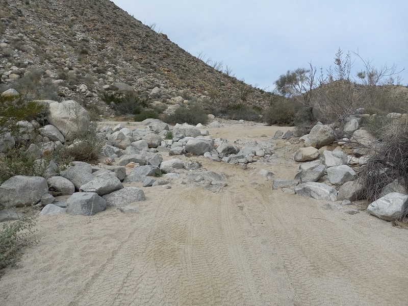
I want to go back and finish the route from Mortero Palms some time. I've been to the point where there's a dry fall overlooking the trestle but I was afraid to downclimb it. But I know that groups of all skill levels have done it, so it must not be that hard. I would have felt better if I was with someone who had done it before and knew the best approach.
We didn't down climb it directly, but traversed across the slope on the climbers right to an easier way down.

edited by tekewin on 4/1/2022 |
4/1/2022
Topic:
Dawns Peak Day Hike
tekewin
|
Dawns Peak (aka Lorenzens Peak, aka Peak 6582) is challenging peak in the Santa Rosa Mountains between Toro and Rabbit Peak. I prefer Dawns Peak (Jerry Schad's name), but I guess it is still officially 6582. I picked up my friend Henry at 2 AM in Mission Viejo and we drove to our starting point on Rockhouse Canyon Trail. The road was in decent shape, but the last few miles to the trailhead had large rocks and deep sand. 4x4 recommended. We started at 5 AM. After 1.8 miles, we started up the first steep ridge that leveled out into a plateau. We were following the standard route and it drops into a wash near the end of the plateau. The wash was easy going and mostly flat. A few dry falls required class 3 or a bypass which was always available. At the end of the wash, we dropped a water cache under a boulder for the return trip. Then, we climbed another steep slope toward peak 3439. At the top of the slope was another plateau, but we were surprised to also find a masterfully constructed 4' cairn. It looked like a mini-version of the giant cairn on Dawns Peak.


dropping into the wash

dry fall with a cool chockstone, we bypassed going up, but down climbed it coming back

Henry climbing the slope toward peak 3489

mini cairn on the P3489 plateau with Dawns in full view
We dropped off the 2nd plateau and started a mile plus traverse across open desert and small gullies toward the ascent ridge. We took a long break at the base of the ridge before starting the brutal 3000' of class 2/3 to Dawns. The ridge was broken into three steep sections with short connectors. The rock was solid, but may not be anchored well to the slope. Some manzanita, junipers, and pinyons dotted the landscape. We were now in full sun, and I was moving slowly but deliberately. At the top of the ridge, there was a final bump to Dawns summit. The brush and trees there were thicker. There was a mostly clear path through but we didn't find it on the way up, so ended up with some unnecessary class 3 and scrapes. The summit was glorious with the famous cairn as a backdrop to the 6000' drop to Clark Dry Lake. Both Toro and Rabbit looked very far away. Salton Sea was shining. Since there was no register, we left one.

start of ascent ridge


Two on the summit

Toro

Rabbit and Salton Sea
When we started down, we dropped a couple of hundred feet on a rib past our ascent path. It looked like it connected below so we forged ahead. This cost us more time and energy as we carefully dropped down a chute, then crossed an unstable scree field to get to the right part of the ridge. Correcting course overheated me a little and I never fully recovered. We continued down the steep ridges, easier with gravity, but nearly as slow as going up. By the time we got off the ridge, I was fairly miserable. It was a suffer fest the rest of the way. I alternated taking sips of water and pouring it over my head to cool off. I guessed it was 10 degrees warmer on the mountain than the NWS had forecast. One intentional change we made to our descent was that we dropped immediately into the wash below the Peak 3489. Going up, we climbed the slope more directly. I thought the wash route was better. Shortly after, we picked up our water cache. At sunset, I got some relief and enjoyed the shadows and twilight as we continued down. We almost made it off the mountain before dark, almost. The open desert return to the truck seemed to go on forever. I was in zombie mode at this point, shuffling across the desert, but did notice the bright star field. We made it back without seeing another soul on the mountain or the road. 16 miles, 6266' gain, 15.5 hours.

Down we go

Almost off the ridge

Almost off the mountain |
4/1/2022
Topic:
Dawns Peak Day Hike
tekewin
|
Buford wrote:
Nice. I prefer long day hikes to carrying overnight gear on hikes like that. When I did the route a couple years ago we also found that other giant cairn.
It’s a shame if the register is really gone. There were some good ones in there. It was in the base of the big cairn.
It's entirely possible that we missed the register(s). Henry's friend had gone up 2 weeks prior and said the register was gone. We honestly didn't look hard for it. I hope the original is still there. |
4/1/2022
Topic:
Dawns Peak Day Hike
tekewin
|
Rocko1 wrote:
Great job. Fantastic report. I hope to do this hike as a two day trip sometime. Make it to the plateau and attempt the peak in the early AM of the next day.
I think I would have enjoyed a 2-day more to be honest. |
4/1/2022
Topic:
Dawns Peak Day Hike
tekewin
|
Rocko1 wrote:
Any chance you can give approximate times to the final plateau and then up to the summit?
Looking at my track, best guess was 3.5 hours to the plateau with peak 3489 on it.
From there to summit, another 4.5 hours (3 hours from base of the ridge).
Took me 8 hours up, 7.5 hours down.
By comparison, Bob Burds report from 2013 took his group 9.5 hours round trip. |
4/1/2022
Topic:
Dawns Peak Day Hike
tekewin
|
Brian wrote:
Well done and great pics. On a loop trip I did earlier this season, I descended that ridge spur that you took up from Clark Valley. Even that part is no joke! And I was imagining what it must be like to deal with that at the end of the day when you've already tackled Dawn's and just want to be done.
At the end of the hike, I swore I would never do this kind of thing again. The next day, looking through the photos, I was thinking I would totally do something like this again. 10 years ago, it would not have been such a stretch for me, but that was 10 years ago, ha.
edited by tekewin on 4/1/2022 |
4/2/2022
Topic:
Dawns Peak Day Hike
tekewin
|
Rocko1 wrote:
I have said that about Villager after I hiked it. Then 2 years later I did Rabbit and swore never again. I am now contemplating doing Villager with a friend-his first time. Funny how we forget the misery.
edited by Rocko1 on 4/1/2022
Yes, it's exactly like that. Have fun on Villager again! |
4/2/2022
Topic:
Dawns Peak Day Hike
tekewin
|
Scooter wrote:
Outstanding trip report. That is the toughest hike in Borrego. We have done the trip both as a day hike and an overnight.
The day hike we camped the night before at the trailhead on Rockhouse road. We left before sunrise and like you came back in the dark. The overnight we spent the night in the flats before the final ascent to Dawns. We also spent the night on Dawns when we traversed the Santa Rosas from Toro to Villager.
I like the overnight version to Dawns. Pack super light, no stove etc because it is all water weight.
Thanks for posting
Sitting between Toro and Rabbit, looking at the terrain and distance between them, increased my respect for anyone who did the Santa Rosa traverse. That is rough terrain with unclear connections in places and few bail points. A magical place. |
4/3/2022
Topic:
Dawns Peak Day Hike
tekewin
|
rockhopper wrote:
Good show man! That's one tough hike. Sounds like you were awake more than 24 hrs. But where are your hiking poles! No poles? I use them going down and have saved me a spill more than a few times. Your right about forgetting the misery. Doing a day hike of Rabbit peak, I swore I would never do that again. If I did Dawns, I would make a base camp. Great trip report.
I usually use a single pole, but thought it would be counterproductive with so much scrambling. Might have saved some stress on the knees but it was also a little less weight. With drive time, I was up almost exactly 24 hours. My poor friend Henry had to drive another hour back to LA. He was drinking coffee on the way back. |
4/5/2022
Topic:
Impossible railroad trip
tekewin
|
Buford wrote:
Bypassing the dryfall in Goat Canyon was no big deal from my memory.
The museum is accurate to some degree. Some of the other trestles and tunnels are there. Puff BM is there. Even if not 100% accurate, the models give a pretty good idea of the area.
edited by Buford on 4/1/2022
I'm surprised they included Puff BM, kind of an odd detail. Did they show the collapsed tunnel on the right side (from the photo viewpoint)? I can't tell from the angle. |
4/6/2022
Topic:
Back to Whale
tekewin
|
Cool trip! Hey, I really like the terrain in Smuggler Canyon. Looks like a lot of fun.
That native shelter boulder looks unusual. I wonder if the boulder erosion is completely natural or if it was shaped.
I can't imagine hauling a tent around and camping on a whim. I can appreciate the true nomad spirit I seem to lack  |
4/6/2022
Topic:
Camera found in Santa Rosas- Update
tekewin
|
Not my camera, either, or anyone I know.
You should definitely investigate the photos to possibly find a clue to the owner.
Maybe post a few photos if there are people someone might recognize.
I did lose a Garmin GPS somewhere below San Ysidro East if anyone finds one there. |
4/10/2022
Topic:
Martinez and Agua Alta 3 Day backpack
tekewin
|
Magnificent trip. With that many miles, I'm surprised your water lasted.
I could barely make out your satellite circle. I do like exploring via Google Earth and heading to interesting places. I don't do that enough.
Thanks for sharing! |
5/10/2022
Topic:
Alta Seca Bench
tekewin
|
A very interesting trip and great photos!
Did you start on Toro or just below it?
Seems like a mostly unexplored area. |
5/21/2022
Topic:
Camera found in Santa Rosas- Update
tekewin
|
Cool! Nice sleuthing. |
8/28/2022
Topic:
Cuyamaca
tekewin
|
Nice snake pix! Rare to see one right after a kill like that. I wonder if a rattlesnake could let go of the prey without eating it first. Fangs might not be able to retract unless he bit it first and was just starting to eat it. |
9/13/2022
Topic:
Hi there!
tekewin
|
Welcome to the forum! Lots of great people and info here and it will get more traffic as the weather cools.
AB is one of my favorite places to hike. Like you said, a lot less crowded than most places even during peak months.
I just did 6582 at the end of March as a day hike. It was already a little warm. One of the most difficult hikes in AB, but amazing scenery all the way. |
10/30/2022
Topic:
Indianhead North Ridge
tekewin
|
It's desert season! I started this year by visiting Indianhead for the second time. My first trip was in 2013 following DPS route B, up Palm Canyon then back along the southwest ridge. This time I tried the north ridge. I drove to the intersection of Borrego Springs and Henderson Canyon, then followed the dirt road past the Jeep statue as far as north as it went. I followed a use trail up a wash toward Henderson Canyon. Approaching the main gully, I noticed some bones of a bighorn scattered around. A brief search revealed an intact skull, a spine, and a couple of legs with flesh still clinging above the hoof. The kill didn't look recent. Just right of the gully, I started climbing in the shade of the mountain. The ground was littered with large boulders, low vegetation, and a surprising amount of grass. The north side must retain water long enough for the slopes to be grassy instead of barren like the south side. This helped with traction as it grew increasingly steep.

Golden hour, summit not visible yet


Easy walk to the summit from here
The route crossed some of the minor ridges to avoid the worst terrain. There was a lot of low level scrambling, but only a couple of moves I'd consider class 3. The slope continued to get steeper near the top and some of the boulders grew to the size of shipping containers. Multiple registers filled a plastic container. I signed the newest one, the previous entry from March. After taking some photos/videos, I headed for the south summit, a prow jutting into space. I had not visited it on my first trip. A faint use trail traced the bottom of the angled slabs and it was easy to get to the high point. It had a dramatic precipice and view. While there is no easy way to the top of Indianhead, the north ridge seemed easier than DPS route B. That impression might be due to having more experience now. The north ridge does provide shade in the morning, so requires less water. Indianhead remains one of my favorite desert peaks.

South summit

San Ysidro East

Looking down from south summit


Heading back down the north ridge

edited by tekewin on 10/31/2022 |
10/31/2022
Topic:
Indianhead North Ridge
tekewin
|
Brian wrote:
Great pics. S Summit doesn't look like a place I'd be comfortable (fear of heights kicking in just from your video).
I think it looks far worse than it is. Definitely worth a few minutes to check out if you trudge all the way up there. |
10/31/2022
Topic:
Indianhead North Ridge
tekewin
|
Rocko1 wrote:
That looks like one tough hike. Did they lift the ban on drones for AB?
Indianhead is a pretty tough hike, but it's not an epic like Rabbit or Dawns.
And a great big mea culpa on the drone. Still banned. I feel pretty dumb for not doing a 2 second google search on this beforehand. So that was the first and last flight in the park.
The laws are a complex mix of federal, state, local, and FAA.
Here is the CA state park rule:
Drones are currently allowed in State Parks, State Beaches, State Historic Parks, State Recreational Areas, and State Vehicular Recreation Areas except where prohibited by a District Superintendent’s posted order.
But I'm not making an excuse. It was a mistake and I should have known.
I don't think anyone was harmed, or annoyed, or heard it, or saw it since I was alone on top of Indianhead.
As an aside, my understanding of the general rules:
National Parks - no
National Monuments - no
Within 5 miles of an airport - no
National Forests - yes, except where prohibited by an order
CA state parks - yes, except where prohibited by an order
BLM land - yes, except where prohibited by an order |
10/31/2022
Topic:
Indianhead North Ridge
tekewin
|
Buford wrote:
Nice. The pictures definitely capture the terrain well. Great start to the desert season. That invasive fountain grass in the pictures is everywhere now. Sounds like the dirt road was open? It's been gated the last couple times I've been back there and was forced to park at the paved curve in the road.
I've done the route you just did and was also surprised at the amount of normal grass on the slopes. Kept it from being too loose but was slippery in it's own way. Another time I came up Henderson Canyon to the Palm Mesa high point, then traversed down to Indianhead hitting all the high points along the way before dropping down to Henderson again.
I remember your report on Henderson Canyon. I actually looked at the rest of the canyon route last night on Google Earth. Looks fun. Making that entire giant loop, not as fun. I went to Palm Mesa High Point from the west via north fork. That was memorable because my partner got double quad cramps on the Palm Mesa summit. Made for a long, tense, return trip. No rescue, so success!
It was pre-dawn when I arrived at the intersection. There was an open dirt road to the Jeep and I just kept going north. I didn't notice any signs, but that doesn't mean they were not there. |
11/2/2022
Topic:
Indianhead North Ridge
tekewin
|
rockhopper wrote:
Nice rock scramble! Fantastic views. Thanks for posting the trail report and for kicking of the desert hiking season. I need to get in gear!
Let's go! |
11/2/2022
Topic:
Pinyon Ridge and Wilson BM
tekewin
|
Awesome trip! The Wilson are is really nice.
Where did you find the Vega BM? It's not listed in Peakbagger. It must be in the area, but you found a thing.
Sunset shot is perfect. |
11/2/2022
Topic:
Tropical Storm Kay aftermath
tekewin
|
Umm, not a rumor, that's a washout.
Good find!
edited by tekewin on 11/2/2022 |
11/15/2022
Topic:
Happy cabins and Myer Valley
tekewin
|
Great trip! That area south of I-8 is some place I've never been. It's looks fun with all those rock piles.
Never heard of "Happy" either, so thanks for the lore. |
11/15/2022
Topic:
White, Wee, Chimney Rock and Pines
tekewin
|
Nice! That is one of my favorite areas of the park.
I've seen a lot of deer around and lots of other tracks. Found an intact baby deer skull near Goat BM, a little NE of White. Also "smelled" cat pee nearby, like fresh pee. Freaky, but never saw anything.
You should definitely go back for Thimble and San Ysidro. Super fun. Easiest way to get there is from Cherry Canyon. I can upload a track if you aren't sure where to park. |
11/15/2022
Topic:
Lucia and Alamo Canyon Rock House Ruins 2-3 day BP
tekewin
|
Rocko1 wrote:
Really fantastic report. I suspect the ducks are for the Villager east approach. I have always wanted to explore that side of the mountain but the parking logistics always deterred me.
Yes, that's east approach to Rabbit through Barton Canyon. The white rocks really stand out in the dark, very helpful.
Amazing trip. Had no idea so many artifacts were out there.
edited by tekewin on 11/15/2022 |
11/16/2022
Topic:
White, Wee, Chimney Rock and Pines
tekewin
|
Rocko1 wrote:
That would be great. I saw many private residences and roads closer to Thimble, just didn't know if it was safe to park there.
Here is google map from Borrego Springs:
https://goo.gl/maps/uwLjfZUUgHy2zUAc7
I usually take Lease Road to the unsigned Cherry Canyon Road. It's dirt road that goes over a small hill and there are some ruts, but you don't need 4x4. There is a small turnout on BLM land that fits maybe 3-4 cars. There are private holdings all around. The trail starts up the dirt road, then turns into a single track. I also attached a GPX of the most direct route to the Thimble. |
11/28/2022
Topic:
Bighorn Canyon, 3,567 Peak and Guzzlers
tekewin
|
Great trip! I love that area. I remember lots of agave on Bighorn Canyon, must have forgotten about the cholla.
Thanks for tracking those pipes back from Blue Spring. I wondered what was at the other end. |
11/30/2022
Topic:
Elephant Benchmark
tekewin
|
You might have noticed Elephant Benchmark (3392') if you have been to the Split Mountains in the southern part of the park. It was named after the rare elephant trees that grow nearby. Elephant trees are mostly found in Baja, Mexico. The trailhead was the Elephant Trees Discovery trail, a one mile loop that has a couple living trees along the trail. And a couple of dead ones. "Hardcore" Henry Chen joined me on this trip. We passed a couple of elephant trees before reaching the major gully north of Elephant. We followed that to Starfish Cove, a confluence of five drainages. From there, we took the ridge. Rocks on the ridge were solid, cactus and agave were abundant, and nothing exceeded class 2.


This was the first elephant tree we found


Henry on the ridge, Starfish Cove below
A small boulder marked the summit and we found a register dating from 1980. Elephant gets an average of 2 visits per year. The last one was in March, 2022. We signed in and read the entires of the adventurers from last 42 years. Views were great in all directions. It had taken us longer to reach the summit than we expected and we decided to take one of the ridge lines down. We picked a ridge south of the ascent gully, but were confident it was unbroken. We scrambled down the class 2+ ridge slowly, dodging cactus. When we reached the top of the final ridge section, we decided to drop into the major eastern gully. That section was sketchy and loose. By our lights, most of the eastern ridge lines will go, and more efficiently than going up from Starfish Cove. When we got back to the trail, we took the other part of the loop, finding the largest and healthiest elephant tree of the day. A fine day in the desert.

Split Mountains (near), Fish Creek Mountains (far)
 \ \
Summit


Biggest, healthy elephant tree on the Discovery Trail

edited by tekewin on 11/30/2022 |
12/12/2022
Topic:
Elephant Benchmark
tekewin
|
tommy750 wrote:
Nice TR. I made it to the bump in the upper left of your second pic a year ago and found cement filled boots in a shelter. There were quite a few healthy looking elephant trees on that side of Alma. As I recall, all the trees seemed about the same size and I didn't seen any "baby" ones which was concerning. Always nice to see the familiar Fish Creek area from a new perspective. Looks like your decent ridge was pretty bouldery.
We didn't see any baby trees either. All the ridges were pretty bouldery, but not overly difficult. I regretted bailing into the wash too soon on the way back. I think it was slower in the wash. |
12/12/2022
Topic:
Elephant Benchmark
tekewin
|
Buford wrote:
Cool trip report. That area is unique. Starfish cove looks interesting, never been there. Any sign of the rest of the bighorn skeleton, or was it just a lower leg?
We found the biggest elephant tree in a side canyon coming down off Elephant BM.
Having read the Schad description, we looked for more skeleton parts, but only found a few scattered bones. Nothing resembling a full bighorn. I imagined Starfish as a wide, flat, sandy area. But it was kind of rough, with boulders, vegetation and mud walls ranging from 5' to 25'. Also much bigger than I expected. |
12/14/2022
Topic:
Elephant Benchmark
tekewin
|
dsefcik wrote:
My son and I backpacked to Starfish Cove back in 2011, there was a BHS lamb skeleton in the wash. Starfish is a drainage, it can be bouldery and hard to navigate or open depending on the season. In another year my son and a couple of other friends backpacked from Little Blair over Whale Peak and down into Starfish via Hapaha, it was a tough 2 day trip that required water stashing prior. I would totally do it again.
---
edited by dsefcik on 12/13/2022
That's an amazing find! |
12/31/2022
Topic:
Stone Circle
tekewin
|
Interesting circle.
That's a big engine for those narrow rails.
Thanks for the photos. |
12/31/2022
Topic:
Grapevine Mountain
tekewin
|
dsefcik wrote:
Nice, have never done the PCT side, have always gone the Schad route and then drop down into Bitter Creek Cyn to return. The Schad route can be tough with the false summits and rocky ridge.
Funny, I've only done the PCT route. This gives me a good excuse to go back and try the Schad route. |
12/31/2022
Topic:
Salton Sea to Lake Cuyamaca-SDTCT
tekewin
|
What monster trip! Great job! |
1/11/2023
Topic:
2023 ABDSP and surrounding areas
tekewin
|
New year, awesome start! |
2/1/2023
Topic:
6582
tekewin
|
Great hike and photos! Glad you made it.
When Henry and I visited, we didn't find the register, but didn't know it was located in the base of the cairn. It might have been there. We left another in the open that maybe was removed or added to the original. These photos kind of want to make me go back, but I also remember how I felt coming down. Haha.
The bighorn carcass was a great find.
On thing being up there really solidified is actually how far away Rabbit and Village look. Knowing how thick the brush can be it seems to be a very daunting task to get to them.
Yeah, they both looked a long way off. Crazy that some people have traversed the entire ridge in one go. |
2/14/2023
Topic:
Haystack Mountain
tekewin
|
I recently discovered Haystack Mountain in the Santa Rosa foothills. The starting point was the Art Smith Trailhead in Palm Desert. The trail was well groomed and started up in earnest through rock piles and varieties of cactus. Barrel cactus in particular seemed to love this area and got larger as I went up. I passed a couple of splinter trails that descended to residential areas. About 2.5 miles in, I reached a palm oasis which seems to be a popular destination.


A little more than 3 miles in, I left the trail and headed toward Haystack. There were multiple ridge line options, but the second ridge seemed the most uniform. Once I gained the ridge, there were 4 peaklets to overcome. Each had a steep section, then the slope leveled off until the next one. The final peaklet was class 3 but had a bypass on the right. The final mile gained 1300'. When I got off the ridge, it was an easy quarter mile walk up. The summit had a large cairn and a register that went back to 2010. I was surprised how often it had been visited, maybe 10 people a year. A reference mark and benchmark were not placed by the USGS, but by the US Army War Department in 1951. I found the views on top superlative. San Jacinto and Gorgonio maintained their winter snow coats, but were looking less covered than last month.


San J and San G.

LaQuinta ridge with several fun peaks

Martinez (left) and Toro (right), and I think one of the bumps in the middle is 6582.


Descent
No wild life this trip. 10 miles, 3400'. I think you can hike to it from the other side on Dunn Road, longer but less gain. |
2/27/2023
Topic:
Haystack Mountain
tekewin
|
rockhopper wrote:
Very nice hike. Brian is right. There is a lot to explore in the Santa Rosa and San Jacinto wilderness. The PCT thru the San Jacinto's is a favorite.
Looks like you scored a perfect day for your hike!
Got lucky considering the weather we've had this year. |
2/27/2023
Topic:
Haystack Mountain
tekewin
|
Rocko1 wrote:
Very cool views up there. That's a bit too far of a drive for me. My back can hardly take driving to Borrego Springs these days lol.
I've resigned myself to long drives. I like doing new mountains if possible, but the radius for new stuff keeps getting wider. The first time I drove to Indianhead (2 hrs 15 min one way), I thought I won't do many drives that long again. Bzzzt! My tolerance is higher now, record day hike drive so far is about 4 hours one way to the SLO area. At some point, overnight becomes mandatory, just for safety driving home. |
2/27/2023
Topic:
Haystack Mountain
tekewin
|
Brian wrote:
Man, there's so much to explore in the Santa Rosas. I've only done a little bit on the east and north sides (basically both ends of the Cactus Spring Trail). I have a nice map of the Santa Rosa and San Jacinto Mountains National Monument that I got at the visitor center at the bottom of the Pines to Palms HWY. Every time I look at that map, I just see lots of places I want to explore.
Yeah, especially the east side of Santa Rosa for me. I've only been to a few of the major peaks there. |
2/27/2023
Topic:
Indian Canyon
tekewin
|
Nice trip!
I was wondering about the water level at second crossing with all the rain we've had. Nice to know it was passable. Who knows after this last set of storms. I love Collins Valley.
I got lucky and was able to do a number of hikes out of Los Coyotes before they had any driving restrictions. I got Square Top from there, probably the shortest route. Also Palm Mesa, Pike BM, and Cody BM. |
3/16/2023
Topic:
Bisnaga Alta to Near Whale Peak
tekewin
|
Very impressive trip! I don't think I've seen that route before, but wasn't on the forum back in 2011.
You really have an eye for native artifacts. I'm sure I walk by treasures all the time in complete ignorance. |
4/25/2023
Topic:
Trail Cam from long ago.
tekewin
|
Curious to know what's on it. |
5/4/2023
Topic:
June Wash Camping/Diablo Hike (April 2023)
tekewin
|
Great report! Sounds fun. I like the views from Diablo, broken earth. Haven't been up June wash, but it looks nice. |
5/4/2023
Topic:
oldBayHiker
tekewin
|
Welcome! I also have a 4x4 Tacoma. It has more features than I will probably ever feel comfortable using. I haven't run into much trouble on the dirt roads in AB. Of course, I don't seek out the dangerous places like the Squeeze or Heart Attack Hill. Much to explore! |
5/4/2023
Topic:
Notify
tekewin
|
There used to be a check box when posting a reply to get notified of additional replies. I can't find it now. |
11/13/2023
Topic:
Crowds
tekewin
|
My wife and I camped at Palm Canyon over the weekend. It was our first time staying there. Fancy campground with showers, really nice.
Since it was only her second time in the park, we visited some of the classics. Maidenhair Falls, Slot loop, Calcite mine. Maidenhair was barely a trickle. Dark, stagnant water at the base and lots of bees. Also a lot of tarantula hawks along the trail. I was surprised by the $10 day hike fee at the trailhead. I haven't been there in a few years, maybe it's not new.
The last time I was at the Slot was about 10 years ago. Since then, a toilet building has been added, the parking area is larger with an overflow, and a park employee was set up collecting the $10 fee on the drive in. What shocked me was the crowds. When we got there at 8:30 AM, about a dozen vehicles were already there. We passed a family of 8 and other parties slowly working their way through the slot. We did a loop around the back toward Borrego Mountain, then made a failed attempt to get back to the main canyon by just heading in that general direction. Hit dead ends about 200' from the main canyon according to GPS. Easy to backtrack and get out, but it was fun to explore some of the side slots. When we got back to the parking lot, there were 40 vehicles and dozens of people wandering around. I am guessing social media (plus the holiday) has exploded the popularity of the Slot.
There were also a lot of people at the Calcite mine. At least 10 trucks passed us either driving in or out.
It wasn't the sparsely populated park I remember even from the last couple of years. Maybe it's because I tend to hang out in harder to reach places, but the crowds were a real bummer. /rant off. |
11/23/2023
Topic:
Crowds
tekewin
|
surfponto wrote:
That has been our strategy Tom. Retired two years ago and we try to do al of our trips starting on a Monday. Occasionally we will meet friends and do a weekend trip but I try to avoid it for the all the reasons stated in this thread.
I tend to blame social media and hashtags 🙄
Will be my strategy too next year. Retiring at the end of the year, or at least downshifting. Might still work part time. |
11/30/2023
Topic:
Crowds
tekewin
|
surfponto wrote:
Congrats on your upcoming retirement 👍
Thanks! It's exciting but also weird. |
12/18/2023
Topic:
Crowds
tekewin
|
dsefcik wrote:
I retired summer 2021, same as surfponto I believe....can't imagine ever getting up every day and going to work again..I have not missed a single day or work!!
Longer story coming soon about that though.
Congrats on the retirement! I'd be interested in hearing that story.
It's hard for me to imagine NOT getting up every day and going to work. I plan to do some online tutoring, but I want to work 2-3 days a week. I need to be doing something productive since my wife has a few years to go for her pension. I don't think I'll miss the full time grind, but I will miss some of the people.
edited by tekewin on 12/18/2023 |
1/11/2024
Topic:
Tesla Cybertrucks tearing up Anza Borrego Desert
tekewin
|
Pretty wild. Do you think they are damaging the truck trails?
I don't know, but my guess is most people who would buy a cybertruck are probably not skilled off road drivers. |
1/11/2024
Topic:
Indian Gorge Campout
tekewin
|
Nice report and photos, thanks for sharing.
I've been hiking in the desert for about 10 years and never seen a boa, so that was a special find. |
3/16/2024
Topic:
My Retriement
tekewin
|
Congrats on retirement! Even though it was a couple years ago.
Those are awesome photos. Very different critters there. I read why you chose Florida, but wow, going from one of the driest parts of the country to wettest. I love mountains too much to live somewhere flat. I don't do harsh winters any more either, so that rules out much of the country for us.
Best of luck going forward and hope you get back to the desert soon. |
3/16/2024
Topic:
Knee replacement
tekewin
|
Good job getting outside. It sounds like it was an improvement, though I am sure it was painful. |
3/16/2024
Topic:
Greeting!
tekewin
|
Welcome! |
19 days ago
Topic:
Middle Ysidro
tekewin
|
I retired on 12/13/23 and had grand plans. Middle Ysidro was early on the list. Unfortunately, on 1/1/24 I rolled my right ankle while running breaking the fibula just below the ankle joint. On vacation in Hawaii. Aloha! First broken bone in my life. Wore a boot for a month, lost half my right calf muscle, and did physical therapy for two more months. I had done a couple of small hikes in February, but this was going to be a real test.
My friend Sean and I started out from S2 just past the Anza-Borrego sign. We made our way past the Bonnie and Clyde benchmarks, then spent a couple miles side-hilling around White BM. As a bonus, I wanted to check out some granite formations that caught my attention on a previous trip. There were four towers (30'-70') on a shelf above the drainage that leads to Hob BM. I called these Hobs Knobs #1-#4. They are nearly in a direct line between The Thimble and Goat BM. Number 4 was the closest and I found an easy ledge to the top. Next, I checked out Number 1 to the east. I saw a good class 3 line using ledges and slabs. I saved the others for a future trip. We crossed the drainage and started up the ridge toward Hob. It would have been easier if we had followed the major gully east of Hob since it had less brush. After reaching the ridge line, we got a look at Middle Ysidro across a brushy saddle.


Knob #1

Me on Knob #1, hard to see

Half way up the ridge

At the base of Middle Ysidro
Sean led the route up some boulders to avoid the worst vegetation. The highest point was northeast of the false summit. The high point was a boulder requiring a single class 3 mantle. There were no marks and no register. Views from the middle of the range were striking. It took us six hours to reach Middle Ysidro. I had planned an eight hour round trip, so water and food were going to be a problem. On the way back, Sean collected some emergency water from a small snow patch and from a puddle on top of a boulder. We descended the gully and made better time. Instead of going back through Hobs Knobs, we followed the drainage, trading extra steps for an easier grade. We took frequent breaks in the shade on the way back. I rationed both food and water. Sean treated the murky water he collected with purification pills and drank up. I drank some of the snow melt, but was not keen on the boulder water. Sean's route finding was key in certain places and I don't think I would have completed this hike without his help. When we reached the truck, I guzzled the water I had, but was very dehydrated. We stopped at the Pala mini-mart on the way back and I loaded up on ice cold drinks. After downing a Gatorade, I was right as rain. I underestimated the effort required for Middle Ysidro. My ankle was sore, but with minimal swelling and no lingering pain. The ankle appears to be back in working order. Hope I can get to the desert a couple more times before it gets too hot.


Sean on the summit block

Amazing Ysidro ridge

Rest stop on the way back


Nursing the last bottle of water

11 miles, 4211' gain, 11 hours |
11 days ago
Topic:
Middle Ysidro
tekewin
|
Britain wrote:
Nice! Looks like your back on the trails!
Yes, great to be moving again. |
11 days ago
Topic:
Middle Ysidro
tekewin
|
Brian wrote:
Nice trip report. I made a half hearted attempt at the western summit last spring but ended up not wanting to deal with the amount of brush on the final approach to the ridge.
I get it. There can be a lot of brush depending on the route you take. Ysidro and the Thimble used to be short-ish hikes from Cherry Canyon. However, with that parking area gone, it's a more serious hike from S2. |
6 days ago
Topic:
Pinyon Wash to Harper Cabin
tekewin
|
Those blooms are amazing. Sounds like a successful trip and kudos for being kind to the biker.
Is the road OK all the way to Harper Flat or even Hapaha Flat? I've only been down that road a little ways to hike to Sunset Mountain. |
6 days ago
Topic:
Pinyon Wash to Harper Cabin
tekewin
|
surfponto wrote:
We went via Pinyon Wash but yes the road in from the other side looked fine.
I have never gone that way and it looks interesting.
Yep the cactus flowers were great. Such a good time to take a trip out there. 👍
Thanks! |
5 days ago
Topic:
Middle Ysidro
tekewin
|
tommy750 wrote:
I've never even heard of Middle Ysidro but looks like a great day hike. Glad you were able to recover from your ankle injury and keep going.
Haha, yeah, it's an unofficial peak with a topo mark in the middle of the range. There were no official marks on the summit. I wanted to hike there because I like the peaks on both ends of the range and it felt incomplete.
I am glad to be able to do longer hikes again and not have it be the limiting factor. |
5 days ago
Topic:
Pinyon Wash to Harper Cabin
tekewin
|
Brian wrote:
That road ends at a canyon which is a short hike up to Harper Flat. The road that passes Harper Flat on the other side can be accessed 2 ways. One end goes in from Pinyon Mountain Road (which necessitates negotiating the squeeze and heart attack hill). The other end goes in from Fish Creek and passes through Hapaha Flat. The biggest obstacle I know of on that route comes just before you get to Hapaha and looks like this:
It's no longer legal to drive through Harper Flat (despite the fact someone did it last summer and was later found dead).
edited by Brian on 4/12/2024
Thanks! That's great information. I might try a hike to Harper Flat from Pinyon Wash. I want no part of the squeeze or heart attack hill. Coming from Fish Creek is a lot of driving. The Vallecito Mountains and surroundings seem like a really remote part of the park. |
12 hours ago
Topic:
Middle Ysidro
tekewin
|
deborah wrote:
That injury sounds like it was rough - good to hear you are back at it! And nice job reaching the peak. It's a good feeling when you get a "project" completed.
Deborah, thanks for the kind words. The break could have been much worse. At least I didn't need surgery. The only thing I can't do on it now is sustained jogging, but it doesn't hamper my hiking plans. I missed the meaty part of desert season, but the mountains aren't going anywhere. |