2/8/2010
Topic:
Bighorn Sheep Sighting in Anza Borrego
hikerdmb
|
I read your post (somewhere else on this site) about looking for the railroad camp in the Indian Hill area and noticed your pics of the pictographs. Did you find the tank just across from the cave? A short distance up the hill. Was it full of water? Make sure you go back again and search for the camp it is a cool find. There is a shelter that is built with cans. It has a neat feeling to walk around and know how many people were there and working on the tracks. |
2/9/2010
Topic:
Bighorn Sheep Sighting in Anza Borrego
hikerdmb
|
I tried to attach a scanned copy of the map of that area. But the site would not let me attach anything over 15kb and that didn't work so well. If you have an old Sweeny Pass topo map that would help. If not, try going a bit more northwest from the cave toward a ridge that runs north south. The tracks are on the west side of this ridge. The camp is in a fairly flat area a very short distance south and east from the south end of that ridge and north of the jeep road. This is all from memory from a bunch of years ago. First time in that area we went from Mortero Palms over the mountains to Goat Canyon and then followed the tracks north through Indian Hill area and back to the truck. NO trains were running then so we went through all the tunnels except I think one was totally caved in. Have since backpacked in a couple of times and day hiked in a couple of times to the Indian Hill area. If you want to PM me I can send you a larger than 15 kb scan of the map with a big X where I remember the camp being located.
David
By the way are the guy who has been putting up reports and running this site for the last couple of years? |
2/14/2010
Topic:
Rainbow Wash
hikerdmb
|
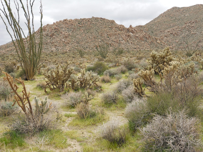
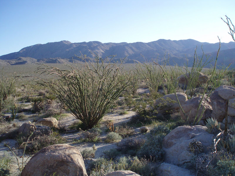
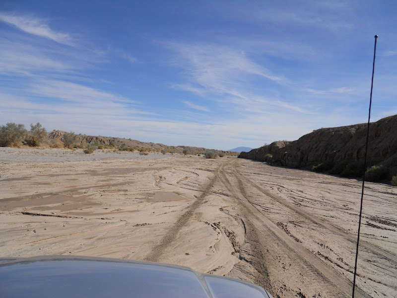
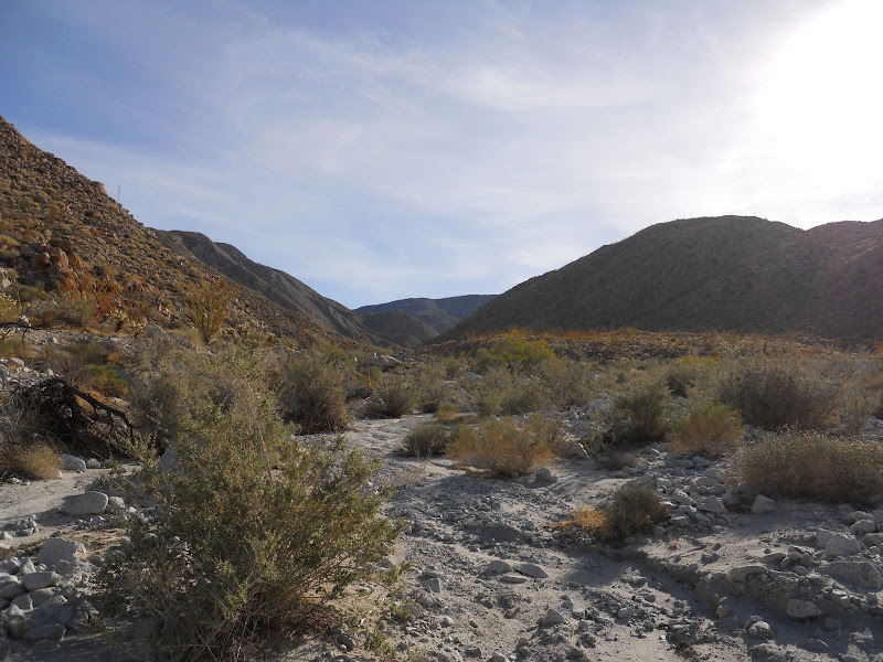
Headed out Friday morning in the jeep for one night in Rainbow Wash.
On the way we went down the Jasper Trail for a few miles and then backtracked to the road down to Culp Valley. There is lots of water/erosion damage to these two roads but still passable to most smaller 4X4's. There are plenty of plants that are now green but no flowers at these upper elevations. On the final part of the descent into Borrego Springs the roadside hills are turning greener by the day, lots of grasses. Brittle bush are green but no flowers yet. Ocotillo are very green with some blooms.
Once on the valley floor we headed up Coyote Canyon. No people or water in the lower stretches of the wash but some mud. The valley floor all around Borrego Springs is green but again no flowers yet. The snow on the mountains was limited to the upper reaches of Toro Peak, unlike 3 weeks ago when that storm left the snow level much lower. Did not go past the Desert Garden.
Then we headed south and went through the Texas Dip and turned into San Felipe Wash. There was a little mud in spots but nothing bad. Went up Rainbow Wash as the ranger plane flew overhead. Camped up the wash a ways and did a nice hike up a side wash toward the badlands. Lots of water came down this wash with lots of new erosion on the sides of the wash. But in this part of the desert there was not too much green. It was a beautiful night with NO wind and temps in the high 40's. Had a nice little fire and watched the Milky Way pass overhead.
In the morning we went out the way we came in and then headed to the Red Ocotillo for breakfast. If you have not been there since they moved to the Palms Hotel, be sure to go and have breakfast. Never crowded and they still have Trivial Pursuit cards to entertain you while you wait for your food.
On the way back up the road, the hills were greener than the day before. A great little trip.
I atatched a couple of pics but not sure if they will come through since this is my first new post on this site. |
2/16/2010
Topic:
Rainbow Wash
hikerdmb
|
Glad you found the camp. Just curious though, how close was my X on the map to the actual location? I think it has been close to 10 years since I was there. |
2/16/2010
Topic:
Rainbow Wash
hikerdmb
|
Glad you found it so easily and can't wait to see what the southern part of the park is like. I was down there 3 weeks ago and am curious to see how it has changed since then. |
2/16/2010
Topic:
Rainbow Wash
hikerdmb
|
That's what we were thinking for the northern part of the park too. |
2/21/2010
Topic:
All the Wild and Lonely Places
hikerdmb
|
I am currently re-reading a great book on the Anza Borrego Desert. The book is titled “All the Wild and Lonely Places, Journeys in a Desert Landscape” and is written by Lawrence Hogue. I saw his name in the summit register on Whale Peak a couple years back so he may still live in the area. This book examines the Anza Borrego region of the desert, the people who lived there in the past, how the desert is today, and how it may be in the future. Each chapter of the book looks at a different area of our local desert (a couple chapters look at areas west of the desert). I have had the book since it was first published in 2000. It was given to me by one of my first grade students as a Christmas gift. I usually take it out every 2-3 years and re-read it. It is without a doubt one of the best student gifts I have ever received. If you travel in this desert, which I am sure you do or you wouldn’t be looking at this board, then I urge you find this book and give it a read. It will provide you with a whole new vision of the places you have been or will want to find after you have finished the book. Anyone else read this? Or know other books about the area that they recommend? |
2/25/2010
Topic:
Rain and wind this weekend
hikerdmb
|
I'll be heading out this weekend in the rain and wind. Probably will check out the Blair Valley area and then up toward the northern part of the park to find a sheltered spot to set up the tent. Next weekend heading to the southern part of the park. When we were in Little Blair about 2 months ago there was a nice pond but it was not too green. I am hoping there is still some water there. If there is no water left, it should at the least be nice and green by now. I attached a picture of how Little Blair Valley looked a few years ago (I think it was April of 2005) and also a picture from January 2010. |
2/25/2010
Topic:
Rain and wind this weekend
hikerdmb
|
The old picture of Little Blair didn't make it through so here is another try. |
2/26/2010
Topic:
Rain and wind this weekend
hikerdmb
|
I'm not so worried about the rain as I am about the wind. I see reports of 45 mph gusts on Saturday but letting up significantly on Sunday. I hope it rains another half inch or so. It will hopefully make everything last a little bit longer.
Did you see they are opening the new area of the park next weekend? Look about halfway down on this link...
http://www.parks.ca.gov/pages/638/files/Vallecito%20Days%20Information.pdf
We have been wanting to visit that valley for many years. The view west into that valley from the top of Whale Peak is what got us wanting to go there. Looks like hiking biking or horses is the only way in there for now. |
2/28/2010
Topic:
Palo Verde Wash and more
hikerdmb
|
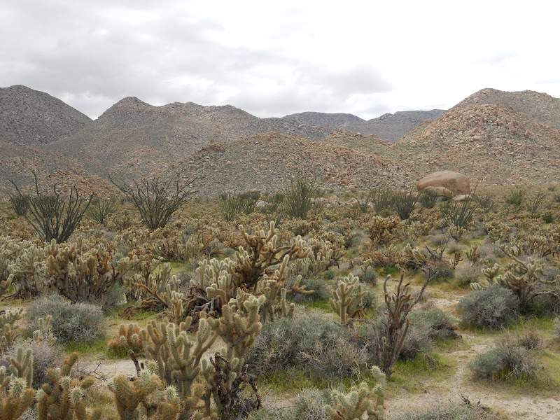
We left home in a pouring rain on Saturday at about 11:00 AM. It rained all the way through the mountains and finally let up as we dropped down toward Scissors Crossing. Headed south on S-2 and did the loop around Blair Valley into Little Blair Valley. The pond from two months ago in Little Blair was gone. It rained off and on as we made the loop. Both valleys are very green! There are not many plants blooming, except ocotillo, but that will surely change in the next couple of weeks as there are lots of newly sprouted wild flowers.
After leaving the Blair Valley area we headed back north on S-2 and turned east on highway 78. Took a short side trip up Plum Canyon. Again it was quite green and the view down into Grapevine Canyon was beautiful with a mix of blue skies and huge puffy clouds over Pinyon Ridge. Saw a lot of Chuparosa blooming and a few very small flowers but there were plenty of new plants that will be blooming soon. The rain had pretty much stopped by now.
We retraced our route back down Plum Canyon and then headed farther east to Buttes Pass. Lots of ocotillo in bloom here and again many small plants not yet blooming. Perhaps a week or so more. Dropped down into San Felipe Wash and then took the Cut Across Trail to Fault Wash. Fault Wash was very sandy and not much growing in this area. At the top of Fault Wash we headed east on Short Wash and then south down Palo Verde Wash.
We went a couple of miles down Palo Verde Wash and then turned back north and headed for the upper part of the wash. We were looking for a sheltered place from the wind which was beginning to pick up as the sun was getting lower. Set up the tent and then it began to rain so we retreated into the tent. The wind blew pretty strong during the rain storm but we were dry and warm. It rained for about 3 hours. Then got out of the tent and made a late dinner.
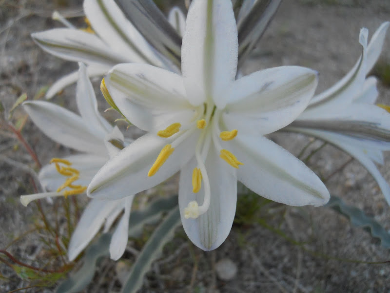
The morning was clear and calm with new snow on Toro, and on the mountains up toward Coyote Canyon and Ranchita. I took an early hike up a couple of side washes near our campsite and found lots of Desert Lily plants, some blooming, some sprouted, and some with blooms which were not yet open. Not much else in this area blooming but like everywhere else there were lots of plants that had sprouted but not yet blooming.
After breaking camp we took Short Wash west to the Thimble Trail and then north to S-22. We drove into Borrego Springs for breakfast at the Red Ocotillo and then stopped by the Visitor’s Center. The lot was full so did not go in. I have never seen so many cars there before.
We then headed up the hill and back toward home at about noon. The view down into the valley was amazing. The Salton Sea was very clear and the valley around Borrego Springs is amazingly green.
Next week we will head for the southern part of the park. I am hoping with the lower elevations down that way there will be more flowers. The rain this weekend in the north should help the bloom last but it is at leastl a week or two away peaking. I attached a few pics below. |
2/28/2010
Topic:
Palo Verde Wash and more
hikerdmb
|
It rained from about 5:30 to 8:30 Saturday night. The wind blew really hard during that time but I brought my North Face tent and it hold up to anything. |
3/2/2010
Topic:
Palo Verde Wash and more
hikerdmb
|
Nice pics and trip report. What is the road that is not closed that you mentioned in the post? I was through there a couple of years ago and don’t remember anything different than the previous years. I don’t remember seeing that sign either of the pictographs either? Where exactly is that?
We still plan to go to the southern part of the park this weekend even though the forecast says more rain this weekend. We are hoping for some flowers to be blooming soon. I attached a picture from Indian Valley from spring 2009. Hopefully it will look better than this in a couple of weeks. |
3/2/2010
Topic:
Palo Verde Wash and more
hikerdmb
|
Bob,
Thanks for that link. It did say something about the pictographs being destroyed and maybe needing to close some areas. I will check my maps when I get home and see if I can figure out where the closure is. |
3/2/2010
Topic:
The Mother of all websites on ABDSP Wild Flowers
hikerdmb
|
My buddy sent me this link today. If you want to know about the wild flowers in ABDSP then check out this link. This guy has done a tremendous amount of work compiling the data you will see. It is amazing. Rainfall totals, photos, trip reports, and more!
http://tchester.org/bd/blooms/2010.html#rain |
3/3/2010
Topic:
The Mother of all websites on ABDSP Wild Flowers
hikerdmb
|
This part of the site
http://tchester.org/bd/species/gallery.html
has great pics of many flowers in the park. He says not all of them but there are plenty on there to try to identify. If I had an iPhone I would be trying to figure out a way to save that page to my phone (in case I was out of cell range) and then there would be no reason to break out the book every time I wanted to know a flower. I am sure someone will know how to do this. Or maybe there is already something like this available.
David |
3/5/2010
Topic:
South end of the park
hikerdmb
|
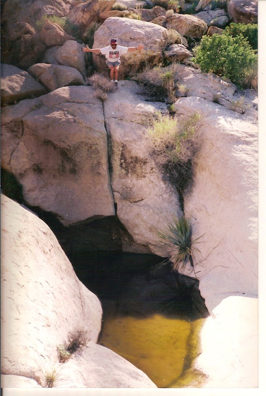
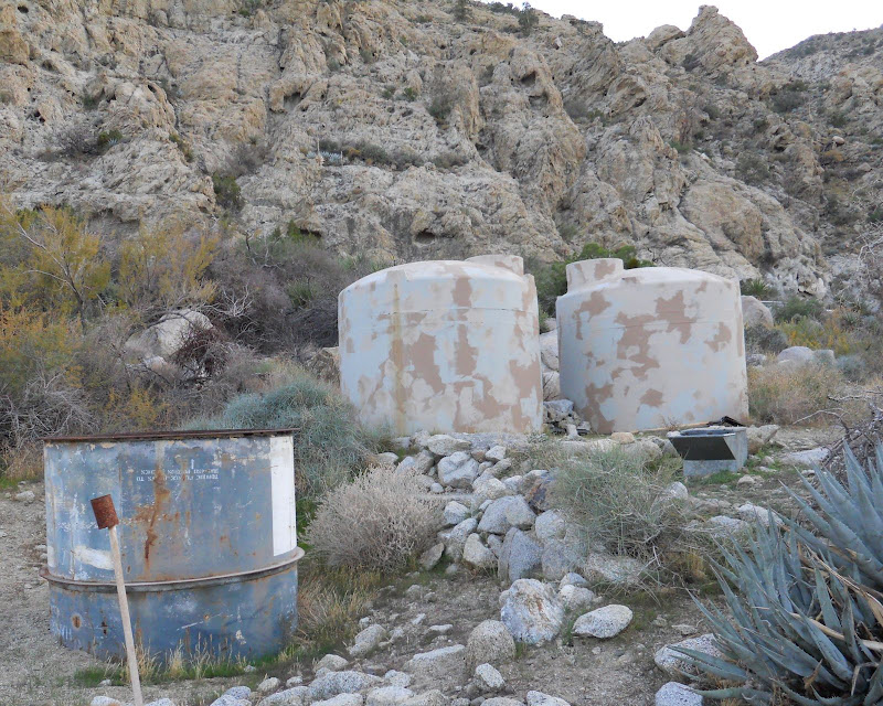
I am packing now and will be heading to the southern part of the park for the weekend. I will post a trip report when we get back home. Looks like there could be some wind again this weekend and a chance of some more rain, sound exactly like last weekend. Hoping for more flowers than last weekend. Have not been to the southern half in a few weeks and it was so green last time we were there I can't wait to see it now. Maybe a hike into Indian Hill on Sunday depending on the weather. I'm really interested to see how much water is in that huge tank across from the pictograph cave.
David |
3/7/2010
Topic:
South end of the park
hikerdmb
|
Sorry I didn't see this until we got back today. We were in that area Saturday afternoon. We were climbing on the train cars by the water tank about 1:30. There were a couple of rigs up on the little mound by the tracks just a bit up from tower but I didn't really see what kind of rigs they were. They were playing some music. Was that you? Sorry we missed you. I will post a trip report in a bit. |
3/7/2010
Topic:
Quartz mystery...
hikerdmb
|
Cayenne,
I'm not the person running this forum, that would be Bob, he already responded to you. I am just a lover of the desert and have been posting with the hope that more people will join in.
As for your question...if I remember from college Geology class many moons ago, the thing you are looking at in your picture is a dike or maybe it is dyke. It is igneous rock that has intruded into the rock around it. I think it happens way under the earth when molten rock (the future dike) finds a small crack or cracks and forces its way in. But again, it has been a while since I was in that class so you might find more info somewhere else about it. But I am pretty sure it is a dike.
David |
3/7/2010
Topic:
Still Too Early
hikerdmb
|
Just returned from a weekend trip into ABDSP and again this weekend there was lots of wind and more rain than last weekend. It is still too early for lots of flowers but it is very green and it rained on us from about 4:00 AM Sunday until we left the desert at about noon. It was a continuous rain, never turned off the windshield wipers all morning.
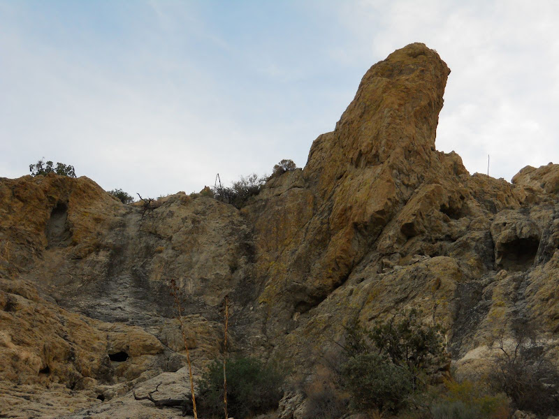
We went out highway 8 to Ocotillo to begin our trip. We took the old highway 80 west from Ocotillo and worked our way up the wash and into the very southern part of the park in the Dos Cabezas area. Stopped for lunch at one of our old campsites and then continued on north. Found that the road to Piedras Grande is closed and I was surprised to read from the sign that you can no longer camp in that valley, only day use. We then continued up to the water tank and took some pics. Then down Mortero Wash to S-2.
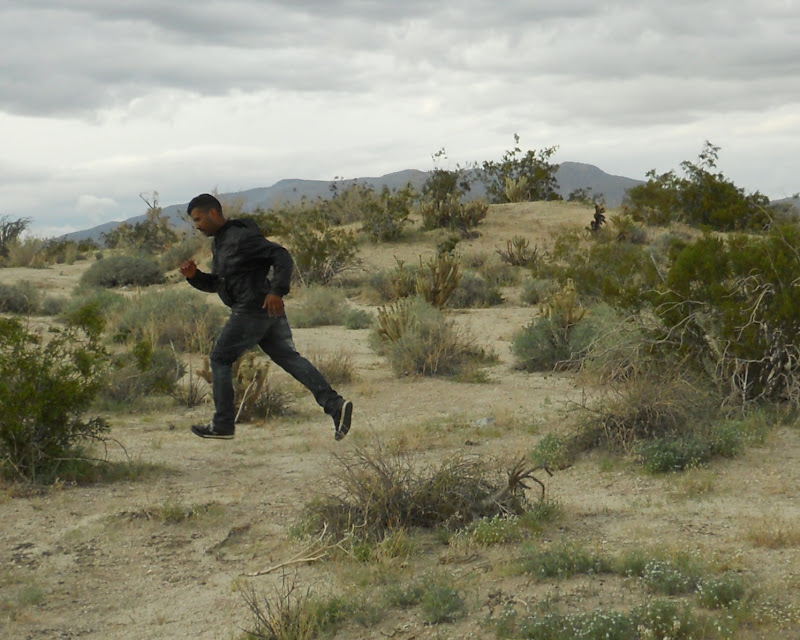
Headed north on S-2 and went up into Indian Valley. Went about 2/3 of the way up each side of the valley. Visited a old smoke tree that we camped by many many times when my daugters were young, I guessed 20 times but my wife thought it was more than that. The tree is now dead and on the ground for the past 5 years or so. It was a little sad. As we left Indian Valley and were almost back to the highway I saw 2 men standing at the junction of the dirt road and highway. Then a Border Patrol truck pulled up, nabbed one guy and the other fled into the desert. He did not appear to have any water or supplies. The BP chased after him and if he wasn't caught he had a miserable night of wind and rain.
We headed into the east side of Carrizo Creek and camped in the area wher Arroyo Seco Del Diablo meets Carrizo Creek. It was quite windy and started to rain just at sunset. We camped on a little side wash where have camped a few times before that is protected a little from the west winds. The rain wasn't much and it stopped shortly after it began. We had a nice fire and the wind died down before we went to bed. We saw some lightning to the east with huge thunder heads.
I was awaken by the sound of rain on the tent at 4:00 AM and it never stopped. Breaking camp in the rain is no fun! We were planning on going back to Indian Hill and taking a hike but with the rain we changed plans. I see now that I am home that rained 0.66 inches in the Fish Creek Mountains. Nice!
Instead we headed north and just toured through the park. I couldn't believe the number of RV's and toy haulers heading west on 78. I think we were still too early for flowers but the week ahead should be sunny and warm so maybe next weekend the real show will start.
We did find a few flowers this weekend and I attached a few pics. |
3/8/2010
Topic:
First fumbling pass at experiencing Anza Borrego
hikerdmb
|
Nicely done! Good story and good pictures too. You know the old saying whatever doesn't kill you makes you stronger. And look at the lessons you already learned in four days.
I agree about the speed in two wheel drive. Many years ago on my first trip all the way through Coyote Canyon, one of the trucks with us was a two wheel drive. He made it all the way to Anza just by blasting through the tough parts. That is the only time I ever heard of a two wheel drive making it through.
I usually go with one other person but I do go backpacking, fourwheelin', hiking around in ABDSP by myself once or twice a year. Though I do take my dog most of those times. One thing I have learned is to be extra extra carefull when you go solo, you know things like looking where you put your hand before you put it there, not taking risks when climbing or descending, and ALWAYS (and this is the MOST IMPORTANT THING) tell someone who is RELIABLE where you are going and when you will return. That way even if it is a weekday or a slow time of year, someone is going to come looking for you. Read "Between a Rock and a Hard Place" by Aron Ralston to find out what can happen when you don't do this.
Glad you made it out alive on this trip.
David |
3/8/2010
Topic:
Still Too Early
hikerdmb
|
Bob,
Yes I did notice there was no water drops anymore. I wonder who took them.
I was really hoping to get back to the cave at Indian Hill and check out the tank across from it. But it was raining so hard on Sunday morning there is no way I was going to do it then. Perhaps another day. We still want to do a couple of backpacking trips this year before it gets too hot and with my daughters coming home for a week and then a planned trip to Yosemite for backcountry skiing I don't know if I can fit it all in. But I am sure going to give it a try.
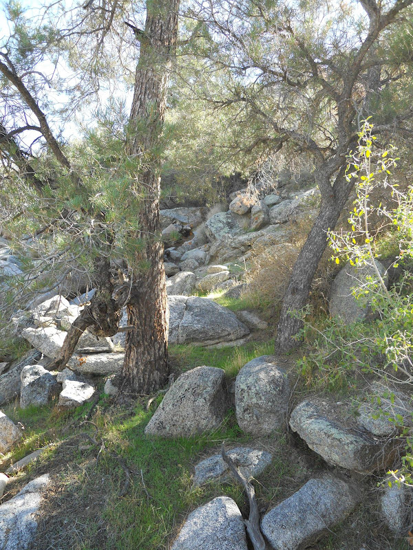
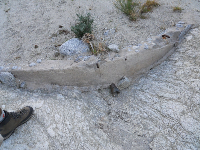
Did you make it that far with your friends? Did you see the tank? Have you seen it before? The first time I saw it it was almost full but each time after it has been empty or nearly empty. It is about the size of a bathtub. I have a picture of it somewhere but can't seem to find it. When standing in the mouth of the cave it is across a little wash up on the side of the hill about the same elevation as the cave.
David |
3/9/2010
Topic:
Still Too Early
hikerdmb
|
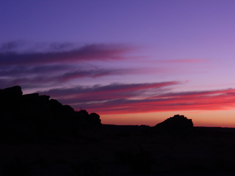
Since I found out how to do this (Thanks Bob) I thought I would share a few more pics from the trip to Piedras Grande and beyond.
This is a huge cholla garden between Piedras Grande and the water tank.
and finally here is the rock tank that is near the cave in Indian Hill. This picture is from 1995. I have not been there this year to check it out, yet.
And finally here is the guy running from the Border Patrol where the Indian Valley road meets S-2
 |
3/10/2010
Topic:
Still Too Early
hikerdmb
|
I wasn't really that close, maybe 10 -15 yards. I did use a little HP Image Zone program to zoom in a bit before I posted it. It was strange seeing one guy just give up and the other take off running. Then the Border Patrol guy got back in his truck turned on his lights and took off after the runner. |
3/12/2010
Topic:
Anza Borrego Foundation "Hike of the Month"
hikerdmb
|
Bob,
Harper Flat is a great valley. I have backpacked in there once every year or two for the last 10+ years. You will like it I am sure. I am interested to see how the flowers are in there this year since I have not been in there since last spring. In fact the weekend we camped in there last year we ran into a group of 12 or so people. That was only the second time we saw anyone else in the valley. The other time we saw one lone day hiker. I wonder if your group is the same group as last year. There is lots of evidence of past habitation in the valley. We have found morteros on the south and north edge of the valley. I have read of sleeping cirlces somewhere in the Flat or Harper Canyon. We have searched more than once for them with no luck, have not looked on the western side of the valley. Maybe you will get led to them by Mark.
Also on your way out you might want to look in some of the side washes that join Pinyon Wash from the east. Last spring there were LOTS of flowers in those washes. The most I found were in a wash that joined Pinyon Wash at a slight angle from the southeast. It was somewhere south of where Nolina Wash joins Pinyon Wash.
Also I just read the link you provided and it said something about a cabin. I would like to know where that is if you will share upon your return. Have not seen that one before. In fact I didn't even know about it.
I hope you have a great hike and find the sleeping circles. Looks like more wind on Saturday.
David
I fixed a couple of directions when I got home and looked at a map.
<em>edited by hikerdmb on 3/12/2010</em> |
3/13/2010
Topic:
Anza Borrego Foundation "Hike of the Month"
hikerdmb
|
Bob,
Having trouble posting anything other than a line or two of text.
<em>edited by hikerdmb on 3/13/2010</em> |
3/13/2010
Topic:
Anza Borrego Foundation "Hike of the Month"
hikerdmb
|
Bob,
Here's another try. Glad you had a good time and can't wait to see the pics.
Here is a pic from March 2009 looking south across Harper Flat with Whale Peak in the distance/
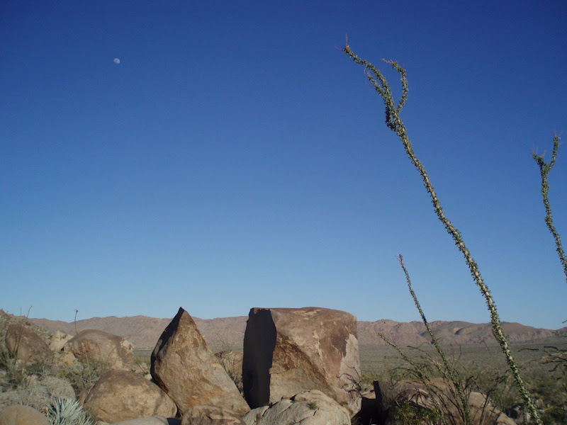
Here is a pic from March 2009 of a large split rock, ocotillo, and the moon, looking east across Harper Flat
 |
3/14/2010
Topic:
Anza Borrego Foundation "Hike of the Month"
hikerdmb
|
I saw that video earlier this winter/or last fall. It is pretty cool with some great train shots too. I liked it so much I had already sent it to my buddy that I camp witih. |
3/14/2010
Topic:
My homage in paint...
hikerdmb
|
Cayenne,
I think you captured the colors and texture pretty well. Those are beautiful. I had to look up diptych to know what that was. Do you hang/exhibit them on above the other like that. Have you heard the term "desert varnish?" Your art reminds me of desert varnish. It is the dark shiny part of the rock. Picture 5 in your series comes pretty close although it may be a bit shinier than usual but hey that is artistic license. The huge rock in this picture is in a place called Papoose Flats in the Inyo Mountains. You can see some desert varnish on it. Look to the lower left side of the arch. There's not a lot there but I couldn't find a picture that showed a lot.
Also the Indians would carve petroglyphs into the desert varnish as in this picture from Canyonlands. It is from a place called Newspaper Rock.
What did you use to give your work that 3D look? I think you have the desert bug for sure!
By the way homage was one of our vocabulary words last week in class and your work definitely pays homage to the desert.
David |
3/14/2010
Topic:
My homage in paint...
hikerdmb
|
The desert varnish is the darker part of the rock. I think you found it. I will look through my old photos and find a better example. Papoose Flat is in the Inyo Mountains. If you drive north on I 15 and then take 395 north from the top of Cajon Pass then drive on 395 for a couple hours you will be in the Owens Valley. On your west will be the Mighty Sierra and on your right will be the Inyo Mountains. Papoose Flat is about halfway between Independence and Big Pine (two towns in the Owens Valley). It is about 8,500 feet in elevation and a fantastic place to visit. Not technically desert but it is high and dry dominated by sage mostly. In the spring though it is an beautiful place and not many people make it up into those mountains. |
3/14/2010
Topic:
My homage in paint...
hikerdmb
|
Cayenne,
If you are asking if your 626 will make it to Papoose Flat, the answer is no, you need four wheel drive for that. Check out this picture that is taken from the southwest looking into the Flat and you will want to go there for sure. It is an amazing place. The arch rock from the other picture is at the end of the short side road that is just to the left of center and a little above center. That should give you some idea of how huge those bouder formations are.
Unfortunately to access many desert places that are off the beaten track you need four wheel drive. You don't always need it but that first time you get stuck without it you will never want to not have it. Does that make sense?
The area you came through on your way into SD is a prime area to see desert varnish. It covers the boulders on both sides of the highway. That area up there right above the desert with all the big boulders is called Jacumba. If your were to go back out that way now you will see it is very green and not at all lifeless.
As you began to climb the mountains out of the desert, if you looked to the north you saw the Piedras Grande area that Bob and I have discussed on this forum. If you are interested in desert with big boulders then you should go here and you should also check out Joshua Tree. It has lots of paved roads and graded dirt roads with beautiful desert scenery. It gets pretty crowded this time of year but it is still worth the drive.
If I could suggest one book to get to help you find some places you can go to in SD, it would be "Afoot and Afield in San Diego County" by Jerry Schad. It will tell you many places you can go and will let you know if you need four wheel drive or not.
David |
3/14/2010
Topic:
Anza Borrego Foundation "Hike of the Month"
hikerdmb
|
Bob,
Nice pics and looks like it was a great day. Can't wait to see the trip report and maybe a map to show which parts of the valley you visited. The cabin looked pretty broke down. Was the damn totally filled in with sand?
David |
3/15/2010
Topic:
Trip to Harper Canyon
hikerdmb
|
Bob,
Nice trip report. It must have been pretty cool being guided around by Mark Jorgenson. How far down Harper Canyon did you go before you came to the dam and the cabin? At the end of the post you said you hiked down Harper Canyon. Did you go all the way down and out or did you go back through Harper Flat and out Pinyon Wash? I have never been down into Harper Canyon. We have walked by the entrance to the canyon while in Harper Flat a couple of times but never entered it. And we have driven to the lower entrance a couple of times too. We have even discussed hiking up Harper Canyon as a way to get to Harper Flat but it so much longer and with way more elevation gain than going through Pinyon Wash, so we have always taken the easy way. Also, any word on sleeping circles? And did you check out any of the side washes in the lower part of Pinyon Wash. I am curios too if the Indian site was just to the left as you entered Harper Flat or somewhere else. I know there are lots of morteros about a half mile or to the east after you get into Harper Flat.
David |
3/15/2010
Topic:
Trip to Harper Canyon
hikerdmb
|
Bob,
I have never been down that drop off by the squeeze. I have been to the top and I have been close to the bottom by coming in through Split Mountain/ Fish Creek, but never been all the way through. When I say we drove to the lower part of Harper Canyon...you can take a dirt road off of highway 78 that will take you to the lower (northern) mouth of Harper Canyon. Sorry I wasn't too clear on that. You can hike up (south) into Harper Flat from the end of this road but it is much longer and more elevation gain than by going through Pinyon Wash. Can you send me a google earth of the location of the cabin and dams?
I did not know about pictographs in Carrizo but I would like to. I know that in Joshua Tree there are some pictographs that were retouched for a Disney film but this is the first I have heard of this in Carrizo. I have seen the pictographs in JT and they are very fake looking.
Also I am still confused on your exit from Harper Flat. Did you go back the same way you came in? If you did go all the way through Harper Canyon I would be interested in knowing what it is like through there.
David |
3/18/2010
Topic:
Indian Hill
hikerdmb
|
This weekend looks like it will be clear and sunny with a very tame wind. I will be heading down to the south end of the park again and hiking into the Indian Hill area and checking out the tank, the cave, and the rest of the area. It has been a few years since I have hiked into this area and I am very excited about the weather and returning to this part of the desert. Maybe we will even find a field of wildflowers but I will definitely listen to Tom Petty's old (1994) album "Wildflowers" while I am on this trip. I will be sure to post some pics and a report.
David |
3/18/2010
Topic:
The Hunt for the elusive Carrizo Gorge Pictographs
hikerdmb
|
Nicely done Bob! Any other pics to share?
David |
3/18/2010
Topic:
The Hunt for the elusive Carrizo Gorge Pictographs
hikerdmb
|
I see what you mean about the pictographs looking touched up. They are very dark. I like the pic of the cruiser and the creek. The hills in the background are amazingly green. That is a lot of water for Carrizo. How far down the canyon was the water flowing? Seeing the flowers makes me even more excited about my trip this weekend.
David |
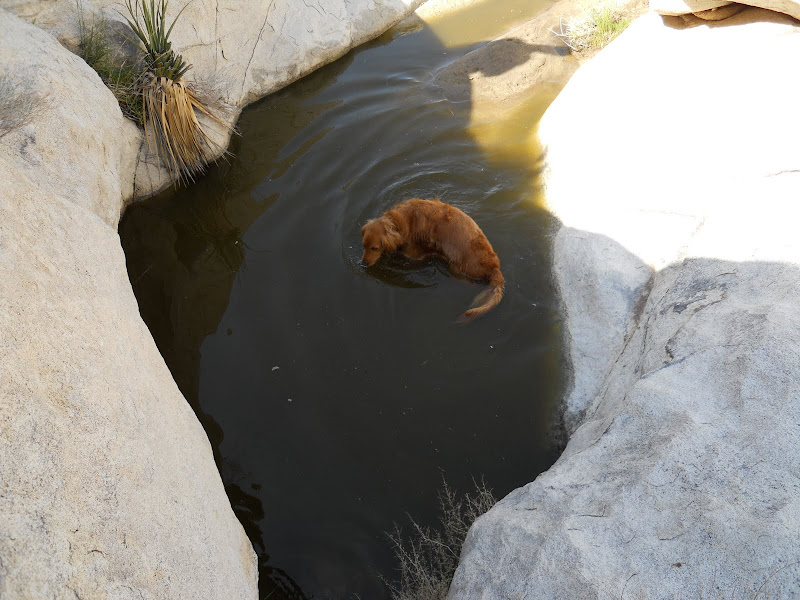
3/21/2010
Topic:
Indian Hill and June Wash
hikerdmb
|
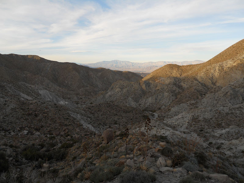
I finally made it to Indian Hill this weekend. I had tried to do the hike a couple weeks ago but a rainy windy day caused a short delay for this hike. It has been many years since we have hiked to the cave but it was well worth the wait. Saturday was a beautiful day, warm with a nice breeze and plenty of blue skies.
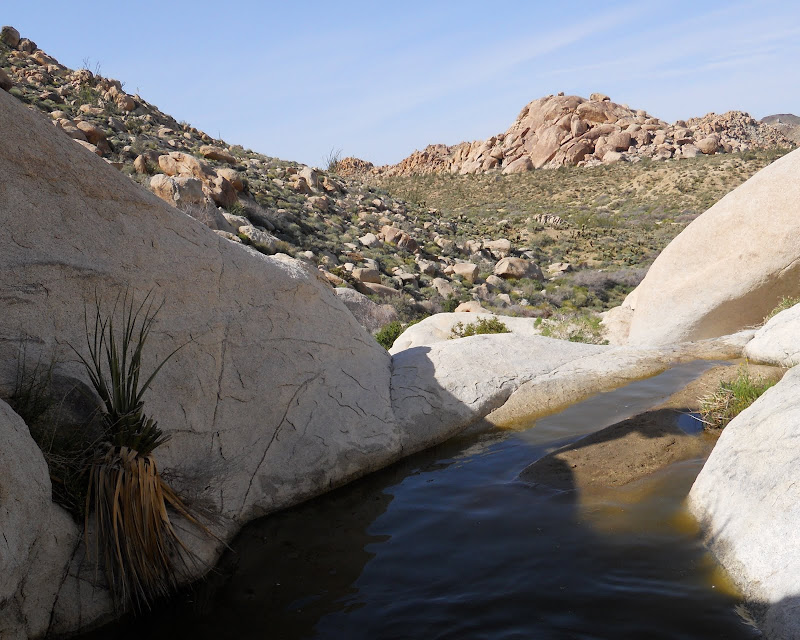
We left the crowded wash and traveled across the flats only to find the huge shelter cave full of a troop of boy scouts out for a night. So we changed course and headed for the tank. The tank was very full and my dog Wylie enjoyed a cool dip after the hike in. He is a 100 pound Golden Retriever so that should give you some idea about the depth of the water in the tank.
The view from the tank is absolutely beautiful.
After our visit to the tank we headed over to the cave and waited for most of the people to leave then climbed up and took a few pics of the beautiful pictographs inside the cave.

We then left the cave area and headed toward the Railroad camp and the old jeep trail.
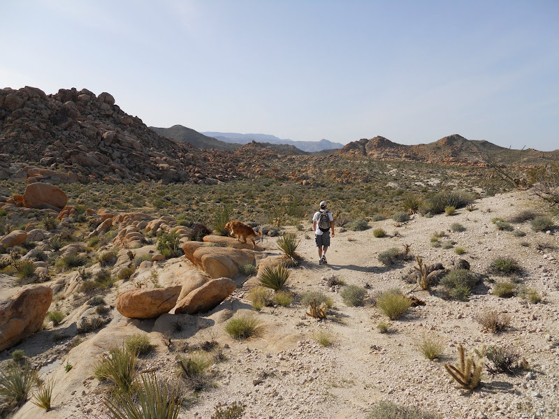
We figured if we hiked back to the truck by this route it would be a little less crowded and it was. We did not see another person till we got back to the truck. Although we did hear the boy scouts having fun somewhere across the desert. We did however, see many beautiful flowers on this part of the hike.
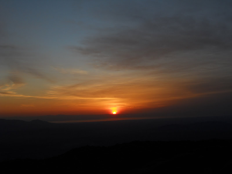
From the Indian Hill area we drove back out to S-2 and then north to June Wash where we would spend the night. We had a great campsite and campfire and awoke to a beautiful sunrise.
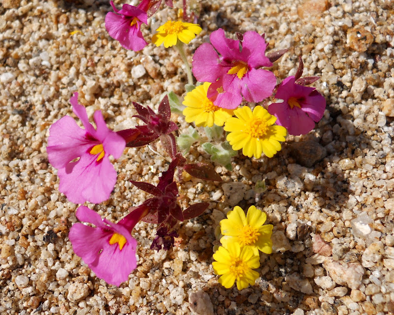
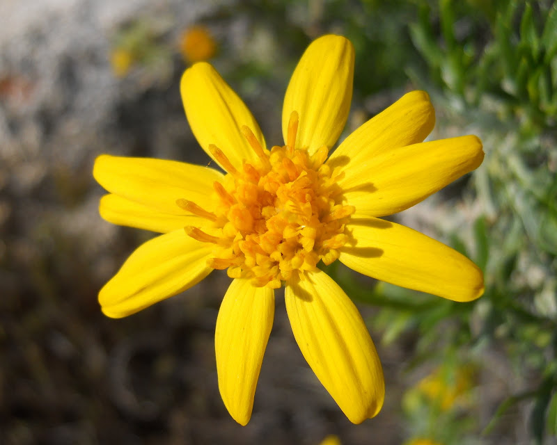
Sunday was very overcast but there were plenty of flowers in this area of the park to keep my attention off the sky. I took a little stroll up a side wash off of the main June Wash and found lots of Brown Eyed Primrose,
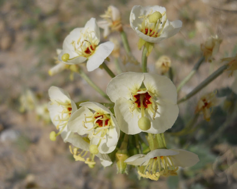
Desert Lilies,
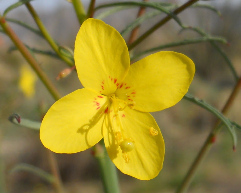
and lots of little yellow flowers that I think are California Suncup.
There were many other flowers in this area, Arizona Lupine, Sand Verbena, Desert Dandelions,Chicory, Desert Pincusion, a few Cholla, and more. There was also a great view of Sombrero Peak.
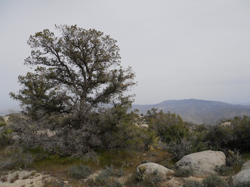
We finished our trip with a drive into Borrego Springs for breakfast. I have NEVER seen so many people in Borrego Springs in my 25 + years of going to ABDSP. |
3/23/2010
Topic:
The Hunt for the elusive Carrizo Gorge Pictographs
hikerdmb
|
I like it. Makes me want to go there. I have been pretty far up that canyon but never knew there were pictographs. It seems I remember talk of a cave being used by illegals a few years ago. Maybe that is the same one.
David |
3/25/2010
Topic:
Anza Borrego Flower Update for March 24th
hikerdmb
|
Nice shot Bob. Is that from Egg Mountain? I am hoping to head out on Monday for the day with a non desert loving friend that I have been trying to convert for a few years. He loves nature and the mountains but I can't quite get him to realize the beauty of the desert. I think it is a green thing. Then we are off to backcountry ski and camp in Yosemite for 10 days. Can't wait!!!!
David |
3/25/2010
Topic:
Anza Borrego Flower Update for March 24th
hikerdmb
|
Thanks Bob. I plan to have a great time and way to give back with the work group. I will share some pics and a report from next Monday if I make it out to the desert again before we leave and if you like snow and mountains and waterfalls, I'll send you a link to my Picasa page to see some of those when I return.
David |
3/30/2010
Topic:
Day trip to the Arroyo Tapiado Mud Caves
hikerdmb
|
We drove through there earlier this winter (Januray) heading up to camp along the little cut across trail that connects Arroyo Tapiado and Arroyo Seco Del Diablo. We were shocked when we went past the mud caves area because there were at least 40 rigs parked in there. But hardly any people. I stopped and asked a guy covered in dirt what was up and he said boy scouts form the OC were exploring the caves. Must have been a couple hundred people there that day.
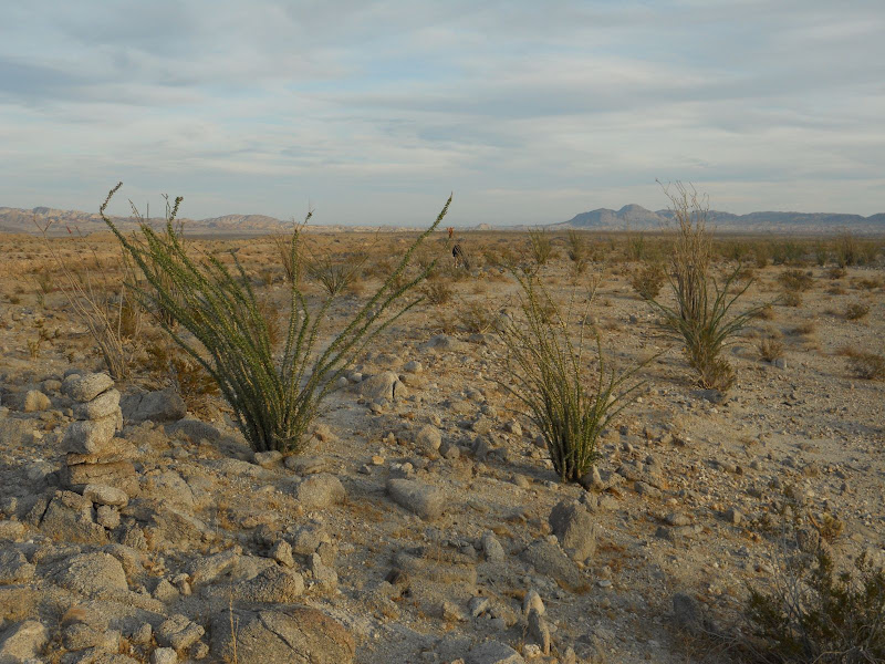
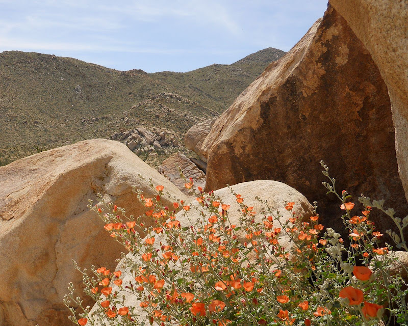
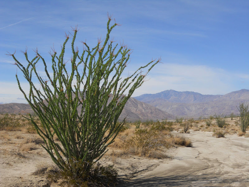
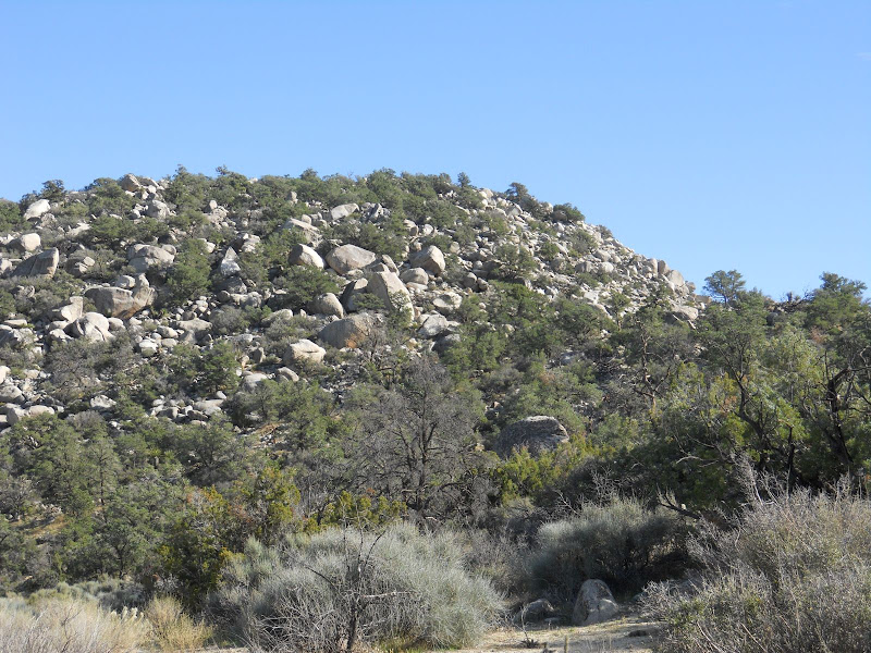
In the afternoon we were hiking northwest on the ridge between Arroyo Tapiado and Arroyo Seco Del Diablo and we came across an old trail coming up out of the wash and then heading up toward Whale Peak. It had huge rock cairns along it. We found 3 or 4 cairns along the trail for about half a mile or so and then it kind of just petered out. If you look in this picture you can see the cairn on the left edge of the pic and to the left of the ocotillo. The trail goes to the right of the ocotillo and off toward the center of the pic. You can see my buddy (dark spot) in the middle of the pic and the trail right by him. It was very cool. The picture is taken looking southeast toward Carrizo Creek and the Impact Area with the Coyote Mountains to the right.
 |
3/30/2010
Topic:
Return to Indian Hill
hikerdmb
|
I went back to Indian Hill on Monday with a buddy that until now didn't really like the desert. I was suppose to take this hike with him on March 7, 2010. That was the weekend it rained all night (see the post "Still too early") and he was coming out on Sunday morning to meet us to do this hike, but didn't make it because of the weather.
Before yesterday he always thought the desert was someplace to drive across to get to someplace better. I am pretty sure after this trip that he has a new appreciation for why I go to the desert so much.
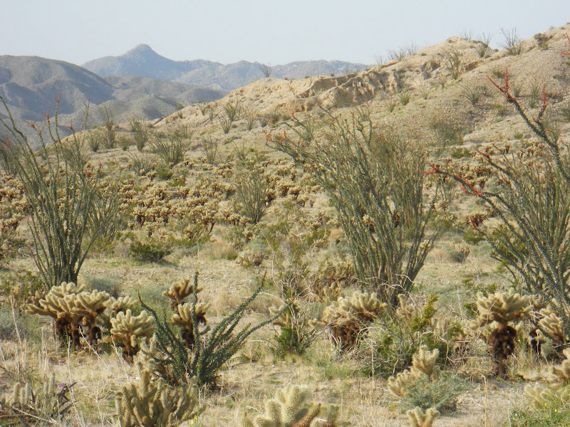
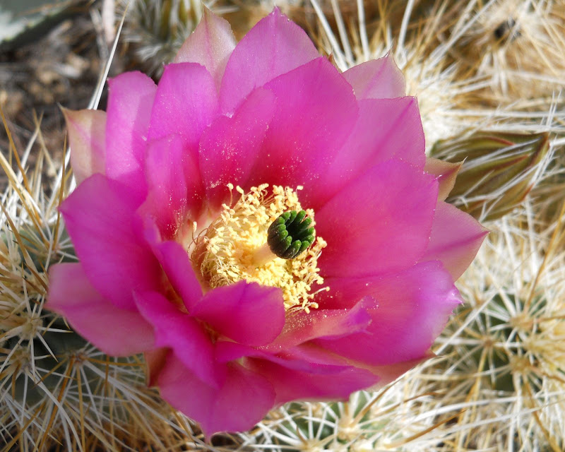
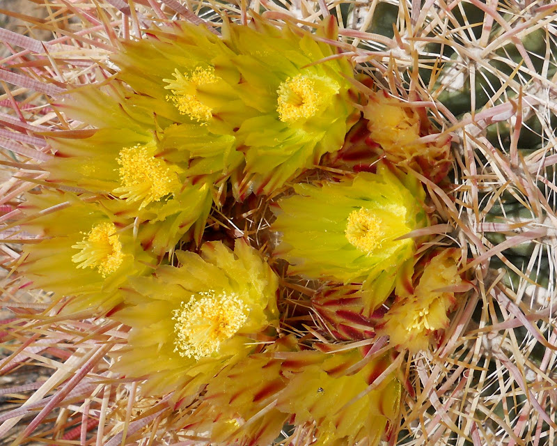
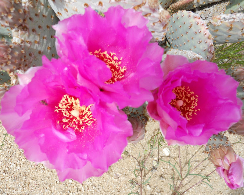
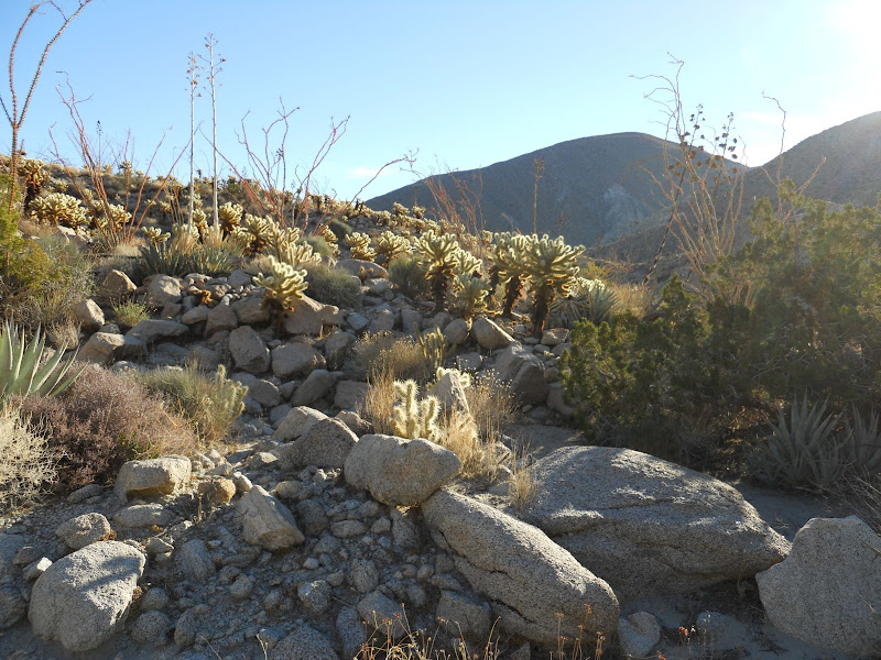
We took the long way by taking old highway 80 from Ocotillo and drove west and then came into the Piedras Grande/ Indian Hill area from the south. I must say that the grasses in this area are starting to brown up but the cactus blooms more than make up for it.
Hedghog Cactus
Barrel Cactus
Beavertail Cactus
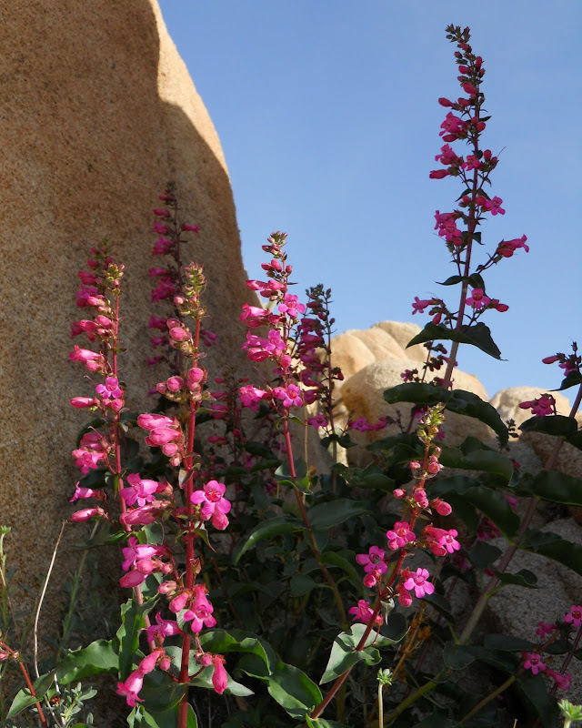
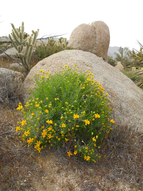
There are also plenty of flowers still at their peak.
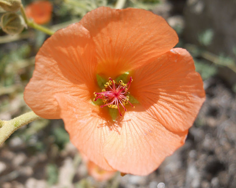
Desert Mallow
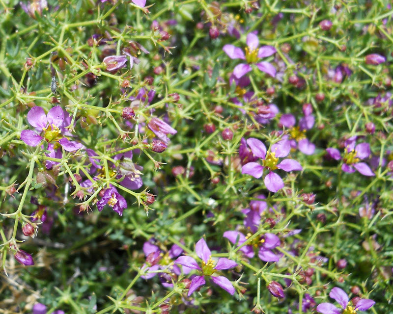
California Fagonia
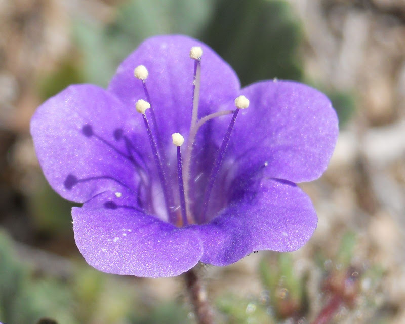
Canterbury Bell
The vistas were magnificent on Monday with the flowers adding to the beauty of the rocks and mountains.
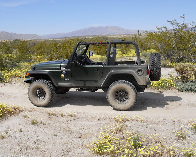
After hiking through Indian Hill we drove down Canyon Sin Nombre and out South Carrizo Creek. We had been here three weeks ago and the grass is definitely browning up but the Desert Dandelions are so thick that you don't really notice the grass. I don't recall seeing fields like this before. And to think someone on Desert USA said there would be no flowers in the southern part of the park this year. If you have not been down to this part of the park this year, GO NOW!
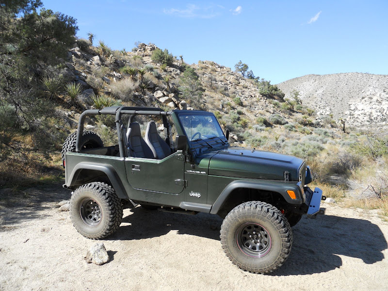
Here is a picture of my Jeep, Desert TJ, that took us on this wonderful day and more flowers with Whale Peak in the distance.
We ended the day with a drive up Corrizo Gorge. It took us about half an hour to reach the water but it was beautiful up there. We ran out of time and had to turn around before we got to the end but it will still be there for another trip. I love the rugged beauty of this part of ABDSP.
 |
3/30/2010
Topic:
Return to Indian Hill
hikerdmb
|
Bob,
We went as far up the gorge to where the road goes down a short steep bank and crosses the creek. I think it is the same place as the pic in your post from going up there that shows your LC by the water. Although there was much less water at that crossing now than when you were there. We only went about 100 yards or so past that crossing before we turned around. It was right near this water cache.
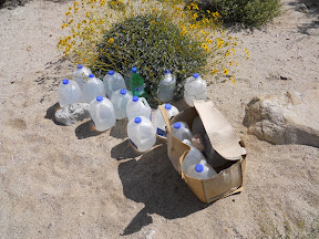
I think it is the same cache as in pic 30 from your Picasa pics from your solo trip. It looked familiar.
I am not sure how much farther the road went on from there but we needed to turn around and get back home by 5:00. How much farther from that crossing were you able to drive? It has been a bunch of years since I have been that far up the gorge and I couldn't believe how much it had changed in that time. Next time I go up that way though I will be sure to ask for some help finding the pictographs up there.
I wasn't even considering looking for the pictographs on this trip because of time constraints so please don't tell me I was only a hundred yards from them. Lots of good 4 low driving in the upper part of the gorge. FUN!
David |
4/11/2010
Topic:
Anza Borrego Mud Caves at Arroyo Tapiado
hikerdmb
|
Bob,
I read the trip report on the website. Looks like it was kind of warm and you had a good sized group too. Nice pics. That is a nice portable grill too.
I missed the desert while I was gone but it is tough to beat backcountry skiing in Yosemite. I will send you a link to the pics when I get them up but I think it will be a while.
David |
4/12/2010
Topic:
Anza Borrego Mud Caves at Arroyo Tapiado
hikerdmb
|
Bob,
Is that pic from after the quake? Did you go out there and find this? As Aron Ralston said after he got stuck between the rock and the wall, something like, "Geologic time in now."
David |
4/16/2010
Topic:
Pinyon Ridge
hikerdmb
|
Leaving tomorrow for an overnight BP trip to Pinyon Ridge. It is over 4000 feet elevation so it should be perfect weather and hopefully clear skies with just a sliver of a new moon in the west. Last year when I did this hike I saw no one except the jet pilot who buzzed my dog and I as we hiked out.
David |
4/16/2010
Topic:
Pinyon Ridge
hikerdmb
|
Bob,
The hike to Pinyon Ridge is about 5 miles each way. It is a very up and down hike with a little more up than down on the way in. Once out there I will camp amongst Pinyon Pine trees and have a terrific view down onto Borrego Springs and out to the Salton Sea. It is a fun hike and you can even climb Wilson Peak once out to the end of the trail. Wilson Peak is not too much of a climb but there is a register on top to sign and a nice 360 degree view.
I have been to the trestle once. We climbed up past Mortero Palms and then down to the trestle. We followed the train tracks down hill and then came back through Indian Hill to the road and hiked back to our truck at Mortero Palms. I think we figured it was about 13 miles or so. The best part was when we got out of the Indian Hill area a guy came by in a truck and offered us a ride for about a mile and also a very very cold Coors Light. My friend almost fell off the back of the tailgate as we got our free ride/beer but it was worth it. I have also hiked through Indian Hill and the RR camp and out toward the trestle but we stopped when we got to a place with a good view of Goat Canyon. It was very cool hiking through the tunnels and I remember on our way back you leave Carrizo Gorge and come through a tunnel and when you come out of the tunnel you are in the Indian Hill side again. It was a very dramatic change of scenery. Hopefully you can get through the tunnels. We had to crawl under a couple of gates to get through one or two of them.
Have a great hike and I hope it is not too hot down there this weekend.
David |
4/16/2010
Topic:
Pinyon Ridge
hikerdmb
|
Bob,
When we followed the tracks downhill from the trestle we came out by the RR Camp and then followed the old jeep road and came out at the wash where everybody seems to park to hike up to the cave in Indian Hill. We did not stay on the tracks all the way around the loop that goes around that area. Also both times I have been on the tracks the train was not capable of running (one of the tunnels was completely collapsed and we had to go around that part) so we were not concerned too much with getting caught by anyone. I am not sure now what is up. I had heard the train was not running but just last month when I was in the area by the big water tank (along the tracks) the number of train cars was cut in half from one trip to the next so there had to be some movement along the tracks. There was about 2 weeks between the trips when the cars moved. That is a tough call on what to do now on following the tracks or not. Are you feeling lucky?
I hope it is a great hike! I will definitely post some pics from my BP trip.
David |
4/16/2010
Topic:
Carrizo Gorge Post made it to the San Diego Reader
hikerdmb
|
Good job Bob! That is great!! Is it in the reader that came out this week?
<em>edited by hikerdmb on 4/16/2010</em> |
4/18/2010
Topic:
Pinyon Ridge
hikerdmb
|
Bob,
Sorry your plans fell through. Just got home an hour or so ago and had a great time. I will post some pictures and a trip report later.
David |
4/18/2010
Topic:
Pinyon Ridge Solo Backpack Trip
hikerdmb
|
The trail to Pinyon Ridge is called the Wilson Trail. It follows an old Jeep road for about 5 miles and ends in a beautiful little valley just to the east of Wilson Peak. This is the sign that greets you as you pull off S-22 and head for the trail head.
As the trail began I gained ground quickly and then dropped down and gained more until I had a view of Cuyamaca Peak off to the west.
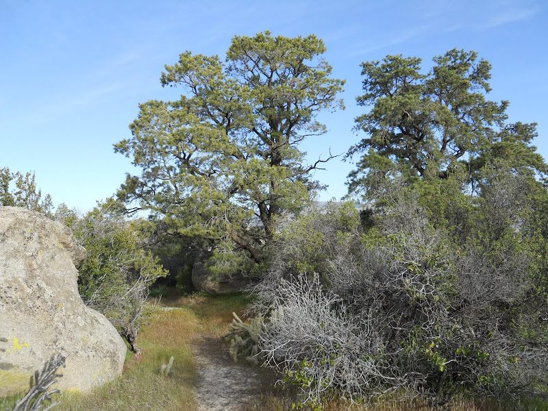
Eventually I gained enough elevation that I saw the first of many Pinyon Pine trees.
As I climbed the last hill up to the small valley where I would make camp I looked off to the north and saw down into Borrego Springs.
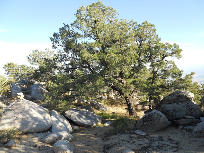
After dropping my pack at the campsite I headed up Wilson Peak and had a 360 degree view. Here is a very nice Pinyon Pine tree and Whale Peak in the distance.
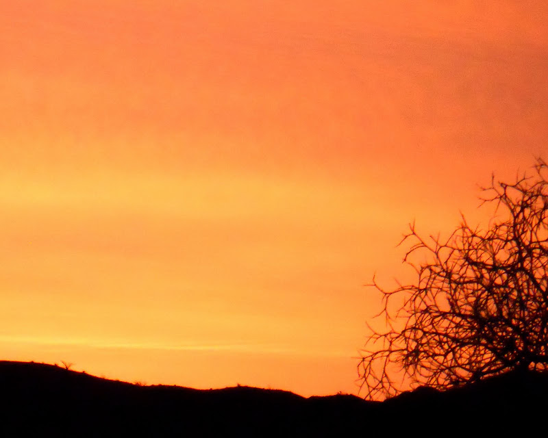
There was an okay sunset on Saturday night.

But the sunrise Sunday morning was spectacular. If you look close you can see the reflection of the Salton Sea.
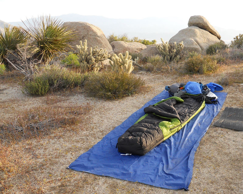
Here is a picture of my campsite for the night. I did not bring a tent and did not need it as the sky was overcast but no rain.
As I was leaving my camp and heading back to the jeep I passed these two huge and healthy Pinyon Pines that mark the place where I would leave the peaceful little valley and begin the hike out.
On the way out I passed this Picture Rock.
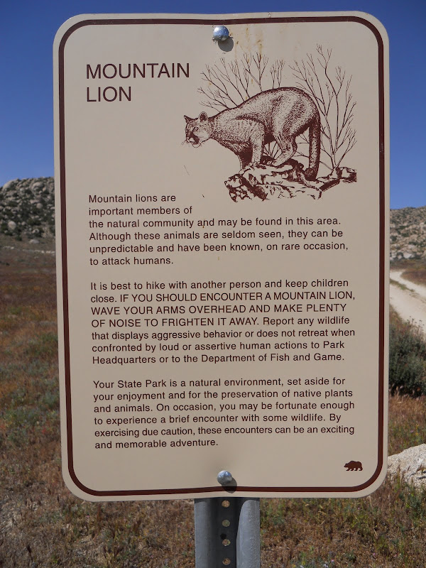
I saw what I think is Mountain Lion scat.
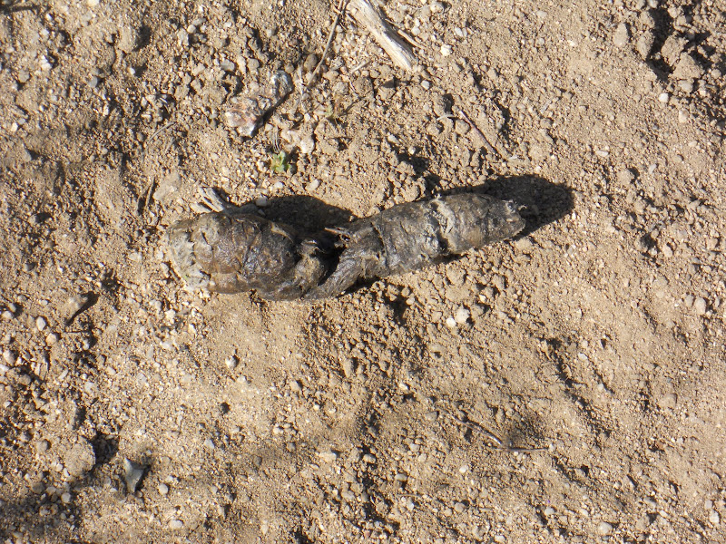
And saw many many beautiful little flowers.
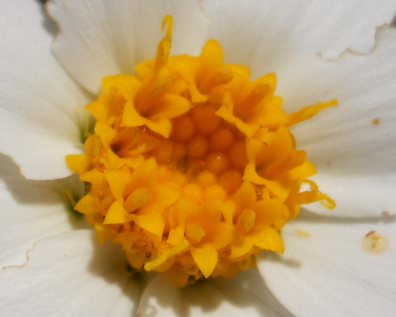
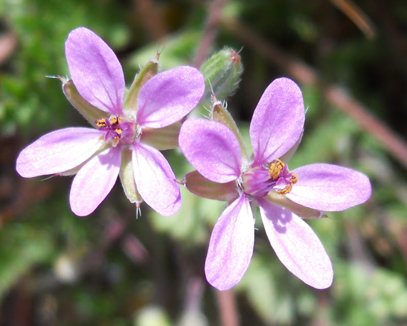
There were lots of these plants blooming however for each one of these I saw blooming there were at least 10 more ready to explode into color.
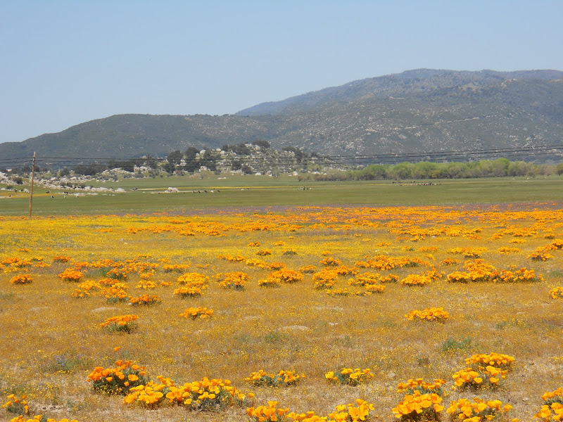
On the drive home I passed by Lake Henshaw. The valley around the lake is so green and covered with many flowers. The orange in the foreground are California Poppies.
It was an amazing backpacking trip. I have done this hike 6 or 7 times over the years and this was the third time I did it solo as a backpacking trip. The view from the top of Wilson Peak and from the eastern edge of Pinyon Ridge is wonderful. It is a pretty easy hike but it does cover about 10 miles with lots of ups and downs going in and coming out. The trail (old jeep road) is easy to follow and takes you to a cool elevation. If you do this hike you will NOT be disappointed.
edited by hikerdmb on 4/23/2010
<em>edited by hikerdmb on 4/26/2010</em> |
4/19/2010
Topic:
Pinyon Ridge Solo Backpack Trip
hikerdmb
|
Thanks Bob and feel free to add it to your site. Hopefully you got to see all the pics on Picasa.
David |
4/21/2010
Topic:
Hiking to Goat Canyon Trestle
hikerdmb
|
Daren,
That looks like a long and rugged hike through some pretty incredible terrain. However when I click on your link I get a blank page. Can you check that? I would like to see more details about this trip.
David |
4/21/2010
Topic:
Hiking to Goat Canyon Trestle
hikerdmb
|
Daren,
It worked for me too. NIce trip. I left you a comment on the site.
David |
5/2/2010
Topic:
Carrizo Gorge East Fork to Carrizo Palms
hikerdmb
|
Bob,
Nice hike. Looks warm. I take it you did this hike instead of the hike to the trestle you had mentioned for last Thursday. It looked REALLY windy on Thursday last week, 40+ gusts. How did the "newbies" like the desert? And did you really say last trip of the season?
David |
5/3/2010
Topic:
Carrizo Gorge East Fork to Carrizo Palms
hikerdmb
|
That would explain the date. Can't wait to read this one.
David |
5/3/2010
Topic:
Carrizo Gorge East Fork to Carrizo Palms
hikerdmb
|
Daren,
In pic 28 is that a rail car coming up the tracks? It looks like the lights are on. Did they stop you for being on the tracks? That looks like a great hike. Getting your Dodge up that trail must have been pretty tight in some spots. I love the view looking down from the trestle.
David |
5/5/2010
Topic:
Carrizo Gorge East Fork to Carrizo Palms
hikerdmb
|
Daren,
Now that I look closer I can see what you mean. Very adventerous indeed! Maybe 2 adventerous souls? I would love to hear the story.
David |
8/29/2010
Topic:
It's time
hikerdmb
|
First post in a while... but with the temps in Borrego Springs in the low 90s this weekend I know it is getting close to time to go out for a hike. I did make it out there twice this summer, once for a round of golf in July and once for a weekend hanging out at the pool at the Borrego Springs Resort in early August, but no backpacking or camping in the desert since spring. I spent the summer hiking lots of miles around Daley Ranch and around the reservoir above Elfin Forest as well as three great trips to the Mighty Sierra . But I am ready for the desert!
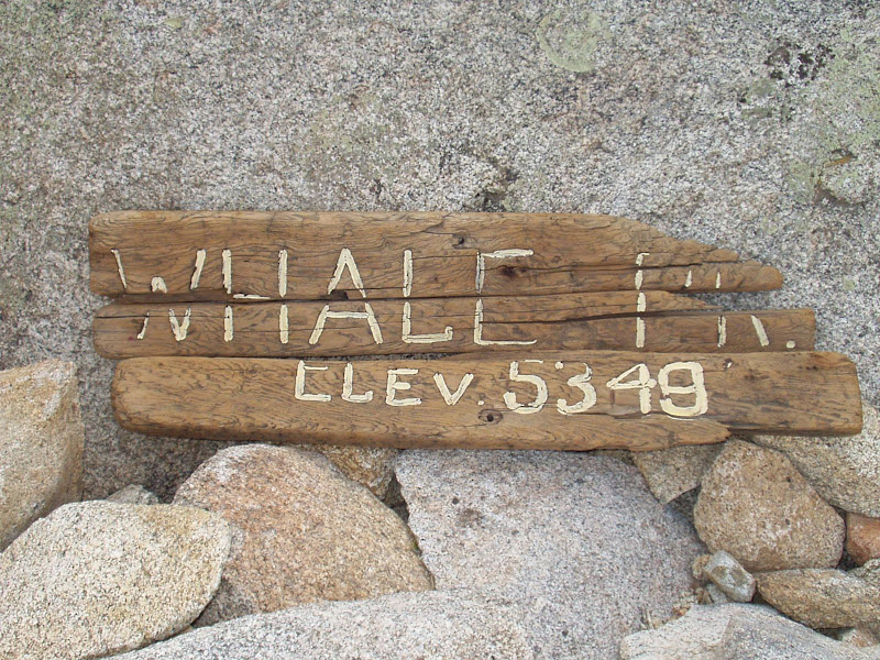
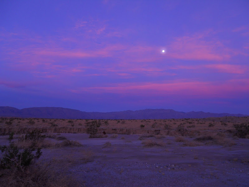
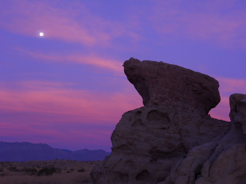
Oh sure its going to be hot again out there for another month or more but I still am ready. I am definitely backpacking up to Whale Peak this fall. I didn't make it there last year but it is tops on my list for this year. Hiking up through the Pinyon Pines and through all those small valleys is amazing, not to mention the view from the top. I remember one Sunday morning we were sitting on the large rocks on the western edge of the summit and got buzzed by a couple of Navy jets screaming up from the valley below. So close you could see the pilots' heads. Very loud but very cool. I have slept up there in the snow, in the rain, in the wind, in temps below 20 degrees, solo without another soul in sight a couple of times, but I've also had to share the summit with several people. It doesn't matter, it is still my favorite backpack trip in ABDSP.
This is a sunrise pic of our campsites from a few years back. It is not my favorite place to stay up there but it is alright.

Here is the sign that is on top. It used to be in one piece but over the years it has been deteriorating. I wonder if it is still there.
Anyone else ready? Got trips planned? I can't be the only one.
<em>edited by hikerdmb on 9/4/2010</em> |
9/4/2010
Topic:
It's time
hikerdmb
|
Daren,
I've looked at that trip down Carizzo Gorge several times from different angles but never seriously considered it. It looks like a long way with lots of bushwacking. Maybe with all the illegal traffic there could be some sort of trails.
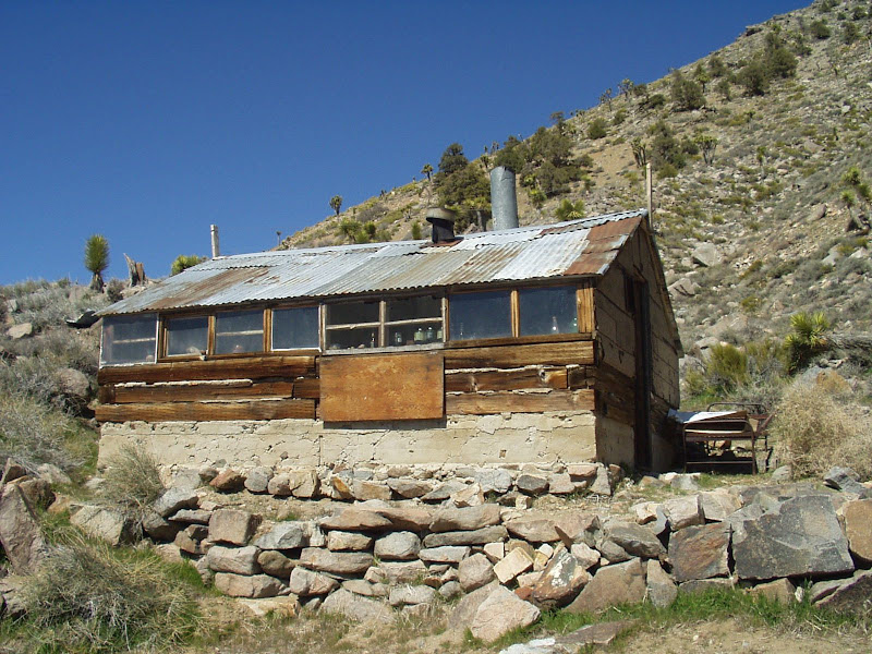
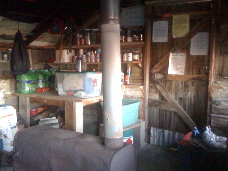
How was DV? Did you stay in any of the old cabins that are scattered around the park? I love those old places and it is so cool to stay in them and think about who built them and all that happened there in the past. What areas did you visit? This is a HOT time to be out there hiking around. I have been there many times but only in fall, winter, and spring and the highest temps were just a bit above 100. I don't know about hiking in the summer. I know this isn't a DV forum but maybe you could post a couple of pics. I put a couple pics of one of the old cabins and one of my favortie DV spots.
David
Here is my favorite cabin in DV.
And this is what it looks like inside. The wood stove keeps it nice and warm in the winter.
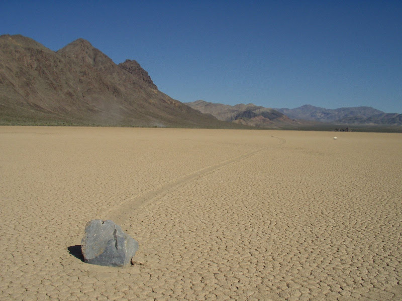
This is the Racetrack Valley where the rocks move across the playa and leave trails. A very cool place in DV
<em>edited by hikerdmb on 9/4/2010</em> |
9/22/2010
Topic:
It's time
hikerdmb
|
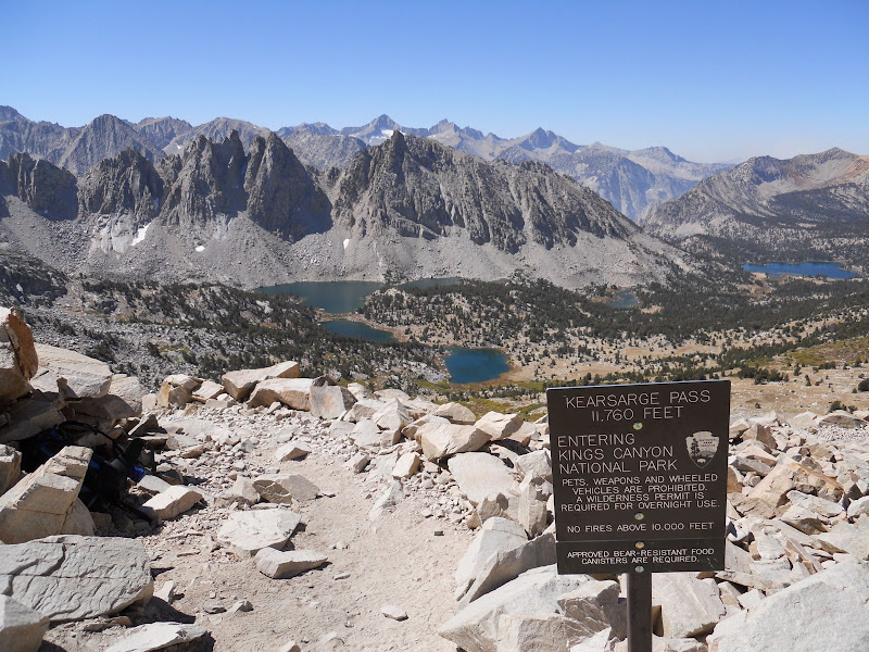
I had last weekend free and it was too hot in the desert for me, I can't do that hot hiking like Daren, so I left after school on Friday and headed to Independence. Dayhiked up Kearsarge Pass with my dog on Saturday. Did a short detour on the way down to visit a couple other lakes. Then drove back home on Sunday.
I don't have a date yet picked out for Whale Peak but I will let you know when I plan to do it. I am not sure of the Carrizo hike either. When you pick a date let me know and hopefully I can make that. That should be an adventure.
Here is a pic from the trip to the Sierra last weekend. It was beautiful except there is a fire over by Cedar Grove that made it pretty smoky in the afternoon and evening.
David
 |
9/27/2010
Topic:
Old Cabins in Aznza Borrego
hikerdmb
|
There are a few places I have been to through the years but I wouldn't say any of them are "cabins" like in DV. I have been to the rockhouse in Rockhouse Canyon between Bow Willow and Carrizo Gorge but it is more like a shack built into the rocks. We camped right outside that one one very cold night then hiked over a pass on an old Indian trail into Bow Willow Canyon to make a loop back to the truck the next day. I have also spent the night at the rock houses up Rockhouse Canyon by Clark Dry Lake. I think there are three old rock houses there but nothing much left but short rock walls. About 25 years ago we stumbled across some very old remains of some sort of cabin in some small dunes on the eastern edge of Clark Dry Lake. Also there is the old stage station out in the eastern part of Carrizo Creek. I think I read somewhere that someone lived there in the 60's or 70's but it was in very bad condition last time I was there. I know Bob went to the old place near Harper Flat last year and had some pictures of it in previous post on here. I have not been to that one before although I have backpacked into Harper Flat 10+ times over the years. I marked the location of that cabin on my map to go see next time. The only pics I have of the rock houses I have been to were taken before digital so I don't have any on my computer or I would share. If I have some time I will look in my old photos and see if I can get a couple to scan and post. |
9/27/2010
Topic:
Old Cabins in Aznza Borrego
hikerdmb
|
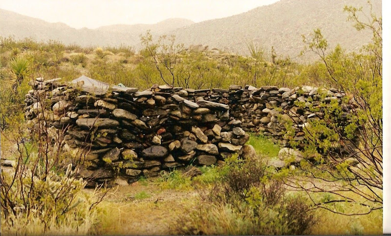
I found a couple of pics of the rock house ruins in Rockhouse Canyon in the northern part of the park. Also I remembered one more cabin. At the northern reaches of Coyote Canyon, the Bailey Cabin. All the times I have been by there it has been locked up and I don't think you can even get there without hiking since they closed the upper part of that canyon. But not absolutely sure about that.
Here is a pic of one of the ruins in Rockhouse Canyon. It was a fairly large "cabin" when it was built but now as you can see, just walls and the place where the door once was located. The others looked pretty much the same as this one.
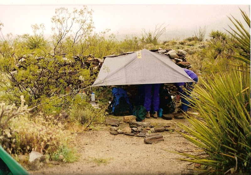
And here is my camp next to the ruin. I used the tarp on this trip because it rained so much. I set up with the rock house wall to block the wind and rain from the north. The snow level on the Santa Rosa Mountains was only about 500' above our camp. There was water running down the canyon as we hiked back out to the truck. That was a very wet trip.
Didn't find any of the other pics. |
9/28/2010
Topic:
Old Cabins in Aznza Borrego
hikerdmb
|
No problem, glad to help. As far as the road up Coyote Canyon...the road all the way to the last water crossing is not bad at all but the bypass they made 15 or so years ago around the willows section is very rough and has one fairly sharp corner with a huge boulder on the right. I have seen full size trucks up there but I wouldn't take my Dodge quad cab. I did have a Dodge before that had the back seat without doors and I took it up there. A couple years ago a saw a nice lifted Land Cruiser high center and lose a lot of fluids about half way up the bypass. The road is not as rough as it was when they first built it but it still is a pretty steep, long, rocky, 4 low section. Once to the top of the bypass it is very easy all around Collins Valley. It is a fun road in the jeep. I always see lots of Boy Scouts hiking up that way almost everytime I go up there.
David |
9/28/2010
Topic:
Old Cabins in Aznza Borrego
hikerdmb
|
Sorry about that previous response but I was thinking I read you were going to Bailey Cabin since Alcoholic Pass goes from Coyote Canyon too. But the road to Rockhouse Canyon is different. It is not too bad until you get to the junction where Rockhouse goes to the right and I think it is Butler Canyon to the left. From that point on it is very rocky and slow going but no big hills or real narrow parts to get through. Lots of small round rocks to crawl over but nothing big. Your truck should make it up. The road actually ends about 50 yards or so from Hidden Spring (I think that is the name). I have not been up that far in a few years but I just remember it being slow and rockyn the last 3 or 4 miles but not dangerous. Hope this helps.
David |
10/22/2010
Topic:
Whale Peak Backpack Possibility
hikerdmb
|
I have been up there probably 10+ times but I have NEVER been that way. I take the short trail from Pinyon Mountain Valley. The first couple of times going that way it is a little confusing but not too difficult. From the top looking down your planned route I say that way is doable but not for me. I look up that way every time we drive down S-2 but never even considered going that way. If you do that I would love to see some pics and hear what it was like. I was planning on going up there this weekend but my buddy hurt his back so we are car camping somewhere out there but no backpacking. Should be interesting to see what the rain did this week.
David |
10/24/2010
Topic:
After an autumn rain
hikerdmb
|
Our plan was to go out and backpack up Whale Peak but my buddy hurt his back so we decided to head out and just camp from the truck. We had no plan on where we would go we just took off. When we left North County it was getting cloudier and we had a little rain as we went over the mountains. Heading down the hill into Borrego Springs the clouds had cleared for the most part but we saw a couple of huge dust clouds blowing across the desert floor and got concerned that it would be windy. However when we got down to Borrego Springs there was not too much wind and it was 80 degrees. Our first trip off road was up to a place we had camped before. We couldn't believe all the green Ocotillos up on the hills and we had to go up and take a look. The road was completely clean of tracks from the recent rains. Here is a view north toward Toro Peak and Clark Dry Lake.
We returned back to the highway and then continued east to Palo Verde Wash. There was lots of wet sand and some mud in this wash but nothing that proved to be too difficult. I was amazed at how much mud there was all the way down this wash.
Palo Verde Wash looking south.
When we got to the Cut Across Trail we turned right and headed west toward San Felipe Wash. There were several places along the Cut Across Trail with huge mud puddles but again we found nothing too difficult. I don't remember rain like this in the fall.
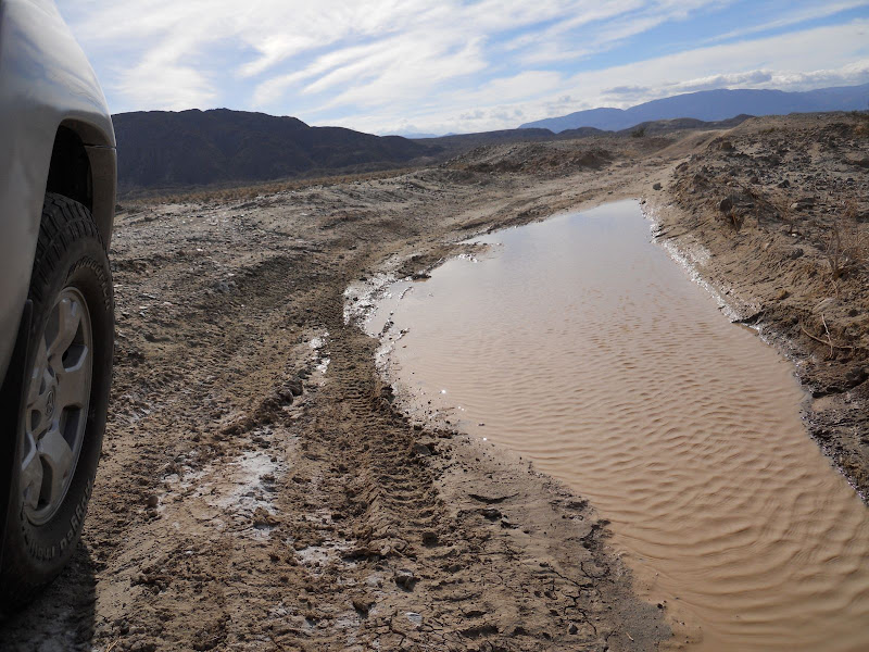
We got down to San Feliipe Wash and found more wet sand and mud and continued on to Rainbow Wash and back to a campsite we have stayed at several times in the last few years.
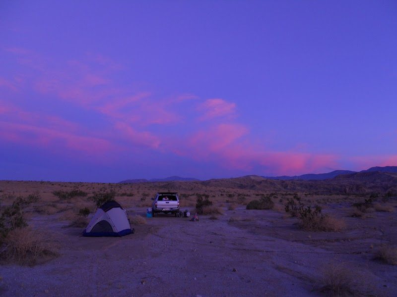
Here is a pic of our camp site.
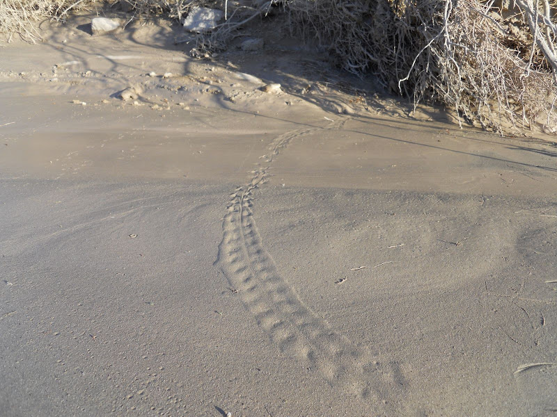
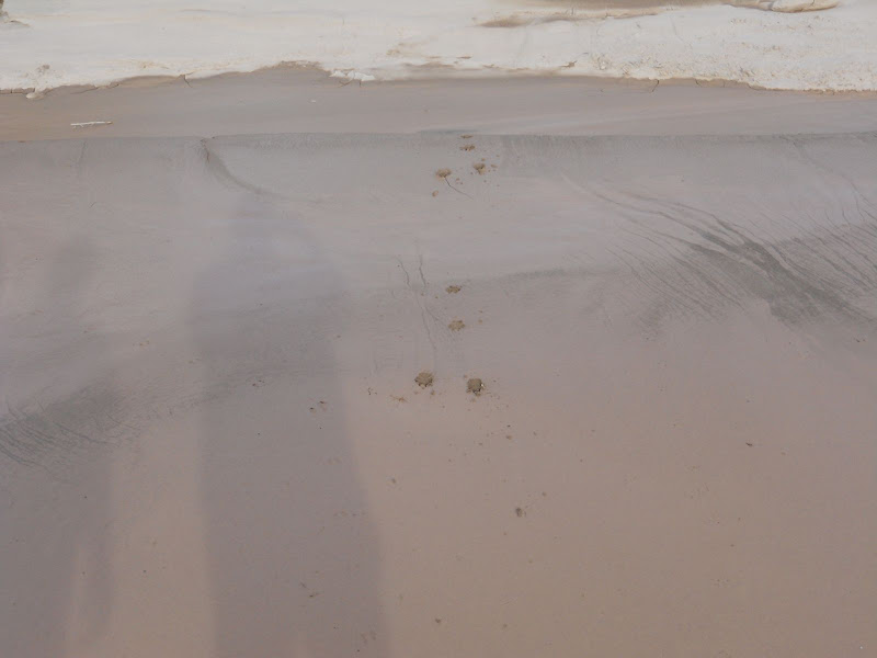
I took a little walk up the wash, this is not Rainbow Wash but it is close to there. Saw lot of animal tracks in the new mud. This is some small animal track but not sure what.
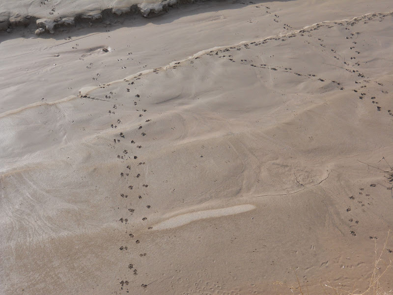
And this is a snake track that went across the wash.
Never saw any water in this wash but lots of mud that sure liked like water with the sun light on it.
One of the coolest things on this hike was all the little plants that were just coming up from seed. It was incredible how such small plants could push through the thick mud to start growing in the sun.
All afternoon the wind was quite calm which was nice. It seemed last year it was windy on pretty much every trip. We had a nice sunset. But it was nothing compared to the sunrise Sunday morning.
Left around noon and got home just in time to see most of the Charger game. Should have stayed in the desert longer.
But that Charger loss was made up by an Auburn win on Saturday and first time ever BCS ranking of #1. |
10/25/2010
Topic:
After an autumn rain
hikerdmb
|
Daren,
I like the pics in the Inner Pasture link. That is a place we talked about going to for many years but have not been in there. It looked pretty interesting. I always wondered what kind of signs of Indian life were in there. Just the name got me interested in going. I am going to need to add that to my list of places to get to.
Was Bisnaga wash your attempt at Whale Peak or just a scouting trip? Did you go by the large dark cliff area that is in that area a few hundred feet above the highway? It looks like it would be an interesting place to check out. It might be a little eastof where you went up
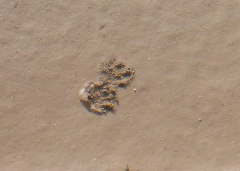
I found a couple more pics of the tracks from my trip. Maybe you can figure out what it is. The tracks were only about one and one half inches to two inches long. Some, that I did not get pics of, had very small claws, four claws per foot if I remember. I was thinking maybe a kit fox.
I also included another track that at first I thought was another snake but in the middle of going across the wash it looks more like footprints. What do you think?
And the last pic is coyote. I thought this was pretty cool how he/she did not want to get too muddy and jumped twice to get across the mud. All the other tracks walked right through.
David
 |
11/1/2010
Topic:
Hunt for the Summer Solstice cave in Indian Valley
hikerdmb
|
Nice job guys. I read the trip report on your blog and looked at the pics. That must have been quite the search to find that wonderful cave and art. It sure is bigger than I
thought. I sure don't want to wish by time (especially this time of year) but can't wait to see what happens there on the summer solstice. Do you think it could line up for the winter soltice or did you find something in your research that makes you think it is only summer? Besides the name?
David |
11/7/2010
Topic:
Solo Backpack to Whale Peak
hikerdmb
|
I loaded my backpack into the Desert TJ and headed out for a quick trip up Whale Peak. I got to the beginning of the route which is up in the valley a few miles in on Pinyon Mountain Road.
The weather report forecasted wind of 40 MPH but the hike up was beautiful with very little wind. The rain from a couple weeks ago let some of the grasses grow a little earlier than usual. This pic is from the climb up the slope above the first valley you cross.
Soon I was high enough that I was surrounded by Pinyon Pine trees. Whale Peak is called an island in the sky. The trees at this elevation are amazing to see. Views like these are what make this my favorite hike in ABDSP.

About half way to the summit I passed the route coming up from Smuggler Canyon. This route starts near the pictographs in Blair Valley. It is pretty rugged down this gorge. You can also see the difference in vegetation on north facing and south facing slopes in this pic.
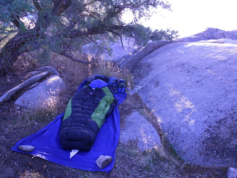
It took one and a half hours to reach the summit. When I signed in the summit register, I was the first signer in over a month. I thought this was kind of strange since the weather has been pretty good this fall. About the time I got to the summit the wind started blowing hard and so after reading through old summit register books I headed for my favorite campsite on the summit plateau. In this site I would be protected from the wind by large boulders and a wall of Pinyon trees. The wind howled all night but I was nice and warm and wind free, for the most part, in my protected site. No tent for this trip.
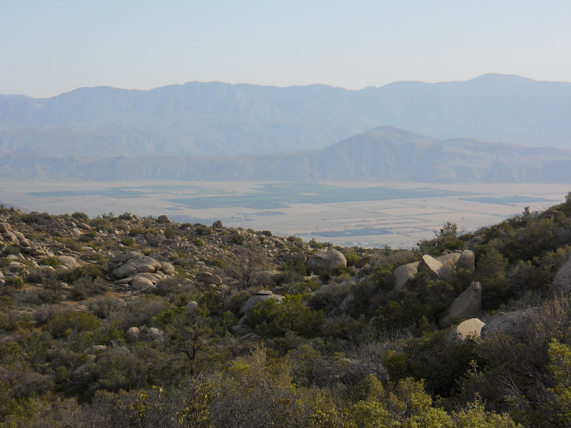
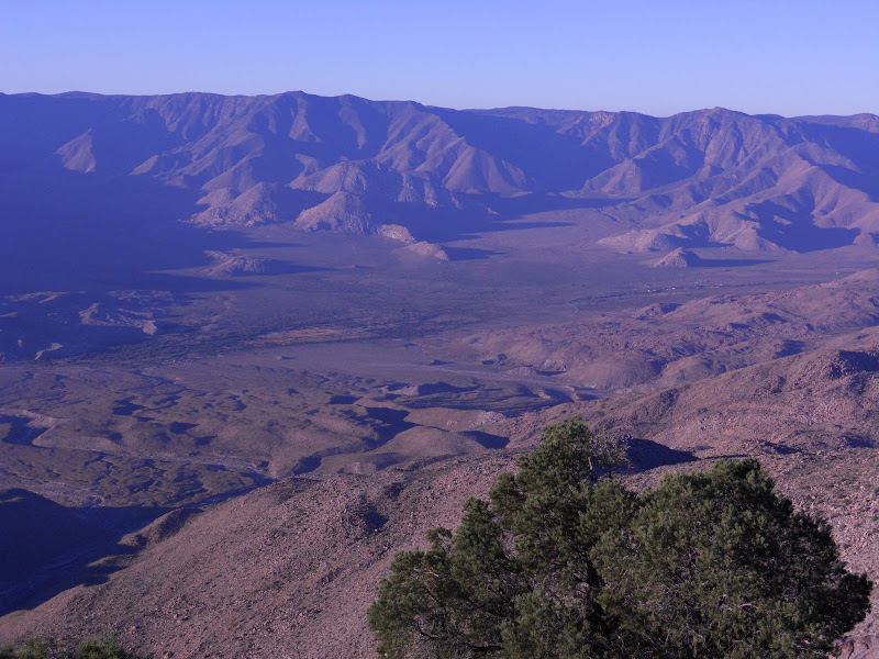
This is the valley that is west of Whale Peak, west of S-2, and at the base of the Laguna Mountains. It became part of ABDSP a couple years ago. It was just opened last year to bicycles, hikers, and I think horses. I hope to make some time soon to get into this area. It looks very cool from up on Whale Peak.
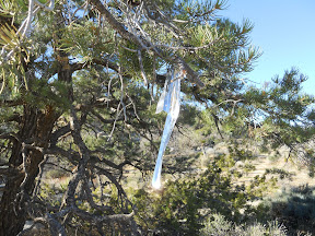
The stars were fantastic. I saw several shooting stars and satellites. There was no moon so it was quite dark. I left early Sunday morning for the hike down the mountain. The number of ducks along the trail was more than I have ever seen on this mountain. Also someone decided to leave other trail markers like these hanging from many trees along the route.
So if you have never been up Whale Peak by this particular route, now is the time to go. The ducks and the ribbons in the trees will make it easy to find your way.
Unfortunately not all the Pinyon trees are doing so well. The lack of rain in the past few years (not counting 2009-2010) has really taken its toll on some of the trees. Let's hope we get another wet winter in the desert this year.
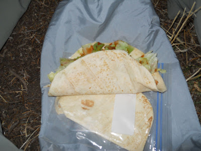
One last pic... dinner on Saturday night was chicken tacos. This is becoming one of my favorite desert backpacking meals. No cooking and no water required and I get two of these tacos from one packet of southwest chicken, a couple of Trader Joe handmade tortillas, a couple of cheese sticks, some lettuce, and some hot suace packets. I get the chicken near the canned tuna at Vons. I keep the lettuce and cheese in an insulated water bottle holder along with one quart of frozen Gatorade. It keeps nicely and then I have a cold drink too, always nice in the desert.
All in all it was a great trip. The wind was strong but not a problem. This is hands down my favorite hike/climb in ABDSP.
<em>edited by hikerdmb on 11/8/2010</em> |
11/8/2010
Topic:
Solo Backpack to Whale Peak
hikerdmb
|
Daren,
I know that view well. We were up there the weekend before last and planned on hiking a section of the PCT to Garnet Peak and back but it was raining and the wind was blowing probably 50 MPH across there so we stayed in the trees and hiked part of the Big Laguna Trail instead and got nice and wet. But it was lots of fun and my dog didn't care that it was raining or windy. Not sure of my plans for this weekend yet but I would love to do a hike with you sometime. It seems you have been some places I have missed in my years of exploring ABDSP.
David |
11/8/2010
Topic:
Solo Backpack to Whale Peak
hikerdmb
|
Bob,
The chicken package says... "Premium Bumble Bee - Prime Fillet - Chicken Breast - Skinless & Boneless - with Southwest Seasonings." It comes in a 4 oz. packet and says "Already Cooked - Just Heat and Serve" on the top of the foil packet. It does not need to be kept cold. Since I rarely take a stove when backpacking in the desert, I just skip the heating part and shred it into a tortilla. Like I said above I found it next to the canned tuna at Vons. There are also some salmon and other items in that same area of the store that you could use. As far as keeping the lettuce and cheese cool... If it is winter and cold I just bury it in the middle of my pack. But on this trip I put those two things in something like this http://www.outdoorresearch.com/site/water_bottle_parka.html with a frozen bottle of Gatorade inside to keep it cool. The water botttle parka is mostly used for backcountry ski trips to keep water from freezing but it works on desert backpacking trips as a mini cooler. All the other stuff is up to you. This time I used some Jack in the Box hot sauce packets and individual snack packets of pepper jack cheese. Hope this helps. When backpacking in the desert water adds so much weight to my pack, I really try to keep the meals easy and simple. And these tacos are easy, simple, and delicious! Of course if car camping it is much easier to keep things cool and fresh.
David
<em>edited by hikerdmb on 11/8/2010</em> |
11/8/2010
Topic:
U.S. Mormon Battalion Trail
hikerdmb
|
I see troops of Boy Scouts each year hiking that portion of the trail. In fact a bunch of years ago one of my students did his eagle scout project and built a monument just off the east side of S-2 to honor the Mormon Battalion. He was also a Mormon (they are big in scouting). Unfortunately a few years ago I noticed the plaque was gone but the stone structure that held it and the wood shade type structure above it are still there. It is just a few yards off the road and a few feet above the road level. Next time I go by I'll see if the plaque has been replaced. I think, if I remember right, the Mormon Battalion just missed making it to the Battle of San Pasqual and maybe if they had been there that battle would have turned out differently. |
11/9/2010
Topic:
Solo Backpack to Whale Peak
hikerdmb
|
Daren,
Try this NWS link http://forecast.weather.gov/MapClick.php?lat=33.02363335727839&lon=-116.28341674804687&site=sgx&smap=1&marine=0&unit=0&lg=en
It has a map you can zoom in and out and click anywhere and it gives a 7 day forecast as well as telling you the average elevation for that particular place. I use this site because it will give a zone forecast for anywhere, not just cities.
I also use this one from Borrego Springs http://www.bageltron.com/~laura/wx/
and this too http://www.wunderground.com/cgi-bin/findweather/getForecast?query=92004.
The last one has an hourly forecast and a good history page for rainfall totals and such.
Here are a couple more that you might like
http://www.wrh.noaa.gov/mesowest/mwmap.php?map=sgx&limit=1&list=1
http://www.cnrfc.noaa.gov/precipMaps.php?group=sd&hour=1&synoptic=0
Hope this helps,
David |
11/18/2010
Topic:
Thanksgiving week break trips
hikerdmb
|
After four weekends in a row I will be a home body for the next couple of weeks. My daughters are both coming home from college for Thanksgiving and my wife is having shoulder surgery. I don't think it would go over too well if I took off for the desert and left them behind. I know you will do a great hike and can't wait to see the pics. Rockhouse is a very interesting area with lots of history. If you go up there you will not be disappointed.
David |
11/18/2010
Topic:
Jacumba Wilderness
hikerdmb
|
Bob,
I have spent a great deal of time in Davies Valley, it is the next valley to the east of Myer Valley. Climbed a mountainon on the ridge between Davies Valley and Myer Valley, no name but elevation is 2120'. Looked over into th Meyer Valley area and it looked very nice. We have also scouted out Pinto Canyon which joins Davies Valley to Myers Valley at the south end of Myer Valley and found some nice pictographs in Pinto Canyon. Also came across a guy in full camo with a large gun strapped to his side sitting on a rock above the pictographs. (Does walk in a serpentine manner mean anything to you? It does to me.) Also about a year or so ago there was a full front page story in the Reader about a couple of guys hiking into Myer Valley, pretty much on the trail described in your article. It was pretty interesting story but I had no luck finding it on-line. Supposedly they found a complete olla in a small cave on the ridge between I-8 and the valley. We have talked about going into Myer Valley for years but never have. Let me know if you are doing this trip. I would like to do a day hike in there, especially in the spring, but not sure about spending a night, always lots of Border Patrol activity along there. Once we took old highway 80 from Mountain Spring and drove all the way to the place where this hike starts but not sure if that is possible anymore.
David
<em>edited by hikerdmb on 11/18/2010</em> |
11/21/2010
Topic:
The View from Monument Peak
hikerdmb
|
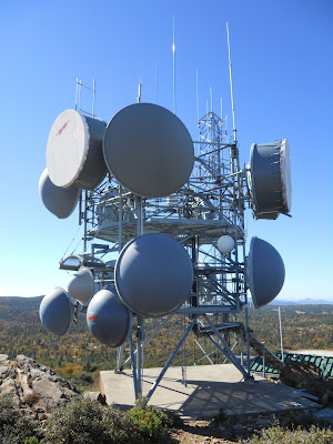
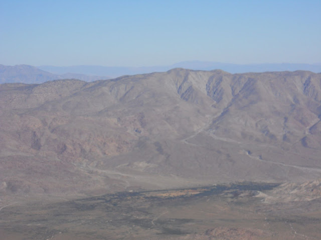
Hiked up Monument Peak in the Laguna Mountains with my wife and my dog on November 13, 2010. We had a great view of the pretty much all of ABDSP. It was the end of the Santa Ana and we also had views north to San Gorgonio, east to Arizona, and all the way to Catalina Island and beyond. While we were up there my wife and I were joking about probably being watched as we walked around the summit area which is covered with lots of towers and dishes. Sure enough I found this today...and we were being watched. The actual summit register is in the rocks near the large bush on the right in this video. Look close about half way through this time lapse video and you can see me taking some pics of Whale Peak and the tower. http://hpwren.ucsd.edu/anim-g/hpwren-iqeye4/dates/20101113-Q4.mp4
The Web cam is in this tower but we didn't see it while we were up there.
And this is one of the pics I took looking at Whale Peak (where I had camped the weekend before).
David |
11/21/2010
Topic:
The View from Monument Peak
hikerdmb
|
Daren,
I found the video by searching through here.
http://hpwren.ucsd.edu/cameras/
I saw on the news a few weeks back that they put up a bunch of new web cams as fire lookouts. And then I found this.
I could see your planned route up Whale Peak. It looks like a long way.
Have a great trip and where did you decide to go?
David
<em>edited by hikerdmb on 11/21/2010</em> |
12/3/2010
Topic:
Jacumba Wilderness
hikerdmb
|
Bob,
Here is the link to the Reader article I couldn't find before.
http://www.sandiegoreader.com/news/2009/jun/03/cover/
It seems like the rock art here is petroglyphs and not pictographs but I can't find any of my old pics to be sure. The Reader article may have some useful info for you. I also sent you a PM to your ***runner account with an attachment of a topo map of the area and some more info.
David |
12/3/2010
Topic:
Jacumba Wilderness
hikerdmb
|
Daren,
That is pretty much what I said in my PM to Bob.
David |
12/7/2010
Topic:
Bighorn Canyon
hikerdmb
|
I am planning a backpacking trip into Bighorn Canyon this weekend. Hopefully I will find a suitable place in there to set up my sleeping bag and spend the night. I am hiking in to look for Blue Spring and then make a traverse to the east through a small pass and down into Nolina Canyon. Then hike down and out through Nolina Wash to make a loop. There is suppose to be some kind of wildlife bubbler/watering system near the spring. I have seen a few of these in the Mojave and up around the Table Mountain area off I-8 but not out in ABDSP. I figure about 7+ miles and a little over 1000' elevation gain. Of course I will be sure to camp far away from the spring (if I locate it) so as not to disturb the wildlife. Never been up in this part of the Pinyon Mountains before and I am looking forward to exploring a new place. Looks like good weather too. Not much of a moon and mostly clear skies.
Anybody been up this way before? I am not sure about connecting Bighorn and Nolina Canyons. I read it could be done but don't know anyone who has been up there. |
12/13/2010
Topic:
Backpacking in Bighorn Canyon
hikerdmb
|
I have been in other areas around the Pinyon Mountains but Bighorn Canyon would be a new destination for me. I did not go solo. I met up with Daren from this forum and also a friend of mine joined the trip. We met at the junction of Pinyon Wash and Nolina Wash on Saturday afternoon. We then drove up Nolina Wash a half mile or so and found a place to park off the dirt road. We shouldered our packs and headed west across the desert toward the mouth of Bighorn Canyon.
It was a beautiful day. I can't remember a December day like this in the past few years. It was actually hot as we made our way into the canyon and there was very little wind. It was nice to get into the canyon and hike in the shade provided by the walls to our west. The hike up was pretty uneventful, mostly hiking on sand with a few boulders to negotiate every so often. When we got up towards the end of the canyon we spotted the low pass to the east that lead to Nolina Canyon. We knew we were close to the watering system below Blue Spring and the search began. We went up the wrong part of the canyon and ended up scrambling up and down a couple of ridges before we spotted the tanks. In the main part of the canyon just like it showed on the topo map.
We hiked a bit further up the canyon above the water tanks to look for any sign of Blue Spring but didn't see anything. We did find the old way of collecting water from this canyon.
The upper part of Bighorn Canyon is very nice. There are some nice rock formations and signs of waterfalls that flow during heavy rains. If you look to the left of this rock formation you can see one of the many dry falls. This one looked to be about 20+ feet tall.
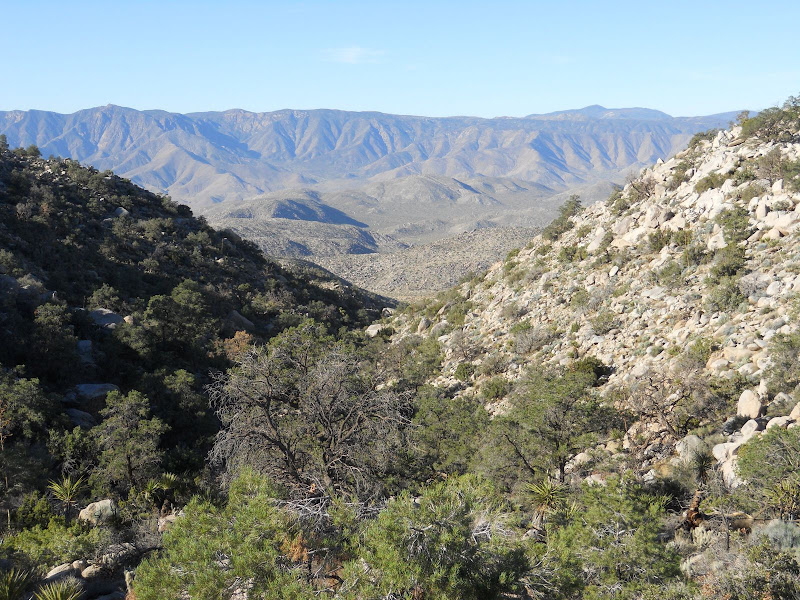
Afer spending a few more minutes looking around this part of the canyon we headed up the final feet toward the low pass. Daren had spotted a fairly level area on the pass during our scrambling around time looking for the tanks. Here is a view back down into Bighorn Canyon from near the pass.
We did find a nice campsite just as the sun was going down. We had dinner and sat back to look at the sky show. The Perseid meteor shower was to be at its peak in a couple of days so we were hoping for a show. We saw a few shooting stars but not as many as I had hoped. The next morning we awoke to another great desert sunrise.
As my buddy and I had breakfast, Daren scrambled up the mountain to the east for a better view. After he returned we packed our gear back into our packs and started our descent into Nolina Canyon. This canyon was quite different than Bighorn Canyon. There were many many animal tracks in the upper parts of the canyon. We also passed many willow trees in this canyon. There must be water just under the sand. We also saw some Pinyon Pine cones on the floor of the canyon. This is very odd because when you look up and all around you cannot see any of these trees. I know they are way up high above this canyon so these cones traveled very far to rest in the sand here. There were some nice stands of Cholla along the sides when the canyon opened up a bit.
It was a pretty easy hike down through here with only a few spots with boulders and rocks to negotiate.
After about an hour or so we made it out of Nolina Canyon and proceeded on down the wash and back to our rigs. There was a great view looking to the north as we exited the canyon. We could see the Santa Rosa Mountains, Toro Peak, and all the way north to San Jacinto Peak. It was another perfect day.
The shade of Nolina Canyon made the hike out very cool. But once we left the shade of the canyon walls it was a bit warmer. It was a great trip! A nice loop hike with some scrambling up and down rocks and ridges, easy hiking in two fantastic canyons, a calm, clear, warm night with lots of stars, and good hiking partners.
edited by hikerdmb on 12/13/2010
edited by hikerdmb on 1/2/2013 |
12/14/2010
Topic:
Backpacking in Bighorn Canyon
hikerdmb
|
It was a terrific hike. Nothing quite like going to a new place and seeing new sights. I liked Nolina Canyon a lot. I am pretty sure that big plant we saw a half mile or so from the rigs is the Nolina plant. Is the elevation total from your GPS for our hike correct? That is a different number than you had said after the hike. The total on your track is closer to what I had on my altimeter. Glad you had a good time. It was nice hearing about some new desert places to explore. Andy and I really liked the hike. He is ready to go again. By the way his pics turned out great. I will send you a PM and see if I can get you a link to his pics. Don't know if he has them open for everyone to see. If not I will see if he minds me posting a couple of them on here. Or maybe he will want to post them himself. |
12/14/2010
Topic:
BFGoodrich MT K/M 2 Tires for my Landcruiser
hikerdmb
|
That is a very nice early Christmas present. |
12/15/2010
Topic:
Backpacking in Bighorn Canyon
hikerdmb
|
Here are a sample of the photographs that Andy took on this hike. He is an excellent young photographer as you can see by his work. Please don't do too much of a comparison between my point and shoot style and his awesome work. My favorite is the last photograph in this group. Maybe he will join the forum and post some more. I know he will be backpacking in ABDSP again.
Near the watering system in Blue Spring.
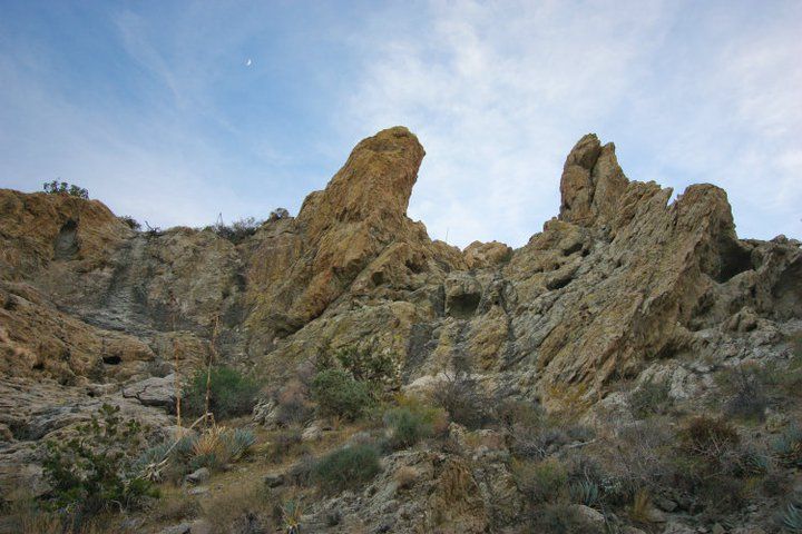
Sunset from near our campsite.
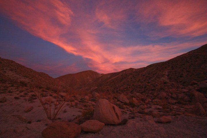
Star trails around the North Star.
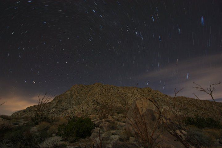
Last bit of light from the setting sun.
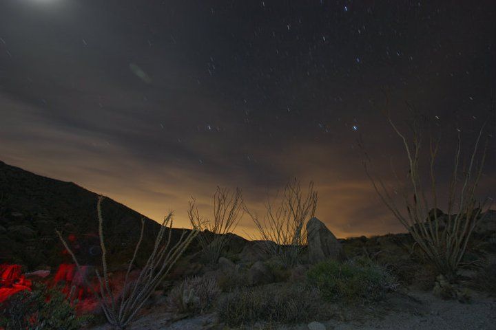
Aircraft crossing the night sky.
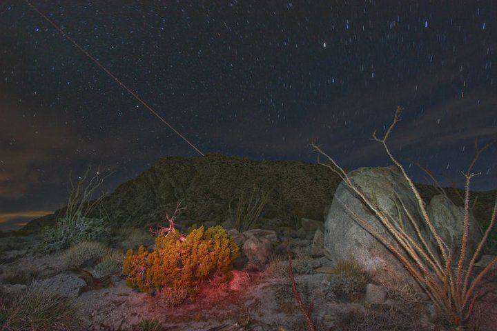 |
12/15/2010
Topic:
Backpacking in Bighorn Canyon
hikerdmb
|
Bob,
I think it was a Canon Digital SLR but I will ask him. His pack was heavy with camera gear and a tripod. I think he had four lenses and the camera body plus he also had a little point and shoot camera.
Daren,
I will make sure I thank him but hopefully he will look on here and see them. I sent him the link to the blog and the forum. I also asked him to post some more. He is quite the artist. I have seen some of his other work and his is definitely talented. That Nolina is definitely what we saw when we left the canyon and were in the wash. I am ready to go again.
David |
12/16/2010
Topic:
Backpacking in Bighorn Canyon
hikerdmb
|
I will ask him about putting them on the front page of the blog. |
12/16/2010
Topic:
Old Cabins in Aznza Borrego
hikerdmb
|
I will also add a welcome to the forum to 6kmclimber. I think the ruins you posted are the same that I mentioned in my post on this topic from 9/27/10. I see your bike in your pic. When I first went there we kind of just stumbled across it by accident. Back in 1987 we could drive right out to those small dunes. Here are a couple of pics from back then. The first is looking into the trees and you can see what I think is the same chimney remains. The second pic is my old red Mitsubishi truck and my buddy's first Toyota truck sitting on the dunes near the old cabin.
David
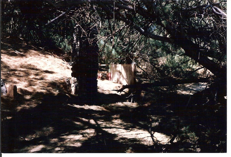
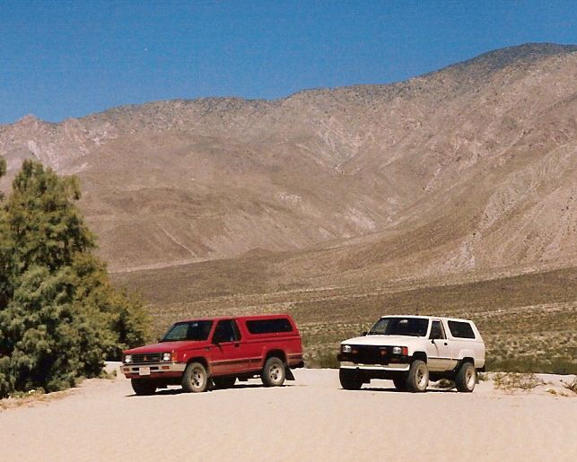 |
12/16/2010
Topic:
BFGoodrich MT K/M 2 Tires for my Landcruiser
hikerdmb
|
I agree completely Bob. Those look really good. Those will work really well on your backroad explorations and rocks. Probably the only drawback might be in deep sand but you don't seem like the type to spend much time at Glamis. Also if you do any snow driving I think those narrower tires will be much better at digging down to the road (dirt or pavement) than a wider tire.
David |
12/17/2010
Topic:
Old Cabins in Aznza Borrego
hikerdmb
|
Those are some nice places. I am going to have to try to get to a couple of those. Thanks for the pics. |
12/17/2010
Topic:
Backpacking in Bighorn Canyon
hikerdmb
|
Bob,
Andy said go ahead and put a couple on the blog. He checked out your site and thought it was cool. His camera is a Canon Rebel xsi, and the lenses are a Canon 10-22mm (this is the one used for most of the pics, including all of the night sky ones), Canon 60mm, Canon 18-55mm, and a Canon 75-300mm.
David |
12/21/2010
Topic:
Rain
hikerdmb
|
Four days of rain in North County and finally it is raining in ABDSP. Can't wait to get back out there.
http://newweb.wrh.noaa.gov/mesowest/getobext.php?wfo=sgx&sid=SDBSG&num=48 |
12/22/2010
Topic:
Rain
hikerdmb
|
I hope it keeps raining in ABDSP but I am ready for it to stop here in north county. I just spent 3+ hours cleaning up 2-3 inches of standing water in my shop under my house. It was actually flowing out of the shop into the garage. So glad I keep all my gear up on shelves. Used the shop vac and must have filled and dumped it 50 times. Only a trickle coming in now so I think I am good unless we get some more rain like last night. NWS says we have almost 8 inches total from this storm but it sure feels like more than that. I know my next house will NOT have a basement!!
<em>edited by hikerdmb on 12/22/2010</em> |
12/22/2010
Topic:
Rain
hikerdmb
|
I have a straight sided bucket that must have 12 inches or more in it. Unbelievable!
I think I recognize that pic. Is that from over by Aguanga? If so I probably have the same pic somewhere.
Scroll to the bottom of this link for storm totals, from about noon today, in our desert and check out the rest of SoCal too. Huge numbers everywhere.
http://newweb.wrh.noaa.gov/sgx/display_product.php?sid=SGX&pil=RRM#
David |
12/22/2010
Topic:
Rain
hikerdmb
|
Daren,
I live on a hill and the water comes down through the ground and comes in through my foundation and looks very similar, less mud more water, to what you showed at the base of your wall, only it was in my shop. The creek picture is pretty amazing. Urban kayaking?
David |
12/30/2010
Topic:
Smoke Tree Canyon / Calcite Mine Area
hikerdmb
|
Daren,
That sounds like an excellent trip and nice pics. How many tanks did you find? Glad to hear it rained hard on Wednesday morning because it didn't look like it rained much out that way from looking at the radar. How close were you to the sheep? That area on the rise between the highway and CDL is ALWAYS filled with RVs this time of the year and some OHV folks congregate on the other side of the road nearby. There is a small area where they can ride there and I have mostly seen young families with young riders staying there since it has to be safer than Ocotillo Wells. Were you solo for this trip? That is pretty wild seeing someone stuck so close to the highway. Was water flowing across the road at Font's Wash? I am hoping to get out next weekend. Maybe some of the mud will be gone.
David |
12/31/2010
Topic:
Backpacking in Bighorn Canyon
hikerdmb
|
Daren,
I will pass that on to him for sure. Thanks
David |
12/31/2010
Topic:
Smoke Tree Canyon / Calcite Mine Area
hikerdmb
|
That definitely looks like an old Indian trail. Here is a pic of an old trail we came across above the upper part of Arroyo Tapiada. It had some huge rock cairns every hundred yards or so. Did the trail you found have any cairns like this? You can see one of the cairns to the left of the ocotillo and the trail runs on into the center of the pic.
|
12/31/2010
Topic:
New lights for Christmas
hikerdmb
|
I got some new auxillary lights for the DesertTJ and recruited my brother to help me do the install (honestly he did almost ALL of the work). I got one pair of 130 watt KC Daylighters to mount on the outer part of the front bumber. I installed a grommet on an existing hole in the fender to run the wiring into the engine compartment from these two lights.
I also got a pair of 130 watt KC Slimlights for my mirror relocation/ windshield bracket mounts. These are the long distance pencil beam style lights. Probably a bit over kill for the distance they shine compared with the speed of my jeep but I was worried about glare off the hood. In a test of these coming up the hill to my house there was no glare problem so I think I got the correct lights for this mounting location. We were able to lift the cowling below the windshield and run the lights down into the engine compartment.
The install took a little over 3 hours but I am quite happy with how it turned out. We used some 3/8" Split Flex Tubing to protect the wiring that was not protected in the KC wiring harness that came with the lights. You can see some of the new flex tube running along the upper part of the firewall leading to the battery.
We found an existing entry to get the wiring through the firewall and into the passenger area of the jeep.
I had to take off the center of the dash to get access to the spot where we would run the wires to the switches. We used an old coat hanger to fish the wiring through the firewall and then into the dash location for the switches.
Here is a close up of the finished switches.
And finally here are a couple pics taken in my driveway of the finished project. Notice the clean jeep. Hopefully it won't stay this way for too long.
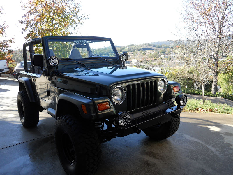
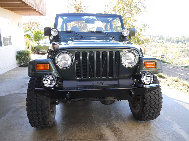
And one pic of how it looked before the lights were installed, in the desert with a bit of dirt on it. This is at the top of the Diablo Drop Off.
 |