|
tommy750 Posts: 1040
8/6/2015
|
Of course, it's dry! The desert is hot and desiccated and it's summer and all the springs out there haven't flowed in decades. But hidden under a canopy of Washingtonias and catclaws could there still be a trickle of liquid life? I had to know, so I figured out a most indirect path to visit this verdant triangle wedged on the eastern slopes of the In-Ko-Pah Mountains, the peninsular range forming the floor of McCain Valley and the western flank of Carrizo Gorge. Daren agreed to accompany me having visited the area once before from the much easier and sane eastern approach. Starting off McCain Valley Rd, we dropped several hundred feet to the east and then headed north. Quickly stumbled onto rock art somewhat atypical for the local Kumeyaay 
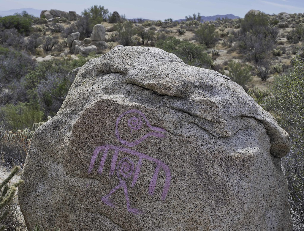 Bird Rock by tomteske, on Flickr Bird Rock by tomteske, on Flickr
 Picto Rock by tomteske, on Flickr Picto Rock by tomteske, on Flickr
A couple miles further and we came upon a spring not listed on the topo map. Had nearby slicks and morteros and a scattering of pottery with more recent use from cattle with broken rock and still intact galvanized tanks.
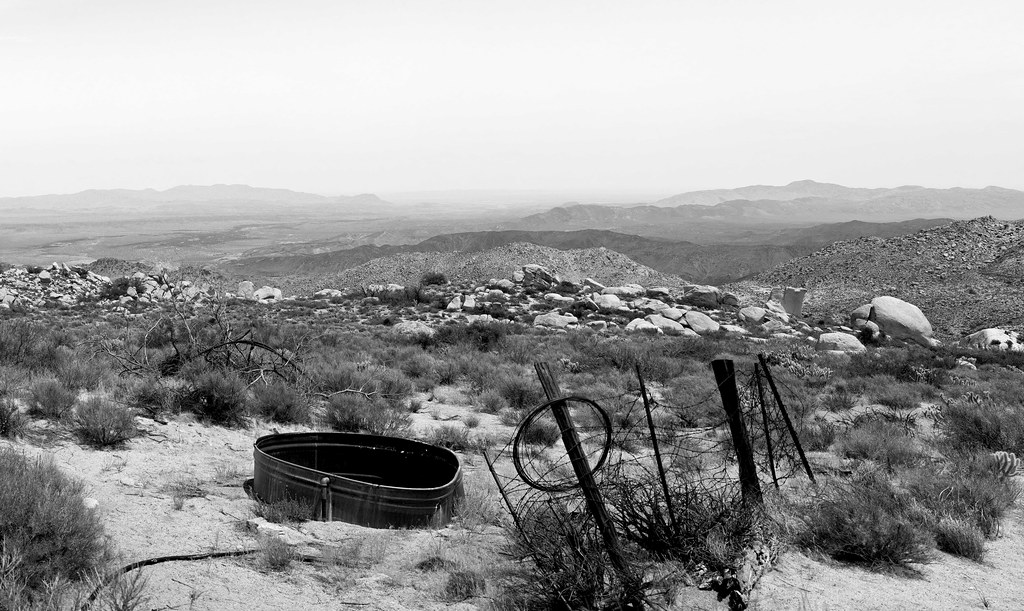 Spring Pano by tomteske, on Flickr Spring Pano by tomteske, on Flickr
Daren found a muddy spot but no pooling water. Nearby, a deer carcass.
 Legs by tomteske, on Flickr Legs by tomteske, on Flickr
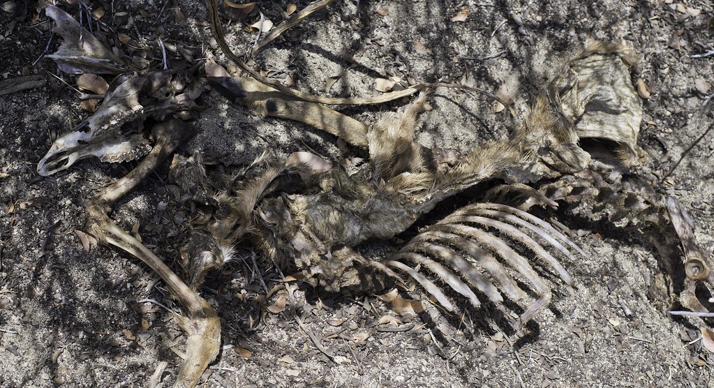 Spring Deer Carcass by tomteske, on Flickr Spring Deer Carcass by tomteske, on Flickr
Above the spring looking toward The Coyotes.
 Spring View by tomteske, on Flickr Spring View by tomteske, on Flickr
A nearby sign warning hunters to stay away from the tank. Am figuring this means it might have still been functional after the cattle left, a wildlife guzzler perhaps.
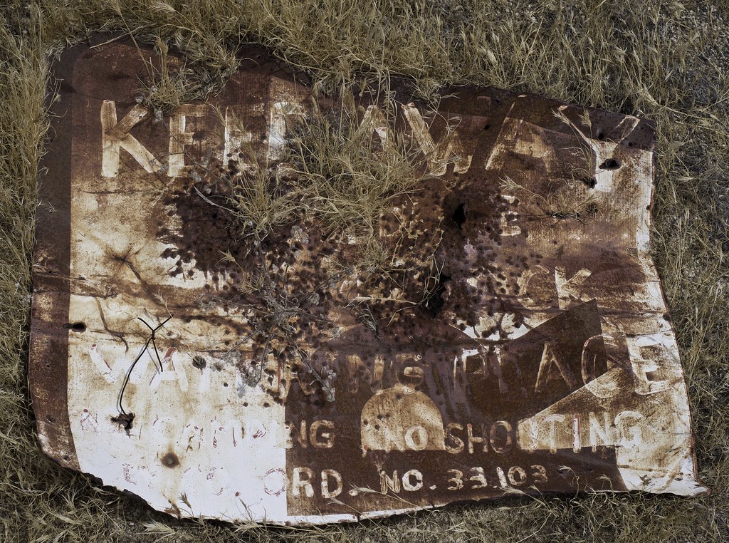 Keep Away by tomteske, on Flickr Keep Away by tomteske, on Flickr
Daren checking out the Carrizo March
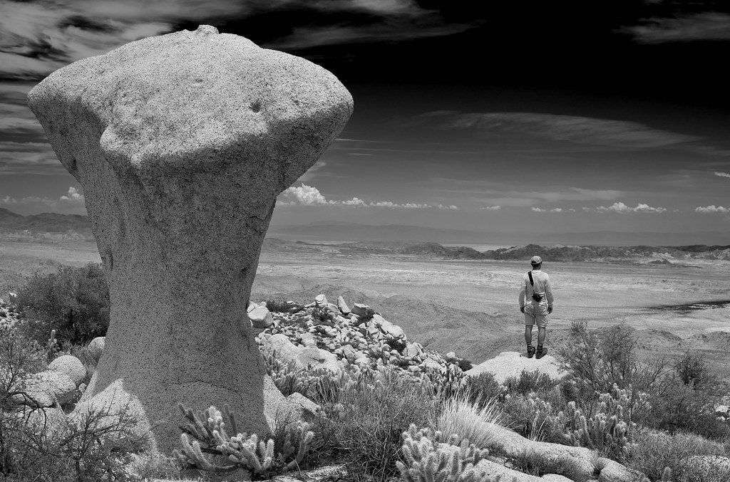 Daren and The Mushroom by tomteske, on Flickr Daren and The Mushroom by tomteske, on Flickr
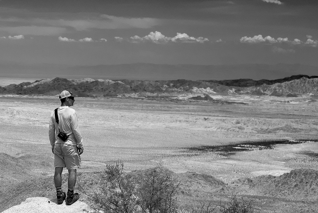 Daren Gaze by tomteske, on Flickr Daren Gaze by tomteske, on Flickr
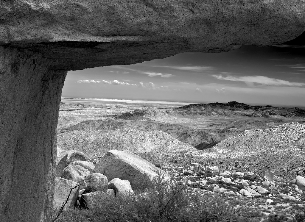
The main reason for the hike was to wander around the northern In-Ko-Pahs and explore a bunch of flats visible on GE and eventually end up at Fingertail Spring, the spring that fed the Rockhouse Canyon cattlemen's shelter with its cistern and trough. After some annoying boulder scrambling in 95+ degree heat, the oasis was in sight. Lots of evidence of previous occupation nearby with slicks, morteros and pottery. I brought my trusty Fiskars to access the depths of the palm oasis if necessary. While Daren napped on a nearby boulder, I dove into the underbrush and found...nothing. Well, not really. The palms swaying in the late afternoon sun and the panoramic views from our perch was finding exactly what we came for.
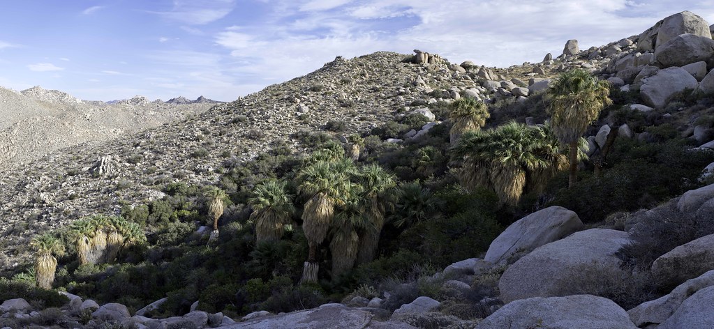 Rockhouse Spring Pano by tomteske, on Flickr Rockhouse Spring Pano by tomteske, on Flickr
Looking down into Rockhouse.
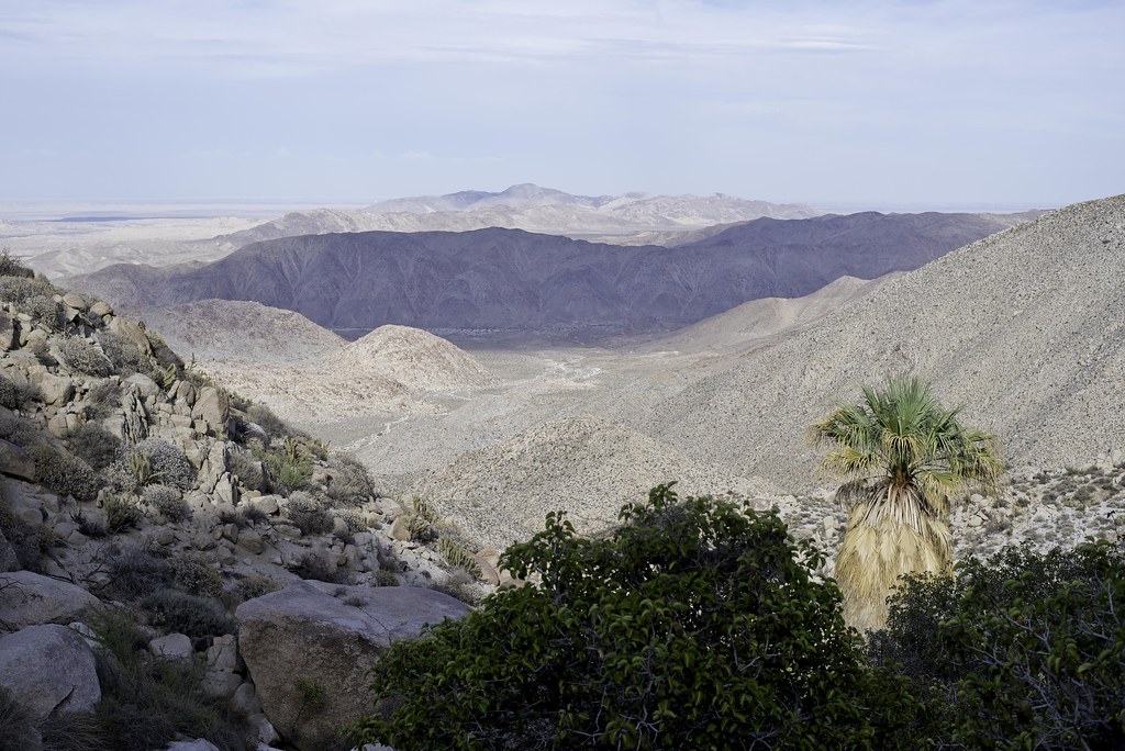 Rockhouse View by tomteske, on Flickr Rockhouse View by tomteske, on Flickr
Back at camp, the sun illuminating Carrizo Mt.
 Carrizo View by tomteske, on Flickr Carrizo View by tomteske, on Flickr
Later that night, someone celebrating the full moon and another desert backpack trip Enjoy. Tom
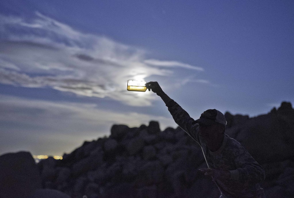 Invisible Man by tomteske, on Flickr Invisible Man by tomteske, on Flickr
|
|
|
link
|
|
dsefcik Administrator Posts: 2609
8/6/2015
|
Nice TR Tom..!!
I never knew it was named Fingertail, you make that up or what..?? I have some photos I still need to develop but I haven't finished the roll yet so I will post some of my own soon...
I brought my 4x5 field camera and do have one shot from that of the cattle trough(s). My shot shows both the older cement water tank and also the newer steel one. Carrizo and the Coyotes of in the distance

A sheet of 4x5 film scanned at 3200dpi is about 181MP and a 2.1GB file...fun...
Had fun Tom, let's do it again sometime...
--
http://www.sefcik.com
http://www.darensefcik.com
http://www.carrizogorge.com
|
|
|
link
|
|
dsefcik Administrator Posts: 2609
8/6/2015
|
Hey, that's my Invisible Man Rain Dance...almost worked to...!!
tommy750 wrote:
Later that night, someone celebrating the full moon and another desert backpack trip Enjoy. Tom
Invisible Man by tomteske, on Flickr
--
http://www.sefcik.com
http://www.darensefcik.com
http://www.carrizogorge.com
|
|
|
link
|
|
tommy750 Posts: 1040
8/6/2015
|
dsefcik wrote:
Nice TR Tom..!!
I never knew it was named Fingertail, you make that up or what..?? I have some photos I still need to develop but I haven't finished the roll yet so I will post some of my own soon...
I brought my 4x5 field camera and do have one shot from that of the cattle trough(s). My shot shows both the older cement water tank and also the newer steel one. Carrizo and the Coyotes of in the distance
A sheet of 4x5 film scanned at 3200dpi is about 181MP and a 2.1GB file...fun...
I'm liking it! Great shot. So glad you were the one carrying 12lbs of field camera gear for that one pic, however
Fingertail is the official name according to Wray's book and it may be in Lindsay but I couldn't find my copy to confirm it.
|
|
|
link
|
|
dsefcik Administrator Posts: 2609
8/6/2015
|
Which book, Historic Backcountry? maybe it's time I buy it....
--
http://www.sefcik.com
http://www.darensefcik.com
http://www.carrizogorge.com
|
|
|
link
|
|
tommy750 Posts: 1040
8/6/2015
|
dsefcik wrote:
Which book, Historic Backcountry? maybe it's time I buy it....
Yep, that's the one. Love that book. Stop by the desert tower on your way back next time out and they may still have signed copies.
|
|
|
link
|
|
ziphius Posts: 911
8/7/2015
|
That was fun. Thanks for your midsummer service to the forum. Christopher Wray's book, yes.
--
http://www.coyotelearning.org
|
|
|
link
|
|
tommy750 Posts: 1040
8/7/2015
|
Jim (ziphius) wrote:
That was fun. Thanks for your midsummer service to the forum. Christopher Wray's book, yes.
Although a burden, I am more than willing to do my community service part to aid the forum all summer long
|
|
|
link
|
|
dsefcik Administrator Posts: 2609
8/12/2015
|
Finally developed my roll of film so here 'ya go...
The Mastermind behind the whole trip with Sombrero Peak in the distance and Whale Peak way far back

Modern Rock Art in B/W

Tom at the spring


The In-Ko-Pah's have all kinds of really cool shaped boulders


Total Mylar Ballons This Trip - 4

--
--
http://www.sefcik.com
http://www.darensefcik.com
http://www.carrizogorge.com
|
|
|
link
|
|
tommy750 Posts: 1040
8/12/2015
|
Nice BW pics. Kinda wanting to go back even though I swore I was done with this corner of the In-Ko-Pahs.
|
|
|
link
|
|
rockhopper Posts: 668
8/14/2015
|
Nice pics. I gotta check out more of that area out some day. Great vista points of the "great" Salton sink / San Andreas zone. I know you can see Mexico and Arid-zona on a bone clear day.
|
|
|
link
|
|
tommy750 Posts: 1040
8/14/2015
|
rockhopper wrote:
Nice pics. I gotta check out more of that area out some day. Great vista points of the "great" Salton sink / San Andreas zone. I know you can see Mexico and Arid-zona on a bone clear day.
Don't wait too long to get out there cuz Tule Wind is coming soon and things are going to look (and sound) very different afterward.
|
|
|
link
|
|
dsefcik Administrator Posts: 2609
8/14/2015
|
tommy750 wrote:
Don't wait too long to get out there cuz Tule Wind is coming soon and things are going to look (and sound) very different afterward.  
--
http://www.sefcik.com
http://www.darensefcik.com
http://www.carrizogorge.com
|
|
|
link
|