|
tommy750 Posts: 1040
4/25/2017
|
As a very sketchy Plan B to a cancelled Santa Rosas backpack trip three weeks ago, Gary and I, the last hikers standing after cancellations, decided to head out to Oriflame Canyon. The canyon, an entry to the Lagunas for centuries, was first traveled by a European in 1772 (San Diego Military Commander Pedro Fages chasing deserters) and later by postmen, miners and ranchers. We started at the old CCC Camp Hark where workers carved out the Mason Truck Trail in the 1930s.
Steps from an abandoned Camp Hark structure.
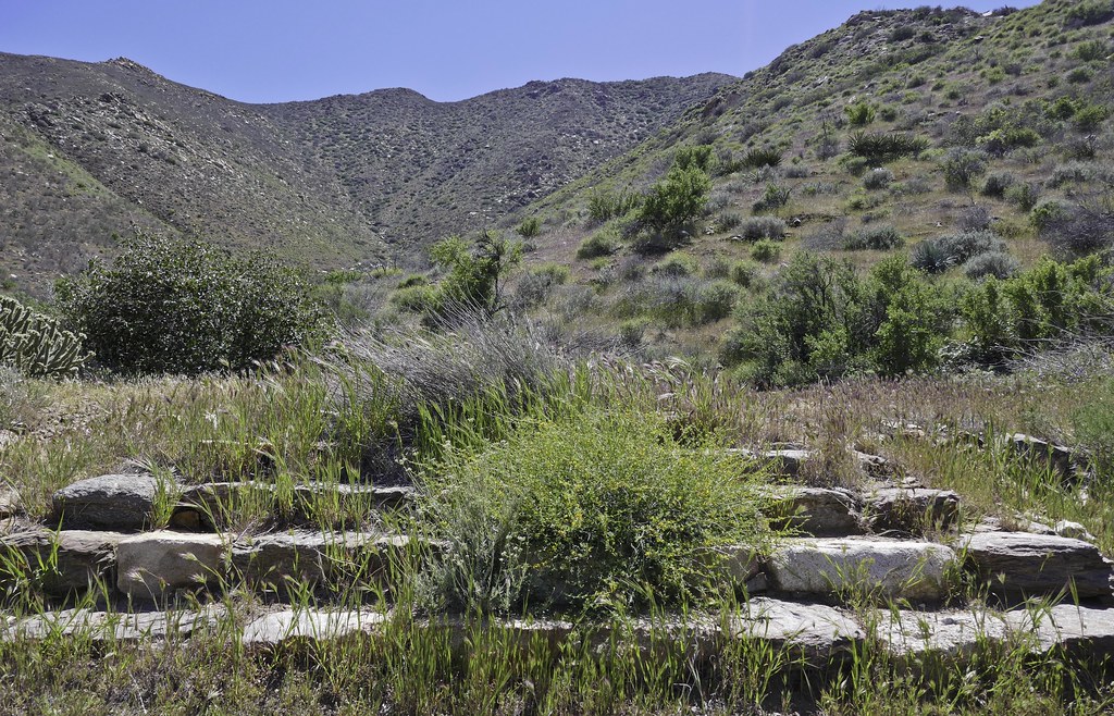 Stairway to Oriflame by tomteske, on Flickr Stairway to Oriflame by tomteske, on Flickr
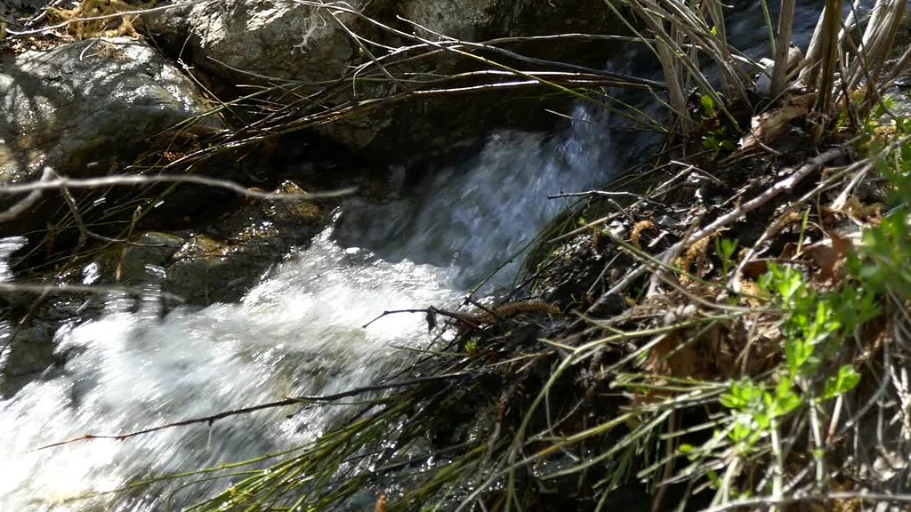
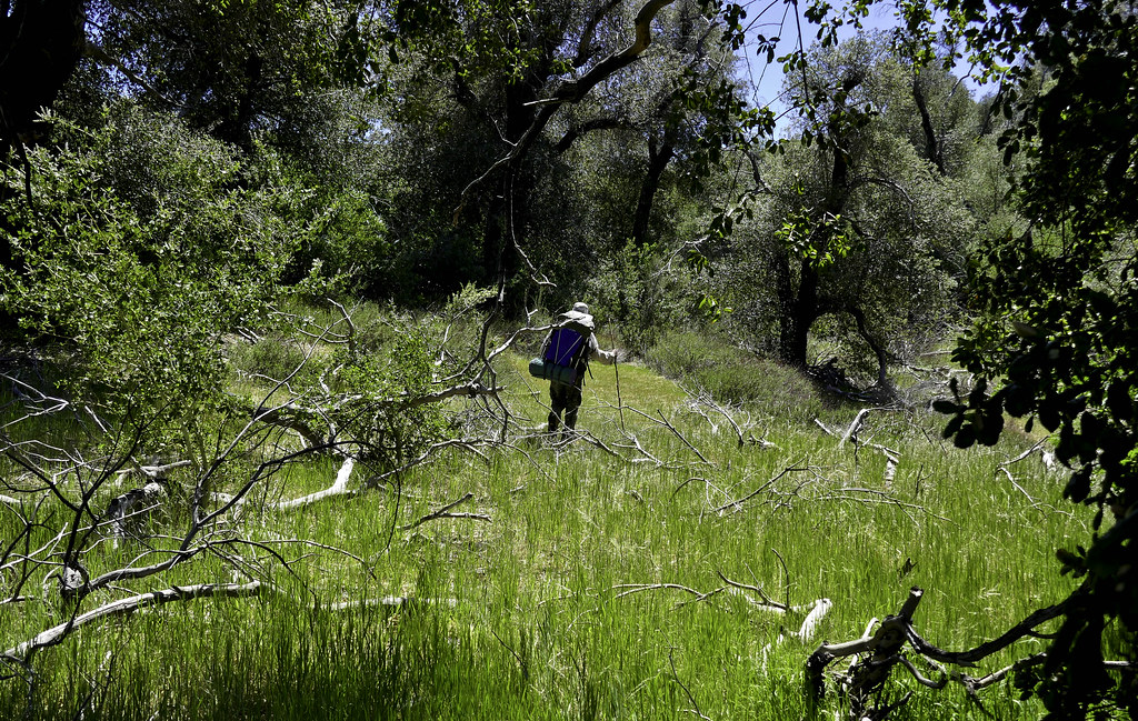
Heading up Oriflame Creek. Still nice and green with lots of flowing water.
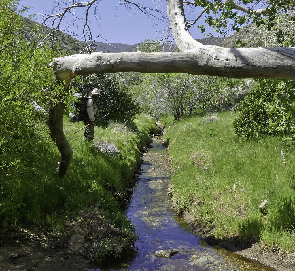 Oriflame Creek by tomteske, on Flickr Oriflame Creek by tomteske, on Flickr
Really spent only minutes looking at GE and a topo map to plan the hike and only had a few points on the GPS. We were to head upstream till we got past BM Roost and then head left up to a "plateau" behind Oriflame Mt. where we would explore old mining and ranching sites. Gary was pretty skeptical but brought the wrong topo map so was stuck with me leading the way. Finally bush whacked our way 1,000 ft up to the base of BM Roost aided by brush clearing from prior fires.
BM Roost on the right and Whale in the background.
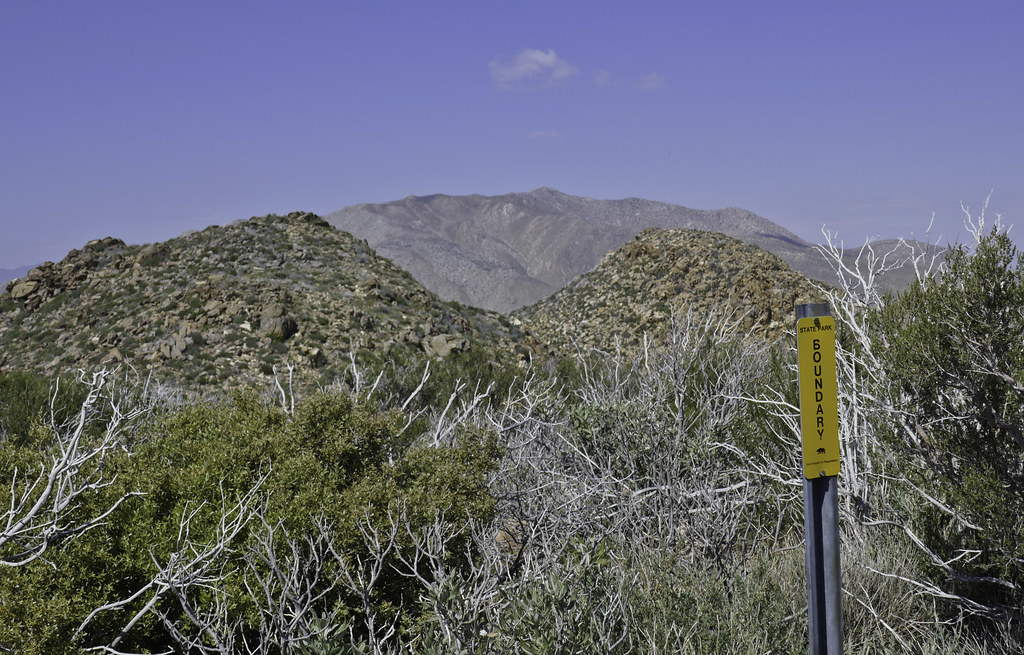 Boundary by tomteske, on Flickr Boundary by tomteske, on Flickr
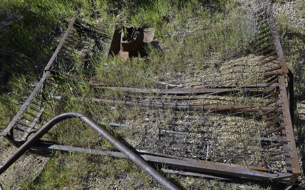
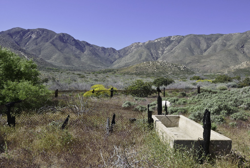
Lots of old troughs and feeder pipes leading mainly to tanks from the old ranching days.
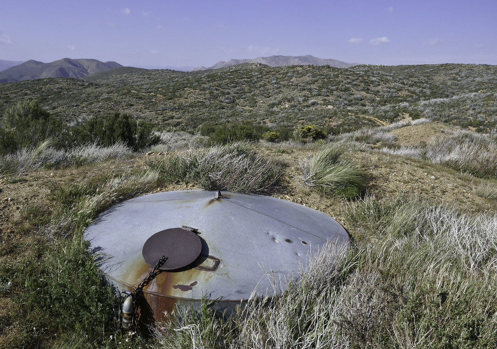 Tank by tomteske, on Flickr Tank by tomteske, on Flickr
Made our way toward some mines high in Oriflame Canyon passing by beautiful magenta purple colored bushes I don't know the name of.
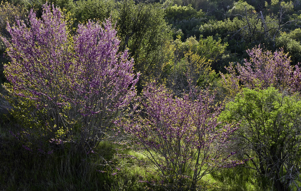 Magenta by tomteske, on Flickr Magenta by tomteske, on Flickr
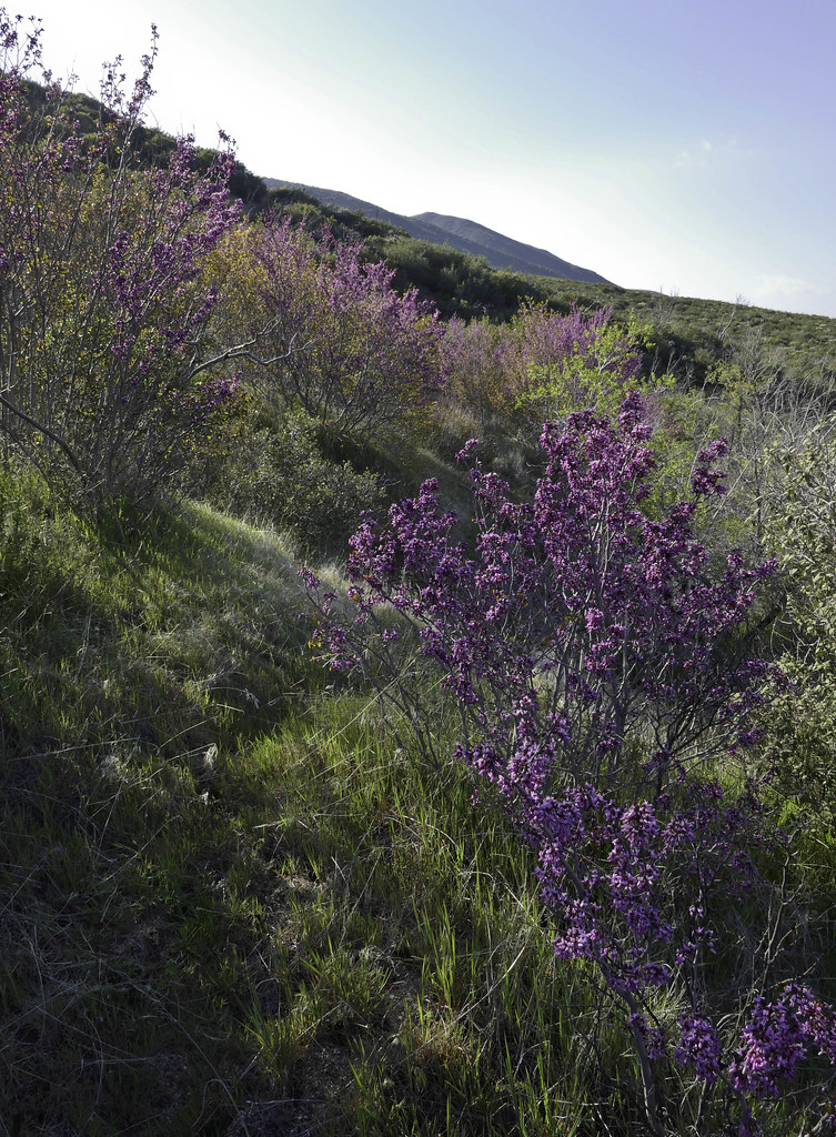 Magenta Bush by tomteske, on Flickr Magenta Bush by tomteske, on Flickr
Spent the night above a gurgling Oriflame Creek.
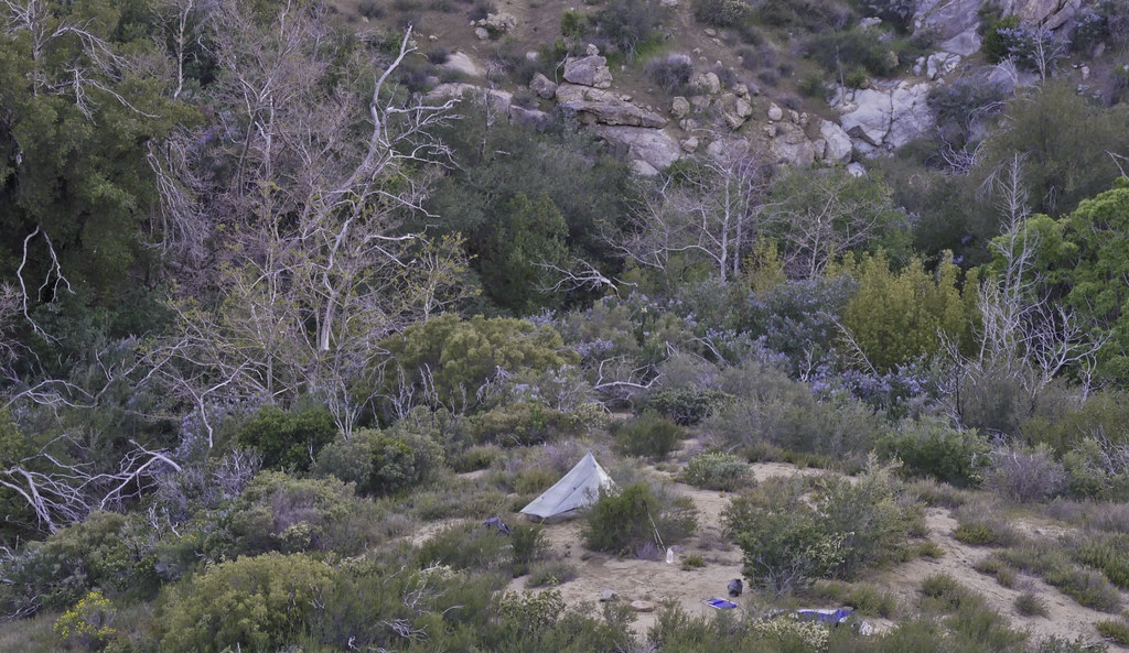 Camp 1 by tomteske, on Flickr Camp 1 by tomteske, on Flickr
Never grow tired of this sound. Click to listen.
 P1020525 by tomteske, on Flickr P1020525 by tomteske, on Flickr
The next day, headed nearby to explore some old mining ruins.
The remains of an old mining shack destroyed by one of recent fires.
 Cabin Remnants by tomteske, on Flickr Cabin Remnants by tomteske, on Flickr
 Bed by tomteske, on FlickrOr Bed by tomteske, on FlickrOr
Nearby shafts.
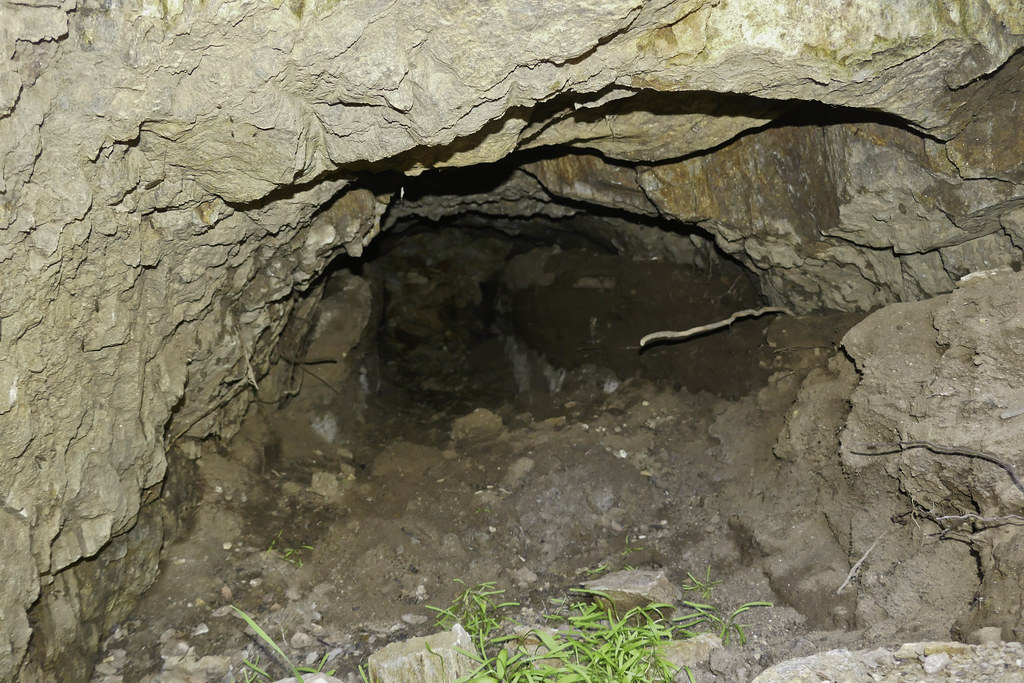 Mine Shaft by tomteske, on Flickr Mine Shaft by tomteske, on Flickr
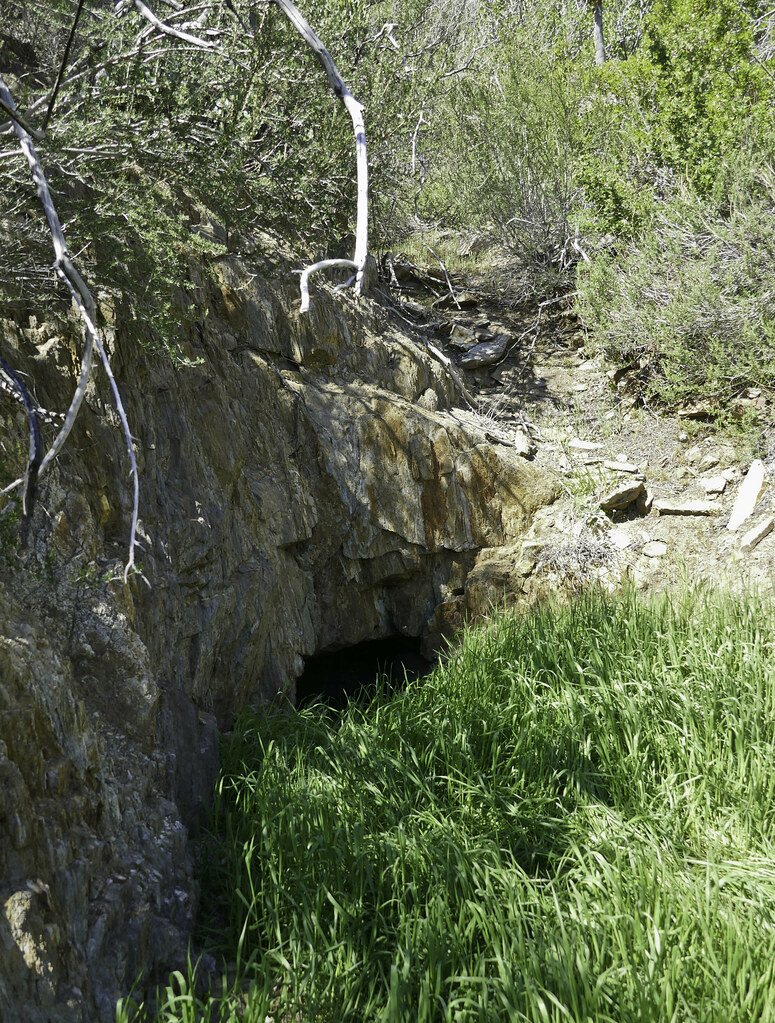 Shaft by tomteske, on Flickr Shaft by tomteske, on Flickr
Lots of bush whacking on old mining roads choked with brush and fallen trees. Gary heading through a nice meadow.
 Gary Grass by tomteske, on Flickr Gary Grass by tomteske, on Flickr
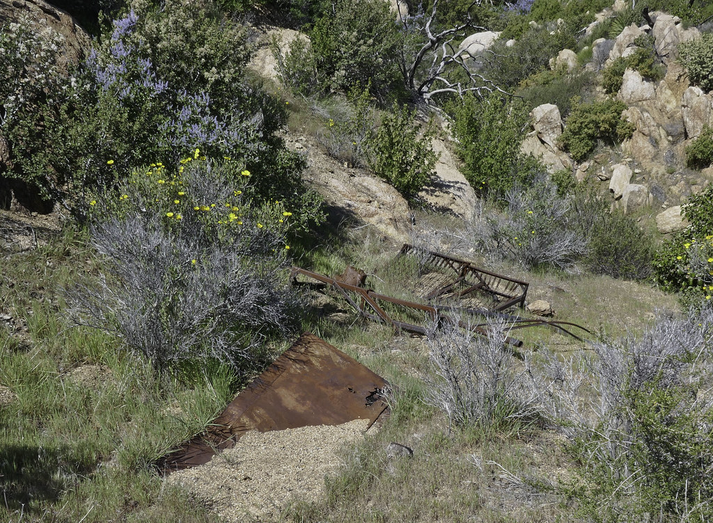
Made it to a old ranching site with an abandoned car.
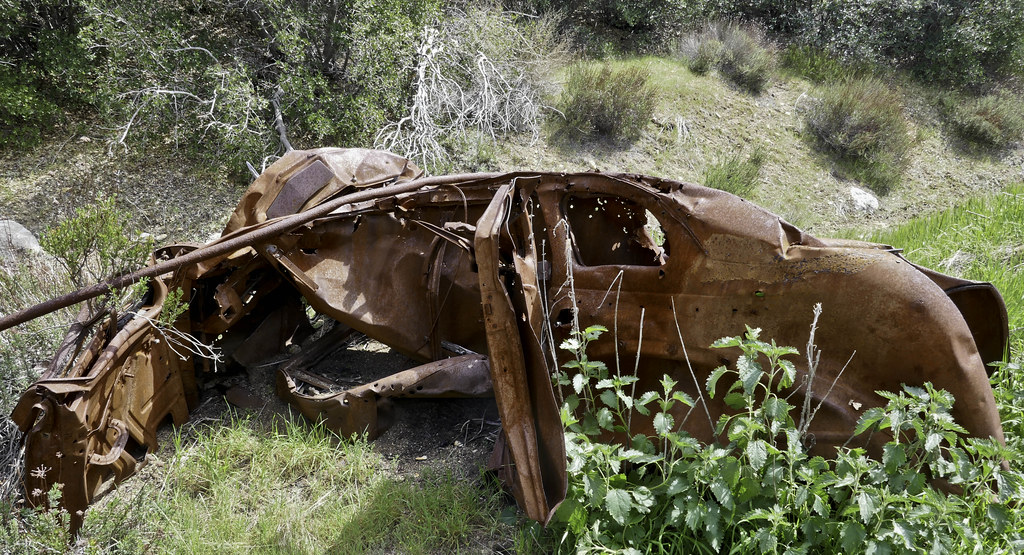 Wreck by tomteske, on Flickr Wreck by tomteske, on Flickr
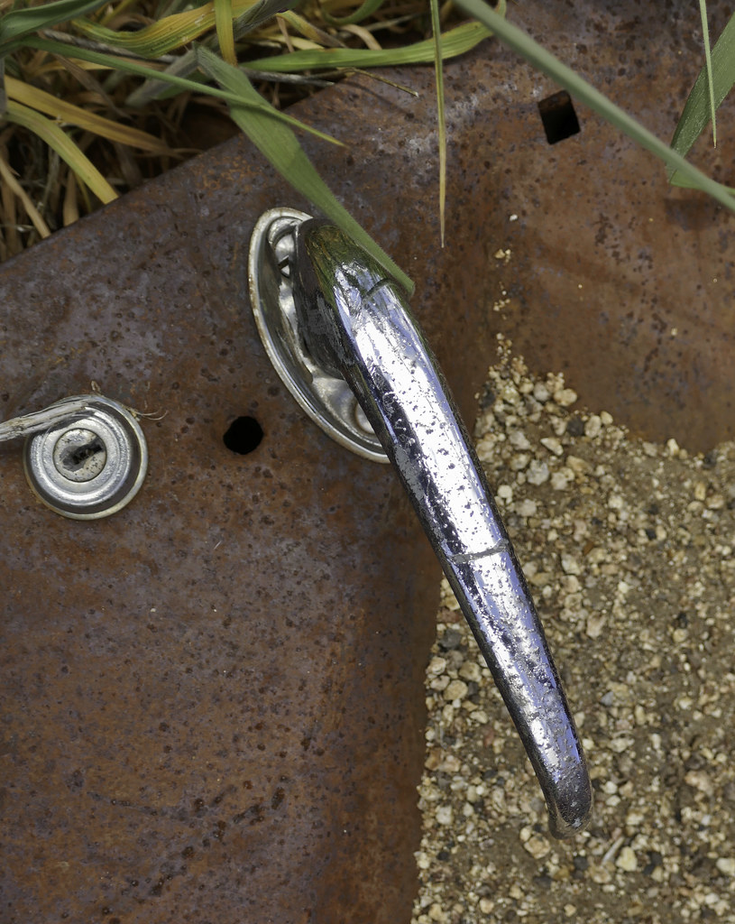 Door Handle by tomteske, on Flickr Door Handle by tomteske, on Flickr
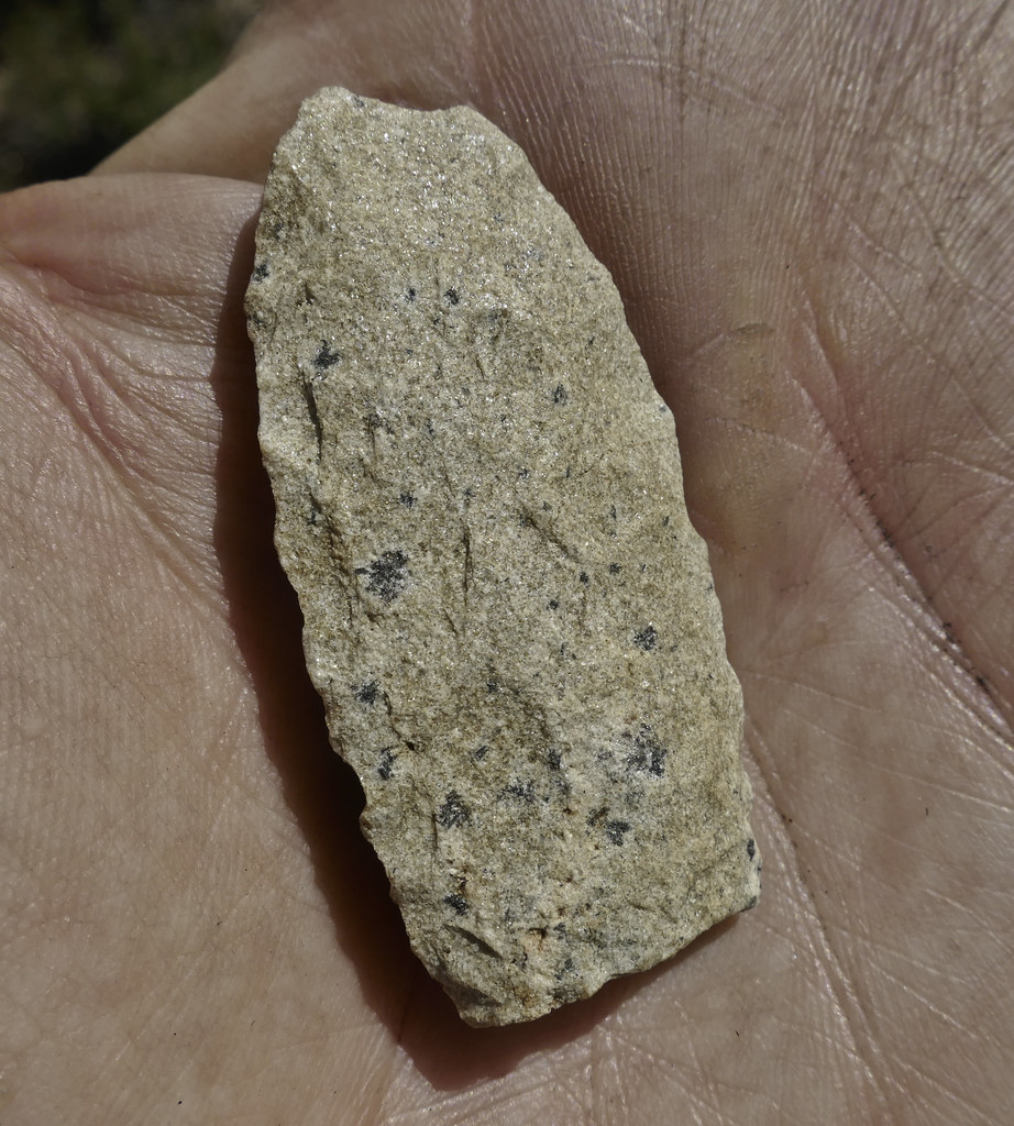
Wandered a few feet away and stumbled onto lots of pottery and flakes and this nice green Desert Side Notch, abandoned before completion.
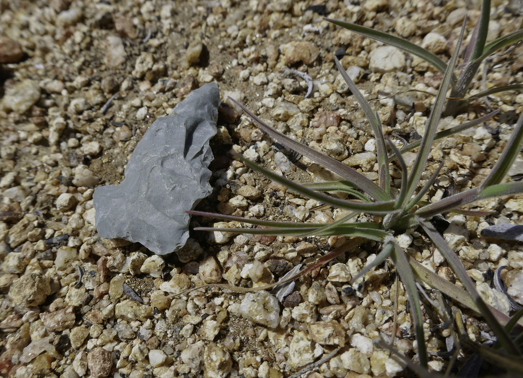 Green Point by tomteske, on Flickr Green Point by tomteske, on Flickr
 Unfinished by tomteske, on Flickr Unfinished by tomteske, on Flickr
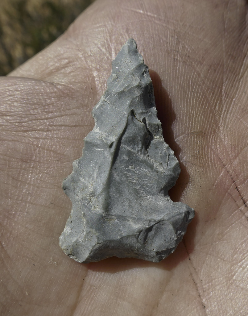
My smugness didn't last long when a little bit up the trail, Gary found an amazing Paleoindian Lanceolate point.
 Paleo by tomteske, on Flickr Paleo by tomteske, on Flickr
Really weathered. Showed this pic to Jeff Sahagun, BLM Archaeologist, and he was quite impressed with Gary's find.
 Paleo Point by tomteske, on Flickr Paleo Point by tomteske, on Flickr
Finally made it to the top of Cottonwood Canyon. The old ranching road and now Cottonwood Hiking Trail would take us 2,000 ft to the canyon floor and our next camp next to the flowing Salt Creek.
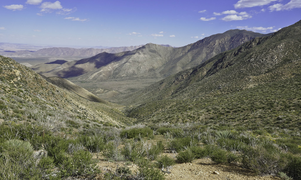 Cottonwood Canyon by tomteske, on Flickr Cottonwood Canyon by tomteske, on Flickr
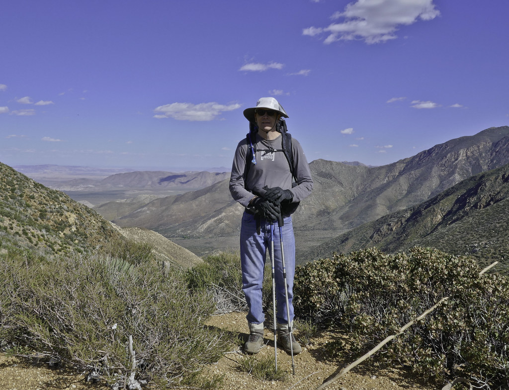 Tommy750 by tomteske, on Flickr Tommy750 by tomteske, on Flickr
Gary heading down.
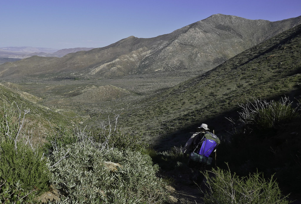 Lone Hiker2 by tomteske, on Flickr Lone Hiker2 by tomteske, on Flickr
Camping next the the flowing Salt Creek and serenaded by frogs all night.
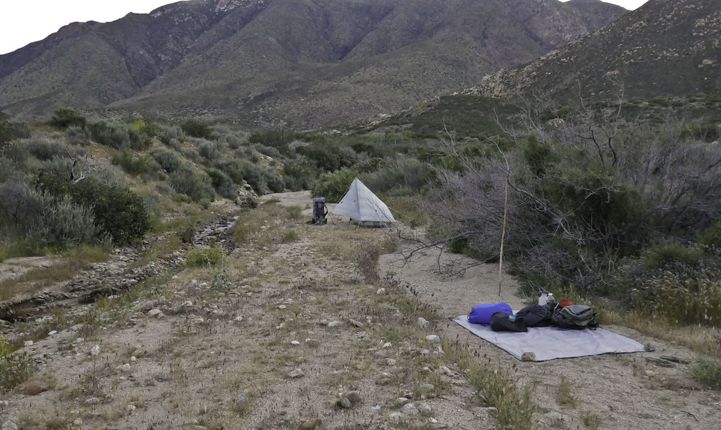 Salt Creek by tomteske, on Flickr Salt Creek by tomteske, on Flickr
On the final day, visited a rock art site Daren said was nearby. Interesting cupules with four vertical grooves.
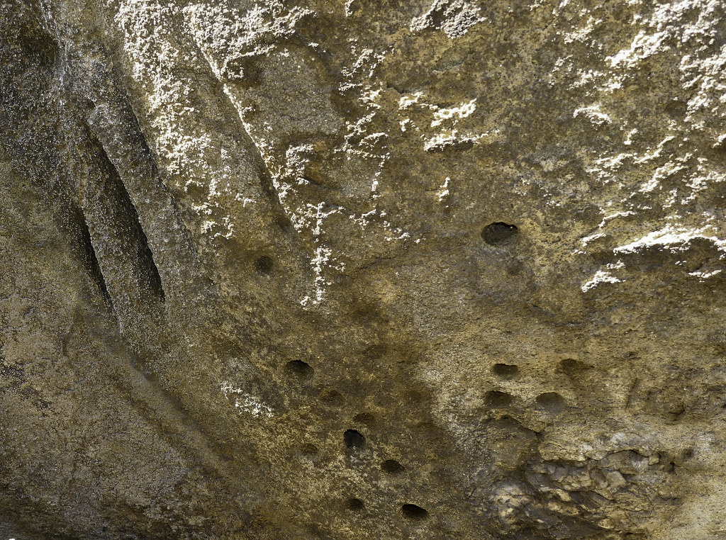 Pit and Groove by tomteske, on Flickr Pit and Groove by tomteske, on Flickr
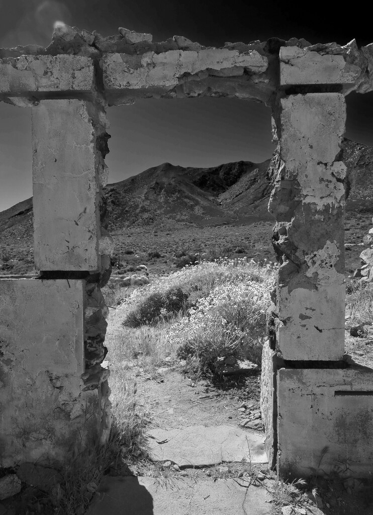
Lots of old ranching and mining ruins on the valley floor. An old rock cabin partially hewn into the surrounding granite.
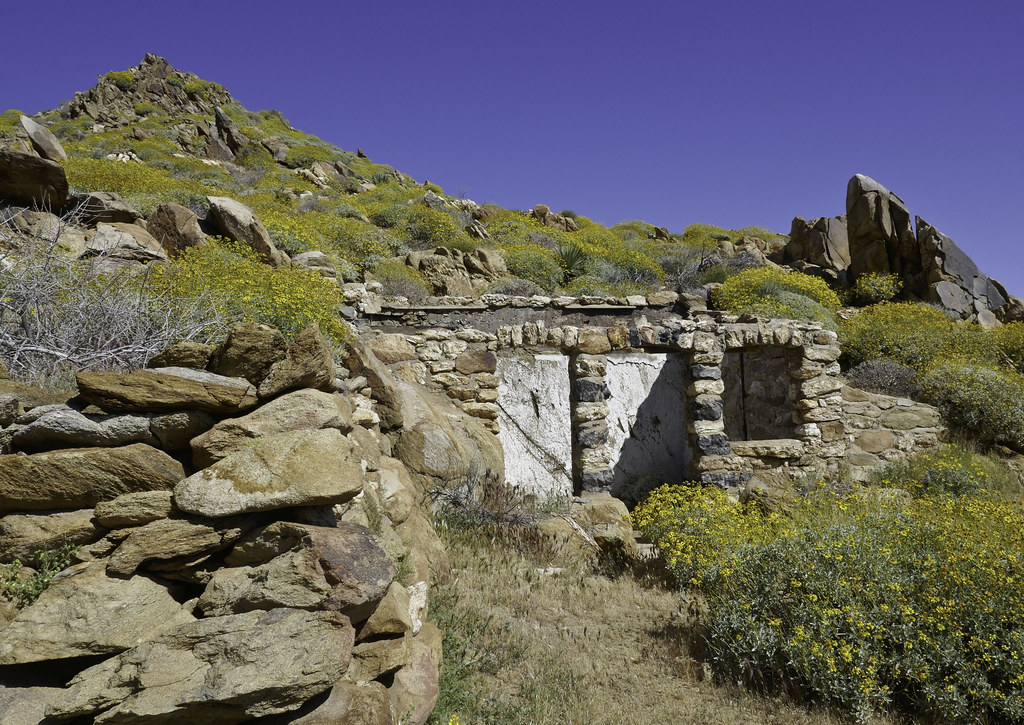 Rock House by tomteske, on Flickr Rock House by tomteske, on Flickr
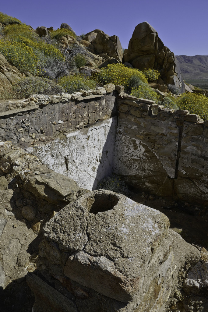 Chimney by tomteske, on Flickr Chimney by tomteske, on Flickr
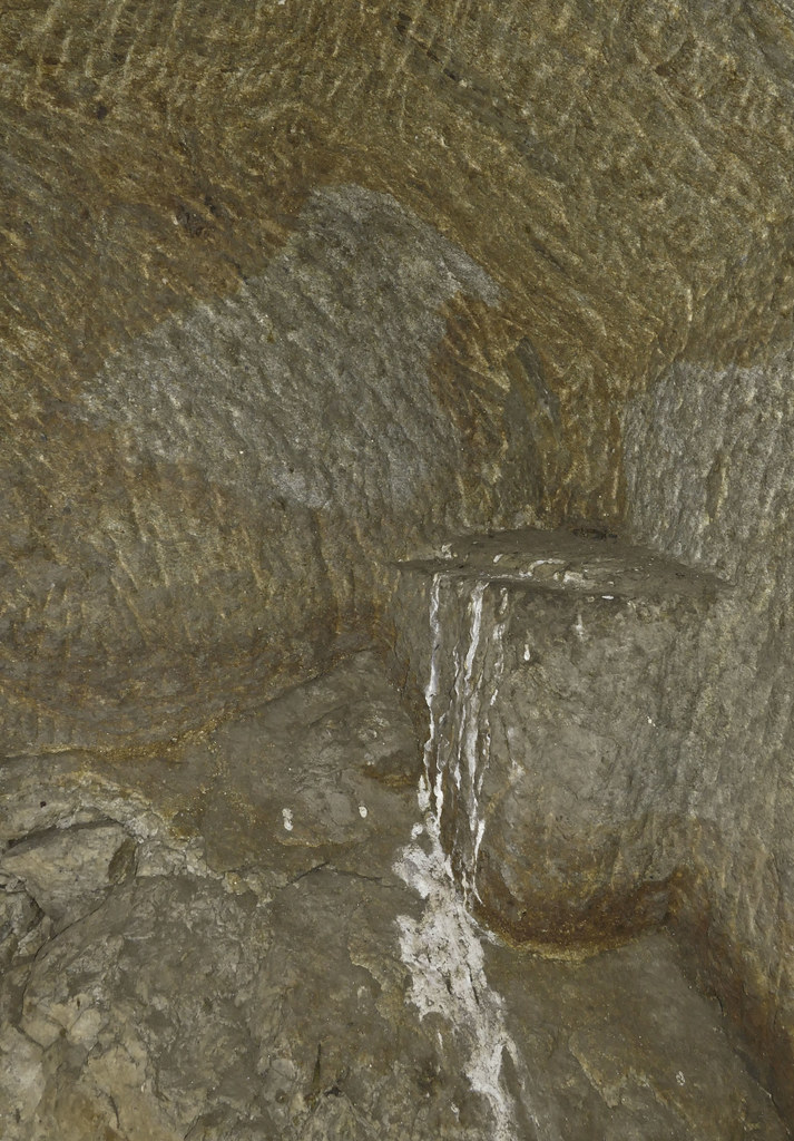 Carved by tomteske, on Flickr Carved by tomteske, on Flickr
 View2 by tomteske, on Flickr View2 by tomteske, on Flickr
Looking west up Cottonwood Canyon.
 Cottonwood Canyon 2 by tomteske, on Flickr Cottonwood Canyon 2 by tomteske, on Flickr
The trip ended up being about 19 miles, 4K G/L. Multiple streams crossed and lots of green for a change.
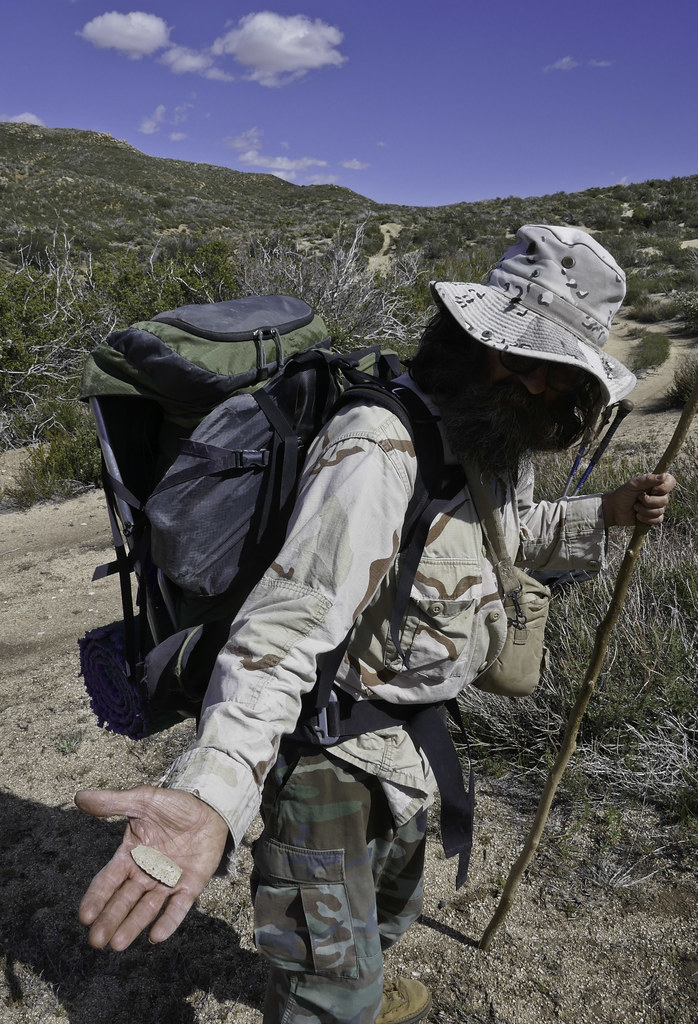
Gary holding the cold beers he hid in Oriflame Creek for our return. Enjoy. Tom
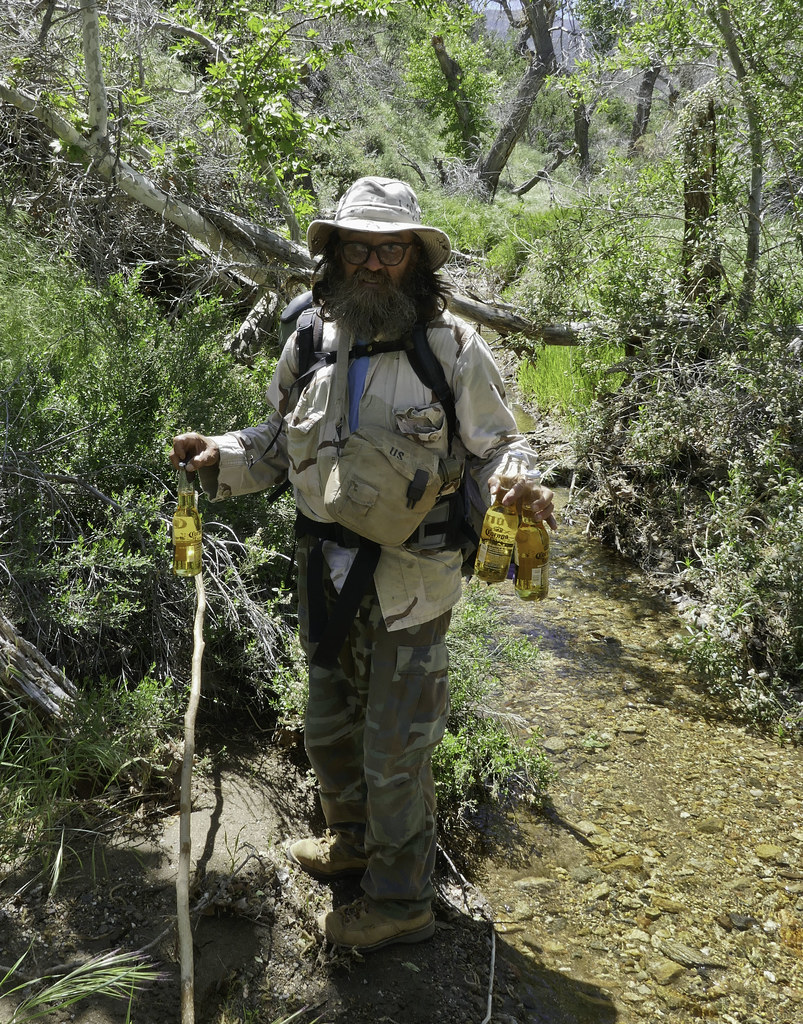 Three Cold Ones by tomteske, on Flickr Three Cold Ones by tomteske, on Flickr
|
|
|
+1
link
|
|
dsefcik Administrator Posts: 2609
4/25/2017
|
Nice trip Tom, wish I could have gone with you.
--
http://www.sefcik.com
http://www.darensefcik.com
http://www.carrizogorge.com
|
|
|
link
|
|
ziphius Posts: 911
4/25/2017
|
Trip reports like that make this forum great.  Thanks. Gary and the beer storage, would have never thought of that.... Thanks. Gary and the beer storage, would have never thought of that....
--
http://www.coyotelearning.org
|
|
|
link
|
|
ziphius Posts: 911
4/25/2017
|
Great point finds too. Was this an out-an-back trip or a counter-clockwise loop going through Mason Valley eventually?
--
http://www.coyotelearning.org
|
|
|
link
|
|
tommy750 Posts: 1040
4/25/2017
|
dsefcik wrote:
Nice trip Tom, wish I could have gone with you.
Yep, you would have enjoyed yourself. Didn't realize how big Cottonwood Canyon really is looking at GE. That alone would be a nice three day trip.
|
|
|
link
|
|
tommy750 Posts: 1040
4/25/2017
|
ziphius wrote:
Great point finds too. Was this an out-an-back trip or a counter-clockwise loop going through Mason Valley eventually?
Always nice to find some artifacts especially since we were preceded by a zillion collectors and cattle hooves. We did a loop.
I'm thinking Gary's done the hide the beer in a stream thing before Great idea.
|
|
|
link
|
|
rockhopper Posts: 668
4/26/2017
|
Tommy and Gary,
Great adventure! Nice to see running water. That's a great place to find "cooler " temps when our desert heats up. Did you guys have to go thru a lot of poison oak? I am a magnet for that stuff down near the creeks. The Oriflame / Rodriguez loop is a neat one too. Nice arrow points you guys found! Gary's looks very unusual and old!!!! Material made of ?? Your green point is neat too. Obviously these ancient peoples were using what ever they could find to manufacture arrow/spear points when the ancient Lake Cahuilla covered the best local obsidian source. btw I found a green point near the coast years back. I think they used rhyolite??? or other semi chipping material.
edited by rockhopper on 4/26/2017
|
|
|
link
|
|
tommy750 Posts: 1040
4/26/2017
|
rockhopper wrote:
Tommy and Gary,
Great adventure! Nice to see running water. That's a great place to find "cooler " temps when our desert heats up. Did you guys have to go thru a lot of poison oak? I am a magnet for that stuff down near the creeks. The Oriflame / Rodriguez loop is a neat one too. Nice arrow points you guys found! Gary's looks very unusual and old!!!! Material made of ?? Your green point is neat too. Obviously these ancient peoples were using what ever they could find to manufacture arrow/spear points when the ancient Lake Cahuilla covered the best local obsidian source. btw I found a green point near the coast years back. I think they used rhyolite??? or other semi chipping material.
edited by rockhopper on 4/26/2017
Very nice to see so much water. We carried 4L down into Cottonwood since we were skeptical we'd find water but ended up crossing streams multiple times and camping next to one. All those frogs going to make it through the hot summer?? We encountered some poison ivy while bushwhacking but Gary thought it was too early in the season to cause much reaction. Didn't have any problems fortunately. Gary's point was pretty neat and had to be in the thousands of years old and looked the part. Not really sure what it was made of but doesn't really look like stuff from around here.
|
|
|
link
|
|
Andy Posts: 12
4/27/2017
|
What a great trip with the bonus of water. Does anyone know if a hike down Cottonwood Canyon from the PCT/ Sunrise HWY is feasible?
|
|
|
link
|
|
tommy750 Posts: 1040
4/27/2017
|
Andy wrote:
What a great trip with the bonus of water. Does anyone know if a hike down Cottonwood Canyon from the PCT/ Sunrise HWY is feasible?
Very feasible. The "trail" is a dirt road starting at Sunrise Hwy you can follow all the way down. Somewhere in the middle of your descent, there's going to be an area where the road is heavily channelized but you can just walk on either side. Should be about 3K elevation loss if you go all the way out to S2.
I think Schad mentions a hike down Cottonwood Canyon and is referring to a cross country route to the south down what the topo map labels as "Cottonwood Canyon."
edited by tommy750 on 4/27/2017
|
|
|
link
|
|
dsefcik Administrator Posts: 2609
4/27/2017
|
The Butterfield store even has a register book for people to sign that hike that area, it's out front of the store.
--
http://www.sefcik.com
http://www.darensefcik.com
http://www.carrizogorge.com
|
|
|
link
|
|
ziphius Posts: 911
4/27/2017
|
Tommy, your magenta trees are Western Redbud! Very cool.
--
http://www.coyotelearning.org
|
|
|
link
|
|
tommy750 Posts: 1040
4/27/2017
|
ziphius wrote:
Tommy, your magenta trees are Western Redbud! Very cool.
Awesome! Knew one of you would know what this was. Was a lovely color splash only along the banks of upper Oriflame Creek. Thanks, Ziphius!
|
|
|
link
|
|
Britain Posts: 596
5/2/2017
|
Did you stay in Oriflame all the way to Cottonwood? I've over nighted near the top of Oriflame but never went into Conttonwood. Really nice pack!
--
Cant drive 55
Britain
http://icorva.com
|
|
|
link
|
|
tommy750 Posts: 1040
5/2/2017
|
Britain wrote:
Did you stay in Oriflame all the way to Cottonwood? I've over nighted near the top of Oriflame but never went into Conttonwood. Really nice pack!
We climbed out of Oriflame Canyon and ended up near BM Roost but then later rejoined Oriflame till we got to the road into Cottonwood. Looks like there would be a great view from the top of Oriflame Mt.
The pack is a Zpack Arc Zip and I really like it. The cuben fiber is a bit delicate for the desert but is still holding up fairly well.
http://www.zpacks.com/backpacks/arc_zip.shtml
|
|
|
link
|
|
Britain Posts: 596
5/2/2017
|
Can you post tracks or a map? In 1980"s I hiked up with the kids. It was really over grown and difficult along the creek. I would like to give it a try in the future but don't want to end up being in a jungle. Almost like starting at the top of the Mason trail and going down. Haha in 2006 I lost a spare tire on my jeep on the Mason trail, the carrier broke loose and the tire went all the way down to the creek. Was a task getting the tire back.
--
Cant drive 55
Britain
http://icorva.com
|
|
|
link
|
|
tommy750 Posts: 1040
5/2/2017
|
Britain wrote:
Can you post tracks or a map? In 1980"s I hiked up with the kids. It was really over grown and difficult along the creek. I would like to give it a try in the future but don't want to end up being in a jungle. Almost like starting at the top of the Mason trail and going down. Haha in 2006 I lost a spare tire on my jeep on the Mason trail, the carrier broke loose and the tire went all the way down to the creek. Was a task getting the tire back.
We had the benefit of a previous fire that appeared to have been about 5-10 years ago but not sure which one. Initially walking on game trails by Oriflame Creek was working okay but it started to get pretty dense and we drifted up the south side of the canyon. This is a rough outline of our trip.
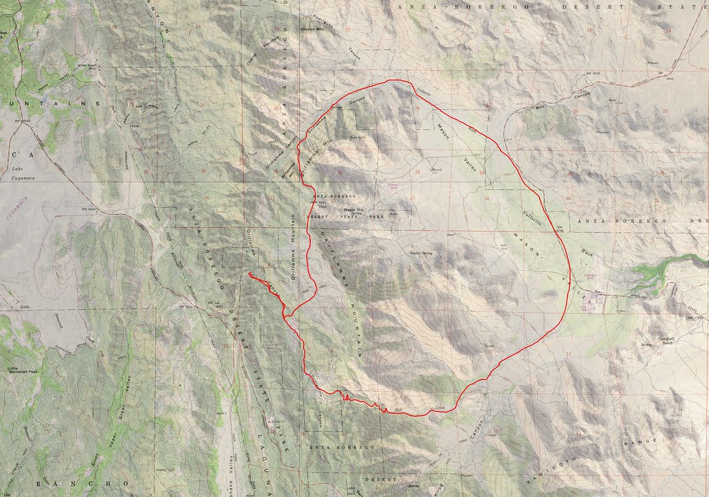 Oriflame Cottonwood by tomteske, on Flickr Oriflame Cottonwood by tomteske, on Flickr
Really nice pack!
Was a tad presumptuous thinking you were referring to MY pack. Gary's pack is probably from the Civil War
|
|
|
link
|
|
Britain Posts: 596
5/3/2017
|
I think the fire was in 2006 or 7. I hiked the area on top of Mason once the brush was taken out by the fire. I had for a long time a pack with the aluminum frame for piling stuff on. Was about 60 lbs when loaded. Made hike the Sierras a task back in the day. Always interested in other packs.
Yes looks like the south side is the way to go. Almost looks like you kissed the PCT and then went south.
Thanks for the info. I may go up Mason and do some photos of that area before I do it.
--
Cant drive 55
Britain
http://icorva.com
|
|
|
link
|
|
tommy750 Posts: 1040
5/3/2017
|
Britain wrote:
I think the fire was in 2006 or 7. I hiked the area on top of Mason once the brush was taken out by the fire.
As best I can figure from the internet, the Oriflame area was burned out by the 2002 Pines Fire. A little of the descent into Cottonwood got hit by the 2013 Chariot Fire. Cause of the Pines Fire is kinda interesting: http://www.fire.ca.gov/cdf/incidents/Pines%20Fire_73/news_files/34_Causerelease.pdf Think it was some sort of drug interdiction mission looking for pot farms.
|
|
|
link
|
|
dsefcik Administrator Posts: 2609
5/3/2017
|
And we all remember the Chariot fire was during the annual BHS Count...
As seen from our Rattlesnake Spring count site with my 500mm lens

--
--
http://www.sefcik.com
http://www.darensefcik.com
http://www.carrizogorge.com
|
|
|
link
|
|
Britain Posts: 596
5/4/2017
|
Your probably right on the year. The brush was fairly cleared off in 2006
--
Cant drive 55
Britain
http://icorva.com
|
|
|
link
|
|
Britain Posts: 596
5/4/2017
|
There's was another fire in the area more north. Burned up Granite mountain in 2012. In 2014 on a hike trying to peak I found a firemans radio on the ridgeline near the top. It was pretty much burned up.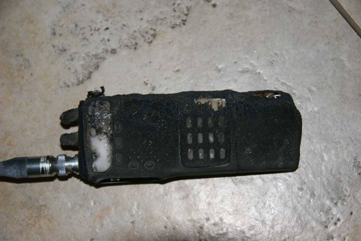
--
Cant drive 55
Britain
http://icorva.com
|
|
|
link
|
|
Britain Posts: 596
5/4/2017
|
Questions:
Is there any private property you need to be aware of? From satellite photo is that a truck trail leading down to cottonwood? I will probably pull out of Oraflame where it curves south and go up the southside to the semi level area. Would I be missing anything worth snooping at by doing this?
I'm so looking forward in doing this next year.
--
Cant drive 55
Britain
http://icorva.com
|
|
|
link
|
|
tommy750 Posts: 1040
5/4/2017
|
Britain wrote:
Your probably right on the year. The brush was fairly cleared off in 2006
Daren pointed me to caltopo.com some years ago and they have a nice fire history overlay that is a lot easier to use than searching calfire's site (fire.ca.gov). Took me a while to figure out the Pines fire since it was so large a burn you have to zoom out to see the name.
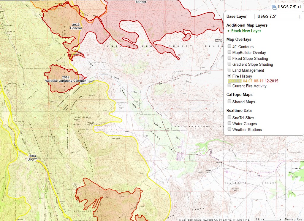 caltopo by tomteske, on Flickr caltopo by tomteske, on Flickr
Regarding private property boundaries, the whole north end of Cottonwood is pretty much private property. Caltopo has an overlay for that as well but it didn't correlate exactly with what Gary and I saw on the ground. Use your best judgment I guess.
Nice radio find. Tom
|
|
|
link
|
|
sddarkman619 Posts: 153
5/20/2017
|
what shelter is that? a Tarptent? Looking for a shelter.
where did you park vehicles so they weren't messed with?
Nice writeup thanks for sharing!
edited by sddarkman619 on 5/20/2017
|
|
|
link
|
|
tommy750 Posts: 1040
5/20/2017
|
sddarkman619 wrote:
what shelter is that? a Tarptent? Looking for a shelter.
where did you park vehicles so they weren't messed with?
Nice writeup thanks for sharing!
edited by sddarkman619 on 5/20/2017
Got an altaplex tent from zpacks.com last year and really like it. It weighs in at 18 oz making it lighter than a lot of bivy sacks. If you're not too tall, their solplex is less than a pound. I like tents because they keep bugs away but obviously there's pros and cons.
We left our vehicles at the Camp Hark ruins. Never have had any problems leaving a vehicle at local sites but not sure about others' experiences.
|
|
|
link
|
|
sddarkman619 Posts: 153
5/20/2017
|
So that shelter in the photos is the altaplex? Yeah I like tents too because they keep the bugs and snakes out. but just thinking lighter and adventurous.
|
|
|
link
|
|
Rocko1 Posts: 588
1/2/2018
|
tommy750 wrote:
sddarkman619 wrote:
what shelter is that? a Tarptent? Looking for a shelter.
where did you park vehicles so they weren't messed with?
Nice writeup thanks for sharing!
edited by sddarkman619 on 5/20/2017
Got an altaplex tent from zpacks.com last year and really like it. It weighs in at 18 oz making it lighter than a lot of bivy sacks. If you're not too tall, their solplex is less than a pound. I like tents because they keep bugs away but obviously there's pros and cons.
We left our vehicles at the Camp Hark ruins. Never have had any problems leaving a vehicle at local sites but not sure about others' experiences.
Those are very nice tents. I just can't bring myself to spend that kind of coin on a shelter.
|
|
|
link
|
|
dsefcik Administrator Posts: 2609
10/21/2019
|
dsefcik wrote:
The Butterfield store even has a register book for people to sign that hike that area, it's out front of the store.
No more register, new owners and it is gone.
Enjoyed re-reading this TR, great work Tom.
--
http://www.sefcik.com
http://www.darensefcik.com
http://www.carrizogorge.com
|
|
|
link
|