|
tommy750 Posts: 1040
3/17/2015
|
Did a couple short trips the last couple weekends. Met up with Daren for the first one and camped in Lycium Wash off the beginning of Fish Creek. Was a nice day to be out but wasn't expecting a literal traffic jam heading in. Have never seen so may vehicles and tents out there. We were going to look for fossil footprints near Sandstone but moved on when a large group showed up in the same area. We decided to try and locate some rock art sites and came across this nice panel.
 Woven_lwe by tomteske, on Flickr Woven_lwe by tomteske, on Flickr
Daren says this guy is called the Paper Sack Man but I have no idea why 
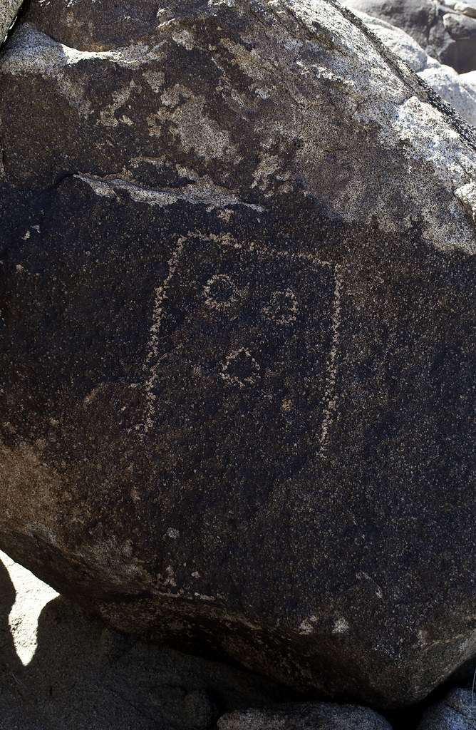 Paper Bag Man by tomteske, on Flickr Paper Bag Man by tomteske, on Flickr
Daren had to leave so I did a little more exploring before the sun went down. Found an area densely covered in flakes from various colored stones.
 flakes by tomteske, on Flickr flakes by tomteske, on Flickr
Bunch of obsidian flakes.
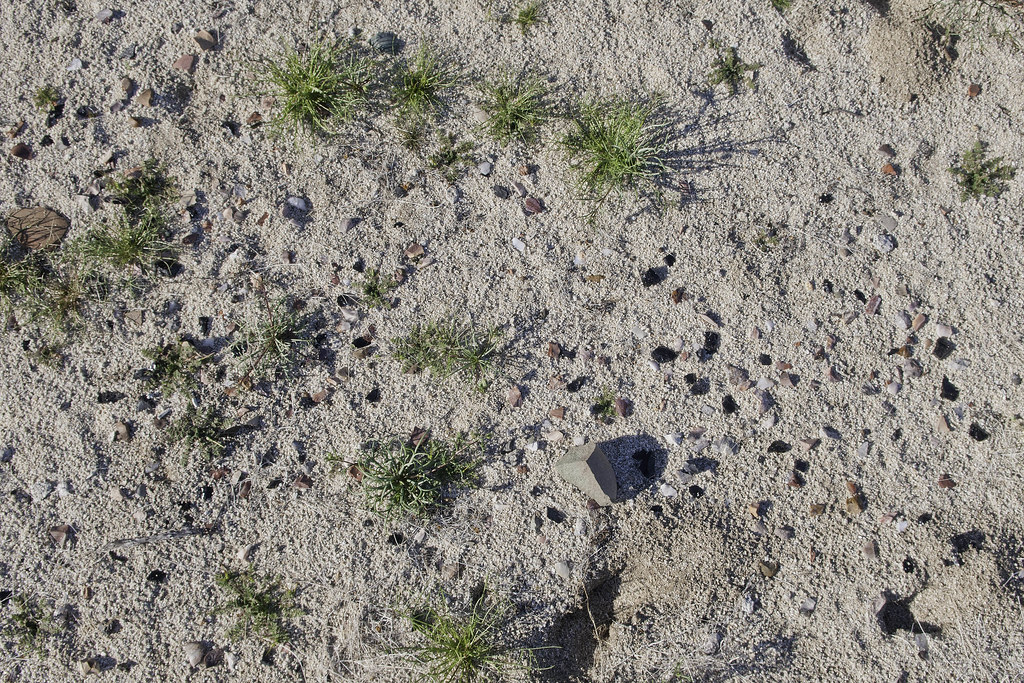 Lithic Reduction Station by tomteske, on Flickr Lithic Reduction Station by tomteske, on Flickr
This past Friday decided to head out to Pepperwood Trail for a overnight trip out to Canebrake (BorregoWrangler did a through hike down Pepperwood last December: http://johnandautumnsadventures.blogspot.com/2014/12/pepperwood-canyon-to-canebrake-valley.html ). Got to the end of McCain Valley Rd at 4pm and headed out. Was the perfect temp that night in Canebrake with clear skies and no bugs.
Saw ML tracks heading down the trail for a number of yards. Those are bigger than my fist.
 ML tracks by tomteske, on Flick ML tracks by tomteske, on Flick
Much greener than the last time I was out there.
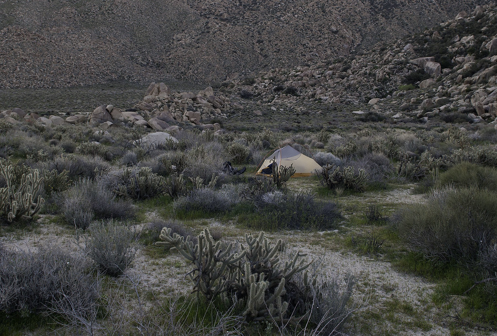 Canebrake Spot by tomteske, on Flickr Canebrake Spot by tomteske, on Flickr
Old relic from the rancher days.
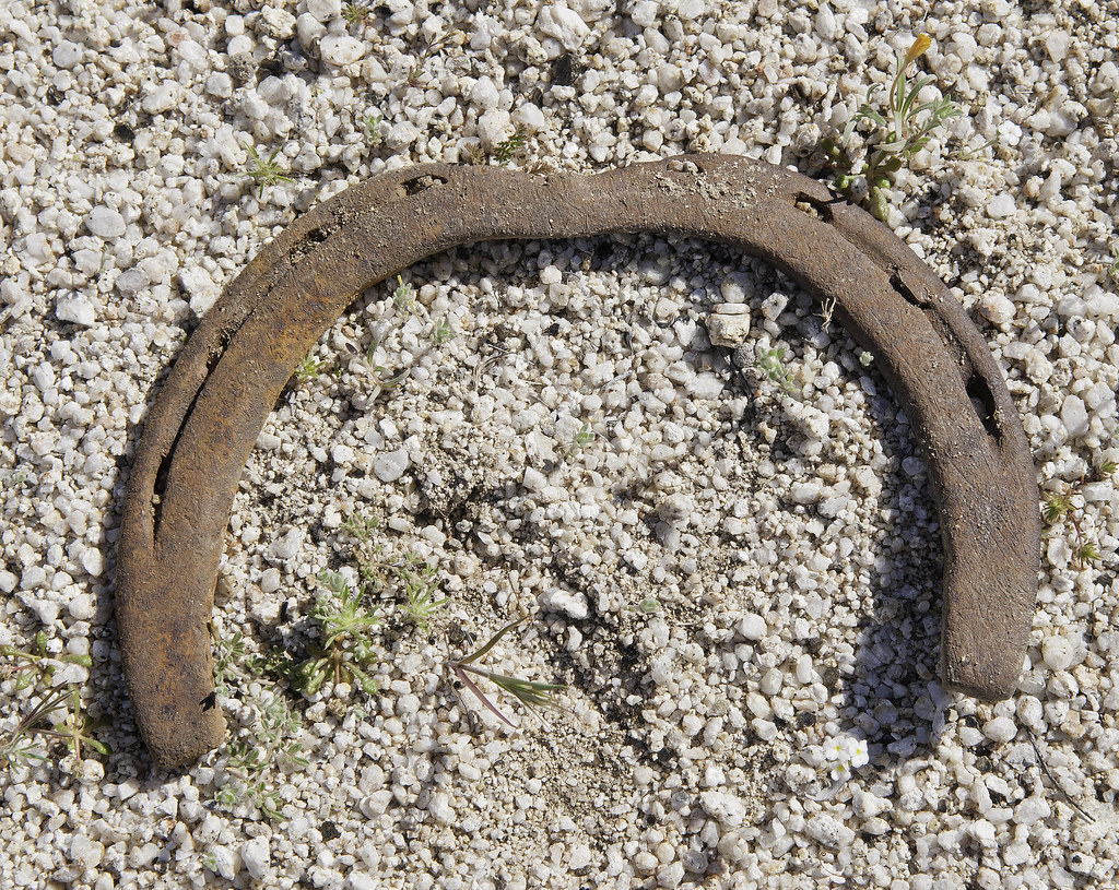 Bent Shoe by tomteske, on Flickr Bent Shoe by tomteske, on Flickr
Looking down Canebrake before the long slog back up Pepperwood.
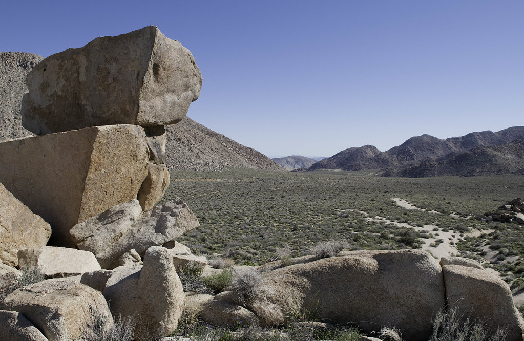 Down Canebrake by tomteske, on Flickr Down Canebrake by tomteske, on Flickr
Looking toward the Sawtooths from below the spring.
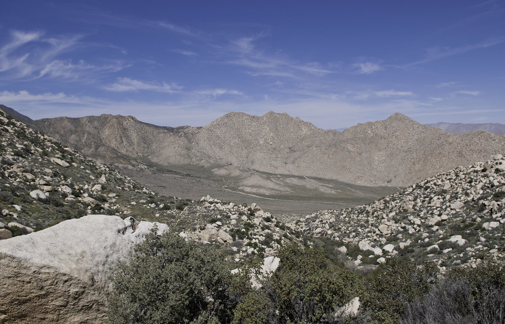 Toward Canebrake by tomteske, on Flickr Toward Canebrake by tomteske, on Flickr
The spring had a fair amount of water. Reading Shads' description sound like there was a pretty good flow in the past.
 Pepperwood Spring by tomteske, on Flickr Pepperwood Spring by tomteske, on Flickr
Didn't really explore around the spring since there were several tents right next to it and the trail. Not sure if I would have stayed there because of the nocturnal traffic. The backpacks, clothing, etc that I noticed looked kind of old, till I found this.
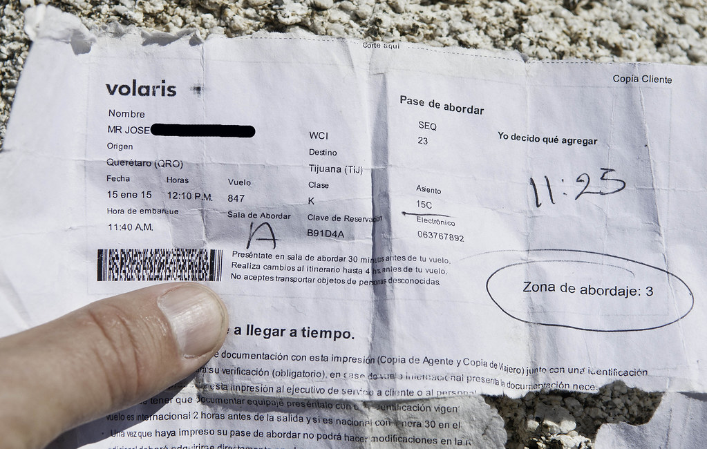 Pase de Abordar Edited by tomteske, on Flickr Pase de Abordar Edited by tomteske, on Flickr
Did a little searching online and Volaris is a budget airline with flights from Queretaro (north of Mexico City) to TJ for about $135. Searched the INS detention website that lists all detainees currently in custody and those who were in custody for the past 60 days which would have covered the time since he arrived in TJ on January 15 and this individual had no hits. So, maybe he made it.
Another couple of nice trips out. Enjoy. Tom
|
|
|
link
|
|
dsefcik Administrator Posts: 2609
3/17/2015
|
Wish I could have gone with you Tom, always wanted to go down Pepperwood. At least I got to see some of the wildflower blooms on my way home. Nice INS investigative report... I believe the traffic we saw out in Fish Creek was the TDS Desert Safari event traffic and also from the otherwise beautiful weather we had.
--
--
http://www.sefcik.com
http://www.darensefcik.com
http://www.carrizogorge.com
|
|
|
link
|
|
tommy750 Posts: 1040
3/17/2015
|
dsefcik wrote:
Wish I could have gone with you Tom, always wanted to go down Pepperwood. At least I got to see some of the wildflower blooms on my way home. Nice INS investigative report... I believe the traffic we saw out in Fish Creek was the TDS Desert Safari event traffic and also from the otherwise beautiful weather we had.
--
Have to agree, great day to be out. The group ahead of us driving out toward Sandstone was the Canyoneers, a group sponsored by SD Natural History Museum: http://www.sdnhm.org/education/naturalists-of-all-ages/canyoneer-hikes/
|
|
|
link
|
|
hikerdmb Posts: 423
3/17/2015
|
That is a beautiful area. Like your tent pic. The reduction station pic looks like a giant pyramid photo taken from space.
|
|
|
link
|
|
ziphius Posts: 911
3/17/2015
|
Given the drought, I'm still amazed that *any* of our springs have water. But maybe it's 10,000 year old 'fossil water' trickling to the surface, who knows. That's an impressive amount of obsidian for one spot, like the flaked stone too. Wish I were out there right now.... sigh.
--
http://www.coyotelearning.org
|
|
|
link
|
|
tommy750 Posts: 1040
3/17/2015
|
hikerdmb wrote:
The reduction station pic looks like a giant pyramid photo taken from space.
Now that you mention it, does look that way. Pretty amazing to think some guy was sitting there ages ago making tools and the remnants are right where they fell.
|
|
|
link
|
|
tommy750 Posts: 1040
3/17/2015
|
Jim (ziphius) wrote:
Given the drought, I'm still amazed that *any* of our springs have water. But maybe it's 10,000 year old 'fossil water' trickling to the surface, who knows. That's an impressive amount of obsidian for one spot, like the flaked stone too. Wish I were out there right now.... sigh.
Interesting article. Amazing how they can figure out water reserves with indirect satellite measurements. Dropping the water table in surrounding areas can't be good for the few spots where the table touches the surface. Agree on the obsidian. Don't think I've ever seen so much obsidian in one place except the Fossil Falls area. Would be interesting knowing if it came from Obsidian Butte or somewhere else.
|
|
|
link
|
|
rockhopper Posts: 668
3/18/2015
|
Tommy,
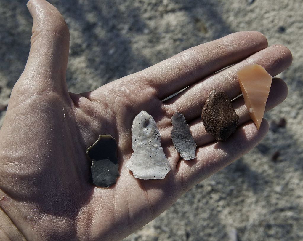
Pretty sure the obsidian came from the obsidian butte or red island area. When ancient Lake Cahuilla was full, the obsidian source was covered so they must have stored the "black glass" elsewhere. It was traded all the way to the coast.
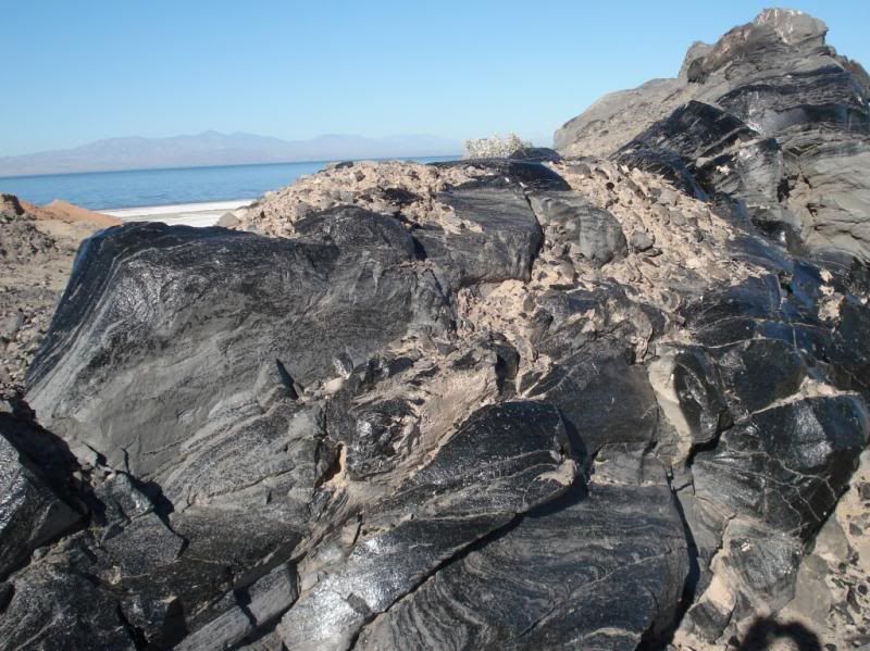
Found this among obsidian flakes about 4 miles from the coast recently even though there is no local source

edited by rockhopper on 3/18/2015
|
|
|
link
|
|
tommy750 Posts: 1040
3/18/2015
|
rockhopper wrote:
Tommy,
Pretty sure the obsidian came from the obsidian butte or red island area. When ancient Lake Cahuilla was full, the obsidian source was covered so they must have stored the "black glass" elsewhere. It was traded all the way to the coast.
Found this among obsidian flakes about 4 miles from the coast recently even though there is no local source
edited by rockhopper on 3/18/2015
Always wanted to head out to Obsidian Butte and check it out. Nice tool find.
|
|
|
link
|