|
dsefcik Administrator Posts: 2609
10/8/2015
|
Tom and I have been going out to McCain Valley the last couple of months for some backpack and car camping trips just exploring around the immense boulder strewn In-Ko-Pah mountain range. Some of our explorations were in ABDSP and some crossed into BLM territories. The weather has been pretty hot this summer and the 4,000+' higher altitude of McCain Valley was tolerable for many weekends. Wildlife was scarce, Pepperwood Spring was dry and the only other people we saw on any of our hikes were OHV users driving around where they shouldn't have been.
I lugged along my Olympus 35mm camera with a roll of Fuji Velvia and struggled to take 29 pictures before I finally decided to roll it up and get it developed..wasting 7 precious frames of Velvia goodness. There really is something magical about Velvia film, it is amazing sharp, colors are warm and beautiful and holding the film in your hands and looking at it thru a loupe reminds me of when I was kid and had all the Disney slides for my View Master....pure joy....
All of the photos on this post are Fuji Velvia 50 35mm from my Olympus OM-1n. Processed at NCP in Carlsbad CA and scanned by me with an Epson V700 scanner. I did no touch up to them other than a small zap of USM.
Here is a really nice early morning view of Canebrake Wash from the Pepperwood trail. Red Top is just out of site on the right side. I have crossed over that pass on the left several times on trips to Potrero

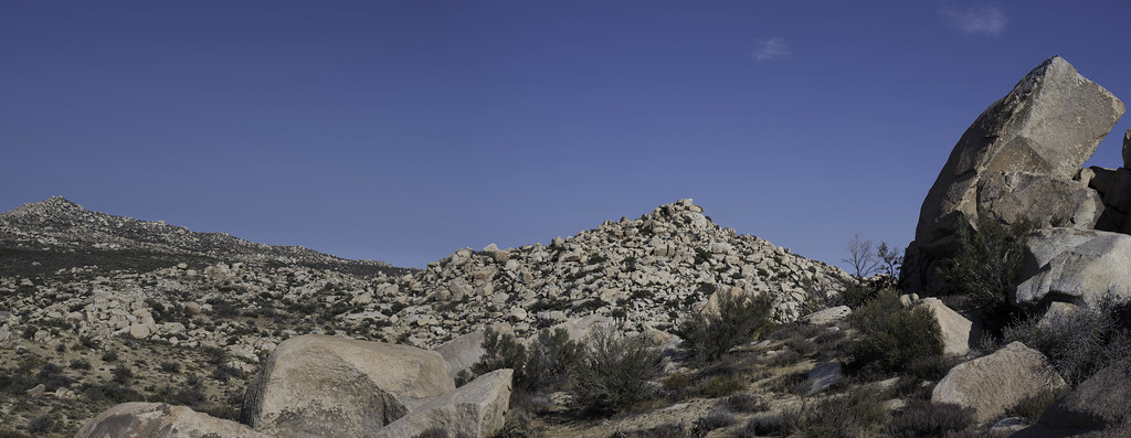
One place I have been trying to find for several years was Thunder Canyon and Tom and I found it...barely. It is very difficult to find and we almost gave up but decided to look down "one more" crack in the boulders. Here is a view of the boulder pile where we found it, even standing right next to it you will miss it if you are not trying to find it on purpose

There is an old coral nearby but has no significant clues to it's location

We did find some nice pictographs and mortars nearby. Here are before and after pictures of DStretch in action with Film photographs. These were scanned on an Epson v700 and Vuescan Pro. I think they are very nice and in some ways better than the digital versions. Large format film I am sure would really make the quality of DStretch images better than any digital cameras


Pepperwood Trail is a regular corridor for undocumented travelers and they will leave behind all kinds clothing discards and in particular shoe covers that keep their tracks from being seen

Some people may not know about it but there will be a wind turbine farm soon built in McCain Valley and turbines will be along one of the ridges that separate McCain Valley and Thing Valley so Tom and I climbed up the ridge to have a look around and the views were amazing. It will be such a shame to put big turbines there.
Here is the ridge we climbed up, my camera jammed on the shot so it doubled up the exposure but you get the idea

Up on the ridge line where the turbines will be placed you can see all of the Carrizo Mtn range, Ocotillo, Canebrake, Fish Creek, just about anywhere east

Tom and I surmised this was some kind of wind data collection pole since it had several spinning things at the top and what looked like CDMA communications strapped on the pole

Tom looking out over Thing Valley and towards the Laguna Observatory

Misc Flora

And Tom near Lowenbrau Pinnacle

Total Balloons for these trips - 20+ stopped counting
----
--
http://www.sefcik.com
http://www.darensefcik.com
http://www.carrizogorge.com
|
|
|
link
|
|
tommy750 Posts: 1040
10/9/2015
|
McCain Valley has sure been a lot cooler than down below but still has been in the mid 80's to low 90's on most of our trips out there although it cools rapidly in the evening. The last few trips out makes you realize there's still an amazing amount of stuff still to explore.
Didn't really pay any attention to the meteorological towers in the past but there's a bunch of them along McCain Valley Rd soon to be replace with turbines 
Nice pics, Daren
|
|
|
link
|
|
ziphius Posts: 911
10/9/2015
|
Nice photos and trip Daren / Tom. Discovering some 'new' pictos must be a thrill. Heading out to Laguna Mtns and Jacumba this weekend to escape the heat at the coast. Ironically, it is 100 deg in La Mesa as I look right now and only 82 deg at Inkopah.
--
http://www.coyotelearning.org
|
|
|
link
|
|
rockhopper Posts: 668
10/11/2015
|
Excellent photos and great report. I need to get out in that area sometime. btw it was 95 deg in inland Encinitas on Sat. 10-10-15.
|
|
|
link
|
|
tommy750 Posts: 1040
10/14/2015
|
This past weekend ended up being the fifth trip out to McCain Valley Daren and I have made this summer and fall. And we haven't really scratched the surface. Daren headed out Friday and I met up with him Saturday morning. We hiked east of Cottonwood campground toward a large "rock pile" south of Sombrero with less than a hundred feet lower elevation. On the way out, Daren spotted a broken metate. Once picked up it's actually a double sided metate which was kinda neat.
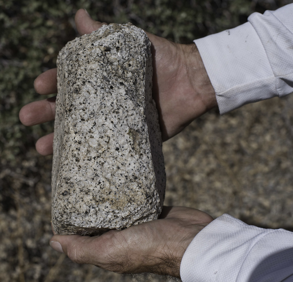 Double Sided Metate by tomteske, on Flickr Double Sided Metate by tomteske, on Flickr
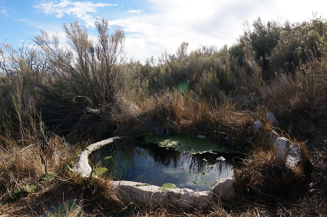
We headed cross country toward an occupation site I'd stumbled onto before and after a few minutes of looking around I heard Daren calling out that he'd found something amazing. Sure enough, he'd found one of those very rare springs that actually has water! I couldn't believe it.
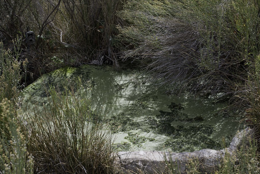 Spring by tomteske, on Flickr Spring by tomteske, on Flickr
Nice flow into the circular trough of about 1-2 gallons per minute:
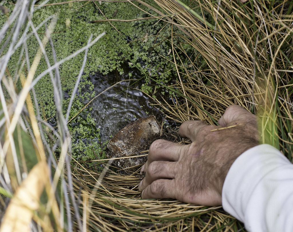 The Pipe by tomteske, on Flickr The Pipe by tomteske, on Flickr
Three trail cams were keeping a watchful eye on the spring, this one and two more closer to the trough. One is visible in the first spring pic. We figured they were place by BLM or ABDSP but when one of them contained a Border Patrol business card, we were somewhat confused on what was going on. Didn't see a lot of evidence of immigrant traffic but who knows.
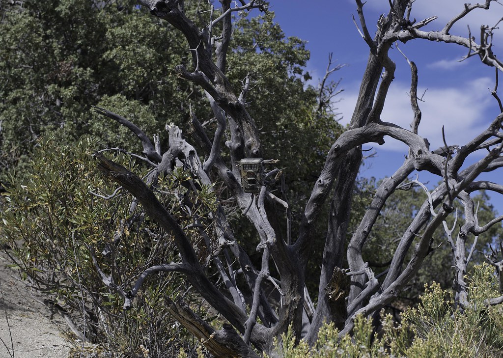 Spring Cam by tomteske, on Flickr Spring Cam by tomteske, on Flickr
Large pottery sherd tucked in the bushes.
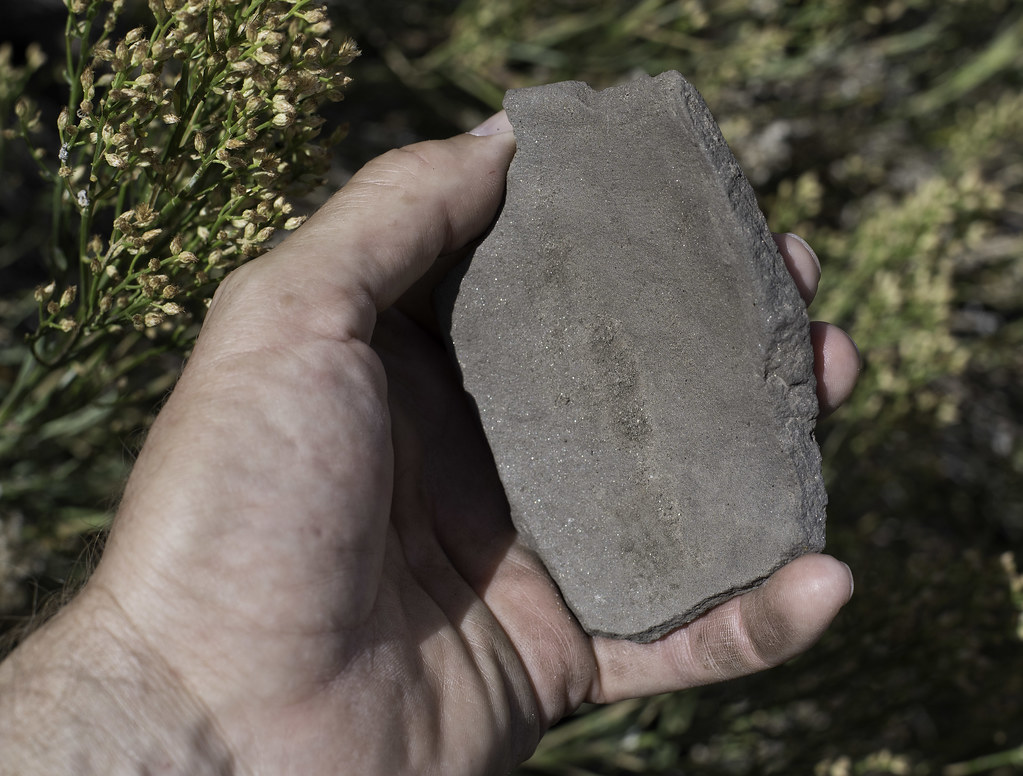 Spring Sherd by tomteske, on Flickr Spring Sherd by tomteske, on Flickr
We ended up camping on top of the rock pile in the middle right with great views in all directions.
 South of Bow Willow Creek by tomteske, on Flickr South of Bow Willow Creek by tomteske, on Flickr
Sunrise over the Coyote Mts.
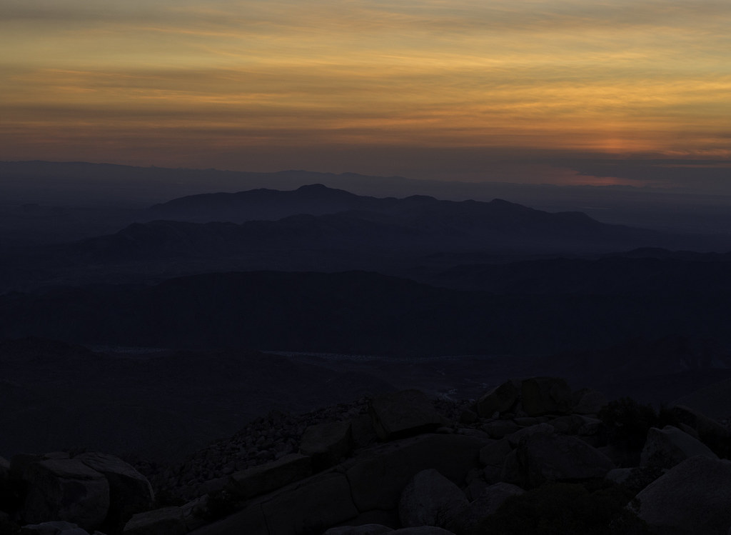 Rock Pile Sunrise by tomteske, on Flickr Rock Pile Sunrise by tomteske, on Flickr
My rather traditional sleeping quarters and Daren's bed of stone with a 15 ft drop a couple feet to the left.
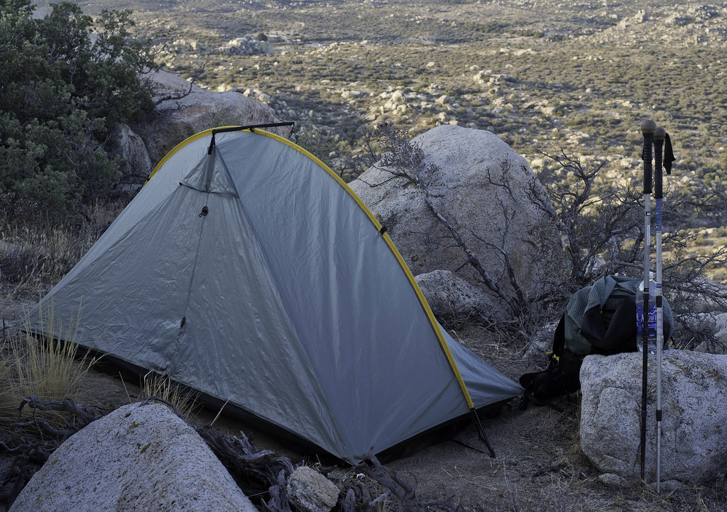 Tarptent View by tomteske, on Flickr Tarptent View by tomteske, on Flickr
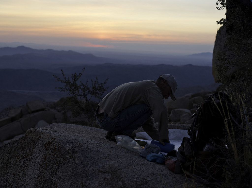 Room With a View by tomteske, on Flickr Room With a View by tomteske, on Flickr
The entire area was covered with deer tracks but we never saw any deer. We did see these kitty tracks following deer prints up a ravine. Size 14 boot for comparison.
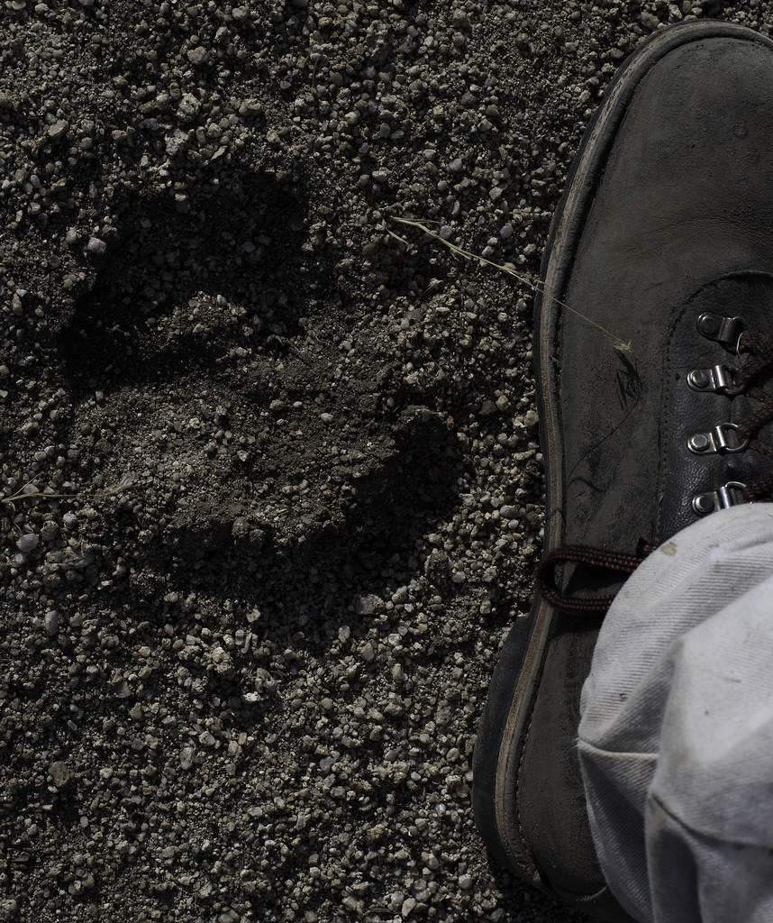 Mountain Lion Track and Size 14 Boot by tomteske, on Flickr Mountain Lion Track and Size 14 Boot by tomteske, on Flickr
Looking west toward the ridge separating McCain and Thing Valleys. The rocky peak to the far right is Peak 4553 just south of the dirt road that heads toward Sombrero. Enjoy. Tom
 McCain Valley from Bow Willow by tomteske, on Flickr McCain Valley from Bow Willow by tomteske, on Flickr
|
|
|
link
|
|
ziphius Posts: 911
10/14/2015
|
Man, that water looks good and clear! Rarest thing out there, congrats on finding it.
--
http://www.coyotelearning.org
|
|
|
link
|
|
dsefcik Administrator Posts: 2609
10/14/2015
|
Nice pics Tom....mine are still rolled up and waiting to be developed...
The views out here are just amazing, especially at night way up on the boulder piles like Sombrero and such. Looking forward to another trip out...
--
http://www.sefcik.com
http://www.darensefcik.com
http://www.carrizogorge.com
|
|
|
link
|
|
dsefcik Administrator Posts: 2609
11/1/2015
|
Got a few more photos developed from the last McCain trip, hope you enjoy...
These old state park signs were originally mounted to redwood posts (sombrero peak background)

This is the headwaters of Bow Willow Creek where it meets the Thing Valley ridge line (home of the new Tule wind turbines).
I thought it was an interesting picture, the shadows were just right to bring out the long draw of the dried up creek bottom.
Note the lone Cottonwood in the middle of the creek (yellow leaves)

These next 2 images I think Tom may have already posted a version of
Here is the Cowboy Crapper...I think I prefer the bushes....

In the midst of arguably the driest season known to us there is still some water in the middle of the high desert

Great views from the In-Ko-Pah mountains, Carrizo Gorge and the Ocotillo Wind Farm below

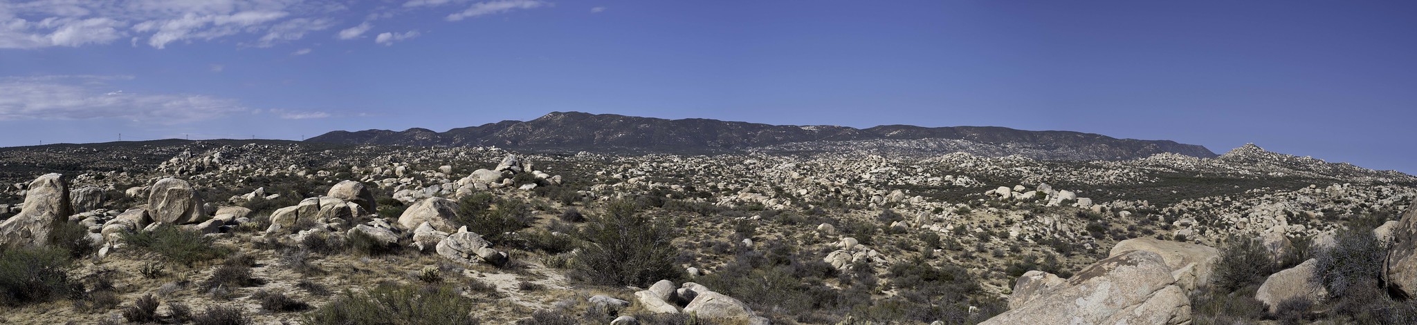
Panorama of the whole desert floor from Sombrero Peak to Ocotillo

--
--
http://www.sefcik.com
http://www.darensefcik.com
http://www.carrizogorge.com
|
|
|
link
|
|
ziphius Posts: 911
11/1/2015
|
Curious, is that spring / trough marked on the topo?
--
http://www.coyotelearning.org
|
|
|
link
|
|
dsefcik Administrator Posts: 2609
11/1/2015
|
Jim (ziphius) wrote:
Curious, is that spring / trough marked on the topo? It is near a marked spring but not right on it.
--
http://www.sefcik.com
http://www.darensefcik.com
http://www.carrizogorge.com
|
|
|
link
|
|
tommy750 Posts: 1040
11/1/2015
|
As best as I can determine, that state park sign has drifted east about 800 ft from where the boundary really is. The spring seems to have done the same  I think the white shirt makes me look fat... I think the white shirt makes me look fat...
|
|
|
link
|
|
dsefcik Administrator Posts: 2609
11/1/2015
|
tommy750 wrote:
I think the white shirt makes me look fat... I think the fat makes you like white.....
--
http://www.sefcik.com
http://www.darensefcik.com
http://www.carrizogorge.com
|
|
|
link
|
|
ziphius Posts: 911
1/2/2016
|
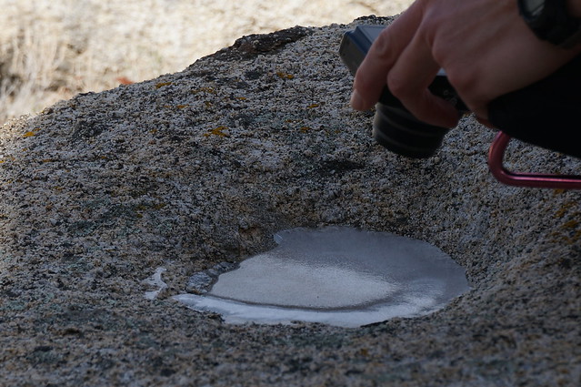
Ever since I saw this post with the spring, I thought it would be fun to try and go find it. I convinced Alex to go on the wild goose chase with me. A couple of context clues and a quick peek at Google Earth (yep, visible!) helped nail it. It looks like the spring area has been pruned back considerably since the summer. No evidence of the trail cam either.
We also found some frozen mortero water:

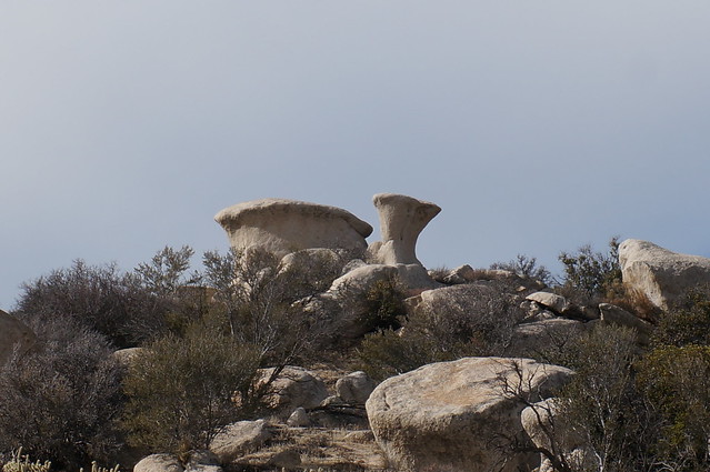
The rock formations in the area are way cool:

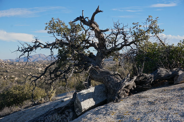
A very cool oak bonsai:
edited by ziphius on 3/12/2018
--
http://www.coyotelearning.org
|
|
|
link
|
|
tommy750 Posts: 1040
1/3/2016
|
Glad you could find the spring, Jim. Love roaming around out there. Nice pics.
|
|
|
link
|