|
Viper Posts: 13
1/8/2020
|
Had a very nice stroll up Coyote Mountain over the weekend. Took the standard east approach from Rockhouse Trail. Not another soul on the mountain. Perfect weather and perfect views.
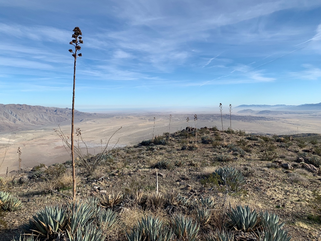
Unobstructed views of the Santa Rosas and a great vantage point for the alluvial fans/bajadas at the base of that range.
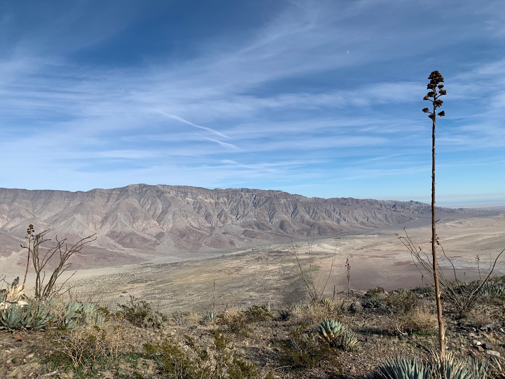
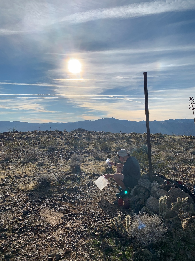
Although the summit has a benchmark and is clearly the highest point of the mountain, there is another prominent bump to the SW that was nagging me to visit, just in case. Sure enough, there was a summit register tucked away in the SW bump, likely mistakenly placed there by early hikers ascending from the south and thinking they reached the top. It was a highlight to find an entry from Jerry Schad, one that pre-dates the first edition of his San Diego book.
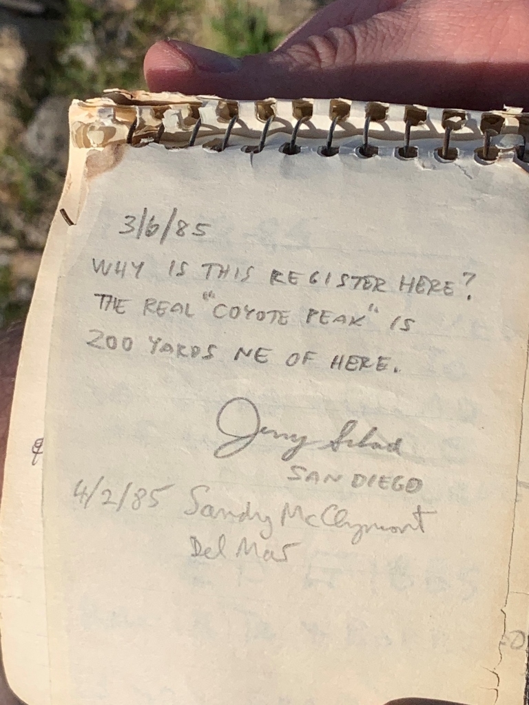
Back on the true summit, the register was well-hidden and also had entries going back a few decades (but none from Schad that I found).
On the descent, we played around with the echoing canyon to the west. There was one really cool spot where the echo was delayed by a full two seconds. That made for a cool effect with the absence of wind and great views.
edited by Viper on 1/8/2020
|
|
|
+1
link
|
|
Viper Posts: 13
1/8/2020
|
It is 5.3 miles RT, with 2,500 feet of gain.
edited by Viper on 1/8/2020
|
|
|
+1
link
|
|
rockhopper Posts: 668
1/8/2020
|
It's a fun day hike. You are correct about the views. The geology of the area is just fantastic.
|
|
|
+1
link
|
|
Buford Posts: 453
1/9/2020
|
Nice. I don't remember finding or even looking for the second register, but I do remember the view.
We could start a thread of places Schad's signature still resides. I know of a couple.
--
Links to my photos: ABDSP photos, Bighorn sheep photos, ABDSP time lapse video, Wildlife photos (mainly birds)
|
|
|
+1
link
|
|
dsefcik Administrator Posts: 2609
1/10/2020
|
Nice post, still have yet to get up Coyote.
My understanding is that the RHC road was closed briefly but now re-opened with the cooperation of the Clark Lake LLC. The parking/camping area just past the lake now has a seismic sensor and looks abandoned as a camping spot. There are No Access signs all over where people used to camp in the RV's. I am wondering if anybody has any specific info about the road...?
Good thing is now you can drive thru the old quarry and take the road around the dry lake if it gets mudd'ed out.
--
http://www.sefcik.com
http://www.darensefcik.com
http://www.carrizogorge.com
|
|
|
+1
link
|
|
Buford Posts: 453
1/10/2020
|
@Rocko1
Sometimes the registers reappear as well. A group might move it only for someone else to move it back. I have noticed large gaps in entries and secondary registers in many places. On Sawtooth we never saw the new register, but we found the tiny Wes Shelberg film canister with the rolled up pages inside.
@dsefcik The park webpage doesn't say anything about the road being closed. They updated the road conditions page on January 4th, not that it is accurate in any way, but it was updated. I haven't been up the RHC road since March.
--
Links to my photos: ABDSP photos, Bighorn sheep photos, ABDSP time lapse video, Wildlife photos (mainly birds)
|
|
|
+1
link
|
|
tekewin Posts: 364
1/11/2020
|
Nice hike. Coyote is a fun mountain and so accessible from Borrego Springs. Bonus on the Schad sig.
I experienced the strongest wind I've ever hiked in on Coyote. Knocked down a couple times and nearly turned back. Didn't even think about going to the south summit. Might be interesting to try it from one of the west ridges.
|
|
|
+1
link
|
|
rockhopper Posts: 668
1/14/2020
|
deborah wrote:
Nice photos and trip report!
tekewin wrote:
Nice hike. Coyote is a fun mountain and so accessible from Borrego Springs. Bonus on the Schad sig.
I experienced the strongest wind I've ever hiked in on Coyote. Knocked down a couple times and nearly turned back. Didn't even think about going to the south summit. Might be interesting to try it from one of the west ridges.
I had a really windy day on Coyote Mountain too. It was blowing so hard it was almost comical.
Before the holidays I had been spending some time up Alcoholic Pass and either towards Coyote Mountain or north up on the rocks. Seems like it's windy up there more often than not. But as soon as you drop down off the ridge to the east it quiets down considerably.
I thought it was interesting that the Rack bench mark (as shown on CalTopo) was actually Rock.

When those N/W winds ramp up in the Winter and Spring and come down and hit the San Jacintos and Santa Rosas they can really funnel thru Anza heading downhill thru Coyote Canyon into Clark dry lake. On the same day you can be in a T-shirt in the Sun with a nice breeze on the East side of the base of Santa Rosas.
Coyote has a great overview of the dry, some times "lake".

edited by rockhopper on 1/14/2020
edited by rockhopper on 1/14/2020
edited by rockhopper on 1/14/2020
|
|
|
+1
link
|