|
rockhopper Posts: 668
6/25/2014
|
Hello all. Now that our "backyard" ABDSP daytime high temps are pegged at the 100 deg F + level for the next several months, I did what the ancient peoples did. Head for cooler ground. Below are pics from two hikes around and nearby a local lagoon near the coast in the N. County. The area was inhabited for thousands of years. Some interesting factoids I picked up reading about the area.
1. Scuba divers back in the 1950's discovered dozens of morteros underwater hundreds of yards off shore at ancient village camp sites when the oceans receded during the ice ages.
2. These ancient paleo peoples were walkers. It was not uncommon for them to walk 30 to 40 miles a day!
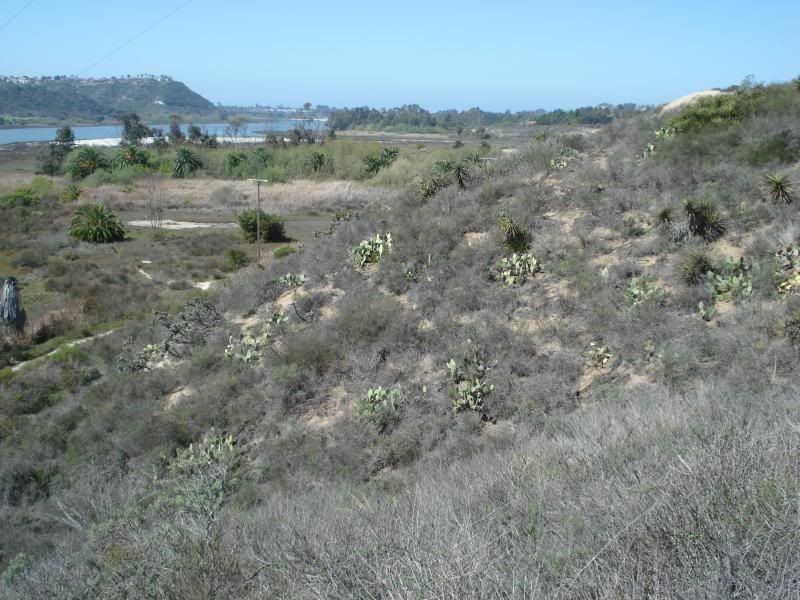
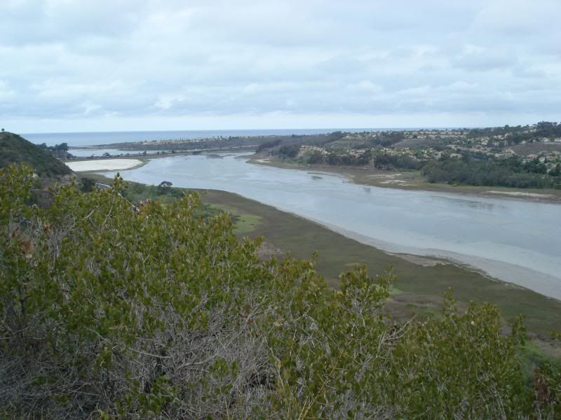
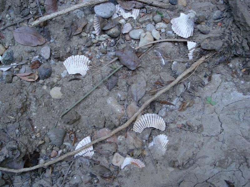
Day one starts around the Eastern edge of the lagoon
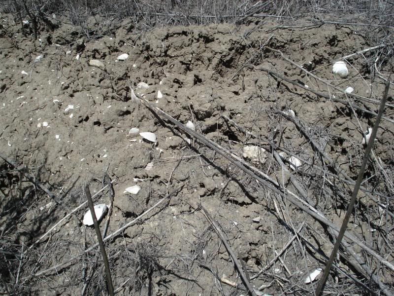
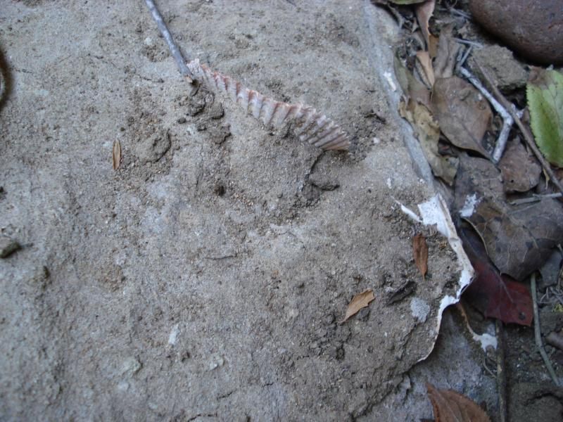
Quickly find a shell dump from several hundred years ago.
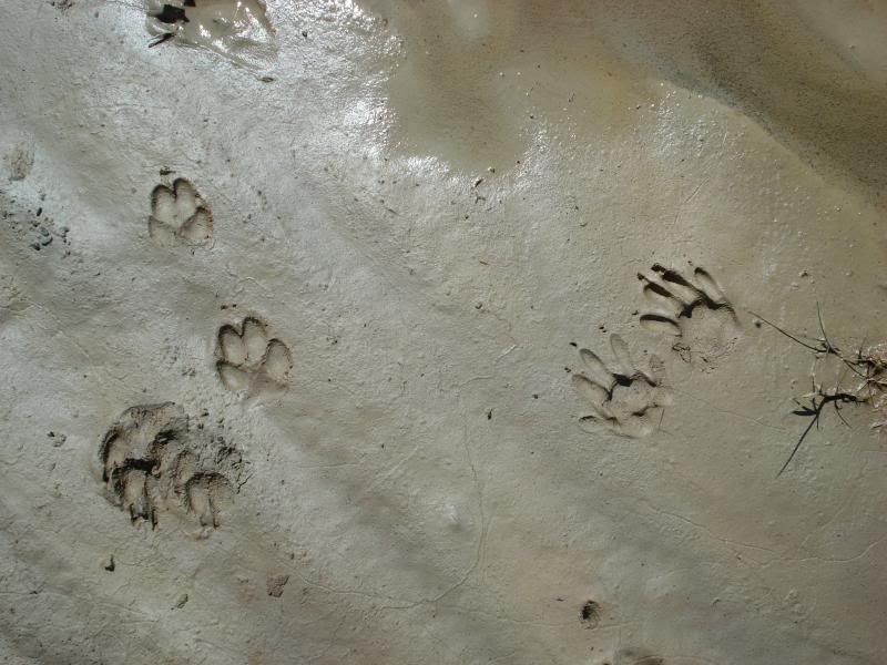
Local critter tracks
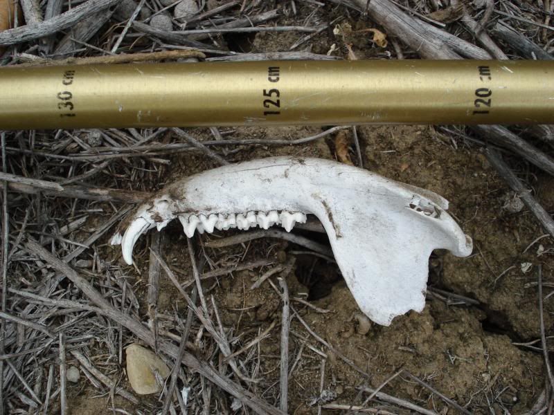
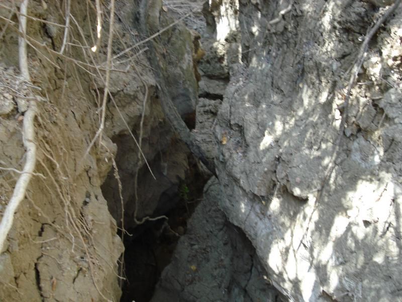
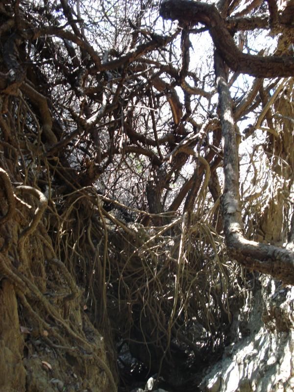
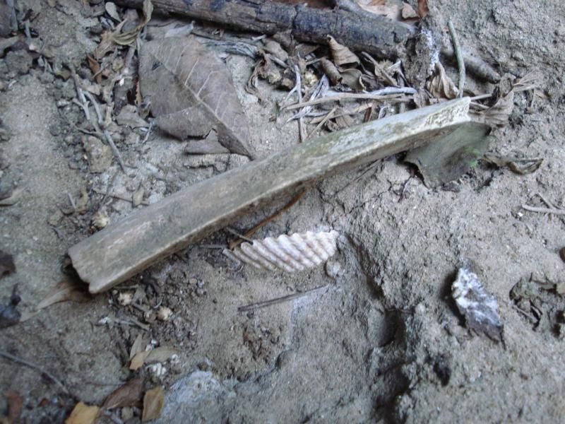
Hiked into one of many brush choked canyons. Coyote jaw?
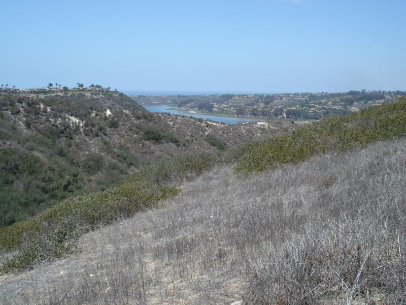
Up a ridge for a view and a breeze.
Day 2. Explore more of the southern reaches of the lagoon.
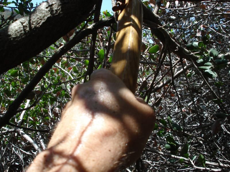
Spent a lot of time cutting tunnels through 8-10 ft high brush.
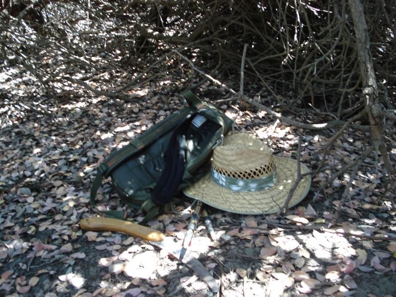
Took a break. At this point my day pack and my self are fully soaked with sweat.
Dropped into a gully for faster travel
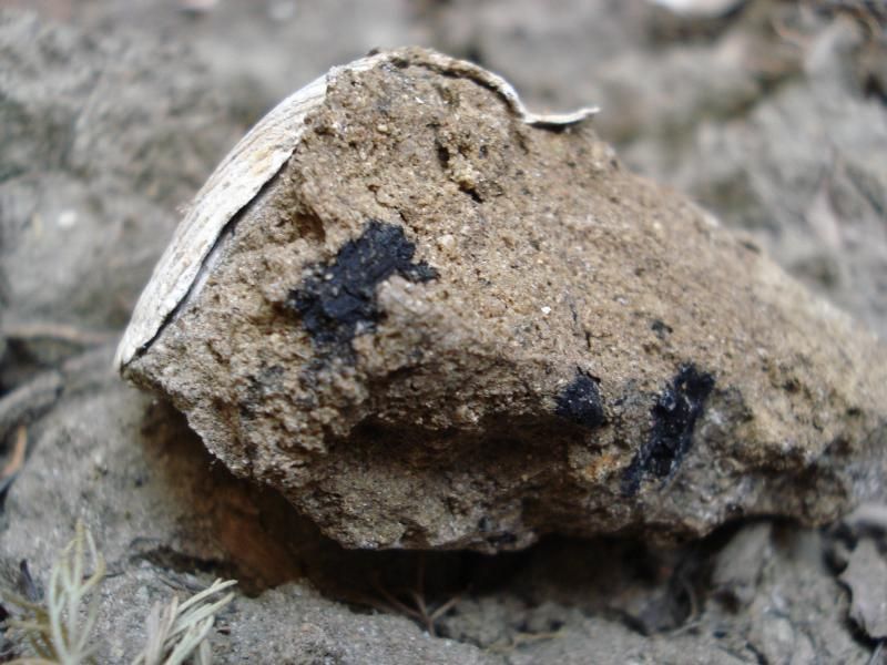
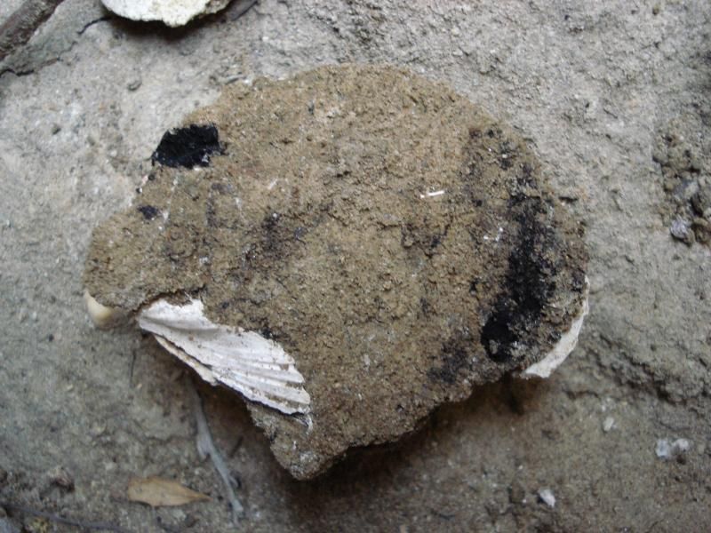
On the side of the gully, and exposed clam cooking site with charcoal , shells and bone.
Good picture of the charcoal pieces.
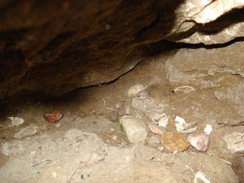
This camp is much much older than the shell site from day one judging by the soil height deposited above. Over 10 feet.
Cheers all. I miss the Desert!
Looks like I will heading up the higher elevations of the Santa Rosas next to escape to warming period.
Paul
edited by rockhopper on 6/25/2014
edited by rockhopper on 6/25/2014
edited by rockhopper on 6/25/2014
|
|
|
link
|
|
surfponto Administrator Posts: 1362
6/25/2014
|
Nice hike David.
Batiquitos lagoon?
Can almost see my house in the first pic in the left corner. (That's our complex up on the hill)
Where did you start the hike?
--
https://www.anzaborrego.net/


|
|
|
link
|
|
ziphius Posts: 911
6/25/2014
|
Nice raccoon tracks! Interesting history. I'm a fan of getting on hands and knees and tunneling through brush too.  Hey, the desert above Borrego Springs near Ranchita has only been in the high 80s this week! Thinking about going to do an overnight somewhere above Big Spring soon. Short hike, plus water! Good luck in the Santa Rosas! Hey, the desert above Borrego Springs near Ranchita has only been in the high 80s this week! Thinking about going to do an overnight somewhere above Big Spring soon. Short hike, plus water! Good luck in the Santa Rosas!
--
http://www.coyotelearning.org
|
|
|
link
|
|
rockhopper Posts: 668
6/25/2014
|
surfponto wrote:
Nice hike David.
Batiquitos lagoon?
Can almost see my house in the first pic in the left corner. (That's our complex up on the hill)
Where did you start the hike?
Hi Surfponto,
Yes it is Batiquitos ( which means little baptized one) go figure?
btw its Paul not David
Hiked in from Swallow tail. Saxony to Quail hollow to Swallow tail then on foot. If you go be careful of the 20 ft gully in the middle of the heavy brush. I almost fell in. It's very hidden in spots.
|
|
|
link
|
|
surfponto Administrator Posts: 1362
6/25/2014
|
Sorry Paul,
For some reason I thought David had posted that.
I need a vacation .....
Bob
rockhopper wrote:
surfponto wrote:
Nice hike David.
Batiquitos lagoon?
Can almost see my house in the first pic in the left corner. (That's our complex up on the hill)
Where did you start the hike?
Hi Surfponto,
Yes it is Batiquitos ( which means little baptized one) go figure?
btw its Paul not David
Hiked in from Swallow tail. Saxony to Quail hollow to Swallow tail then on foot. If you go be careful of the 20 ft gully in the middle of the heavy brush. I almost fell in. It's very hidden in spots.
--
https://www.anzaborrego.net/
|
|
|
link
|
|
rockhopper Posts: 668
6/25/2014
|
No Problem. Cheers
Added a few more pics for grins.
Crawling and cutting through here was the hardest part.
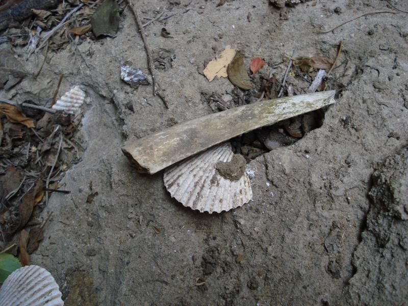
Another shot of the same spot as above.Erosion exposed old clam fire pit.
More charcoal bits and pieces from some ones ancient dinner.
Bone frag in pit area. Bone id anyone?
other subject.
Re: Santa Rosa mtn drive up. Is the spring 3/4 the way up still flowing? The one flowing from the Galv. pipe on the left side of the dirt access road.
Paul
edited by rockhopper on 6/25/2014
|
|
|
link
|
|
dsefcik Administrator Posts: 2609
6/25/2014
|
Probably Saber Tooth....
Nice, hike, close to the coast and much cooler temps.
I am heading back to ABDSP to Rattlesnake Spring next week for 4 days of sheep counting, still a fine time of year to go to the desert..!!
--
http://www.sefcik.com
http://www.darensefcik.com
http://www.carrizogorge.com
|
|
|
link
|
|
dsefcik Administrator Posts: 2609
6/25/2014
|
Probably%20Saber%20Tooth....%3Athumb%3A%3Cdiv%3E%3Cbr%3E%3C/div%3E%3Cdiv%3ENice%2C%20hike%2C%20close%20to%20the%20coast%20and%20much%20cooler%20temps.%3C/div%3E%3Cdiv%3E%3Cbr%3E%3C/div%3E%3Cdiv%3EI%20am%20heading%20back%20to%20ABDSP%20to%20Rattlesnake%20Spring%20next%20week%20for%204%20days%20of%20sheep%20counting%2C%20still%20a%20fine%20time%20of%20year%20to%20go%20to%20the%20desert..%21%21%3C/div%3E
--
http://www.sefcik.com
http://www.darensefcik.com
http://www.carrizogorge.com
|
|
|
link
|
|
dsefcik Administrator Posts: 2609
6/25/2014
|
Probably%2520Saber%2520Tooth....%253Athumb%253A%253Cdiv%253E%253Cbr%253E%253C/div%253E%253Cdiv%253ENice%252C%2520hike%252C%2520close%2520to%2520the%2520coast%2520and%2520much%2520cooler%2520temps.%253C/div%253E
--
http://www.sefcik.com
http://www.darensefcik.com
http://www.carrizogorge.com
|
|
|
link
|
|
anutami Posts: 491
6/26/2014
|
Great report! Thanks
Nolan
|
|
|
link
|