10/19/2011
Topic:
New Topo Maps App for the iPhone
dsefcikAdministrator
|
I have had Back Country Navigator on my Android phone for about 6 months or so and actually prefer it over my $300 Delorme. Battery life on the phone is a problem so I usually just use the Delorme but I did use the phone for many trips. Download the topos to the phone for free from mytopo.com and off you go. It does all the usual features, waypoints, tracks, routes, etc.
The Delorme does have some advanced features that I sometimes use like layered maps, it can layer topo maps and color aerial maps for a blended view on the GPS screen and you can also draw out coordinates (like a square plot or a property line) and overlay that on the maps, etc.
What app did you find for the iPhone?
David..don't laugh at us...
Daren |
10/25/2011
Topic:
Split Mtn Road access via Plaster City question
dsefcikAdministrator
|
Hey chevell, thanks for that info, I was still wondering about that route. I m not sure I have enough confidence in my driving skills to take my 9k lb diesel truck down a 60mph deep sand freeway. The trauma of getting stuck in sand twice in my CJ5 still haunts me today. I have had my diesel get stuck just pulling off onto the shoulder of the S2, without 4WD I would have been stuck. I guess I will be going the long way to get there. I may be doing a modified version of this trip soon.
Thanks for the info!
Daren |
10/25/2011
Topic:
Borrego Days 2011
dsefcikAdministrator
|
I really like the Fish Creek photo, I still need to get out there...thanks for sharing that. |
10/25/2011
Topic:
Borrego Days 2011
dsefcikAdministrator
|
Hey Bob, is that a new bumper and winch on your Toyota?? |
10/25/2011
Topic:
Whale Peak / Inner Pasture / Goat Cyn Trestle
dsefcikAdministrator
|
One thing I realized when I was hiking Whale Peak was that I can tell if the weather is too cold for me just by my food. As I felt the cold breeze ripple across my sweat drenched back while eating my *crunchy* Cliff bar and eating my Trader Joe's'Os from the can *with a spoon*, it dawned on me that it really is just too cold for me if my Cliff bar is not melting when I eat it or if I can't just "drink" my canned food without the need for a utensil.
sigh...winter is coming and I may need to hang up my desert gear..... |
10/25/2011
Topic:
Whale Peak / Inner Pasture / Goat Cyn Trestle
dsefcikAdministrator
|
DHeuschele wrote:
I will be backpacking to the Domelands this weekend (~6 miles RT) with my 9 year old (his second backpack trip).
How did that trip go? I did not see a TR for it. Curious to know if your son enjoyed it and if you guys saw any wildlife there. |
10/26/2011
Topic:
Desert Pavement
dsefcikAdministrator
|
Desert Pavement near Ocotillo
 |
10/29/2011
Topic:
Indian Valley to Inner Pasture - Need 2 Vehicles
dsefcikAdministrator
|
I am thinking of doing a hike that starts in Indian Valley and crosses thru Canebrake Wash and Inner Pasture. This would be about an 11 mile point-to-point mostly downhill sandy wash hike and would require 2 vehicles. I am looking to see if there is anybody who would like to join me on this trip and provide the extra vehicle needed. See the map below for the route. I would be probably driving out after work and camping out overnight close to the end point of marker "B" and then in the morning leave one vehicle at marker B and drive to marker "A" in the 2nd vehicle. From marker A hike the route and then when back at B drive over to Indian Valley at marker A again and camp overnight. There should be some interesting finds along the hike not mention visiting an extremely remote area that few people ever see.
Anybody interested?
 |
10/29/2011
Topic:
Indian Valley to Inner Pasture - Need 2 Vehicles
dsefcikAdministrator
|
Forgot to mention that the second vehicle should be high clearance and capable of driving thru a rocky section of Indian Gorge, don't need 4WD, just good tires and some ground clearance. You might get a few new pinstripes also. |
10/30/2011
Topic:
6582 redux
dsefcikAdministrator
|
I was thinking of maybe heading out there soon and was going to revisit the route you took Stewart but your image is gone! Anyway to see it again?
This guy has some interesting photos of that same area as well as the whole rockhouse valley area
http://ponart.com/2007_01_07/rhp.html
http://ponart.com/ |
10/30/2011
Topic:
Whale Peak / Inner Pasture / Goat Cyn Trestle
dsefcikAdministrator
|
Almost forgot about this quick video I made with my camera as I was coming back down Whale Peak. Basically it shows where I started from out at the S2 and then the route up the ridge line, over to Whale Peak and then back down to where I was standing when I filmed it. That was a tough hike, I have one purple toenail from it.
Click the image to play the movie.

<em>edited by dsefcik on 10/30/2011</em> |
10/30/2011
Topic:
Black Bear sighting in Mason Valley
dsefcikAdministrator
|
Saw this searching for something else
http://www.backcountry.net/arch/pct/0005/msg00265.html
It is also mentioned in the Lindsay book on page 197.
Anybody know anything further about this?? |
10/30/2011
Topic:
From the Unpublished Series
dsefcikAdministrator
|
So I have many photos that for one reason or another I never did publish on my website. Looking thru some of them today I thought I should start an "Unpublished Series" thread and start posting some of them. This will be my first one.
=====================================
Everyone has seen the Box Canyon Monument right? It is right there on the S2 highway with an easy pullout to stop and view the canyon from.

How many of you have seen the Box Canyon Monument Outhouses across the highway? There are two of them made out of stone.

They looked to be in good shape and me being the curious one and always interested in the unusual and different things I decided I should go take a closer look at them.

Not wanting to offend anyone here in the forums without their consent I decided not to post the next image directly but instead offer a link to my photo gallery that you the reader can decide to click on and view the inside of one of these fine outhouses if you so choose. Mind you this was taken in the middle of the day in late June and it was probably low triple digits temps outside.
To see what was inside one of the outhouses click here
Why are there such nice restroom facilities here that are not taken care of and hidden out of the view of most visitors??
Daren |
10/30/2011
Topic:
Whale Peak Backpack Possibility
dsefcikAdministrator
|
Finally got around to hiking this, see TR here http://forums.anzaborrego.net/travel/anzaborregoprevious/forum/topic155-whale-peak--inner-pasture--goat-cyn-trestle.aspx |
10/30/2011
Topic:
From the Unpublished Series
dsefcikAdministrator
|
Sunrise over the Imperial Valley with Jupitor, Mecury and Venus seen in the early morning sky.
18mm / ISO 100 / f22 / 30 second exposure / 5:05am

<em>edited by dsefcik on 5/30/2012</em> |
10/30/2011
Topic:
From the Unpublished Series
dsefcikAdministrator
|
Some Dstretch enhanced photos of pictographs at Indian Hill

--

--

--

--

--

--

--

--

--

--

--

--

--

--

--

-- |
10/30/2011
Topic:
The *new* Desert Magazine online
dsefcikAdministrator
|
One thing I did not mention is how to get the search results with the filename of the pdf that it matched. I had to pipe several commands together to get it to work, here is what I ended up with for the rock house search term:
for f in *.pdf; do echo "$f" >> /tmp/desertmg.txt;pdftotext "$f" - | grep -i "rock house" >> /tmp/desertmg.txt; done
Hope this is helpful
Daren |
10/30/2011
Topic:
Indian Valley to Inner Pasture - Need 2 Vehicles
dsefcikAdministrator
|
Hey David, thanks for the offer, Friday morning may work, let me see if anybody else wants to hike it and we can decide for sure in the next couple of days. If you will be somewhere else in the park more convenient let me know, I may plan a different one way hike. Where are you gonna go 4 wheeling?
Just BTW, the Inner Pasture hike is mostly all sandy wash except the first small saddle going out of Indian Valley which has some cholla and rocks. Wylie could do it, it just may be the distance that would be hard. |
10/30/2011
Topic:
Indian Relics for sale
dsefcikAdministrator
|
Looking thru an old Feb 1964 Desert Magazine issue, the classifieds had some interesting things for sale, here are a few of them:
SELLING 20,000 Indian relics. 100 nice ancient
arrowheads $25. Indian skull $25. List free.
Lear's, Glenwood, Arkansas.
FOR SALE: 24x21" olla, found Anza Borrego
Desert, flawless condition, $450 or best offer.
Picture sent on request. Andrew Willison, Jr.,
P. O. Box 2390, Sacramento, California.
INDIAN RELICS, coins, gems, minerals, fossils,
turquoise, pawn jewelry, Navajo rugs, pottery,
baskets, specimens, collections, books, an-
tiques, old guns. Arrowheads, $18.80 per
100. Price list free. Lakeside Trading Post,
8264 Wintergardens Blvd., Lakeside, California. |
11/1/2011
Topic:
Borrego Days 2011
dsefcikAdministrator
|
How was RHC? I am thinking of heading out that way this weekend.
I can say that down in Vallecito (which is below Monument Peak and the Lagunas in general) there is a lot of mountain lion scat, big ones, almost the length of my feet and an inch or so in diameter..I have not seen any actual mountain lions out there but the evidence is there and signs warn of them in the area.
This one is is from Indian Valley

TR wrote:
Addendum to the Borrego Days trip, and another trip to Rockhouse Canyon this past weekend.
I've seen two mountain lions on the drives home. One from the Borrego Days trip, outside of Ramona. It was crossing the road.
The other, this past Sunday evening, on the Sunrise Highway. (Yeah, I like to vary my route back to San Diego.) It was also crossing the road.
Neither one was in a particular hurry. There must be plenty of food for them. Because I seeing a lot of scat.
I haven't seen a mountain lion in six or seven years. And it was in Yellowstone. |
11/1/2011
Topic:
From the Unpublished Series
dsefcikAdministrator
|
This kinda broke my heart, two young coyote road kills within a few miles of each other. If you see road kill you should take a photo and report it when you get home. There is a website that collects this data and you can find here http://www.wildlifecrossing.net/california/
A juvenile coyote just south of Oriflame Canyon road

This young pup was just a few miles up the road in front of the Butterfield Stage store
 |
11/1/2011
Topic:
Whale Peak / Inner Pasture / Goat Cyn Trestle
dsefcikAdministrator
|
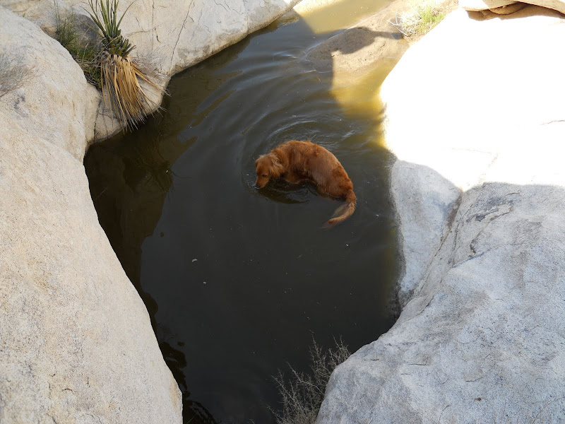
Look forward to seeing some pictures...sounds like you have been busy. I still need to make it out to the wind caves, I went once with my son and our dog but we were tired and it was hot so we only went about a mile or so and turned back. Glad you and your son had a good time. |
11/2/2011
Topic:
Indian Hill, again.
dsefcikAdministrator
|
hey TR, nice pics...another great trip out to indian hill!
here is my take...the scat (and i am no expert and could be completely wrong) is really dark and smooth...meat..it is not pinched (so probably not cat) and does not have the usual long taper of a coyote...there are many droppings instead a single long "log" so i sense distress in the diet. i doubt it was a domestic dog, probably coyote, especially if it was in the middle of a game trail.
you seem to be knowledgeable in geology, i am not and would like to be...a rock to me is "cool looking" but nothing deeper...
i totally recognize the landscape in your photos, especially the long white rock line in one of your photos, i believe i hiked the same hill my first time out there.
one thing that disturbs me is the fresh vehicle tracks in some of your photos, i can only hope they are border patrol.
i am glad you found the mortero boulder i referenced, i thought it was pretty cool.
i don't think you will find anyone who is willing to post gpx coordinates for the cave but you are close and i would recommend that you take some binoculars with you the next trip and remember that the topo maps do not indicate the correct indian hill for your purposes. i found the cave with bino's and just looking around. the fun part is actually finding everything else that has nothing to do with the cave!
daren |
11/5/2011
Topic:
Santa Rosa Peak Baggers special
dsefcikAdministrator
|
I have been near Pyramid. You can see from my route below. From what I remember, going towards Pyramid was not all that difficult, the terrain was easy to navigate, no huge boulders or cholla and such. I think it would be easy to get to Pyramid from the natural water tanks by just continuing up the wash and then ascend as needed. From there I am not familiar with the area. I also don't recall it taking too long to get to the peak I was at, maybe a few hours from Arroyo Salado campground.
It is quite possible you would find an old indian trail. I found some sections up on the ridge line heading east towards Truckhaven.
Your plan seems doable with some effort to not dilly-dally.
Will this be a solo trip or are you looking for others to join you?
 |
11/5/2011
Topic:
Santa Rosa Peak Baggers special
dsefcikAdministrator
|
I think adding Rabbit/6582 would be pushing it..the lack of water would be a problem. It would be interesting to do the trip as you kinda suggested, a one way back down into Rockhouse Cyn. |
11/5/2011
Topic:
Harper Cabin
dsefcikAdministrator
|
WHERE'S THE MOVIE LINK???
David made a great movie of the trip..post that link David! |
11/5/2011
Topic:
Harper Cabin
dsefcikAdministrator
|
I like the rainbow picture, it has nice lines to it..
Good to see you also in the mylar ballon count..can't believe how many of those damn things there are out threre. |
11/7/2011
Topic:
Domeland and Wind caves - Oct 2011
dsefcikAdministrator
|
Looks like it was great trip, it is nice to see kids are still getting outdoors. I remember a trip a couple years ago to the mud caves and there were a couple hundred girl scouts..they were everywhere!
I am puzzled by the heat you mention, I haven't seen those high of temps in Oct so far. |
11/7/2011
Topic:
New tires
dsefcikAdministrator
|
I find that the BFG's (on my trucks) have handled great in dry, rocky conditions but in mud or sand they suck. I have also split the sidewalls on two tires so far on my new truck, once in Death Valley and once out in ABDSP. I suppose I could blame my crappy driving skills. They aren't cheap either at $200 each. |
11/10/2011
Topic:
Indian Hill, again.
dsefcikAdministrator
|
DHeuschele wrote:
Lindsay in Anza Borrego Desert Region (p. 206) lists the hill as UTM 5-77.6E 36-24.1N (Northeast corner of Topo section 29) and also points out that it is mislabeled on the Topo maps.
So that is the gps of the actual hill and not the cave? That should get you close enough to find the cave if so. Either way you are close, you just need to wander around a bit more. |
11/10/2011
Topic:
Canebrake Wash / Indian Valley
dsefcikAdministrator
|
http://www.sefcik.com/2011/11/canebrake-wash-indian-valley-abdsp.html
A trip out to explore the ridge lines of Indian Valley was detoured by the rains and instead turned into a trip out into Canebrake Wash. When I drove into Indian Valley the weather was great. I drove out to the end of the north fork and was going to camp there but the bees were numerous and after about 30 minutes I found myself doing nothing but swatting bees away from me and the inside of my truck so I decided to go back down the road a bit to a nice little sandy area that was bee free. During the night the clouds started rolling in and so did the wind. My truck was rocking like crazy from the wind, it can get really, really windy in Indian Valley. The morning showed me nothing but dark rain clouds hovering above False Sombrero so I decided to go out into Canebrake Wash and explore there instead. Canebrake and Inner Pasture is really just amazing place, it is vast and empty, I am becoming fond of hiking there.
A possible yoni rock carving in Indian Valley

Mr. Taratula in Canebrake

Agave plant scat..yumm

Large sand berm in Canebrake (click to enlarge)

The Crawford Ranch

Looking west-north from the sand berm, wow...it is just amazingly vast here..that is Red Top in the distance. You can see the rain clouds moving in.

Looking North into Inner Pasture towards Moonlight Canyon...it is far away.

Morteros near some rock shelters indicate Native American habitation

Why do they always crap in the morteros???

Close up showing the hair and bones in the scat

One of the larger rock shelters I found (click to enlarge)

View north-west from the shelter (click to enlarge)

Another smaller rock shelter, little remained

More possible Yoni rock carvings back in Indian Valley

Leaving Indian Gorge a nice rainbow stretched across the road. It was short lived though as the rain was following me and would soon start raining hard.

Total Mylar balloon count for a 7 mile hike - 6
 |
11/10/2011
Topic:
Canebrake Wash / Indian Valley
dsefcikAdministrator
|
hikerdmb wrote:
Nice pics Daren. Is the picture looking out to Red Top taken from the top of the sand berm? That berm is quite amazing. It looks kind of like a longer version of Egg Mountain. That does look like a very cool place to explore. Lots of old history.
Yes, it was taken at the east end where it abuts the large round hill. It must be a mile or so long. I did not get to walk the length of it as it started raining and I headed back. The wind was so strong that it was blowing raindrops on me from the clouds coming down out of the Laguna's.
hikerdmb wrote:
How close can you get to the ranch at the mouth of the canyon? Is someone living there now? Also is there an old runway between the berm and the ranch? On google earth there is something long and straight there.
David
The runway is really nothing more than a big stretch of sand..it is hard to define when you are down on the ground but there is a lot of open sandy area there. The ranch property line (a wire fence) is just east of the landing strip and it heads south-east diagonally. You can see a faint trace of it on GE. I believe people are living out there, there were semi fresh tire tracks on the dirt road and the property looked lived in by the wood piles and such.
I definitely have plans to go back out, I didn't get a chance to explore where I wanted as the rain drove me back.
A brief video I did with my camera is here:
 |
11/12/2011
Topic:
Rain
dsefcikAdministrator
|
Yes, it was raining out there..I just got home from exploring some areas of the Salton Sea, Salvation Mtn and Slab City....more than 400 miles of driving today! Will try and post some pis later. |
11/15/2011
Topic:
Yet again, Indian Hill
dsefcikAdministrator
|
You almost have it in one of your pictures...you were right there. |
11/15/2011
Topic:
Indian Hill Trip
dsefcikAdministrator
|
Great report...a couple things I noticed, there doesn't seem to be a spring noted on any topo maps for that tank location but it is a water shed route down the mountain. That small campfire I also noticed a year and a half ago, shows how little deterioration happens with fire debris/damage. Climbing up to the top is worth the effort, you will see many of the Yoni rock carvings not seen from ground level.
The rock art panel you showed, I don't have any pictures of..I am guessing they are not located in the main cave but elsewhere nearby?
The large amount of cat scat down in the smaller shelters gave me pause to continue exploring a couple of months ago, there was a lot of it. |
11/15/2011
Topic:
Indian Hill Trip
dsefcikAdministrator
|
nice shot Bob! |
11/15/2011
Topic:
Rain
dsefcikAdministrator
|
http://www.darensefcik.com/Photography/San-Diego/Salton-Sea/20065582_LM3VQ2

--

--

--

--
 |
11/15/2011
Topic:
fire last summer in Anza B?
dsefcikAdministrator
|
I know the fires touched upper Palm and Henderson Canyons but I don't think they reached over into Cougar..but I am not sure. I would call the visitor center just to confirm the area is open. |
11/16/2011
Topic:
Indian Hill Trip
dsefcikAdministrator
|
Interesting to compare your photo of the tank with David's, almost looks like it has filled in with sand some.
Yours

David's
 |
11/16/2011
Topic:
From the Unpublished Series
dsefcikAdministrator
|
Anyone else hiked up to the "Ship" benchmark? This lies in the heart of ABDSP.
I am expecting a large response to this thread so be sure to respond with your answer quickly....
Bob, can your server handle the load from something like this??
 |
11/17/2011
Topic:
From the Unpublished Series
dsefcikAdministrator
|
A few days prior, I was not able to be there on the 21'st. |
11/18/2011
Topic:
From the Unpublished Series
dsefcikAdministrator
|
Some pieces of the Serpent sculpture in progress

--
 |
11/18/2011
Topic:
From the Unpublished Series
dsefcikAdministrator
|
I was out several times during the summer to see if the sculpture was finished and saw the progress of it. Never did see anybody actually working on it though, maybe 110 degrees was just too hot..??

--

--

--

--
 |
11/19/2011
Topic:
From the Unpublished Series
dsefcikAdministrator
|
Pocket Mouse in Indian Valley North Fork
 |
11/26/2011
Topic:
Harper Canyon to Harper Flat
dsefcikAdministrator
|
That looks like a great hike, it is a lot like Alma Wash which I did with my son on Monday/Tuesday. I would like to do a point-to-point trip that goes from Alma Wash > Starfish Cove > Vallecito Mtns > Harper Flat > Harper Cyn. Would you be interested in that? |
11/26/2011
Topic:
Harper Canyon to Harper Flat
dsefcikAdministrator
|
yeah. pretty much..i haven't mapped it out but i would guess it is somewhere around 15 miles total. it was about 5.5 miles from the trailhead to where we camped in starfish cove. |
11/28/2011
Topic:
Alma Wash
dsefcikAdministrator
|
http://www.sefcik.com/2011/11/starfish-cove-night-sky-stars.html
Alma Wash was more work than I anticipated, it was almost 6 miles each way and an elevation gain of around 1500' with lots of boulder wash once you got into the canyon area. My son and I saw a lot of different scat, coyote, cat, sheep and many tracks, human and animal. This hike is more popular than I thought given all of the foot prints we saw.
The night sky was filled with stars, I think this is the Milky Way, Orion's Belt and Sirius and probably many more, pretty sure the big huge planet that hung out (not pictured) was Jupiter. Here are two different exposures.
ISO 3200, Exposure 30 seconds, Aperture f4, Focal Length 10mm

ISO 12800, Exposure 15 seconds, Aperture f4, Focal Length 10mm

Alma Wash is known for it's Elephant Trees

The Trailhead, check out the difference in what a zoom lens vs a wide angle lens will do with the distant landscape (entrance to Alma Wash) in this picture and the next one below.

My son is ready to hike out

Number #9 on the trail, "the" Elephant Tree. There are many more Elephant trees in the canyon up on the ridges.

Starting up the wash towards the entrance to the canyon

The entrance to the canyon

The next couple of photos show the canyon and if you look closely you can see the many Elephant Trees up in the ridges

--

My son found a dead lamb

My sons hand for size reference

Multiple scat droppings in a single footprint

Mandatory scat with bones photograph

Total Mylar balloons this trip - 1
--
<em>edited by dsefcik on 11/28/2011</em> |
11/28/2011
Topic:
Harper Canyon to Harper Flat
dsefcikAdministrator
|
I was thinking maybe end of July or middle of August, that way I don't need to bring all of my cold weather gear...haha...really, whenever...it only took me year to go to Alma Wash so throw out some dates.
You can see pictures from our trip to Alma Wash here http://smu.gs/tz658b
or on the TR I posted here http://forums.anzaborrego.net/travel/anzaborregoprevious/forum/messages.aspx?TopicID=181 |
11/28/2011
Topic:
Harper Canyon to Harper Flat
dsefcikAdministrator
|
There are also some areas with evidence of recent rockfall. A huge boulder has fallen and blocked the canyon floor except for an 18 inch wide crack on the east side that you can squeeze through.
What do you think is "recent", 10 years, 50 years, 500 or last week?
What does it sound like when something like that falls and hits the ground?
There was a spot in Alma Wash that also had "recent' boulders fall down into the wash, I wonder if they happened as the result of the same seismic activity. |
11/28/2011
Topic:
Indian Hill Trip
dsefcikAdministrator
|
We stopped out last Sunday and took a look at the tank, it had some water but not much. I also found some palm sized pieces of pottery near the grinding areas as we climbed up towards the tank.
 |
11/28/2011
Topic:
Alma Wash
dsefcikAdministrator
|
He insisted on bringing his big, monstrous orthopedic pillow...it basically filled the pack. So then I had to attach the green side packs so he could bring his pencils, notepads and way too much food. I just let him..he was carrying it..not me. In the end he figured it out, bring simple stuff. I still carried my regular 3 gallons of water though..can't have too much water right?
Thanks for the info on the stars, I am gonna research that some more. I am also pretty sure (because my google sky maps app told me) that Mars was out later in the night until dawn in the eastern skies. |
11/28/2011
Topic:
Alma Wash
dsefcikAdministrator
|
Check out his pillow inside the sleeping bag....

<em>edited by dsefcik on 11/30/2011</em> |
11/28/2011
Topic:
Salton Sea
dsefcikAdministrator
|
My son and I spent a day exploring a small part of the Salton Sea..it is just a weird place.
Old trees

We saw a coyote cross the road and I could see these tracks in the lake bed leading off towards Red Hill

This is the begining of a new mud pot volcano

Mud Pot bubbling

You can watch a video of the Mud Pots here http://www.darensefcik.com/Photography/San-Diego/Salton-Sea/20065582_LM3VQ2#1605276073_GmrcP92-L-LB
Where else can you photograph the sea from a fish bone beach and see mountains in the background?

Three birds nests

Osprey we saw. We saw him out in the trees also but then he flew over to the road.

We also saw this Osprey driving out to the Salton Sea. They were doing touch-n-go's at Ocotillo Wells

The Red Sea at Obsidian Butte. This is a large panorama, you may download the original here http://www.darensefcik.com/Photography/Panoramas/16201833_YA53r#1605248058_bnWz5Hf-O-LB

-- |
11/28/2011
Topic:
Alma Wash
dsefcikAdministrator
|
How much climbing/scrambling to get up to Starfish Cove? How much hiking/walking?
David, sorry..didn't answer these..there were a few small dry falls but mostly just stepping on or around lots of small boulders so no real climbing but a few small scrambles up over dry falls. My GPS tracked 5.85 miles from the trail head to where we camped and it took us 4.5 hours to hike out and 3 hours to go back. |
11/28/2011
Topic:
Alma Wash
dsefcikAdministrator
|
Great websites..thanks! I like the map download one. I have also been looking at this website http://astrobob.areavoices.com/
Still trying to wrap my head around how to identify all of them...I just don't see the triangle 
epolomsk wrote:
Lovely pix,
You might enjoy these links about the stars:
http://earthsky.org/tonight/summer-triangle-in-fall-and-winter-sky
http://www.skyandtelescope.com/observing/ataglance
http://www.skymaps.com/downloads.html
I'm looking forward to a trip out there in almost exactly a month!
-Elisha, Desert Rat and Astronomy Professor at U. Wisconsin |
11/30/2011
Topic:
Alma Wash
dsefcikAdministrator
|
Here are a few more pics from the hike
The lowest ISO picture I took of the stars
ISO 800, Exposure 30 seconds, Aperture f4, Focal Length 10mm

View of the Elephant Tree parking area from peak 646. You can see my red truck down the left'ish middle

View of Alma Wash and the distant entrance to the canyon that leads to Starfish Cove

I forgot I found a Mylar Balloon on Peak 646 AND in Starfish Cove, total Mylar balloon counted updated to (2) for this trip

-- |
12/5/2011
Topic:
From the Unpublished Series
dsefcikAdministrator
|
Ursa Major was the focus of this photo but you can also see part of Ursa Minor in the upper right. There are probably other visible stars but those are the only ones I know. This was taken at the Culp Valley campground on July 1st 2011 at 1:30am.
ISO 1600, Exposure 30 seconds, Focal Length 20mm, Aperture f/6.3

Here is what Stellarium shows me

--
<em>edited by dsefcik on 12/5/2011</em> |
12/5/2011
Topic:
Met Diana Lindsay near the San Pascal Battlefield.
dsefcikAdministrator
|
Was the reenactment at San Pascal? I heard they may be shutting down that museum/park.
I have quite a few Sky Art sculpture pictures on my website http://www.darensefcik.com/Photography/Anza-Borrego-Desert-State-Park/Sky-Art/16733252_WcCZts
I was going to try and go meet her at the book signing a few weeks back but did not make it out there..I should have tried harder.... |
12/5/2011
Topic:
Met Diana Lindsay near the San Pascal Battlefield.
dsefcikAdministrator
|
I think the potential closure is part of the whole state park closure budget problem
http://eastcountymagazine.org/node/7130
I have driven by the museum many times but never stopped in..maybe now should be the time..... |
12/6/2011
Topic:
From the Unpublished Series
dsefcikAdministrator
|
From the website:
Stellarium is a free open source planetarium for your computer. It shows a realistic sky in 3D, just like what you see with the naked eye, binoculars or a telescope.
It is being used in planetarium projectors. Just set your coordinates and go.
http://www.stellarium.org/
I had totally forgotten about this program on my computer. We had some teachers using it at school. It is kinda neat...I need to start using it more often. |
12/8/2011
Topic:
Lunar Eclipse This Saturday
dsefcikAdministrator
|
Anybody going to try and photograph or view the lunar eclipse this Saturday? I am trying to pick a good viewing spot in San Diego to photograph, any suggestions? |
12/9/2011
Topic:
Lunar Eclipse This Saturday
dsefcikAdministrator
|
I made two videos simulating the eclipse in Stellarium, click the image to play them.

--

From the UT website:
 |
12/10/2011
Topic:
Lunar Eclipse This Saturday
dsefcikAdministrator
|
Almost didn't get up to watch it, it was nice and warm in bed...managed to get up though and walk with my dog to a place I could see the eclipse. I fumbled in the cold and dark trying to get my camera settings dialed in and didn't manage to get any real nice photos. Here is my stab at it...there were some nice photos posted to the UT website.
 |
12/15/2011
Topic:
Truck Camper
dsefcikAdministrator
|
I used to have a camper on my old '63 Chevy C20. It was one of those classic Six-Pac 1980 models. It was great when I would go with my wife and young kids, just roll up, kick out the cooler and spare tire and we were done. Back in those days we could ride IN the camper and we had a pass thru in the rear window, my kids would even crawl thru it to go from the truck cab to the camper. Since I pretty much camp solo these days I am happy with my shell and truck bed or just out on the ground.
Speaking of truck campers and ABDSP, anybody know who the guy is in Ocotillo that has the big hand built wooden camper on his truck?? |
12/15/2011
Topic:
Truck Camper
dsefcikAdministrator
|
hikerdmb wrote:
Hey Daren,
Do you have a pic of the hand built camper you saw?
no...but i can/will after next week..i am gonna go out this weekend for a few days and will take a picture. |
12/15/2011
Topic:
Ghost Mountain Thanksgiving
dsefcikAdministrator
|
http://www.sefcik.com/2011/12/ghost-mountain-thanksgiving.html
My son and I spent the Thanksgiving day exploring Little Blair valley and Ghost Mountain. We revisited the jet airplane wreckage and some Native American features he had not seen before. We also took a trip up to the Marshal South home site and hiked over to the top of Ghost Mountain. I was surprised how few people were camping in Little Blair for the holidays.
The Marshal South home site. The old cement pond and what is left of the house

--

--

This is the "dump". I found many of the large mouth glass jars common to that era here and also many of the same down in Carrizo at the railroad camps

This is the kiln the South's used to make their pottery. It looks much smaller than the drawings Marshall South submitted to the Desert Magazine articles

My son reading the Ghost Mountain register. I had come up here back in June and the next register entry we saw was from November, no visitors for 4 months. You can see Granite mountain in the far off distance. It was a gorgeous day

I saw this nice "Y" shaped cactus at the base of the mountain

-- |
12/18/2011
Topic:
Whale Peak Via Pinyon MTN Road
dsefcikAdministrator
|
Very Cool!! Your kids look like they had fun.
Nice post, thanks for sharing! |
12/22/2011
Topic:
ABDSP vs death valley NP
dsefcikAdministrator
|
Hi, I just got back from 4 days in Indian Valley so I am a little late on this thread. I would also choose Death Valley if you have never been there. Since we don't know what you enjoy doing during your trips it is hard to make a recommendation of what to do or see. If you are into hiking check out this book from your library or purchase if you like and plan some trips
http://www.amazon.com/Hiking-Death-Valley-Natural-Wonders/dp/0965917800
If your into just driving around and checking out the local sites, try this book
http://www.amazon.com/Explorers-Guide-Valley-National-Second/dp/0870819623/ref=pd_cp_b_0
Definitely check the morning report, the weather can be cold,cold right now and snow will fall in many areas of the park. The forum Hikerdmb mentions is also an excellent resource for up to date reports.
Be aware that Telescope Peak road past the Kilns is closed this time of year. The Saline Valley road is also subject to closure or bad conditions.
If you plan to travel anywhere off the main paved highways, please, please go prepared. Spare tire, water/food to last a few days and warm clothing. If something happens you may not see people for days. AT&T and Verizon service works on the paved main highways and very few other areas.
If you drive up from the south, I recommend stopping at the Trona Pinnacles, you can camp there also.
Daren |
12/22/2011
Topic:
ABDSP vs death valley NP
dsefcikAdministrator
|
It should also be noted that DV has very different car camping rules than ABDSP. In DV you can only car camp 2 miles **away** from developed areas and roads. I think ABDSP says you can only car camp 1 car length off the road. In DV camp fires are permitted ONLY in fire rings in developed campgrounds. ABDSP allows fires anywhere as long as you bring your own metal container and haul away the ashes. This means if you want to have a campfire in DV you must camp at a campground with fire rings.
Download the PDF from the below link for a lot of great information about the park and back country travel.
http://www.nps.gov/deva/planyourvisit/upload/Backcountry%20Roads-2.pdf
Daren |
12/22/2011
Topic:
ABDSP vs death valley NP
dsefcikAdministrator
|
Wildrose campground is free and has fire rings. You can drive up to the old kilns and then hike to the top of wildrose peak. I usually will drive up the 395 highway, stop at Trona Pinnacles and then head out to Telescope Peak area, Wildrose is on the way. If you do get to that area, check out the Minnietta Mine (on BLM land, BLM camping rules apply). I have some pictures here
https://plus.google.com/photos/114408624137259208254/albums/5527509948658391073?banner=pwa
DV is vast, do some homework before you go so you have some ideas of what you want to see...wish I was going.... |
12/22/2011
Topic:
ABDSP vs death valley NP
dsefcikAdministrator
|
Also, also...if you are on the 395 south of Lone Pine (has a great park with a stream) stop and camp at Fossil Falls. It is a very interesting area and there are petroglyphs to find if you search them out.
http://www.blm.gov/ca/st/en/fo/ridgecrest/fossil.html |
12/23/2011
Topic:
New user-New Years Options
dsefcikAdministrator
|
I just spent 4 days camping at the North Fork campsite your truck photos are in, one of my favorite places for sure. In 4 days I saw nobody....I did see one set of tracks where somebody must have pulled up and turned around while I was out hiking...but that was it. The North Fork is just plain awesome and that campsite is is coveted by anyone who has been there. Those are great pictures of your kids!
If you are going to camp at Agua Caliente, I say hike Moonlight Canyon out into Inner Pasture. Another great area is to go just north over to Vallecito and hike around Troutman Mtn, Storm Canyon, Potrero Cyn. Everyone else here has given you some great ideas also. |
12/23/2011
Topic:
Starry Nights in Indian Valley
dsefcikAdministrator
|
I picked up an old used Minolta kit lens hoping to try and get better photos of the stars. It is a faster lens at f/1.7 but not very wide (50mm) but it definitly lets in more light and allows me to take shorter exposures and get more stars in the picture. My son also gave me an astronomy book he picked up at the thrift store, it is pretty good and I am still learning more about the stars. This is the book he got me
http://www.amazon.com/Advanced-Skywatching-Astronomers-Starhopping-Exploring/dp/0783549415
The stars only came out the last couple nights I was there, it had been cloudy the first 2 nights.
Here is a shot of Orion and a close up of the nebula. I am amazed at what the camera can pick up.
50mm, ISO 1600, f/1.7, 5 seconds

Here are some star trails above a peak just north of False Sombrero, this lens really lets a lot of light in!
50mm, ISO 100, f/1.7, 34 minutes

This is a still photo of the same hill and stars before the star trails picture (above). The bright star is Polaris. There sure are a lot of stars out there.
50mm, ISO 800, f/1.7, 15 seconds

Here is Mars above the Imperial Valley.
50mm, ISO 800, f/1.7, 10 seconds

Orions Belt
280mm, ISO 12800, f/5.6, 3.2 seconds

Saturn (middle), Spica (up to right).
300mm, ISO 12800, f/5.6, 1/2 second

I don't have a telescope, this is my star gazing kit

http://www.sefcik.com/2011/12/starry-nights-in-indian-valley-abdsp.html
--
edited by dsefcik on 12/23/2011
<em>edited by dsefcik on 12/24/2011</em> |
12/23/2011
Topic:
New user-New Years Options
dsefcikAdministrator
|
Keep going past the "difficult" section, it is easy after that or go around it taking the mine road/trail. You will get to a point that is just before the topo map marked indian hill and you will see posts up for no entry for vehicles..park there, there is a big open area to park and then you follow the wash under the train tracks bridge. The vehicle tracks you may see going around the posts may be border patrol, they will ignore park rules. It is about a 1 mile walk, not difficult. The old jeep road you see on the topo maps is closed.
DRT Lakeside wrote:
Looking at the topo map it shows a jeep trail getting close to Indian Hill, but in one of the posts someone mentioned that they were surprised/unhappy to see vehicle tracks in one of the pictures. My question is: How far should/can we drive along the road paralleling the tracks until we park and hike to Indian Hill? I noticed in the topo map there is an old jeep trail going towards the hill, I assume it goes under or over the tracks. Is that closed or is it an "old" road. Should we walk it?
|
12/23/2011
Topic:
New user-New Years Options
dsefcikAdministrator
|
If you find it..you will know it is the right one...have fun and report back... |
12/26/2011
Topic:
Wildlife in INdian Valley
dsefcikAdministrator
|
Some wildlife I saw while camping last week in Indian Valley
A cool looking insect but I do not know what it's name is..anybody know?

A Black Throated Sparrow, common in rocky areas of the desert

A Red Tail Hawk that was injured somehow. I heared him screeing in the morning but when I drove out later he was in the middle of the road and would not move. I took a couple of photos and thought I could "shoo" him away but I ended having to use a broom to nudge him off to the side. I could not see any visible injury but he obviously was hurt somehow..I felt bad for him.

--

-- |
12/27/2011
Topic:
Wildlife in INdian Valley
dsefcikAdministrator
|
epolomsk wrote:
I believe thats one of the "velvet ant" species
BTW: fun book to browse on desert critters: Desert Wildlife by Jaeger
That's it!! Thanks!
I'll check out his book, be sure to report on your trip! |
12/27/2011
Topic:
Wildlife in INdian Valley
dsefcikAdministrator
|
Females – wingless, ant-like; Males – winged, wasp-like
Female velvet ants dig into the nesting chambers of ground-nesting bees and wasps and lay their eggs on the larvae inside. When the immature velvet ant is born, it eats its host and then spins its cocoon within the pupal case of its host.
ouch..glad I just let her go about her business |
12/30/2011
Topic:
The Aliens of In-Ko-Pah
dsefcikAdministrator
|
Merry Christmas from the In-Ko-Pah Aliens
 |
12/30/2011
Topic:
McCain Valley Sunrise Power Link
dsefcikAdministrator
|
A hawk enjoying a new SPL tower

They are destroying McCain Valley and the Tule Wind Project will bring 100+ wind generators to the the valley. The helicopters are flying from sunrise to sundown, the valley is being bulldozed away for tower pads and laydown areas. |
12/30/2011
Topic:
McCain Valley Stars
dsefcikAdministrator
|
McCain Valley is a great place to view the stars, it has some very dark skies. I spent the night with my son this last week there and got to view more stars than I photographed...it was cold, very cold..
The moon and Venus

The moon, Venus and Fomalhaut(?) form a triangle. AN airplane flew thru sky during the photograph

Cygnus, the Northern Cross, Vega is below. It seems centered in the Milky Way,

-- |
12/30/2011
Topic:
Dolomite Mine
dsefcikAdministrator
|
McCain Valley was too cold so we headed down to the desert floor. Instead of below freezing temperatures at McCain Valley we spent the night in high 60's at the Dolomite Mine site...much, much better!
On the way in

The main mine structure

Looking down

Rocky Bones guarding the mine

My son and I at the campfire

This really didn't turn out as good as I wanted

-- |
12/31/2011
Topic:
McCain Valley Stars
dsefcikAdministrator
|
I would love to do that! let me know what your plans are....can't remember the last time I looked thru a telescope. |
12/31/2011
Topic:
Dolomite Mine
dsefcikAdministrator
|
Here is a panorama shot from the mine of the McCain Valley, Laguna Mtns and some of the other southern mountain ranges. If you look closely you can see the McCain Valley pinnacle rock and also the Laguna observatory.
Click this link for the full size version (18mb)
 |
12/31/2011
Topic:
Arroyo Tapiado Mud Caves
dsefcikAdministrator
|
Looks cool, I like the mud cracks shot. Sorry we couldn't hook up, we probably drove right past each other. |
1/1/2012
Topic:
Wildlife in INdian Valley
dsefcikAdministrator
|
anutami wrote:
So all are aware...There is a wildlife rehabilitation center in Ramona, CA located right off Highland Valley road. They take in injured animals and try and rehabilitate them to realease them back into the wild.
http://www.nctimes.com/news/local/article_57020e23-28c8-5436-beaa-a6fd0ae19432.html
http://www.humanesociety.org/animal_community/shelters/ffa_wildlife_center.html
Thank you for those links, do you have any experience with them? I was not able to find out much information about how to contact them to report an injured animal, only how to volunteer or to donate. I did not get the impression they were setup to have people call or report injured animals...maybe I missed something? |
1/1/2012
Topic:
McCain Valley Sunrise Power Link
dsefcikAdministrator
|
yeah, I was out hiking El Cajon mtn a couple of weeks ago and saw them flying thru the valley. From what I have seen they are flying pallets (skids?) of equipment, generators, etc all day long. Even had a BLM ranger comment about how large the laydown areas and access roads are. It is awful.... |
1/1/2012
Topic:
ABDSP vs death valley NP
dsefcikAdministrator
|
Wow...so jealous...love all the pics of your kids, wish I was there. You guys did get to many different places, I bet you will be going back. You have so much more to explore, you only touched the surface.
Snow at the kilns..awesome, looks like a great trip!
Did you guys go down into the bottom of Ubehebe? Love that place... |
1/2/2012
Topic:
Arroyo Tapiado Mud Caves
dsefcikAdministrator
|
Pretty sure, it was a huge, long cave that was up over a sand hill and behind some trees/bushes? Kinda hard to find? When I went last time there was a tour group and about 500 girl scouts. When we went into Hidden Cave they were all coming back out, we had to suck in our guts and climb up the wall a bit to let them go by.
BTW, your pictures link is broken, I get an "oopps error page and 2 lashes will be given to the developer"
surfponto wrote:
Have you been to Carey's Big Mud Cave?
I was blown away by how big it is.
On the opposite end of the spectrum , E-Ticket is very tight and requires a LOT of crawling 
Pictures Link
dsefcik wrote:
Looks cool, I like the mud cracks shot. Sorry we couldn't hook up, we probably drove right past each other.
edited by surfponto on 1/2/2012
edited by surfponto on 1/2/2012
edited by surfponto on 1/2/2012 |
1/2/2012
Topic:
Arroyo Tapiado Mud Caves
dsefcikAdministrator
|
yeah, looks good...you got me looking at my maps of the caves now and am thinking of heading out there soon...thanks!
surfponto wrote:
Does the link work for you now?
Bob |
1/3/2012
Topic:
Carrizo Canyon Road
dsefcikAdministrator
|
At your "end of road on topo map" is about correct for hard core 4x4. A more realistic end point is maybe a few hundred yards back before it crosses the wash and you can see that clearly if you zoom in and look at where the road dips down into the wash and picks up again on the other side a ways down. You can probably go close to six miles in. That is how far I went in my crew cab Dodge diesel truck. |
1/3/2012
Topic:
Carrizo Canyon Road
dsefcikAdministrator
|
PS, you have a lot of great pics on your google site. I still need to get up to Red Top. |
1/3/2012
Topic:
Carrizo Canyon Road
dsefcikAdministrator
|
I just looked at your topo lines, you should be able to make it into 24 just past 13 and easily into the middle of 12 where the east fork branches off and heads towards the railway and carrizo palms. After the middle of 12 is where it gets rougher. |
1/3/2012
Topic:
Carrizo Canyon Road
dsefcikAdministrator
|
OK, Cal Topo is cool, thanks!
This is where we parked last time I believe Cal Topo Map
[Update] I just checked my Google Earth waypoint and that is where we parked in my big Dodge truck.
<em>edited by dsefcik on 1/3/2012</em> |
1/4/2012
Topic:
NOAA Radiosonde Found
dsefcikAdministrator
|
While out exploring the mountain ridges of Indian Valley a couple of weeks ago I found a NOAA Radiosonde
I turned it over and found some instructions inside. It was pretty beat up and crumbling apart

I guess I am supposed to return it. I had a large trash bag with me so I packed it up and tied it to the outside of my pack and hauled it home

I would be curious to know if anybody else has found one of these in the park or elsewhere.
http://www.erh.noaa.gov/gyx/weather_balloons.htm
-- |
1/4/2012
Topic:
Carrizo Canyon Road
dsefcikAdministrator
|
hvydrt wrote:
I've been working out an idea for an all day cross country extravaganza in that area. I need to wait a month or 2 for a little more day light before I give it a try.
Would enjoy hearing more about that trip, I have ventured thru many parts of the Gorge. I am also planning on hiking down thru the Gorge from Jacumba beginning of Feb. |
1/6/2012
Topic:
New Years Trip-Scratching the Surface
dsefcikAdministrator
|
Great report, thanks for sharing...I am glad you were able to leverage help from this website to make your visit a fun one.
I am interested in the dead hawk in Indian Valley since I saw an injured hawk the week before Christmas. I saw him in the North Fork, where did you see the one you photographed?
As for Inner Pasture, check the map boundaries but in general most of it is BLM and they don't care, camp all you want. From Moonlight canyon straight out to the first ridge or so is ABDSP so their camping rules apply but outside of that you will probably only encounter wildlife or undocumented travelers.
The injured hawk I saw the week before Christmas, he could not fly
--
|
1/6/2012
Topic:
New Years Trip-Scratching the Surface
dsefcikAdministrator
|
Accessing Sombrero Peak from the south fork is probably one of the more popular routes because it is a shorter distance than from McCain Valley. It is a bit steeper though. From the end of the south fork just follow the faint trail and rock piles up the main draw until you reach the first side canyon on your left. You will see rock piles going up, just follow that up to the ridge line and keep going up.
I saw several cars of people going up over the holiday break when I was there. |
1/7/2012
Topic:
New Years Trip-Scratching the Surface
dsefcikAdministrator
|
surfponto wrote:
Great view of the whole area from the top.
You can see the Goat Canyon Trestle from Sombrero Peak
 |
1/8/2012
Topic:
Crooked Neck - Legends of the Cuyamaca Mtns
dsefcikAdministrator
|
The one known as the Cuyamaca Peak, acquired the name of
Poo-kwoo-sqwee (Crooked Neck), in the same battle.
For anyone interested in the history of the Kumeyaay and the Cuyamaca Mountains, this is a very interesting read, you can download or read it online from the OpenLibrary online, it was published in 1914. Cuyamaca Peak is an iconic landmark from almost everywhere in San Diego, it is visible from the shorelines to the desert peaks.
OpenLibrary Online Version
Download PDF Version
 |