3/18/2022
Topic:
Road conditions Jasper Trail to Wilson Pk Trl Head
Buford
|
Have a sense of adventure, you have a Subaru not a Toyota Yaris 
As of a couple weeks ago before the last snow storm you could easily get in from the Jasper trail turnoff on S22 and then turn left down Old Culp Valley Road to the trailhead. That is probably the easiest route. You can also make it up from the bottom of Old Culp Valley Road. I doubt that has changed much. I haven't done the section at the top in a while that goes into Ranchita.
The park road conditions web page is overly cautious to the point of being useless. Almost everything is listed as 4wd high clearance. There are very few true 4wd high clearance roads in the park. There are definitely some. |
3/18/2022
Topic:
Coyote Mountain
Buford
|
Nice. Coyote is a fun one. Looked like a good day for it. Good to hear some lambs are around this season. |
3/21/2022
Topic:
Pinyons and Wreckage
Buford
|
That is a killer sunset and a cool trip.
My guess is the wreckage is mining gear. Hard to tell from the pictures. I have found the engine of the plane wreck near Ghost Mountain. I’ll see if I can dig up the story on it.
It’s been depressing watching all the pinyons die off. I found a healthy bunch of pinyons this weekend and it was good to see. |
3/29/2022
Topic:
Impossible railroad trip
Buford
|
A trip to the trestle, kind of...


The San Diego Model Railroad Museum in Balboa Park has a couple scale models of the trestle over Goat Canyon. Not the easiest to photograph behind the glass but interesting anyway. I've been fascinated with the museum since I was a kid.
edited by Buford on 3/29/2022 |
4/1/2022
Topic:
Dawns Peak Day Hike
Buford
|
Nice. I prefer long day hikes to carrying overnight gear on hikes like that. When I did the route a couple years ago we also found that other giant cairn.
It’s a shame if the register is really gone. There were some good ones in there. It was in the base of the big cairn. |
4/1/2022
Topic:
Impossible railroad trip
Buford
|
Bypassing the dryfall in Goat Canyon was no big deal from my memory.
The museum is accurate to some degree. Some of the other trestles and tunnels are there. Puff BM is there. Even if not 100% accurate, the models give a pretty good idea of the area.
edited by Buford on 4/1/2022 |
4/1/2022
Topic:
Dawns Peak Day Hike
Buford
|
tekewin wrote:
Buford wrote:
Nice. I prefer long day hikes to carrying overnight gear on hikes like that. When I did the route a couple years ago we also found that other giant cairn.
It’s a shame if the register is really gone. There were some good ones in there. It was in the base of the big cairn.
It's entirely possible that we missed the register(s). Henry's friend had gone up 2 weeks prior and said the register was gone. We honestly didn't look hard for it. I hope the original is still there.
I still think you did the right thing by day hiking it. Hauling extra water and sleeping gear up the first ridge to sleep in the wash would hurt.
A picture of the register from a couple years ago. Looks like it was not the original. It did contain some good signatures and went back to 1980.

It sucks if someone took it.
@Rocko1
For hiking time, it is all dependent on the individual, weather and exact route choices. Some are much faster, some much slower. |
4/6/2022
Topic:
Impossible railroad trip
Buford
|
tekewin wrote:
Buford wrote:
Bypassing the dryfall in Goat Canyon was no big deal from my memory.
The museum is accurate to some degree. Some of the other trestles and tunnels are there. Puff BM is there. Even if not 100% accurate, the models give a pretty good idea of the area.
edited by Buford on 4/1/2022
I'm surprised they included Puff BM, kind of an odd detail. Did they show the collapsed tunnel on the right side (from the photo viewpoint)? I can't tell from the angle.
It isn't marked as "Puff BM" but the model has a tunnel on that side and a ridge over it. I don't remember the service road going around. I don't remember seeing the collapsed tunnel in the model. There are two model versions of the trestle.
The models are accurate enough that one of them has the tankers above the trestle and idle cars sitting next to it. As a kid I could spend a lot of time at the museum waiting for the model trains to go by. I think the museum is worth a visit if you are in the area. I don't think it is worth a whole long trip just to see. |
4/6/2022
Topic:
Camera found in Santa Rosas- Update
Buford
|
Not my camera. I would check the photos out and see if they could help ID the owner in case they wanted the memory card or gear back. Looks like the camera is destroyed though. |
5/3/2022
Topic:
2022
Buford
|
Costas

meep meep


A couple different takes on the milky way

 |
5/3/2022
Topic:
2022
Buford
|
One more from an area most people just drive past.
 |
5/8/2022
Topic:
2022
Buford
|
Brian wrote:
Great pics as always, Buford. I don't recognize the last one so I'm sure I've just driven past it too.
Scissors area.
Rockrunner
Tarantula hawk
 |
5/9/2022
Topic:
Alta Seca Bench
Buford
|
Nice. There is so much up there to explore. Very few people up there I assume? I am a little surprised the road was open, they sometimes close it due to weather.
Glad you found the ridge down to the cottonwoods. I have really enjoyed hikes like Rockhouse to Toro where you can go through multiple biomes in a day hike. |
5/9/2022
Topic:
2022
Buford
|
Thanks.
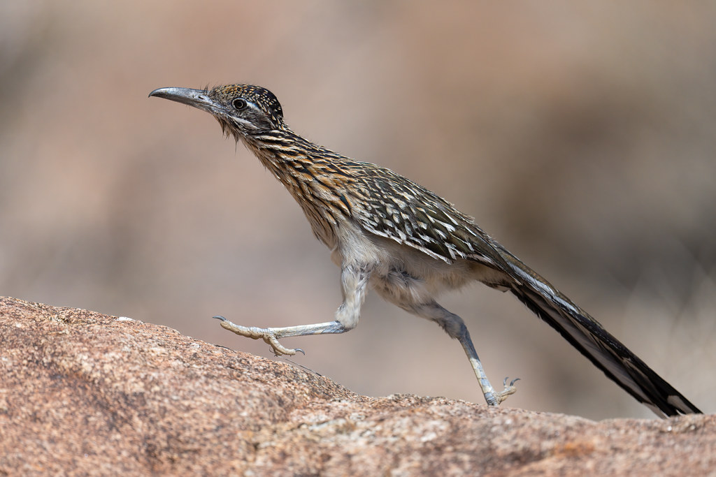
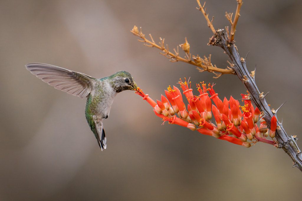
A couple more. The roadrunner tried to attack a dove and the dove got away.


 |
5/10/2022
Topic:
2022
Buford
|
dsefcik wrote:
...
Last milky way shot looks like the culp valley / pinyon campsite at the end of the road near the trail to pinyon ridge.
--
Correct. I've scouted that site out before for milky way shots, never got around to shooting there until last weekend.
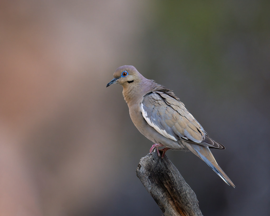
I usually try and get birds in flight instead of bird on a stick shots. I couldn't get the doves to cooperate. |
5/10/2022
Topic:
Alta Seca Bench
Buford
|
Brian wrote:
Buford wrote:
I am a little surprised the road was open, they sometimes close it due to weather.
I always check this page before I go.
https://www.fs.usda.gov/recarea/sbnf/recarea/?recid=81714&fbclid=IwAR0GW9delpT-LLXErehAP2YEXkFyHbYr4U-NhM4I3wc21SgP4g3fwiL0rys
The forecast for the storm that rolled through didn't call for any accumulation (although there was some), so that's probably why they didn't bother to close it.
How accurate is the site? I have found too often the USFS does not update road closures and have hit unexpected locked gates a few too many times. I imagine some districts are better than others at keeping the website up to date.
I can say the road to Toro is treacherous to even walk when it gets covered in ice. |
5/25/2022
Topic:
2022
Buford
|
@rockhopper nice cacti. They bloomed well this year, nothing else did that I saw.
@dsefcik I actually thought of doing the branch and swirly sand pattern in the wind. Bad, windy weather makes for really good timelapse conditions. |
9/11/2022
Topic:
Hi there!
Buford
|
Welcome! As someone else mentioned, there will probably be more posts as it cools off. Lots of people on here spend a lot of time in Anza Borrego. I haven't driven the old Coyote Canyon route but I've mountain biked it years ago.
A number of people on here have hiked many peaks in the area including 6582. I've only done Schad's route to 6582. It is a step up in difficulty from the standard Villager route. Imagine doing Villager from Clark Dry Lake up one of the ribs instead of the easy ridge trail. |
10/31/2022
Topic:
Indianhead North Ridge
Buford
|
Nice. The pictures definitely capture the terrain well. Great start to the desert season. That invasive fountain grass in the pictures is everywhere now. Sounds like the dirt road was open? It's been gated the last couple times I've been back there and was forced to park at the paved curve in the road.
I've done the route you just did and was also surprised at the amount of normal grass on the slopes. Kept it from being too loose but was slippery in it's own way. Another time I came up Henderson Canyon to the Palm Mesa high point, then traversed down to Indianhead hitting all the high points along the way before dropping down to Henderson again. |
11/9/2022
Topic:
White, Wee, Chimney Rock and Pines
Buford
|
Cool trip. I remember finding some big pinyon pines in that area too. No big cat prints or deer in the area?
I've been down to the waterfall mentioned in Schad's book. It was dry when I was there. Definitely can be a bushwhack in the canyon bottoms. |
11/9/2022
Topic:
Lucia and Alamo Canyon Rock House Ruins 2-3 day BP
Buford
|
Nice work. Definitely looks worthy of exploring. Lots of cool artifacts you guys found. Good to see the lone hiker still has the port and starboard tape on the trekking poles.
Always sketchy leaving a car there even for a couple hours. I only know about the two parking areas already pointed out. |
11/21/2022
Topic:
Bighorn Canyon, 3,567 Peak and Guzzlers
Buford
|
That is a fun hike. I remember the cholla garden coming off the peak down to Blue Spring well. I have not been up the Bighorn drainage, it looks worth exploring. I did a double take with the gloved hand and the register, I thought those were my pictures since I wear the same gloves 
The guzzlers used to be monitored and maintained by volunteers and park employees. Volunteers were supposed to check their "adopted" guzzler occasionally. The park has been short staffed for a while. Don't know how much effort the park employees have put into maintaining the guzzlers and how much they care about them per the UT article among other things. The state park, DFW, and other agencies are all separate and may not all be working towards the same goal. Many volunteers are now unwilling to work with the park due to changed rules for volunteers. The park has also been less than responsive when informed of issues.
Guzzlers have parts break from being out in the elements. Things can clog, float switches freeze open, catch matts get blown away, and many other problems. This could cause one tank to be full and another empty even though they are in close proximity. I don't know which guzzlers got helicopter drops this summer.
There was a part time job opening available earlier this year to monitor the guzzlers for DFW. I don't know if they filled it. If anyone is interested I can try and find the link again.
I am pro guzzler. They are replacing water sources and making areas inhabitable to make up for what we have destroyed. What about all the ranches that tapped historic sheep sources dry? What about the golf courses, farms, windmills, and houses moving onto sheep habitat? |
11/23/2022
Topic:
Bighorn Canyon, 3,567 Peak and Guzzlers
Buford
|
Rocko1 wrote:
dsefcik wrote:
pre pandemic gary and i were the monitors for the sunset mtn guzzler but always checked in on the blue spring, nolina, pinyon and harper guzzlers. ditto what buford said, floats go bad, pin holes develop, wind pulls apart plumbing, etc. harper was the only non functioning guzzler i was aware of as of 2021. park officials started requiring covid vaccines, finger printing, background checks, etc for volunteers so gary and i resigned as volunteers.
Yeah, ludicrous. Worth emailing anyone about non-op guzzlers or is it a waste of time?
Per the UT article, the park may or may not care but CA DFW will care.
I would let the park know. I don’t know who to contact at the park.
I would contact CA DFW. They have an interest in guzzler condition. CA DFW is responsible for sheep recovery and monitoring. The guzzlers are a big part of that. |
12/11/2022
Topic:
Elephant Benchmark
Buford
|
Cool trip report. That area is unique. Starfish cove looks interesting, never been there. Any sign of the rest of the bighorn skeleton, or was it just a lower leg?
We found the biggest elephant tree in a side canyon coming down off Elephant BM. |
12/16/2022
Topic:
Hapaha Flat Thanksgiving Weekend
Buford
|
Very nice. Good to see all the sand verbena in bloom already. I'd be almost afraid of all the vehicles in Fish Creek in a holiday weekend as black friday. Do most stop well short of Hapaha flat?
I can't believe how many points you find. |
12/16/2022
Topic:
Salton Sea to Lake Cuyamaca-SDTCT
Buford
|
That is a lot of miles but some cool scenery. Inspiration Point is one of the best places to watch storms spilling over the Ysidro range and onto the desert floor.
I too am surprised about going all the way up to the top of the Jasper Trail and coming back down Grapevine instead of cutting across the badlands from Arroyo Salado to the Texas Dip and through the narrows. |
12/20/2022
Topic:
2022
Buford
|
I don't know why but LightRoom keeps messing up my flickr that is used to host images. It breaks the old photo embeds. That is why old posts sometimes don't have all the images anymore. I don't know which photos some had originally so I won't fix it.
Here are some new images:


edited by Buford on 12/20/2022 |
12/21/2022
Topic:
2022
Buford
|
Brian wrote:
First pic looks like Middle Willows? Rocko1 and I did a very wet traverse through there last year.
That would be correct. Trail looked pretty well trimmed. Water is currently flowing all the way out to the citrus orchards at the end of the pavement. I didn't feel like wet feet so didn't go any further.
The sand verbena and stars shot was just enough breeze for the flowers to be too blurry. I was trying to get the flowers sharp and the stars as out of focus balls. |
12/31/2022
Topic:
2022
Buford
|
tommy750 wrote:
NIce pics Buford! Really like the BW of the ramp. A review of the Nikon P1000 popped up in my youtube feed and I thought of all your bird pics. Not sure how good it is but sure looked like fun. Thanks!
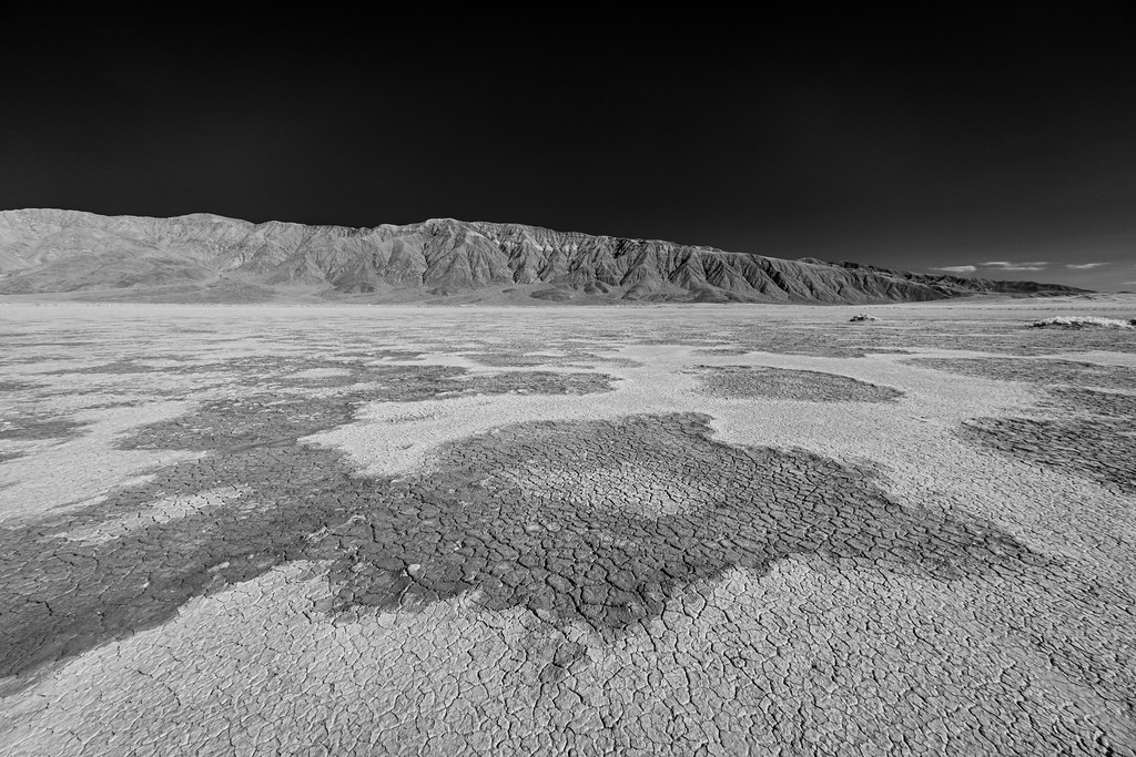
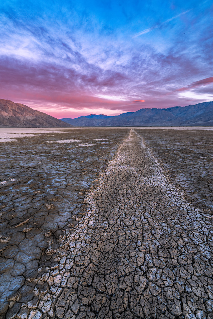
Thanks. That is an IR image of the ramp in black and white. I hiked across Clark Dry Lake to find some interesting patterns. I had to avoid the car doing donuts on the lake bed mid day.
I have no idea if the Nikon P1000 is good or not, but I can say the hobby is expensive if you get hooked.
I will start a new thread for 2023 photos. |
12/31/2022
Topic:
Stone Circle
Buford
|
Nice. The narrow gauge rail is really cool. |
12/31/2022
Topic:
Grapevine Mountain
Buford
|
It sure gets cold down there along the 78 from Scissors all the way past Tamarisk Grove.
I've only done the PCT route. I also hit up false Grapevine just to the south.
All the wire and wooden posts are usually the original surveyors equipment from when the BMs were placed. |
1/10/2023
Topic:
first desert weekend of 2023
Buford
|
Very nice. Funny how the stuff on the slot memorial keeps changing over the years. The dropoff is supposed to be one way, downhill to prevent it from getting all torn up. Just like the Diablo Dropoff. Doesn't mean there are any signs or that people would follow the posted signs anyway if they existed.
The UT just had an article that featured the Carrizo Gorge Pictos. |
1/10/2023
Topic:
2023 ABDSP and surrounding areas
Buford
|
New year, new thread.
New shots from Sunday, no prizes for guessing the location:


6582 just after dawn


An old picture from a couple years ago. I just had it printed 12x18" on acrylic and hung it on the wall last night. It looks amazing with the bird printing larger than life size and crystal clear.
edited by Buford on 1/10/2023 |
1/11/2023
Topic:
first desert weekend of 2023
Buford
|
Brian wrote:
Buford wrote:
The UT just had an article that featured the Carrizo Gorge Pictos.
I saw that article. They were talking about how the train would disturb the serenity of the "Solstice Cave" (pretty sure they meant the Blue Sun Cave since the Solstice Cave is nowhere near the tracks) and then had a picture of the Carrizo pictos which is neither of those things.
I noticed the same thing about the article and locations. I was actually there the day the photo in the article took place at Carrizo Gorge Pictographs. I happened to be hiking by as Ernie Cowan and the Native American group was wrapping up their visit. I briefly talked with Ernie.
I even saw a Subaru make it to the end of the road and back without damage, though a couple times it only had 3 wheels on the ground slowly crawling along as I followed. |
1/12/2023
Topic:
2023 ABDSP and surrounding areas
Buford
|
Thanks. Easy morning when the clouds look like that. The key is not to sleep in too long when it is cold out. Only hard part is finding the interesting parts of the lake bed in the dark.
I messed around with some in black and white too.
 |
1/16/2023
Topic:
2023 ABDSP and surrounding areas
Buford
|
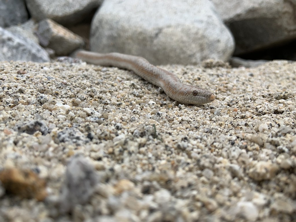
Cell phone shot. Didn't expect to see a rosy boa out in January.
 |
1/25/2023
Topic:
Any flowers or blooms showing in Anza Borrego yet?
Buford
|
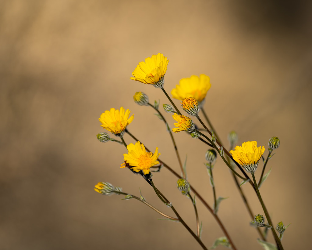
Things have been blooming since November from the fall rains. Lots of verbena, primrose, poppies, and desert sunflowers. It looked like the winter bloom was actually winding down a couple weeks ago with stuff going to seed. Spring bloom may just be getting growing. Everything was green a couple weeks ago. Despite all the rain in the city, not sure how much made it to the desert floor. Don’t know how good spring will be. |
1/27/2023
Topic:
Any flowers or blooms showing in Anza Borrego yet?
Buford
|
surfponto wrote:
Buford wrote:
Things have been blooming since November from the fall rains. Lots of verbena, primrose, poppies, and desert sunflowers. It looked like the winter bloom was actually winding down a couple weeks ago with stuff going to seed. Spring bloom may just be getting growing. Everything was green a couple weeks ago. Despite all the rain in the city, not sure how much made it to the desert floor. Don’t know how good spring will be.
Great thanks,
Just got back from the southern area and there were a lot of Sand Verbena, primrose in some of the washes.
Unfortunately i lost my phone with all my pictures near the Vallecito Creek turn off on my way out. 😫
it was a crazy trip, saw two overturned 18-wheelers off the 8 near the Tecate divide on my way out and then dropped into Ocotillo to find hundreds of semis parked along the S2 waiting out the wind.
Going to head out again tomorrow for another phone search but I think it is futile at this point.
Windy!
Yeah, the verbena and primrose were still strong. The sunflowers and daisy's and other items had mainly already gone to seed a couple weeks ago in some of the washes I was in. Flowers are nice, flowergeddon is not. |
1/28/2023
Topic:
6582
Buford
|
Nice. Going up the gentler Rockhouse approach must take some of the sting out of that final climb. Still, no way it is easy. Is Rockhouse longer mileage wise?
Was the register there? It was in 2019 when I did 6582, but the recent report from Tekewin indicates it disappeared. |
2/5/2023
Topic:
Any flowers or blooms showing in Anza Borrego yet?
Buford
|
Definitely starting to see lots of people out there this weekend. I am probably going to avoid the usual flower spots at the north end of the park for a while.
Sand verbena and primrose were widespread. Sunflowers in some areas. Strange it isn't all that green in some of the flower fields. Other areas are very green. Hopefully no flowergeddon like a couple years ago. |
2/5/2023
Topic:
6582
Buford
|
Brian wrote:
Buford wrote:
Nice. Going up the gentler Rockhouse approach must take some of the sting out of that final climb. Still, no way it is easy. Is Rockhouse longer mileage wise?
Was the register there? It was in 2019 when I did 6582, but the recent report from Tekewin indicates it disappeared.
I think the mileage would be about the same as the traditional route IF one's vehicle could make it to the road end (which is pretty screwed up right now - we didn't see any evidence of recent tire tracks for about the last 1.5 miles). Since I parked in my usual spot at the Rockhouse/Butler split, our route was 6 miles longer than the traditional route (but those extra miles are essentially road walking).
We didn't find any register. We might have spent more time looking if not for the persistent blasts of cold wind that were encouraging us to get on our way.
That definitely looks like a more efficient route than Schad. I think part of the point of Schad's route is to take you by the Corp BM area and explore the canyon on the way up.
Cool bighorn find.
I have always been able to get my vehicle to the end of the Rockhouse Truck Trail even when it is in bad condition. However, it is not any quicker than walking. |
2/5/2023
Topic:
2023 ABDSP and surrounding areas
Buford
|
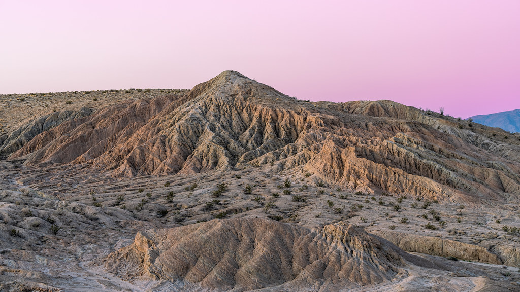
New shots, nothing great...


 |
2/5/2023
Topic:
6582
Buford
|
Brian wrote:
Buford wrote:
I have always been able to get my vehicle to the end of the Rockhouse Truck Trail even when it is in bad condition. However, it is not any quicker than walking.
I remember seeing your truck parked at the end one time last year when it turned out we were both exploring different areas that started from there.
The weird thing about the last section of road now is that there are spots where I can't tell where the road is supposed to be (along with spots where I know it used to be somewhere else but now has a new route).
I have driven to the end about a half dozen times. First experience was with one of the old timers in the dark. A number of the times have actually been in the dark. The road always changes depending on the last flood. I have full skid plates plus rock sliders and definitely have used them there. Sometimes there are branches of the road that eventually meetup and it is not clear which is "official."
From what you have said, I am surprised more people don't do 6582 via Rockhouse instead of the Schad route. I have been on the ridge between Rabbit and 6582. It got brushy really quick north of Rabbit. |
2/9/2023
Topic:
White Whale/Pinyon
Buford
|
Well done! Hiking in desert snow is magic. |
2/23/2023
Topic:
Indian Canyon
Buford
|
Very nice. That is one way to access the Palm Mesa area I’ve always been curious about. Always worried about the brush. I’ve seen the old maps showing the trail up.
Boulder alley was a mess in December. About as bad as it has been in the last couple years. I was able to drive over and almost no one was in Collins Valley which was really nice. However, all the road grading equipment was parked at the bottom and the road leading up was just graded. They must have just graded Boulder Alley right after. It was definitely not Subaru passable then. I have mixed feelings about how accessible they have made it the last couple years. |
8/27/2023
Topic:
Trail Cam from long ago.
Buford
|
Usually the game cameras set by the park have etched on them "property of CA State Parks" or something similar from a couple I have stumbled on.
State park ones are usually locked with a cable lock, and many in ABDSP have the same key. |
11/19/2023
Topic:
Crowds
Buford
|
Oh yeah. It has been getting more and more crowded over the last 10 years or so. If you go off the beaten path you can still find places without people. You used to be able to do that on seldom used roads, now you have to do it on foot. Peak bagging is increasingly popular too.
They have been improving roads like Calcite Mine and Boulder Alley. They have been adding fire rings to the primitive camps like Culp Valley and Arroyo Salado. I heard rumors they may start charging for those too if they haven't already. They have been charging to camp at Sheep Canyon for a while now.
Too many people, not enough outdoors. |
12/17/2023
Topic:
Sad News about Anza Borrego
Buford
|
Every time there is a lot of rain the road into Collins Valley gets obliterated. My guess is the tropical storm did a number on the bypass a couple months ago. They always open it back up once the road is repaired. It doesn't make sense to close it to hikers, but probably easier to regulate. If you backpack up there chances are nothing will happen. Sometimes I think that road should stay closed and be hiking access only based on the behavior I've seen in Collins Valley.
More and more people were backpacking in Palm Canyon over the years. The human waste, toilet paper, fire rings, people chasing sheep for selfies, and number of search and rescue incidents in the canyon (not necessarily backpackers) probably caused them to say enough.
I don't agree with lot of direction that park is taking, but I don't see issues with most of this.
edited by Buford on 12/18/2023 |
3/11/2024
Topic:
My Retriement
Buford
|
Jealous of some of the wildlife you have there. Hopefully you get back out here.
As long as we don’t see you on the news with the headline “Florida man…”  |
3/11/2024
Topic:
Sandstone Canyon question
Buford
|
Isn’t there an “official” listing of all rock art in the park kept somewhere with locations? Obviously not public information though. I’d be curious what sites have faded away. |
3/12/2024
Topic:
upcoming? Rosa (looking for advice)
Buford
|
I've done Rosa twice, both times as a loop starting with Pyramid, Rosa, Mile High, and Villager once.
There is a well defined trail from just north of pyramid to where the red and green lines meet. The trail follows the ridge or just off it. From where the red and green lines meet, the ascent is completely off trail. I don't remember it being particularly bad. Just steep and rocky like the rest of the desert.
I believe there is an old native american trail that goes from your "trail to Rosa" mark to the green line, if you can find it. I can't remember exactly which saddle it connects to. |
3/13/2024
Topic:
upcoming? Rosa (looking for advice)
Buford
|
Good luck if you go for it.
I haven't done the yellow route on your map, can't comment on if it is better or worse.
Here is the approximate route I did both times. I took the miners trail from Palo Verde to Smoke Tree. If you don't do Pyramid, there is a native american trail that climbs from the the bottom of Smoke Tree on the west side of Pyramid and joins the ridgeline somewhere north of the peak before Marble. The benefit is once you gain the Pyramid ridgeline it is relatively easy going until the final climb to Rosa.
Don't know how all the old native american and miners trails have held up with some of the rain. Some were already hard to find and follow a couple years ago.
 |
26 days ago
Topic:
upcoming? Rosa (looking for advice)
Buford
|
Nice ram skeleton.
I don't see any exposure on the ridge, I see a trail 
It's been windy most times I've been up in that area. |