7/30/2013
Topic:
The Sound of a Turbine
tommy750
|
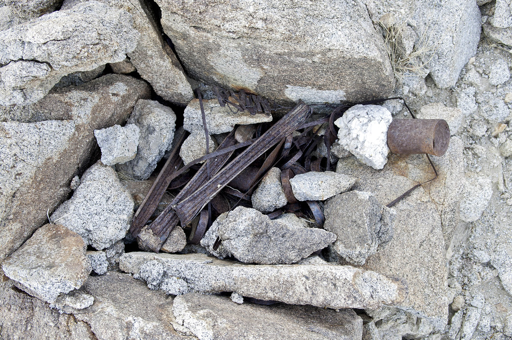
Decided to take a quick trip out to the desert before the sun set. Was driving up EC 109 toward Dos Cabezas by 7pm. Only about 95 and a nice breeze. Today was the first time I've ever stood underneath a turbine while powered up by a stiff breeze. Very disconcerting to say the least. Watch the video on your desk top with the sound up. It's really hard to imagine how loud it is. BTW, saw a semi with another turbine blade in tow somewhere up Dos Cabezas Road. Assuming another defective blade discovered? Tom
A lot of the turbines are back on line. Guessing about 50% or so.

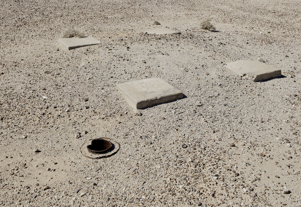
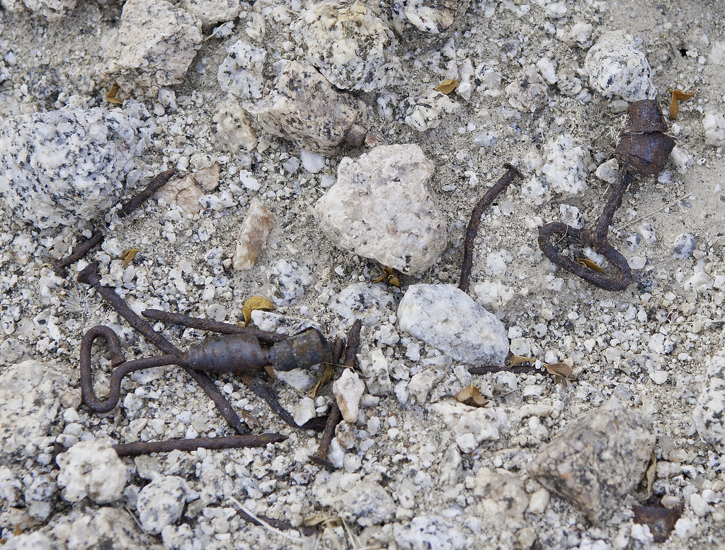
Wind Turbine by tomteske, on Flickr
Modern "sleeping circle" with not so great view. Saw it on Google Earth and assumed it was something old. Doesn't look like it's been used in many years and not visible from any roads.

Circle of Life by tomteske, on Flickr
This turbine is near Palm Canyon Wash where it crosses the railroad tracks but it could be any of them. Can't get this video to embed so here's the link:
http://www.flickr.com/photos/tommy750/9404234397/ |
8/21/2013
Topic:
Oldest North America rock art site identified
tommy750
|
Jim (ziphius) wrote:
http://www.livescience.com/38865-oldest-petroglyphs-rock-art.html
Saw that in the news. Very interesting. The actual article link with a free(pay wall of $31.50 for the full text article) abstract including pics/graphs is here: http://www.sciencedirect.com/science/article/pii/S0305440313002288
Kinda reminded me of the tufa petroglyphs near the Valerie Jean fish traps. Not aware if they've been dated but are obviously not nearly as old. C-14 dating of tufa is apparently very complex since it's not entirely composed of "fresh" atmospheric C-14. Thanks. Tom |
8/22/2013
Topic:
Oldest North America rock art site identified
tommy750
|
Jim (ziphius) wrote:
Slightly related, a 'new' photographic tool to create gigapixel images, applied to a petroglyph site in Texas. Based on stitching together high-resolution images, used by Mars Rover. The resolution is absolutely scary! Zoom in and find the petroglyphs, approximately just north and west of of the center of the area, in the 'warmest brown' region. Extensive number of glyphs! You can also zoom in on the scale / legend in the lower right corner to see how they obtained the imagery from the ground:
http://www.gigapan.com/gigapans/136529
I'm having a hard time figuring out the scale on the pic! Can't tell if I'm looking at boulders or pebbles. Also has a weird 3D effect presumably from the different times of day it was shot. Nice pic. Tom |
8/22/2013
Topic:
Bighorn Sheep Count 2013
tommy750
|
This may help out your Rattlesnake Canyon sheep, Daren. Few scattered thunderstorms just passed through after a horrible dust storm out here in the Valley. Tom
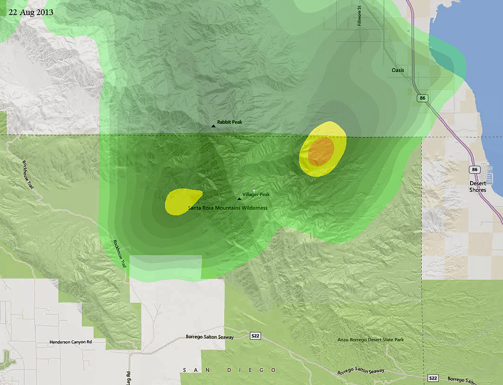
Rain by tomteske, on Flickr |
8/23/2013
Topic:
Bighorn Sheep Count 2013
tommy750
|
Nice lightning pics, Nolan! Finally got my tripod and camera set up as the storm passed so I got nada  Tom Tom |
8/25/2013
Topic:
Flash Flood Chasing
tommy750
|
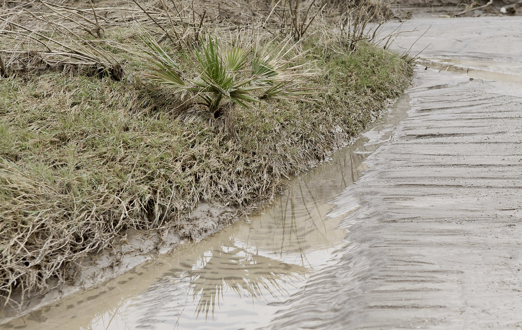
Now might be an excellent time to downgrade your expectations about this trip report! I'm just going to say it was a successful proof of concept. After seeing Daren's post about the flash flood chaser in Utah, thought this weekend might be an opportunity to give it a shot. The weather reports seemed to indicate Tropical Storm Ivo would dump 2-3" in the Colorado Desert area starting in earnest this afternoon. In comparison, Kathleen was 8-10" and completely devastating.

Ivo by tomteske, on Flickr
My friend Amy agreed to join me and we agreed on a very conservative plan with lots of contingencies. The first rule was no Fish Creek! Got out on S2 with no rain threatening so decided to swing down Canyon Sin Nombre and drive up Carrizo Creek into the canyon if conditions allowed. Saw lots of trash and broken bottles at campsites in Sin Nombre which I don't recall the last time out. Also this panel with some weird erosion and unfortunately, lots of graffiti.
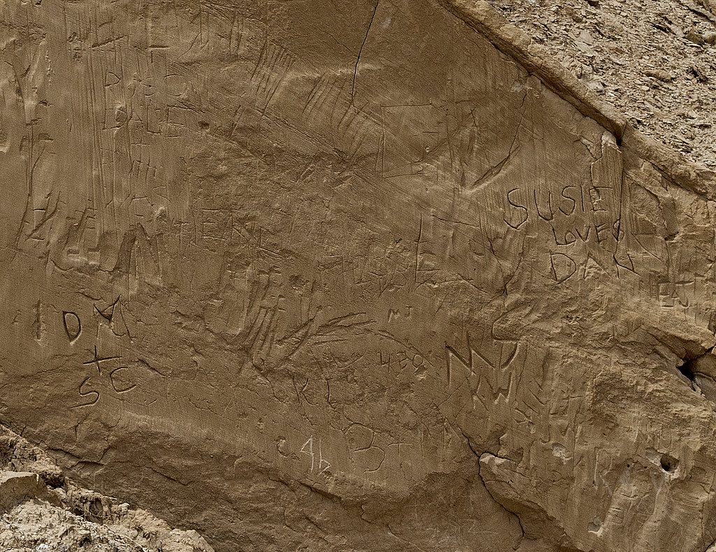
Historical Graffiti by tomteske, on Flickr
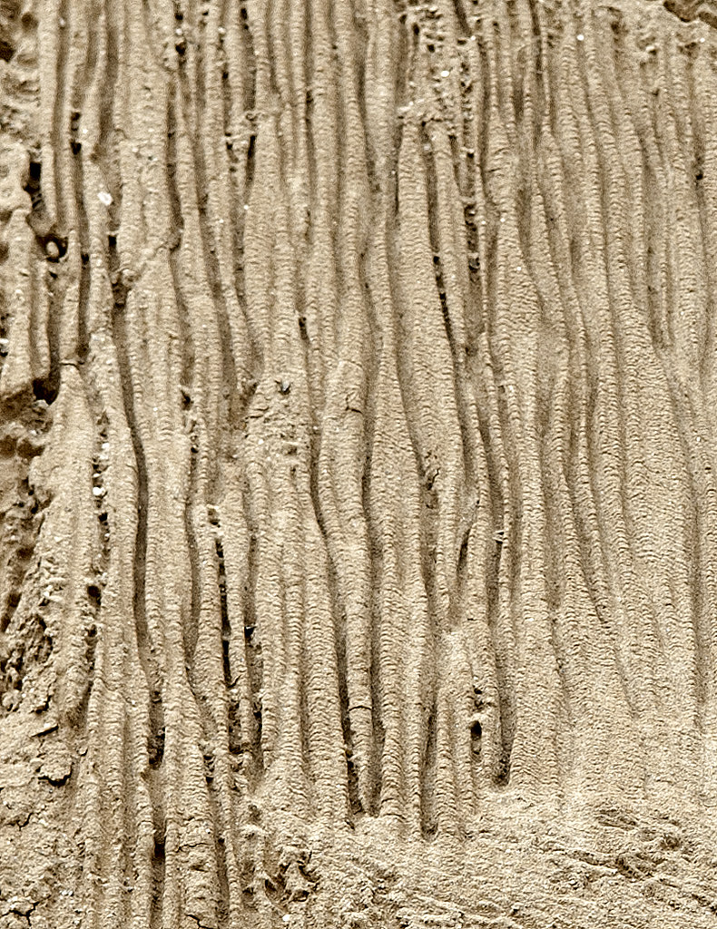
Drips by tomteske, on Flickr
Walked a few hundred feet up the main Sin Nombre slot canyon and on the way out was consternated to realize we'd both walked by this guy on the way in passing a couple of feet away. Not sure how healthy he was since I noticed zero movement after we stopped to gawk and after returning with my camera. Appears to be a Colorado Desert Sidewinder.
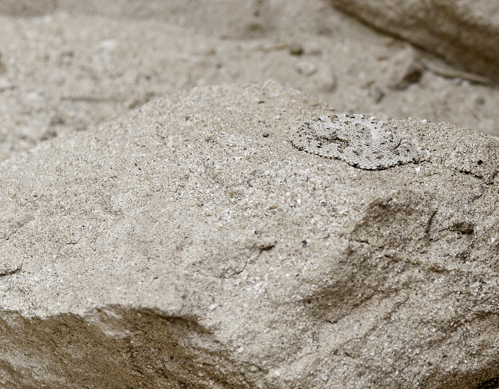
sidewinder2 by tomteske, on Flickr
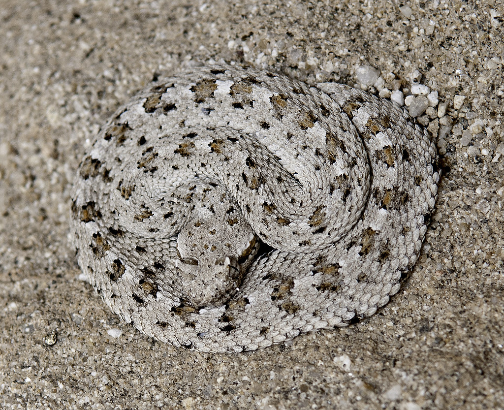
Colorado Desert Sidewinder by tomteske, on Flickr
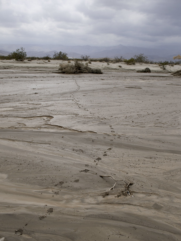
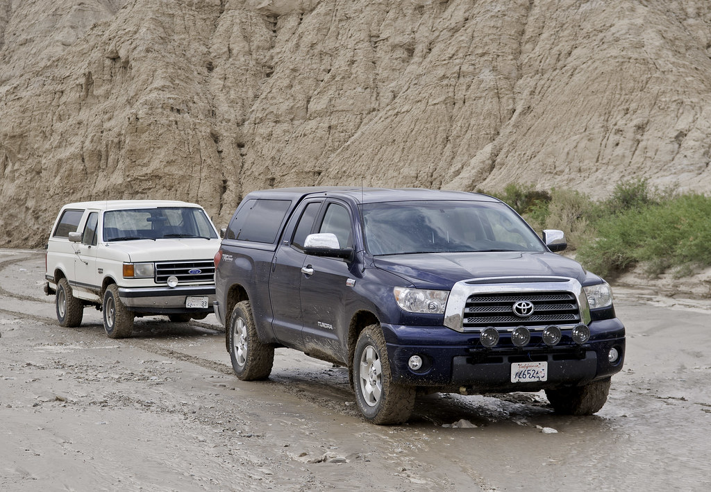
Made it into Carrizo Creek and only saw a couple sets of (ATV) tracks in the entire wash which as you know is rare. Actually, there were lots of tracks but they were animal. Looked like 1-2' of water had passed through in the recent past probably with Friday's storms.
Single Track by tomteske, on Flickr
Tracks by tomteske, on Flickr
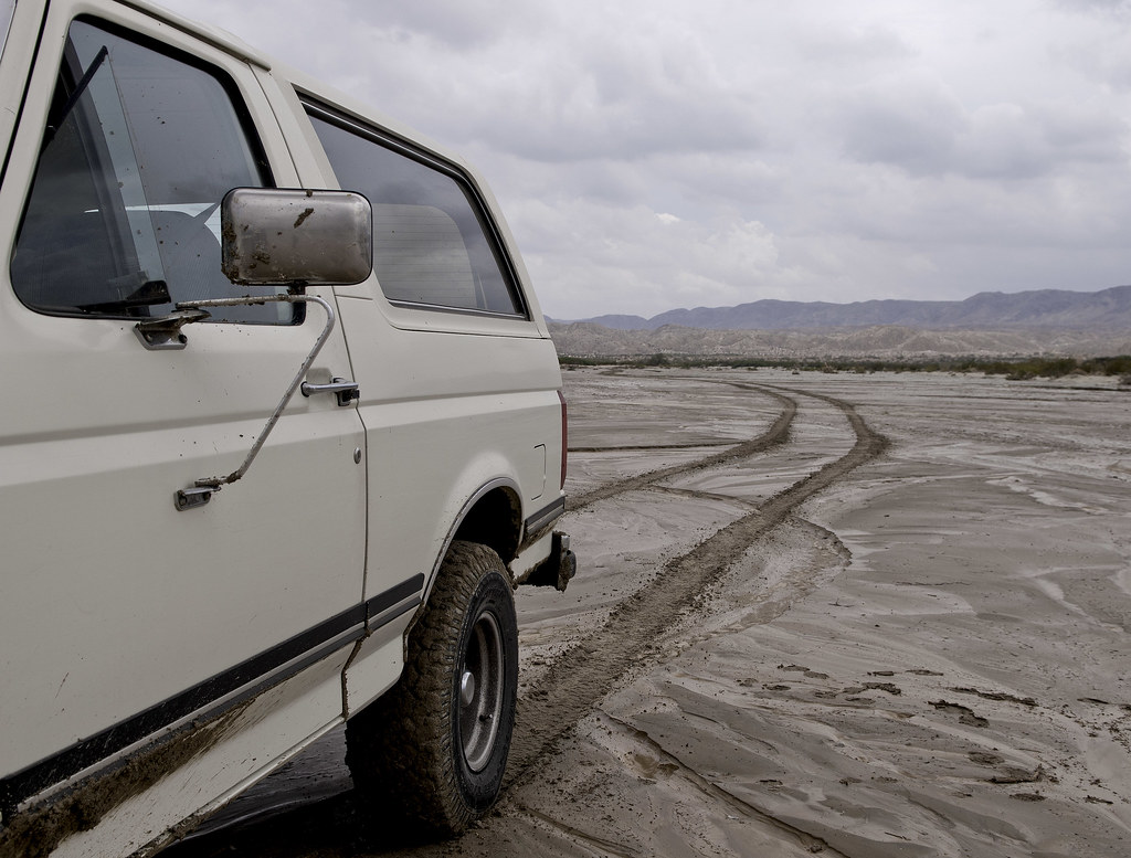
Two guys on ATVs. They had been down to the marsh and said the water was about three feet deep.
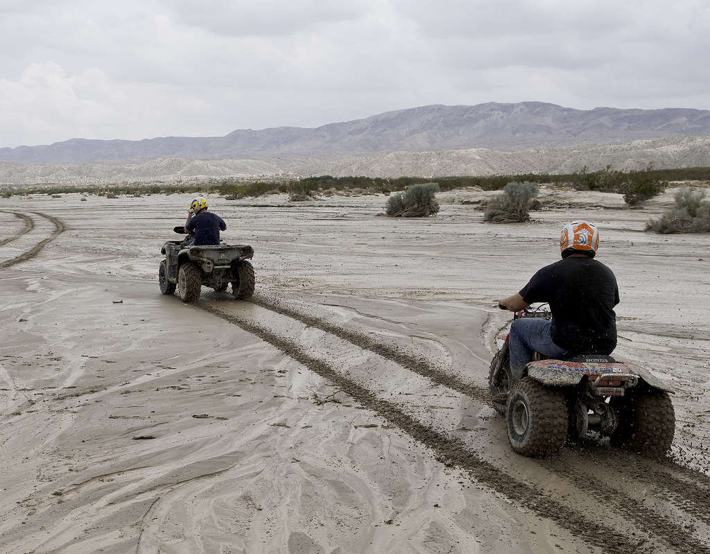
ATVs in Vallecitos by tomteske, on Flickr
Turned up Seco del Diablo and saw no vehicle tracks. Drove as far as the seep and decided to turn around.
The Seep at Seco del Diablo by tomteske, on Flickr
Up Seco del Diablo by tomteske, on Flickr
Seco del Diablo by tomteske, on Flickr
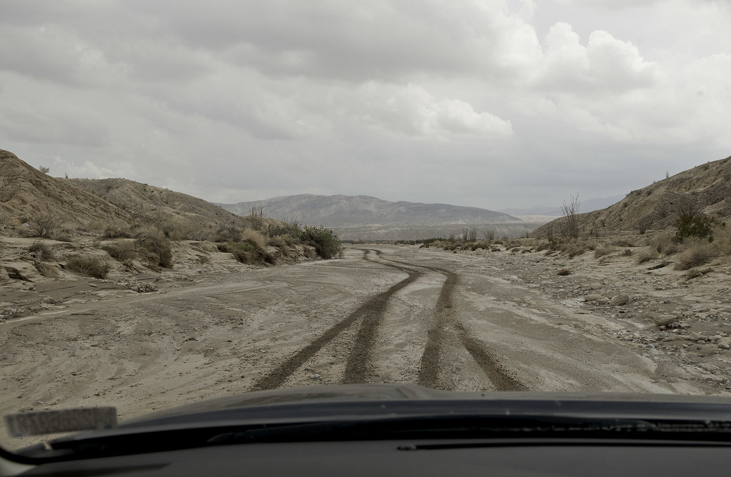
Ended up driving in Bow Willow Creek which wasn't exactly the best way towards S2 since there's usually lots of silt now interspersed with mud. Had a few dicey moments but no real problems. Took a brief drive down S2 and then into Carrizo Canyon. The sky was really starting to darken and rain was falling up canyon. Figured we'd drive up till it got rocky and wait to see if anything materialized.

Carrizo Wash by tomteske, on Flickr
We made it to the east fork and then it started to pour. Only lasted about fifteen minutes and pretty much stopped.
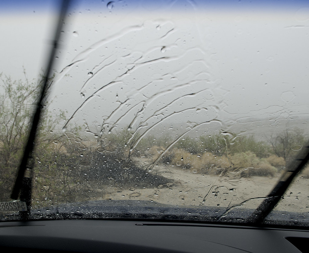
East Fork Downpour by tomteske, on Flickr
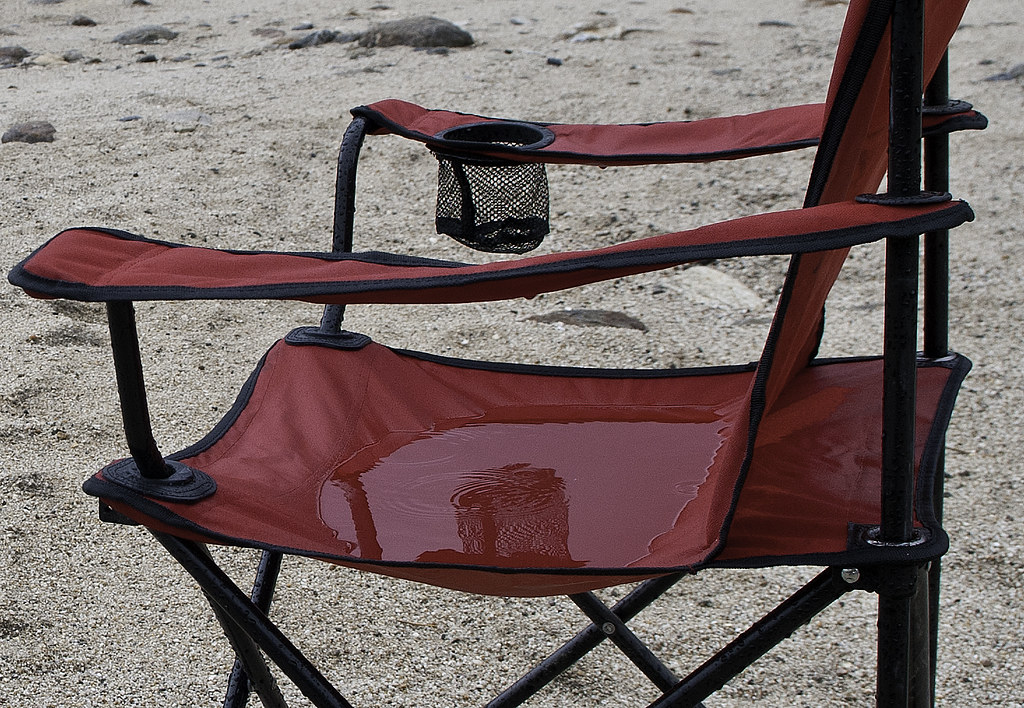
Chair Puddle by tomteske, on Flickr
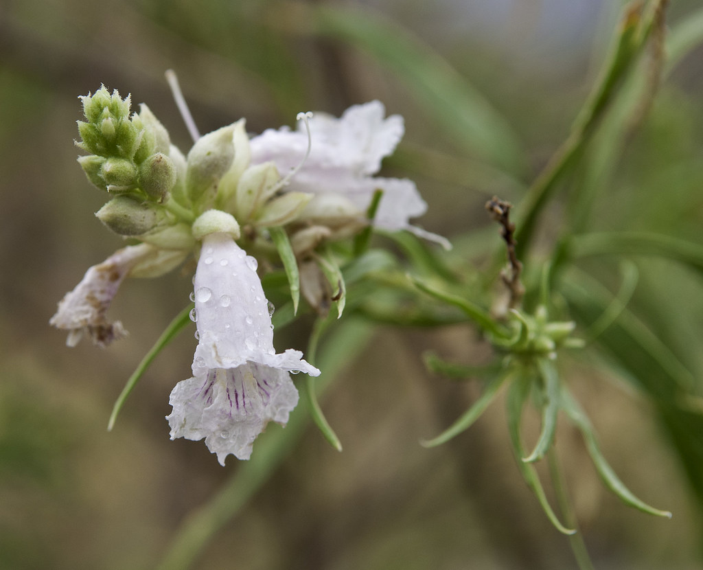
Blossum by tomteske, on Flickr
We decided to walk over to the deepest channel to see what if anything was happening and heard a familiar sound. Click the link to see the Carrizo Canyon Flood, er, some water 
http://www.flickr.com/photos/tommy750/9594588723/
Lake forming behind tamarisk branches
http://www.flickr.com/photos/tommy750/9594596385/
With the sky clearing and the sun peaking through, we knew the Great Carrizo Flood of 8-25-13 was not to be. But as always, was good being out in the desert again. Enjoy. Tom
Carrizo Sun by tomteske, on Flickr |
8/26/2013
Topic:
Flash Flood Chasing
tommy750
|
Jim (ziphius) wrote:
Great trip Tommy and I loved the video! Next time, bring one of those plastic toy army men with you and prop it up in your field of view for some scale perspective! What a flood!
Exactly! If we came up with zero video, were thinking of staging a shot with toy cars swept away by a gallon of muddy water |
8/26/2013
Topic:
Flash Flood Chasing
tommy750
|
surfponto wrote:
Great Trip Report
Funny looking at the satellite shot in first picture and then reading your account of what actually transpired.
Bummer about the trash in canyon Sin Nombre. Have not seen that before either.
Looks like my Land Cruiser will finally be back in commission next Saturday..fingers crossed
Been really missing going out to Borrego.
Been living vicariously thru you guys and your trip reports for the past few months.
Pretty hard predicting where the rain will fall! As soon as we left, El Centro, it started pouring there and the streets were flooded. 86 flooded, 78 flooded, Mexicali flooded, S2 and Carrizo not so much. Next time. Good to hear your Land Cruiser is ready to head out. Tom |
8/26/2013
Topic:
Flash Flood Chasing
tommy750
|
Nolan (anutami) wrote:
Nice summer trip! Did you have any problems in canyon sin nombre? There is that one tight section which was washed out last year and a bit rough and rocky.
Also, I am in need of some new tires for my rig and I think you have the BFG all terrains, how did they do in the mud?
We both made it through the tight spot without much trouble. Agree, some years are better than others in that area. Driving your camper through there sounds challenging! Haven't had any problems with the BFG ATs. They seem to do pretty well in the mud but I've never had more aggressive tires to directly compare them with. Have about 25-30K on this set and they're holding up well. Hope that helps. Tom |
9/1/2013
Topic:
Mountian Center Fire
tommy750
|
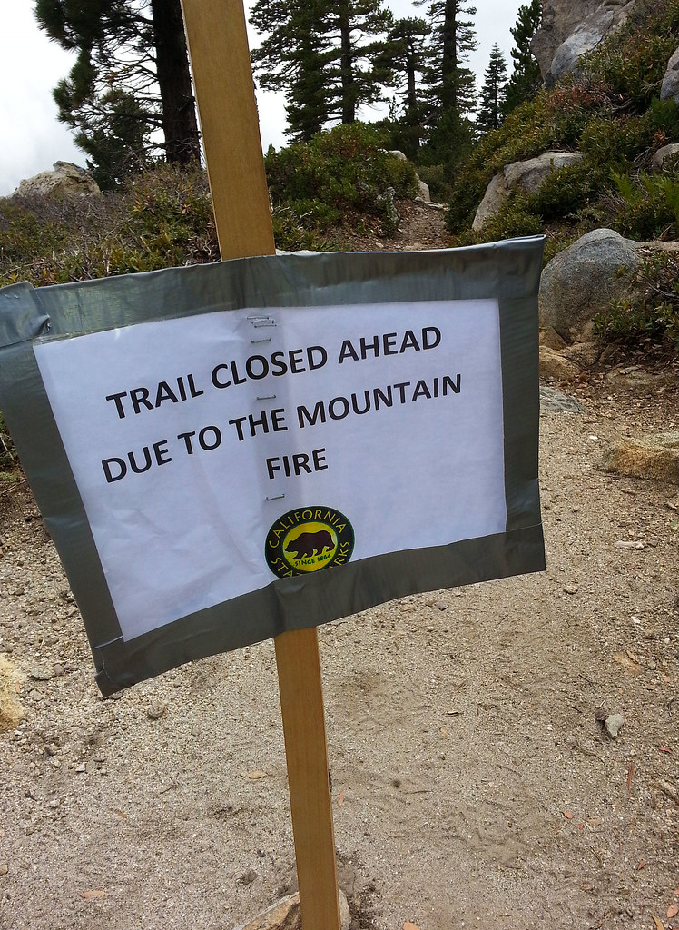
Did the lazy tram to Mt. San Jacinto hike yesterday with the girlfriend. The wilderness near Hidden Lake was closed because of the fire. Couldn't see any damage from the fire till Wellman Divide and it was hard to see since it was cloudy and pretty gray. Here's a couple cellphone pics from Wellman. Had to pump up the saturation so you could see the burnt areas.
Wellman Divide by tomteske, on Flickr
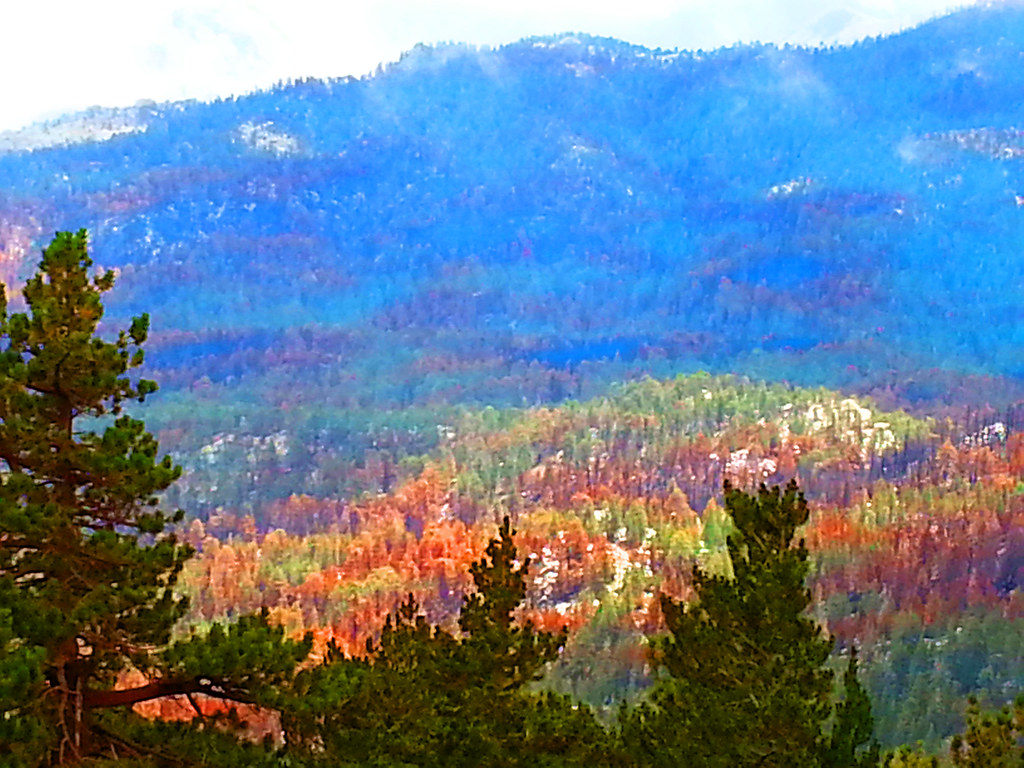
Wellman Divide2 by tomteske, on Flickr
Wellman Divide3 by tomteske, on Flickr
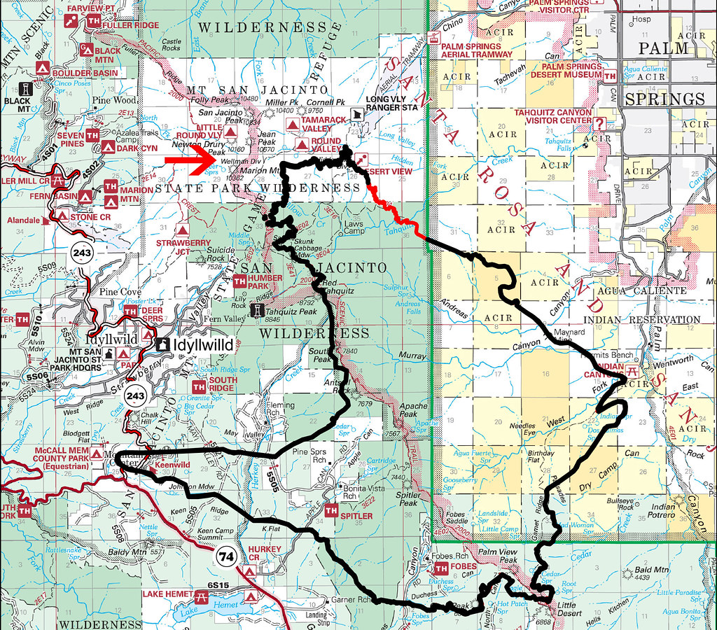
Here's the final perimeter map from calfire with the red arrow pointing to Wellman Divide.
Mountain Fire by tomteske, on Flickr
Here's the link to the State Parks emergency closure order from 8/28/13: http://pstramway.com/downloads/2013-State-Park-Trails.pdf Tom |
9/5/2013
Topic:
How many straws are drinking from the Colorado?
tommy750
|
Interesting video. The last straw is the All American Canal and it shunts 3.1M of California's 4.4M acre foot yearly allotment to the Imperial Valley AKA Colorado DESERT. We get to inundate our 500K acres of tillable Ancient Lake Cahuilla lakebed with about 5-6ft of water to ensure cows get their alfalfa. California's $1T economy jealously eyes Imperial Valley's $1B economy with all that water. Tom |
9/16/2013
Topic:
Quick Trip to Borrego Springs - 9/14-15/2013
tommy750
|
Was also out last weekend (near Blue Angels Peak and the border) and have to agree, things are looking pretty green. That's a mighty nice tinaja pic, Hikerdmb |
9/22/2013
Topic:
Forum Member Nolan in Truck Camper Magazine
tommy750
|
Great article Nolan. Saw your Death Valley pics. Girlfriend and I are headed there early Nov. for a week. Any suggestions on must see sites and camping spots? Was planning to hike Telescope Pk but the rest of the trip is open. Thanks. Tom |
9/23/2013
Topic:
Broke Down in Anza Borrego: Sept. 21st, 2013
tommy750
|
Nice TR. Remember taking my new scratch free Tundra through a short cut from Fish Creek to Diablo not knowing it was The Dropoff. Lesson learned! Glad you made it out okay. Tom. |
9/23/2013
Topic:
Whale Peak from the air
tommy750
|
Nice video. Makes you realize how much is still out there to explore. Thanks. Tom |
9/23/2013
Topic:
Forum Member Nolan in Truck Camper Magazine
tommy750
|
Thanks for all the DV suggestions! Sounds like a week isn't near enough time to really check the place out. Tom |
9/23/2013
Topic:
SCORE Comes To Imperial Valley
tommy750
|
Looks like Superstition and West Mesa are going to have more visitors shortly. Doesn't mention an exact course but 80 miles is a lot of desert real estate to cover. Tom
http://www.ivpressonline.com/news/local/score-international-race-to-come-to-imperial-valley/article_b7386c2a-234e-11e3-a667-001a4bcf6878.html?mode=jqm |
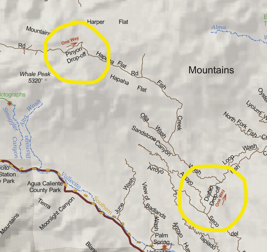
9/29/2013
Topic:
Upper Fish Creek
tommy750
|
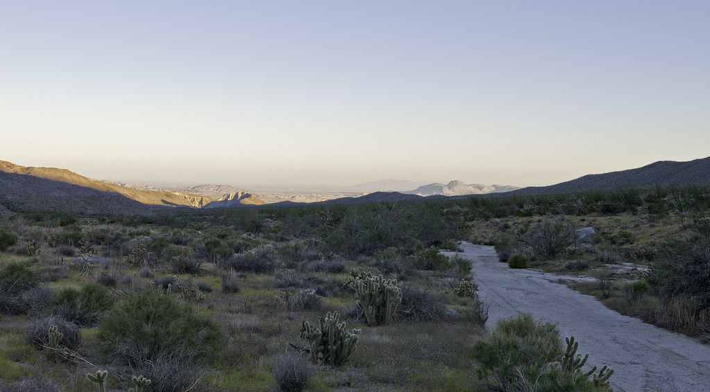
Wanted to see if we could make it all the way to the Pinyon Dropoff yesterday. Only made it to Hapaha Flat where it descends into Pinyon Wash before getting the "it's way past turn-around time" evil eye from my driving buddy. We started at Plaster City so it was already over 50 miles off road. Passed the ranger near Elephant Knees and he said there had been seven flash floods in the last couple months. Really green in Olla Wash and Hapaha Flat area. Lots of flowers, insects and grasses. Fish Creek above Olla Wash was much smoother than I recall but still had some large rocks in areas that added a few more scrapes to the Tundra underbelly. There were no tire tracks past Dave McCain Spring with the road a channelized stream bed.
Olla Wash Ocotillos. My friend Amy noticed the ocotillos are really straight and vertical or really convoluted. Some genetic difference? Who knows.
Olla Wash Ocotillos by tomteske, on Flickr
Upper Fish Creek tight spot.
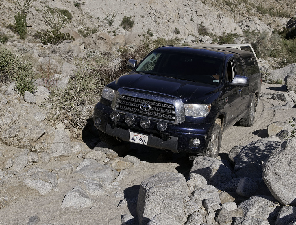
Upper Fish Creek Squeeze by tomteske, on Flickr
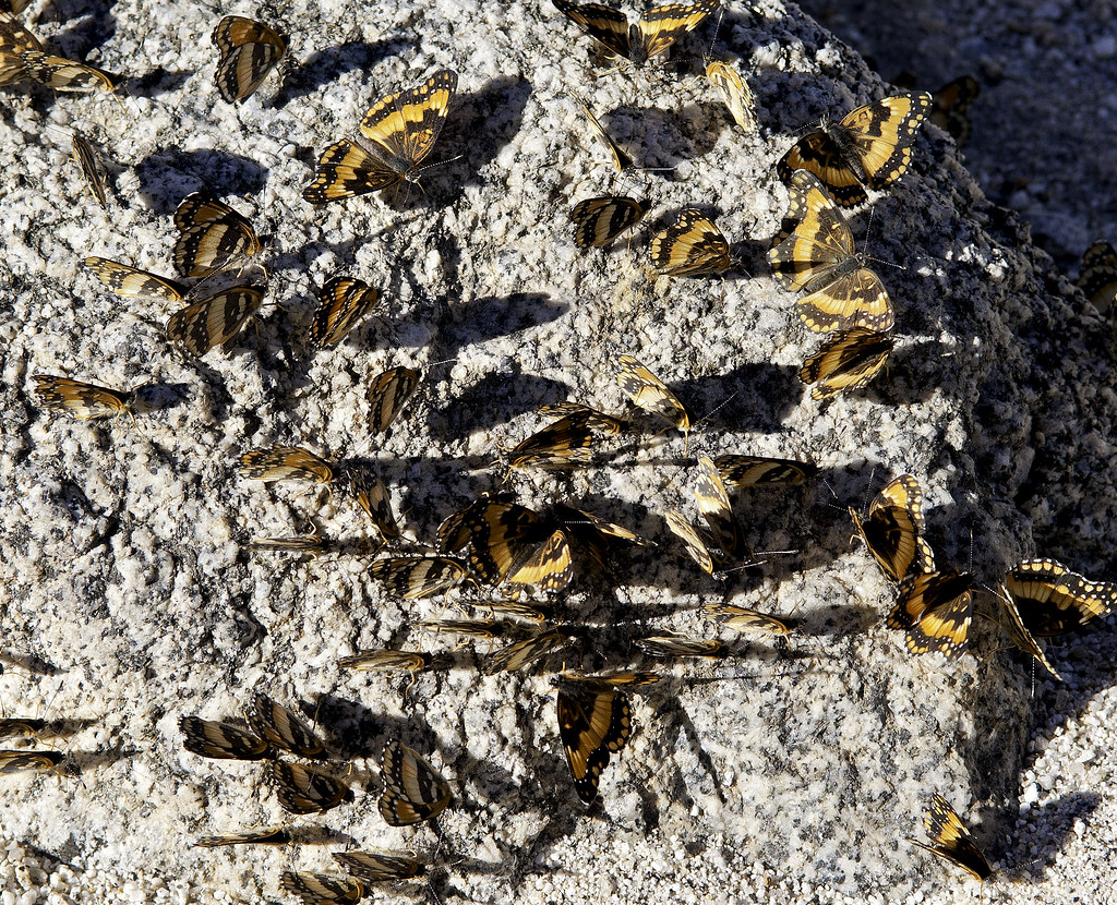
Right next to the road, a rock seemed to have a strange motion. Not sure why that rock was special but you'd think the zillion lizards out there would have found it.
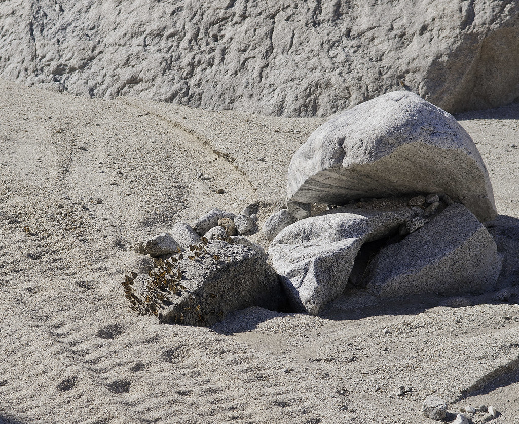
Butterfly Rock3 by tomteske, on Flickr
Butterfly Rock by tomteske, on Flickr
Still a few faded glyphs at Split Rock.
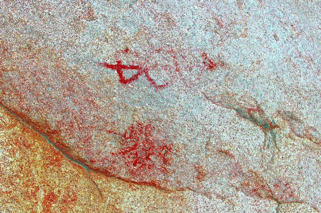
Split Rock Picto_yrd by tomteske, on Flickr
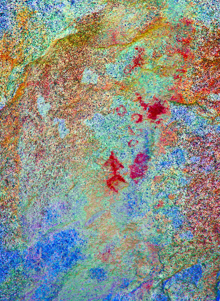
Split Rock Picto2_lxx by tomteske, on Flickr
Not sure if this is a picto or a historical graffito in the bottom center.
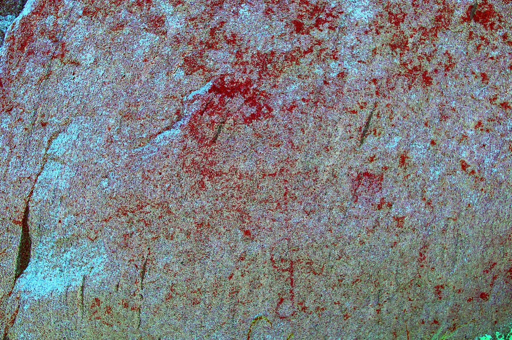
Split Rock Picto3_yrd by tomteske, on Flickr
Caterpillar.
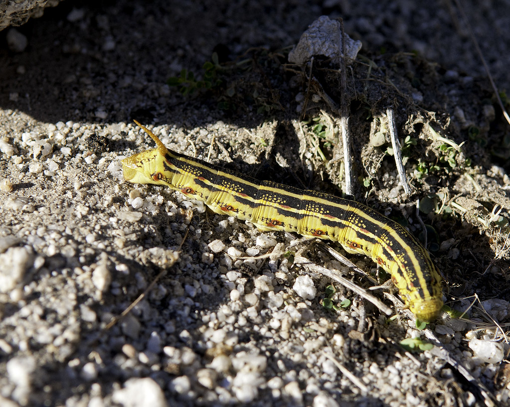
Catepillar by tomteske, on Flickr
Heading home. Enjoy. Tom
Few more pics at: http://www.flickr.com/photos/tommy750/sets/72157636002082846/
Hapaha Flat2 by tomteske, on Flickr |
9/29/2013
Topic:
Upper Fish Creek
tommy750
|
DesertWRX wrote:
2 days ago we drove up to the intersection of Olla and Fish Creek. Could not see any tire tracks going up Fish Creek. Nice to see your pictures!
Yeah, we drove right into Olla by mistake since most of the tracks headed that way. Glad to hear you we're out there. Really pretty now. Tom |
9/29/2013
Topic:
Upper Fish Creek
tommy750
|
Looks like that rocky step left an impression on a lot of us, Nolan That was actually the only real tough spot since a few of the boulders were a little too large as you know! Had to do some rearranging to get by. Were you able to get through the winding canyon upstream with your camper? Those vertical walls looked like a tight squeeze. Thought further upstream was better than last year since a lot of the melon sized rock had been covered up by a layer of sand. Temps were mid-upper 80's but dropped to 70 at dusk at Hapaha Flat. Tom |
9/30/2013
Topic:
First trip of the season
tommy750
|
We drove up EC 085 earlier Saturday morning and unless you were in 4WD, there's no way you could have made it. My PU immediately dug in while crossing one of the first washes while in 2WD. There were some areas of deep silt further up. Think you chose wisely. BTW, if heading out to the desert from SD on I-8, EC 085 from Plaster City to Split Mt Rd. is a 25 mile "shortcut" that's a nice change from S-2 or 79. Tom |
9/30/2013
Topic:
Upper Fish Creek
tommy750
|
Jim (ziphius) wrote:
Very nice Tom! Those are California Patch butterflies! Quite the mysterious aggregation on that one rock. I forget what the caterpillar is... my girlfriend and I saw many of them in the Oriflamme Canyon area last week. Apparently, the natives ate 'em.
edited by ziphius on 9/30/2013
Found it, the White Lined Sphinx Moth caterpillar. Internet is amazing. Would assume eating those is an acquired taste. Thanks for the butterfly ID. Agree, seemed weird seeing all of them on that rock. Maybe someone dumped out their coke or beer there Tom |
9/30/2013
Topic:
Upper Fish Creek
tommy750
|
surfponto wrote:
Ditto
Butterfly shot is great and the Ocotillo look amazing.
Way to put that Tundra in a hairy situation Tom..
dsefcik wrote:
........ I wish had time to get out there right now....
edited by surfponto on 9/30/2013
Sounds like you guys are in need of a vacation! Tom |
10/1/2013
Topic:
First trip of the season
tommy750
|
DesertWRX wrote:
I was hoping the rains would have hardened up the silt sections!
Already some pretty silty stretches but overall, thought it was in really good condition. |
10/11/2013
Topic:
Blair Valley & Cool Canyon
tommy750
|
Great trip report. Those butterflies are amazing. That spot on Pinyon Mt Rd looks worse than ever. Have made it through with my Tundra once but usually stop there and hike. Tom |
10/11/2013
Topic:
Culp Valley to Coyote Canyon & Kane Springs Road
tommy750
|
Nice trip! Did you see anything at Harpers Well or Kane Spring? Tom |
10/11/2013
Topic:
Let the season begin
tommy750
|
That spider looks scary. Probably getting lots to eat with all the bugs out. Glad it's that time of year! |
10/12/2013
Topic:
Davies Valley To BM Kirk
tommy750
|
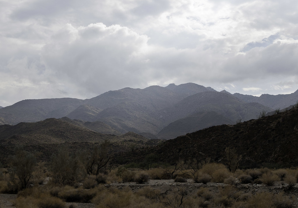
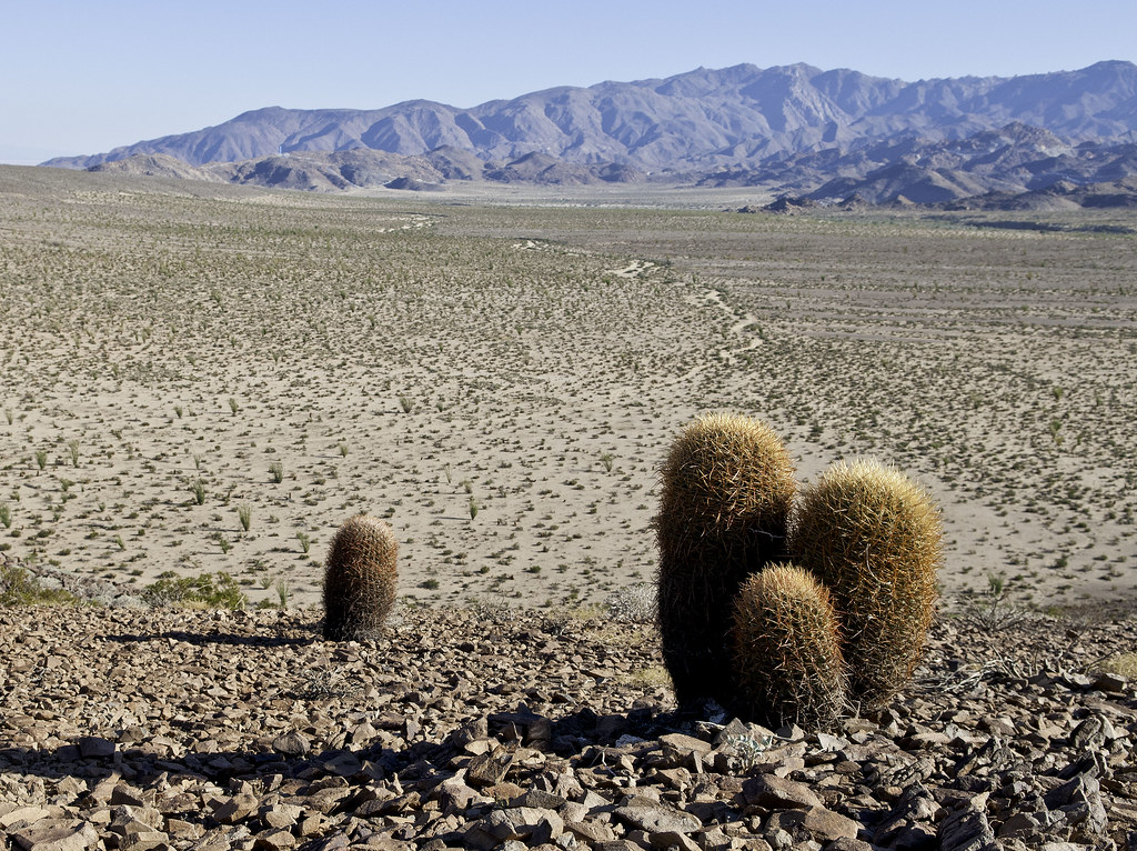
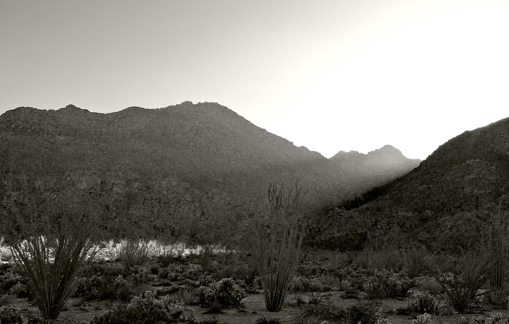
This is my third trip through Davies Valley. It is an amazingly quiet place. Have yet to see a single person there including BP (there are helos occasionally). Decided to head south toward a prominent volcanic hill where one has a commanding vista south toward Pinto Canyon and Mexico and north toward Carrizo Mt.
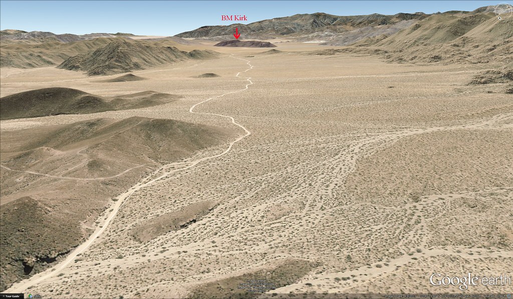
Davies Valley GE by tomteske, on Flickr
The two SUVs are still at the northern end of the valley.
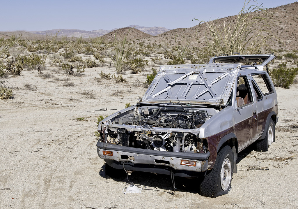
Davies Valley SUV by tomteske, on Flickr
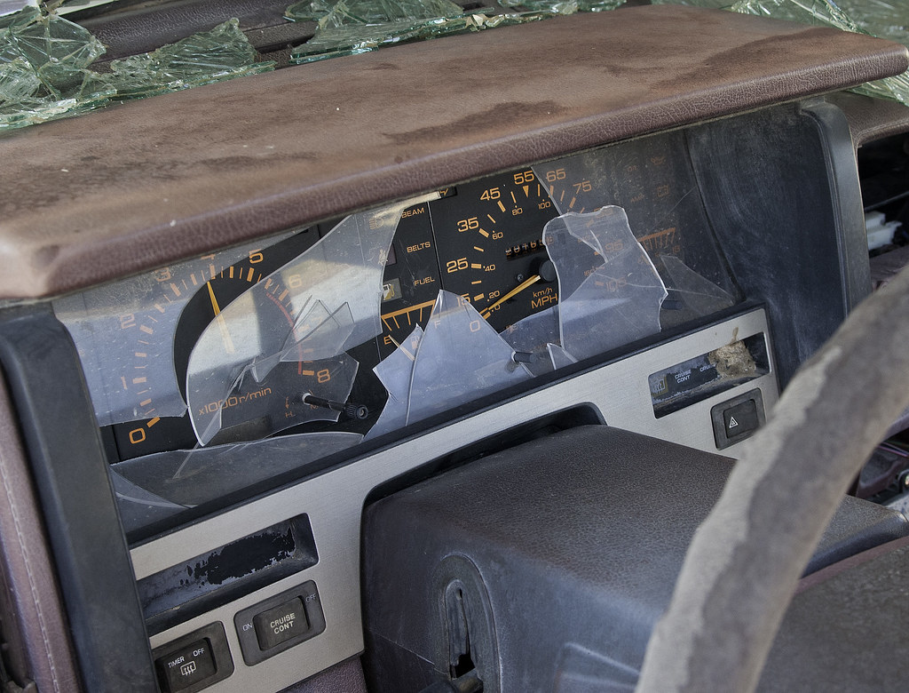
3800 RPMs by tomteske, on Flickr

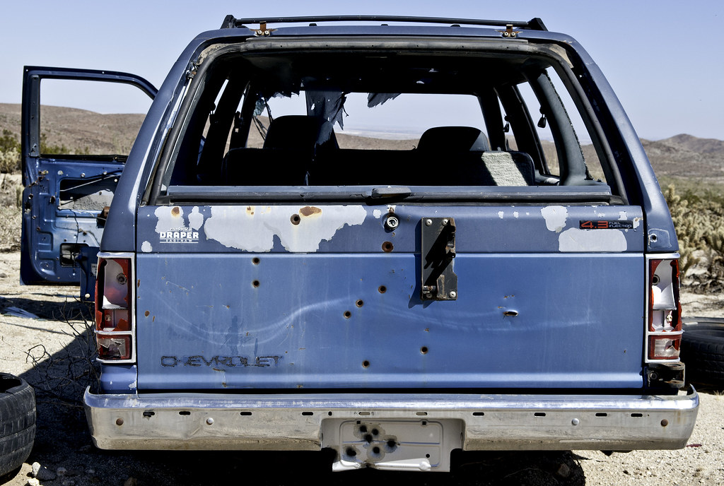
Blazer in Davies Valley by tomteske, on Flickr
Draper Chevrolet is still selling cars in Saginaw.
Draper Saginaw by tomteske, on Flickr
Topo map shows an old well in the middle of the valley.
The Well by tomteske, on Flickr
An isolated pile of rocks with the only remaining water from the rain earlier this week.
Mortero Mojado by tomteske, on Flickr
Few sherds nearby.
Sherd at Mortero Rock by tomteske, on Flickr
On top.
North Davies Valley by tomteske, on Flickr
Couple of rock circles on top. Not sure how old they are.
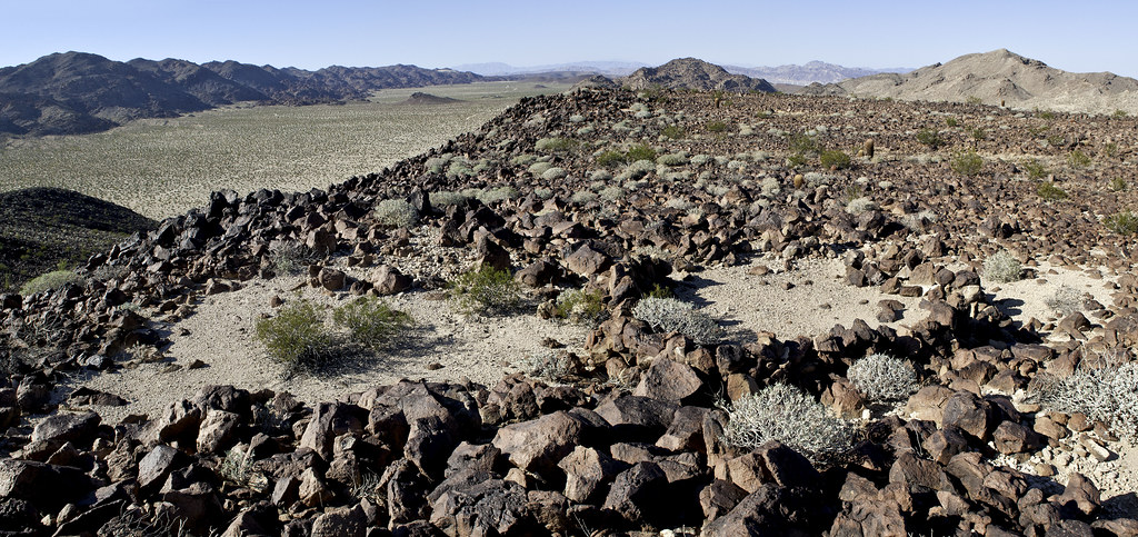
Rock Shelters Near BM Kirk by tomteske, on Flickr
BM Kirk.
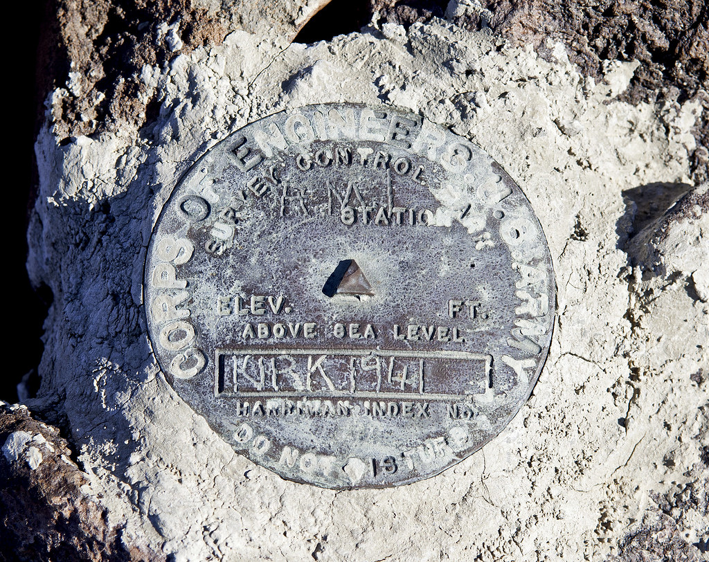
BM Kirk by tomteske, on Flickr
Looking south toward Pinto Wash and Mexico.
South Davies Valley3 by tomteske, on Flickr
Rock enclosure complete with camo netting. Not sure it's going to help all that much against a BP helo with FLIR.
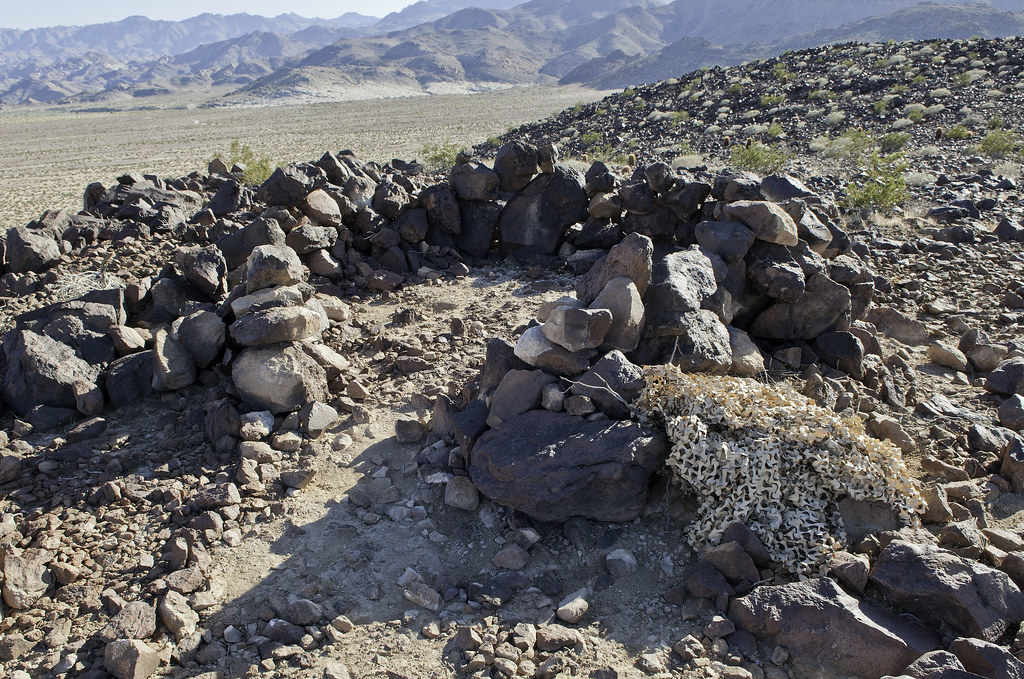
Camo Blind by tomteske, on Flickr
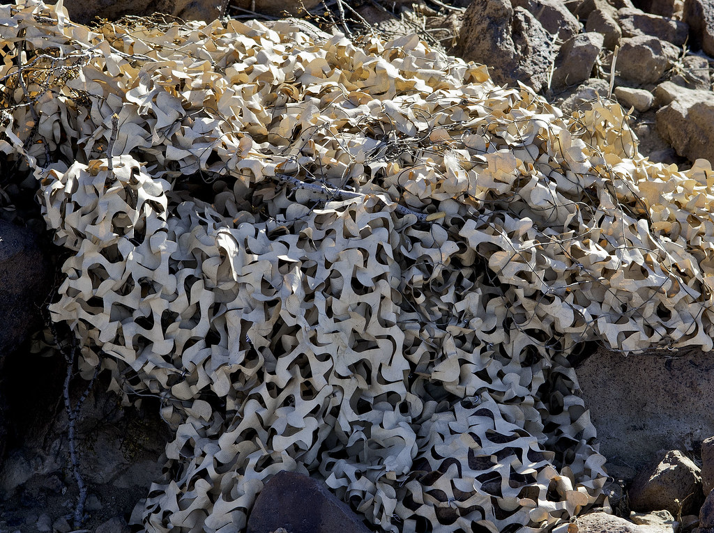
Camo by tomteske, on Flickr
The dry lakebed north of Kirk.
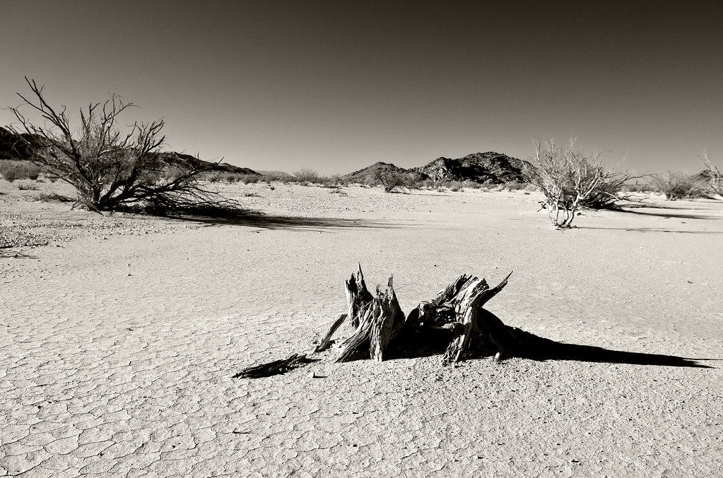
Lacustrine Wood by tomteske, on Flickr
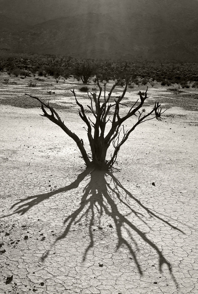
Light by tomteske, on Flickr
Heading home. 12.5 miles RT. 73 degrees when I started and 72 when I returned. The desert season has arrived! Enjoy. Tom
The Light by tomteske, on Flickr |
10/12/2013
Topic:
Davies Valley To BM Kirk
tommy750
|
hikerdmb wrote:
I love that area. Spent lots of time out there before the road got gated. Thanks for the pics.
Yeah, the gate pretty much shut the entire valley down. First hundred yards of road past the gate would keep out anything not 4x4. Tom |
10/12/2013
Topic:
Davies Valley To BM Kirk
tommy750
|
dsefcik wrote:
That one SUV with the cable in the front looks like someone was trying to give it a tow. Nice TR....still wishing I had time to get out there, I haven't been back since the Sheep Count in July.
Didn't notice the cable. Would be a long tow back south but doable. Is your truck running well now, Daren? Tom. |
10/12/2013
Topic:
Davies Valley To BM Kirk
tommy750
|
rockhopper wrote:
Looking at those SUV's reminds me of the movie "No Country for Old Men" Wonder what the story was?
Looks like a great trip. I am heading out to the mud volcanos and hot springs soon now that the temps are dropping.
Talked to a BP agent recently who said they found them abandoned. He wasn't sure if they were carrying people or drugs. I wondered if there had been a shoot out since they're riddled with bullet holes but he said BP used them for target practice.
That movie is why I'm walking right past any dope or money lying out in the desert! Tom. |
10/12/2013
Topic:
Davies Valley To BM Kirk
tommy750
|
Jim (ziphius) wrote:
tommy750 wrote:
Talked to a BP agent recently who said they found them abandoned. He wasn't sure if they were carrying people or drugs. I wondered if there had been a shoot out since they're riddled with bullet holes but he said BP used them for target practice.
That movie is why I'm walking right past any dope or money lying out in the desert! Tom.
Tommy, I'm pretty sure it is ok to pick up a bag full of drug money as long as you remove the tracking device before taking it home! Very nice trip and photos, thanks for posting! - Jim
Someone will hire an Anton Chigurh to get that bag back!
edited by tommy750 on 10/12/2013 |
10/14/2013
Topic:
Culp Valley to Coyote Canyon & Kane Springs Road
tommy750
|
BorregoWrangler wrote:
tommy750 wrote:
Nice trip! Did you see anything at Harpers Well or Kane Spring? Tom
I don't think I traveled that part of Old Kane Springs Road. Harpers Well and Kane Spring are east of Split Mountain Road, right?
Yes, you're right. Have never been on it. Looks like the part east of Split Mt. Rd is pretty sketchy or nonexistent when looking at GE. Not sure of the boundaries of San Sebastian Marsh/San Felipe Creek ACEC (BLM website down) but they probably preclude anything but a walk through that portion. Looks like you can catch the far east part off 86, though. Tom
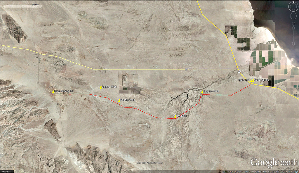
Kane Spring Road by tomteske, on Flickr |
10/14/2013
Topic:
Culp Valley to Coyote Canyon & Kane Springs Road
tommy750
|
BorregoWrangler wrote:
tommy750 wrote:
BorregoWrangler wrote:
tommy750 wrote:
Nice trip! Did you see anything at Harpers Well or Kane Spring? Tom
I don't think I traveled that part of Old Kane Springs Road. Harpers Well and Kane Spring are east of Split Mountain Road, right?
Yes, you're right. Have never been on it. Looks like the part east of Split Mt. Rd is pretty sketchy or nonexistent when looking at GE. Not sure of the boundaries of San Sebastian Marsh/San Felipe Creek ACEC (BLM website down) but they probably preclude anything but a walk through that portion. Looks like you can catch the far east part off 86, though. Tom
Thanks for posting that. From what I've been able to find, Old Kane Springs Road marks the boundary of the ACEC. So you can travel along the route that you highlighted in red. At Harpers Well there's a toppled wall along the wash that used to prevent erosion. About 12 feet of the old well casing has been exposed and toppled, now laying on the sand bar. One of these day I'll need to get out there and explore more of that area.
I agree, looks like a fun place to check out. Tom |
10/16/2013
Topic:
Ultralight at Fonts Point
tommy750
|
Seems like ABDSP is attracting some international visitors this time of year:
http://www.ivpressonline.com/news/local/quicknews/authorities-seize-ultra-light-pounds-of-marijuana/article_373114ec-35fe-11e3-91c0-001a4bcf6878.html
Here's another ultralight crash near Niland from earlier this summer:
http://www.ivpressonline.com/news/local/valley-police-beat-agents-seize-small-aircraft-k-in-drugs/article_05028df8-1078-11e3-a9a9-0019bb30f31a.html |
10/17/2013
Topic:
Ultralight at Fonts Point
tommy750
|
Jim (ziphius) wrote:
tommy750 wrote:
Seems like ABDSP is attracting some international visitors this time of year:
http://www.ivpressonline.com/news/local/quicknews/authorities-seize-ultra-light-pounds-of-marijuana/article_373114ec-35fe-11e3-91c0-001a4bcf6878.html
Here's another ultralight crash near Niland from earlier this summer:
http://www.ivpressonline.com/news/local/valley-police-beat-agents-seize-small-aircraft-k-in-drugs/article_05028df8-1078-11e3-a9a9-0019bb30f31a.html
Sounds like they just need to lighten their loads a little bit, maybe just try to carry 40 lbs of weed next time. Seriously though, I saw an ultralight aircraft near the Otay border months ago and suspected it wasn't a hobbyist out for a Sunday flight. Ultralights have become a serious problem in the drug smuggling arena. Smuggling is occurring in the most remote areas, even the far offshore Channel Islands, such as San Nicolas Island, which is entirely operated / owned by the Navy:
http://www.vcstar.com/news/2012/mar/02/panga-found-on-san-nicolas-island-3-arrested/
Only a matter of time before drones flying 10 ft the ground will be zipping back and forth. Smuggling has got to be the world's second oldest profession |
10/21/2013
Topic:
Green Desert
tommy750
|
Wow, that is green. Ever ventured into the Sierra La Laguna biosphere north of Cabo? Drove through once in 2010 mid-summer and was pretty green (Camino de las Naranjas travels east-west and is a steep winding one lane dirt road) but must be amazing now. Great trip. Tom |
10/21/2013
Topic:
Coyote Mts Sheep
tommy750
|
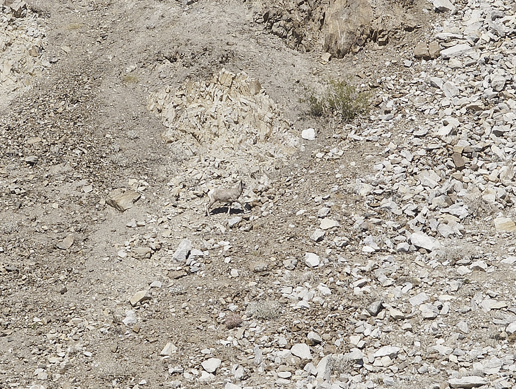
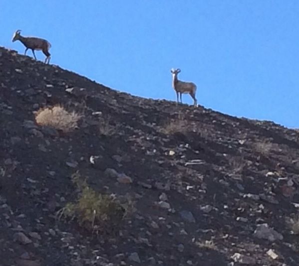
Did a hike in the Coyote Mts near Carrizo on Saturday (84 degree when I started and 90 when I returned) and saw six bighorn sheep. Heard what sounded like a small rock fall and saw them walking by. Was under the impression they left during the summer since there's no water supply and returned in the winter. Found one mention here on page 13 ( http://www.fws.gov/carlsbad/speciesstatuslist/5yr/20110421_5yr_pbs.pdf ) stating there's now a full time presence in The Coyotes. Supposedly they don't venture down to Carrizo Marsh because of the Tamarisk invasion and lack of escape terrain but who knows. Tom
Since some of us don't have 500mm lenses, these four sheep look pretty tiny
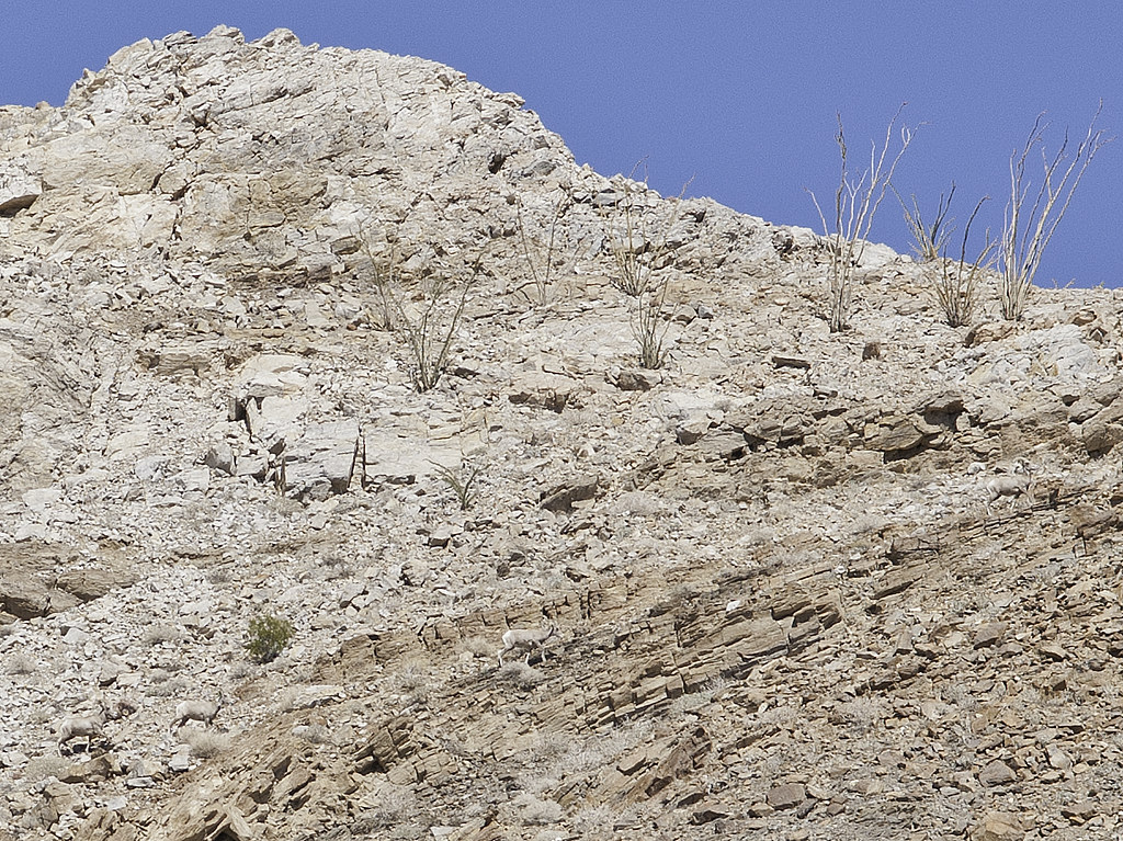
Four Sheep by tomteske, on Flickr
Here's the fifth one trailing the others by a few minutes. The final one ran by about fifty feet in front of me but, of course, by then I had put my camera away.
Fossil Canyon Sheep by tomteske, on Flickr |
10/21/2013
Topic:
Coyote Mts Sheep
tommy750
|
Jim (ziphius) wrote:
Nice sighting Tom! Interesting status review too, with the *new* year-round presence in the Coyote Mountains. Maybe the sheep know about some undocumented water source in that region, heh? So, were you literally hiking in Fossil Canyon when you saw them? (judging from the name of your 2nd photo)
Yeah, was going to explore slot canyons north of Fossil Canyon when I spotted the sheep. They were past the very end of Fossil where it turns into 5-6 small washes. Didn't get as far as I'd like since my intended approach ended at a dry fall with a 25ft shear drop off. Someone had strung a rope down one side but looked like it had been there a long time. Tom
Am I the only one who doesn't know how to do an eye splice or has that rope been there a while?

The Rope by tomteske, on Flickr |
10/22/2013
Topic:
Coyote Mts Sheep
tommy750
|
dsefcik wrote:
I don't think the ewes ever travel far from home, rams on the other hand will travel around. They are supposed to be doing Tamarisk removal in Carizzo Marsh with money from Pattern and the wind turbine project.
You're totally right, Daren. Here's the Helix Environmental mitigation report from last year that outlines their restoration plans for Carrizo Marsh: http://www.ocotilloeccmp.com/Wild1s_PBS_MMP.pdf
According to one of their press releases from February of this year, Helix has already started the restoration with a major burn scheduled for sometime "in the fall." I actually called Helix today for an update and received a call back from a secretary (super nice who admitted she was a temp) telling me the project manager told her to tell me to call a person named "Anza Borrego" at 760-767-5311 (the ABDSP Visitor Center number!) for more info. She even spelled out the person's name to make sure I got it right
Has anyone actually driven out to the marsh and seen any changes? I haven't been out there in over a year. Tom |
10/24/2013
Topic:
Coyote Mts Sheep
tommy750
|
BorregoWrangler wrote:
tommy750 wrote:
Has anyone actually driven out to the marsh and seen any changes? I haven't been out there in over a year. Tom
Yeah, I posted an update of that area recently. All the Tamarisk has been removed from Carrizo Creek.
Thanks! I saw your post but completely fixated on the adobe structures. Need to get out there again. Tom |
10/26/2013
Topic:
San Felipe Wash to Old Kane Springs Road
tommy750
|
Can't recall if I posted this before but this is above Old Kane Spring Rd in Carrizo Wash right before it joins San Felipe Creek. We tried for about an hour to get the Bronco out before giving up. Glad you got the FJ out. Nice trip report. Liked the shell pic. Haven't seen any that large. Tom
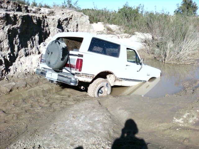
Bronco by tomteske, on Flickr |
10/26/2013
Topic:
Pinyon Wash / Split Rock / Harper Flat
tommy750
|
I like how the old film gives your right front tire a nice whitewall look |
10/26/2013
Topic:
Coyote Mts Sheep
tommy750
|
Went out yesterday to see if I could get around the dry fall. Basically just hiked straight over into Carrizo Badlands. None of the slot canyons I saw on Google Earth really amounted to much. Did see some activity on top to Carrizo Mt.
Watched these guys land on top of Carrizo. It's nine miles hiking from the Painted Gorge gate or you can pretty much drive to the summit. But this looks like cheating to me
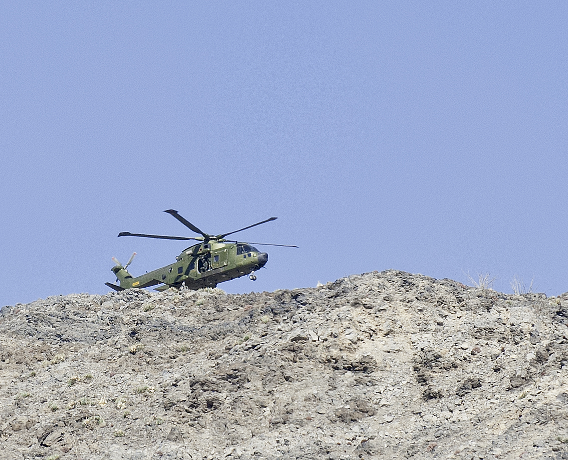
Helo on Carrizo by tomteske, on Flickr
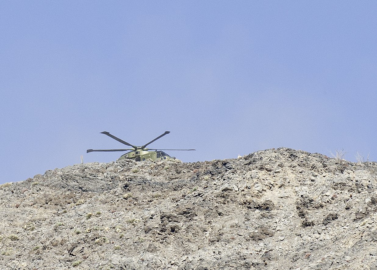
Helo on Carrizo2 by tomteske, on Flickr
Didn't notice the three people on top till I got home and looked at the pics.
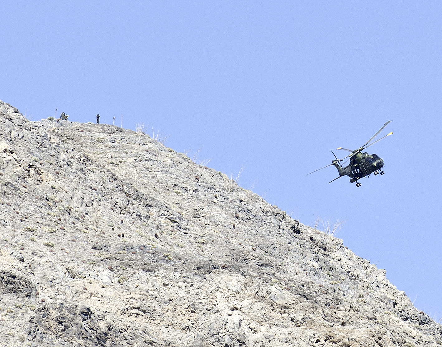
Helo on Carrizo6 by tomteske, on Flickr
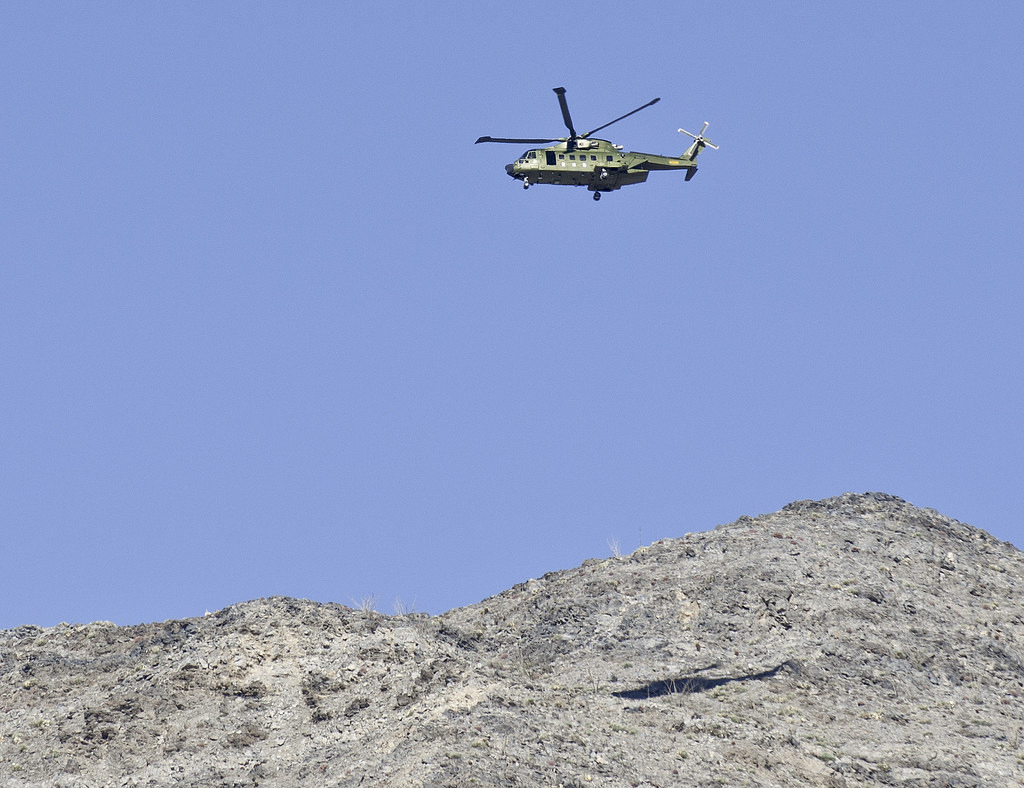
Helo on Carrizo3 by tomteske, on Flickr
Wheels up and heading home.
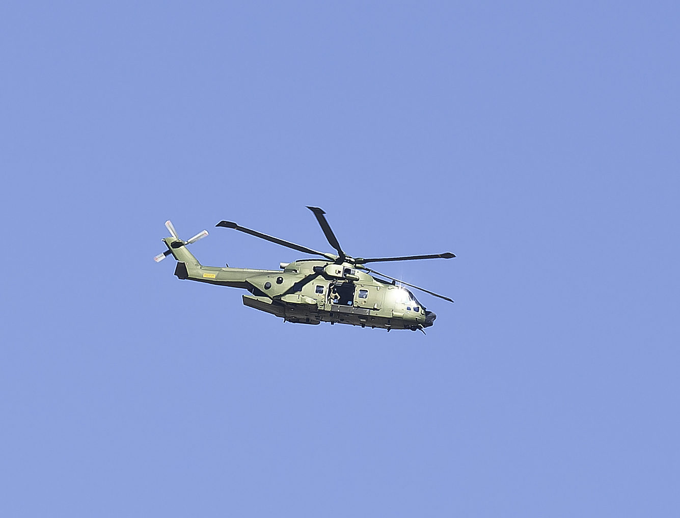
Helo Wheels Up by tomteske, on Flickr |
10/27/2013
Topic:
Coyote Mts Sheep
tommy750
|
dsefcik wrote:
Could you tell who they were, army, BP..??
Didn't see any markings on the hello. Two of the guys on the ground looked like flight crew and the third had a backpack on. Not sure what was going on. |
10/27/2013
Topic:
Coyote Mts Sheep
tommy750
|
dsefcik wrote:
Could you tell who they were, army, BP..??
The helo looks like a British Merlin HC3A. The British are coming? |
10/30/2013
Topic:
Piepkorn slot
tommy750
|
The plaque is on a boulder near the "one-way" route through the Volcanic Hills on the ABDSP pdf map (http://www.parks.ca.gov/pages/638/files/ABDSPmap.pdf). My torn up sidewalls and chunks of missing tread on both front tires are a result of foolishly driving my Tundra through there---twice Seemed like a perfectly acceptable short cut from Indian Hill to S2 except it's not unless you're driving a short wheelbase 4x4. Tom
Here's a pic of one part of the road:
volcanic hills by tomteske, on Flickr
edited by tommy750 on 10/30/2013 |
11/8/2013
Topic:
GPS Recommendation
tommy750
|
I use My Topo on an iPad and love it. It seamlessly connects standard 1:24K topos you download for free. The big touch screen gives you the big picture you don't get on a tiny GPS and you can easily zoom in if desired. Doesn't allow tracking but you can do waymarks and screen saves are easy. Think it cost $9.99. Tom |
11/10/2013
Topic:
GPS Recommendation
tommy750
|
surfponto wrote:
Thanks Tom
What kind of dash mount do you have for it?
Thanks,
Bob
tommy750 wrote:
I use My Topo on an iPad and love it. It seamlessly connects standard 1:24K topos you download for free. The big touch screen gives you the big picture you don't get on a tiny GPS and you can easily zoom in if desired. Doesn't allow tracking but you can do waymarks and screen saves are easy. Think it cost $9.99. Tom
Haven't been using a dash mount but looks like a lot are available and sounds like a great idea now that you mention it. Tom |
11/10/2013
Topic:
Little Blair to Alma Wash Backpack Trip
tommy750
|
Nice trip Daren. How many miles was it? That sheep cache is pretty amazing. Tom |
11/10/2013
Topic:
Harper Flat via Pinyon Wash
tommy750
|
Nice trip and pics, Nolan. Looks like the Tarantula Hawks will have lots of places to lay their eggs this year! |
11/10/2013
Topic:
Memorials in the Park
tommy750
|
Interesting idea. Should be quite a few pics for this topic. Tom
Near Coyote Wash and EC085. According to the Internet, found lying outside his car with a shotgun nearby.
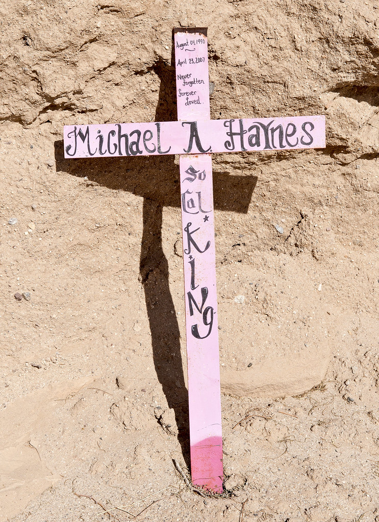
Sixteen by tomteske, on Flickr
Yuha Desert
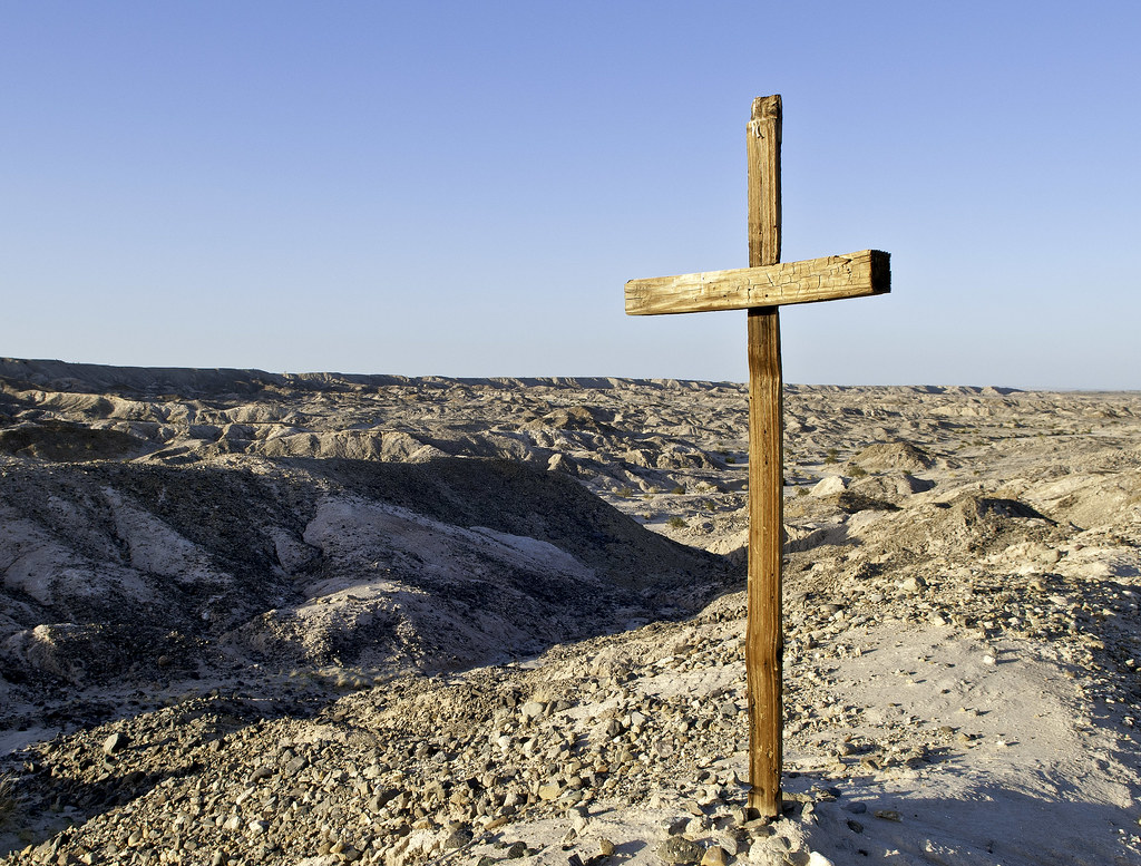
Yuha Cruz by tomteske, on Flickr
West of Coyote Mts
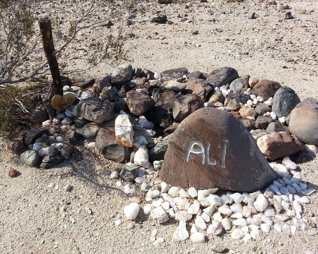
Ali by tomteske, on Flickr |
11/11/2013
Topic:
Memorials in the Park
tommy750
|
dsefcik wrote:
Hey Tom, where is the one you have from out in Pinto area?
Here it is. Tom

Cruz Azul2 by tomteske, on Flickr
Cruz Azul by tomteske, on Flickr |
11/13/2013
Topic:
Memorials in the Park
tommy750
|
rockhopper wrote:
Unknown graves on the West side of Toro Peak , South West of the old lumber mill at elevation approx. 6500 ft.
Anyone have any info?
edited by rockhopper on 11/11/2013
edited by rockhopper on 11/11/2013
Assuming that's near Coyote Creek east of Vandeventer Flat somewhere? That looks like an interesting place to explore. You hiked there or drove? Looks like it's somewhat accessible off 74. Tom |
11/14/2013
Topic:
Memorials in the Park
tommy750
|
rockhopper wrote:
Hi Tommy 750,
Either hike in from Rock house Canyon or Hike down from Toro Peak. It's eaiser coming down from the mountian.
As I remember there were about 8 or more marked ( falling apart) wooden grave markers with no info. No idea of age
or who they were. But the view from the memorial ground was fantastic! I have a guess.
a) Converted Christian native Americans
b) Lumber mill workers ( seems like a lot) from the old Santa Rosa lumber mill
c) Homesteders who lived on or around the mountian
Going back has been on my list. If I can still find it! We just stumbled on it hiking down towards Toro Spring.
Thanks for the info. Need to head out there sometime. Tom |
11/18/2013
Topic:
Hunt for the Summer Solstice cave in Indian Valley
tommy750
|
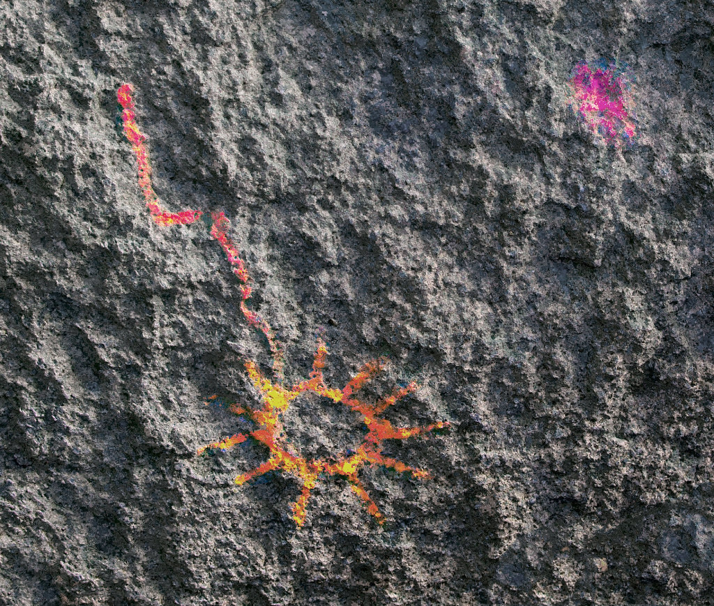
Bob, reading your post now over three years ago got me started looking for this cave. My third attempt was this past Saturday. After studying Google Earth at length, I concluded a large boulder lodged on a steep Indian Canyon slope MUST be the place. Climbing to the exact spot, I realized I'd failed again. Deciding to keep looking around, I spied a possible location far in the distance. Only when I could see an orange sun on the rock ceiling did I know for sure I'd finally found it. My favorite picto is the sun or star with the tail. Comet anyone? Thanks for the adventure! Tom
Sun Tail2 by tomteske, on Flickr |
11/19/2013
Topic:
Hunt for the Summer Solstice cave in Indian Valley
tommy750
|
surfponto wrote:
Third time is the charm.
Good job. It is amazing how hard it is to find,
I agree that falling star/comet picto is very cool.
Did you get pretty scratched up hunting for the cave?
Yes, pretty scratchy out there. Noticed a lot of Ephedra/Mormon Tea plants. Not sure if just paying attention or there's a lot around that area. Want to try that stuff one day |
11/26/2013
Topic:
Kumeyaay Nation Sycuan Documentary
tommy750
|
Agree, nicely done presentation. Two of the main historians interviewed have their books shown below. Many of us have Carrico's book but Newcomb's may not be as familiar. Nice overview of the European Christian mindset that justified and encouraged the conquest of The Americas. Tom
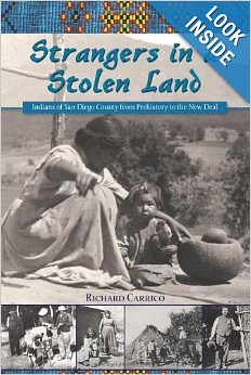
51YeZf66aAL__SY344_PJlook-inside-v2,TopRight,1,0_SH20_BO1,204,203,200_ by tomteske, on Flickr
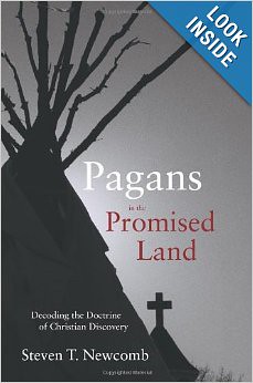
41lcAKUuuaL__SY344_PJlook-inside-v2,TopRight,1,0_SH20_BO1,204,203,200_ by tomteske, on Flickr |
11/27/2013
Topic:
Orocopia Mountains
tommy750
|
Very nice! Tried to do Bradshaw Rd couple years ago west to east but the road from 111 was closed. Wasn't sure what happened till read an article the nearby area was wired with explosives for seismic testing. Need to get out there. Really like the railroad track/sunset pic. Tom |
11/27/2013
Topic:
GPS Recommendation
tommy750
|
Awesome, Bob. I like it. What is the program you're running in the photo? I need to get a mount for Xmas! Tom |
11/27/2013
Topic:
Ticks!
tommy750
|
Here's a nice little article from East County Magazine reviewing ticks in San Diego County. Watch the video as well. Tom
http://eastcountymagazine.org/node/14459 |
11/29/2013
Topic:
Ticks!
tommy750
|
rockhopper wrote:
Had my share. It's a miracle I never got lymes disese. Soaking in ubber hot hot mineral baths kills the virus.
That sounds like a great treatment for everything you get while out hiking |
11/29/2013
Topic:
Inner Pasture - Searching for the spring
tommy750
|
How many rolls of old film do you have, Daren??
Wonder exactly if or when topo maps update whether a spring is dry e.g. Dave McCain. Do the next gen topo maps do that or just copy the old ones?
Nice trip. Tom |
12/7/2013
Topic:
Hunting in the In-Ko-Pah Mountains
tommy750
|
Very nice, Daren. Looks like someone did their own version of "DStretch" on Knaak's page 73 pic. Did you see the "fertility rocks" Crawford found nearby? Isn't that how the whole yoni thing got started? Tom |
12/9/2013
Topic:
Goat Canyon Trestle Hike, November 2013
tommy750
|
Great trestle pic! Any RR police out and about? |
12/15/2013
Topic:
NOAA Radiosonde Found
tommy750
|
Was out goofing off in The Coyote Mts today and found a pretty beat up radiosonde. Couldn't remember from you all if I was to collect it or document its location. Didn't really have a way to bring it back so it's still out there. Will call the number listed in this thread tomorrow and at least pass on a waypoint.
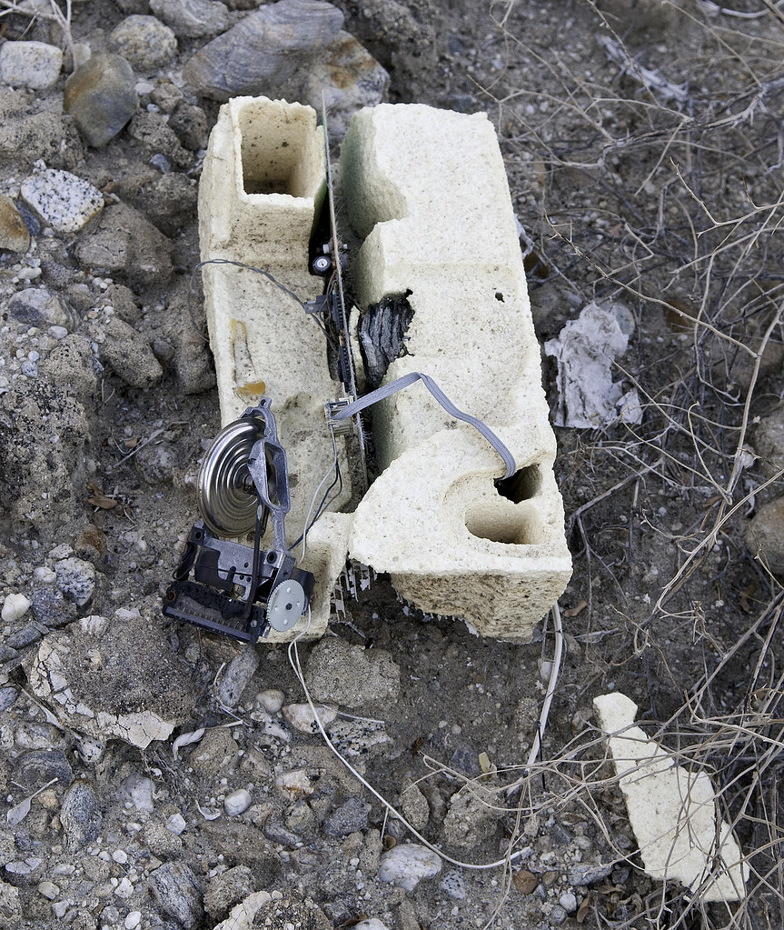
Radiosonde2 by tomteske, on Flickr

Radiosonde by tomteske, on Flickr
Think this is a piece of the balloon base found 20 ft away.
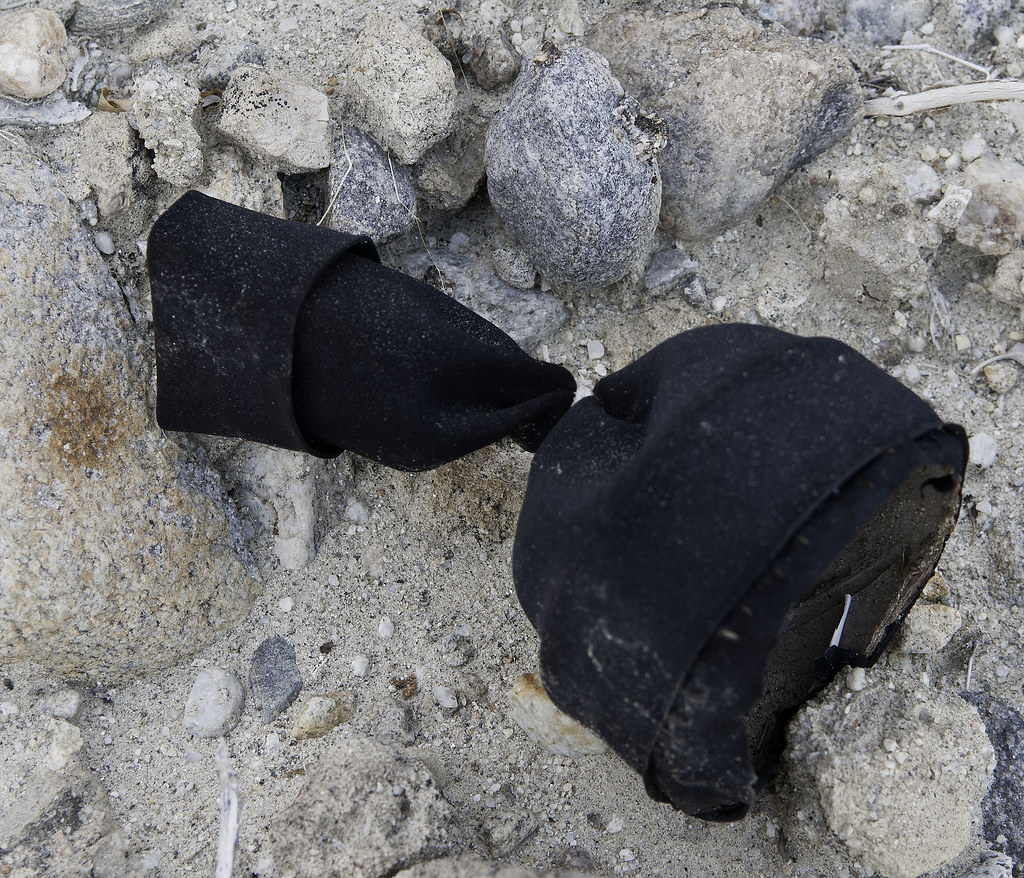
Balloon by tomteske, on Flickr |
12/16/2013
Topic:
NOAA Radiosonde Found
tommy750
|
I talked to someone named Alex at the Rancho Bernardo facility. Very interesting. Apparently a subcontractor at Miramar releases two balloons daily (seems releasing these in a populated area would be an air traffic control issue). They're tracked for about 1 1/2 to 2 hours till about 80,000 ft when the balloon usually bursts. They descend with a parachute (he says the descent lasts about 2-3 hrs) but are no longer tracked. Alex says the recovery rate is about 10-20% for his facility but differs from site to site. The eventual landing spot may vary from nearby in SD during low wind days to Nevada, Arizona and eastern CA on windy days (as in jet stream windy). Like you said, Daren, he wasn't that concerned regarding an exact landing site or a beat up radiosonde for that matter. If we collectively have found a few of these with 730/year being released, imagine how many mylars are getting released from SD for us to find a few EVERY hike! |
12/16/2013
Topic:
NOAA Radiosonde Found
tommy750
|
Jim (ziphius) wrote:
Tommy, I just noticed the fancy Oris watch in your photo! Care to provide a review?
The review is my perfectly good low maintenance cheap GShock watch wasn't "suitable or dressy enough" for work (according to the girlfriend) so I ended up with a semi-reliable not cheap Oris which is getting no special treatment as of late |
12/16/2013
Topic:
Found Camper Part in Sheep Canyon
tommy750
|
Wow, that's terrible! But if it was going to happen, better on 085 than I-8 going 70. Glad your insurance will cover the damage. |
12/19/2013
Topic:
The Mud Palisades & Anicent Forest of Fish Creek
tommy750
|
Everyone's been up Fish Creek a bunch but still amazing stuff every time! Nice metate and petrified wood. Have seen a few pieces out there but not like that. Tom |
12/24/2013
Topic:
Christmas Wishes
tommy750
|
Christmas Wishes straight from the Coyote Mts
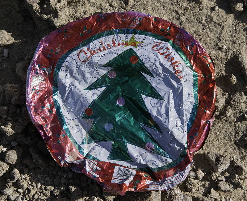
Christmas Wishes by tomteske, on Flickr
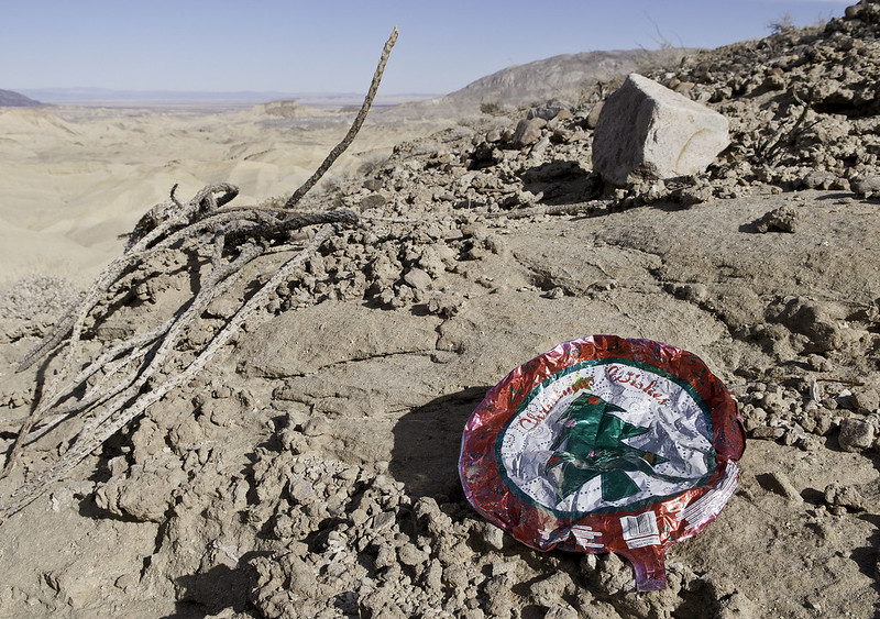
Christmas Wishes2 by tomteske, on Flickr |
12/26/2013
Topic:
Carrizo Mountain & Indian Hill: Dec. 13-15th, 2013
tommy750
|
BorregoWrangler wrote:
Jim (ziphius) wrote:
Nice trip Wrangler. I once poked around the southern part of the Coyote Mountains in mid-summer after a flash flood, looking for fossils in the deep shade of the canyons. Not too bad if you stay in the shade! Have you seen any bighorn in that range in your trips out there? [ I see from your blog that you've encountered bighorn tracks. ]
edited by ziphius on 12/24/2013
Yeah, some friends of mine actually caught sight of some on their way up the mountain. I haven't seen any myself up there for years.
edited by BorregoWrangler on 12/25/2013
I've seen sheep up Fossil Canyon twice and in Butaca Canyon once in the last couple years. Haven't seen any in the lower northern part of the Coyotes. Tom. |
12/31/2013
Topic:
Diablo Dropoff graded
tommy750
|
Not really that sad they graded that route. Spent about two hours driving the half mile through that area when it was 100 degrees at midnight and when my pickup had only about two small scratches. Bent the driver's door and scratched both sides of my bumper making it through there. Tom
Diablo Dropoff by tomteske, on Flickr |
1/2/2014
Topic:
Diablo Dropoff graded
tommy750
|
The OTHER drop off, Bob
brochure0203.cdr by tomteske, on Flickr |
1/3/2014
Topic:
Diablo Dropoff graded
tommy750
|
surfponto wrote:
For some reason I was thinking Pinyon.
Have never done Diablo Drop Off
Maybe now that it is graded I will do it with the Land Cruiser.
edited by surfponto on 1/2/2014
If you did the squeeze and Pinyon drop off, Diablo will bore you. Pinyon is way worse. That's a great shot at the squeeze. Tom |
1/13/2014
Topic:
Sold my truck
tommy750
|
Forget the monster trucks, Daren. Your motorcycle background and "go light" philosophy means this just might be the one! With the Ural Gear-Up's 2WD, gazillion mpg and that new fancy winch, the desert is your oyster Tom
http://www.imz-ural.com/2013-ural-gear-up/
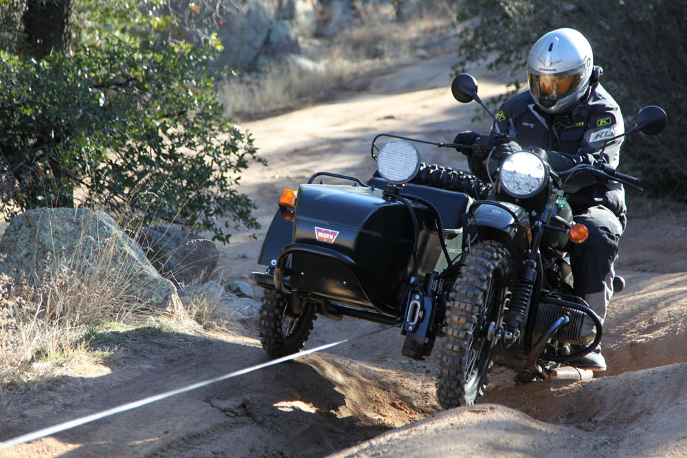
warn_ural_lead by tomteske, on Flickr |
1/19/2014
Topic:
Mine Wash Trail Cam
tommy750
|
Met up with Daren yesterday after an ABDSP class. We decided to camp out at the end of Mine Wash. After a couple drinks, he commenced with a rather dubious photo shoot utilizing a pinhole camera he'd never used to take what ended up being mainly campfire pics. Not to be outdone, I pulled out a trail cam I'd never used and stuck it on a rock facing the main wash. Daren tossed a few piece of pita into the foreground for bait and back to the campfire (in a metal container of course ) we went. Had very low expectations when I downloaded the card today but here are the pics:
I'm thinking this is a rabbit.
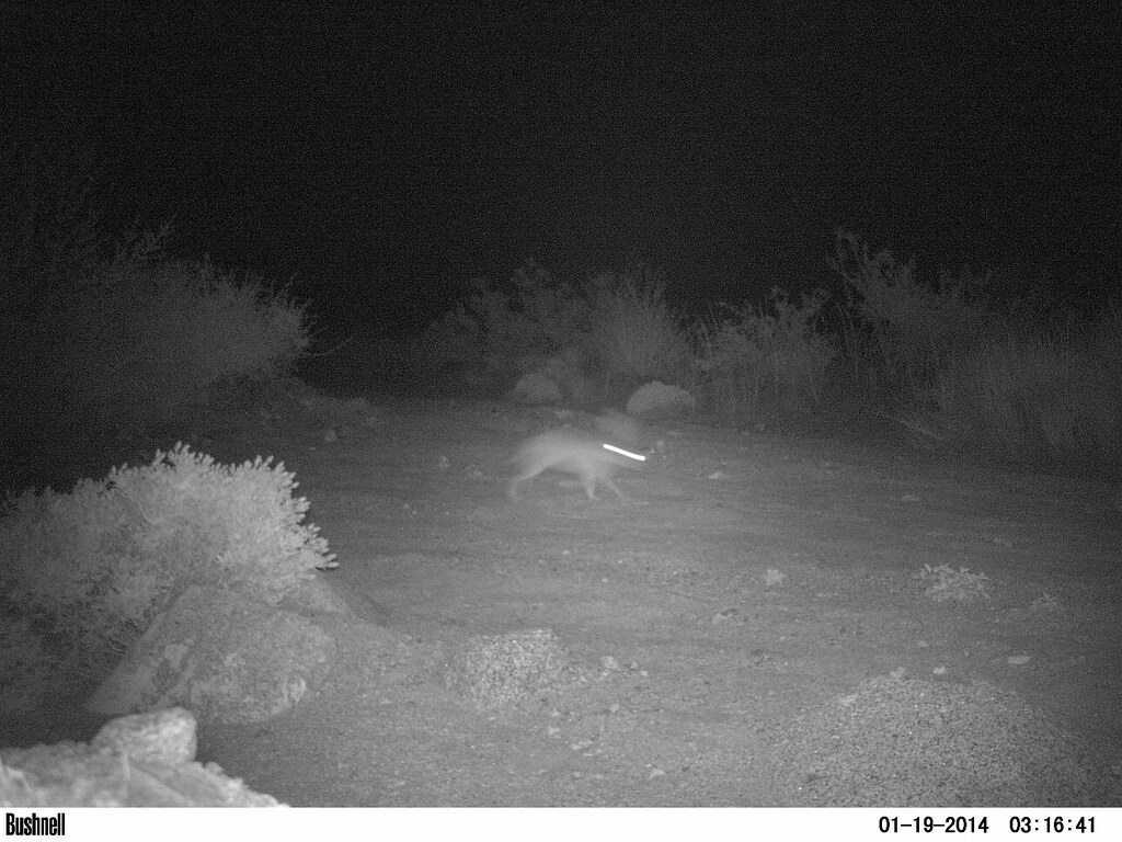
EK000025 by tomteske, on Flickr
Definitely a rabbit.
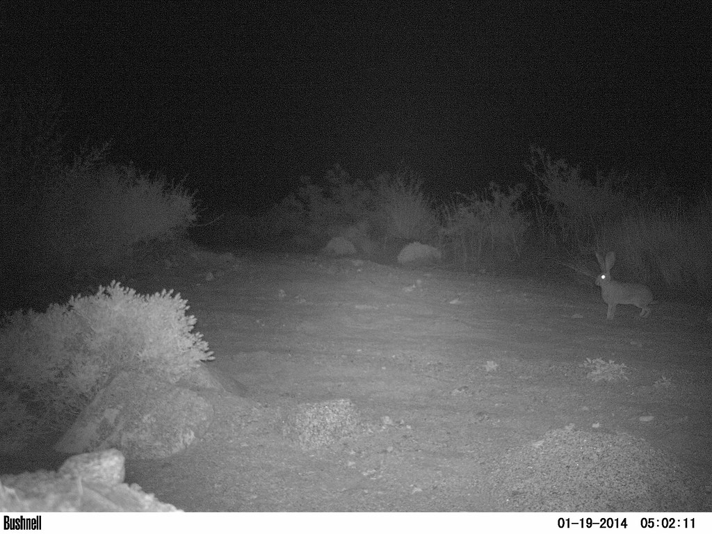
EK000029 by tomteske, on Flickr
This one kind of took me by surprise.
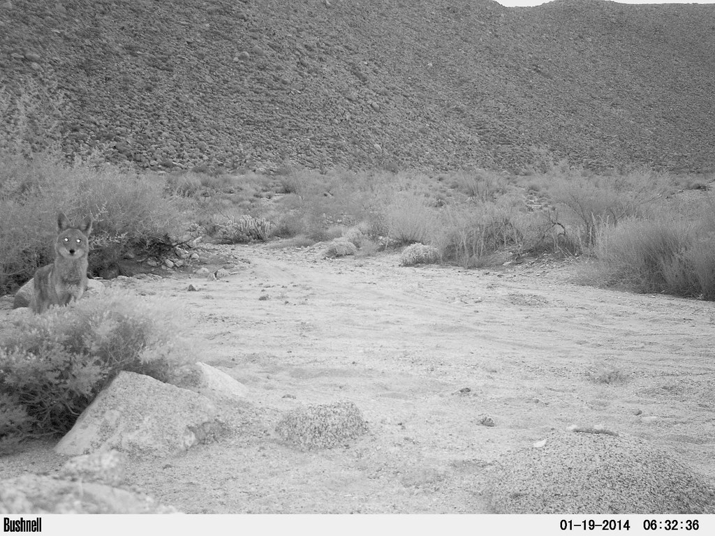
Trail Cam3 by tomteske, on Flickr
Another nice pose.
Trail Cam4 by tomteske, on Flickr
This was a pretty random placement on a rock behind my truck. Need to bring this camera out camping a lot more. Can't wait to see how the pinhole pics turn out, Daren. Enjoy. Tom |
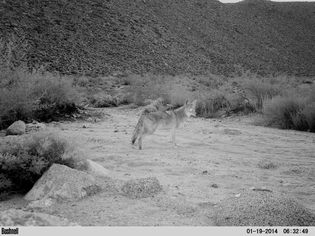
1/20/2014
Topic:
Mine Wash Trail Cam
tommy750
|
Yeah, that looks like a big coyote. Not sure on the scale. Maybe I'll stick a yardstick in the sand next time. I was sleeping comfortably in my pickup shell while Daren was on the ground with that guy sniffing around. Nolan, didn't think about a water bowl. Was thinking more of dumping a little bit of smelly cat food on the ground Bob, Daren wouldn't shut up about how awesome his new truck was! Tom |
1/21/2014
Topic:
Mine Wash Trail Cam
tommy750
|
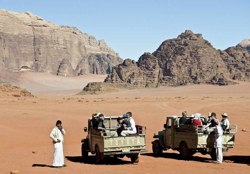
dsefcik wrote:
tommy750 wrote:
Bob, Daren wouldn't shut up about how awesome his new truck was! Tom 
Now that we know you're into classic Toyota trucks Daren, here's my favorite taken in Jordan's Wadi Rum on a tour a few years back. Straight up old school. Tom
Wadi Rum by tomteske, on Flickr |
1/21/2014
Topic:
Mine Wash Trail Cam
tommy750
|
surfponto wrote:
tommy750 wrote:
dsefcik wrote:
tommy750 wrote:
Bob, Daren wouldn't shut up about how awesome his new truck was! Tom
Now that we know you're into classic Toyota trucks Daren, here's my favorite taken in Jordan's Wadi Rum on a tour a few years back. Straight up old school. Tom
....
Classic shot.
45 Series Land Cruiser pickups, pickup version of our FJ40.
Things are bullet proof.
Were those the diesel versions?
That I couldn't tell you. We were actually on our way to see a rock art site. Tom |
1/29/2014
Topic:
Fish Creek New Years 2013
tommy750
|
I like your tripod stabilizing device. How much did you pay for that?
Any pics back from the Mine Wash pinhole camera yet? |
2/4/2014
Topic:
Jamul Kiln Ruins
tommy750
|
This is a completely legit hike on public land in an ecological reserve. This link should clarify things. Check out the additional link on "The General's Lady" which mentions the kilns and additional fascinating history on the messy transfer of lands from The Kumeyaay to Mexicans to Americans. Tom
http://www.dfg.ca.gov/lands/er/region5/ranchojamul/ |
2/8/2014
Topic:
West Mesa
tommy750
|
Decided to take take a drive yesterday up EC085 from Plaster City to Split Mt Road and maybe do some hiking along the way. Have been through there a bunch but still lots to see.
Closed gate looking through the bombing range toward Carrizo Mt. If you zoom in, a nice target in the distance.
Bombing Range Gate by tomteske, on Flickr
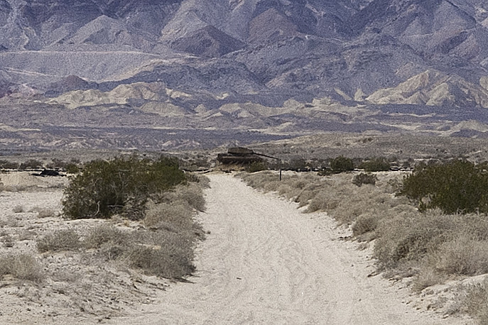
Tank by tomteske, on Flickr
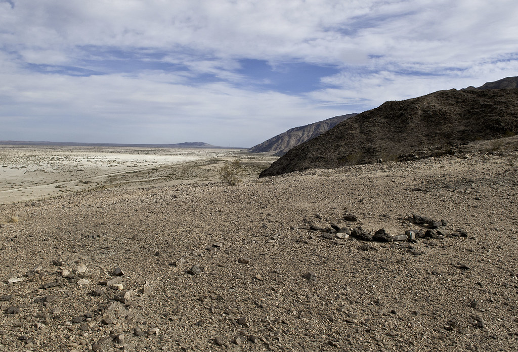
Still find the Ancient Lake Cahuilla remnants fascinating. A rocky prominence was too difficult for the Kumeyaay to skirt when the lake was at maximum fill, so they built a trail over it which is still visible.
Point Trail by tomteske, on Flickr
The trail and ridge with the lake at its 43ft maximum on GE
Point Trail by tomteske, on Flickr
The trail leads to a site with three slicks, the only ones I've seen along the Fish Creek Mts shoreline. The ridge is visible in the background along with a nice beach.

Three Slicks by tomteske, on Flickr
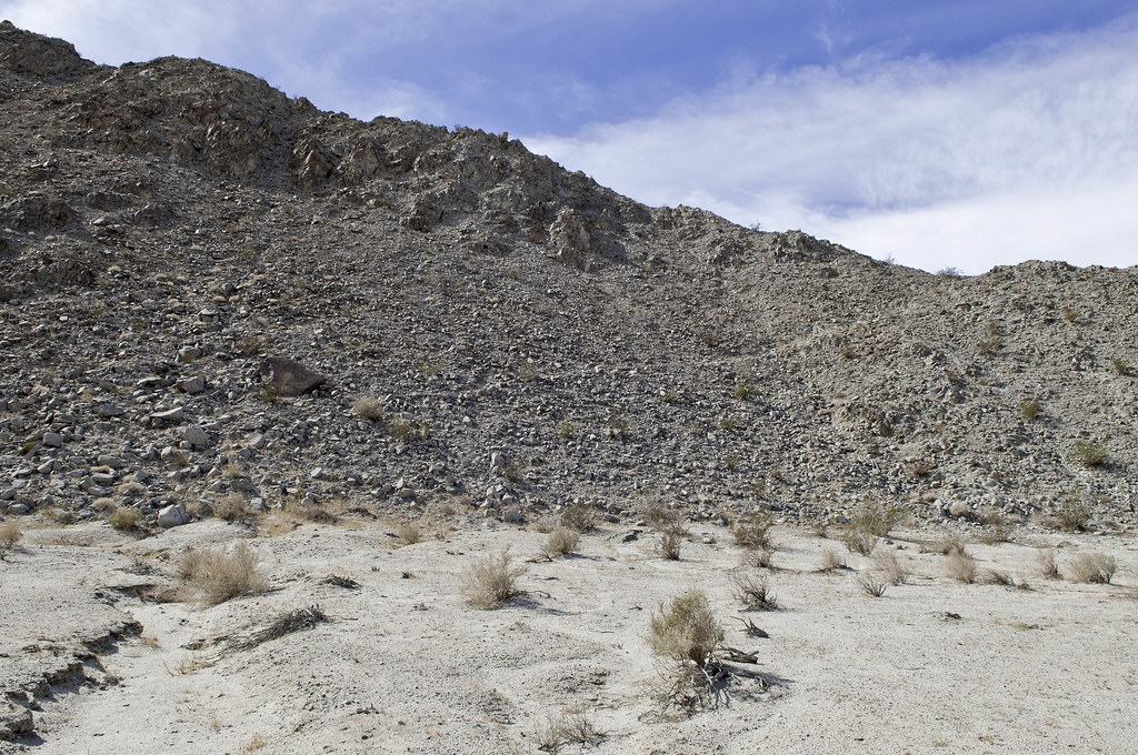
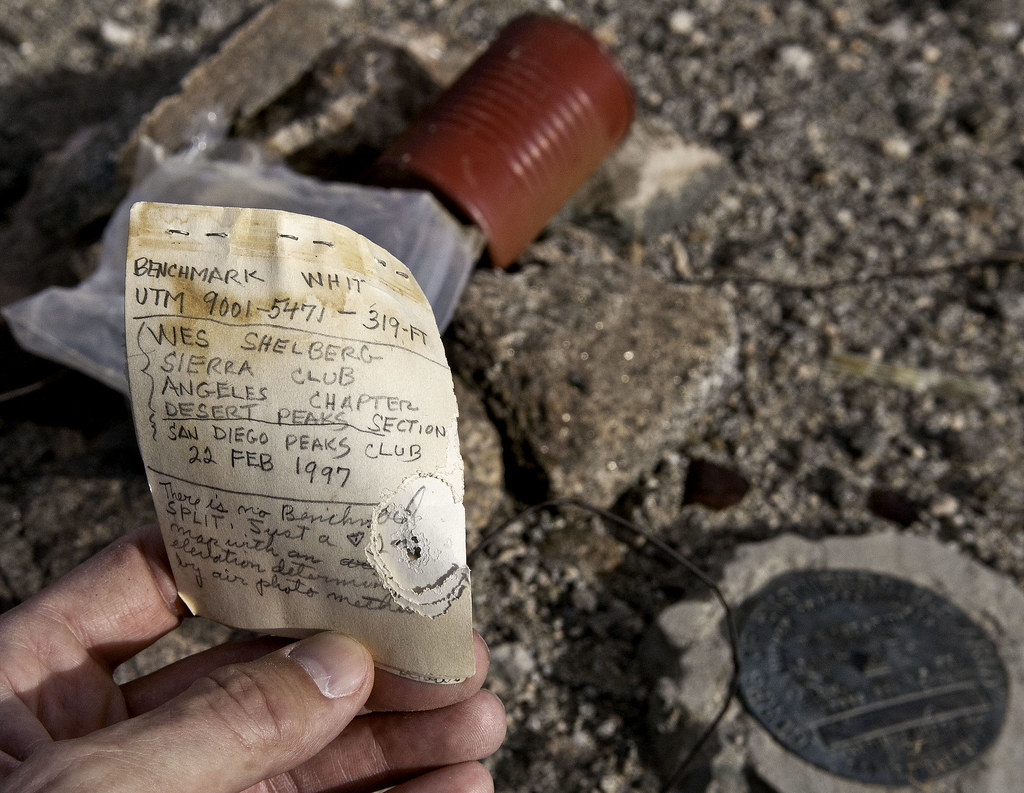
Went a few miles further NW and decided to explore the last place the shoreline touches Fish Creek Mts before the alluvial fan of Fish Creek pushes it eastward. Climbed up a 300ft ridge and found BM Whit.
BM Whit by tomteske, on Flickr
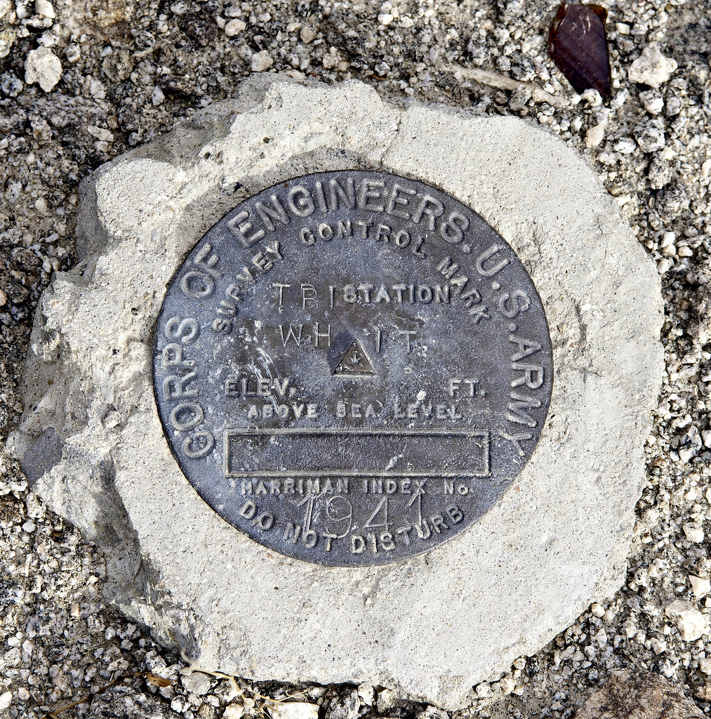
BM Whit2 by tomteske, on Flickr
First entry in 1997. Last entry was 2011.
BM Whit3 by tomteske, on Flickr
One of a pair of rock circles looking toward Superstition, both visible on GE.
Rock Circle by tomteske, on Flickr
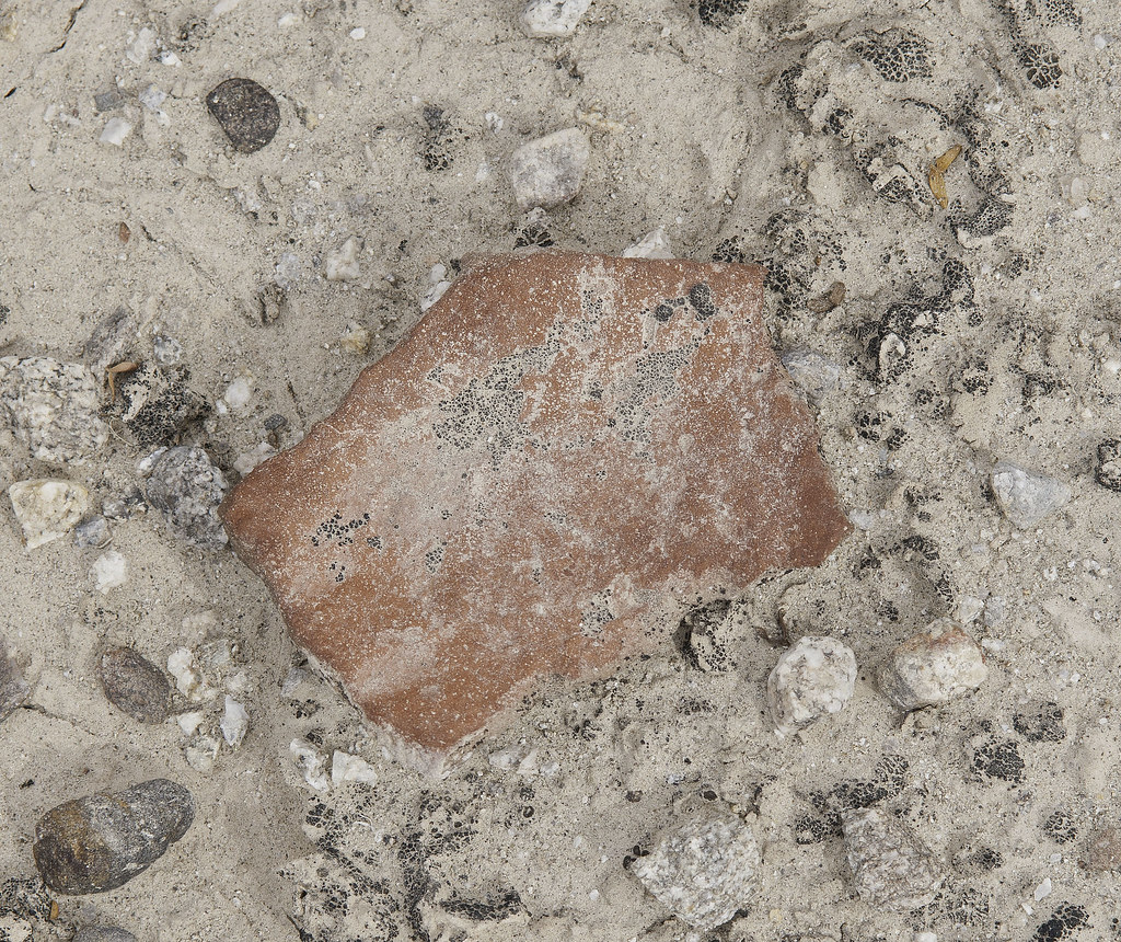
Mandatory sherd pic.
Weathered Sherd by tomteske, on Flickr
On the way down, another desert memorial with libation vessels evident.
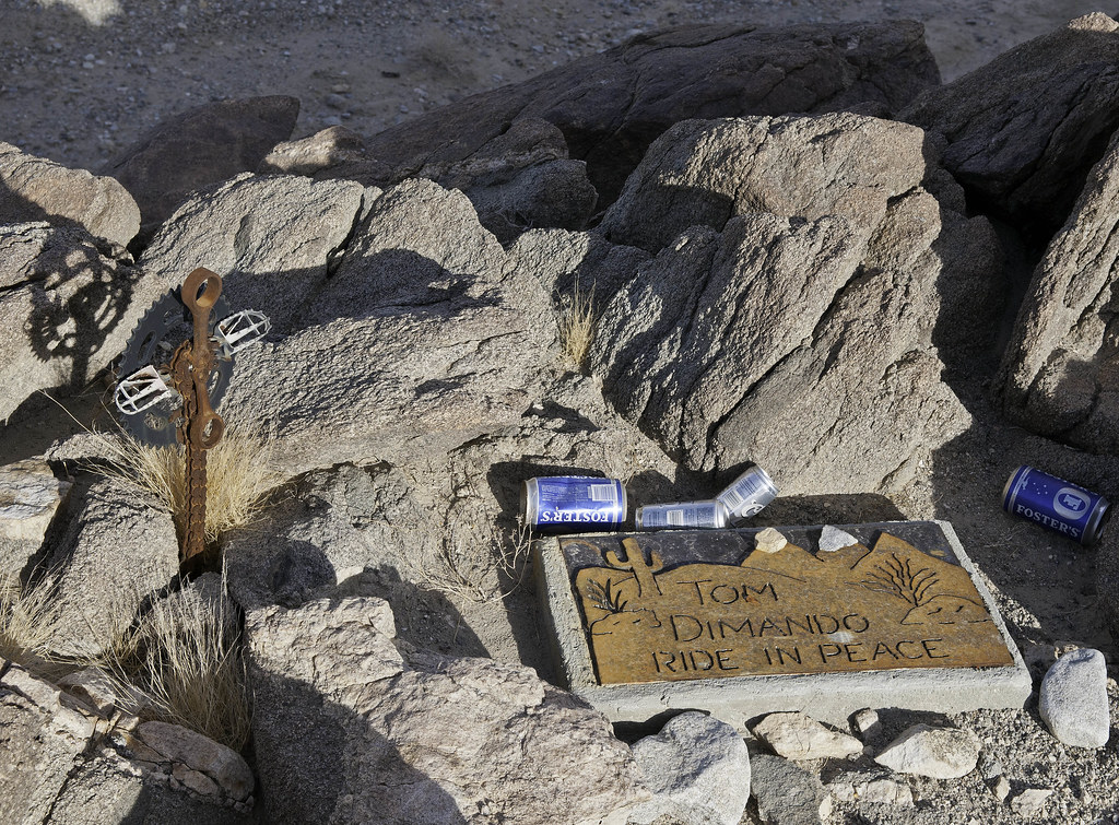
Tom Dimando by tomteske, on Flickr
Innovative cross.
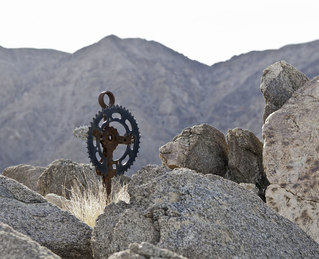
Tom Dimando Cruz by tomteske, on Flickr
Everything was dried up except this lovely flower. Thinking this is the Southwestern Prickly Poppy.
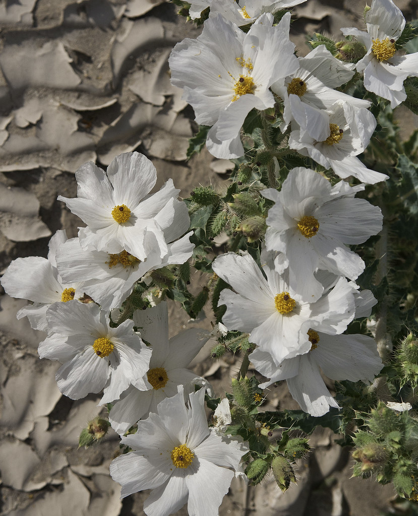
Flowers by tomteske, on Flickr
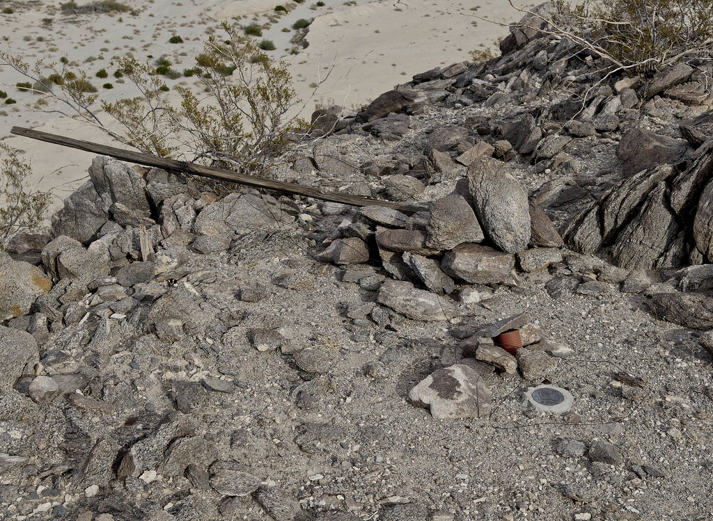
Decided to keep heading north to visit a site Daren had said had a bunch of sleeping circles.
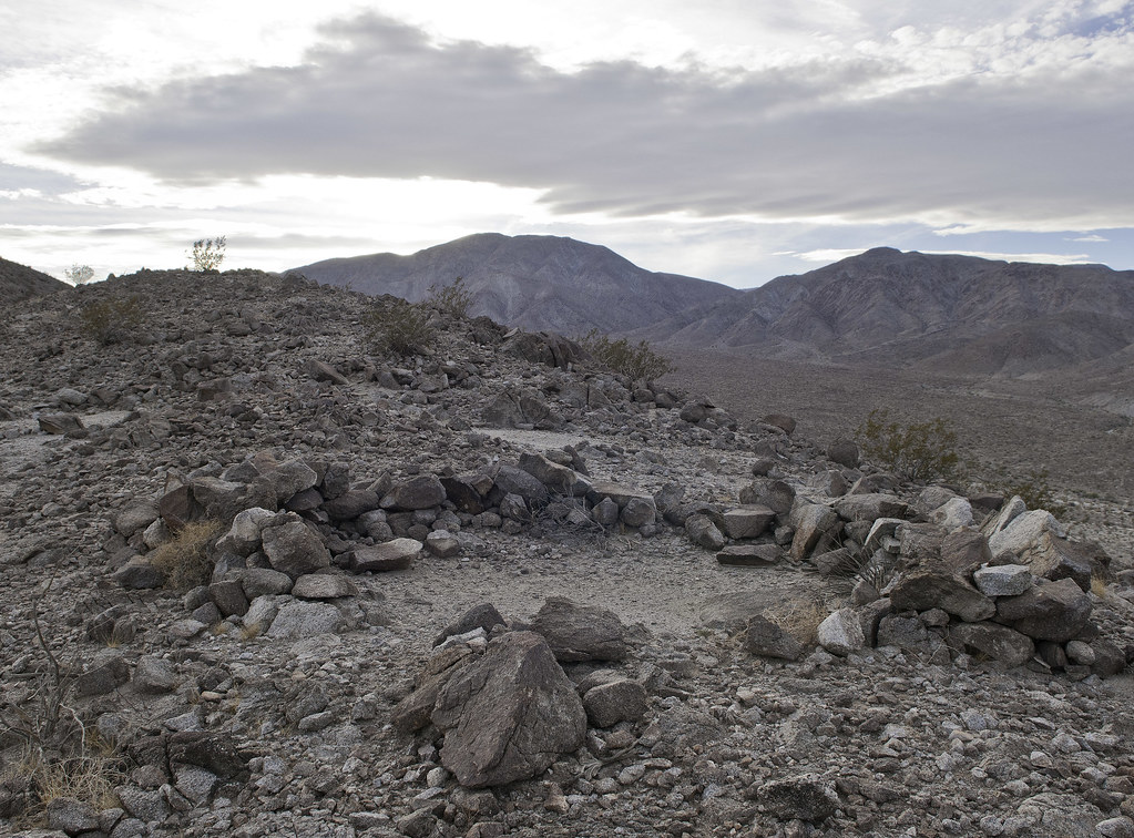
Ridge Circle by tomteske, on Flickr
Some of them looked modified and maybe miners were responsible since historic trash was a few feet downhill.
Refuse by tomteske, on Flickr
Trash by tomteske, on Flickr
Nothing fantastic but a great way to spend your day off and put in 6-7 miles of hiking. Enjoy. Tom
Fish Creek Mts by tomteske, on Flickr |
2/8/2014
Topic:
West Mesa
tommy750
|
rockhopper wrote:
Ditto on the old indian trails above the old shoreline. Some references state the Lake Chauilla filled multiple times going back thousands of years. It's neat hiking on those old trails. I've seen that trail you hiked on Google E. Need to hike those trails in that area still .There was a lot of prospecting and mining in that area in the last 1800's and 1900's
Here's a pic of a trail above the ancient shoreline to the north I hiked recently.
sunglass for scale of sherds
edited by rockhopper on 2/8/2014
Is that ascending from the desert floor or further up in the Fish Creek Mts? The only other one I've been on is a couple miles up and is an old mining trail heading to about three mines on the top of the mountains. Nice potsherds! Tom |
2/8/2014
Topic:
West Mesa
tommy750
|
Florian wrote:
Is there a legal vehicle route all the way through from Plaster City to Fish Creek? I'm assuming there is you went to the Whit BM. I was somehow thinking was closed to vehicles.
-Florian
edited by Florian on 2/8/2014
EC085 is the way! Just east of the covered parking at Plaster City off Evan Hewes Hwy is the entrance from the south or make a left onto it while heading south on Split Mt Rd just past Fish Creek. It's twenty-five miles of nice smooth road that will take you less than an hour to travel with a few areas of deep sand and a few areas of deep silt. Wouldn't recommend 2WD unless you're really talented or have a 4X4 right behind you |
2/8/2014
Topic:
West Mesa
tommy750
|
Jim (ziphius) wrote:
Nice tour Tom. Is that memorial something you just happened to stumble upon, or is there some history that led you to search for it?
Just stumbled on it. Googled the name and some hits on a guy in Oceanside but don't really know. Tom |
2/8/2014
Topic:
West Mesa
tommy750
|
dsefcik wrote:
Looks like some fresh tracks going off towards the target. I have heard from a credible source that those circles I mentioned were used by 1960-70's desert hippie kooks...but who knows. Wish I was able to get out there with you...
Yes, they looked fresh. Can't imagine aerial bombing practice a few hundred yards from a public road but who knows. Have seen some F-18s making low passes through that area before but didn't see any ordinance. Tom |
2/9/2014
Topic:
West Mesa
tommy750
|
Nolan (anutami) wrote:
tommy750 wrote:
EC085 is the way! few areas of deep silt. Wouldn't recommend 2WD unless you're really talented or have a 4X4 right behind you
Thanks for the TR! When we were out there over New Years people were shooting towards the mountains and made it impossible to hike around. Someone even brought a. 50 cal. and was blasting away! Its seems to be a very popular place to shoot out there. What is your strategy for the deep silt areas? Do you take them straight on or try and detour around? I would not even attempt in 2wd, it felt scetchy to me in 4WD plus I lost my camper out their so I have a lot of respect for that road!!!! Have you talked to any Border Patrol about how often the drug runners use that road? It seems that would be a very popular route.
The shooters were out in force about 3/4 mile further north when I was hiking around BM Whit. Looked like they were firing NW into a hillside. One of them even has a small cannon. My strategy for silt is to find the shallowest track and go for it. There are now about 3-4 parallel tracks through that area and some aren't really bad. About a month ago I was heading through the silty stretch and nearly swapped ends a couple times when I tried driving on the steep slope right next to the tracks. I get stopped about every other time I go through there by the BP. Got stopped on Friday and the agent wanted to peek in my shell and back seat. An agent last year said coyotes run immigrants straight through the Fish Creek Mts on 1-2 day trips which must be really tough since the terrain is terrible. BTW, saw an abandoned PU shell by the side of the road on EC085. Tom |
2/9/2014
Topic:
West Mesa
tommy750
|
rockhopper wrote:
Found this in a book ("Our historical desert" Lindsay) describing the mining in the area maybe?
edit to make picture post
edited by rockhopper on 2/9/2014
That is a great story! Here's all the mines I've found the couple times I've climbed into the Fish Creek Mts. Looks like they could be three hours NE of the stage station 
Fish Creek Mines by tomteske, on Flickr |
2/10/2014
Topic:
West Mesa
tommy750
|
rockhopper wrote:
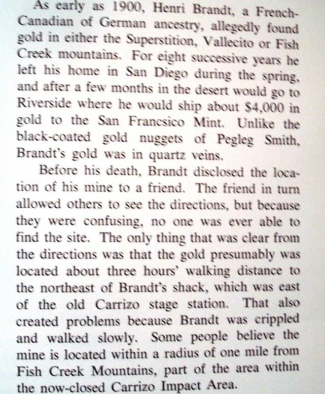
I think the "shack" shown as a pinned photo on G.E. near the Carrizo stage station maybe Brandts shack.
As best as I can determine from LIndsay and Wray, the rock house west of the stage station was built by the Graves Family out of El Cajon in the early 1950s. The land was deeded to ABDSP and the place fell into disrepair. The Brandt cabin was supposedly four miles east of the stage station somewhere between the mouths of Deguynos and Barrett Canyons. Regardless, Desert Mag has the "exact" location and it's smack dab in CIA. The full article is in the July 1966 issue and is actually a response to an October 1964 article that suggest an approximate location. Again, thanks for the great story. Tom
X marks the spot!
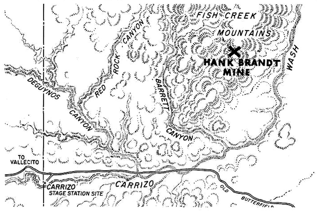
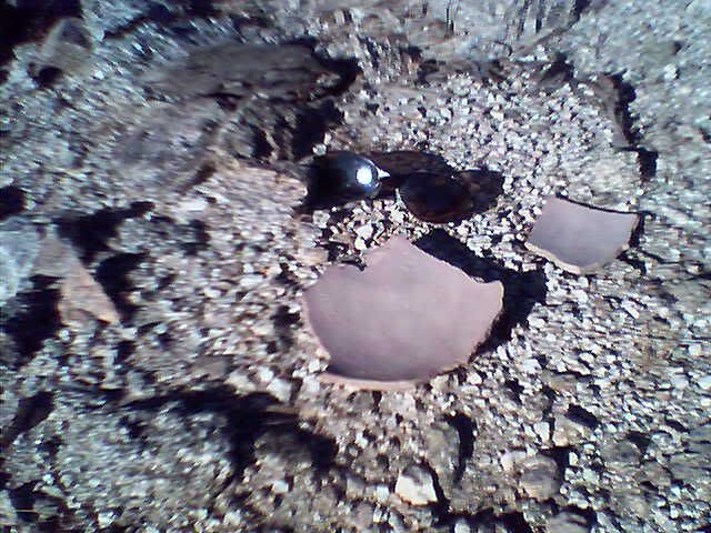
Hank Brandt Mine by tomteske, on Flickr |
2/11/2014
Topic:
Night timelapse from the last few weeks
tommy750
|
Very nice. Great video. Would love to see more. Tom |
2/13/2014
Topic:
Cactus, Big Horn Sheep and the Goat Canyon Trestle
tommy750
|
Nice pics and trip. Can't believe I've never been out there. Thanks. Tom |
2/18/2014
Topic:
Happy Presidents Day Weekend!!!
tommy750
|
Nice Kit Fox! See those occasionally with the high beams on but not that close. Great shot. Tom |
2/18/2014
Topic:
Blair Valley and Mud Caves with the Kids
tommy750
|
Nice trip. Was about that age my first trip out to ABDSP and never quit going. Suspect that bunch won't either. Great looking point. Tom |
2/19/2014
Topic:
Happy Presidents Day Weekend!!!
tommy750
|
Great video of your little trash bandit! Tom |
2/20/2014
Topic:
Salton Sea Exploration
tommy750
|
Have to agree with Ziphius. That was an epic report! Looks like the water level was a few feet lower than the last time I was out at Bombay Beach. Never been to Salvation Mt. Need to get out there. Interestingly it's built on the old Lake Cahuilla shoreline. Thanks. Tom |
2/23/2014
Topic:
Sandstone Canyon Discovered
tommy750
|
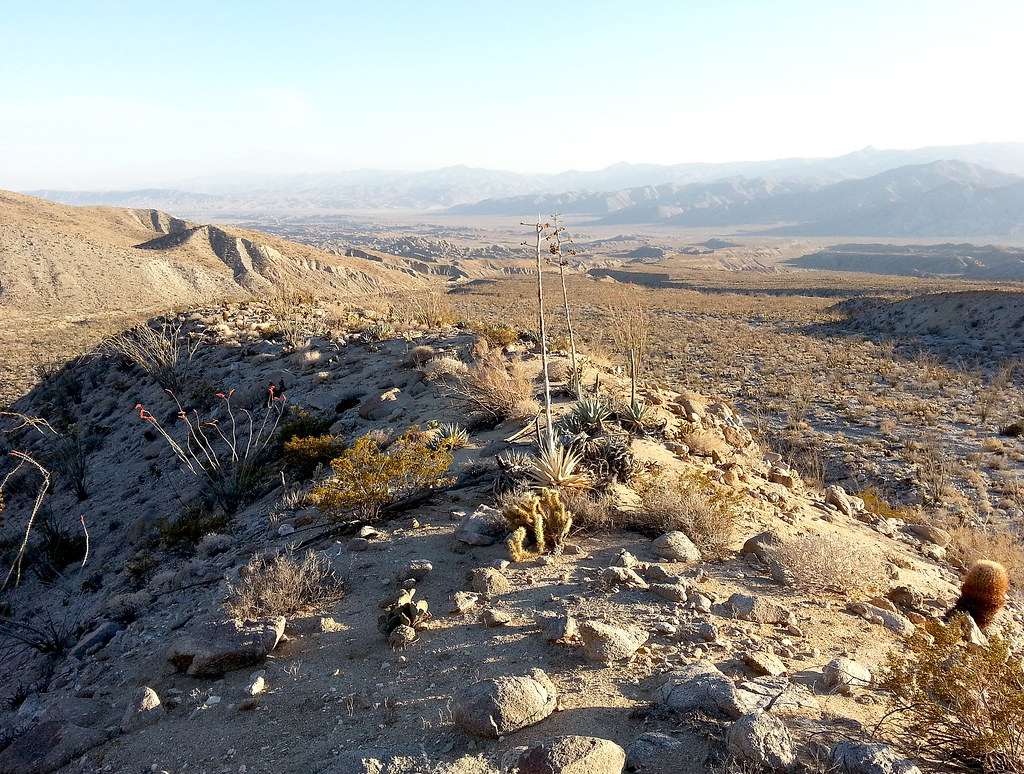
Have been thinking about an east approach to Whale Peak so thought I'd drive up June Wash and take a little hike to check out the terrain. Ascended a shoulder of Diablo with the great views it affords
June Ridge by tomteske, on Flickr
Was a little careless with the cholla but glad I was wearing jeans.
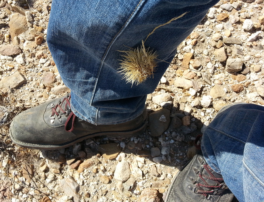
Cholla by tomteske, on Flickr
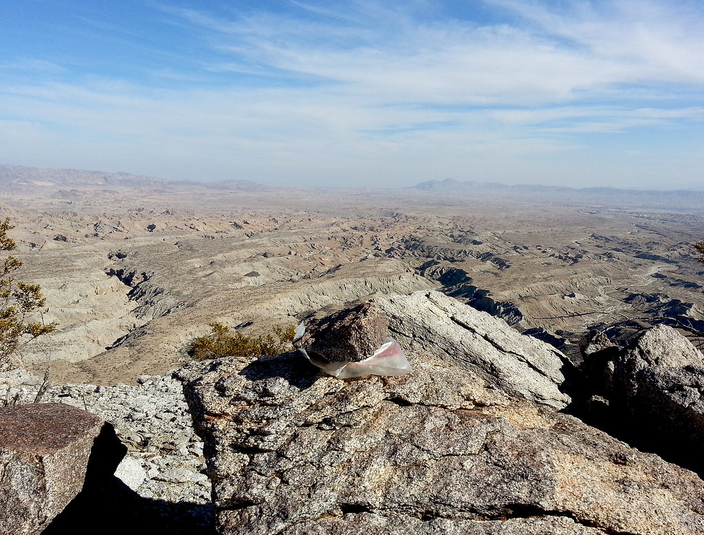
View from the highest point on Diablo, a bit north of the BM. Seems to have a competing register. Sandstone passes to the left of Diablo and June to the right. Seco del Diablo and Tapiado dead end into it.
Diablo by tomteske, on Flickr
BM Diablo
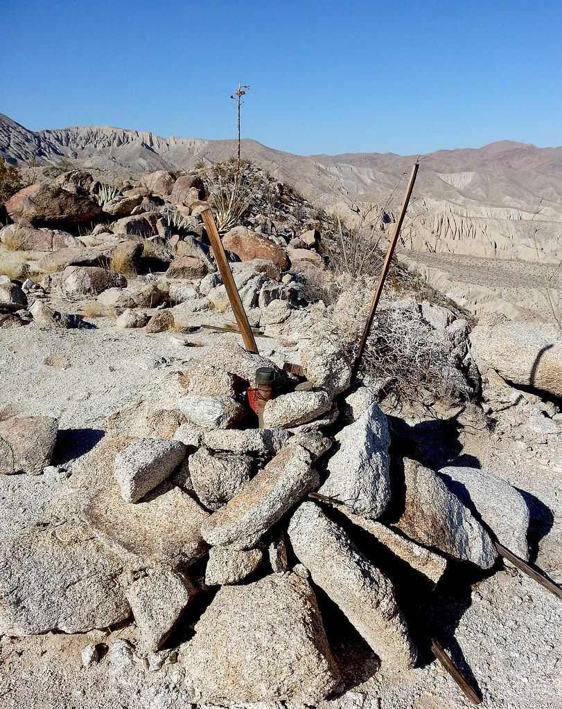
BM Diablo by tomteske, on Flickr
Found this business card with the date on the back.

Carl Whitefield by tomteske, on Flickr

Carl Whitefield2 by tomteske, on Flickr
Have never heard of this person, but the internet has! Apparently Whitefield was with the Asst. District Superintendent Leo Crawford on top of Whale Peak some time in 1955 and noticed a prominent canyon to the east. Later that year, they explored the area and discovered the now named Sandstone Canyon. Whitefield revisited the area in December 1955 with a William Kenyon and "with our wives", the trip and canyon's discovery documented in Desert Magazine here: http://mydesertmagazine.com/files/195609-DesertMagazine-1956-September.pdf So sometime right around the canyon's discovery, Whitefield climbed Diablo and left his card in the registry. Isn't that a neat bit of park history? Possibly even true
Headed home. Enjoy. Tom
June Wash by tomteske, on Flickr
edited by tommy750 on 2/23/2014
edited by tommy750 on 2/23/2014 |
2/24/2014
Topic:
Sandstone Canyon Discovered
tommy750
|
Daren, you told me about your back breaking east Whale Pk descent. Was hoping to find something easier! Tom |
2/24/2014
Topic:
Show us your Cholla bomb photos
tommy750
|
surfponto wrote:
Found this shot from our Inner Pasture Hike we did with Daren a couple years back.

Nice one-off designer shoes there |
2/27/2014
Topic:
Jamul Kiln Ruins
tommy750
|
You can check the CDFW Lands Staff Directory below but I don't see "Lands Supervisor" on the list. Maybe the dept. website is being updated to reflect this as well?
http://www.dfg.ca.gov/lands/directory.html |