3/1/2014
Topic:
Peace and quiet, stars and pottery
tommy750
|
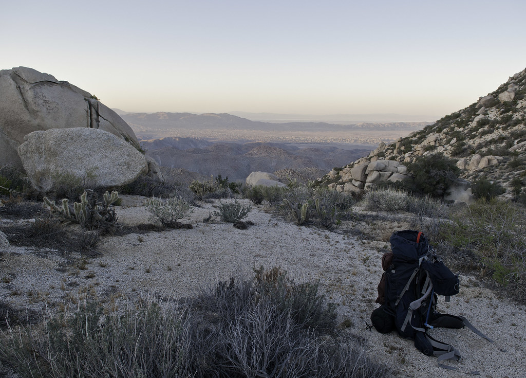
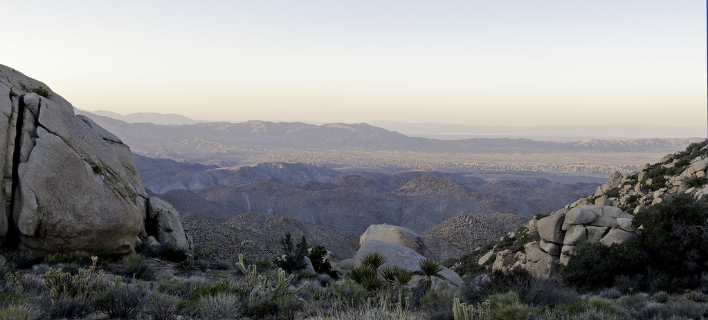
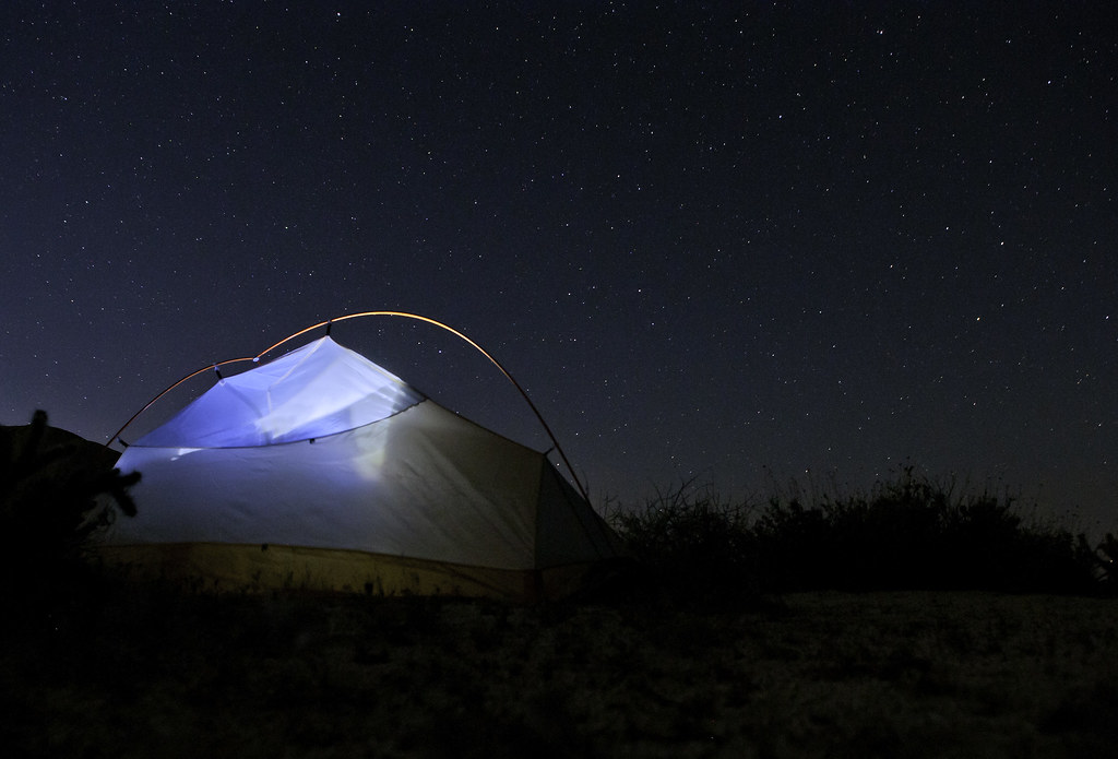
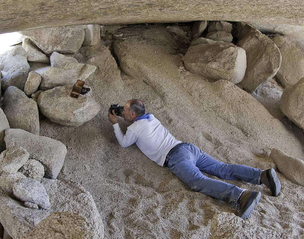
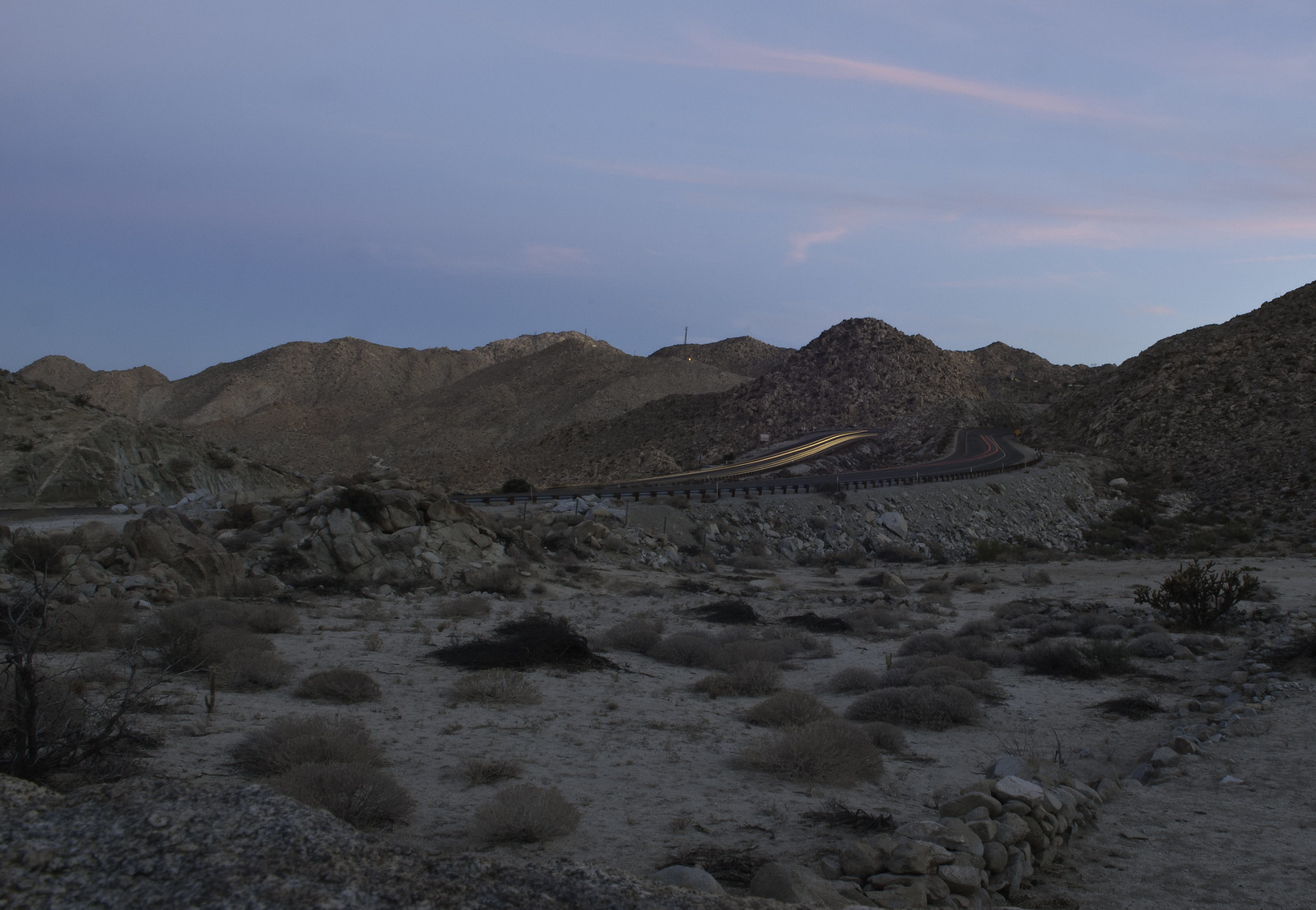
Nice trip and pics, Jim. With your night shots and the Sony, at least you don't have to worry about the mirror up vibration problem! Have you tried covering the lens with your hat etc right when you push the shutter to avoid shutter bounce? Liking the size of your camera as well. Full size DSLRs are like carrying a lead brick around with you. Thanks. Tom |
3/7/2014
Topic:
Peace and quiet, stars and pottery
tommy750
|
Jim (ziphius) wrote:
Tom, you give me too much credit photography-wise. I had to look up "shutter bounce" to find out what it means.  Thanks for the advice, I like the size of this camera too! It was recommended to me by a coworker who has used it to photograph whales and penguins from a unmanned aerial system (a glorified toy hexacopter). The NEX6 was light enough to get the job done: Unmanned Aerial System Page Thanks for the advice, I like the size of this camera too! It was recommended to me by a coworker who has used it to photograph whales and penguins from a unmanned aerial system (a glorified toy hexacopter). The NEX6 was light enough to get the job done: Unmanned Aerial System Page
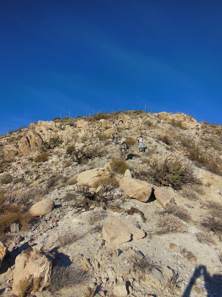
I would guess that these systems could be used to conduct bighorn surveys in remote areas, to replace the light aircraft filled with biologists. I've heard the bighorn aerial survey census is defunct because of safety reasons. See, I'm bringing this thread back to an Anza Borrego theme...
tommy750 wrote:
Nice trip and pics, Jim. With your night shots and the Sony, at least you don't have to worry about the mirror up vibration problem! Have you tried covering the lens with your hat etc right when you push the shutter to avoid shutter bounce? Liking the size of your camera as well. Full size DSLRs are like carrying a lead brick around with you. Thanks. Tom
edited by ziphius on 3/1/2014
A drone is definitely on my wish list! That sound like an amazing way to see large chunks of the desert-like the CIA If anyone has any footage of ABDSP from a drone, it would be neat to see. Tom |
3/7/2014
Topic:
Peace and quiet, stars and pottery
tommy750
|
dsefcik wrote:
tommy750 wrote:
Have you tried covering the lens with your hat etc I tried that once, to try and get star trails with a fireball point....only problem was I started drinking and talking with the other guys and totally forgot to remove the hat so in the morning I had a 16 hour exposure of my hat 
I think that is the funniest post you've ever made, Daren! The two times I've stumbled across your campsite out in the desert at night, I know I've ruined your time exposures with my headlights. Now, you have a perfect solution! Tom |
3/7/2014
Topic:
Sandstone Canyon Discovered
tommy750
|
mrkmc wrote:
Nice! I saw Leo's card in another register a few years ago:

That's a great find! Can we all pay a penny more on our property taxes so these guys can get laminated business cards we'll all be able to enjoy in like 200 years?? I think this ambulance driver from Diablo's register is on to something

Laurence Daniel Gagnon by tomteske, on Flickr |
3/23/2014
Topic:
Some benchmarks and Truckhaven Trail, March 2014
tommy750
|
Nice trip. Found a .50 cal round on the bluff just east of paint as a kid. Great memories camping and exploring in Fonts Point wash. Thanks. Tom |
3/26/2014
Topic:
SCORE Comes To Imperial Valley
tommy750
|
Here's the official map for the upcoming SCORE 250. No shortcuts up EC085 this weekend! Tom
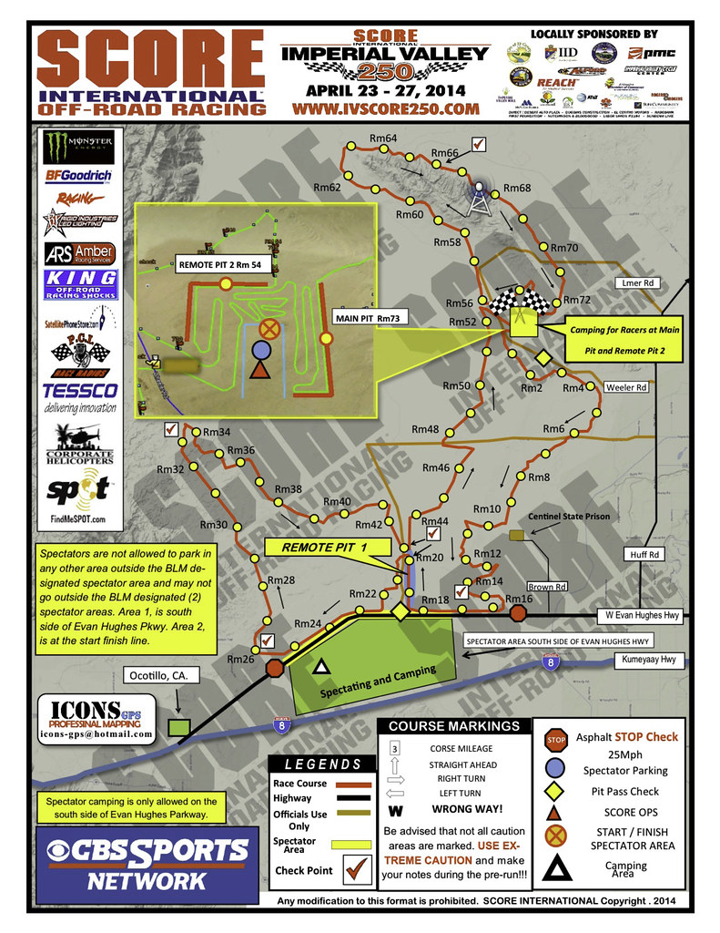 |
3/30/2014
Topic:
Saving the Mojave from the solar threat
tommy750
|
Nolan (anutami) wrote:
I spoke with the engineer who designed the solar farm in Ramona where I live (off dye road)and he said the Desert is not the best place to put solar because the electronics in the panels get extremely hot during the summer and start to limit production. He also said the solar companies are paying $600 per acre per month to lease the land, which includes all set up and tear down for free. The farm in ramona is 43 acres so I am pretty sure the farmer is getting 25k per month! Not a bad way to make a living. I am not sure about BLM land though. If that is the case a 4,000 acre solar farm near soda mtn would give the gov't $2.4 mil per month! No wonder our backcountry lands are being sold out under our feet.
Here is the link to the ramona farm
http://m.utsandiego.com/news/2013/feb/06/ramona-solar-farm-county-supervisors/[/quote]
Was out with Jeff Sahagun, the BLM El Centro archaeologist a while back and I asked him why not put solar on all the marginal Imperial Valley farmland instead of scraping pristine BLM desert. He replied that BLM desert is essentially free for these large corporations but they'd have to pay a few bucks monthly to rent farmland, so that was a nonstarter. Guess BLM (AKA we taxpayers) is getting jack for these destructive solar arrays that should be on our roofs and not in our deserts.Tom |
3/30/2014
Topic:
Fish Creek Mountains
tommy750
|
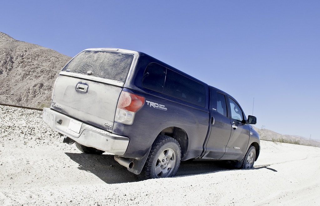
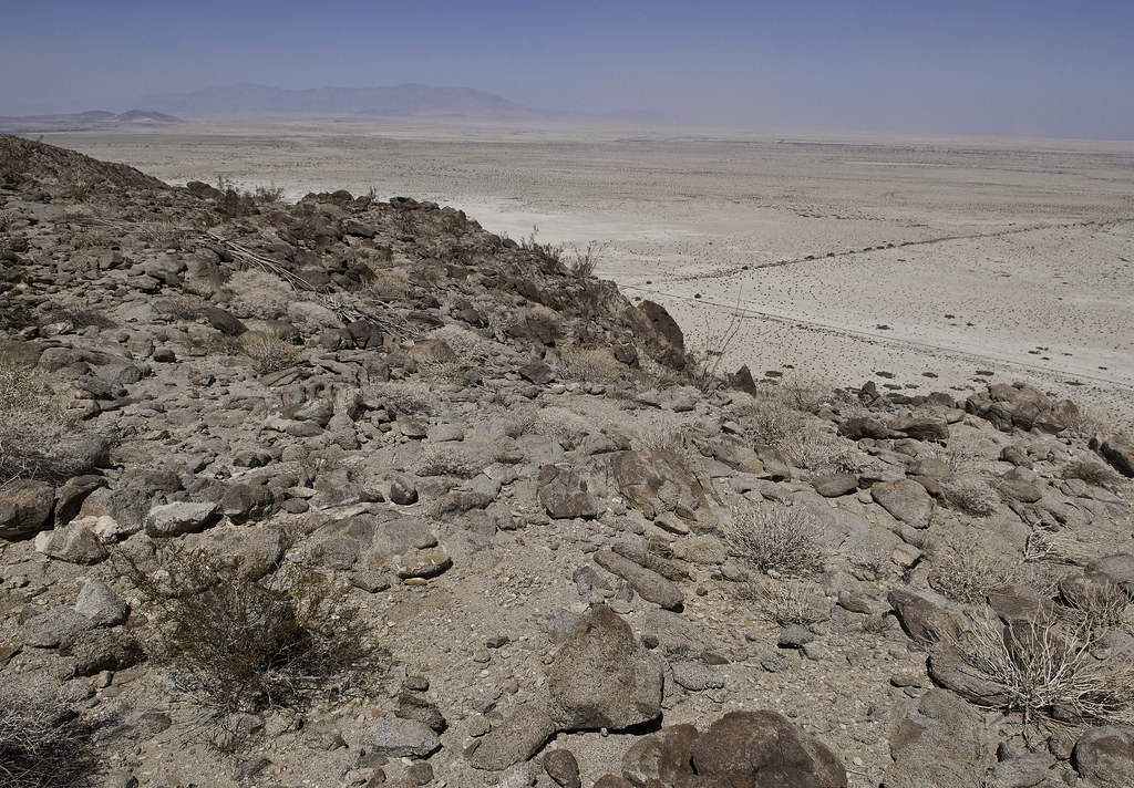
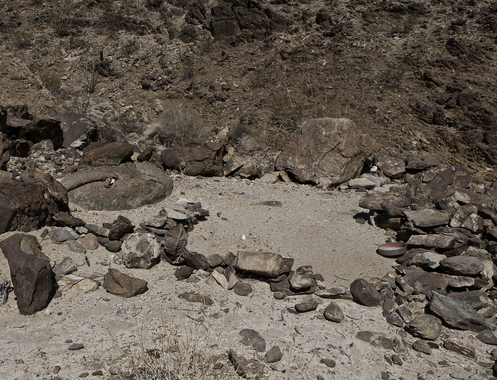
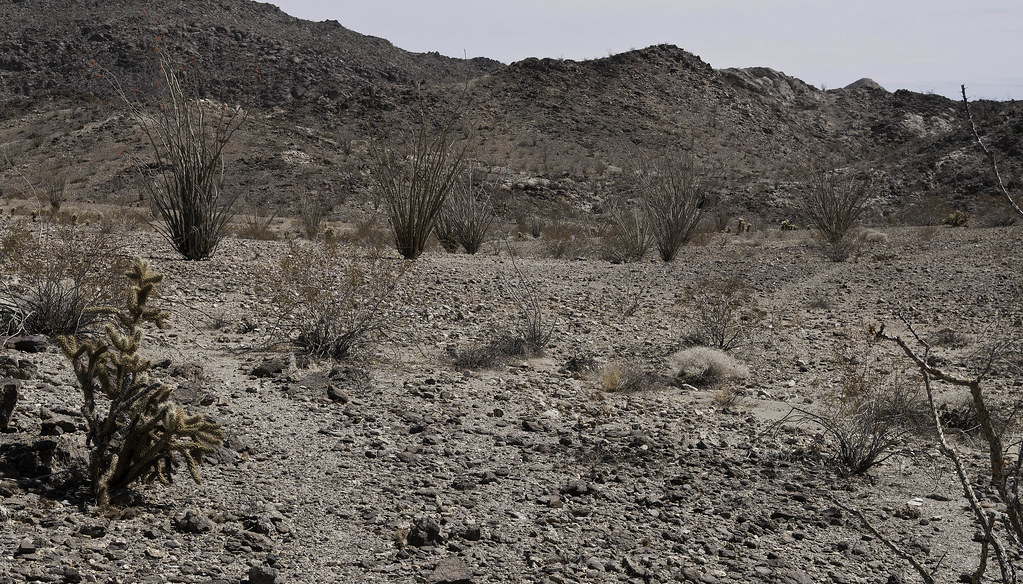
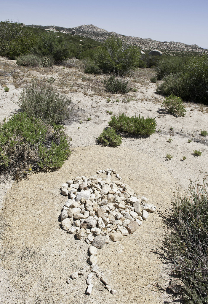
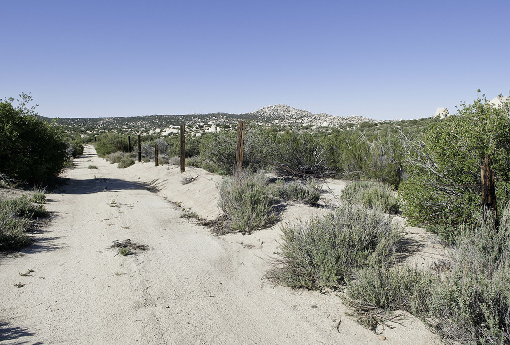
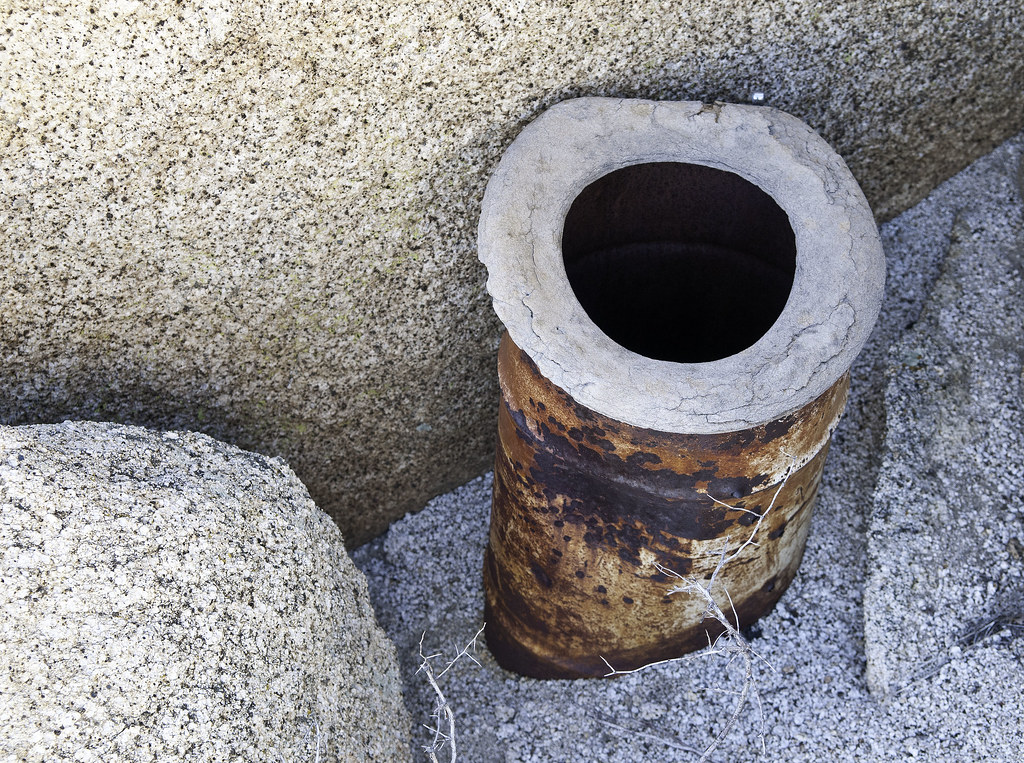
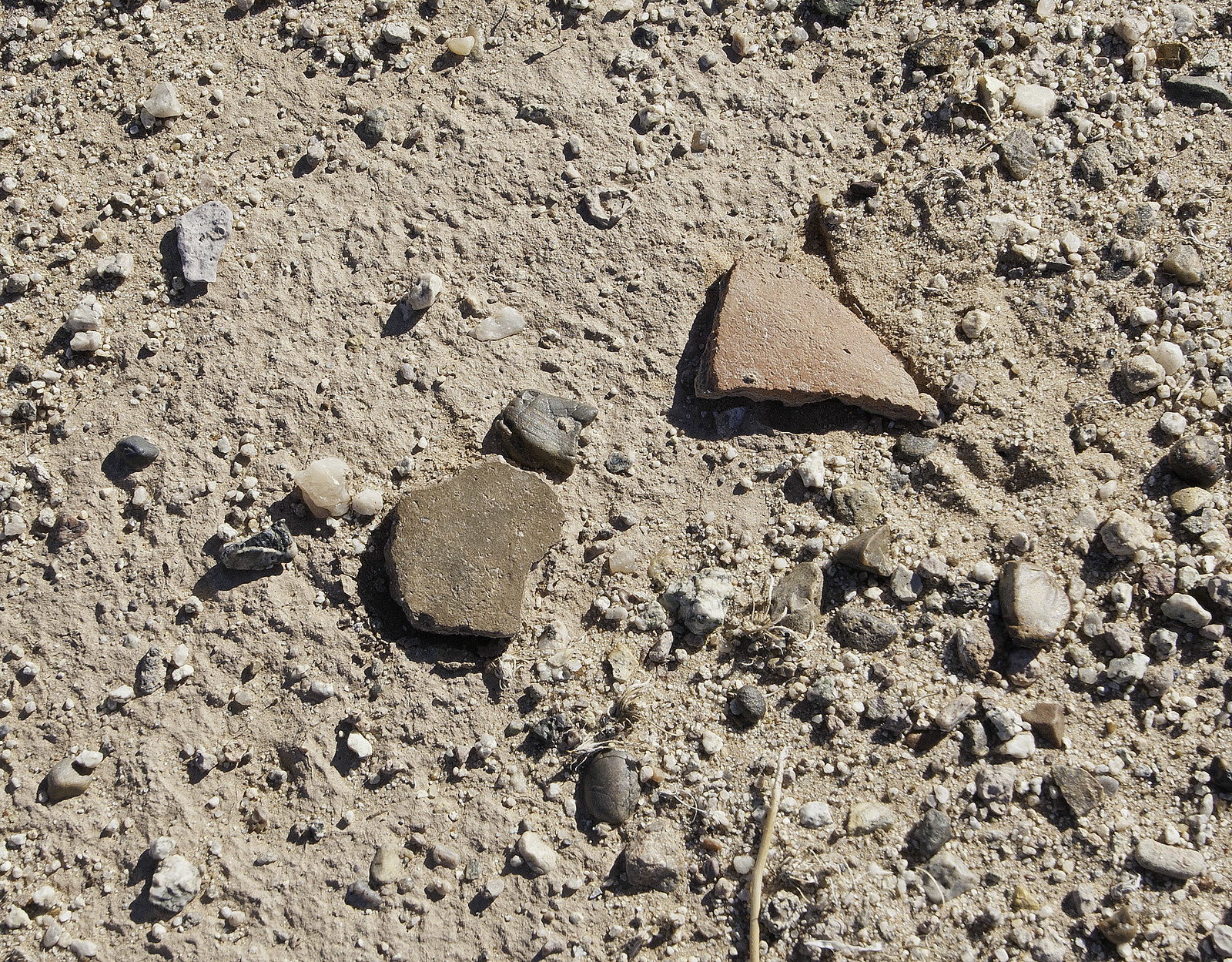
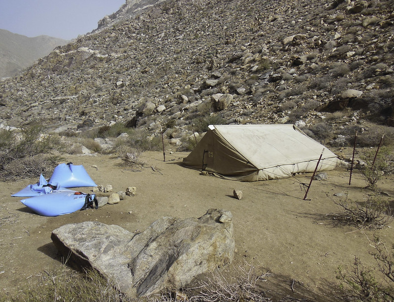
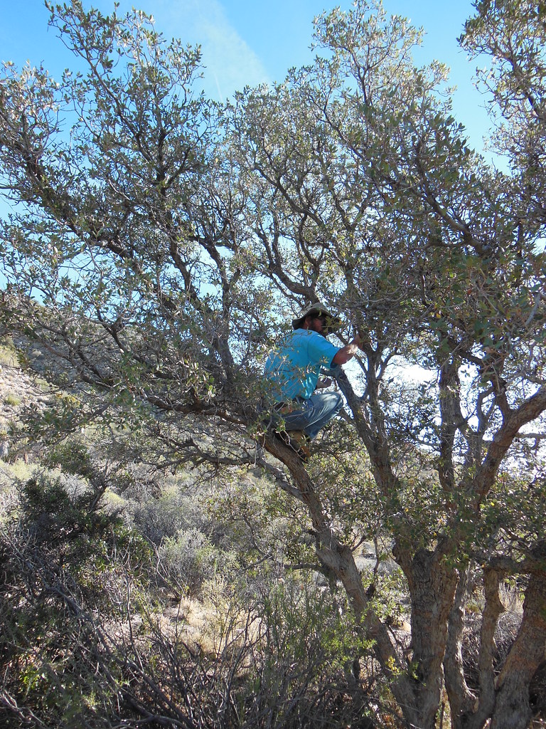
In an act of penance for eating an entire can of Pringles BBQ on the drive back from SD not to mention ice cream cake washed down with vodka a little later, decided to hike into the Fish Creek Mts even though the forecast was for temps in the mid 80's. Headed up EC085 and encountered the standard sand and silt. Who makes a shell that won't fill with tons of dust after one trip out! They leak like sieves even though I seal the tailgate with foam and have a bedliner 
While ascending, found a mine near the trail and behind that, a site littered with pottery sherds.
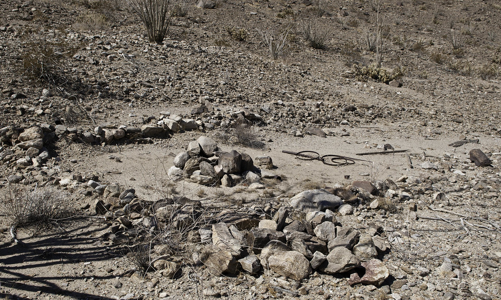
Finally getting on top, spied an old miner's camp still containing the essential frying pan.
The long metal thing looks like an umbrella shaft.
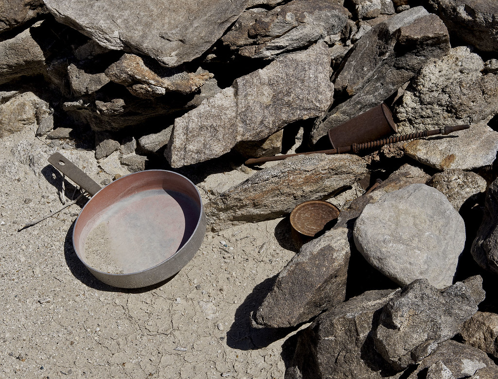
If only we could find "John", we could give him his pan back
Also found what appears to be an old round at the campsite.
Lots of trails crisscross the area. Here's a trail junction, both leading toward the confluence of Barrett and Red Rock Canyons
Another miner's shack down Red Rock Canyon.
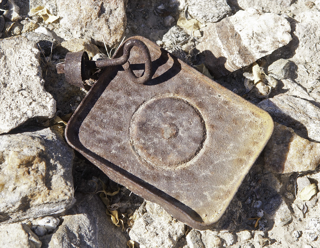
Old School tins.
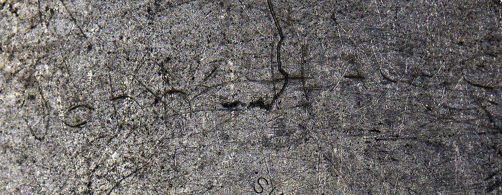
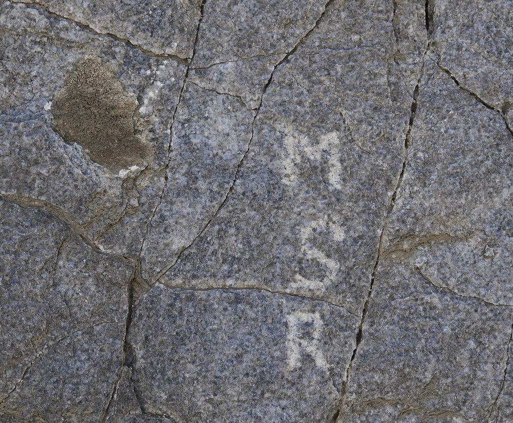
Maybe an old miner's historical graffito.
Headed toward Barrett on an old trail for a peek at the CIA. Just happened to stop right at the border. This is actually a tributary of Barrett.
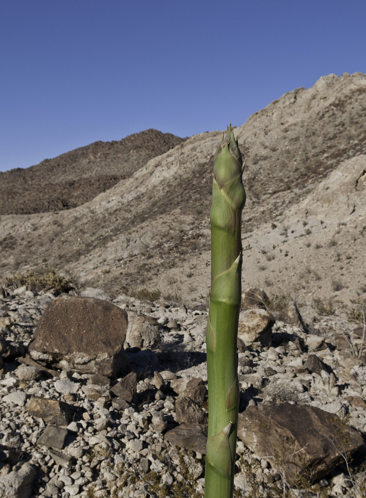
A new agave stalk pretty much marked the boundary.
A little over nine miles, 3K gain/loss, 3 liters, 6 salt tablets-all because of a can of Pringles Now, time for salmon with brown jasmine rice, honey dew. And, vodka. Enjoy. Tom |
3/31/2014
Topic:
Mojave Desert
tommy750
|
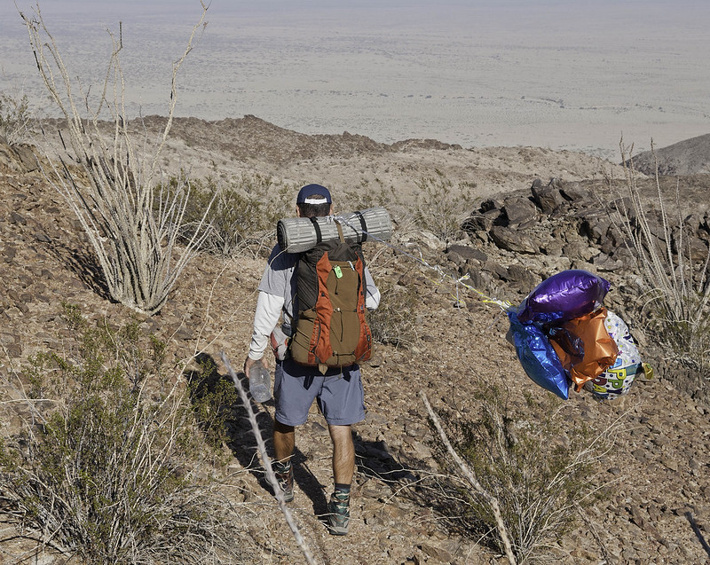
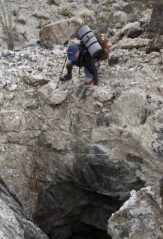
Very nice pics, Daren. Finally, your star trails were affected by something other than someone's headlights When I visited the Blythe Intaglios, held my camera overhead with a monopod and used a fisheye. A drone would really be awesome, however. That canyon Gary is climbing out of doesn't quite look like an "easy" hike! Tom |
3/31/2014
Topic:
Fish Creek Mountains
tommy750
|
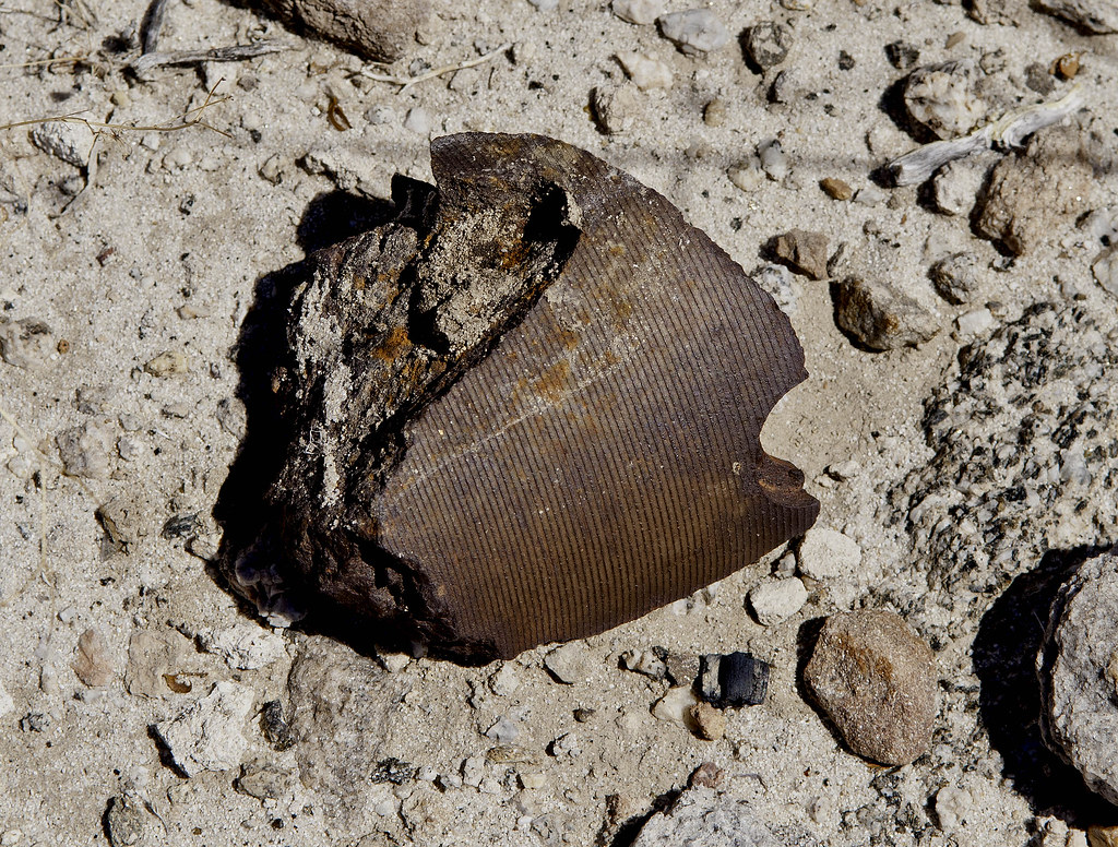
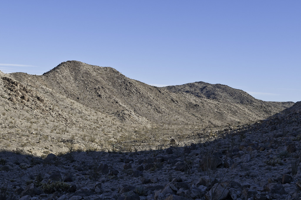
For all the Teflon frying pan skeptics out there, this (obviously) Regal Ware made in the USA high quality cooking implement could have be made as early as 1960 when Teflon was introduced to the American culinary scene. I chose to leave it in situ knowing it was probably already a historical artifact If my recollections are correct, a lot of these Fish Creek Mts mines date back to WWII and have been sporadically worked up till the 60's and 70's. I counted at least seven mines while hiking around yesterday. Most were shallow pits but some were about 8-10ft deep.
Jim, that should be the Santa Rosas in the background |
3/31/2014
Topic:
Mojave Desert
tommy750
|
dsefcik wrote:
tommy750 wrote:
That canyon Gary is climbing out of doesn't quite look like an "easy" hike! Tom  Well, he did carry all my water, I just carried my camera in my hand, no backpack or anything....was kinda nice, all my hikes should be like that.... Well, he did carry all my water, I just carried my camera in my hand, no backpack or anything....was kinda nice, all my hikes should be like that....
Yeah, I remember carrying water for some sheep counter guy on a 9 mile hike up Rattlesnake Canyon earlier this month. Hey, wait, that was for you! |
4/1/2014
Topic:
Another Journey Up Fish Creek with a Backpack trip
tommy750
|
Great trip report, Nolan. Nice to see the sheep are making more sheep. That kid they were searching for is Mickey Guidry and here's a link to one of the many article written about his disappearance: http://eastcountymagazine.org/node/2826. The vehicle he ran away with made it to the bottom of the Pinyon drop off but things get murky after that. Surprised to learn one of the sheriffs officers searching for him ended up marrying his mom. Tom |
4/1/2014
Topic:
Another Journey Up Fish Creek with a Backpack trip
tommy750
|
dsefcik wrote:
Smart man giving the kids radios to carry along...
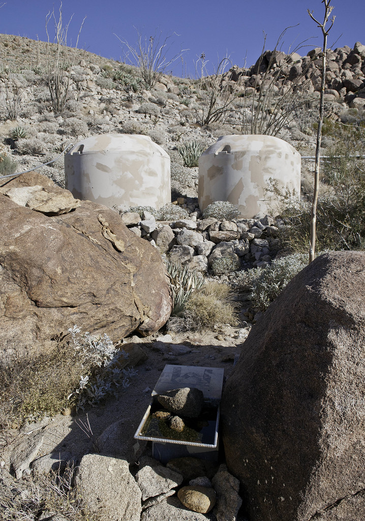
I think Tom and I did a very similar route back in December, the tanks were full at 12,000 gallons each (if I remember correctly)
Something didn't look right about those tanks. Those are at a guzzler 1 mile east of Dave McCain Spring. Now, the hike makes sense. Tom
Here's the Dave McCain Spring Guzzler we visited.
 |
4/9/2014
Topic:
Davies Valley and Pinto Canyon
tommy750
|
Florian wrote:
I didn't realize Davies Valley was closed to vehicles now. I've camped in Boundary Canyon years ago.
-Florian (who is reading through old posts)
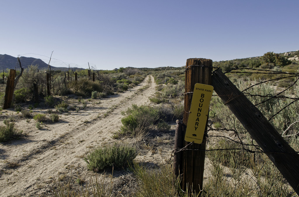
The Jacumba Wilderness was designated in 1994 but not sure exactly when the gates went up. Sure is peaceful. Have yet to see a single person while hiking out there. Tom |
4/9/2014
Topic:
West Mesa
tommy750
|
Florian wrote:
I drove EC085 for the first time today. Drove south to north. Lots of silt and not a very interesting road. But the Fish Creek mtns are enticing. Didn't do much hiking but did visit the WHIT benchmark and signed below Tom .. http://instagram.com/p/mls77rvarT
The register needs a new logbook.
-Florian
Agree, the mts are enticing. Still need to hike the entire ancient shoreline on the NE edge and spend a day or two on top. Anyone know a source to ID old mining claims? There's a bunch of them out there. Would be interesting to know their history. Tom |
4/14/2014
Topic:
Southern AB, April 2014
tommy750
|
Another great trip out in the desert, Florian. Your jet photo reminds me of one I "took" while out in Superstition photographing the Blue Angels a few days after getting my new Tundra in 2009 (it most certainly doesn't look like this now!). Was amazed to see a photo of the month winner in Nat Geo with the Blue Angels in the background of some guy's dog pic looking equally as fake as mine. Lots of readers called them on that one. Tom
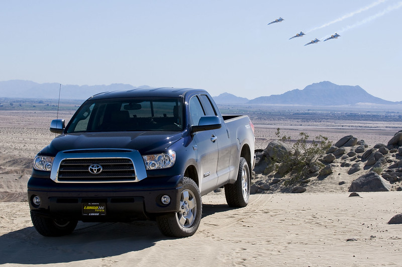 Blue Tundra and Blue Angels by tomteske, on Flickr Blue Tundra and Blue Angels by tomteske, on Flickr
 Blue Angels at Superstition by tomteske, on Flickr Blue Angels at Superstition by tomteske, on Flickr |
4/28/2014
Topic:
Cactus spring trail to Martinez Canyon Rock House
tommy750
|
Great trip, Rockhopper. You beat the stormy weather I'm presuming? That cabin looks pretty neat. Tom |
5/1/2014
Topic:
Pattern Energy Fraud?
tommy750
|
You may want to check out East County Magazine's report on Ocotillo Wind's first year production numbers and Pattern's misleading and potentially fraudulent application for the project. Incendiary. Tom
http://eastcountymagazine.org/was-it-fraud-experts-raise-serious-questions-after-low-first-year-energy-production-ocotillo-wind-pr |
5/1/2014
Topic:
The Impossible Railroad
tommy750
|
My thoughts exactly on the tickets. Would be nice to borrow that guy's vehicle for a spin, however. |
5/4/2014
Topic:
Sombrero Overnight Backpack
tommy750
|
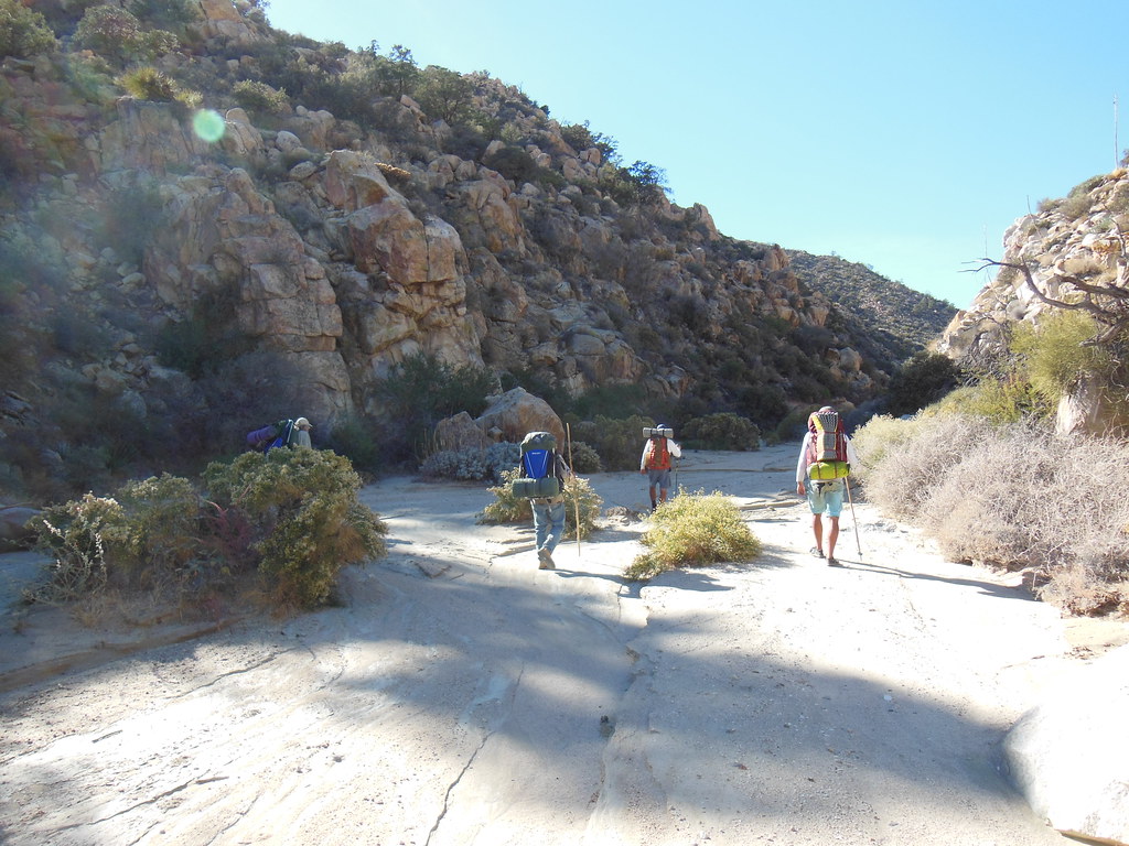
Friday after work, I finally threw all the overpriced lightweight backpacking stuff I bought at REI about a year ago into my pack and headed out for a little trip. Actually, this was my first overnight trip ever excluding once in a college backpacking PE class. Decided to head out to Sombrero Peak and muck around since the desert floor was heating up. My pack weighed in at 40lbs which is insanely heavy for a dayhiker but apparently no big deal for the backpacker crowd which I have yet to join.
This must be the way.
 The Way to Sombrero by tomteske, on Flickr The Way to Sombrero by tomteske, on Flickr
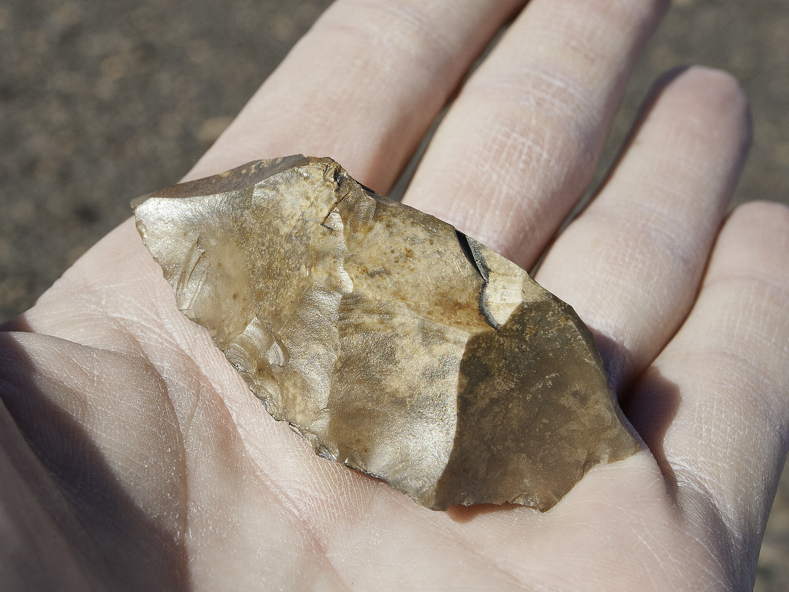
Headed down Canebrake road toward Sombrero Peak. On the way back found a nice uniface right in the middle of the road about here. If you start at Cottonwood East and take Canebrake Rd, you can now hit an ATV trail (BP?) that will take you right up to the ridge west of Sombrero and skip traversing the brush choked ravines you used to cross in the last mile. Progress?
 Canebrake Road by tomteske, on Flickr Canebrake Road by tomteske, on Flickr
An old abandoned ranch on the way. Old magazines lying around were dated to 1992 which seemed about right.
 Canebrake Ruins by tomteske, on Flickr Canebrake Ruins by tomteske, on Flickr
 Canebrake Ruins2 by tomteske, on Flickr Canebrake Ruins2 by tomteske, on Flickr
An old corral and chute to the north just outside of the ABDSP boundary.
 Canebrake Chute by tomteske, on Flickr Canebrake Chute by tomteske, on Flickr
Entering the park. A small portion of it jogs south to this point after passing just below Sombrero Pk.
 Canebrake Boundary by tomteske, on Flickr Canebrake Boundary by tomteske, on Flickr
Tule Mt and Jacumba in the distance.
 Toward Jacumba and Tule by tomteske, on Flickr Toward Jacumba and Tule by tomteske, on Flickr
Decided to camp at the saddle below the peak.
 Sombrero Saddle by tomteske, on Flickr Sombrero Saddle by tomteske, on Flickr
Nice view of the Tierra Blancas and Carrizo Badlands.
 Sombrero Saddle Dusk by tomteske, on Flickr Sombrero Saddle Dusk by tomteske, on Flickr
Mandatory night sky with tent illuminated by headlamp time exposure
 Sombrero Night by tomteske, on Flickr Sombrero Night by tomteske, on Flickr
The next morning.
 Sombrero Sunrise by tomteske, on Flickr Sombrero Sunrise by tomteske, on Flickr
Packed up and headed down into the draw below. Found a few rock features and sherds but couldn't really explore much because of time commitments.
On the way back started seeing sherds and flakes in the trail which apparently crossed a large village site.
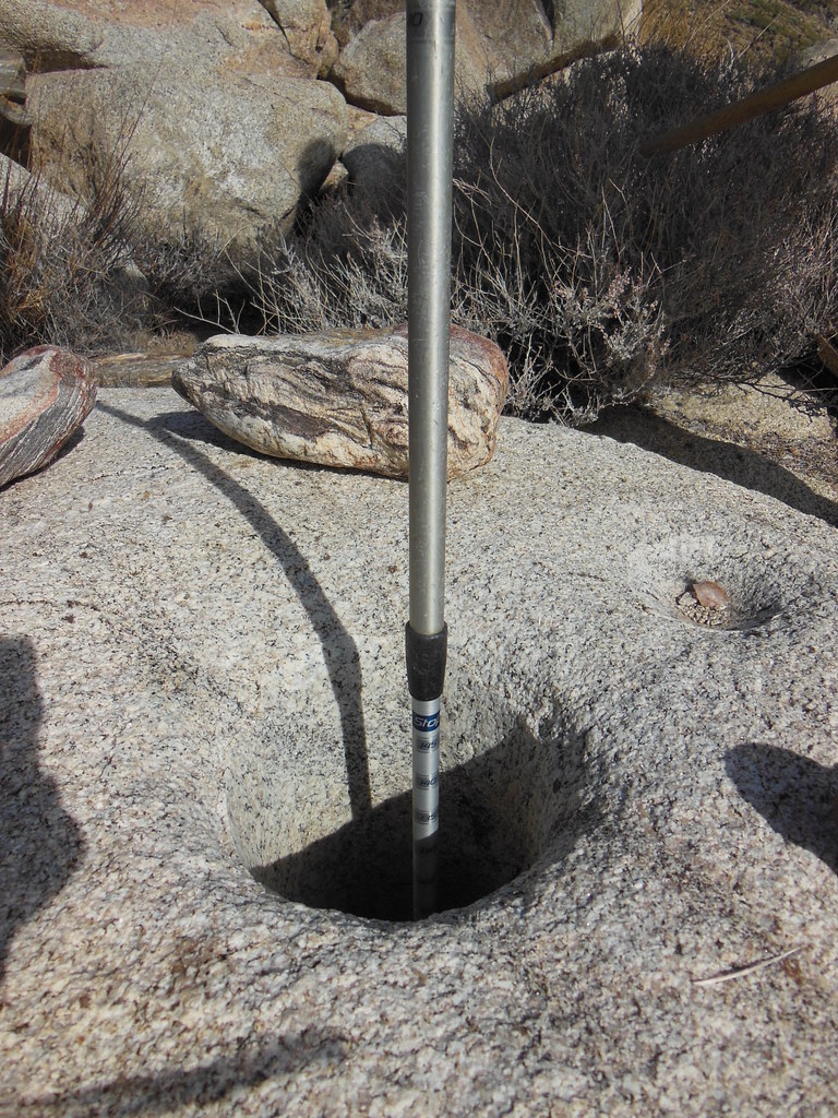
Lots of morteros.
 Villiage Morteros by tomteske, on Flickr Villiage Morteros by tomteske, on Flickr
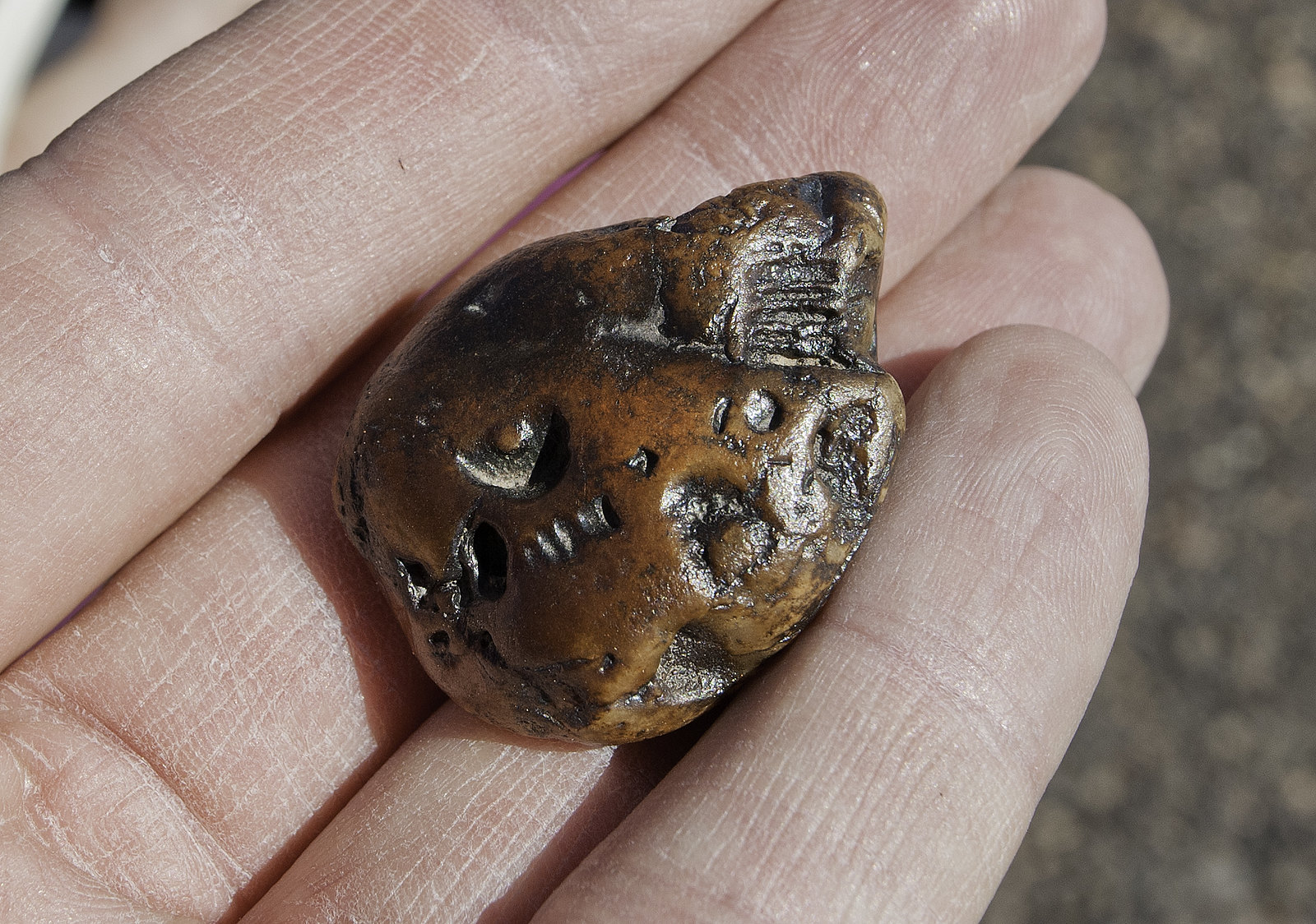
Nice core. Almost looked like it could have been some sort of hammer stone since it had a lot of pitting and abrasions on it.
 Village Core by tomteske, on Flickr Village Core by tomteske, on Flickr
This loo looks like a modern addition to the site
 Village Loo by tomteske, on Flickr Village Loo by tomteske, on Flickr
The site was well onto BLM land so I'm not sure how this sign fit in.
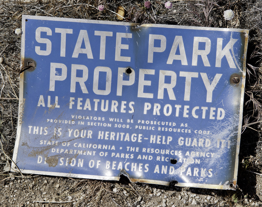 Village Sign by tomteske, on Flickr Village Sign by tomteske, on Flickr
Almost stepped on this guy as I was approaching Cottonwood.
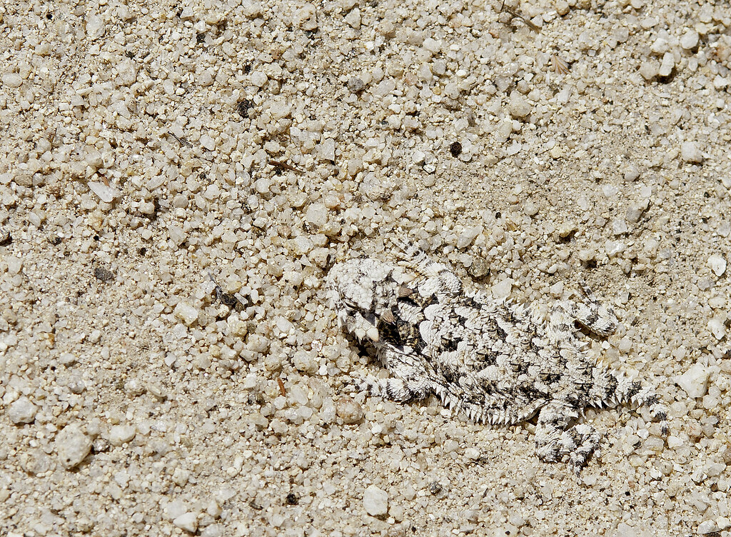 Cottonwood Horned Toad by tomteske, on Flickr Cottonwood Horned Toad by tomteske, on Flickr
Eleven miles, 2000ft gain/loss, 5 liters and a nice time. Not convinced I'm cut out for the heavy backpack "Lug Life" but time will tell. No heavy DSLRs next time for sure! Enjoy. Tom |
5/5/2014
Topic:
Sombrero Overnight Backpack
tommy750
|
Ziphius: I blame all you guys posting great TRs about backpacking in the boonies! Finally, couldn't resist.
Rockhopper: Agree they made water way too heavy I hear you with the sleeping pad. Ended up with an inflatable one which worked well except almost passed out trying to inflate the thing.
Dsefcik: Have been to Sombrero from the west multiple times dayhiking and never end up taking the same route since as you said, the trail kinda fades out. The red building is fairly recent so not a lot of cool stuff lying about.
Nolan: Yeah, definitely heating up out here; will you be sporting an A/C unit on your new camper?
Hikerdmb: Didn't go to the top this trip out but have in the past; amazing how you can see Sombrero from just about anywhere; weighed my camera and jacket when I got back: 6.5lbs. That's 3 liters of water right there!
Thanks for all the positive feedback. Definitely need to get back out there. Tom |
5/6/2014
Topic:
Sombrero Overnight Backpack
tommy750
|
Nolan (anutami) wrote:
tommy750 wrote:
Nolan: Yeah, definitely heating up out here; will you be sporting an A/C unit on your new camper?
Tom
Yes, I am actually driving up to Portland next week to pick up the camper (avoiding sales tax and delivery fees) I am going to take several weeks to work and explore the northwest. In addition to the ac unit I also ordered thermal pane windows which should help with insulation.
edited by anutami on 5/5/2014
Glad to hear you'll be up and running again. Sounds like a great way to spend a few weeks. Enjoy. Tom |
5/6/2014
Topic:
Sombrero Overnight Backpack
tommy750
|
dsefcik wrote:
I like the Sombrero Sunrise photo...so much for the security bars on the red building...
Was a real pretty sunrise; was surprised how the red building had no real signs of any animal occupation; expected it would be full of rats and bird poop etc at the least. Tom |
5/22/2014
Topic:
The Border and Pinto Wash
tommy750
|
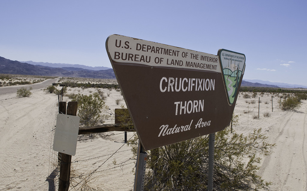
Had the afternoon off so decided to head out with my friend Amy for a drive. We've never been down to the border in the Yuha ACEC so headed out on Hwy 98 to EC 282. A little bit outside the park boundaries but still close enough Stopped at Crucifixion Thorn, apparently common in AZ and NM but not so in CA. Definitely pokey.
 Crucifixion Thorn by tomteske, on Flickr Crucifixion Thorn by tomteske, on Flickr
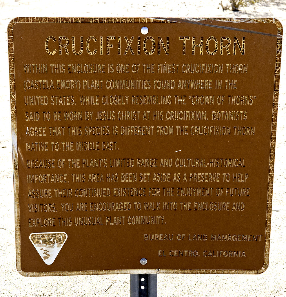 Crucifixion Thorn2 by tomteske, on Flickr Crucifixion Thorn2 by tomteske, on Flickr
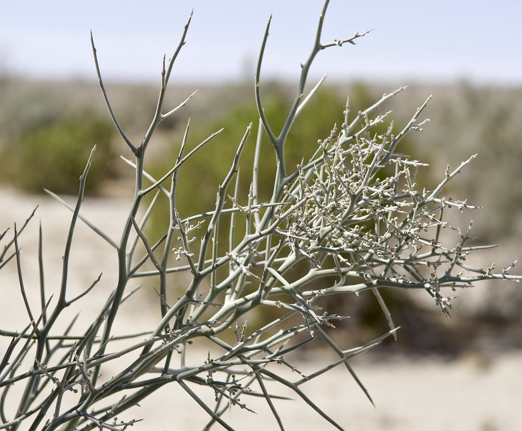 Crown of Thorn by tomteske, on Flickr Crown of Thorn by tomteske, on Flickr
The view toward Jacumba Wilderness. Skull Valley is on the other side of the mountain ridge.
 Border by tomteske, on Flickr Border by tomteske, on Flickr
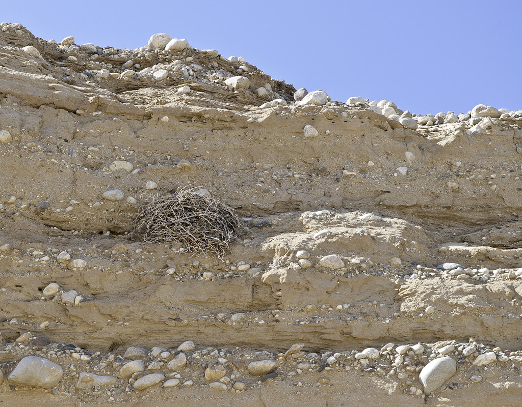
We turned north into Pinto Wash and I quickly noted a raptor nest tucked in the cliff face.
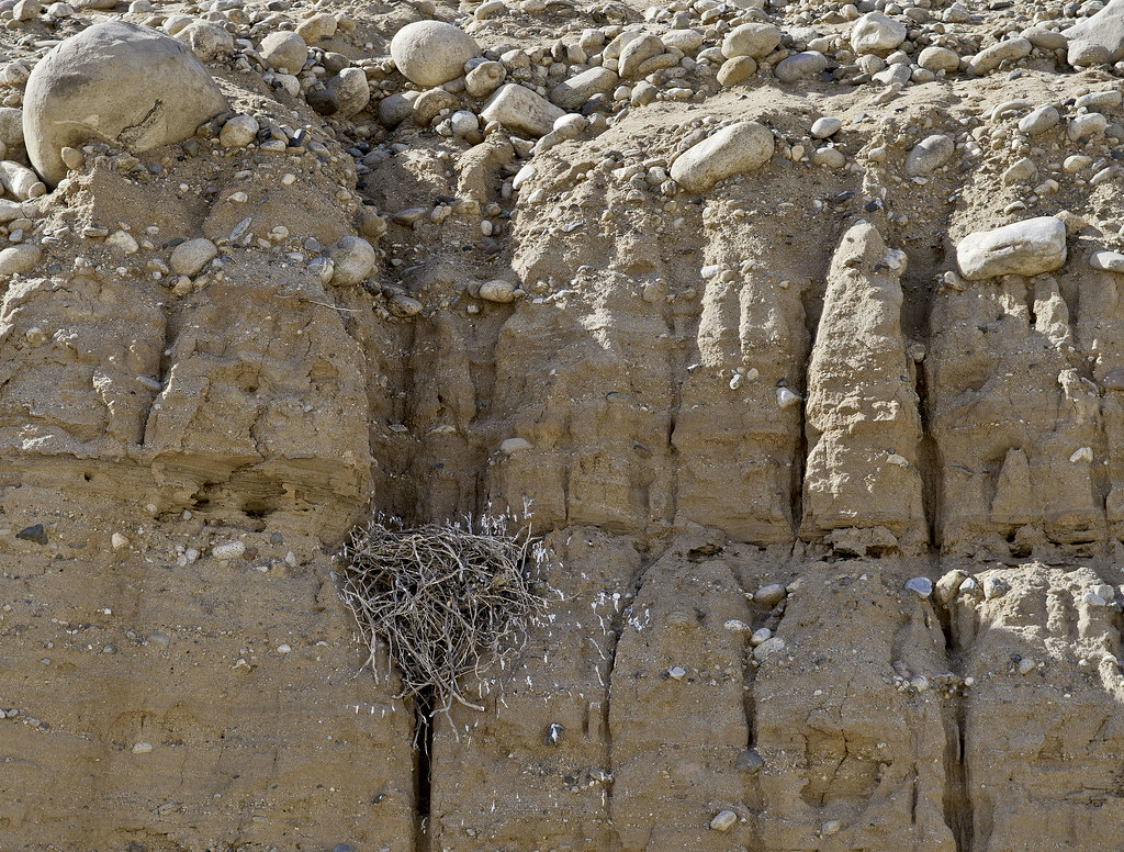 Pinto Raptor Nest by tomteske, on Flickr Pinto Raptor Nest by tomteske, on Flickr
Amy noted another one a couple hundred yards downstream.
 Raptor Nest 2 by tomteske, on Flickr Raptor Nest 2 by tomteske, on Flickr
This one seemed somewhat accessible from above so we climbed out of the wash to see if we could view the nest from above.
Nope!
 Raptor Nest 2 From Above by tomteske, on Flickr Raptor Nest 2 From Above by tomteske, on Flickr
Saw a hawk walking on the desert floor but by the time I could grab my camera, he'd flown off.
 Pinto Raptor by tomteske, on Flickr Pinto Raptor by tomteske, on Flickr
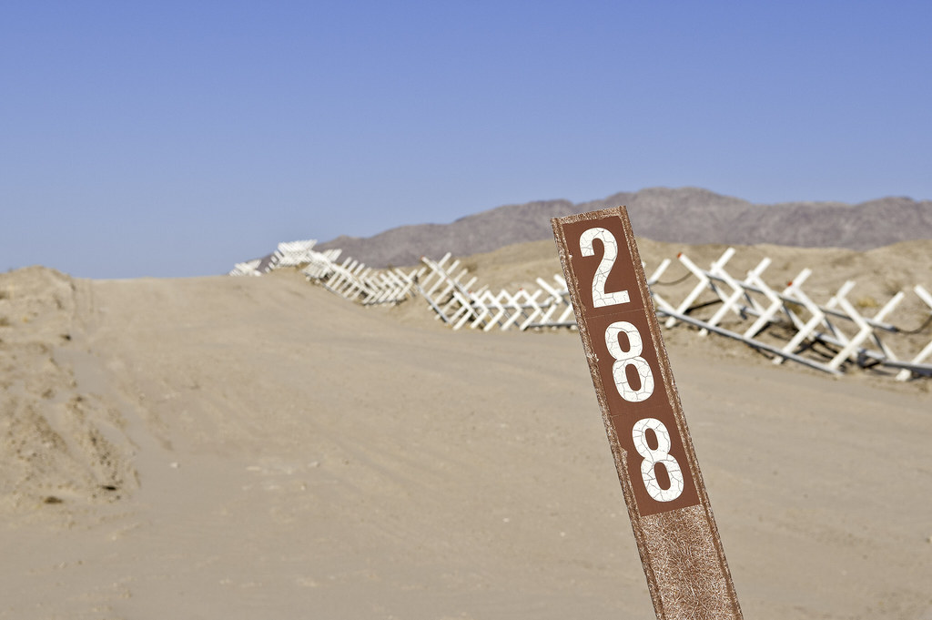
Came across boundary marker 228. Number 1 is near El Paso, TX and is the start of the land border with Mexico, the Rio Grande being the border further SE to the Gulf. Some may have visited 231 near Blue Angels Peak. Now might be a good time to recommend Rachel St. John's great book on the US Mexico border entitled, "Line in the Sand, A History of the Western U.S.-Mexico Border."
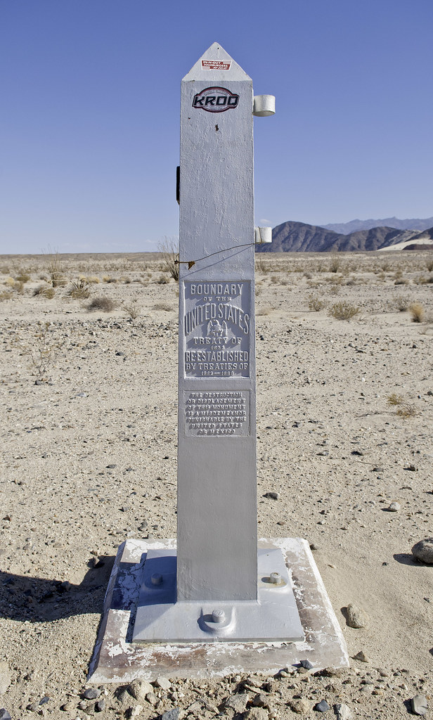 228 by tomteske, on Flickr 228 by tomteske, on Flickr
Here's 227 from the Mexican side:
 227 by tomteske, on Flickr 227 by tomteske, on Flickr
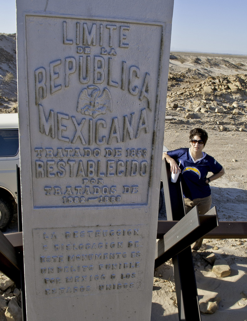 Limite de La Republica by tomteske, on Flickr Limite de La Republica by tomteske, on Flickr
Lots of signage regarding the trek ahead:
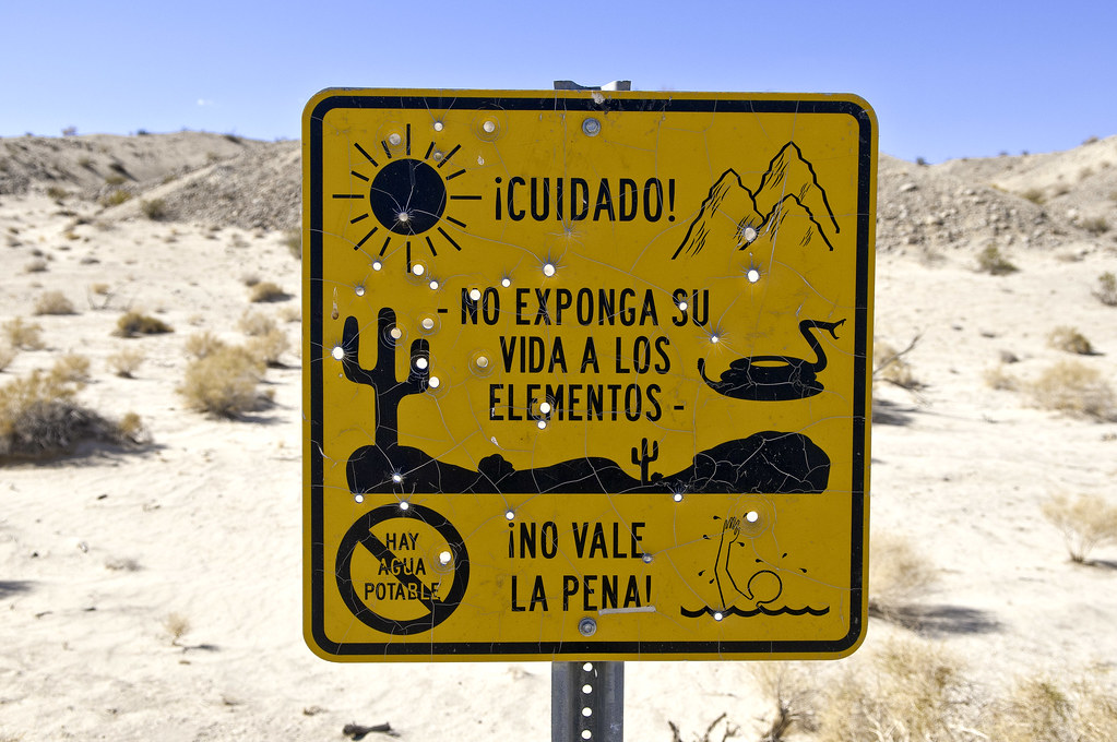 Cuidado by tomteske, on Flickr Cuidado by tomteske, on Flickr
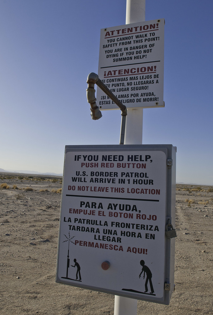 Para Ayuda by tomteske, on Flickr Para Ayuda by tomteske, on Flickr
British Petroleum?
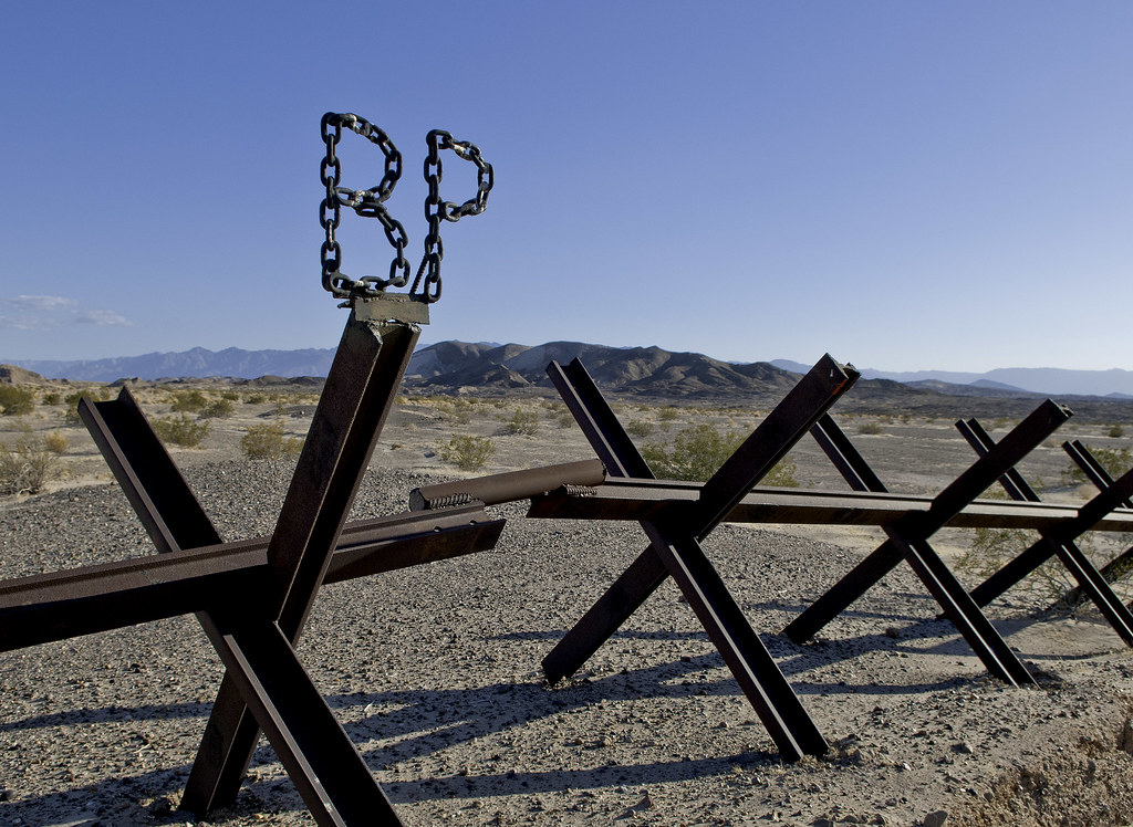 BP by tomteske, on Flickr BP by tomteske, on Flickr
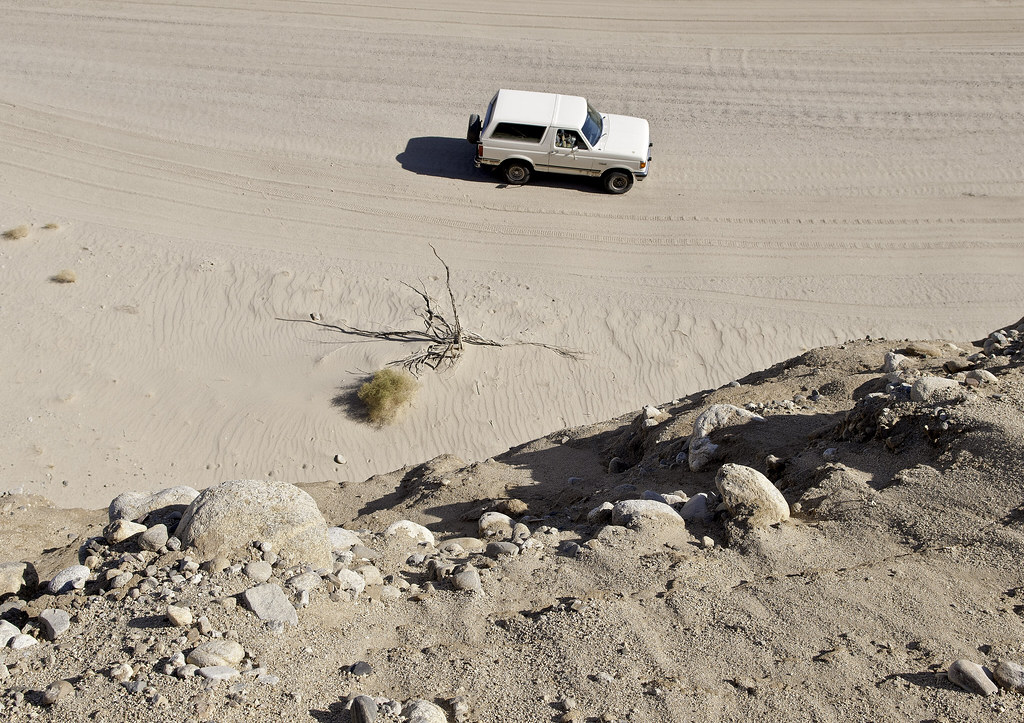
We were stopped four times but always apologetically by the local BP agents because "the cameras were going crazy." Few random shots at the fence.
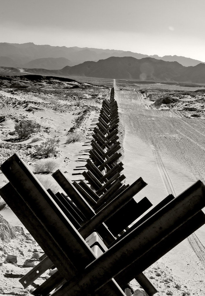 La Frontera by tomteske, on Flickr La Frontera by tomteske, on Flickr
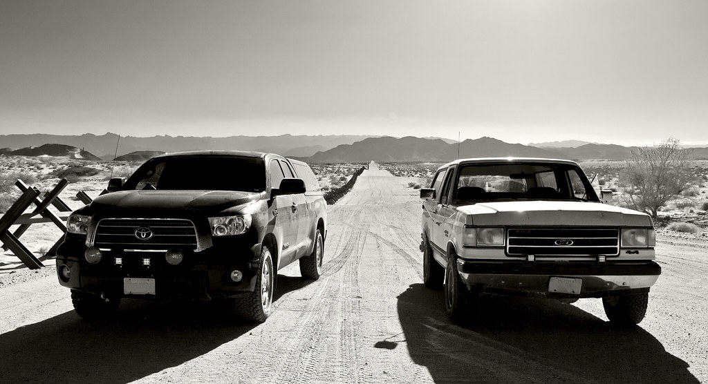 Tundra and Bronco by tomteske, on Flickr Tundra and Bronco by tomteske, on Flickr
 EC 288 by tomteske, on Flickr EC 288 by tomteske, on Flickr
Headed NW into the Yuha Desert on EC358 and immediately got stuck because I forgot to turn on the 4WD. A lttle shovel work and I was on my way.
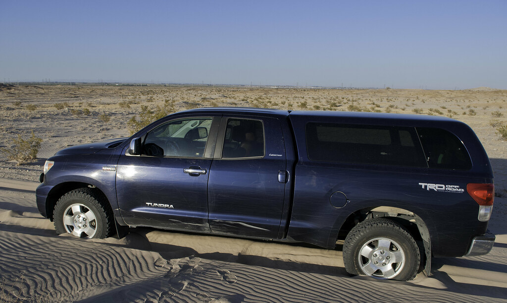 Stuck Tundra by tomteske, on Flickr Stuck Tundra by tomteske, on Flickr
Passed by a couple solar plants at the start of our trip. Here's where the energy ends up, in the Yuha ACEC, on its way West.
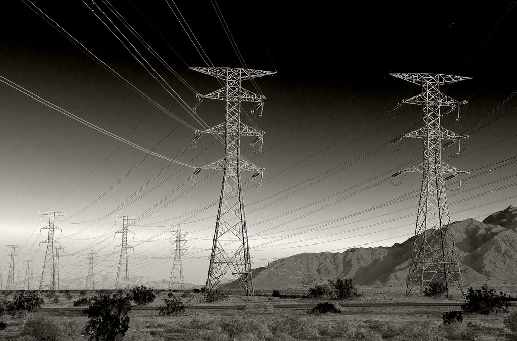 Yuha Vista by tomteske, on Flickr Yuha Vista by tomteske, on Flickr
 Yuha Power by tomteske, on Flickr Yuha Power by tomteske, on Flickr
 Yuha Totem by tomteske, on Flickr Yuha Totem by tomteske, on Flickr
Another quick trip out to the Colorado Desert and a great way to spend an afternoon, Enjoy. Tom |
5/22/2014
Topic:
The Border and Pinto Wash
tommy750
|
dsefcik wrote:
Looks like fun, I like how you managed to get a picture of the boundary marker on the Mexican side without crossing into Mexico...
Long arms! BP said they didn't really care if we walked around the markers and took pics. Tom |
5/22/2014
Topic:
The Border and Pinto Wash
tommy750
|
Jim (ziphius) wrote:
Enjoyed the photos Tom. I didn't realize the border 'fence' looked like that out there. Somebody obviously crossed the border though...
Yeah, it's quite variable in the few locations I've visited. The section near Jacumba looks like a fairly impassible barrier fence. Up above In-Ko-Pah, there's a few strands of wire or nothing at all. Further west in Pinto Canyon where you can drive on a road from Mexico all the way up Davies Valley, nothing. Tom |
5/22/2014
Topic:
The Border and Pinto Wash
tommy750
|
Florian wrote:
Neat photos. Thanks for sharing.
-Florian
Thanks for the upvote, Florian. Always fun seeing all the pics everyone posts. |
5/22/2014
Topic:
A few nice blooms still out there
tommy750
|
Nice. How did your 4X6" film pics turn out? |
5/22/2014
Topic:
A few nice blooms still out there
tommy750
|
Jim (ziphius) wrote:
Nice snake, really sharp pics. Which camera? That's a massive amount of honeycombs.
Any one seeing live hives out there anymore? Have found several abandoned ones filled with honey but no bees in the last couple years. Just me? |
5/27/2014
Topic:
A few nice blooms still out there
tommy750
|
dsefcik wrote:
tommy750 wrote:
Nice. How did your 4X6" film pics turn out?
Here you go...over exposed, the shutter needs adjustment. You can see De Anza resort, Gray Mtn & Table Mountain way off in the background. The one thing with these big negatives is you can zoom 100% in and still see lots of detail.

Wow, you're right. Nice tattoo on that lady at De Anza |
5/28/2014
Topic:
The Border and Pinto Wash
tommy750
|
surfponto wrote:
So the BP didn't hassle you for crossing over the border to take pics?
Bob
I asked the first agent who stopped us if we could jump the vehicle barrier and take photos of the markers and he said it would be fine. Definitely worth a detour to the area your next trip out, Bob. |
5/29/2014
Topic:
Memorial Day Hikes
tommy750
|
Yes, I took a few pics out there in the 95 degree heat with Daren and Gary. Here's a representation of what the Pictograph Trail site would look like in the 1960's complete with actors in period clothing
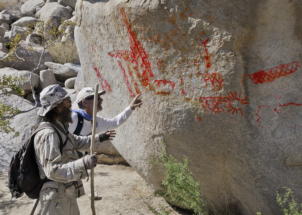 Daren and Gary DStretched by tomteske, on Flickr Daren and Gary DStretched by tomteske, on Flickr
These two campers like to wear matching "twinsie" outfits for their desert hikes!
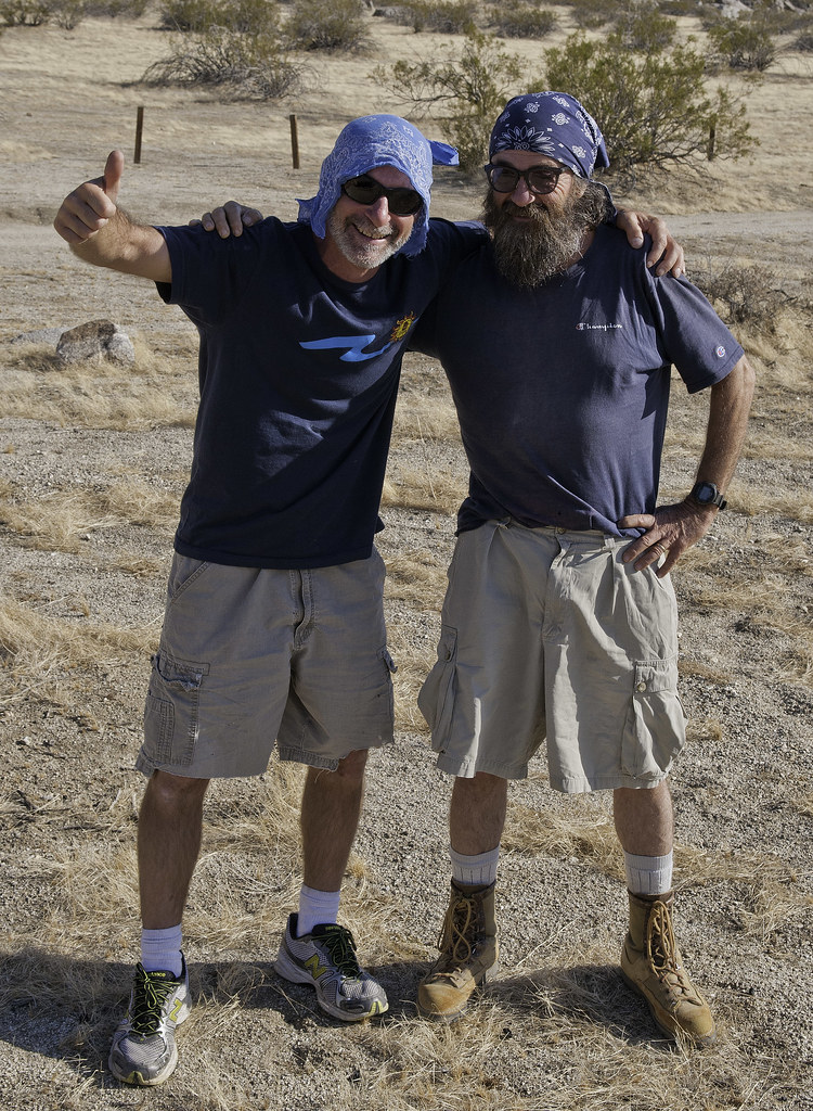 Twinsies by tomteske, on Flickr Twinsies by tomteske, on Flickr |
6/2/2014
Topic:
McCain Valley
tommy750
|
Glad to hear the water is back on at Cottonwood. There was none a few weeks ago when I was last out there.
Have seen dirt bike tracks on trails out there in the past but the big change for me was the well marked and groomed ATV trail out toward Sombrero I mention earlier http://www.anzaborrego.net/anzaborrego/Forum/messages.aspx?TopicID=777 Looked like spurs headed out to several ridges so was assuming it was BP but who knows. Tom |
6/3/2014
Topic:
EC O85
tommy750
|
How do you roll the windows up on that thing? 100 degrees and billowing silt, nice Tom |
6/3/2014
Topic:
EC O85
tommy750
|
This is something I found recently online. It comments on U.S. Gypsum and the history of the mining railway next to EC085.
Mineral Resources of the Fish Creek
Mountains Wilderness Study Area,
Imperial County, California
By VICTORIA R. TODD, DAVID E. DETRA, JAMES E. KILBURN,
ANDREW GRISCOM, and FRED A. KRUSE
U.S. Geological Survey
HARRY W. CAMPBELL
U.S. Bureau of Mines 1987
A large gypsum mine owned and operated by the U.S. Gypsum
Company lies 1.5 mi west of the study area (the U.S.
Gypsum quarry). The Imperial Gypsum quarry
produced a small, unknown tonnage of gypsum
that was marketed as a soil conditioner in the Imperial
Valley. The U.S. Gypsum Company has
18 unpatented placer claims inside the study area.
Completion of the San Diego and Arizona
Eastern Railroad in 1920 permitted the Fish
Creek Mountains gypsum deposits to be mined.
Imperial Gypsum and Oil Corporation acquired a large
block of gypsum claims in the Fish Creek Mountains
and constructed a narrow gauge railroad from the San
Diego and Arizona Eastern track to the deposit in
1922. The first shipment of crude gypsum was made in
1922. In 1924, Pacific Portland Cement Company
bought the Fish Creek Mountains gypsum operations
and built a calcining plant (Plaster City plant) at the
junction of the narrow gauge railroad with the main
line. The Plaster City plant and quarry were sold in
1945 to U.S. Gypsum Company who modernized and
expanded the operation. In 1971, the U.S. Gypsum
quarry produced 742,000 tons of gypsum,
making it the largest operating gypsum mine
in the United States. |
6/4/2014
Topic:
First Trip Report with my new rig
tommy750
|
Nice to see you're back in business. Liked you pics of that fern? lined channel. Pretty amazing. Tom |
6/4/2014
Topic:
EC O85
tommy750
|
dsefcik wrote:
tommy750 wrote:
How do you roll the windows up on that thing? 100 degrees and billowing silt, nice Tom Tom, you are the only silt cryer I have met...most of us just brush it off...
I've been called many a thing, but silt cryer is a first |
6/19/2014
Topic:
Borrego Palm Canyon "Fannypack" Trip
tommy750
|
All the macro pics with your S100? Very nice. Like the toad and damselfly pics especially. So what kind of film does your 1916 Kodak use again? Tom |
6/22/2014
Topic:
Borrego Palm Canyon "Fannypack" Trip
tommy750
|
Typical trip with Daren is sitting around watching him contort to get the shot
 Stan Cam2 by tomteske, on Flickr Stan Cam2 by tomteske, on Flickr |
7/7/2014
Topic:
Arizona/Utah vacation pics
tommy750
|
Sounds like a great trip, Florian. North rim is always worth the detour. Is your Petroglyph Rock referring to the Capitol Reef site right on Hwy 24 near Fruita? Thought that was a pretty neat place. Tom
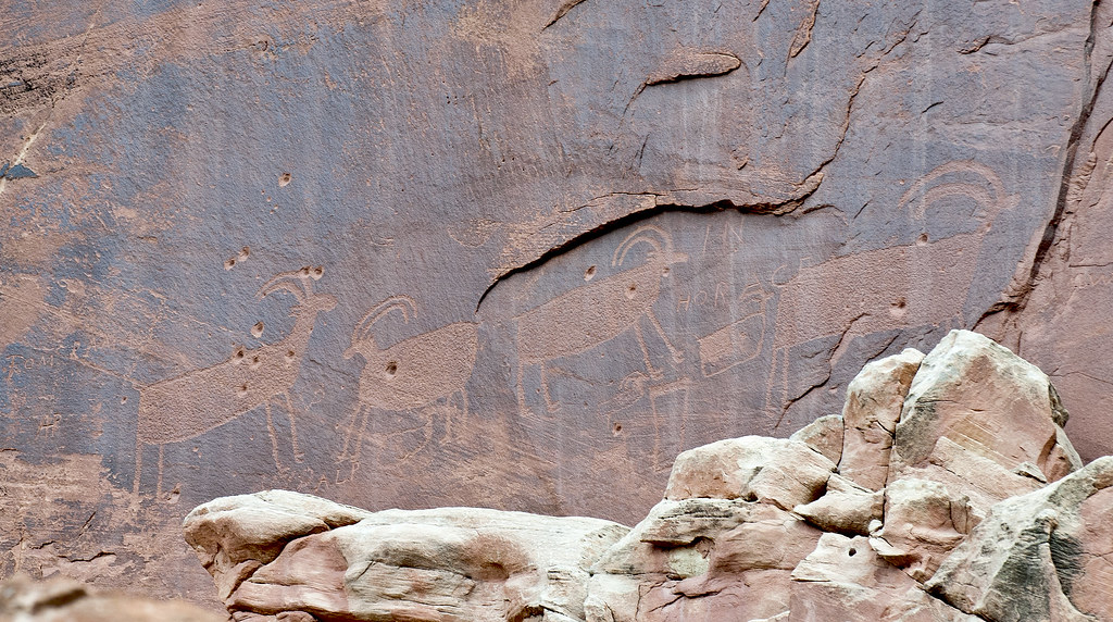 Capitol Reef Bighorn by tomteske, on Flickr Capitol Reef Bighorn by tomteske, on Flickr |
7/7/2014
Topic:
Bighorn Sheep Count 2014
tommy750
|
dsefcik wrote:
My entire setup for the trip

.
Guess liquids really were a little scarce up there
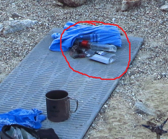 Supplies by tomteske, on Flickr Supplies by tomteske, on Flickr |
7/7/2014
Topic:
Bighorn Sheep Count 2014
tommy750
|
dsefcik wrote:
Jim (ziphius) wrote:
Animals look a lot better this year, heh? Yeah, the spring seems to be holding it's own, it was quite full the whole time and never seemed to diminish in quantity.

Here's the spring on 3/8/14 when we hauled water up for Daren, Gary and Randy. It was overflowing to the left down the hillside. I stuck a stick in a deeper part and it was about 10 inches deep as I recall. Glad to see it did better this year than last. Tom
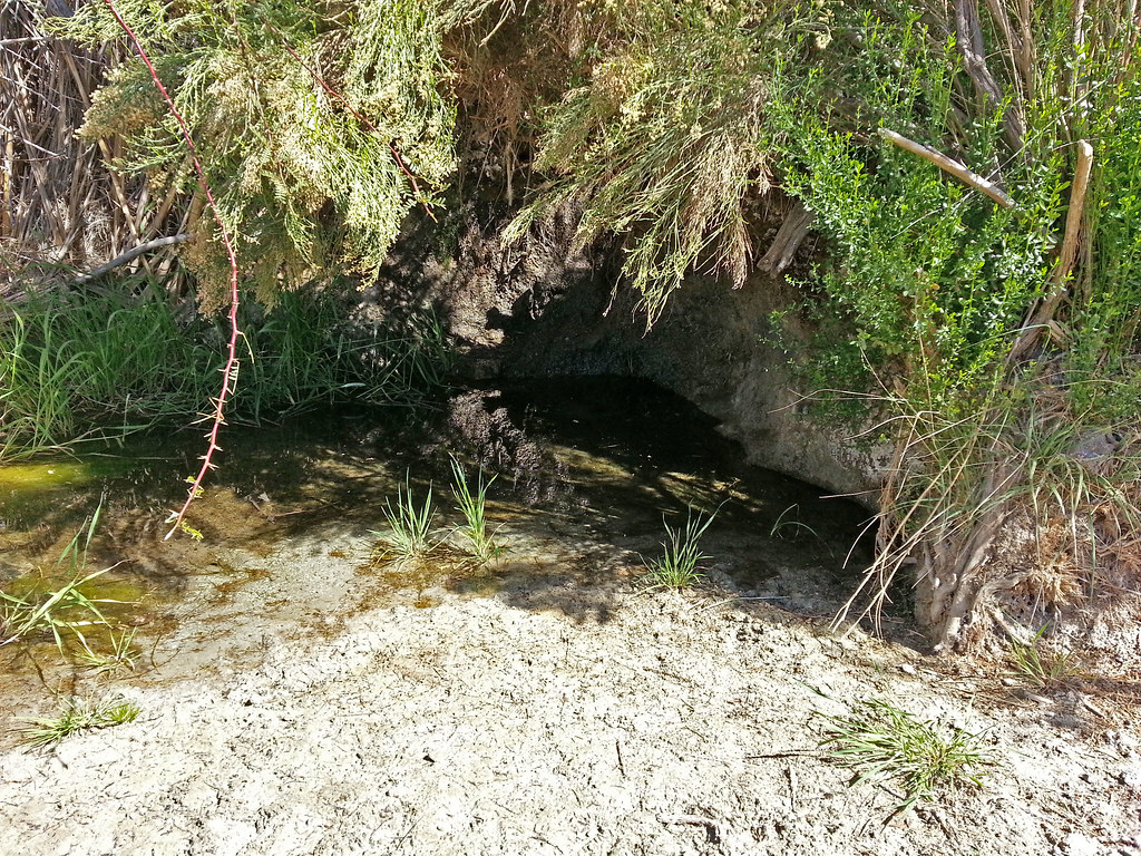 SpringL by tomteske, on Flickr SpringL by tomteske, on Flickr |
7/27/2014
Topic:
Carrizo Gorge
tommy750
|
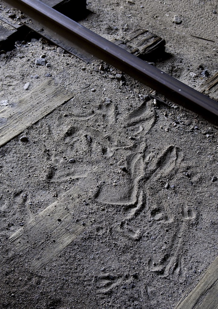
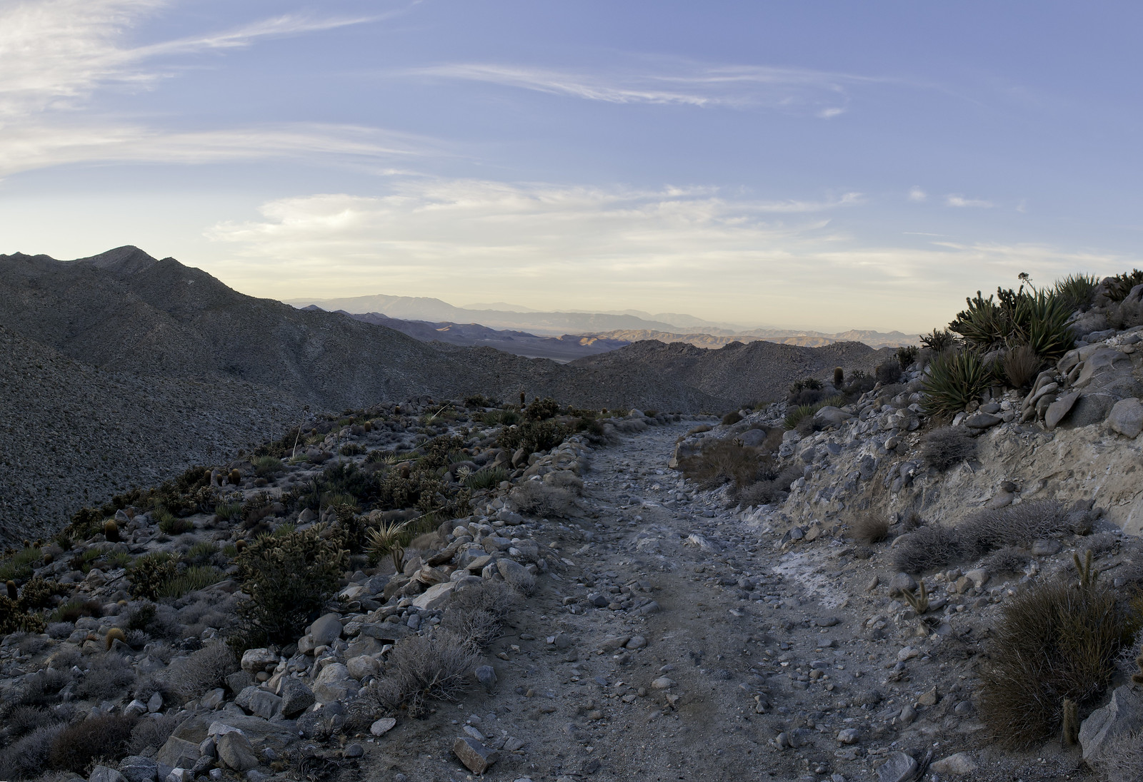
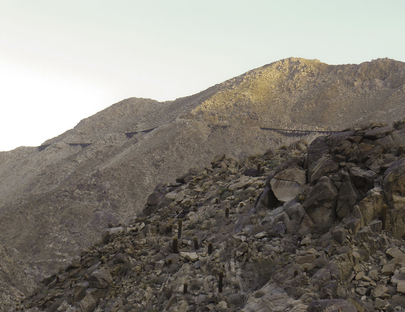
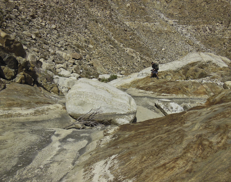
Met up with Daren last Friday for some hiking and camping. Ended up heading out to Goat Canyon via Carrizo Gorge mainly since I'd never been. Was near 90 degrees at the start and over 100 when we arrived at the trestle which is about 600 ft closer to the desert floor. Total of 15 miles in and back.
A few railcars are still at the siding past De Anza Resort. Like to find interesting details in these steel boxes.
 Steps by tomteske, on Flickr Steps by tomteske, on Flickr
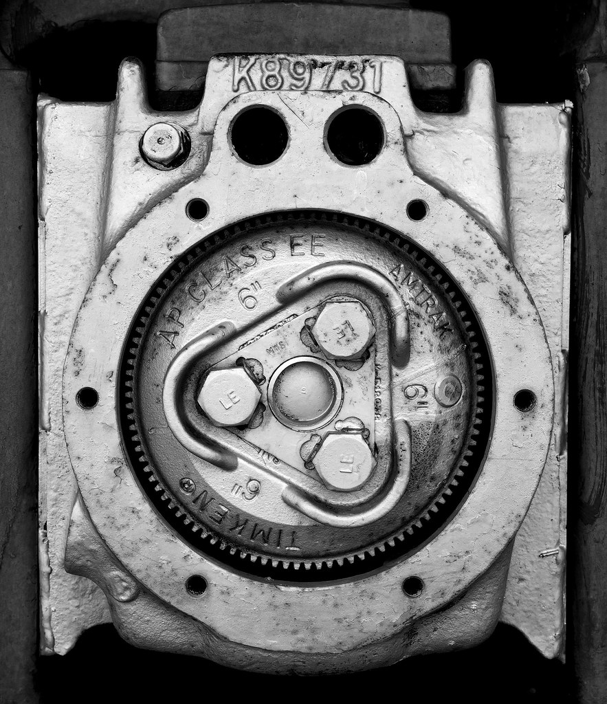 Timkin by tomteske, on Flickr Timkin by tomteske, on Flickr
Further down, Daren spotted this ewe and immediately sensed something wasn't right. She kept going in and out of the tunnel entrance and only slowly walked away as we approached.
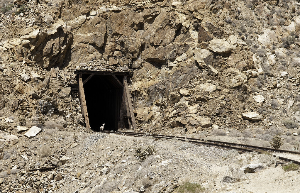 Guardian Ewe by tomteske, on Flickr Guardian Ewe by tomteske, on Flickr
When we entered the tunnel, we discovered why.
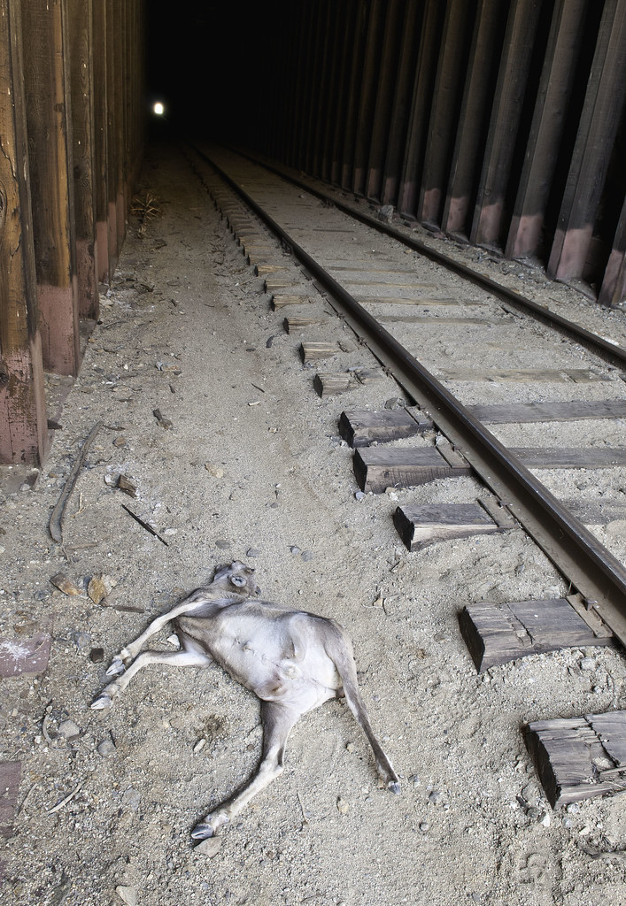 Lamb Fall by tomteske, on Flickr Lamb Fall by tomteske, on Flickr
We figured the lamb must have died within the last 24 hour since no smell, hardly any flies and no predation. Looked like it had struggled to stay up with several areas nearby looking like it could barely stand. Being spectators to the persistent maternal yearning for a now deceased lamb was sad to say the least. Daren says the lamb was born way too late in the season to have a decent chance at survival.
 Struggling by tomteske, on Flickr Struggling by tomteske, on Flickr
No human company the entire way except a few military choppers flying up and down the gorge.
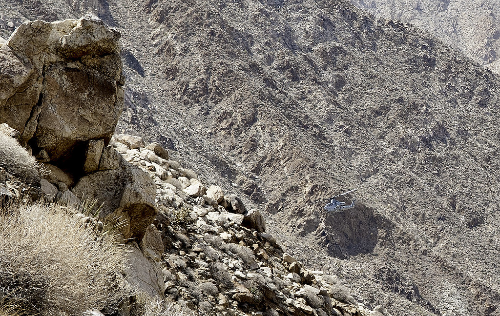 Carrizo Cobra by tomteske, on Flickr Carrizo Cobra by tomteske, on Flickr
Several miles out there, looks like someone ran out of juice before reaching their destination.
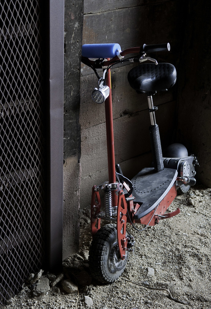 Scooter by tomteske, on Flickr Scooter by tomteske, on Flickr
After ten tunnels, the trestle. Couple panoramas and time to get back in the shade.
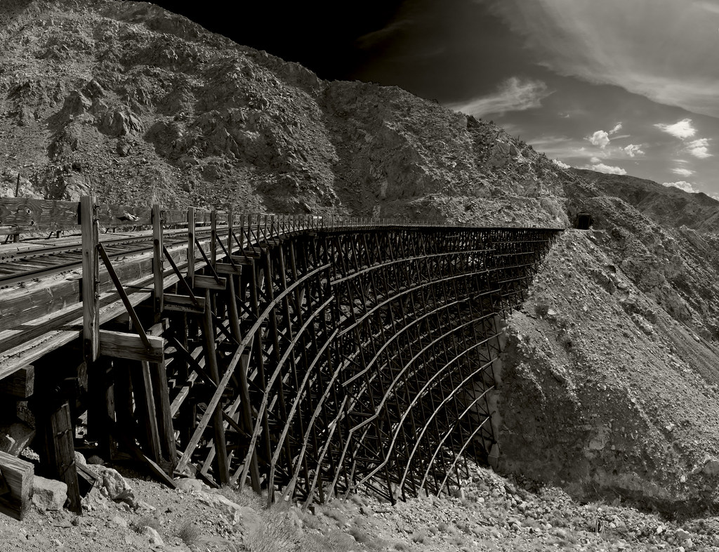 Goat Canyon Trestle Panorama2 by tomteske, on Flickr Goat Canyon Trestle Panorama2 by tomteske, on Flickr
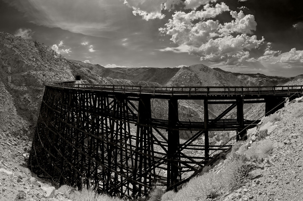 Goat Canyon Trestle Panorama by tomteske, on Flickr Goat Canyon Trestle Panorama by tomteske, on Flickr
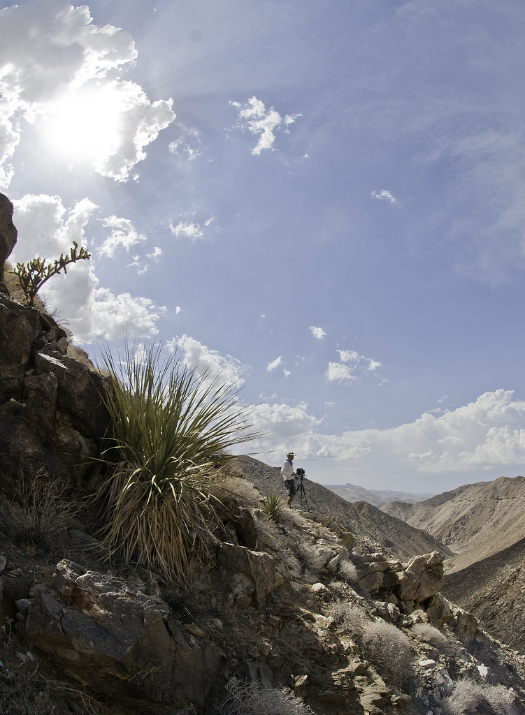
Daren lugged a huge camera and tripod all the way out and started looking like Ansel Adams sans the beard
 Asel Sefcek2 by tomteske, on Flickr Asel Sefcek2 by tomteske, on Flickr
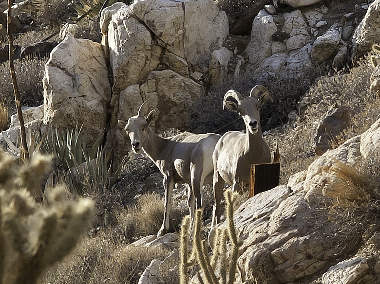
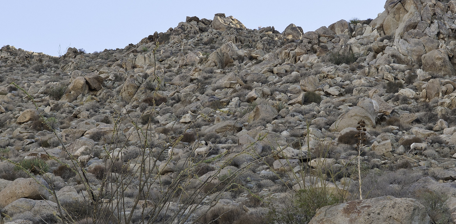
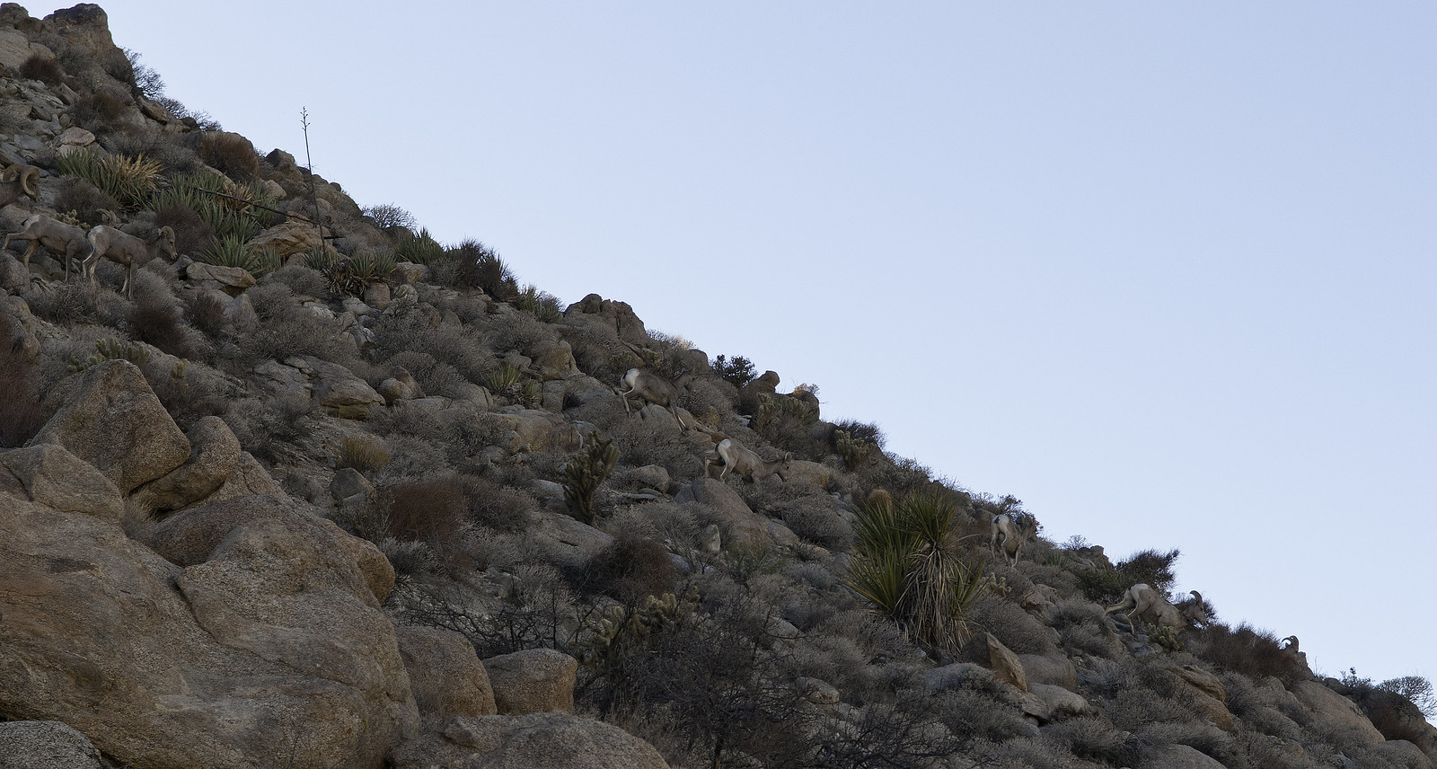
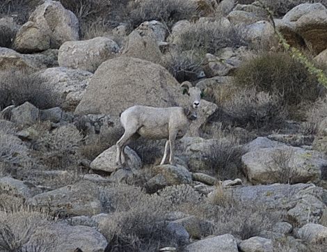
On the way back, these guys were kind enough to wait while I shed my pack and grabbed for my camera. Haven't seen bighorn around here this close up before so it was pretty exciting seeing seven of them take their time passing by.
 G7 by tomteske, on Flickr G7 by tomteske, on Flickr
Someone's missing something.
 Missing Something by tomteske, on Flickr Missing Something by tomteske, on Flickr
Heading home. Found the remains of another lamb on the way back and saw cat tracks walking to a spring inside one of the tunnels.
 Heading Home by tomteske, on Flickr Heading Home by tomteske, on Flickr
The only pic I managed from our campsite on Table Mt after a few too many refreshments. Enjoy. Tom
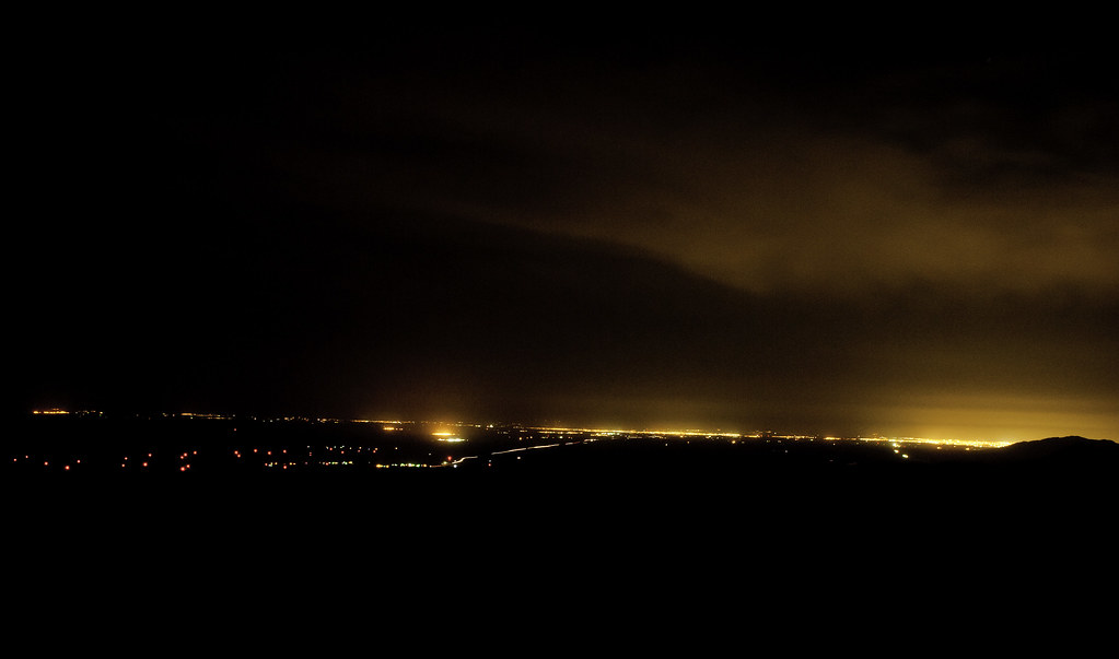 The View by tomteske, on Flickr The View by tomteske, on Flickr |
7/28/2014
Topic:
Carrizo Gorge
tommy750
|
surfponto wrote:
Where did you guys end up camping?
I thought the scooter pic was funny. At first I thought you guys rode scooters out there.
We ended up camping near the radio towers at a pullout with a nice rock wall. Nice view if you could see straight
Scooter ride out there would be interesting and a little more sane than what we did. Wasn't sure if it was because he found a shiny red thing out in the desert or the heat, but sensed Daren was starting to think about "rescuing" that thing |
7/28/2014
Topic:
Carrizo Gorge
tommy750
|
Jim (ziphius) wrote:
I dunno Tommy, your photos are always razor sharp - are you using some secret filters?
My "secret" is dragging a glass brick around and then shooting the pic in raw and photoshopping it. Always try to imagine every pic needs to be interesting enough to hang on my wall and try to spend a few extra seconds on the basics like framing, balance, movement. Every once in a while it actually works! Tom |
7/29/2014
Topic:
Carrizo Gorge
tommy750
|
dsefcik wrote:
The trestle, Nagaoka 4x5 field camera, Nikkor 135mm lens, f/64, 1/4 second exposure, ISO 100 Arista EDU film

Thanks for posting you pics, Daren.
Sorry for my ignorance, but how much postprocessing can you do with this negative? In PS, you whip through about 10 different filters and make any individual corrections to colors with a slider. Do you have to shoot ten different pics all with different filters and then tweak them while exposing your paper?
dsefcik wrote:
Still researching the ....something...Headache Bromo Seltzer rock in Jacumba...anybody got the story on it? Is historic as they saved it from destruction from multiple projects I am sure

Also, speaking of historical graffiti, not sure if this guy makes the 50 year cut but, but does anyone know anything about this tagger/street artist? I'm thinking they're all the same guy. One of these is from the first spur, the other is at the trestle with the railroad switch and water tower from Dos Cabezas. Looks like these have been around for a number of years. Tom
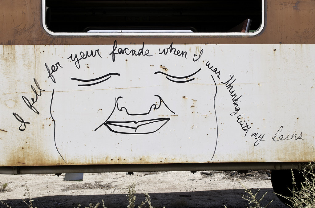 Graffiti2 by tomteske, on Flickr Graffiti2 by tomteske, on Flickr
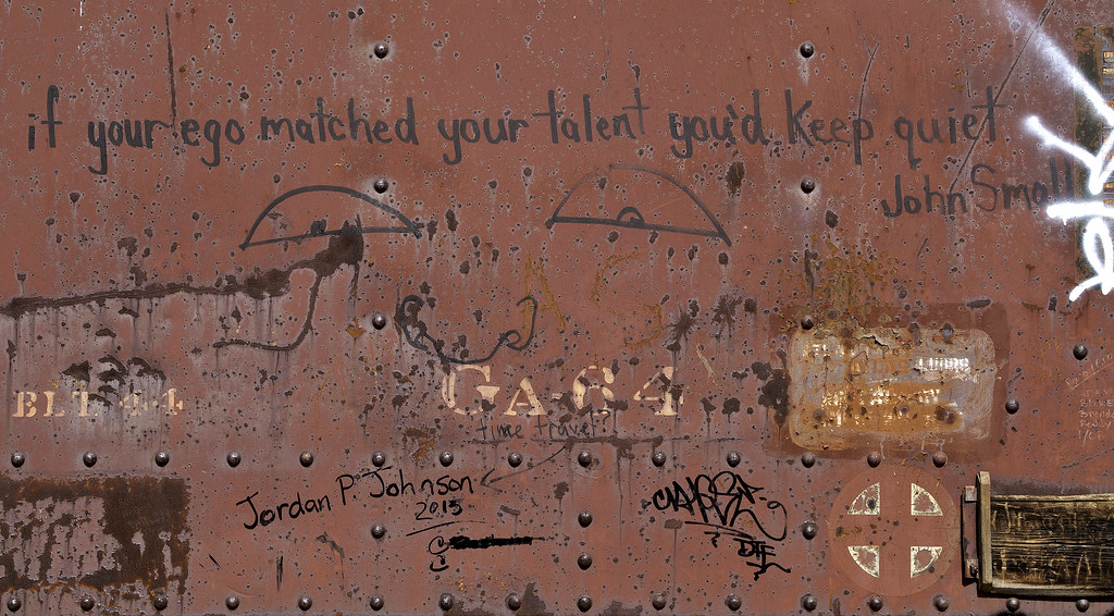 Goat Canyon Graffiti by tomteske, on Flickr Goat Canyon Graffiti by tomteske, on Flickr
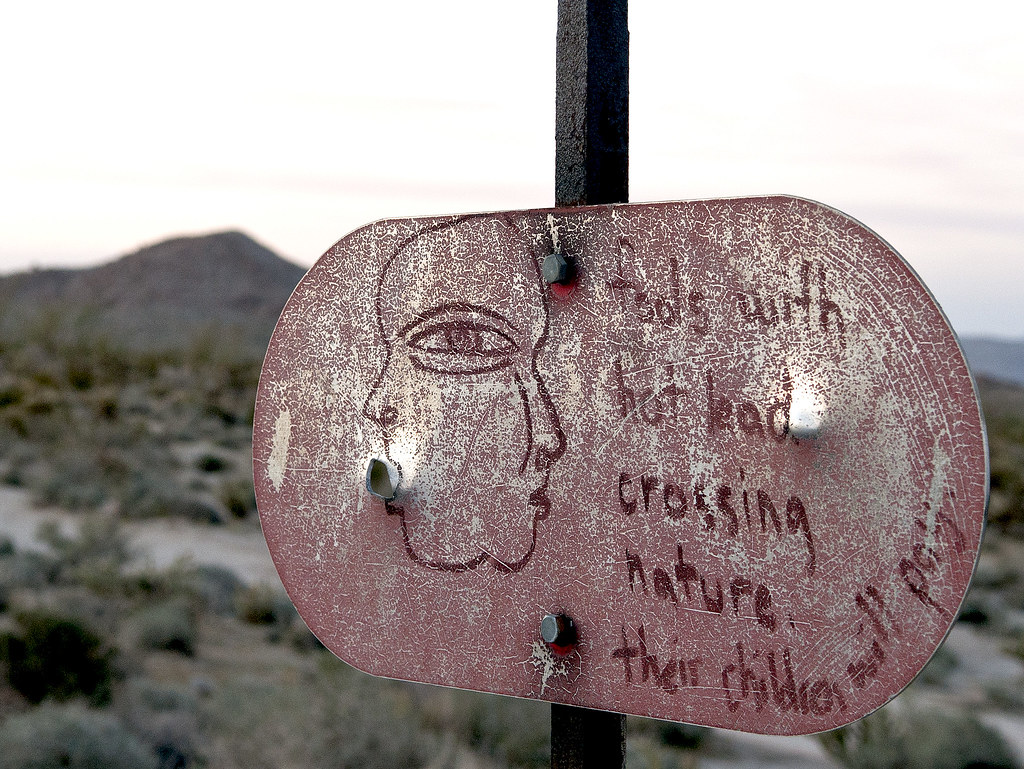 Fools by tomteske, on Flickr Fools by tomteske, on Flickr
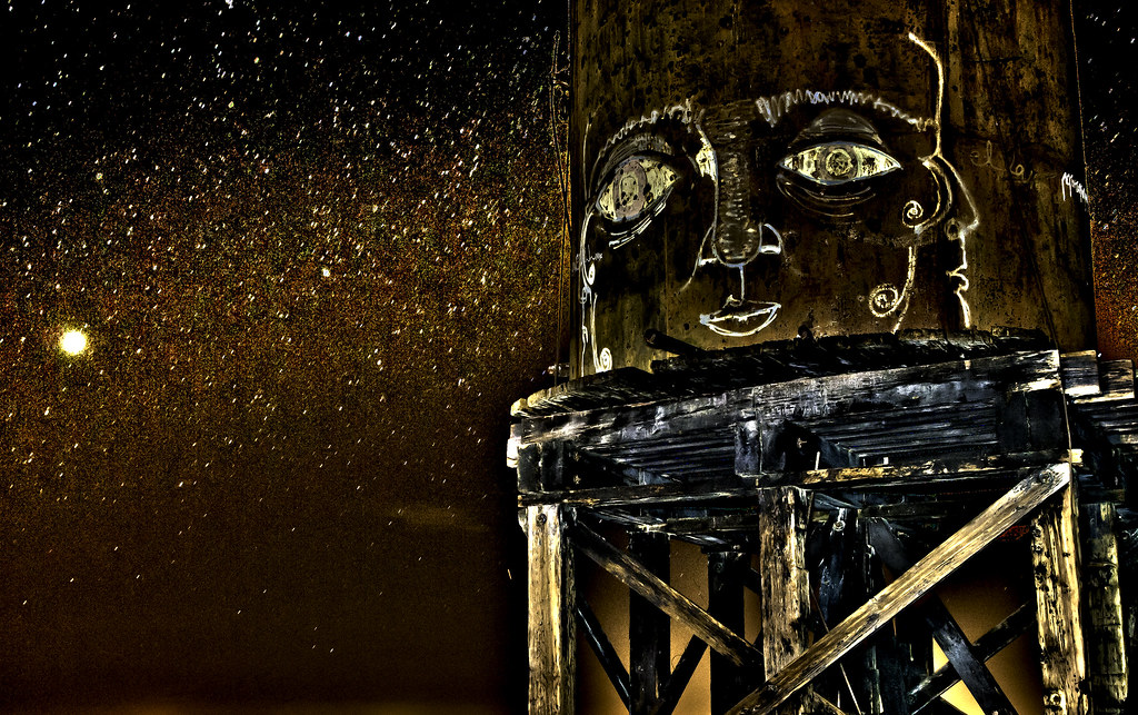 Milky Way by tomteske, on Flickr Milky Way by tomteske, on Flickr |
8/8/2014
Topic:
Carrizo Gorge
tommy750
|
railexplorer wrote:
rockhopper wrote:
Great report and photos! In the news a while back the was a group of investors planning to open the rail line down to Mexico. Any new info? That train ride would be one of the top train rides in the world and would bring in tourists from all over. Oh, Oh! Maybe better if left as is. After all is was/is the impossible railroad!
The investors, or I should say the group with operating rights, is known as the Pacific Imperial Railroad (PIR). In a nutshell, because the whole story would make War and Peace look like a short story, the PIR is still "functioning" to what degree no one really knows. They made their $500K payment to MTS in July and supposedly have the next $500K installment in hand.
There are questions whether their lease agreement with MTS is legal. Two congressmen, D. Hunter and J Denham (Merced), have asked for MTS to provide them with documents regarding the lease.
Whether they actually get the railroad up and running again is still up in the air, although most people with railroad knowledge doubt that the PIR has the ability to get it up and running.
As for opening up the gorge as a tourist railroad, that won't happen either. The insurance would be astronomical, the maintenance costs and the up front costs to get the line in operating condition would make the whole project a non starter. That is unless you've got pockets as deep as Warren Buffet and have nothing else better to spend your money on.
You may be right. Looks like the entire route would need a substantial overhaul and a lot of it is still in Mexico. Thanks for your input. Tom |
8/8/2014
Topic:
Carrizo Gorge
tommy750
|
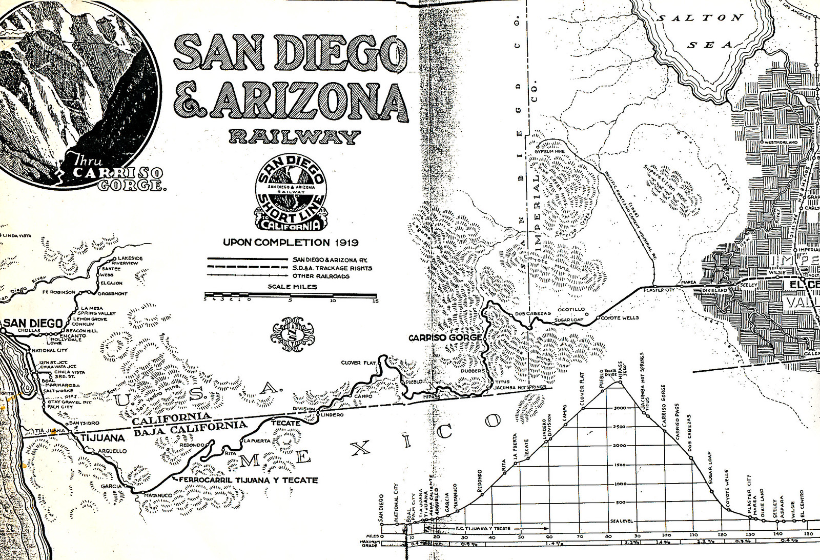
Here's a copy of an old map I had given to me recently. Tom
 SDAAR by tomteske, on Flickr SDAAR by tomteske, on Flickr |
8/10/2014
Topic:
Carrizo Gorge
tommy750
|
rockhopper wrote:
btw Awesome map Tommy 750c.
It's obviously a copy of a copy etc. Not sure where it came from but was in a box of maps I sort of inherited. The "Carriso Gorge" stop on the map looks like it would be important but doesn't look like much passing by. Tom |
8/24/2014
Topic:
BorregoFest Event: October 10th - 12th, 2014
tommy750
|
Nolan (anutami) wrote:
BorregoWrangler,
Looks like a good time.
Is the road up to Carrizo Mountain something I could get my rig up to?
Nolan, I've driven my Tundra to the top and think it might be a tight squeeze through Painted Gorge with your rig. There's also a few tight rough corners on your way up once out of the gorge. Great views and camping if you can make it. Definitely a 4x4 route. Tom |
8/25/2014
Topic:
BorregoFest Event: October 10th - 12th, 2014
tommy750
|
Nolan (anutami) wrote:
Thanks for the heads up. Is it street legal vehicles only up there or could I drive a yamaha rhino up there to scout it out?
As best as I can tell from looking at the BLM WECO map, there's "open" routes to Painted Gorge and "limited" routes inside the gorge and on top of Carrizo which in this case specifically refer to the six month closure not vehicle type. So, you should be good. Tom |
8/29/2014
Topic:
Racetrack Mystery Solved
tommy750
|
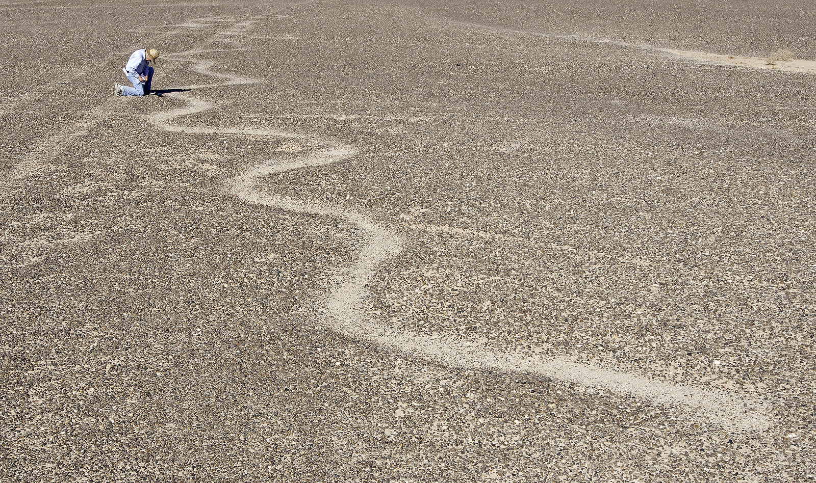
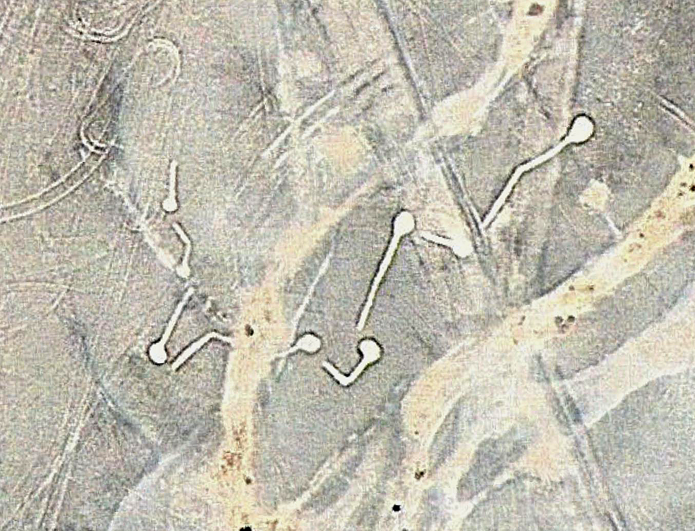
A fantastic bit of science to solve this riddle. The PlosOne article is here and is a fun example of careful science solving a rather insignificant yet knotty problem: http://www.plosone.org/article/info%3Adoi%2F10.1371%2Fjournal.pone.0105948
Here's a pic of the actual rock tracks
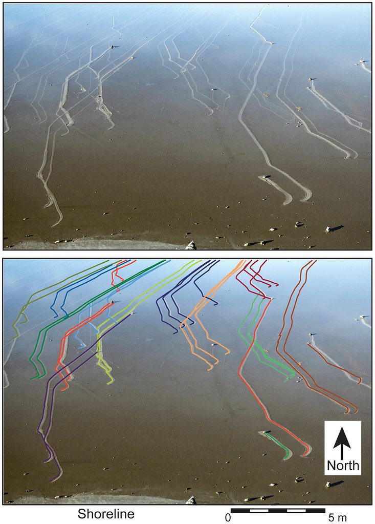 Figure 2 by tomteske, on Flickr Figure 2 by tomteske, on Flickr
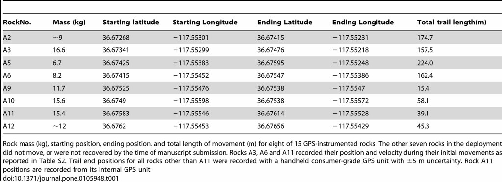
The weights of some of the rocks are quite impressive! 16.6kg=36.5lbs
 journal.pone.0105948.t001 by tomteske, on Flickr journal.pone.0105948.t001 by tomteske, on Flickr |
8/29/2014
Topic:
Racetrack Mystery Solved
tommy750
|
dsefcik wrote:
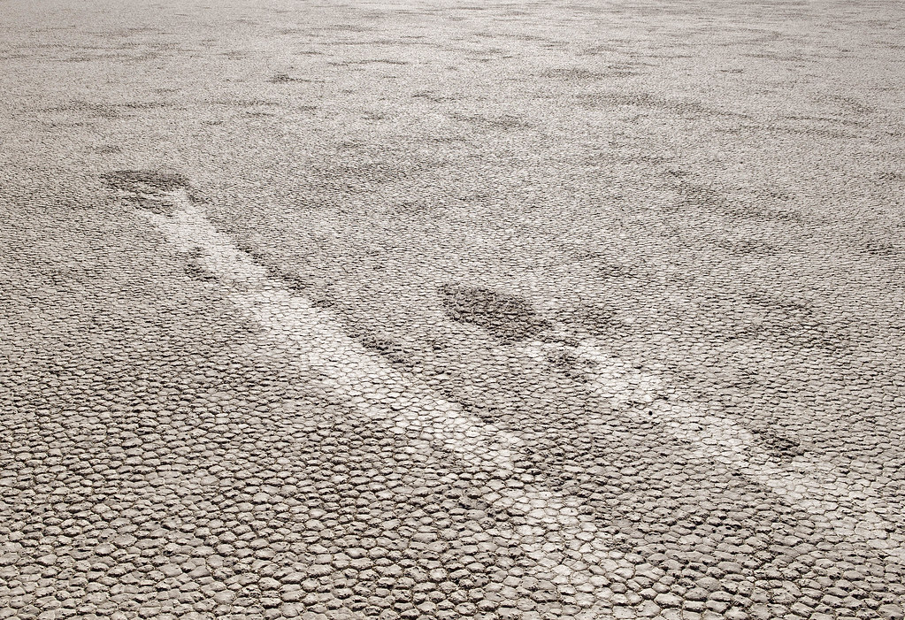
Are there any rocks left out there or have they finally all been taken?
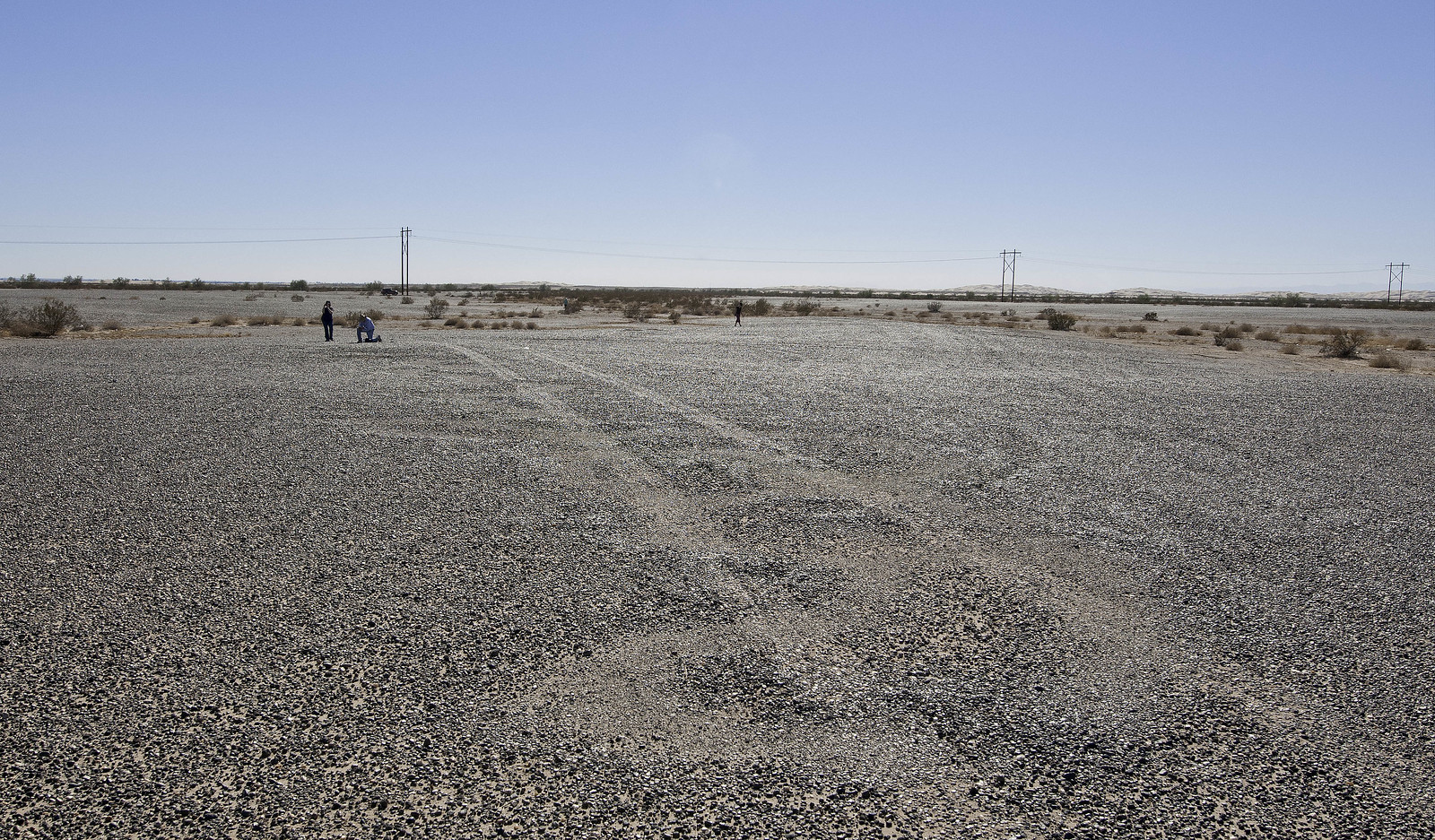
The road goes by the west shore of the playa and most are gone leaving trails like this. If you walk toward the east side, you'll still see some. Was there in November of last year and didn't walk over to the eastern shore so never saw the gps tagged rocks or the weather station.
 Purloined Pebbles by tomteske, on Flickr Purloined Pebbles by tomteske, on Flickr |
9/19/2014
Topic:
Little Blair and Thomas Mountain
tommy750
|
dsefcik wrote:
hikerdmb wrote:
Here is looking down on the campsite from the Shake BM.

Great thing about that photo is you can also see the Quake peak....Shake & Quake in Earthquake Valley
edited by dsefcik on 9/15/2014
BM Quake is on the ridge between Blair and Little Blair so it wouldn't be in this pic looking north into Earthquake Valley. This was a test right, Daren? |
9/19/2014
Topic:
Little Blair and Thomas Mountain
tommy750
|
Nice pics, hikerdmb. Never been to Thomas Mt. Looks like a great summer spot. Tom |
9/21/2014
Topic:
Little Blair and Thomas Mountain
tommy750
|
rockhopper wrote:
Yes, Thomas mountain and valley are great areas to "hang out" and explore. Miles and miles of fire roads running from the south end all the way to Hemet lake. My Dad bought property up near the area back in the 60's. You could spent weeks roaming around up there. I always liked to go after a light snow fall ( man am I dreaming) for a water source. The road would dry out quickly but still find snow in the shade. There are remnants of buildings and home steads and mines all around Thomas peak. Many have been overgrown by brush.
One time in my previous non-politically correct life back in the 80's I was traversing the n-s ridge road on my motorbike when I found a fire brake running due west down from the top of the mountain down to Bautista canyon. Bulldozed probably from the 1950's. You know the ones that go straight up /down. Only a deer trail remained. Let's just say I dumped my CR480 cycle more than a few times to avoid going over the handle bars. Going back up was an other story. It was a 2000 ft hill climb. Like an endless Matterhorn hill climb from "On any Sunday" but hitting / busting thru scrub oak and Manzanita all the way up. It was one #^>^%&!!!! Well at least I widend the trail for the deer for a year or two.
That's a great story! Now, I'll definitely have to get out there. Thanks. Tom |
9/21/2014
Topic:
Little Blair and Thomas Mountain
tommy750
|
dsefcik wrote:
I should have looked more closely, looks like Granite off to the left in the distance....thanks Tom for keeping me in line....
Digging thru my mazillion photos I found one from Shake looking towards Quake...Tom, can you please put it thru your verification test? David, sorry to go off topic from your post..


dsefcik wrote:
Yeah...you got me...I was not looking closely enough....nice catch..
tommy750 wrote:
dsefcik wrote:
hikerdmb wrote:
Here is looking down on the campsite from the Shake BM.
Great thing about that photo is you can also see the Quake peak....Shake & Quake in Earthquake Valley
edited by dsefcik on 9/15/2014
BM Quake is on the ridge between Blair and Little Blair so it wouldn't be in this pic looking north into Earthquake Valley. This was a test right, Daren?
Never been on Shake or Quake but it looks reasonable |
9/23/2014
Topic:
Olancha, Sirretta Peaks and Monache Meadows Sierra
tommy750
|
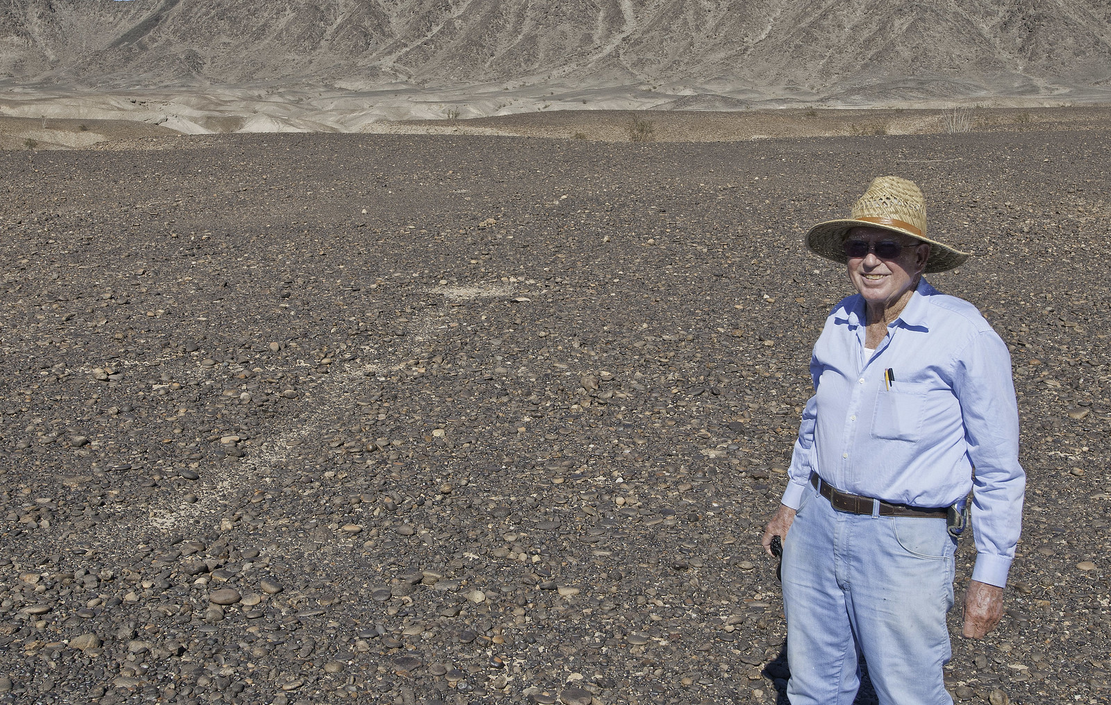
Looks like another great hike, Daren. Wish I could have joined you guys. Did you use a backpack? Noted the water level of Lake Isabella is down to 10% of capacity. Wonder if they're doing any rafting these days on the Kern. |
10/20/2014
Topic:
Return to Ghost Mountain
tommy750
|
Nice trip, Nolan. Any pics of your solar panel setup? Did you install it yourself? Thanks. Tom |
10/20/2014
Topic:
Return to Ghost Mountain
tommy750
|
Thanks for the solar panel info, Nolan. Looks like a great setup. Don't have an RV so won't need that much output but certainly thinking about a smaller auto battery solar changer in case the truck battery dies in the middle of nowhere. Tom |
10/22/2014
Topic:
Yuha and Mt Springs Exit
tommy750
|
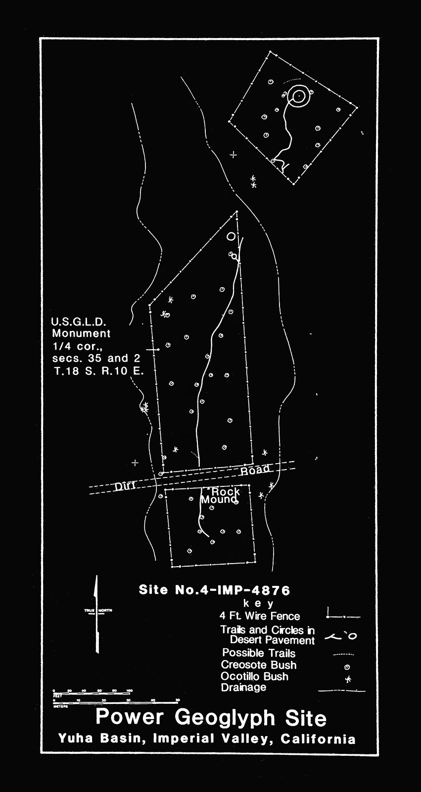
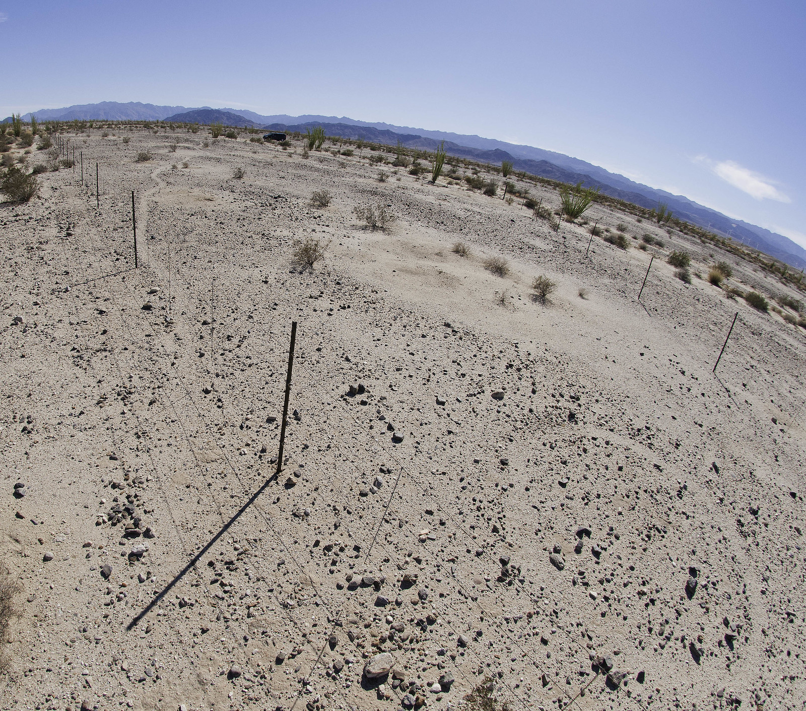
A couple weekends back, needed to head into San Diego so decided to take the "long way." Pulled off I-8 at Dunaway Rd and headed into Yuha. Was trying to find a geoglyph I'd never seen. On the way, this fenced area caught my eye:
 Labios Geoglyph by tomteske, on Flickr Labios Geoglyph by tomteske, on Flickr
There were 5-6 cairns arranged around it but wasn't sure if it was a geoglyph or something historical. Spoke with Harry Casey, the pilot who photographed most of the geoglyphs in the Southwest with Jay von Werlhof, but he wasn't familiar with it.
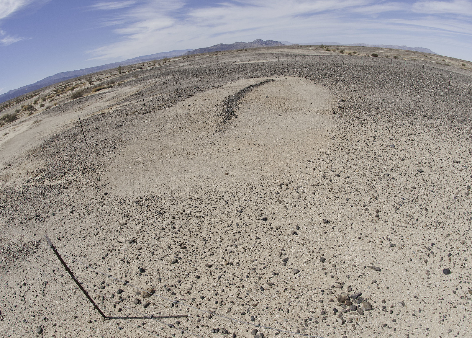
Finally found the Power Geoglyph, miles to the Southwest:
 Power Geoglyph by tomteske, on Flickr Power Geoglyph by tomteske, on Flickr
Similar sites are present to the Northeast and reportedly ( von Werlhof) are communication sites to contact the Creator for healing, knowledge or advice. A road and streambed have divided this site into three. Supposedly, there is yet another one somewhere in the Yuha.
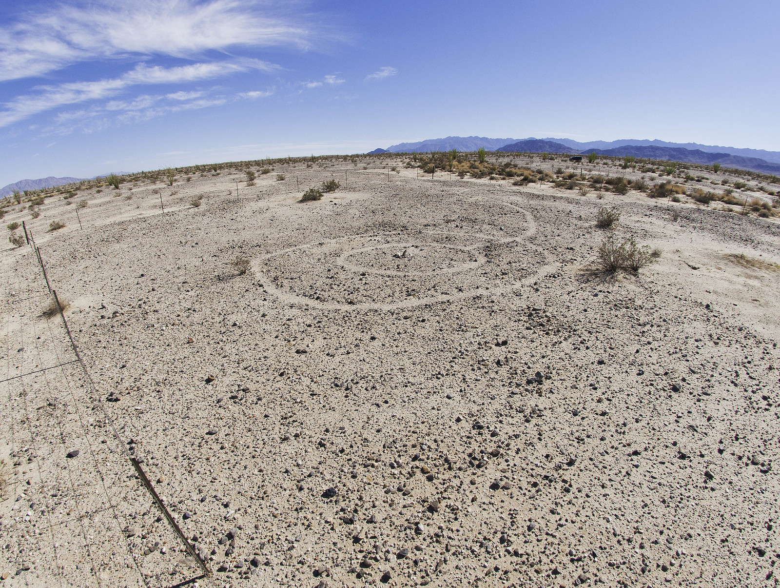 Power Geoglyph2 by tomteske, on Flickr Power Geoglyph2 by tomteske, on Flickr
 Power Geoglyph3 by tomteske, on Flickr Power Geoglyph3 by tomteske, on Flickr
Finally got back on I-8 and took the Mt Springs exit. Parked under the overpass, grabbed my pack and headed north. Over a draw, I entered Devil's Canyon in the Southern part of ABDSP.
 Devils Canyon by tomteske, on Flickr Devils Canyon by tomteske, on Flickr
Heard a noise on the ridge to the West and saw these guys. Ended up being 14 sheep including three collared ewes. This was the first group of six.
 Group of Six by tomteske, on Flickr Group of Six by tomteske, on Flickr
Here's the second group of eight.
 Group of Eight by tomteske, on Flickr Group of Eight by tomteske, on Flickr
Some of the tagged ewes. Daren says the CDFW runs the program but nothing has happened in the past five years secondary to funding issues.
 Red Collar Red Tags by tomteske, on Flickr Red Collar Red Tags by tomteske, on Flickr
 Green Collar Green Tags by tomteske, on Flickr Green Collar Green Tags by tomteske, on Flickr
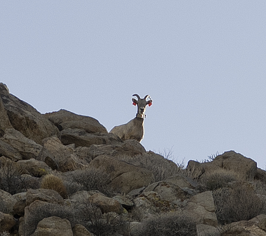
Here's a couple rams because it's rutting season. The pics are heavily cropped because I didn't have a big lens with me.
 Two Rams by tomteske, on Flickr Two Rams by tomteske, on Flickr
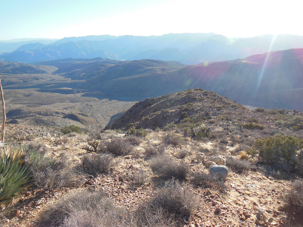
Ended up climbing out of Devil's Canyon onto one of the two roads descending from Table Mt to Mt. Springs. The road was covered with fresh tracks and sheep scat. Nice view toward the Dos Cabeza area.
 Above Mt Springs by tomteske, on Flickr Above Mt Springs by tomteske, on Flickr
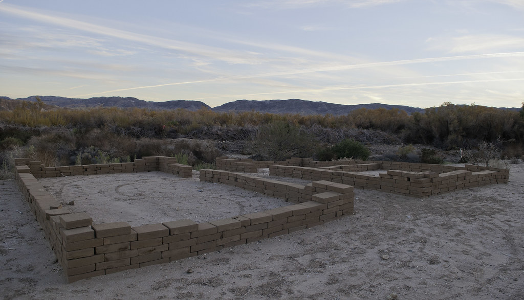
The road leads to Mt Springs and what remains of the 1860's stage coach stop. Low stone walls remain from buildings and corrals with the trough a much later addition. The "Mt Springs" across I-8 to the East was developed later for the Hwy 80 gas station.
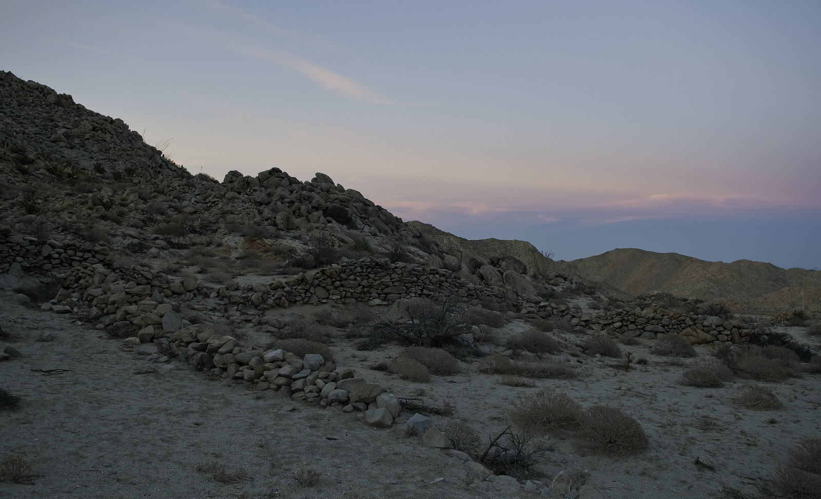 Mt Springs Corrals by tomteske, on Flickr Mt Springs Corrals by tomteske, on Flickr
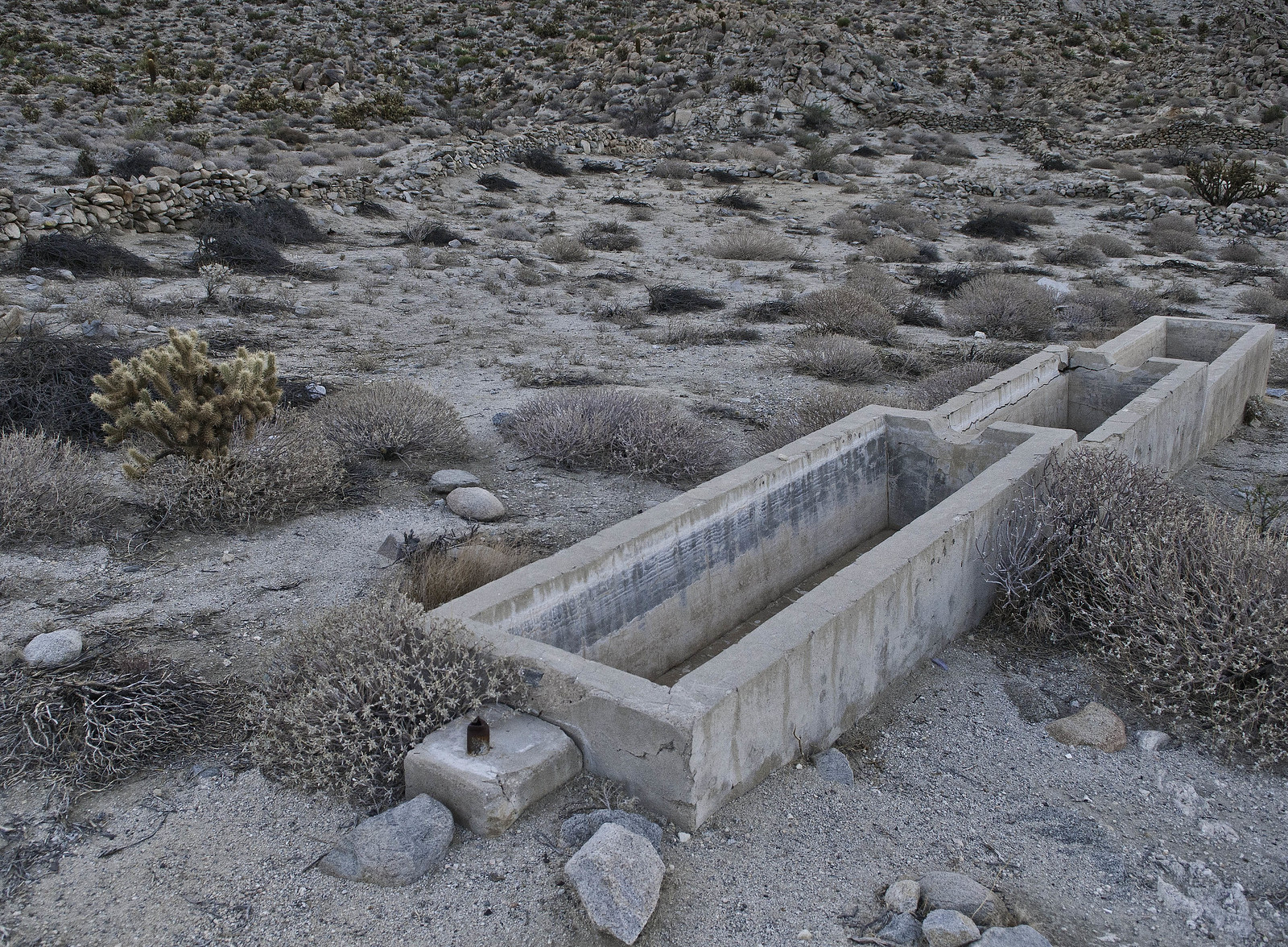 Mt Springs Trough by tomteske, on Flickr Mt Springs Trough by tomteske, on Flickr
There is no access to the site from I-8 but it's an easy .8 miles from Mt. Springs exit if you walk outside the freeway fence. Saw a CHP looking through some guy's camera who was stopped here a few weeks back. Was thinking he might be getting cited but who knows.
 Dusk at Mt Springs by tomteske, on Flickr Dusk at Mt Springs by tomteske, on Flickr
Was getting dark, so hiked back to the truck and headed on to SD. Enjoy. Tom |
10/23/2014
Topic:
Yuha and Mt Springs Exit
tommy750
|
Nolan (anutami) wrote:
nice pics, your fish eye lens is sweet.
Yes, I was actually wondering how you were getting those shots.
Usually use the monopod instead of a tripod but forgot it for this trip. A drone would be ideal but not really counting on Santa to come through with that Daren, the 10mm fisheye works well and you can flatten the image a bit in photoshop if necessary. Tom
edited by tommy750 on 10/23/2014 |
10/23/2014
Topic:
Yuha and Mt Springs Exit
tommy750
|
dsefcik wrote:
Here is a very skewed 4 photo stitched panorama of the Mojave Twins, both of these are from my Pentax 6x7 film camera

Would be hard to tell that's not the way it actually looks. Is your file like 300MP? Tom |
10/26/2014
Topic:
Driving The Mojave Road
tommy750
|
Great pics, Daren! Especially like your Lanfair Valley Joshua Tree forest and the Piute Creek petros with the shallow depth of field. Did I miss your bent palm tree petro pic somewhere? I could barely see it when we arrived. The problem with this trip was three days to finish it but finding three weeks of stuff to explore on the way. Need to get out there again.
Here's Daren at Piute Creek with his 8lb camera
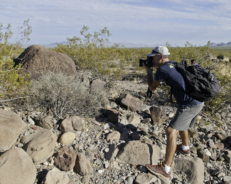 Daren at Piute Creek by tomteske, on Flickr Daren at Piute Creek by tomteske, on Flickr
A little smores bandit clearing out the campsite near the Lava Tubes.
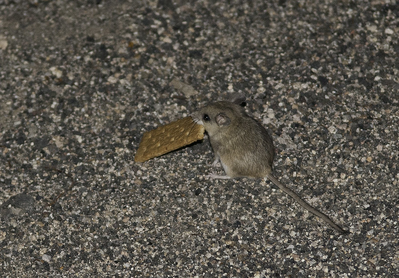 Graham Cracker by tomteske, on Flickr Graham Cracker by tomteske, on Flickr
Was taking pics of tiny yellow flowers with a macro lens and decided to take one of a rabbit dropping and saw this. Amazing microcosm on a solitary dropping!
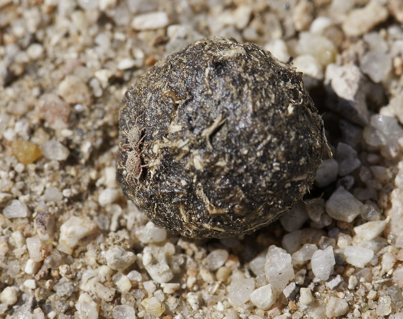 Rabbit Dropping by tomteske, on Flickr Rabbit Dropping by tomteske, on Flickr
The famous school bus in Lanfair Valley:
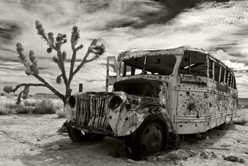 Lanfair Bus2 by tomteske, on Flickr Lanfair Bus2 by tomteske, on Flickr
Great classic trip for anyone with a 4x4. We had no problems with any part of the road (only went to about mile 80) except right before Rock Spring where there is a treacherous drop off we elected to skip. The Casebier Mojave Road Guide is pretty much essential to take with you. |
10/26/2014
Topic:
Yuha and Mt Springs Exit
tommy750
|
Yeah the red and green ear tags with the matching red and green collars were kinda interesting. Is that the standard tagging technique?? I don't know. Was nice to see a bunch of sheep where there weren't any a few years back. Tom |
11/7/2014
Topic:
Indian Valley / In-Koh-Pah Mountains Backpack
tommy750
|
Great fox pics, Daren. Was busy preparing my tent for the deluge that hit Jim (we got a few drops only) so I missed Foxy Loxy.
I can attest my pack was way over 20lbs! Great trip. |
11/7/2014
Topic:
Halloween weekend trip
tommy750
|
Looks like a great trip, Jim. Must have been pretty bad wind to bend a tent pole. We had a little but not like that. Like your lightweight stove. |
11/7/2014
Topic:
Halloween weekend trip
tommy750
|
I purchased as my first stove ever, the JetBoil. Now, I find it mocked on ultralight sites as the "JetBrick." Weighed it last night at 14.1 oz and the partly used canister at 6.4 oz. Does boil 2cups in 3 minutes and the insulated cup is kinda nice. Even caught Daren admiring it but he'd already had a few |
11/7/2014
Topic:
Halloween weekend trip
tommy750
|
dsefcik wrote:
"...just weighed one of my old 4oz bottles of denatured alcohol full and it weighed...4oz"..
Just, wow. |
11/7/2014
Topic:
Halloween weekend trip
tommy750
|
Actually, 4 oz of alcohol volume are 3.3oz of alcohol weight. If the plastic bottle weighs .7 oz, then 4 oz = 4 oz. Daren, your empirical prowess is just, wow! |
11/8/2014
Topic:
Geoglyph Hunting With Harry Casey
tommy750
|
Harry Casey of Brawley is a pilot who has aerially photographed most of the geoglyphs in the Southwest. Check out this recent article by IV Desert Museum Director Neal Hitch: http://www.ivpressonline.com/life/desertmuseum/desert-geoglyphs-still-shrouded-in-mystery/article_e1675d59-2050-5818-a3eb-ee6fb8502c34.html
Had the opportunity to join Harry and his lovely wife Margaret along with IV Desert Museum staff Jessica and Ann for a trip to explore geoglyphs near Yuma.
Here's The Horse Geoglyph presumably created after the reintroduction of the extinct horse back into America by the Spaniards in the 1500's. A nearby petroglyph panel has a mounted figure similar to the picto at Dos Cabezas but we didn't have time to visit this site.
 Pilot Knob Horse by tomteske, on Flickr Pilot Knob Horse by tomteske, on Flickr
Further to the west, an anthropomorph looking very similar to lots of local picto sites.
 Knob Hill Anthropomorph by tomteske, on Flickr Knob Hill Anthropomorph by tomteske, on Flickr
Harry Casey at the same site.
 Harry Casey at Pilot Knob Anthropomorph by tomteske, on Flickr Harry Casey at Pilot Knob Anthropomorph by tomteske, on Flickr
The site is near the All American Canal and US-Mexico border so the typical discarded immigrant apparel and supplies are abundant. Was not expecting this upscale water bottle, however. Almost took this one home!
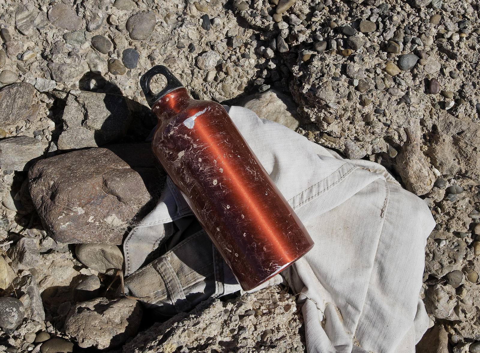 Upscale Immigrant by tomteske, on Flickr Upscale Immigrant by tomteske, on Flickr
Here's a discarded flip phone a little ways away.
 Cell Phone by tomteske, on Flickr Cell Phone by tomteske, on Flickr
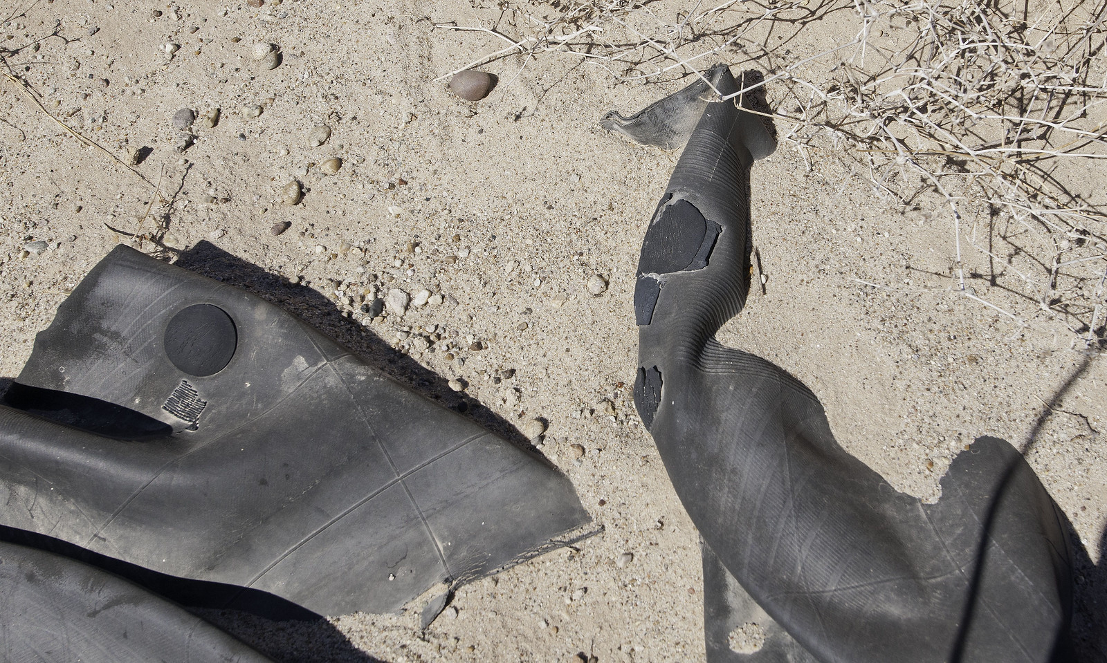
This inner tube has traveled across the canal more than once!
 Inner Tube Repairs by tomteske, on Flickr Inner Tube Repairs by tomteske, on Flickr
Jessica found this nice worked piece of stone. Some sort of tool or core with lots of patination.
 Patinated Core by tomteske, on Flickr Patinated Core by tomteske, on Flickr
She also found some nice fossils.
 Weathered Fossils by tomteske, on Flickr Weathered Fossils by tomteske, on Flickr
Visited one further site, a snake.
 Pilot Knob Snake Geoglyph by tomteske, on Flickr Pilot Knob Snake Geoglyph by tomteske, on Flickr
Unfortunately, it's not well protected and now permanently scarred by this driver.
 Tire Tracks by tomteske, on Flickr Tire Tracks by tomteske, on Flickr
Walking back, I stumbled on 10-20 sherds lying on the desert pavement. Guess we're not the first ones out here.
 Sherd Patch by tomteske, on Flickr Sherd Patch by tomteske, on Flickr
After getting home, tried to find everything on GE and stumbled on this nearby. What is this?? Guess there's still lots of stuff out there. Enjoy. Tom
 Nearby by tomteske, on Flickr Nearby by tomteske, on Flickr
edited by tommy750 on 5/6/2015 |
11/9/2014
Topic:
Geoglyph Hunting With Harry Casey
tommy750
|
dsefcik wrote:
Nice, sorry I could not join you today, looked like fun. Too bad about the snake and tire tracks, that was the first thing that caught my eye.
On GE, the whole area looks like someone took a pen and scribbled/doodled over it. A zillion tracks everywhere. BLM has fenced a lot of it off but fencing to some is often just a suggestion. |
11/10/2014
Topic:
Geoglyph Hunting With Harry Casey
tommy750
|
Jim, the oldest one dated so far is in the Yuha. Went there once and couldn't see anything. Apparently more obvious in aerial photos. Tom |
11/13/2014
Topic:
Rockhouse Canyon in Carrizo Gorge Backpack
tommy750
|
Nice trip Daren. Wish I could have made it. Me thinking I had Veteran's Day off was wishful thinking. Nice point. That spring from your view down the valley is higher that I thought! |
11/18/2014
Topic:
Carrizo Gorge Backpack
tommy750
|
Nice trip Daren. Now, the hardest part about hiking Carrizo Gorge is getting to the trail head! Haven't uploaded any of my pics yet but will try to post some later. Will be nice to finally clear all those tamarisk out although it was a deal with the devil that's accomplishing it. Less cover for predators (we found four sheep skeletons total and a skunk or raccoon), a higher water table for the indigenous flora and fauna and easier hiking, all pluses. Heard the entire watershed was seeded as a result of Tropical Storm Kathleen in 1976. Took a closeup of the largest tamarisk stump I could find and by counting the rings, I ended up at over thirty years of growth. In the ballpark if my dendrochronology is right |
11/18/2014
Topic:
Whale Peak via the Pictograph Trail
tommy750
|
Great trip report. Like the Smuggler's dry fall pic. Always a nice hike. My favorite route to the top is via Pinyon Wash and Harper Flat. |
11/19/2014
Topic:
Carrizo Gorge Backpack
tommy750
|
Here's a few more pics from the trip:
Sunrise Sunday morning somewhere near Goat Canyon:
 sunrise by tomteske, on Flickr sunrise by tomteske, on Flickr
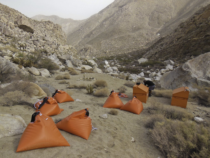
Looked like some orange dots were barely visible upstream from our camp. When we hiked closer, it was a campsite for crews clearing the tamarisks. Nice 72 gal water bladders!
 water drop by tomteske, on Flickr water drop by tomteske, on Flickr
Another camp much further upstream.
 coyote spike camp by tomteske, on Flickr coyote spike camp by tomteske, on Flickr
Not sure if this was a raccoon or skunk or ?
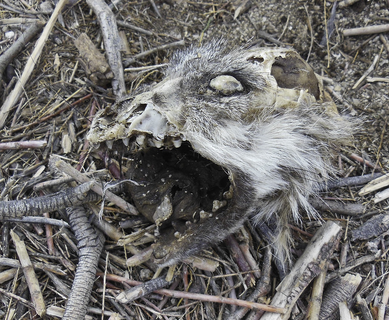 raccoon maybe by tomteske, on Flickr raccoon maybe by tomteske, on Flickr
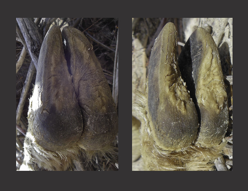
Close up of hooves from the ram Daren posted pics of. Front is on the left and rear on the right. Supposedly more block like and less rounded than a deer. Don't think I could tell the difference.
 front and back by tomteske, on Flickr front and back by tomteske, on Flickr
Nice metamorphic rock. Daren says this spot looks really nice when there's water. We did find two small areas with standing water in the sections we hiked.
 metamorphosis by tomteske, on Flickr metamorphosis by tomteske, on Flickr |
11/19/2014
Topic:
Carrizo Gorge Backpack
tommy750
|
Jim (ziphius) wrote:
I want giant water bladders delivered to me in the backcountry! The skull... maybe a possum? Looks pretty flat on the top, teeth are widely-spaced.
Opossum wasn't even on my radar. Now that you mention it, think you're right Jim. Was thinking the exact same thing about dropping a few of those bags out in the boonies. Would save a lot of our backs from wearing out |
11/19/2014
Topic:
Carrizo Gorge Backpack
tommy750
|
dsefcik wrote:
Here is the metamorphic rock water bed back in April 2010

quote]
I like it! Do you have any pics of the swimming pool with the shallow end rock dam? Think I'll stay with my tent and dump the bivy especially after your snake pic. Felt like a straight jacket anyway.
|
11/26/2014
Topic:
RockhouseValley (north) backpacking TRIP
tommy750
|
Was nice to meet you Dave. Have to agree Rockhouse is pretty desolate and a very big coincidence our two groups met up. Don't think I saw another human footprint out there the entire trip. Great place to explore. Tom. |
11/29/2014
Topic:
Rockhouse Canyon / Buck Ridge / Jackass Flat 4 Day
tommy750
|
Like your camera and pics, Daren. Reluctantly ditched my dlsr for the trip since it weighed in at 4.5lbs and carried a point and shoot which isn't the same. Great quartz desert side notch point find and like the pic. |
12/1/2014
Topic:
Rockhouse Canyon / Buck Ridge / Jackass Flat 4 Day
tommy750
|
Here's a few more pics from the trip last week.
Everyone getting ready to head out on Saturday morning after the most grueling part of the trip, the drive to the trailhead
 DSCN1310 by tomteske, on Flickr DSCN1310 by tomteske, on Flickr
Getting ready to descend into Rockhouse.
 DSCN1325 by tomteske, on Flickr DSCN1325 by tomteske, on Flickr
The view from the seep above Santa Rosa Village.
 DSCN1380 by tomteske, on Flickr DSCN1380 by tomteske, on Flickr
My sleeping quarters at the Cottonwoods near Nicholias Canyon. Dropped to below 20 degrees that night. Need to bring down booties next time!
 DSCN1444 by tomteske, on Flickr DSCN1444 by tomteske, on Flickr
Gary picking mistletoe off a nearby oak he's been tending for the past couple decades. He says it was near death from a severe mistletoe infection when he started removing every stem each visit he made to the area. This trip, a few smalls stems were removed and the tree looks healthy.
 DSCN1445 by tomteske, on Flickr DSCN1445 by tomteske, on Flickr
A deep mortero.
 DSCN1403 by tomteske, on Flickr DSCN1403 by tomteske, on Flickr
Heading up Alder Canyon a ways before we turned left toward Buck Ridge.
 DSCN1521 by tomteske, on Flickr DSCN1521 by tomteske, on Flickr
The view from Buck Ridge into Dry Wash/Jackass Flat. We would need to descend 1600 ft to our camp in the wash.
 DSCN1538 by tomteske, on Flickr DSCN1538 by tomteske, on Flickr
 DSCN1539 by tomteske, on Flickr DSCN1539 by tomteske, on Flickr
Happy for the invite to a nice 25 mile 5K gain/loss trip, my first multi day BP trip ever. Enjoy. Tom |
12/1/2014
Topic:
Piedras Grandes / Indian Hill
tommy750
|
Nice sunset, pic Daren. Need to check out your camera. Really nice pics and not 5lbs to carry. My 16MP point and shoot gave me very large file blurry overexposed jpeg mush last trip out. |
12/2/2014
Topic:
Rockhouse Canyon / Buck Ridge / Jackass Flat 4 Day
tommy750
|
rockhopper wrote:
2. Was there any remnant of the 4x4 rock built road going up the 30 ft water fall drop off? Others may chime in on the history of this. A 4x4 club back in the day (1950's- 1960's) ?? built a road up Rock house canyon. I don't know if they ever made it to the valley floor. But parts of the 4x4 ( rock and boulder) road built by these guys still was intact about 20 years ago.
Gary pointed out where 4x4 enthusiasts had built a road bypassing a dry fall to access Rockhouse. Looked pretty narrow and sketchy to me and not much more than a rock ledge remained along with a graffito dating to 1969 that indicated some VW "sand buggies" had made it through. Tom |
12/5/2014
Topic:
Random photos from Borrego Springs and Culp Valley
tommy750
|
Jim (ziphius) wrote:
Very nice pic! |
12/8/2014
Topic:
Borrego Palm Canyon Backpack
tommy750
|
Nice trip, Daren. Only carrying two liters would make almost any hike a great one |
12/11/2014
Topic:
Pepperwood Canyon to Canebrake Valley
tommy750
|
Great trip. Have done parts of that trip but would like to try Pepperwood sometime. Did you get see anything that looked like a trail heading up Canebrake toward Thing Valley? It's listed on old topo maps but can't really see anything on GE. Tom |
12/12/2014
Topic:
Pepperwood Canyon to Canebrake Valley
tommy750
|
dsefcik wrote:
tommy750 wrote:
Great trip. Have done parts of that trip but would like to try Pepperwood sometime. Did you get see anything that looked like a trail heading up Canebrake toward Thing Valley? It's listed on old topo maps but can't really see anything on GE. Tom Sounds like a trip to me Tom! When you wanna go..??
Any time after the holidays sounds good to me. Thinking we need to swing by Carrizo Gorge first and borrow a couple chain saws to clear a trail |
12/14/2014
Topic:
Carrizo Badlands
tommy750
|
Decided to head out today and explore a bit of the south Carrizo Badlands. Drove into Canyon Sin Nombre and passed the graffiti point with some new additions since the last time I was through. Parked about a mile upstream from Carrizo Creek and headed east on foot
 Graffiti Point by tomteske, on Flickr Graffiti Point by tomteske, on Flickr
Looking toward Carrizo Mt.
 Carrizo Badlands by tomteske, on Flickr Carrizo Badlands by tomteske, on Flickr
Nice solitary chunk of petrified wood.
 Petrified Wood by tomteske, on Flickr Petrified Wood by tomteske, on Flickr
On a secluded dune in the middle of nowhere. Why Lady Campers, Why?
 Jafra and Ricky by tomteske, on Flickr Jafra and Ricky by tomteske, on Flickr
Made it to BM Leckie.
 BM Leckie by tomteske, on Flickr BM Leckie by tomteske, on Flickr
 BM Leckie View by tomteske, on Flickr BM Leckie View by tomteske, on Flickr
 Badlands From Leckie by tomteske, on Flickr Badlands From Leckie by tomteske, on Flickr
A little further up, a view of Carrizo Creek with the remarkable changes from tamarisk abatement.
 Carrizo Burn by tomteske, on Flickr Carrizo Burn by tomteske, on Flickr
Decided to go north side of the creek and passed through areas of previous dense growth with zero problem. Spied a very large mortero and a curious vertical groove I've never seen at a rock feature before. A few more slicks and morteros were nearby.
 Pit and Groove by tomteske, on Flickr Pit and Groove by tomteske, on Flickr
 Carrizo Mortero by tomteske, on Flickr Carrizo Mortero by tomteske, on Flickr
Few remnants of old fencing.
 Carrizo Contrails by tomteske, on Flickr Carrizo Contrails by tomteske, on Flickr
Encountered a couple photo reference points.
 Photo Point by tomteske, on Flickr Photo Point by tomteske, on Flickr
 Photo Point2 by tomteske, on Flickr Photo Point2 by tomteske, on Flickr
Looking toward South Mesa and Gert Wash.
 Toward South Mesa by tomteske, on Flickr Toward South Mesa by tomteske, on Flickr
My goal was to try and find some possible sleeping circles I thought I saw on GE but they were sandy depressions and a couple "sleeping squares." Nice place to pitch a tent.
 Sleeping Square by tomteske, on Flickr Sleeping Square by tomteske, on Flickr
Was getting late but decided I'd dash toward the Stage Station and then head home. It's just behind the ridge in the center of the pic.
 Toward Carrizo Stage Station by tomteske, on Flickr Toward Carrizo Stage Station by tomteske, on Flickr
 Carrizo Stage Station by tomteske, on Flickr Carrizo Stage Station by tomteske, on Flickr
A few yards to the west is the collapsed rock house with assorted piles of junk and the famous Carrizo tractor.
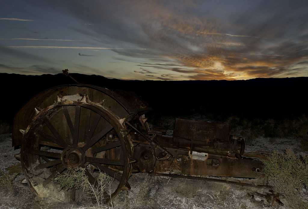 Carrizo Tractor by tomteske, on Flickr Carrizo Tractor by tomteske, on Flickr
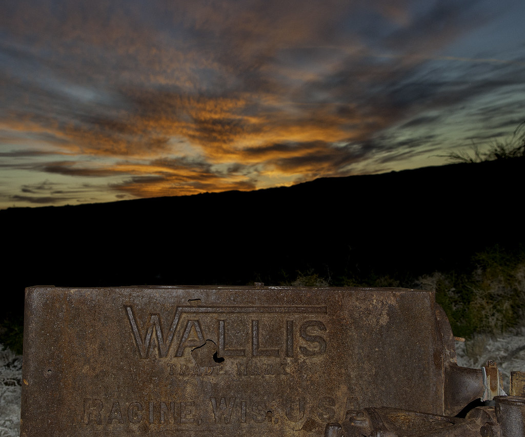 Wallis Sunset by tomteske, on Flickr Wallis Sunset by tomteske, on Flickr
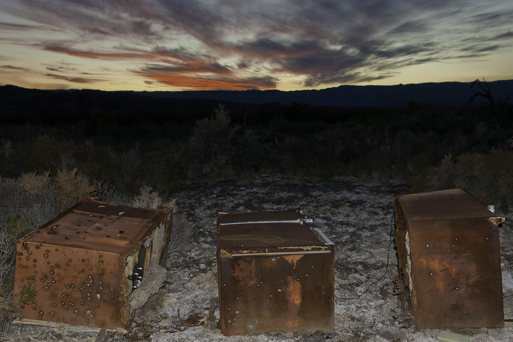 Sunset Refrigerators by tomteske, on Flickr Sunset Refrigerators by tomteske, on Flickr
Popped on the headlamp and headed home. Two mylars, 10.5 miles and another relaxing day in the desert. Enjoy. Tom |
12/14/2014
Topic:
Pepperwood Canyon to Canebrake Valley
tommy750
|
dsefcik wrote:
I have Titanium Loppers...only 1lb!
Wow, Daren. Santa's been good to you! Rockhopper and I will probably have to stick with the archaic wood and steel method |
12/15/2014
Topic:
Carrizo Badlands
tommy750
|
Jim (ziphius) wrote:
Way to go on sleuthing out the sleeping square from GE. That groove / mortero combo is a new one to my eyes. Always something new to find out there. Love the photos, particularly your B&Ws. Funny that you found nail polish containers out there....there is a lot of internet chatter about sniffing polish (and remover) to get high. Maybe they weren't doing their nails after all.... and if you want to get high, word on the street is that Bacardi or Grey Goose is the way to go.
Sniffing nail polish was not even on my radar but I think you nailed it, Jim! That probably explains why my in-house mani-pedi consultant AKA girlfriend wasn't too impressed with the brands (think her expert reply was something like, "do they still make that crap?"). |
12/15/2014
Topic:
Carrizo Badlands
tommy750
|
dsefcik wrote:
Absolutely love it Tom, I really like the B/W photos, I need to learn how you make those. I have not been out to Carrizo Marsh yet, would like to go someday. Too bad we missed each other this weekend, you would have enjoyed going with us.
Assuming you're going to post on your trip? Also assuming you got time lapse shots of the meteor shower? Yeah, wish I would have found out about my change in plans earlier so I could have joined you. |
12/15/2014
Topic:
Carrizo Badlands
tommy750
|
dsefcik wrote:
I brought all the camera crap to record them, fast wide lens, tripod, cable release, etc...but the cheap bottle of booze I brought knocked me out until the early morning sun came poking it's head of the mountain ranges...
That seems so unlike you, Daren!  |
12/16/2014
Topic:
Vallecito Valley overnight
tommy750
|
Have to admit, the spider video was worth the 78 seconds! Were the skid marks from a coyote or hawk or ? Great trip. Need to head back out there. |
12/27/2014
Topic:
5 Day Backpacking Trip Indian Gorge/Canebrake-
tommy750
|
Another great trip report, Daren. That's a great view from the saddle looking into Potrero. For some reason I'm thinking you found room in your pack for bubble bath this time out |
1/12/2015
Topic:
Fish Creek Mountains
tommy750
|
Here's a couple more pics from the trip.
Daren with a mylar parade:
 Mylar parade by tomteske, on Flickr Mylar parade by tomteske, on Flickr
More tins. Pretty much a vegetarian so wasn't familiar with the term "kippered."
 Kippered by tomteske, on Flickr Kippered by tomteske, on Flickr
Aaannd Daren's life insurance premiums just doubled
 Just Looking by tomteske, on Flickr Just Looking by tomteske, on Flickr |
1/16/2015
Topic:
Wind Turbine Catches Fire
tommy750
|
Just saw this in the local Imperial Valley Press: http://www.ivpressonline.com/quicknews/wind-turbine-catches-fire/article_76664f1a-9d1d-11e4-9aaf-2fd162924c2c.html
Here's the short video on youtube: http://youtu.be/aegHUv2OkEE |
1/20/2015
Topic:
Wind Turbine Catches Fire
tommy750
|
Thanks for the pictures, Daren. And, congratulations on being the lucky recipient of my 500th post! |
1/21/2015
Topic:
Sheep / deer at the water trough?
tommy750
|
Nice find, Jim. The 8/28/14 GE imaging for the desert area is fantastic. Was out there last year ( http://www.anzaborrego.net/anzaborrego/forum/topic898-yuha-and-mt-springs-exit.aspx ) and saw 14 sheep with tons of prints and scat leading to Mt. Springs. Got to the spring area at dusk and only saw the empty troughs closer to the freeway. Missed the trough you're seeing. Before you stop on I-8 and spend too much time exploring the old stage stop etc, check GE for the CHP cruiser parked a few yards uphill on the eastbound shoulder. They've been known to cite people there. |
1/25/2015
Topic:
New Free BLM Routes of Travel Map App
tommy750
|
A couple weeks ago I was talking with Jeff Sahagun, BLM El Centro GIS specialist/archaeologist, and he mentioned BLM routes of travel were available on Avenza System's PDF Maps. Downloaded it to my android and had a chance to check it out while driving around the Yuha Desert this afternoon. Worked real well with the geolocalization feature coming in real handy in the maze of BLM roads out in the Yuha. Here's the no brainer steps to getting it:
Download PDF Maps from Android PlayStore or Apple App Store. Haven't tried it on my iPad since I forgot my iTunes password
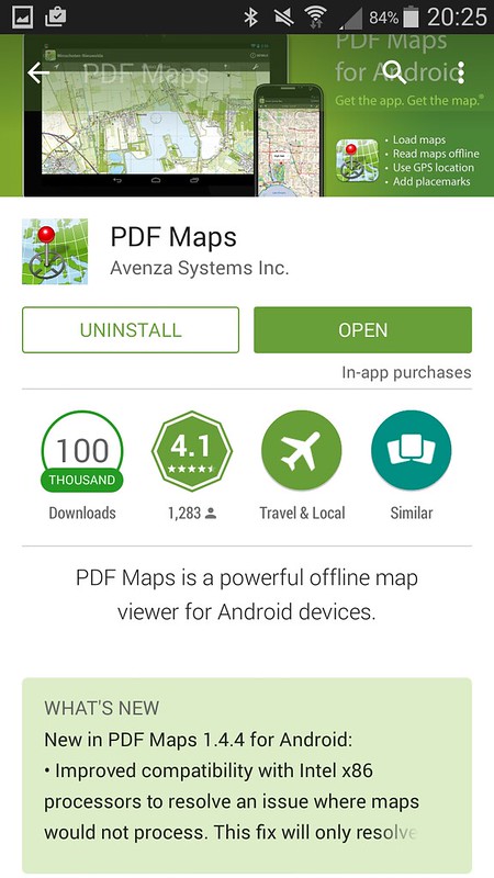 Screenshot_2015-01-25-20-25-28 by tomteske, on Flickr Screenshot_2015-01-25-20-25-28 by tomteske, on Flickr
Once installed, click on the app's shopping cart icon and search for "BLM." You can use either the map/list to find the Imperial Valley choices. Jeff said there were three, Western Imperial County, Eastern Imperial County and the sand dunes but I'm not finding the Eastern map.
 Screenshot_2015-01-25-20-21-01 by tomteske, on Flickr Screenshot_2015-01-25-20-21-01 by tomteske, on Flickr
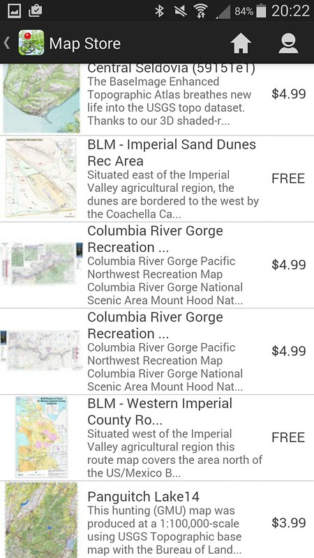 Screenshot_2015-01-25-20-22-06 by tomteske, on Flickr Screenshot_2015-01-25-20-22-06 by tomteske, on Flickr
Here's a view of Yuha. There's a lot of other features you can use in the app and it apparently interfaces with GE although I haven't tried transferring kml/kmz files yet.
 Screenshot_2015-01-25-20-13-35 by tomteske, on Flickr Screenshot_2015-01-25-20-13-35 by tomteske, on Flickr
You can also download the familiar ABDSP PDF map by searching "Anza Borrego". For FREE, not a bad app. Tom
 Cerro Centinela by tomteske, on Flickr Cerro Centinela by tomteske, on Flickr |