11/30/2015
Topic:
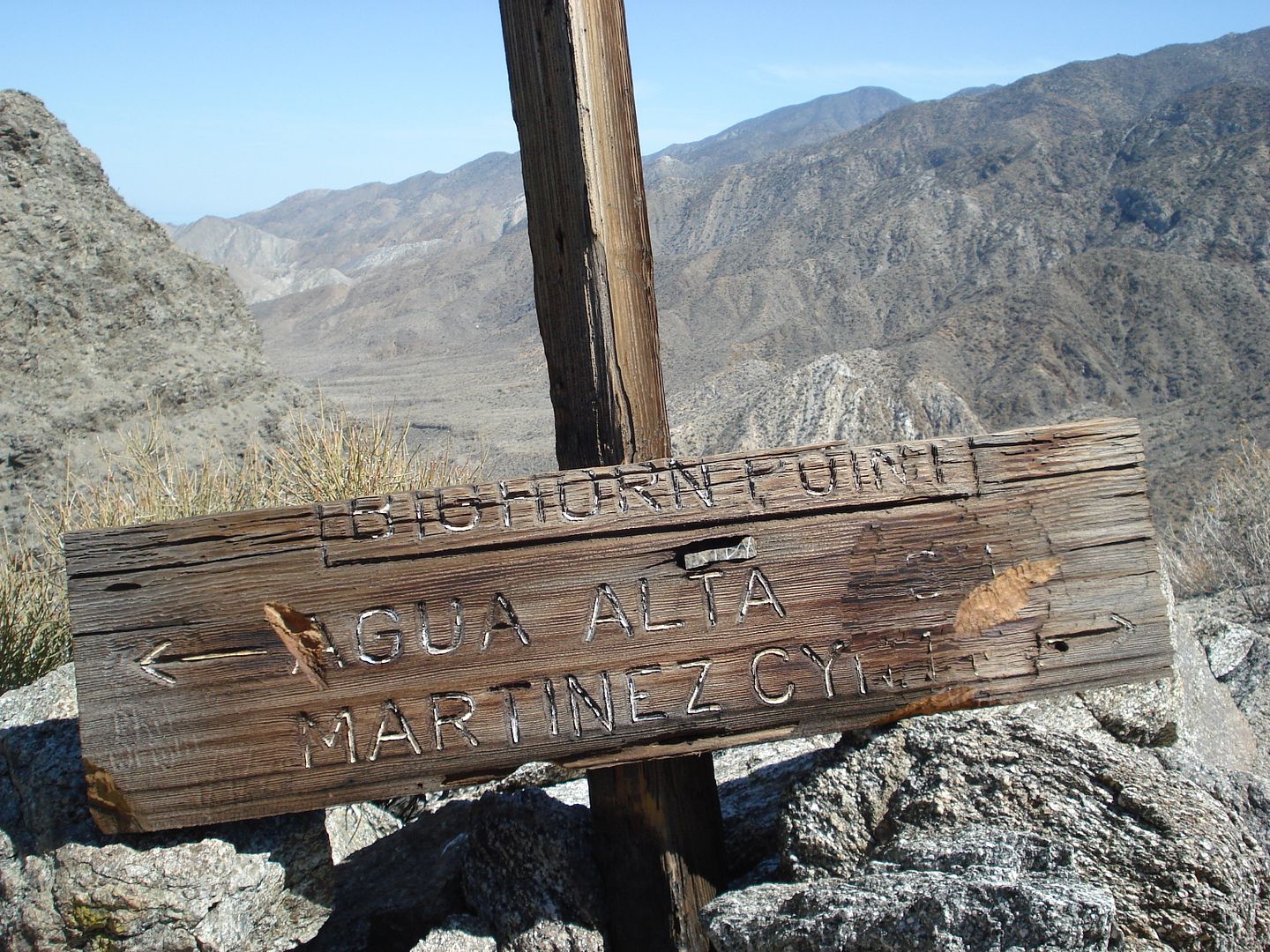
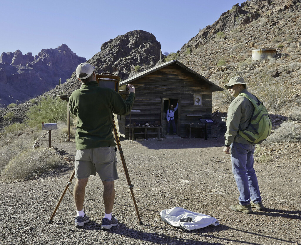
Martinez and Agua Alta Canyons Backpack
tommy750
|
Jim (ziphius) wrote:
Looks like a great area and fun time. Love the cabin-in-the-morning and frog photos. Whenever I hear of a pool of water being 'putrid green', my immediate thought is blue-green algae, which can contain some deadly toxins or at least stuff that won't make you feel good. Any photos of the putrid green pools? You guys obviously made it back alive!
I didn't take any but maybe Daren did. Yeah, the water was a bit sketchy in my opinion but Daren, Gary and Joel kinda shrugged it off. Always thought it would be interesting to take samples of all these remote springs to see what's in the water. |
11/30/2015
Topic:
Martinez and Agua Alta Canyons Backpack
tommy750
|
rockhopper wrote:
Great loop trek! Please post more photos. Did you find the sections of the Indian trial heading down from Agua Alta trail? I have an old topo showing that trail also. I tried going up to Agua Alta spring from the bottom on that route years ago but was low on water and had to turn back. Good to see you guys using the cactus spring trail. It needs more traffic to keep it recognizable. I was just there last season, Cactus Spring trail / Jack miller cabin / Auga Alta spring. The trail they say is over 1000 years old and is cut wast deep as it heads over the pass towards Pinyon valley.
btw Jack Miller built a road to his cabin up the canyon in the 1920's with a Buick with additional wheels bolted on the back! The road was in constant need of repair after the floods. Also, it was his second Cabin. The first one was down stream a bit and was washed away. You could still see remenets of the old cabin about 20 years ago as I remember.
Sign off the trail on a ridge on my last hike
edited by rockhopper on 11/30/2015
edited by rockhopper on 11/30/2015
edited by rockhopper on 11/30/2015
Definitely took a few looks at your posts Rockhopper before our trip out there. We could still see some ot the old road to Jack Miller in places but most of it was washed out. Couldn't figure out how he got throught The Narrows but the topo map and GE seems to indicate he went over the ridge to the north. Definitely looks like it would be a challenge to maintain. The Cactus Springs trail we traveled had a few parts where it was quite obvious but for the most part we just headed in the same general direction or used the gps. The trail down from Agua Alta Spring area to the canyon was nonexistent except at the top and as Daren said it was probably a game trail to the abandoned guzzler. Not much noticeable after that. Daren found a few large cairns north of the canyon but unclear if they were mining or Indian. |
12/2/2015
Topic:
Martinez and Agua Alta Canyons Backpack
tommy750
|
dsefcik wrote:
rockhopper wrote:
Daren, how did that water taste? Hope you are ok. Nothing like burping up algae iodine water all day....yummm, made my coffee and oatmeal have some added trail flavor. By the last day it was tasting good, kinda missed it....
Think I still have a half liter or so of the "good stuff" I can send you for Christmas, Daren  Nice pics. Nice pics. |
12/8/2015
Topic:
Mojave National Preserve and other areas
tommy750
|
Nice trip Nolan. Glad you had a chance to get out on the Mojave Rd. That one inside/outside thermometer pic makes me want to get a camper |
12/14/2015
Topic:
Hiker rescued in Rock house canyon 12-13-15
tommy750
|
Didn't know there were "woods" to get lost in at RHC The guy's feeling bad enough for spending all that tax payer money and then the UT has to publicly shame him with the ex-Marine stuff. Nice touch. |
12/19/2015
Topic:
3 Day Backpack through Vallecito, Canebrake and IP
tommy750
|
Nice Christmas tree, Jim That's a great area to visit. Heading out there Monday-Tuesday for a quick trip and hoping it won't get to freezing temps! I have a five year old Marmot 15 Long and it weights 46oz. Sure you didn't lose a couple rolls of quarters in yours?? |
1/3/2016
Topic:
McCain Valley / In-Ko-Pah Mts Last 2 months
tommy750
|
Glad you could find the spring, Jim. Love roaming around out there. Nice pics. |
2/2/2016
Topic:
Any Interest in going to Pinto Canyon - early 2016
tommy750
|
surfponto wrote:
It is a pretty crazy story...cool though
http://www.robertmarcos.com/ghost-ship/
A great California tale for sure. Unfortunately, it quickly unravels with only a bit of fact checking:
1) You can't sail from the Sea of Cortez right into Ancient Lake Cahuilla since the lake level when full was 42ft and sea level is, well, zero.
2) There is some debate the lake contained water in 1612.
3) It's unlikely the ghost ship was trapped by sand bars because the water level of the lake rapidly dropped. It takes about 57 years for the lake to dry.
3) Sailing the 130 miles to Blythe against the mighty Colorado in a Spanish caravel seems a herculean task.
4) A point 300 ft SE of the farthest eastern point of the Superstition Mts would put the ghost ship about five miles from the nearest shoreline of Ancient Lake Cahuilla and over 300 ft above the highest 42 ft shoreline.
5) The supposed ship-like petroglyph in Pinto Canyon looks ship-like because the bottom half of the strange shape has been removed by the abrasive force of water flowing in the wash. Similar intact pictographs at El Vallecito look nothing like a vessel.
6) Finally, there is no Santa. Sorry. |
2/3/2016
Topic:
Any Interest in going to Pinto Canyon - early 2016
tommy750
|
Okay, maybe Santa is still plausible. I'm going to walk that part back  |
2/7/2016
Topic:
Tarantulas, Cahuilla Indians, & Johnny Cash
tommy750
|
A. johnnycashi. Nice. So what are the main kinds of tarantulas we have around here, Jim? Thanks. |
3/4/2016
Topic:
Anza Borrego Wildflower Update
tommy750
|
Here a link to today's latimes.com story on ABDSP wild flower enthusiasts:
http://www.latimes.com/science/la-sci-flower-stalkers-20160305-story.html |
3/31/2016
Topic:
Domelands in the Coyote Mountains Wilderness
tommy750
|
Hey Bob, found this neat website that has a bunch of TRs on the Coyote Mts!
http://www.anzaborrego.net/anzaborrego/Forum/topic973-the-domelands-wind-caves-and-slot-canyon.aspx
http://www.anzaborrego.net/anzaborrego/forum/topic695-carrizo-mountain--indian-hill-dec-th-.aspx
http://www.anzaborrego.net/anzaborrego/forum/topic426-carrizo-mountain--yuha-basin.aspx
http://www.anzaborrego.net/anzaborrego/forum/topic275-coyote-mountains.aspx
http://www.anzaborrego.net/anzaborrego/forum/topic196-dolomite-mine.aspx
http://www.anzaborrego.net/anzaborrego/forum/topic171-domeland-and-wind-caves--oct-.aspx
Here's some of my flickr albums of the the Coyotes. Love that place.
https://www.flickr.com/photos/tommy750/albums/72157636976269185
https://www.flickr.com/photos/tommy750/albums/72157636738433725
https://www.flickr.com/photos/tommy750/albums/72157629181073275
https://www.flickr.com/photos/tommy750/albums/72157628200928743 |
4/12/2016
Topic:
What Is This??
tommy750
|
Found this in a meadow high on Whale Pk about a week ago. Does this look familiar to anyone? I kinda think it looks like a cap on a metal curtain rod but I'm assuming that may be incorrect! So far, a cap on a metal fence, a miner candle holder and Daren's "metal stabby thing with swirly design" are the top possibilities
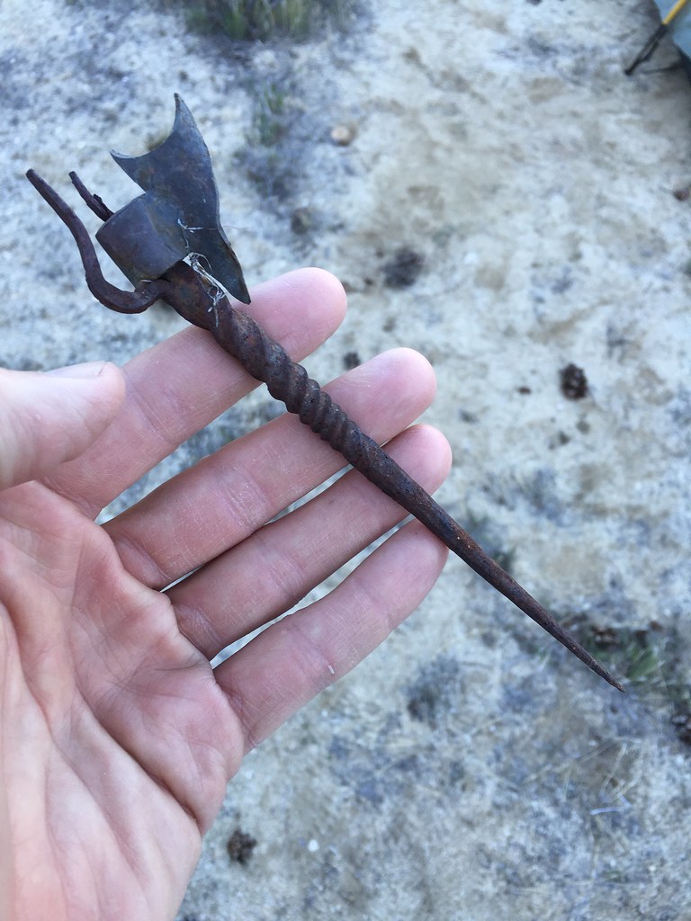 IMG_1643 by tomteske, on Flickr IMG_1643 by tomteske, on Flickr |
4/13/2016
Topic:
What Is This??
tommy750
|
dsefcik wrote:
Going with miners candle holder
http://www.miningartifacts.org/minerscandleholders.html
The miner's candle holder actually goes in your hat so I'm not sure how this artifact would work since the "candle holder" is not perpendicular to the pointy thing but who knows. |
4/26/2016
Topic:
Jacumba and Table Mountain Exploration
tommy750
|
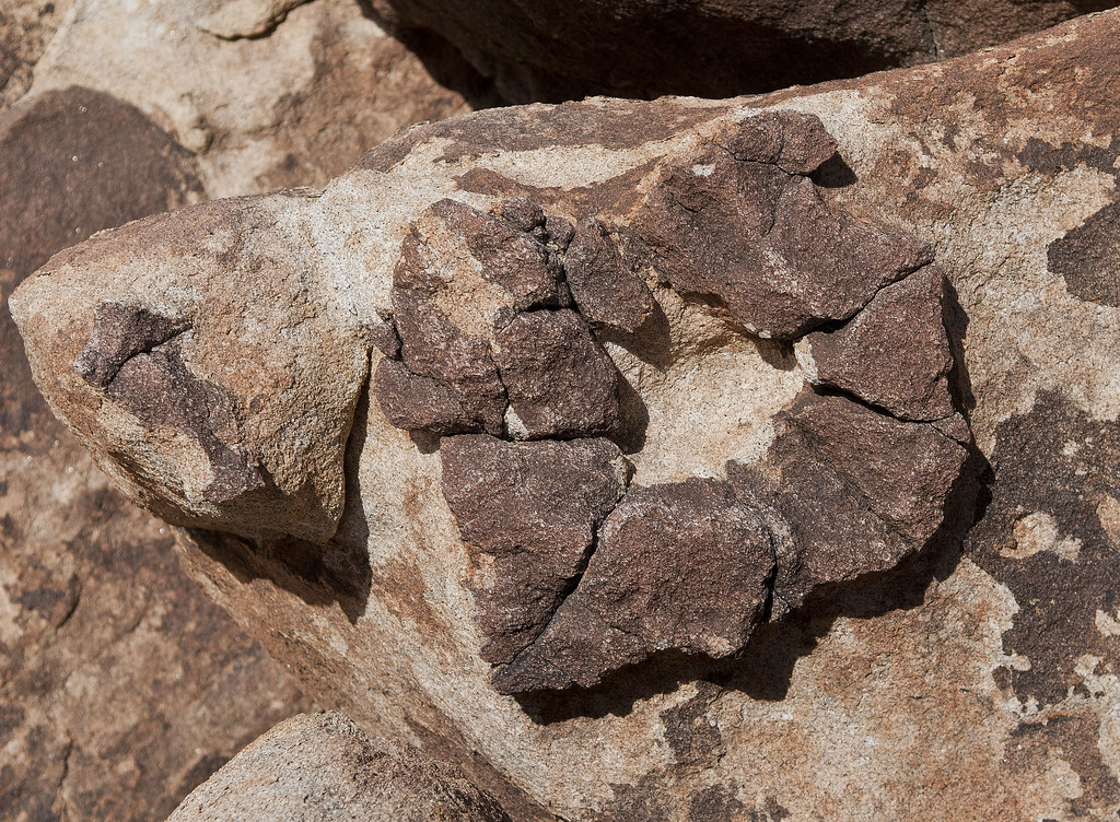
Here's what little I know of this subject. The linear and oval indentations on granitic rocks in ABDSP reminiscent of the human vulva are often referred to as "yoni," a term first applied to these non-pictograph structures by Charlotte McGowan in her 1982 "Ceremonial Fertility Sites in Southern California." Others have subsequently made similar observations. The basic idea is natural rock features were worked or enhanced by the Kumeyaay and utilized during fertility rites. The ONLY ethnographic account of these structures linked to anything Kumeyaay or any type of fertility rite was relayed to Ken Hedges by an old rancher at the Crawford Ranch who stated a shaman approached him in 1935 asking to bury his dead relative on the ranch and mentioning in passing that women who could not conceive would visit "magic stones" in order to conceive. That's it! In 2012, Heather Thomson began giving lectures discussing her Masters Thesis which attempted to answer the question whether the granitic vulva-like structures were soley the result of natural weathering or was there evidence the structures had been worked or enhanced. I attended one of her lectures in 2013 at the San Diego Archaeological Center and basically she identified numerous typical examples of yonis (many with trinomials) and had five geologists examine them for any signs of enhancement and whether all the observed characteristics were a result of natural weathering. The unanimous opinion from the geologists was no enhancement and all characteristics a result of granitic natural weathering. I haven't read Heather Thomson's thesis but it sounds like an interesting read.
edited by tommy750 on 4/26/2016 |
4/30/2016
Topic:
Jacumba and Table Mountain Exploration
tommy750
|
Canebrake Jeff wrote:
I,m sure the geologists said " There does not appear to be any recent signs of enhancement and the surface appears to be naturally weathered". A follow up question should be " In what time frame would signs of enhancement be erased by natural weathering" There unanimous answer would be " Ummm, I guess maybe 300 to 500 years depending on many unknown factors". Tommy750 is correct with his info on Charlotte's study, But he must not have read her conclusion. She writes "Four Yonis appear to have been altered by pecking, grinding or carving,or carving. (7 others) appear to have been enhanced to make them more closely resemble their human counterpart, the vulva." She also wrote in her conclusion "In many cases, the yonis are directly incorporated into village sites." Once you have seen as many as I have, you develop a feel for what is altered and what is natural.
McGowan has made a fascinating hypothesis. Now, what's needed is evidence. Reversals of the burden of proof such as, "prove yonis at one time in the past weren't enhanced" are not convincing. There are many thousands of rubs, slickes, basins, morteros, cupules, metates and manos next to these same yonis still showing obvious wear so one might think at least some yonis would also show residual enhancement or modification. Find that one worked yoni and Thomson's counter hypothesis can be rejected. |
5/2/2016
Topic:
Hiking to the top of Guatay Mountain
tommy750
|
ziphius wrote:
Looks like a great trip Bob. If you're looking for Whitney training opportunities, the El Cajon Mtn. hike is a good one! - Jim
My thoughts exactly. Better yet, summit El Cajon and bounce on over to Rock Mt for an extra 3 mile bonus still honoring the "uphill both ways" theme of El Cajon |
5/3/2016
Topic:
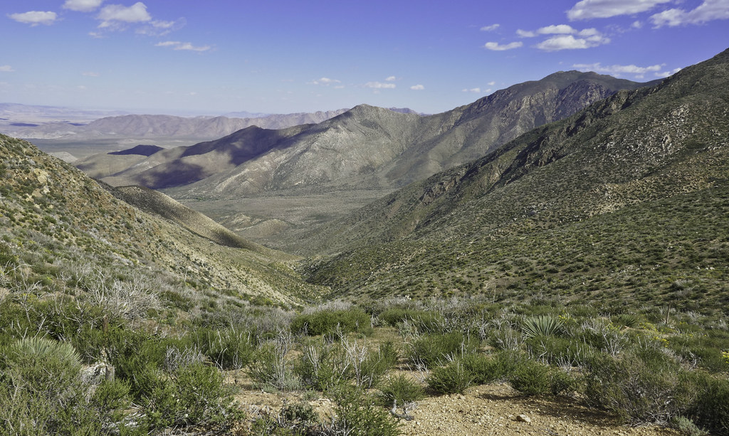
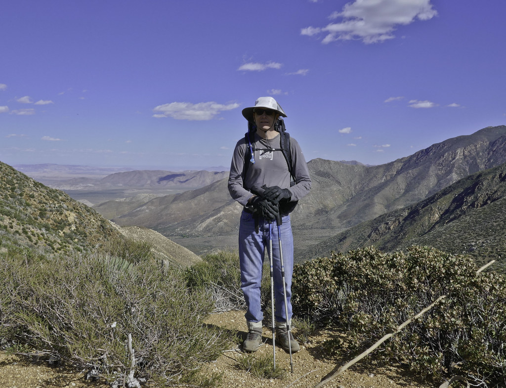
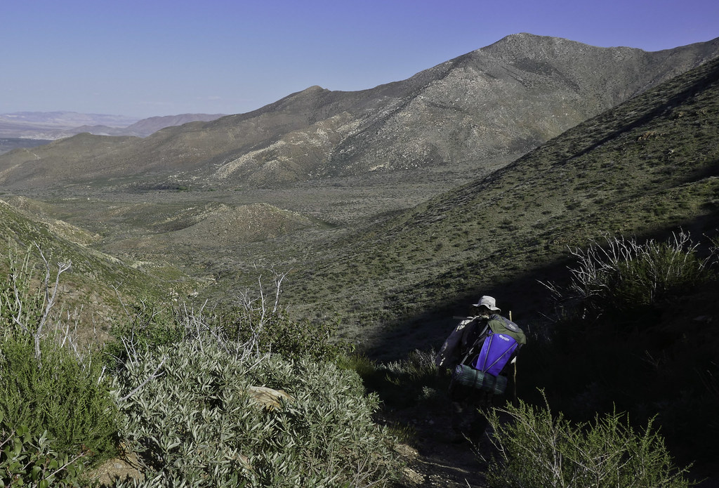
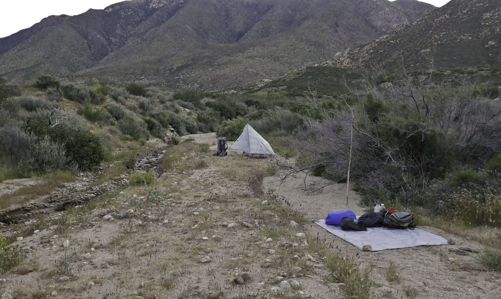
Santa Rosa Mnts / Martinez Canyon 12 Day Backpack
tommy750
|
Great pics, Daren. Glad you guys had a chance to use your cold weather gear Looks like Gary is wearing his ground cloth in that one pic... |
5/13/2016
Topic:
Yoni
tommy750
|
Fanning the flames, Daren, fanning the flames Apparently geologists call these mimetoliths. Here's a quote from the Memphis Archaeological and Geological Society newsletter (http://www.memphisgeology.org/images/rocknews0613.pdf) on the subject:
"The word “mimetolith” was developed in the 1980s by .R. V. Dietrich, Professor at Central Michigan University, and he describes the mimetoliths as: “a natural topographic feature, rock outcrop, rock specimen, mineral specimen, or loose stone the shape of which resembles something else…or the surface pattern of which resembles [something else] such as an animal, a flower, a person.” The key words in the above definition are natural, shape, and resembles. For a rock to be considered a mimetolith the shape must be natural and original to the rock, no alterations in shape or appearance, although in some situations a cut rock will reveal a mimetolith not previously observed in the original rock. Resembles, which is an open ended and subjective description, is essentially in the eye of the beholder. If a rock resembles a cow to you and a horse to the next person, you both are correct."
This mimetolith reminds me of the person who stole MY parking space this morning:
 Yoni Not by tomteske, on Flickr Yoni Not by tomteske, on Flickr |
6/3/2016
Topic:
Proposed closures in ABSP, read and act now
tommy750
|
Just read the ABDSP Cultural Preserve Management Plan ( http://www.parks.ca.gov/pages/21299/files/final_abdsp_cultural_preserve_management_plan_112612.pdf ) and it provides careful case-by-case recommendations for all the varying preserves. Don't have any problems with that but blanket prohibitions on all "off trail" activities in preserves is dumb. And, I sent an email to the State and ditto Daren's recommendation. |
6/3/2016
Topic:
Canebrake Valley 3 Day BP
tommy750
|
Had a chance to spend a few days out in Canebrake Valley with Daren a couple weekends ago. Wanted to head out again this weekend but apparently it's hot today!
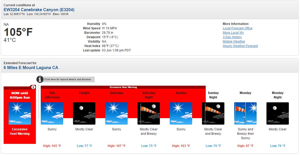 Canebrake Weather by tomteske, on Flickr Canebrake Weather by tomteske, on Flickr
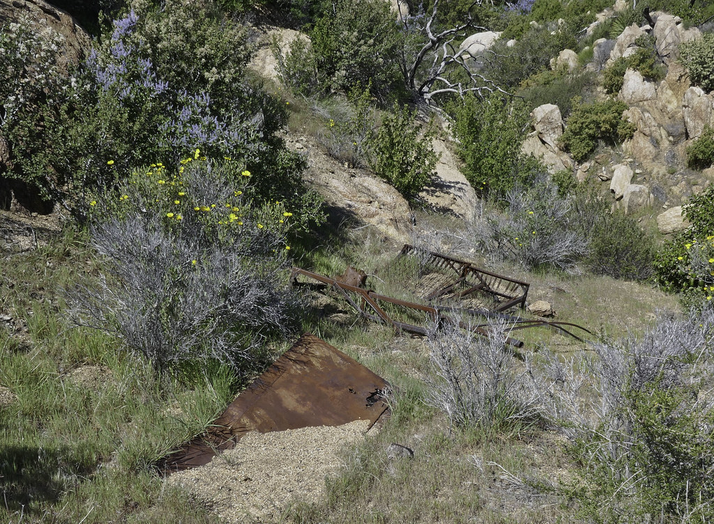
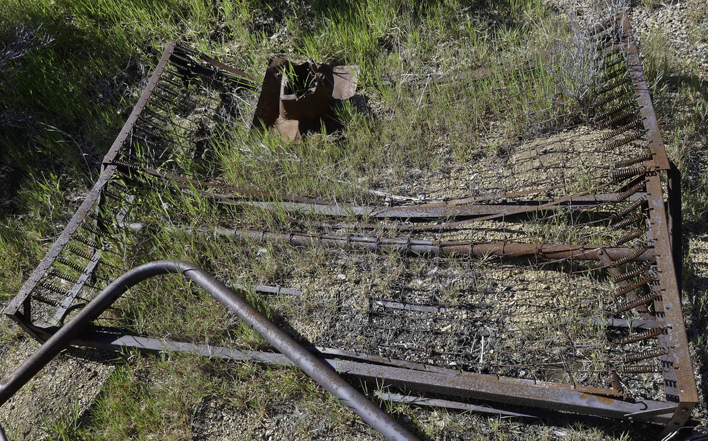
Parked in North Fork of Indian Canyon and took the trail north over the saddle into Canebrake. Daren wanted to see if he could relocate the ejection seat from the nearby T-33 crash site that he previously found but didn't have a point for. Definitely in the middle of nowhere but he found it.
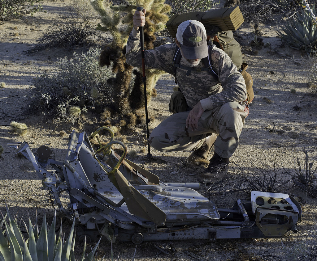 T-33 Seat and Daren by tomteske, on Flickr T-33 Seat and Daren by tomteske, on Flickr
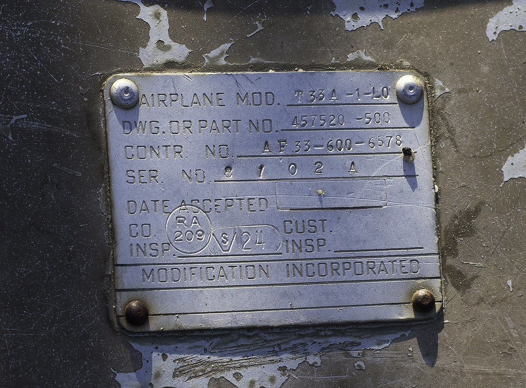 T-33 Seat by tomteske, on Flickr T-33 Seat by tomteske, on Flickr
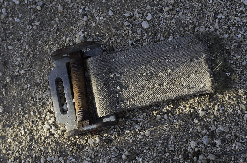 T-33 Seat Belt by tomteske, on Flickr T-33 Seat Belt by tomteske, on Flickr
About 350 yrds SW on a course that would roughly line up the seat and crash site, we came across some electronics presumably from the jet. The canopy and trainee ejection seat were recovered immediately after the crash so it may have been from one of those items
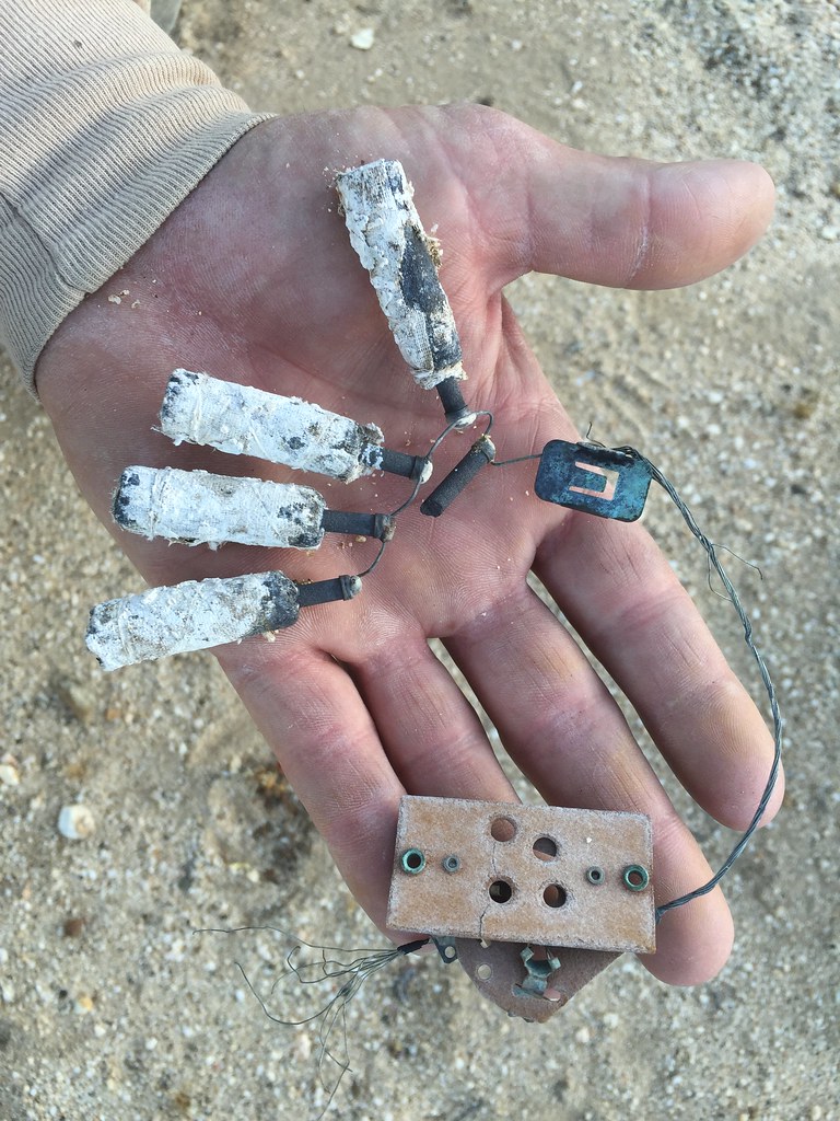 IMG_2023 by tomteske, on Flickr IMG_2023 by tomteske, on Flickr
Was so windy we had a hard time meeting up after the search since we couldn't hear each other yelling less than 100 yrds apart. Even my super loud whistle was inaudible. Settled on a semi protected camp site near some dunes and dampened the wind noise that night with a dab of 60% water
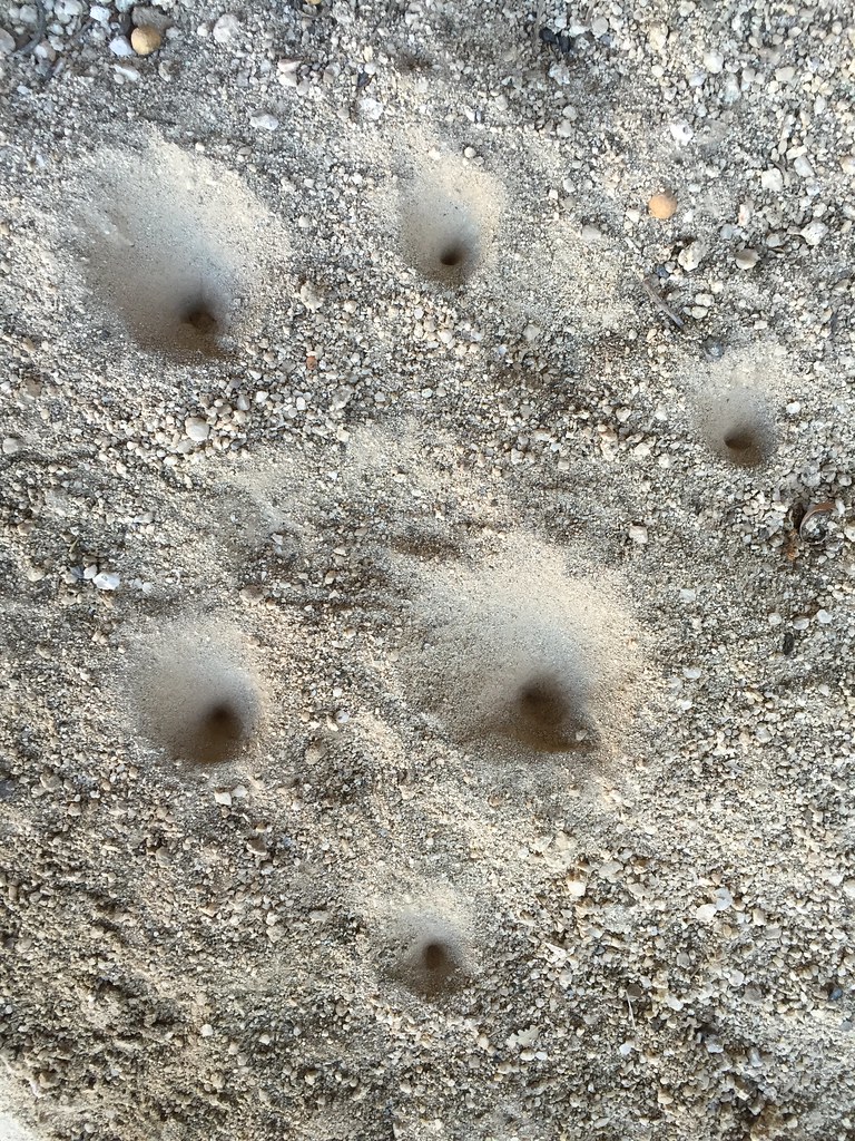
The next day we headed up the canyon making a detour to a spot I'd previously stumbled upon with a lot of sherds and flakes. While Daren explored nearby, I ended up finding six points scattered across the sand. Here's some of the better looking ones. All were Cottonwoods or Desert Side Notches except one obsidian awl. All were broken. Found one more the next day to make seven total for the trip.
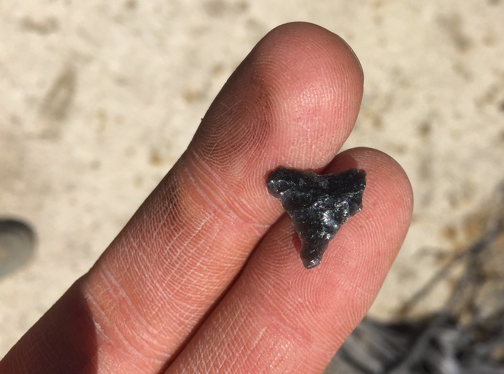 IMG_2029 by tomteske, on Flickr IMG_2029 by tomteske, on Flickr
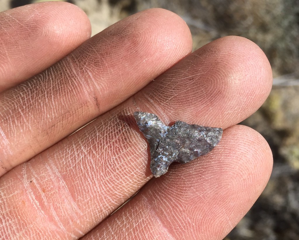 IMG_2035 by tomteske, on Flickr IMG_2035 by tomteske, on Flickr
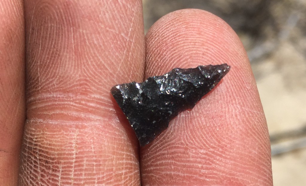 IMG_2038 by tomteske, on Flickr IMG_2038 by tomteske, on Flickr
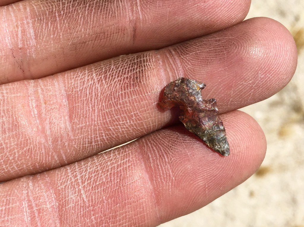 IMG_2048 by tomteske, on Flickr IMG_2048 by tomteske, on Flickr
By the side of the road, there were a couple buried 55 gal drums with their lids off. One had become an animal trap. Several mice carcasses, one near dead whiptail? with a bloody bite mark, two feisty spiny lizards and a red racer were inside the deepest one. Daren scooped the whiptail out and I tried bare handing the other guys who were less than cooperative. Finally got serious after I put a glove on and safely deposited the remaining critters on level gound. The barrel lids were replace and weighed down with rocks.
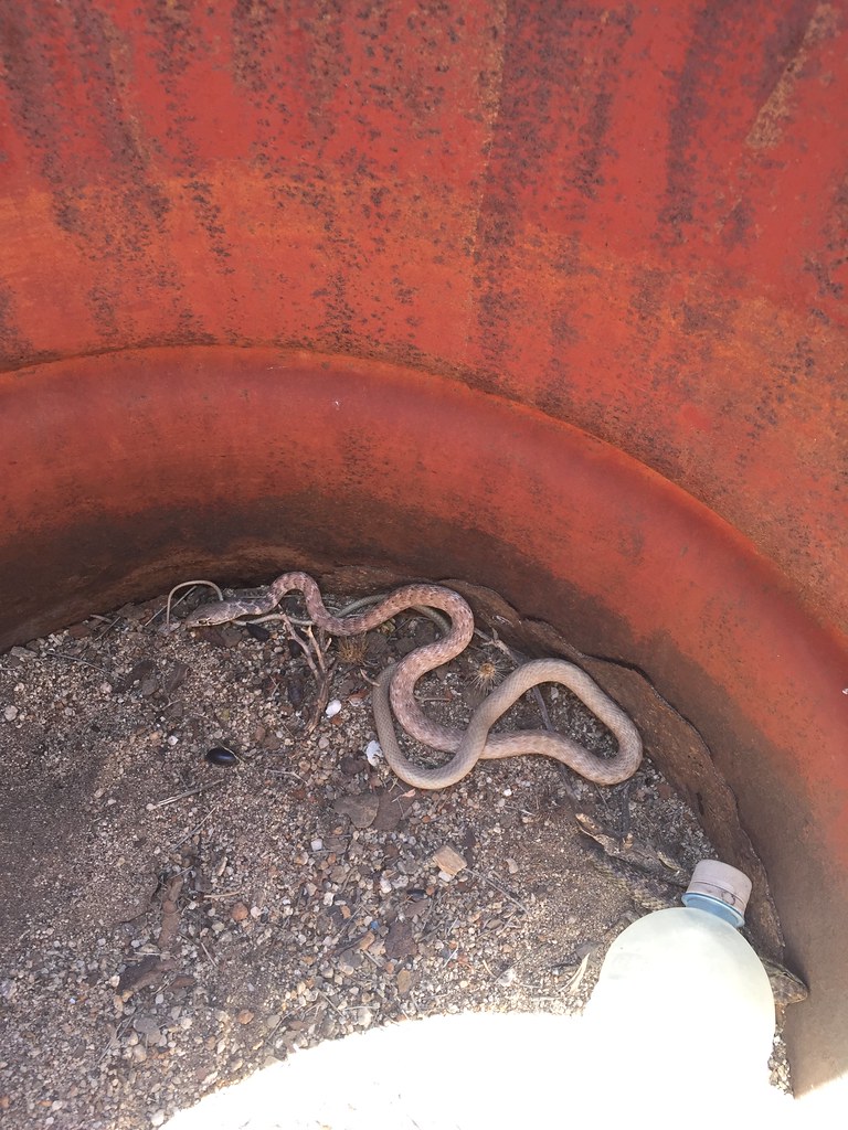 IMG_2051 by tomteske, on Flickr IMG_2051 by tomteske, on Flickr
Found another stranded red racer a while back in similar circumstance near Indian Hill: http://www.anzaborrego.net/anzaborrego/Forum/topic1024-west-of-indian-hill.aspx
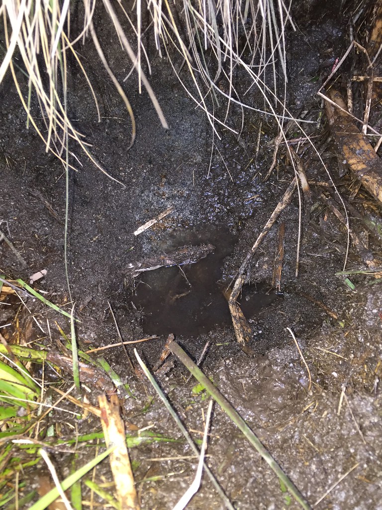
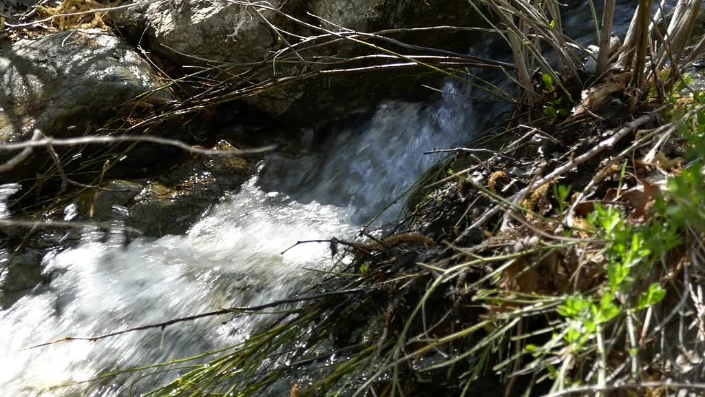
We only brought a few liters each hoping to use a spring Daren and his friend Craig had discovered on a previous trip. If it was dry, the trip would be over.
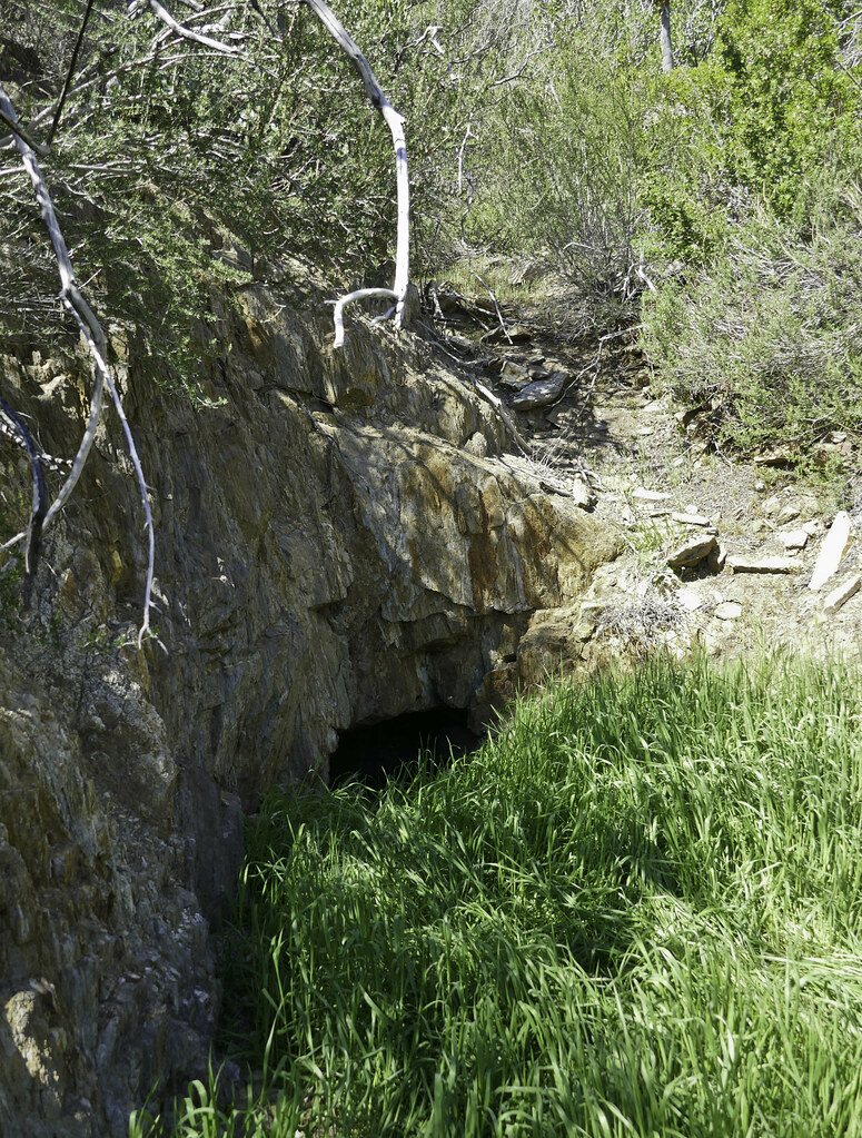
Success. We were able to extract about 8L out of this seep. Reportedly it was flowing a lot better in the past but not doing so well now. Lots of swarming bees around the narrow entrance so I was volunteered to crawl in and filter the water.
 IMG_2060 by tomteske, on Flickr IMG_2060 by tomteske, on Flickr
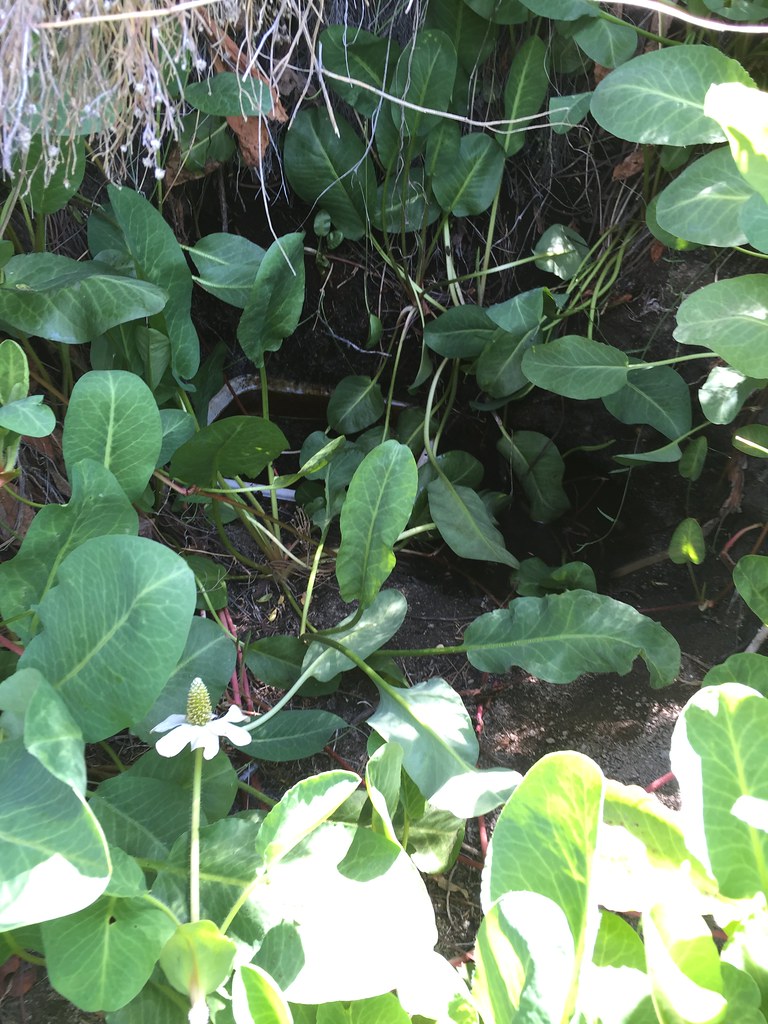
Lots of pretty flowers nearby, one with a little white spider who would stick his leg out from the petals presumably to feel vibrations off potential meals.
 IMG_2064 by tomteske, on Flickr IMG_2064 by tomteske, on Flickr
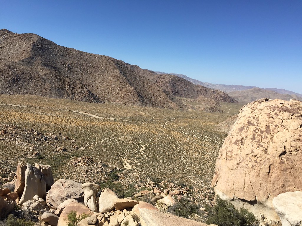
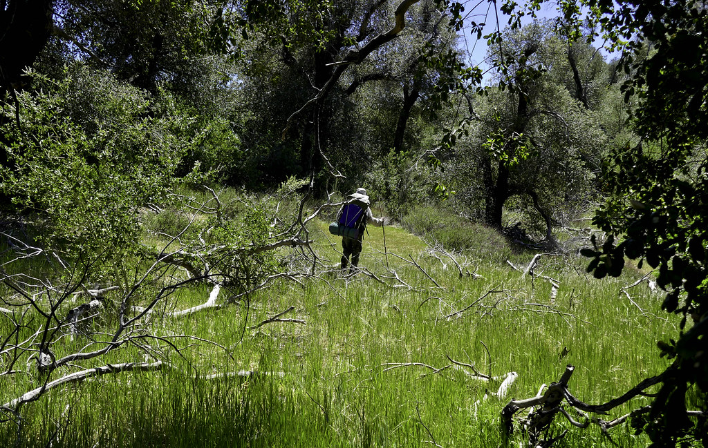
View down Canebrake.
 IMG_2075 by tomteske, on Flickr IMG_2075 by tomteske, on Flickr
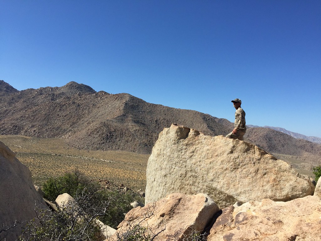
Daren looking all explorer-y
 IMG_2072 by tomteske, on Flickr IMG_2072 by tomteske, on Flickr
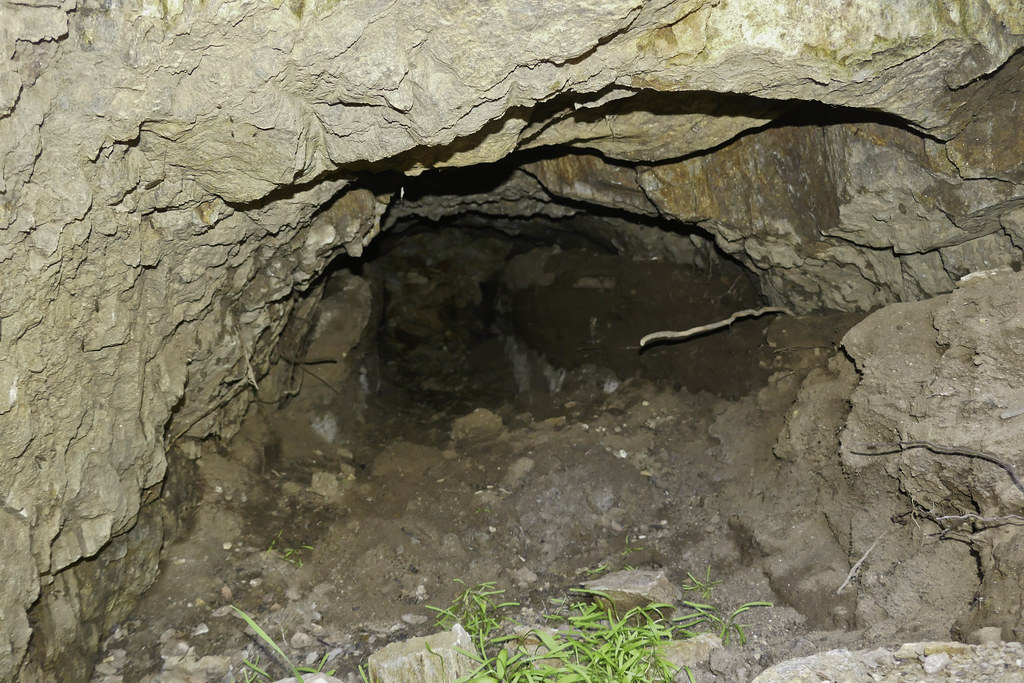
Ant Lions in a rock shelter.
 IMG_2067 by tomteske, on Flickr IMG_2067 by tomteske, on Flickr
Since it was still really windy, we searched for another protected camp site for the night and promptly found this below another seep.
 IMG_2082 by tomteske, on Flickr IMG_2082 by tomteske, on Flickr
After about 20 minutes of hacking reeds away, the result.
 IMG_2095 by tomteske, on Flickr IMG_2095 by tomteske, on Flickr
The next morning and about time to pack up and head home. Enjoy. Tom
 Toward Potrero by tomteske, on Flickr Toward Potrero by tomteske, on Flickr
edited by tommy750 on 6/3/2016
edited by tommy750 on 6/3/2016 |
6/3/2016
Topic:
Canebrake Valley 3 Day BP
tommy750
|
I like it! The red racer seems to be a popular snake out there. Crossing the saddle into Canebrake is a tad on the steep side and definitely has some cuts potential.
surfponto wrote:
Looks like an amazing trip. I did that hike with Daren once over the saddle. For some reason I remember it being hard and I think I went home with a few cuts
Here is my post when i did the hike into Canebrake with him many moons ago. |
6/4/2016
Topic:
Canebrake Valley 3 Day BP
tommy750
|
Nice pics Daren. You think there's water near your rancher camp since you found a hose bibb?? |
6/6/2016
Topic:
Canebrake Valley 3 Day BP
tommy750
|
rockhopper wrote:
What a huge rarely travel area in the county. You could spend weeks looking around in that valley. Need to get out there some day!
Great trail report and photos. Wow 6 points in one trip! Rabbit and bird hunting points?
Definitely agree there's a lot to explore out there!
It's my understanding that during the late prehistoric period, there is a near complete replacement of larger projectile points previously used with throwing spears, atlatls, etc with the smaller points such as Cottonwood or Desert Side Notch which are the main types in this area. There are experimental archaeology videos where these small points do very at penetrating fresh deer carcasses so I'm assuming they were used with larger game as well. |
6/6/2016
Topic:
Canebrake Valley 3 Day BP
tommy750
|
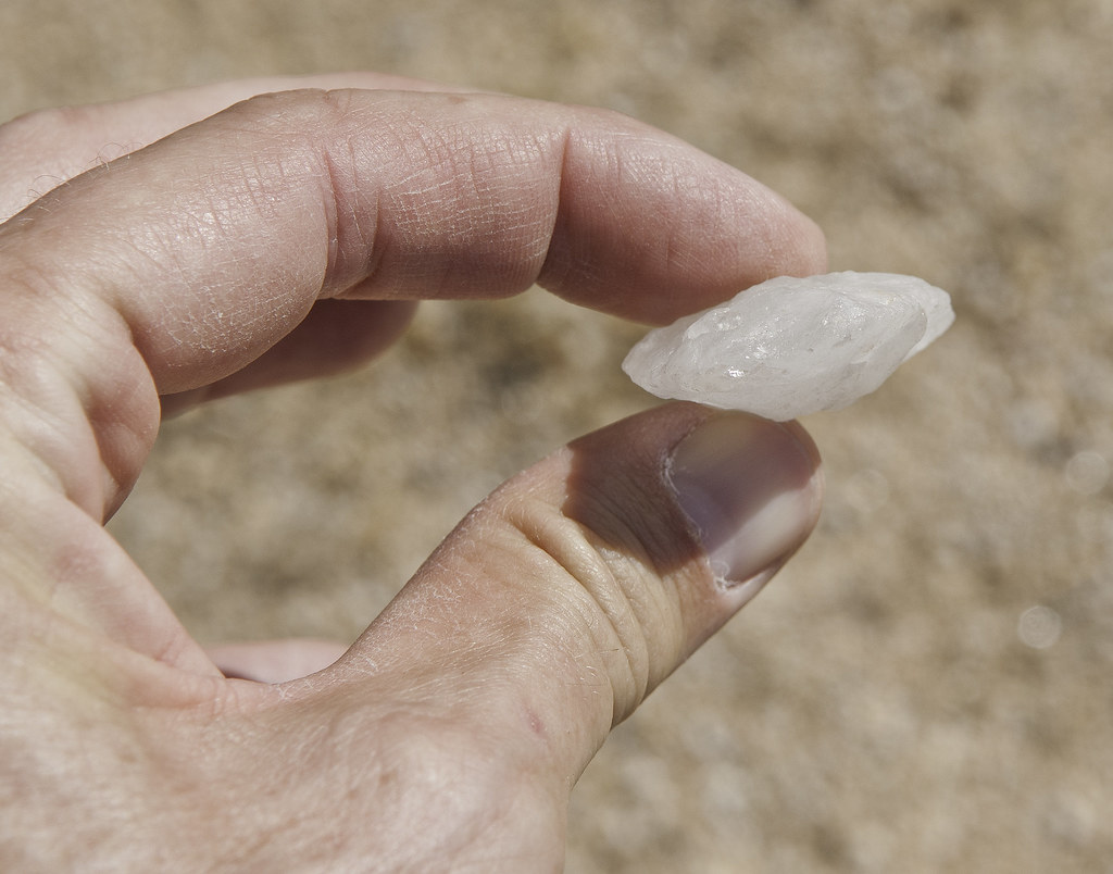
Here's the only thing I've ever found that may have once been a dart but not really sure. Found it out in Davies Valley. Looks like the tip and base broke off and it was well worn. Looks much bigger than any other point I've seen
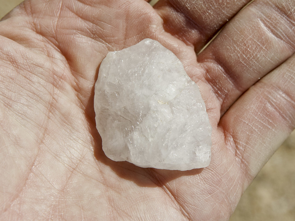 The Point by tomteske, on Flickr The Point by tomteske, on Flickr
 The Point2 by tomteske, on Flickr The Point2 by tomteske, on Flickr |
6/10/2016
Topic:
Carrizo Gorge Railway - Does the Saga Ever End?
tommy750
|
Apparently the saga will never end!
http://www.sandiegouniontribune.com/news/2016/jun/09/desert-line-gets-new-operator-repairs-starting/ |
6/10/2016
Topic:
Carrizo Gorge Railway - Does the Saga Ever End?
tommy750
|
dsefcik wrote:
tommy750 wrote:
Apparently the saga will never end!
http://www.sandiegouniontribune.com/news/2016/jun/09/desert-line-gets-new-operator-repairs-starting/

And they're going to have it operational in two years! |
6/15/2016
Topic:
To the top of El Cajon Mountain aka "The Beast"
tommy750
|
dsefcik wrote:
surfponto wrote:
We should plan to do this again.
I probably need a few weeks so Mary will forget about how hard it was than we will drag her back up there I remember August as always being a good time to hike it...
El Cajon is closed in August because of the extreme heat. Showed up years ago in August with my now fiancée packing two liters each and made it to the four mile saddle before realizing we'd made a huge mistake. Was 93 that day and well over 100 in some spots. We laid in a ditch in the shade till late afternoon when my very annoyed older brother (contacted by phone) showed up packing the sweetest water I've ever drank. Still read the UT and sneer at the idiots getting airlifted off El Cajon but realize I was almost one of them.
That's a really good time up and back, Bob. Need to get out there and hike it again! |
6/15/2016
Topic:
To the top of El Cajon Mountain aka "The Beast"
tommy750
|
Think I missed that PE class in grade school where the teacher said drink more water when playing dodge ball in the heat but El Cajon helped me sort that out!
Daren, figured you were kidding, but since everyone was talking about the rule breakers, thought I'd throw in my worst breakin the law hiking anecdote
Jim, my fiancee has permanently crossed El Cajon off her hiking list and not infrequently reminds me of it  |
6/17/2016
Topic:
Proposed closures in ABSP, read and act now
tommy750
|
Borregolinda wrote:
This just in! Good for ABDSP!
http://www.sandiegouniontribune.com/news/2016/jun/17/borrego-park-regulation-change/
edited by Borregolinda on 6/17/2016
Thanks for the update. Definitely good news. 👍 |
6/23/2016
Topic:
Salton Sea Documentary "Breaking Point"
tommy750
|
Breaking Point is a documentary detailing ominous issues affecting the Salton Sea. Was just released on DVD a few days ago and is available for free if you have Amazon Prime: https://www.amazon.com/Breaking-Point-Bill-Wisneski/dp/B01GU3TTES/ref=sr_1_1?s=movies-tv&ie=UTF8&qid=1466715087&sr=1-1&keywords=breaking+point+documentary
Here's a Desert Report article from earlier this year: http://www.desertreport.org/?p=1704 |
6/28/2016
Topic:
Salton Sea Documentary "Breaking Point"
tommy750
|
Interesting times indeed for the remains of Ancient Lake Cahuilla. At the end of next year, the 800,000 acre feet of water guaranteed by the 2003 Quantification Settlement Agreement to maintain the sea level in spite of reduced agricultural runoff (due to conservation and fallowing) will have been delivered and no more is anticipated. The delivery was intended to tide the sea over till a permanent solution to expanding shorelines with exposed toxic sediment would be in place in the far distant year 2017. Well, guess what, 2017 ain't that far off and neither are the toxic dust storms! The documentary's two mentioned funding sources, geothermal energy and Lithium extraction, don't seem to have become the hoped for panacea as geothermal is much less lucrative than initially though and the much hyped startup Simbol Materials' plan to extract lithium from geothermal brine is over as the company has apparently failed. So, basically we're doomed... Always though filling the sea with actual sea water (like the good old pre-Colorado River sediment blocking off the the upper gulf days) would be such an ingenious plan but the $30-40B price to build the pipeline seems to dampened some of the initial enthusiasm. |
7/2/2016
Topic:
A trip to the past
tommy750
|
Have been back there a few times and agree it's a great area to explore. There's an old mining road that gets you to the top of the canyon minus some of the the slipping and sliding and is also an alternative route to Carrizo Mt. Thanks for sharing. |
7/4/2016
Topic:
Sheep Count 2016
tommy750
|
Nice trail cam pics, Daren. "Much cooler" as in only 100 or?? |
7/4/2016
Topic:
Pinto Canyon Overnighter
tommy750
|
Previously read your story and enjoyed it. Do you have any of your own pics? The two you posted look like they came from my Flickr account without attribution: https://www.flickr.com/photos/tommy750/albums/72157631997506878/with/8181558436/ |
7/5/2016
Topic:
Pinto Canyon Overnighter
tommy750
|
RobertMarcos wrote:
Hi Tommy. I apologize for using your photos without your permission. Back on our 2008 hike, my partner Tom and I split up the cargo - he carried a 4 x 5-inch field camera and tripod, (which I thought was unnecessary), and I carried 3 gallons of water - plus all the normal equipment. We're both professional photographers and as such we always put our paying client's projects ahead of our own. So it was months before I saw one of his 4 x 5" images, (very dull since it was taken at twilight and the wall of petroglyphs was in shadow). I did however provide that image, (sharpened and with added contrast) to the archaeological team which was assembled by Dr. Raymond Ashley prior to the Maritime Museum's trip to the Pinto Canyon petroglyph site. I lost track of the image after that. So I hope that helps to explain my lack of photos from that trip. Thanks and best wishes - robert
edited by RobertMarcos on 7/5/2016
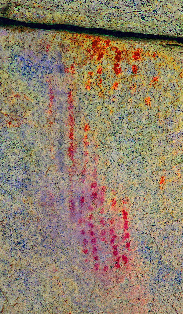
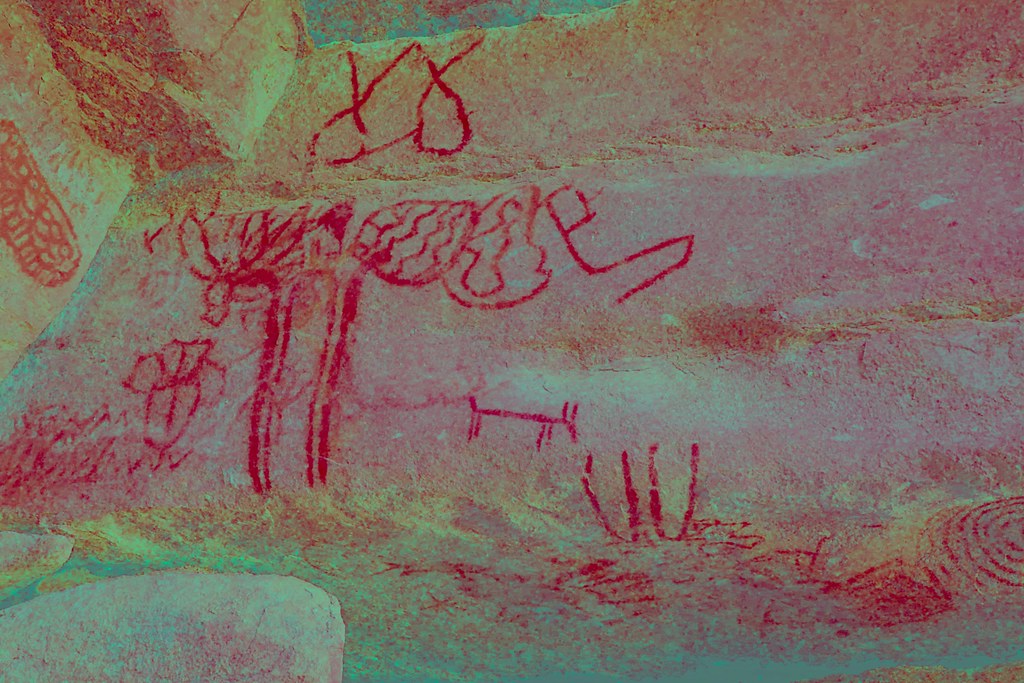
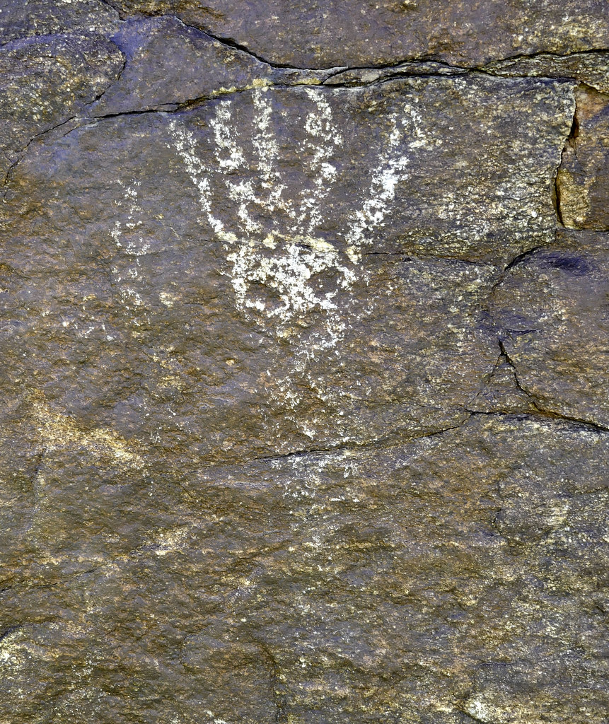
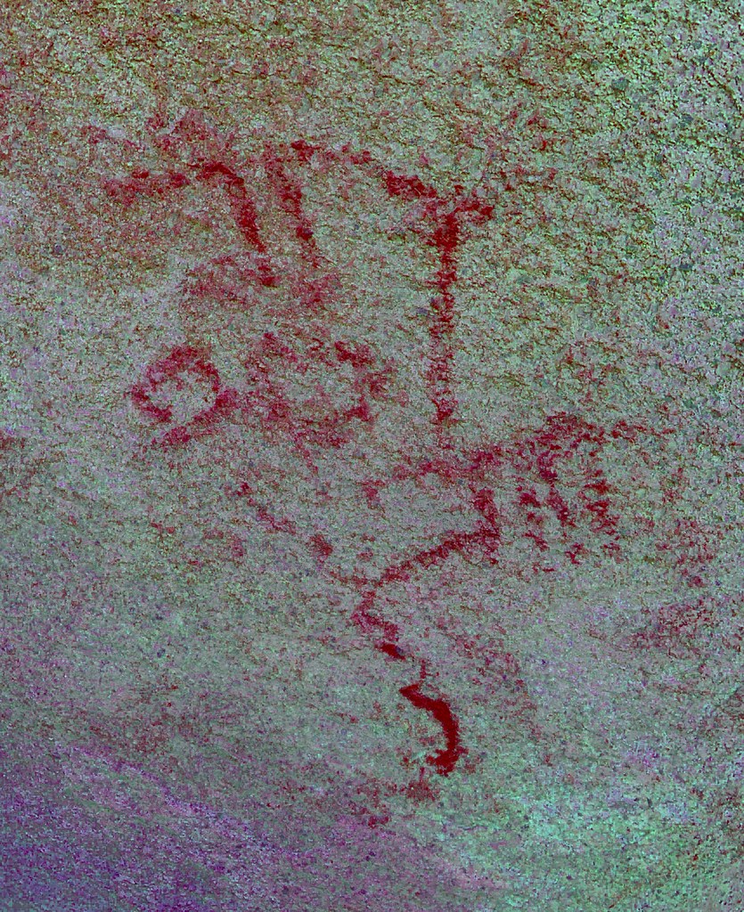
Not a problem Robert. I have my own opinions on whether that petroglyph site actually makes reference to Spanish sailing vessels mainly influenced by the obvious water flow weathering below the petroglyph which nearly erases still visible vertical lines protruding from the "vessel" hull. You may have noticed this since you curiously tightly cropped one of my pics to mainly exclude this. Also, similar pictographs at El Vallecito just eight miles to the SW reveal mast-like structures and a "hull" with similar vertical lines protruding from the bottom. Here's a couple pics:
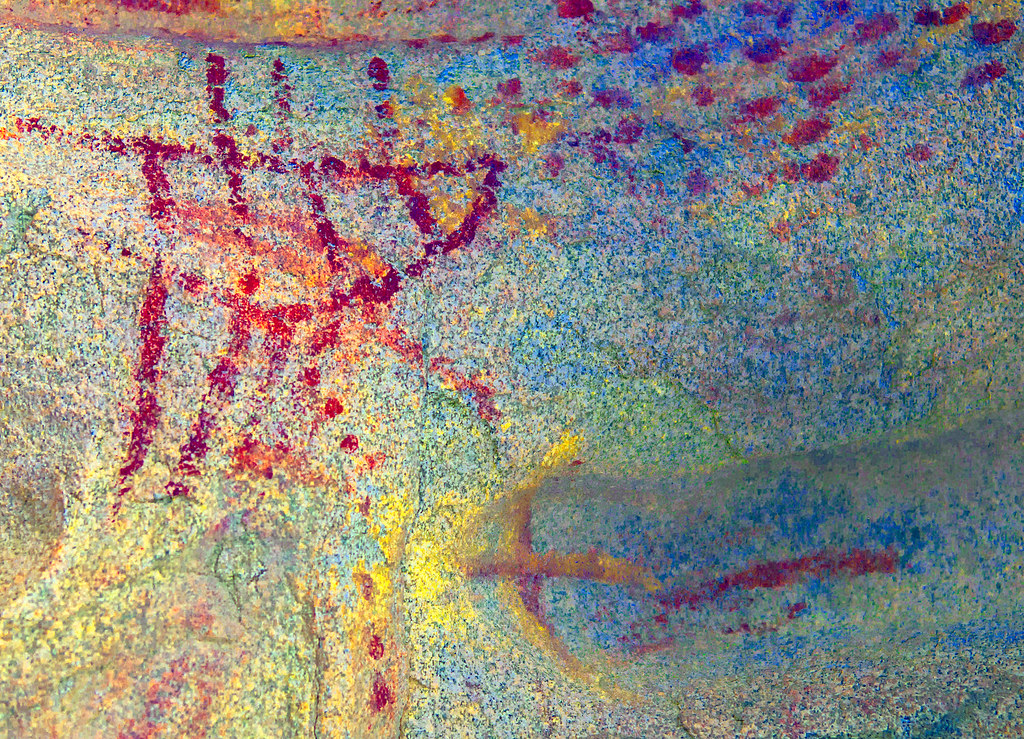 Cueva del Solecitos o Wittinnur by tomteske, on Flickr Cueva del Solecitos o Wittinnur by tomteske, on Flickr
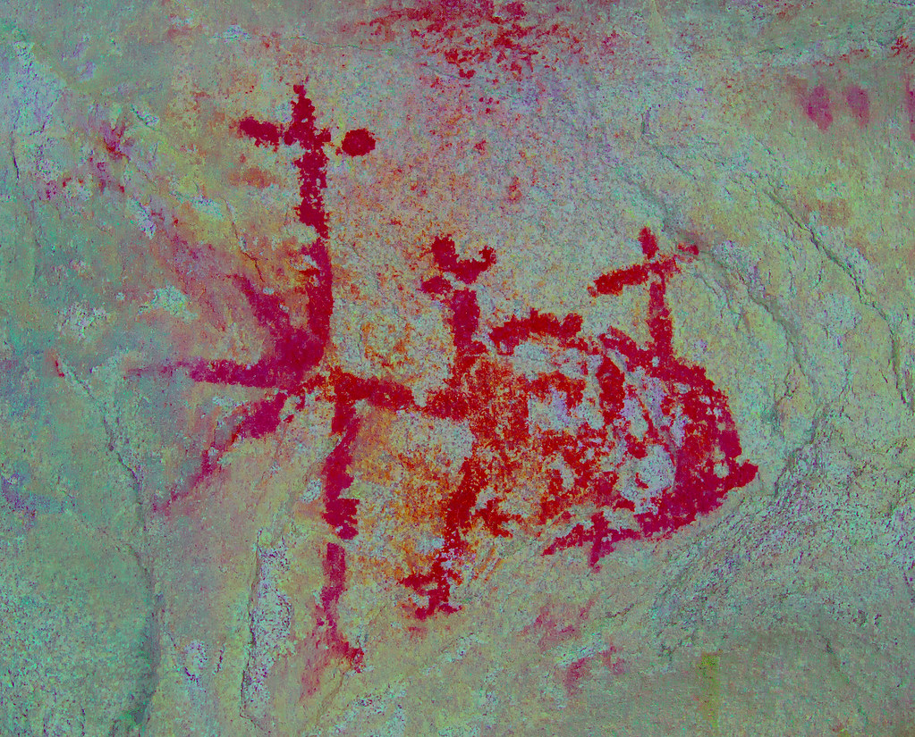 Cueva del Solecitos o Wittinnur by tomteske, on Flickr Cueva del Solecitos o Wittinnur by tomteske, on Flickr
In spite of the knit picking, would love to read more of your desert adventures so let us know if you write some more
edited by tommy750 on 7/5/2016 |
7/5/2016
Topic:
Pinto Canyon Overnighter
tommy750
|
ziphius wrote:
Interesting story. I wonder if the pot is still there. The description of its location is a bit detail-rich, the kind of clues that pot-hunters would take advantage of.
edited by ziphius on 7/5/2016
Mini-confession, Jim: though the identical thing and spent an afternoon searching the "detail rich" area a few years back but left thinking artistic license or darn pot-hunters. |
7/8/2016
Topic:
Canebrake Valley 3 Day BP
tommy750
|
Roryborealis wrote:
This was found in Pedras Grandes on a leaf of a plant about 2 feet above ground. Literally lifted it as it grew. I wish I had a shot of that! I believe it's a dart, but not for sure.
Nice find! Looks like a Sierra Side Notch point, a type of Desert Side Notch with a third basal notch presumably to center it easier in the shaft before mastic was applied.
|
7/11/2016
Topic:
Canebrake Valley 3 Day BP
tommy750
|
sddarkman619 wrote:
Tom do you have a book title that tells of the different types? I'd like to learn more about the different types.
tommy750 wrote:
Roryborealis wrote:
This was found in Pedras Grandes on a leaf of a plant about 2 feet above ground. Literally lifted it as it grew. I wish I had a shot of that! I believe it's a dart, but not for sure.
Nice find! Looks like a Sierra Side Notch point, a type of Desert Side Notch with a third basal notch presumably to center it easier in the shaft before mastic was applied.
edited by sddarkman619 on 7/11/2016
edited by sddarkman619 on 7/11/2016
I got this book a while back and found it quite helpful: https://www.amazon.com/Stone-Spear-Arrow-Points-California-ebook/dp/B002EZYXGG/ref=sr_1_3?ie=UTF8&qid=1468268631&sr=8-3&keywords=arrowheads+of+california
Looks like it's out of print but a kindle version appears to be available. |
7/11/2016
Topic:
7 Day Backpack in the Sierras
tommy750
|
Looks like a nice trip Daren. That guzzler sure looks fancy compared to the helter skelter ones we have around here |
8/11/2016
Topic:
Drone crash overlooking Vallecito Valley
tommy750
|
It should have automatically flown back to the starting point if radio signal was lost. May have done a controlled landing before the batteries died. No ID on the drone? No fun throwing a $1,000 bill away Nice view of Storm Canyon. |
8/15/2016
Topic:
Looter M.D. Pleads Guilty
tommy750
|
This story has been unfolding over the past year. One guy stealing 20K artifacts is pretty hard to imagine. Feds should have made him do time. $250K fine in view of his specialty is a few hard slaps on the wrist IMHO.
http://www.latimes.com/local/california/la-me-doctor-looting-artifacts-20160815-snap-story.html
http://indiancountrytodaymedianetwork.com/2015/10/14/california-md-indicted-21-felony-counts-was-hoarding-30000-indian-artifacts-162074 |
8/16/2016
Topic:
Looter M.D. Pleads Guilty
tommy750
|
dsefcik wrote:
Not being able to collect mushrooms, flora and fauna seems sufficient enough to me...
If only he would have stuck to collecting mushrooms and plants and skipped all the rest...
20K artifacts is collecting 3 every day for 20 years. Don't see how that's even possible. |
8/24/2016
Topic:
The Santa Rosas Sawmill Trail (Sort Of)
tommy750
|
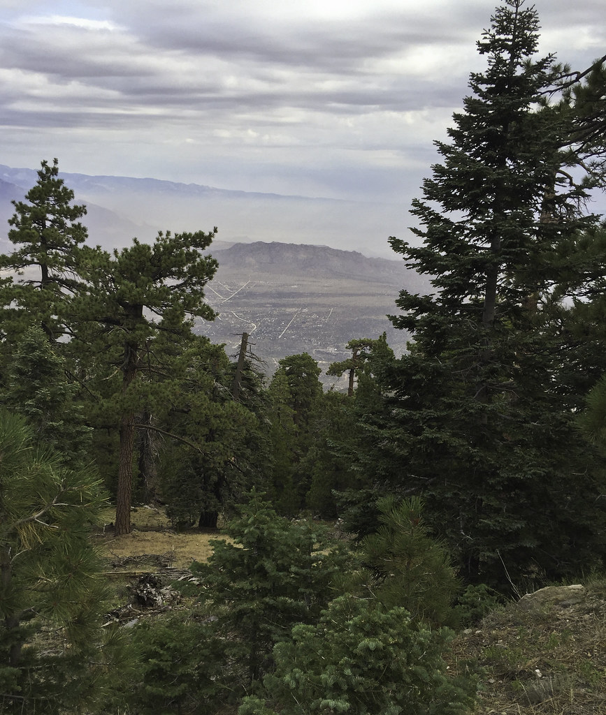
Was looking for a good way to put in some hiking and dodge the heat so I decided to head out to the Santa Rosas this past weekend for an overnight trip. Was curious about the dirt road that switch backed up the northern slopes toward Toro Pk. The road was built in the 1930's to access timber in the Santa Rosas. A mechanic from ND named Arthur Nightingale became interested in the Santa Rosas and bought land on top and built a cabin near Stump Spring. With the Palms to Pines Hwy under construction, he decided to purchase land at Pinyon Flats and sell lots. To furnish lumber for the new construction, he built the sawmill near the treeline. Little remains except a kiln and a nearby log splitter. A great resource for this area and the adjacent San Jacintos is "San Jacintos" by Robinson and Risher. The BW photos below are from this book:
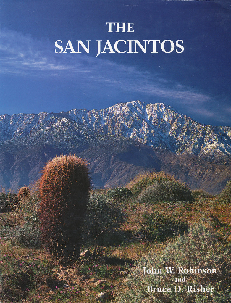 San Jacintos by tomteske, on Flickr San Jacintos by tomteske, on Flickr
The Sawmill trail dirt road. It ends five miles up at the sawmill ruins where a trail continues to the top.
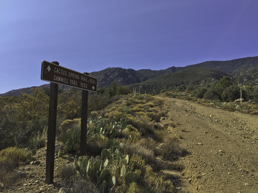 Sawmill Trail Sign by tomteske, on Flickr Sawmill Trail Sign by tomteske, on Flickr
 Sawmill Trail Sign2 by tomteske, on Flickr Sawmill Trail Sign2 by tomteske, on Flickr
Was a little disconcerting to note smoke coming from the west Santa Rosas when I started and almost thought of calling it in till I saw a spotter plane circling. Later from far up the road, watched a Huey land in the parking lot multiple times blasting my car with rotor wash. Not sandblasted when I got back luckily. Lots of aircraft overhead all day. Here's a water drop by a helo near the center of the screen. My iPhone doesn't have a zoom lens
 Water Drop by tomteske, on Flickr Water Drop by tomteske, on Flickr
Arrived at the old sawmill ruins. The most notable structure is the old charcoal kiln.
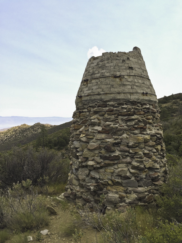 Kiln by tomteske, on Flickr Kiln by tomteske, on Flickr
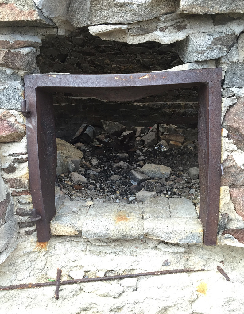 Kiln Door by tomteske, on Flickr Kiln Door by tomteske, on Flickr
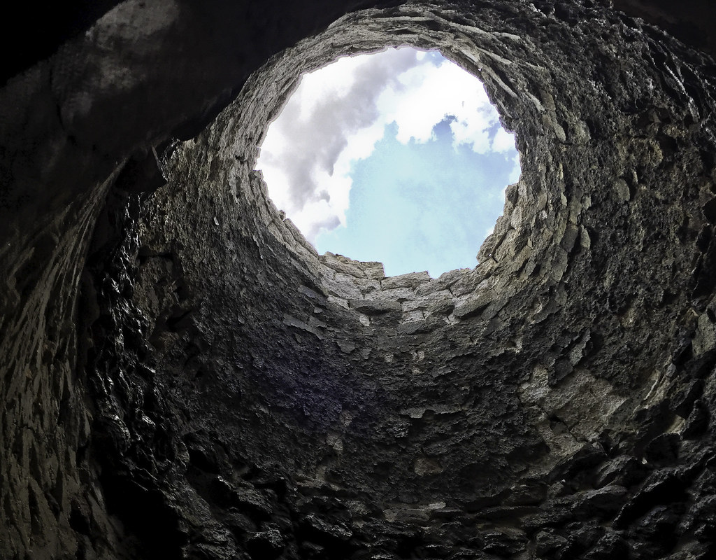 Kiln Clouds by tomteske, on Flickr Kiln Clouds by tomteske, on Flickr
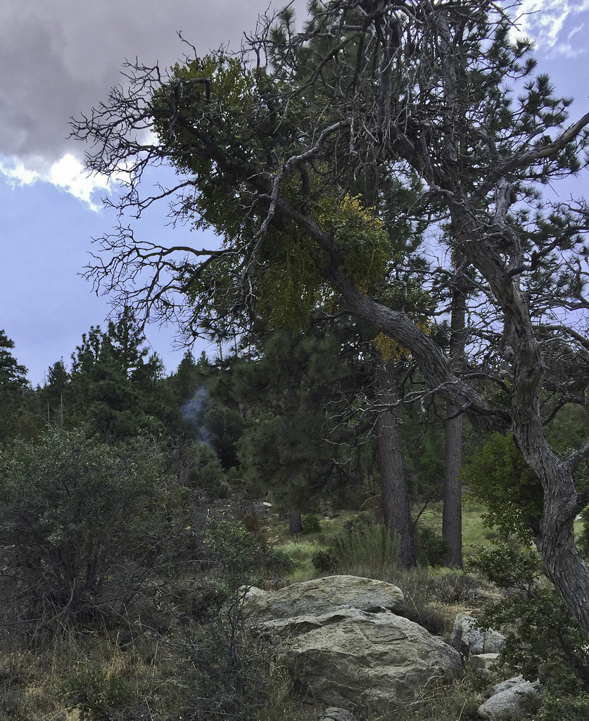
Was going to take a leisurely lunch and explore two springs to the west when I noted smoke coming out of the forest ahead.
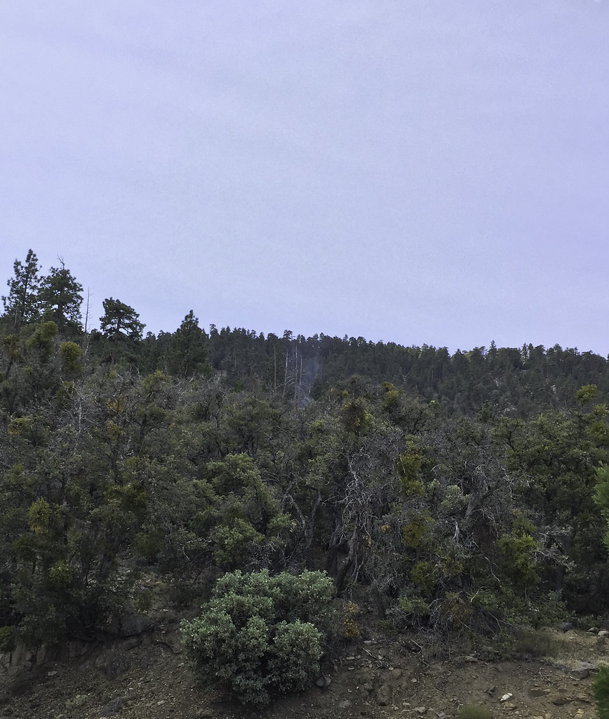 First Smoke by tomteske, on Flickr First Smoke by tomteske, on Flickr
Had to head further up the road into the wilderness toward the smoke.
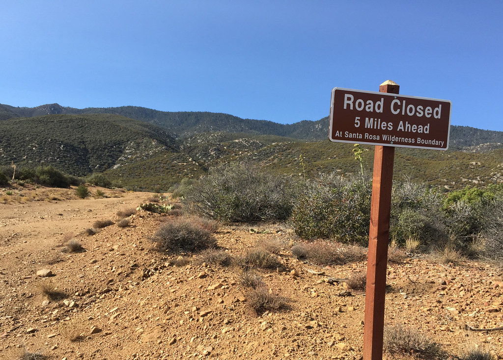
 Wilderness by tomteske, on Flickr Wilderness by tomteske, on Flickr
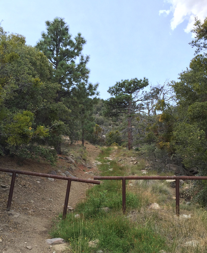 Sawmill Trail Barrier by tomteske, on Flickr Sawmill Trail Barrier by tomteske, on Flickr
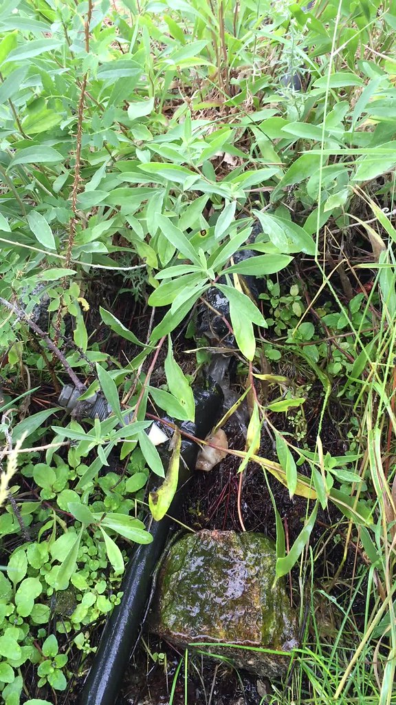
It was uphill from a meadow with an active spring and lots of plastic piping which started making me a speck nervous since informal farming operations are know to occur this time of year in the Santa Rosas. Gave a couple yells to make sure I wasn't interrupting anyone and ended up startling a deer and myself.
 First Smoke2 by tomteske, on Flickr First Smoke2 by tomteske, on Flickr
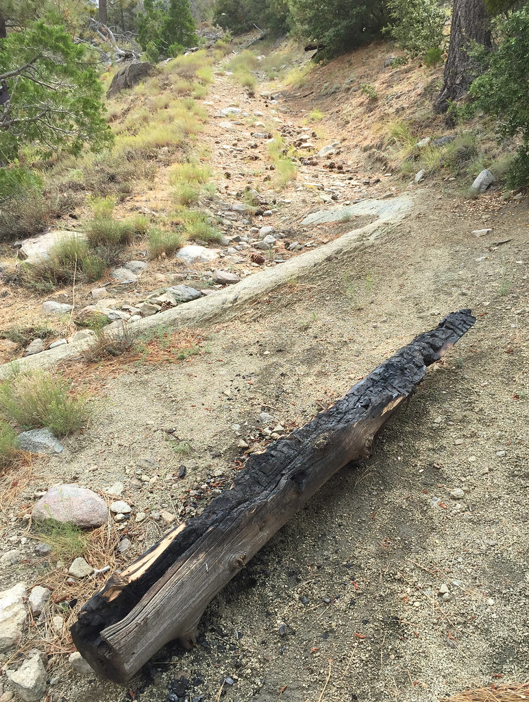
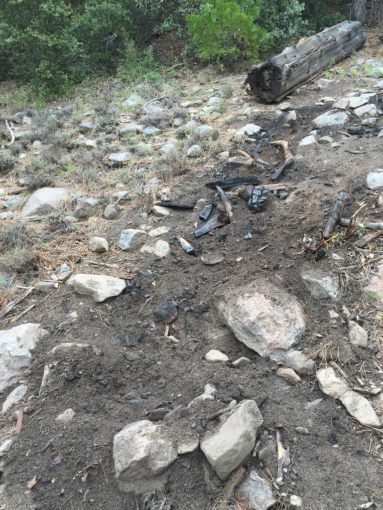
Ended up calling the fire in and got a call back from a BLM firefighter who said he would take care of it. Was a log on fire and this pic is after me stomping on the part in flames and dumping about 2L of my drinking water and another liter I got from the spring on top of it.
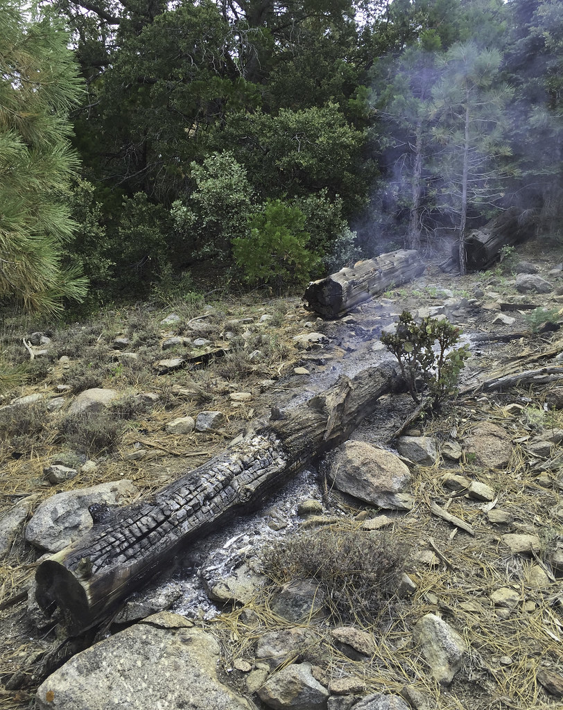 Lightning Log by tomteske, on Flickr Lightning Log by tomteske, on Flickr
Nearby, another burned out log.
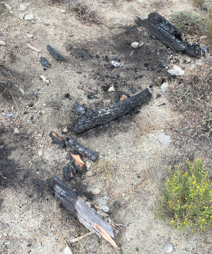 Lightning Strike by tomteske, on Flickr Lightning Strike by tomteske, on Flickr
The spring pipe had a trickle coming from it and the plastic lined basin below was in disrepair
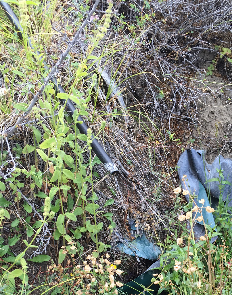 Sawmill Spring by tomteske, on Flickr Sawmill Spring by tomteske, on Flickr
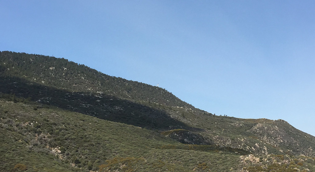
The smoldering log didn't seem to be a threat and when some other people showed up, I decided to head on up the dirt road that travels up to the Santa Rosas crest. The road to the sawmill is a nice gradual incline and fairly smooth, but after the sawmill, it's pretty rocky and a lot steeper. Here's a nice smooth section with a great view of San Jacinto.
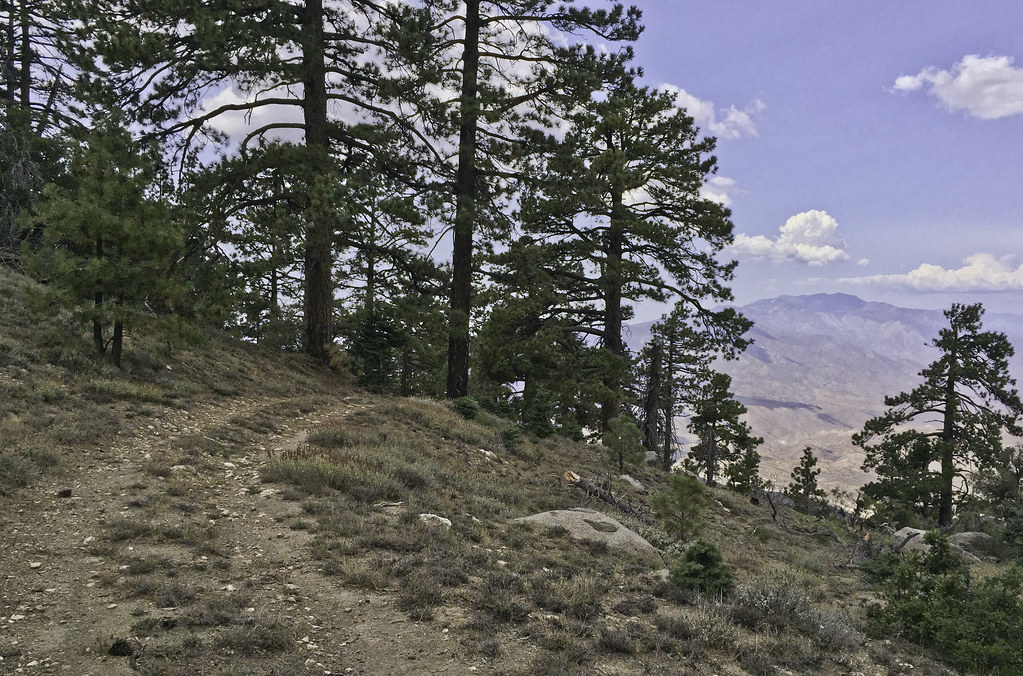 San Jacinto by tomteske, on Flickr San Jacinto by tomteske, on Flickr
Shortly thereafter, it started to lightly rain and was a nice way to finish the rest of the climb to the top. Now, pretty much out of water after losing some on the log fire, I headed the two miles straight toward Santa Rosa Spring, the one fairly sure thing water source up on top.
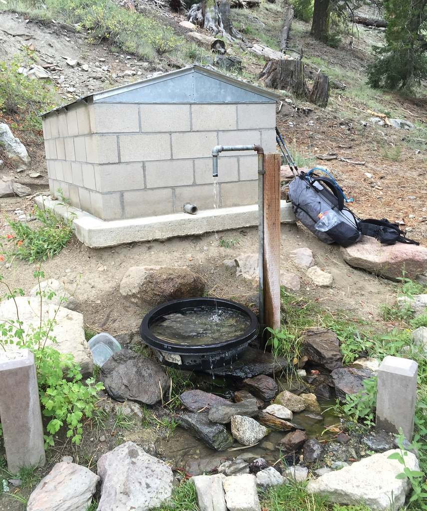 Santa Rosa Springs by tomteske, on Flickr Santa Rosa Springs by tomteske, on Flickr
Lots of fire prevention signage on the way. Place by Desert Steve Ragsdale in the 1940's after a fire, his cabin on top of Santa Rosa Mt unfortunately fell victim to what his poetry railed against.
 DSR Poetry by tomteske, on Flickr DSR Poetry by tomteske, on Flickr
 DSR Poetry2 by tomteske, on Flickr DSR Poetry2 by tomteske, on Flickr
 DSR Poetry3 by tomteske, on Flickr DSR Poetry3 by tomteske, on Flickr
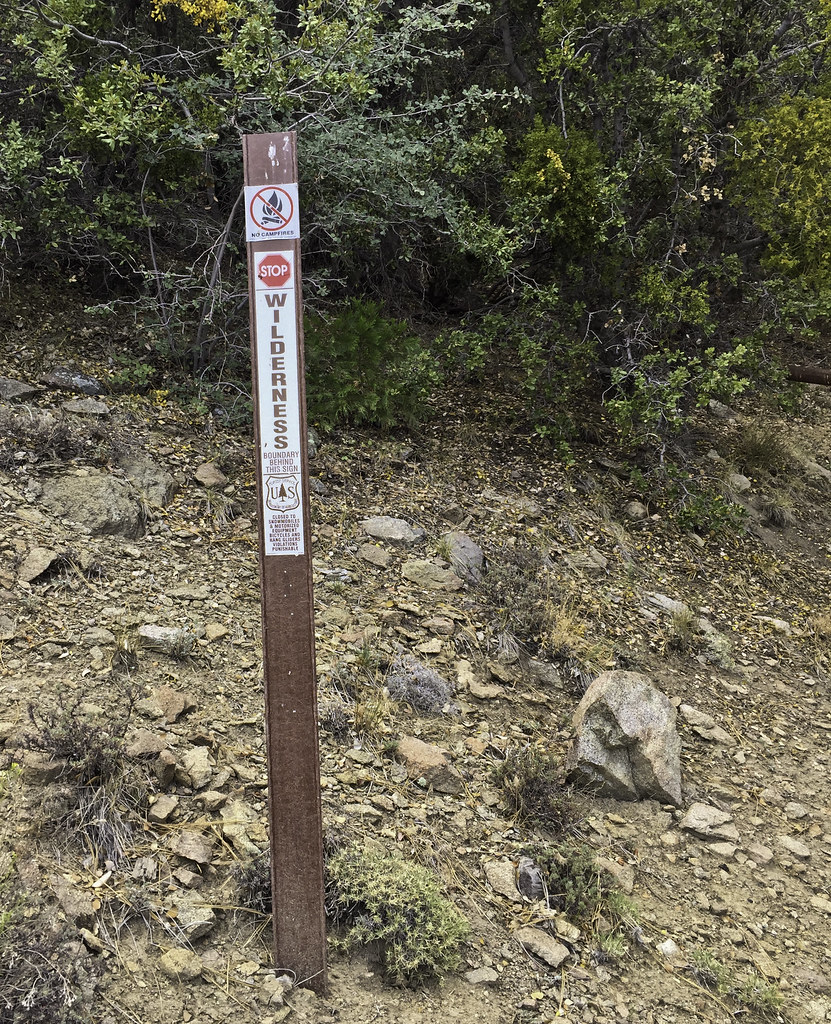
Wanted to spend the night somewhere near Santa Rosa Pk and after scouting out some nice view spots, got lazy and ended up with a sweet spot with level ground and a big picnic table. Guess everyone's serious about fire prevention up here
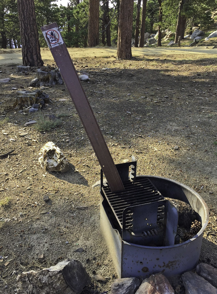 No Campfires by tomteske, on Flickr No Campfires by tomteske, on Flickr
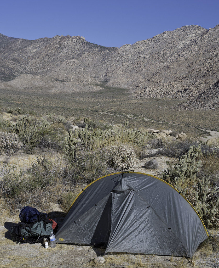
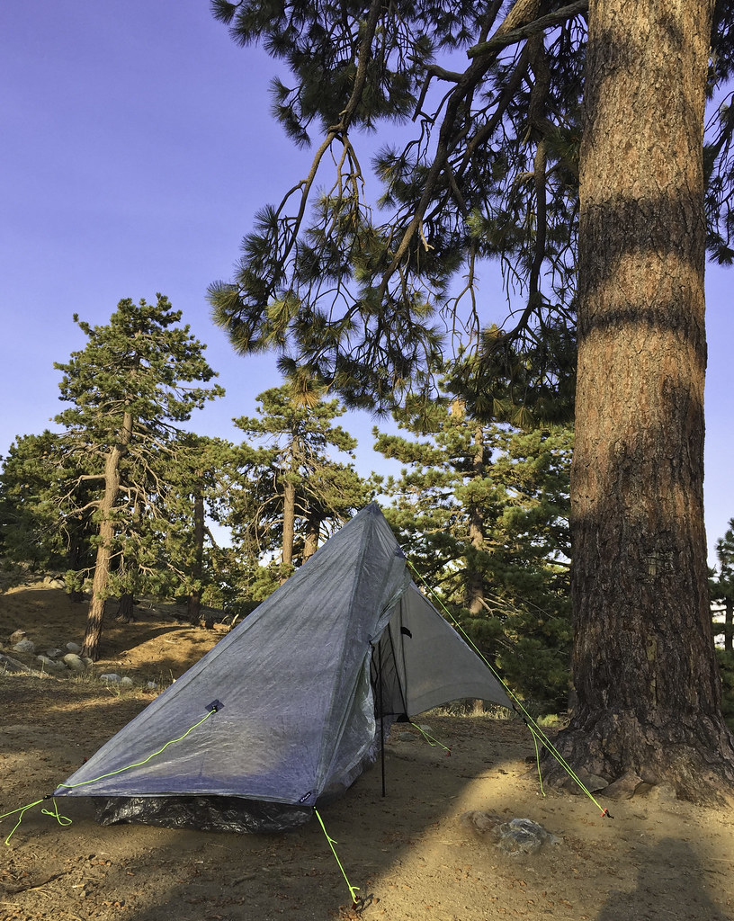 ZPack Altaplex by tomteske, on Flickr ZPack Altaplex by tomteske, on Flickr
A few hundred feet up are the remains of Desert Steve Ragsdale's cabin. Nearby was parked a Civil Air Patrol vehicle bristling with antennas presumably helping out with the swarm of aircraft involved in fire suppression.
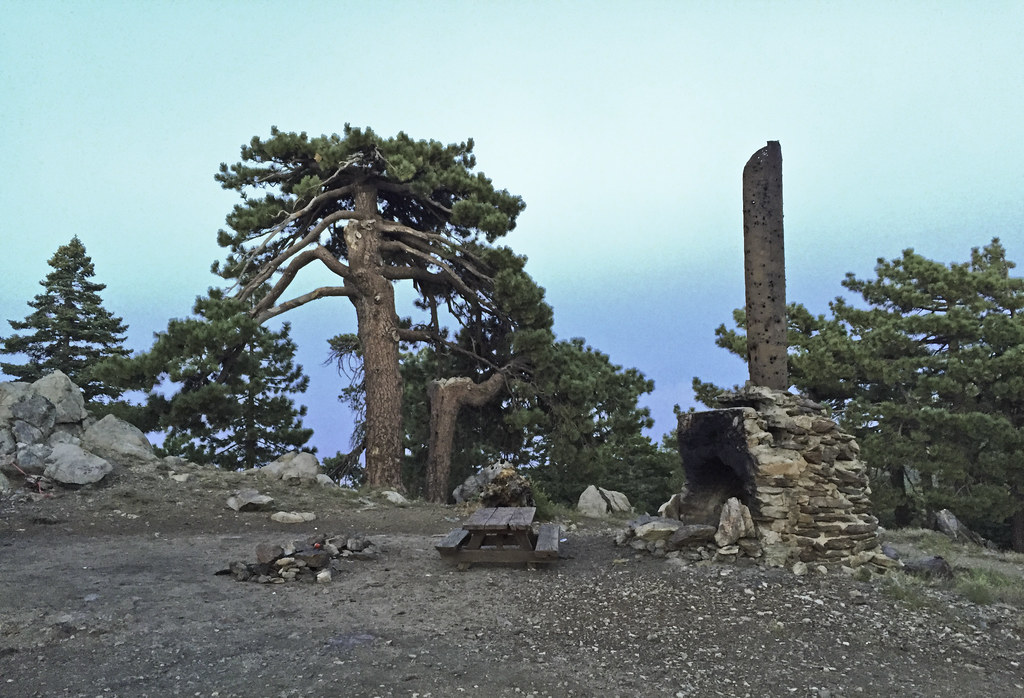 Desert Steve Ragsdale Cabin Site by tomteske, on Flickr Desert Steve Ragsdale Cabin Site by tomteske, on Flickr
 Desert Steve Ragsdale Cabin by tomteske, on Flickr Desert Steve Ragsdale Cabin by tomteske, on Flickr
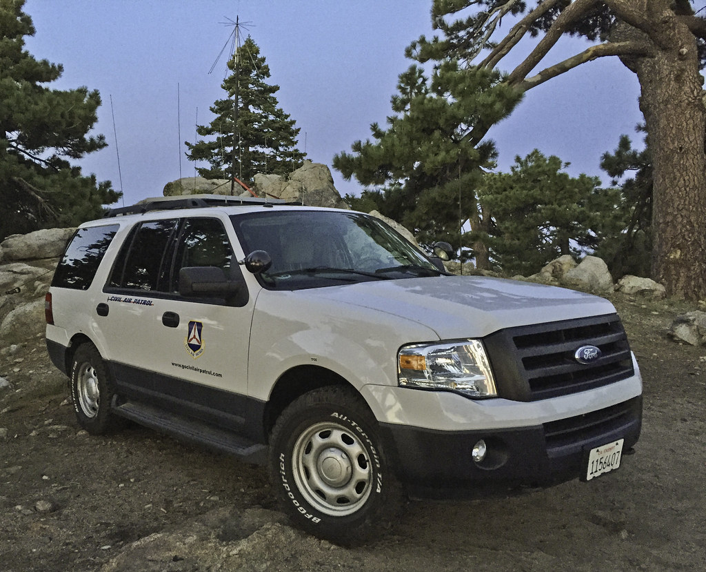 Santa Rosa CAP2 by tomteske, on Flickr Santa Rosa CAP2 by tomteske, on Flickr
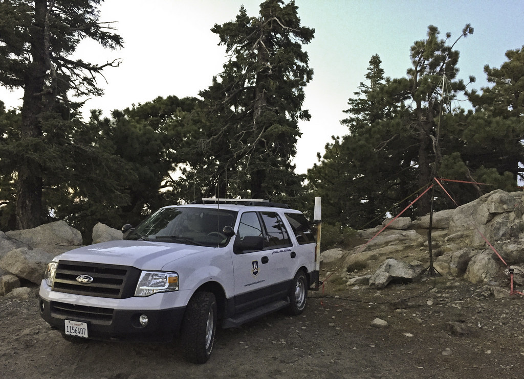 Santa Rosa CAP by tomteske, on Flickr Santa Rosa CAP by tomteske, on Flickr
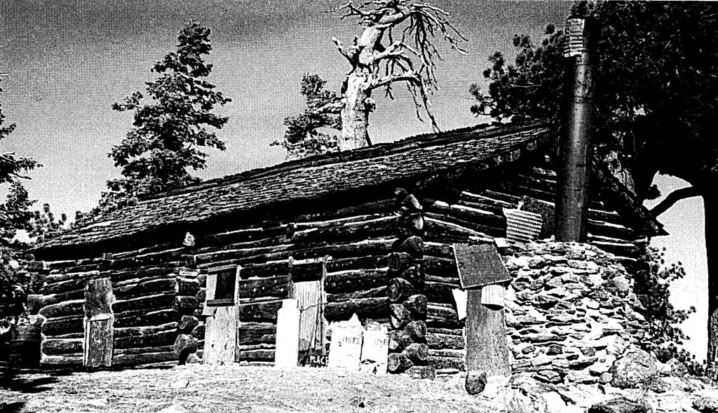
The next morning, headed out toward Stump Spring to see if I could see the old cabin nearby, the only other cabin on top of the Santa Rosas. However, it was fenced and signed and fresh tire tracks since yesterday's rain leading to it made me keep on hiking. A pic from yesteryear.
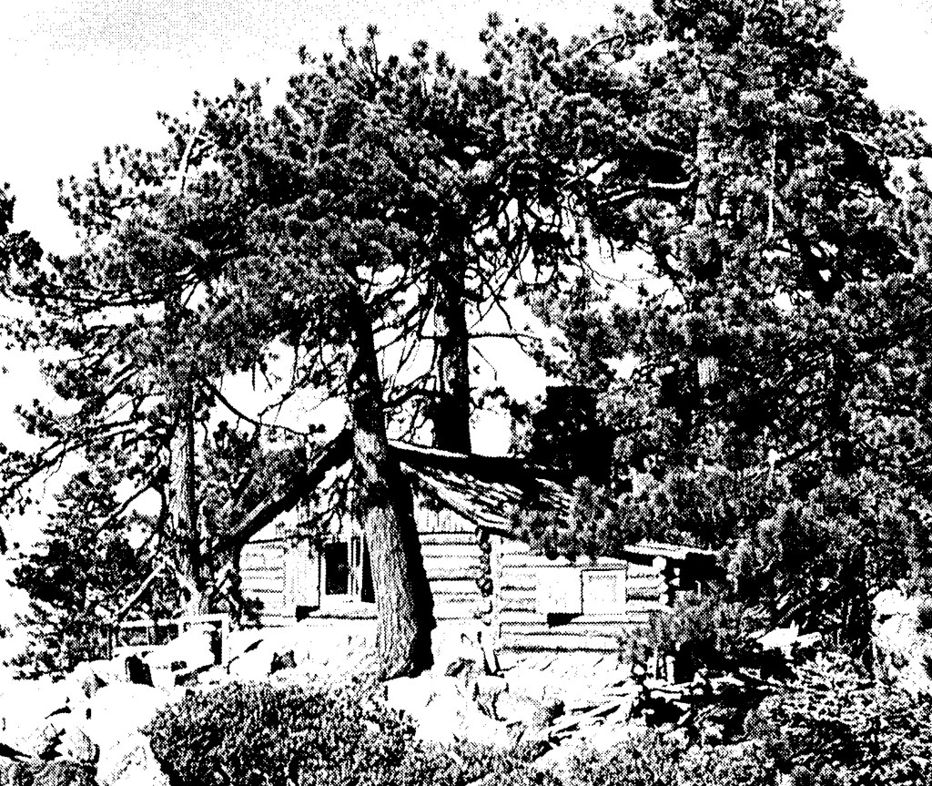 Stump Springs Cabin by tomteske, on Flickr Stump Springs Cabin by tomteske, on Flickr
Heading back down. Pinyon Flat and the parking lot far below.
 Pinyon Flats by tomteske, on Flickr Pinyon Flats by tomteske, on Flickr
Wanted to see if BLM actually showed up yesteday. Not sure why BLM was involved since it wasn't on BLM land but interagency cooperation I guess. The burning log was dragged a couple hundred feet out of the forest onto a road while the site was dug up and drenched. Shortly thereafter, bumped into the firefighters who were coming back to take a second look and make sure everything was okay. They said they had lots of fires in the Santa Rosas in the previous days secondary to multiple lightning strikes and this fire was from yet another.
 Burning Log by tomteske, on Flickr Burning Log by tomteske, on Flickr
 Afterward by tomteske, on Flickr Afterward by tomteske, on Flickr
 BLM Firefighters by tomteske, on Flickr BLM Firefighters by tomteske, on Flickr
The meadow nearby. Heard a funny noise and discovered the spring actually has pretty high flow! Tried to trace the 2" piping uphill to the origin but it went underground and I lost interest. Click on the "Gurgling Spring" pic to see a short clip.
 Sawmill Spring Meadow by tomteske, on Flickr Sawmill Spring Meadow by tomteske, on Flickr
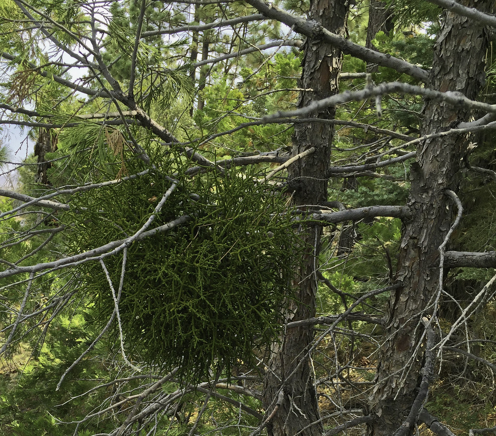 Mistletoe by tomteske, on Flickr Mistletoe by tomteske, on Flickr
 Gurgling Spring by tomteske, on Flickr Gurgling Spring by tomteske, on Flickr
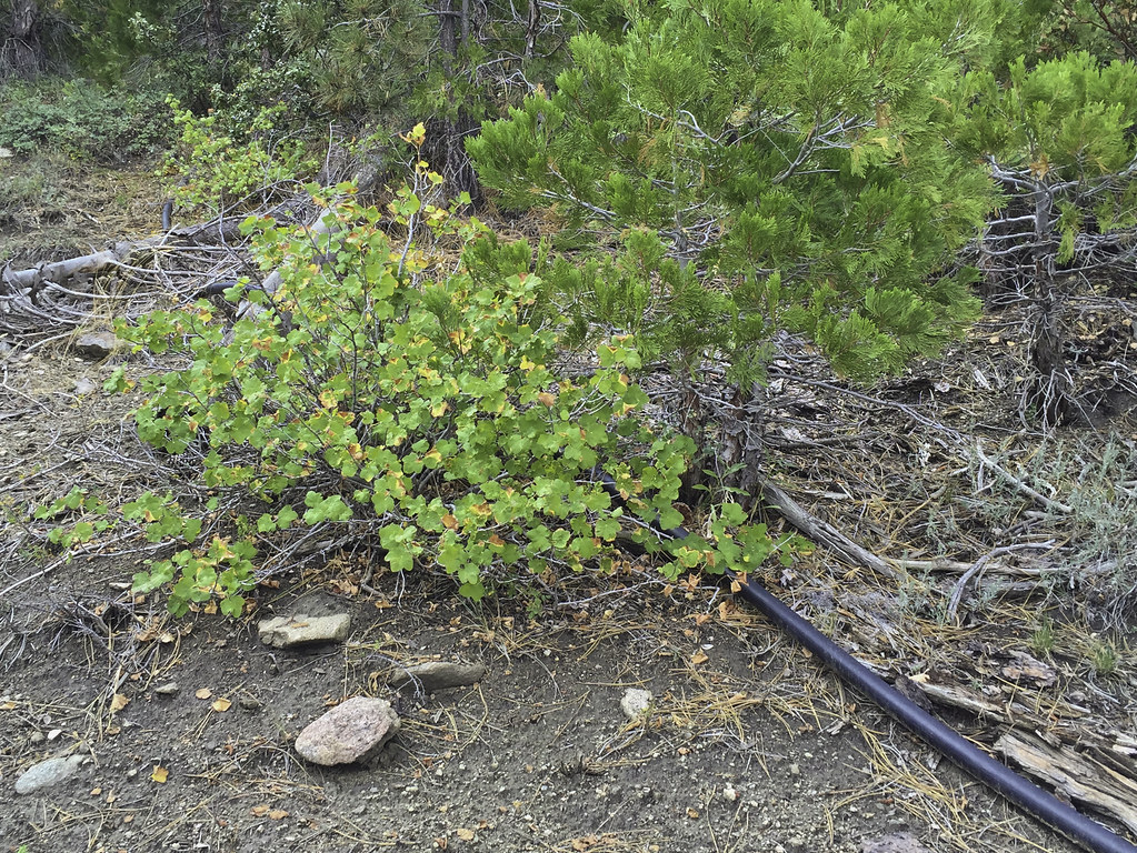 Spring Pipe by tomteske, on Flickr Spring Pipe by tomteske, on Flickr
The trip ended up being about 23 miles and 5K G/L. THOUGHT I had climbed the Sawmill Trail to the top till I realized later from other internet posts/pics the real trail exited the sawmill ruins to the west and ended up near the communication tower access road near Santa Rosa Springs. Next Time! Enjoy. Tom
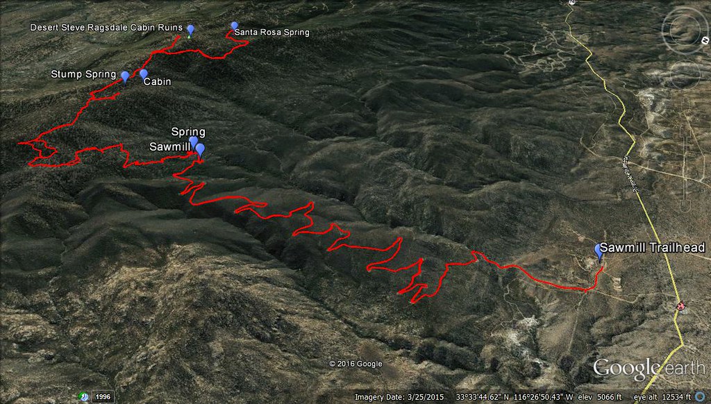 Sawmill Trail GPS by tomteske, on Flickr Sawmill Trail GPS by tomteske, on Flickr
edited by tommy750 on 8/24/2016 |
8/27/2016
Topic:
The Santa Rosas Sawmill Trail (Sort Of)
tommy750
|
dsefcik wrote:
Nice trip and report Tom, wish I could have joined you. I was exploring Pine Valley gold mines Sunday and saw lots of lightning just up towards the Lagunas. Looks like a good trip, hope your new Zpack gear earned it's pay....8-)
Zpack stuff seems to be working out well so far. Just wish they'd make water lighter . Got any pics from the mines?? |
8/28/2016
Topic:
The Santa Rosas Sawmill Trail (Sort Of)
tommy750
|
ziphius wrote:
I like the view from inside the kiln. Funny-sounding spring too. That tent is known for its head room big man.
Was kind of a weird sound to hear out there. From old pics the pipe drained into a plastic lined basin and then over to a pond near the kiln that's now dry. |
9/6/2016
Topic:
The Santa Rosas Sawmill Trail (Sort Of)
tommy750
|
rockhopper wrote:
Great trail report! I remember the old cabin before it burned down. 20 years ago?? I might have some old film pictures buried some where. It's nice to get up and in the shade of the pines this time of year. I see Borrego Springs dipped into the 90's this week. Yeah!
Thanks for sharing.
edited by rockhopper on 9/5/2016
Would be nice to see your pics of the Ragsdale cabin. Walked outside this morning in El Centro and agree the weather is starting to feel a little better. |
9/20/2016
Topic:
The Santa Rosas Sawmill Trail (Sort Of)
tommy750
|
sddarkman619 wrote:
the cabin by the spring you didn't go see, why didn't you go further? what did the sign say? and could you not go see it from a different angle?
How many miles was the hike? and did you walk it from the bottom where your tracks begin?
edited by sddarkman619 on 9/20/2016
The cabin is on private property and well fenced and signed. The sign at the locked gate said "No Trespassing." I possibly could have attempted to skirt the property for a view but wasn't that interested.
The trip was about 23 miles and I started in the Cactus Spring Trail parking lot. You can drive the five miles to the sawmill ruins but I didn't. |
10/1/2016
Topic:
Mount Whitney
tommy750
|
Congrats on making it to the summit AND keeping your dinner reservations, Bob! Daren and I were on Langley a couple days earlier and I was more than happy to have spent a couple days acclimating at 10-11K before bagging my first 14er. As for the quality of hikers on Langley, was a speck disconcerting seeing 70 year olds already descending while we were just starting...
Daren on the top
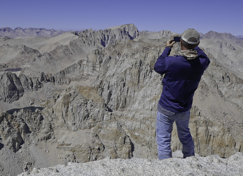 Whitney Pic From Langley by tomteske, on Flickr Whitney Pic From Langley by tomteske, on Flickr
Whitney from Langley 4.8 miles south. If you zoom in, you can see the cabin and people on top.
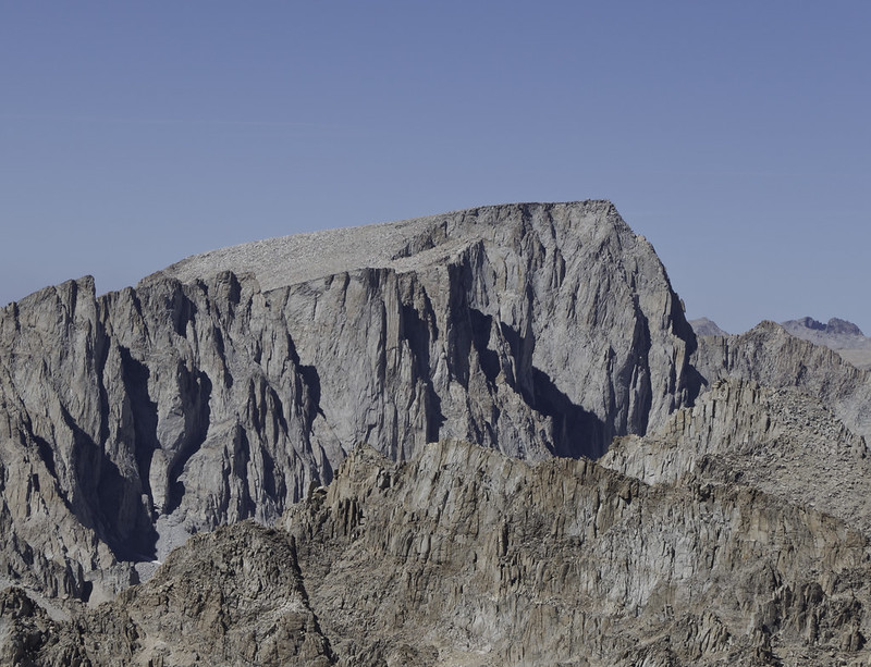 Whitney From Langley by tomteske, on Flickr Whitney From Langley by tomteske, on Flickr |
10/5/2016
Topic:
Full Size Trucks
tommy750
|
Hi Andruno, about three years ago they ran a small bulldozer through there and made things a lot easier. Haven't been through with my Tundra in a couple years so not sure what it looks like now. Check out the post below. Good luck! Tom
http://www.anzaborrego.net/anzaborrego/forum/topic697-diablo-dropoff-graded.aspx |
10/21/2016
Topic:
Storm Canyon / Vallecito
tommy750
|
Looks like a great trip, Daren except maybe the temp That's the "Blue Buddha??" Looks more like George Washington to me... |
10/29/2016
Topic:
Bahia de Los Angeles Road Trip
tommy750
|
I know it's a tad south of ABDSP but still kinda the trip everyone likes to take. Headed out a couple weeks ago for a short trip to Baja. My first trip to Baja was Thanksgiving 1977 when my cousin invited me to drive down to Bahia de Los Angeles in his 1st Gen Bronco. Was a great trip and always look forward to heading back. The fiancee and I headed south on Hwy 5 and after a late start ended up spending the night in a $50/night San Felipe motel. After that, she suddenly showed an unexpected enthusiasm for camping and avoiding further similar accommodations Haven't been to San Felipe since the early 1970's and obviously it's changed. A couple B/Ws from a then 12y/o:
 San Felipe Early 1970s by tomteske, on Flickr San Felipe Early 1970s by tomteske, on Flickr
 San Felipe Early 1970s 2 by tomteske, on Flickr San Felipe Early 1970s 2 by tomteske, on Flickr
Made it to LA Bay continuing down Hwy 5. Used to be a nightmare past San Felipe but now has fairly standard Hwy 1 type road to Puertocitos and wonderful wide road to Gonzaga Bay. There's still a 25-30 mile gap to Laguna Chapala on Hwy 1 but it should be done in about 1-2 years.
 Hwy 5 Construction by tomteske, on Flickr Hwy 5 Construction by tomteske, on Flickr
Made it to LA Bay and camped on Punta La Gringa. Had a few coyotes pass by several times that night even ending snooping around a few feet outside the truck but couldn't find the camera in time.
 Dos Coyotes by tomteske, on Flickr Dos Coyotes by tomteske, on Flickr
The next morning.
 P1000402 by tomteske, on Flickr P1000402 by tomteske, on Flickr
 P1000407 by tomteske, on Flickr P1000407 by tomteske, on Flickr
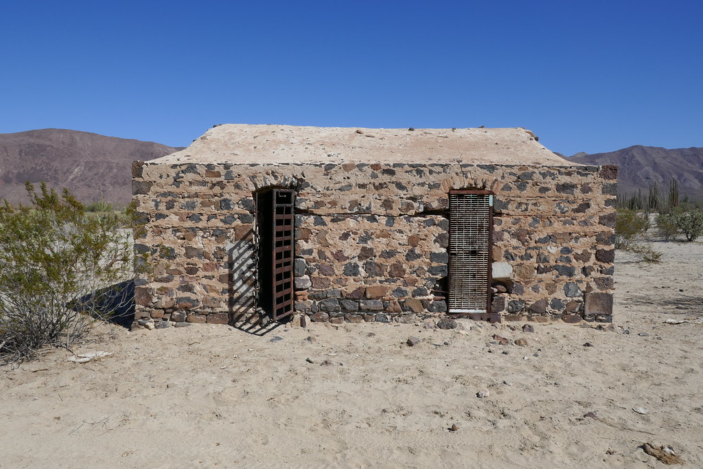
Drove on to Bahia de Las Animas and stopped at the remains of the Las Flores silver mining operation from the early 1900's. Only a stone jail remains standing.
 P1000441 by tomteske, on Flickr P1000441 by tomteske, on Flickr
The road to Las Animas used to be horrible and now it's actually only a little sketchy the last five or so miles.
 P1000448 by tomteske, on Flickr P1000448 by tomteske, on Flickr
The last couple miles in the good 'ol days. Kinda reminds me of that silty stretch on EC085.
 The Silt Road to Bahia de las Animas June 81 by tomteske, on Flickr The Silt Road to Bahia de las Animas June 81 by tomteske, on Flickr
Bahia Las Animas. You can see the Tundra as a little dot on the beach.
 P1000572 by tomteske, on Flickr P1000572 by tomteske, on Flickr
Same place I use to camp in the 1980's and actually looks the same which is kinda weird since every other beach camping spot is now loaded with casitas and keep out signs.
 Bahia de Las Animas Tundra by tomteske, on Flickr Bahia de Las Animas Tundra by tomteske, on Flickr
Back in the day...
 Campsite Bahia de las Animas June 81 by tomteske, on Flickr Campsite Bahia de las Animas June 81 by tomteske, on Flickr
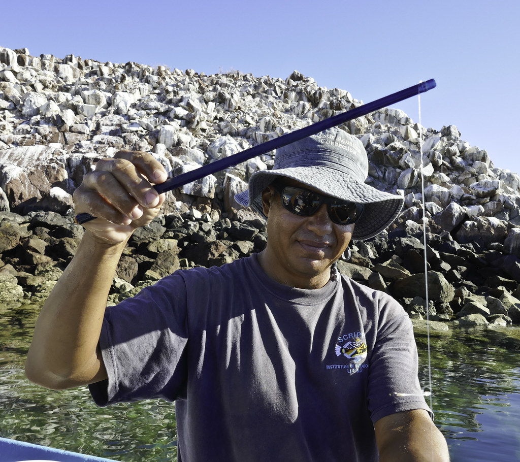
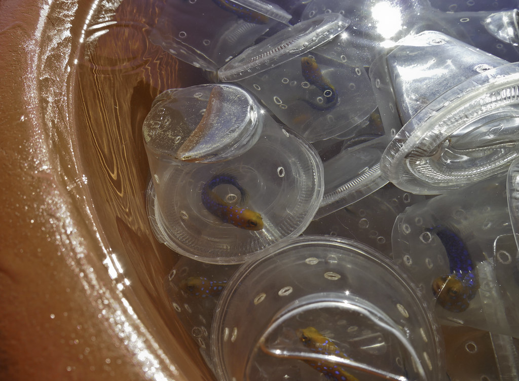
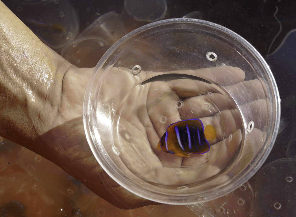
A local fisherman wandered down the beach to chat and a couple hours later we were out of Patron, beer and low on vodka.  Francisco more than made up for it the next day by taking Sandie and I out to see his tropical fish operation. He and Horacio capture Blue Spotted Jawfish, a sought after salt water aquarium fish for the world market. It's apparently only endemic to mid Gulf of CA locations on sandy flats at 15-30M depth. Horacio dives down to 15-20M and using an "advanced" fishing rig, captures the little guys and places them in small plastic containers. They store them in barrels offshore and when they have about 400 or so fish they head out to Ensenada with the fish in containers aerated with O2 tanks. They get $2.50 per and a quick internet search indicates they're resold in the $100-200 range. Freakin middlemen! Francisco more than made up for it the next day by taking Sandie and I out to see his tropical fish operation. He and Horacio capture Blue Spotted Jawfish, a sought after salt water aquarium fish for the world market. It's apparently only endemic to mid Gulf of CA locations on sandy flats at 15-30M depth. Horacio dives down to 15-20M and using an "advanced" fishing rig, captures the little guys and places them in small plastic containers. They store them in barrels offshore and when they have about 400 or so fish they head out to Ensenada with the fish in containers aerated with O2 tanks. They get $2.50 per and a quick internet search indicates they're resold in the $100-200 range. Freakin middlemen!
Horacio showing off his advanced rig. He puts a chunk of meat on a barb-less hook and catches somewhere around 50/hr. The internet says the fish do not appear to be endangered. Notice his Scripps tee. He helps them out doing research on sea cucumbers.
 Fishing Gear by tomteske, on Flickr Fishing Gear by tomteske, on Flickr
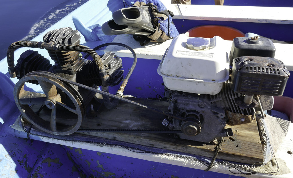
Old School diving hookah.
 Old Scool Hookah by tomteske, on Flickr Old Scool Hookah by tomteske, on Flickr
 Blue Spotted Jawfish by tomteske, on Flickr Blue Spotted Jawfish by tomteske, on Flickr
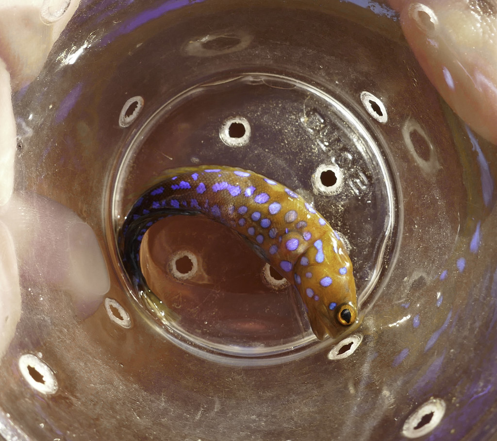 Gobio con Puntos Azules by tomteske, on Flickr Gobio con Puntos Azules by tomteske, on Flickr
Checking their stock before they head to market to make sure everyone is alive. Some die mainly related to getting hooked in the wrong spot.
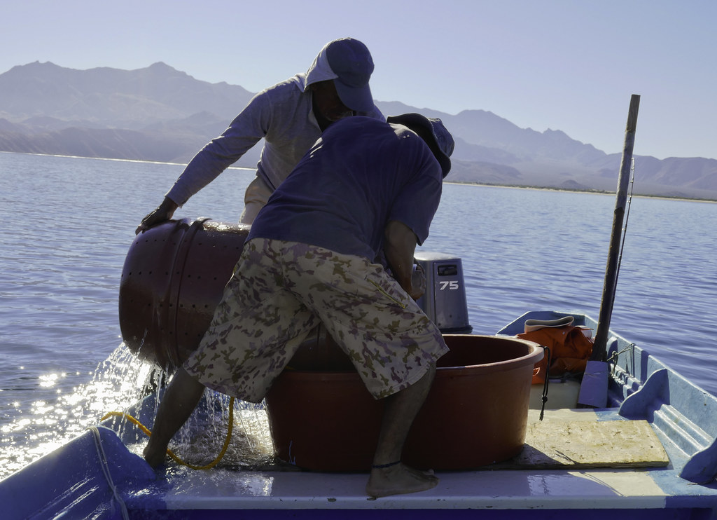 Francisco y Horacio by tomteske, on Flickr Francisco y Horacio by tomteske, on Flickr
A less common angel fish
 Angel Fish by tomteske, on Flickr Angel Fish by tomteske, on Flickr
Abandoned fishing camp with a interesting arrangement of engine cowls
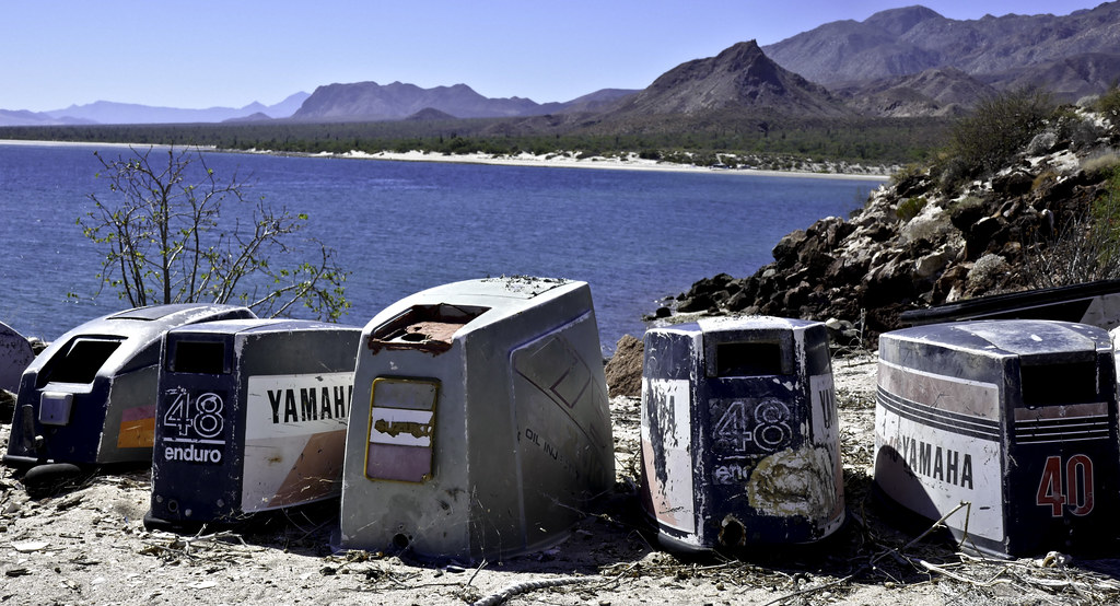 Cinco Cowls by tomteske, on Flickr Cinco Cowls by tomteske, on Flickr
Nice chapel to the Virgin de Guadalupe.
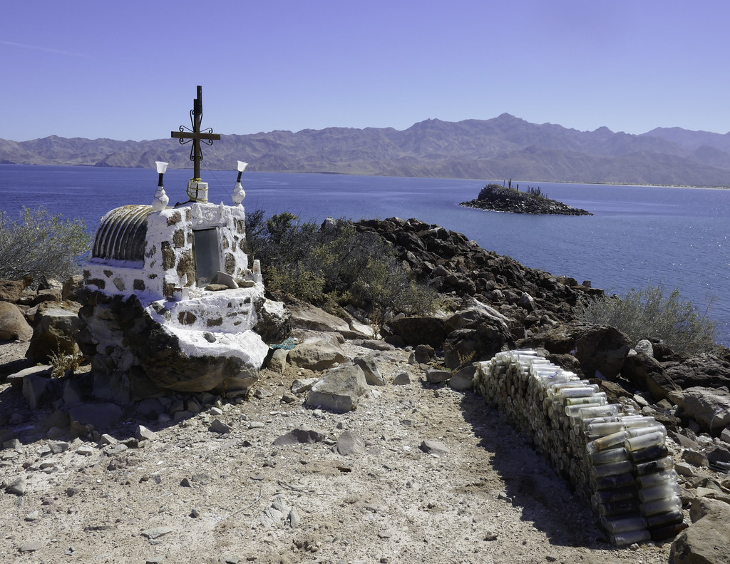 Santuario Virgin de Guadalupe by tomteske, on Flickr Santuario Virgin de Guadalupe by tomteske, on Flickr
Pangas.
 Dos Pangas by tomteske, on Flickr Dos Pangas by tomteske, on Flickr
We were going to spend another day on the other side of Las Animas. All we had to do was cross a tidal flat and then enjoy the pristine dune lined shore. Well, things went south pretty quick and let's just say we escaped from a major disaster in mud much too deep for a heavy Tundra with an incoming tide. Took only about 30 seconds to get this covered in mud and a heck of a lot longer to wash most of it off.
 Close Call by tomteske, on Flickr Close Call by tomteske, on Flickr
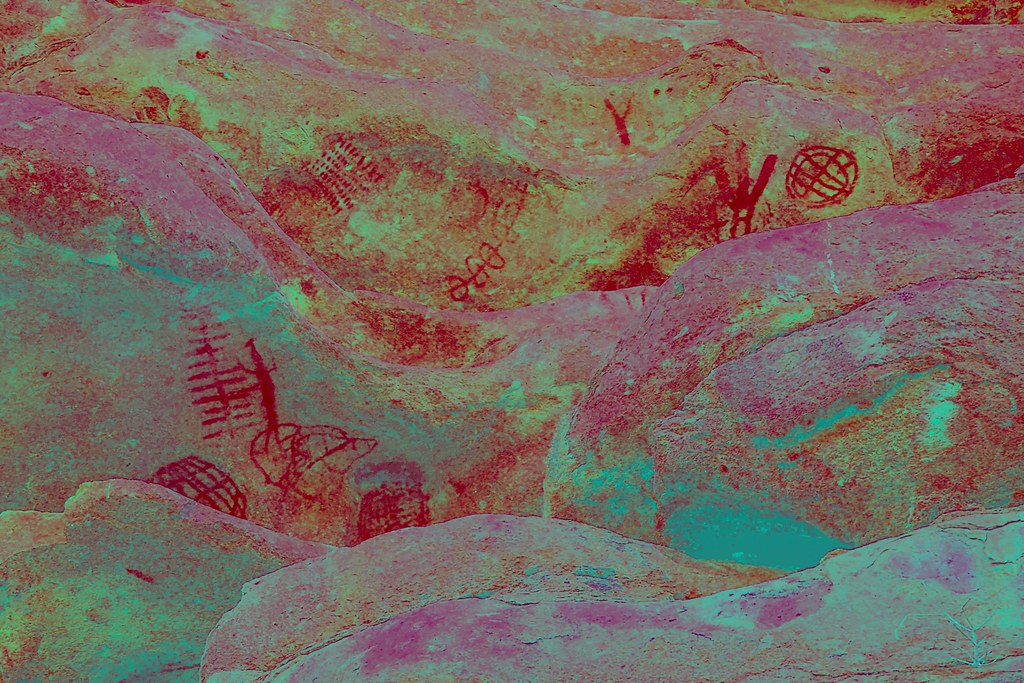
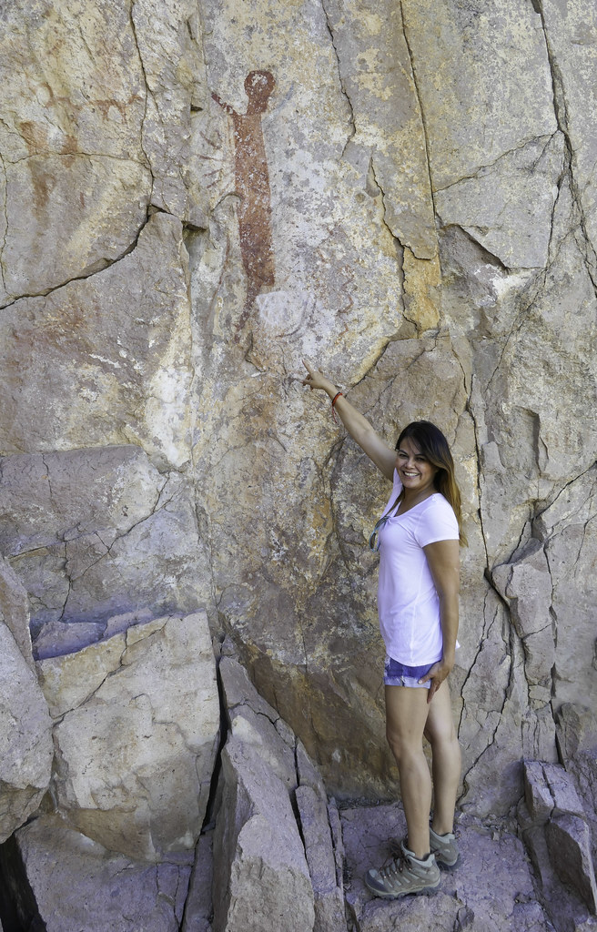
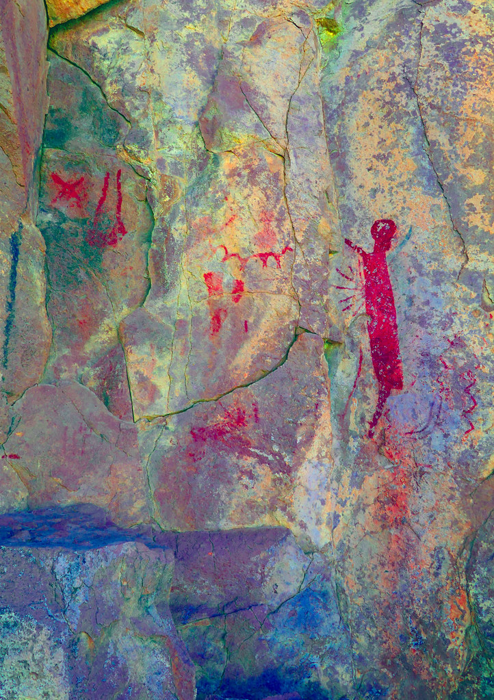
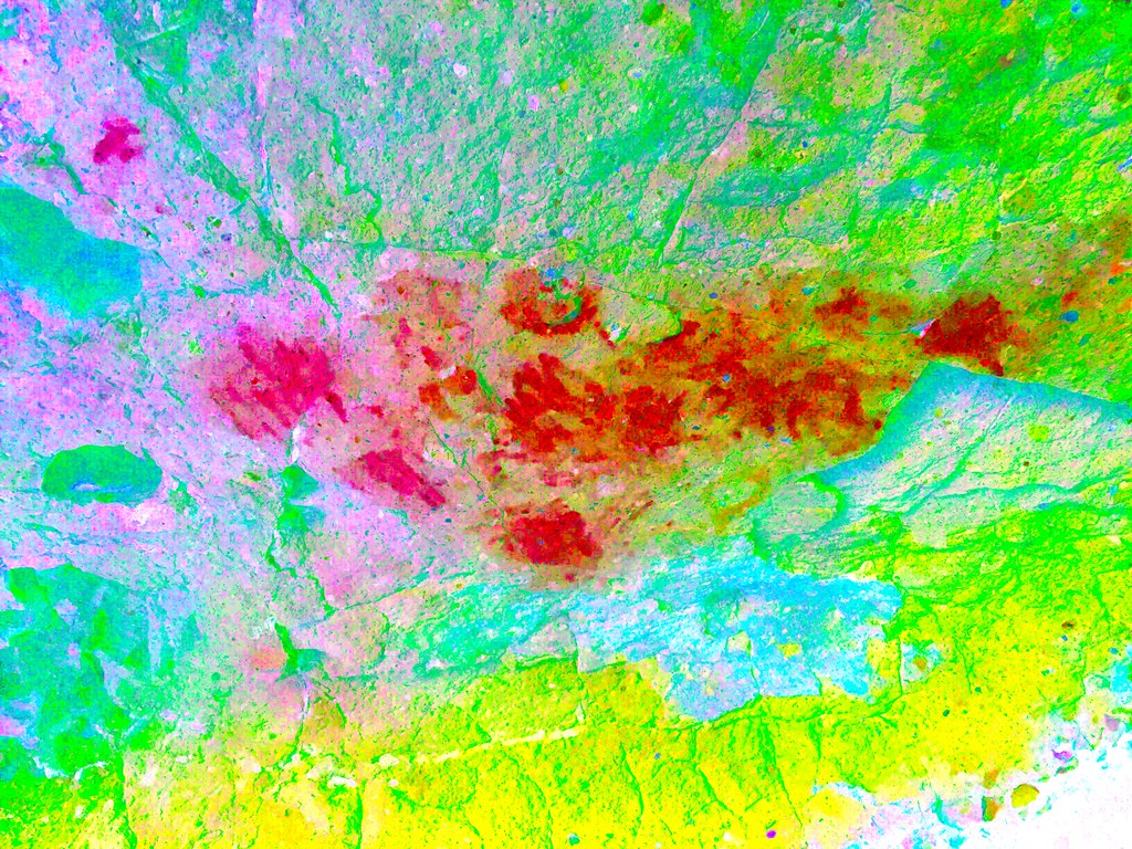
Headed back to LA Bay and located a nearby rock shelter with pictos. Several published reports on Cueva Abraham indicate a few pictos but quickly found a few unreported ones with the DStretch app. This is the Northern Abstract Style and is in between our La Rumorosa style and the Great Murals style farther to the south.
 Cueva Abraham by tomteske, on Flickr Cueva Abraham by tomteske, on Flickr
 Cueva Abraham2 by tomteske, on Flickr Cueva Abraham2 by tomteske, on Flickr
 Dotted Lines_lds by tomteske, on Flickr Dotted Lines_lds by tomteske, on Flickr
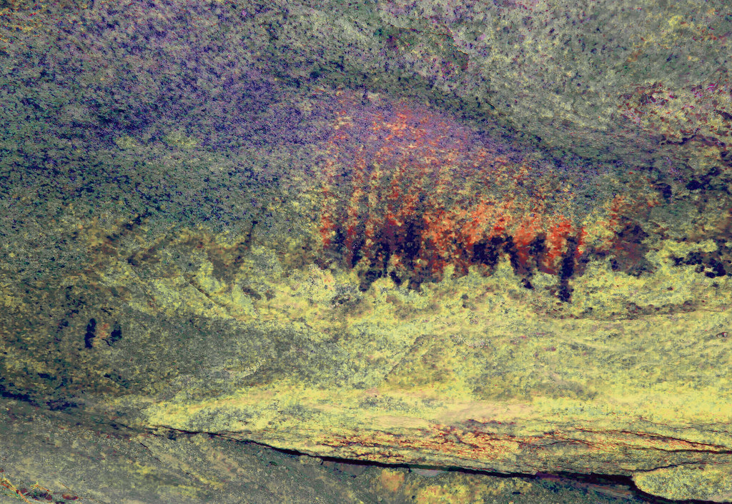 Flames by tomteske, on Flickr Flames by tomteske, on Flickr
 Concentric by tomteske, on Flickr Concentric by tomteske, on Flickr
Headed out to visit another Northern Abstract site on our way to Mision San Francisco de Borja Adac. Unlike the occasional faded picto or two we're used to seeing, Montevideo is chock full of amazing well preserved pictos you don't even have to get out of your car er, 4x4, to see. All along this point are literally hundreds of pictos.
 Montevideo Point by tomteske, on Flickr Montevideo Point by tomteske, on Flickr
 P1000655 by tomteske, on Flickr P1000655 by tomteske, on Flickr
 Montevideo by tomteske, on Flickr Montevideo by tomteske, on Flickr
 MV_lre by tomteske, on Flickr MV_lre by tomteske, on Flickr
 P1000726_lre by tomteske, on Flickr P1000726_lre by tomteske, on Flickr
 P1000741_lre by tomteske, on Flickr P1000741_lre by tomteske, on Flickr
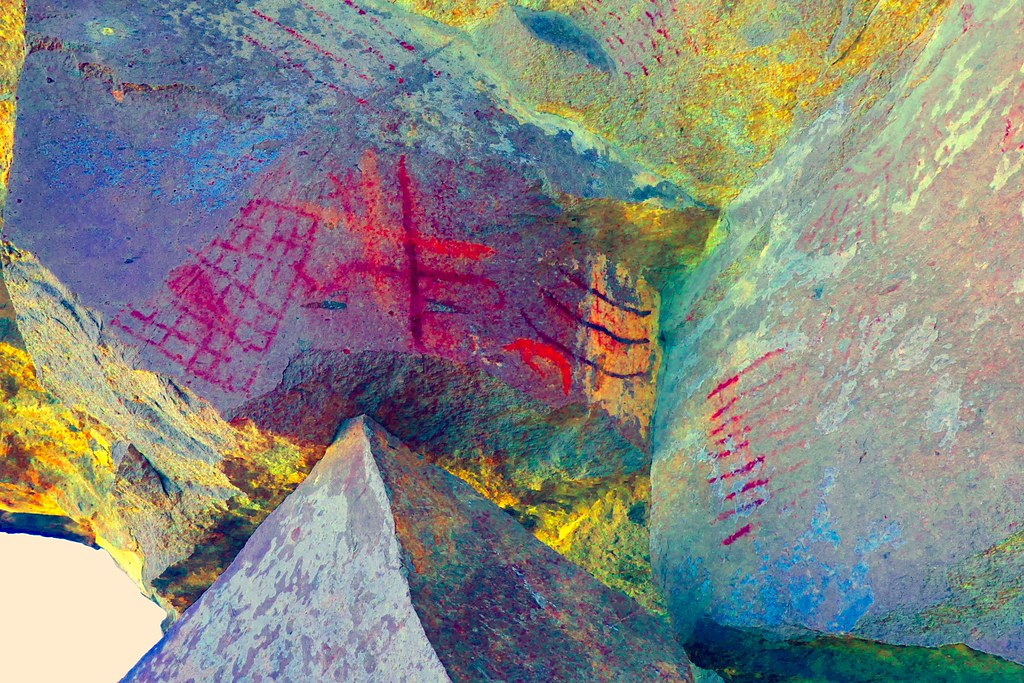 P1000813_lds by tomteske, on Flickr P1000813_lds by tomteske, on Flickr
 P1000820_lds by tomteske, on Flickr P1000820_lds by tomteske, on Flickr
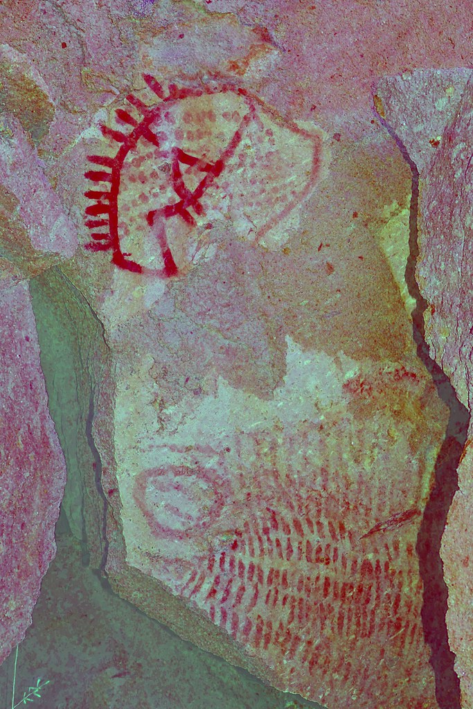 P1000811_yrd by tomteske, on Flickr P1000811_yrd by tomteske, on Flickr
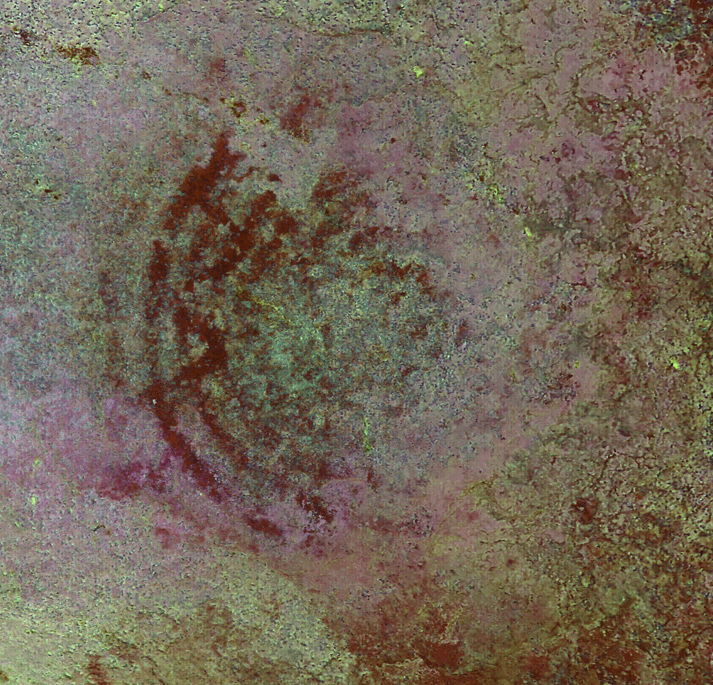
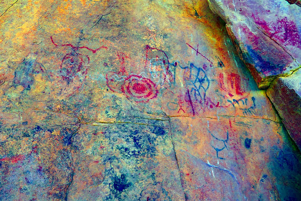
There is at least one picto representative of the Great Murals style at this site since it's right at the borderzone between the two styles.
 Sandie and Great Murals Style by tomteske, on Flickr Sandie and Great Murals Style by tomteske, on Flickr
 Great Murals_lds by tomteske, on Flickr Great Murals_lds by tomteske, on Flickr
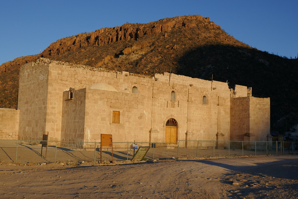
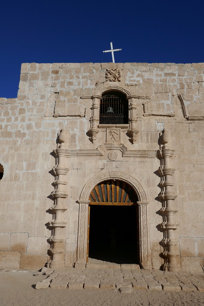
About 20-25 miles further south is the Jesuit founded Mision San Francisco de Borja Adac.
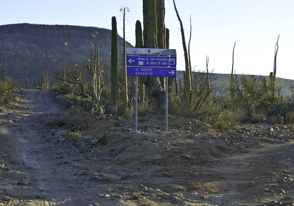 San Borja Road by tomteske, on Flickr San Borja Road by tomteske, on Flickr
 P1000892 by tomteske, on Flickr P1000892 by tomteske, on Flickr
 San Borja Cruz Blanco by tomteske, on Flickr San Borja Cruz Blanco by tomteske, on Flickr
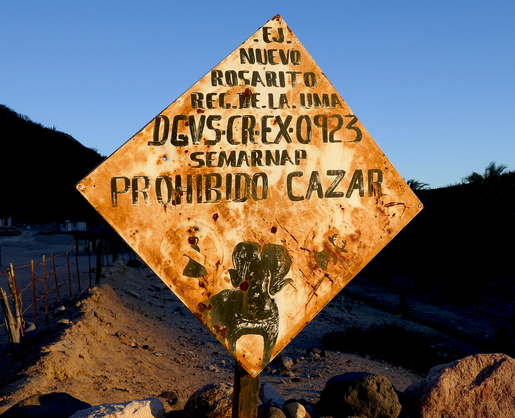 No Cazar by tomteske, on Flickr No Cazar by tomteske, on Flickr
 P1000907 by tomteske, on Flickr P1000907 by tomteske, on Flickr
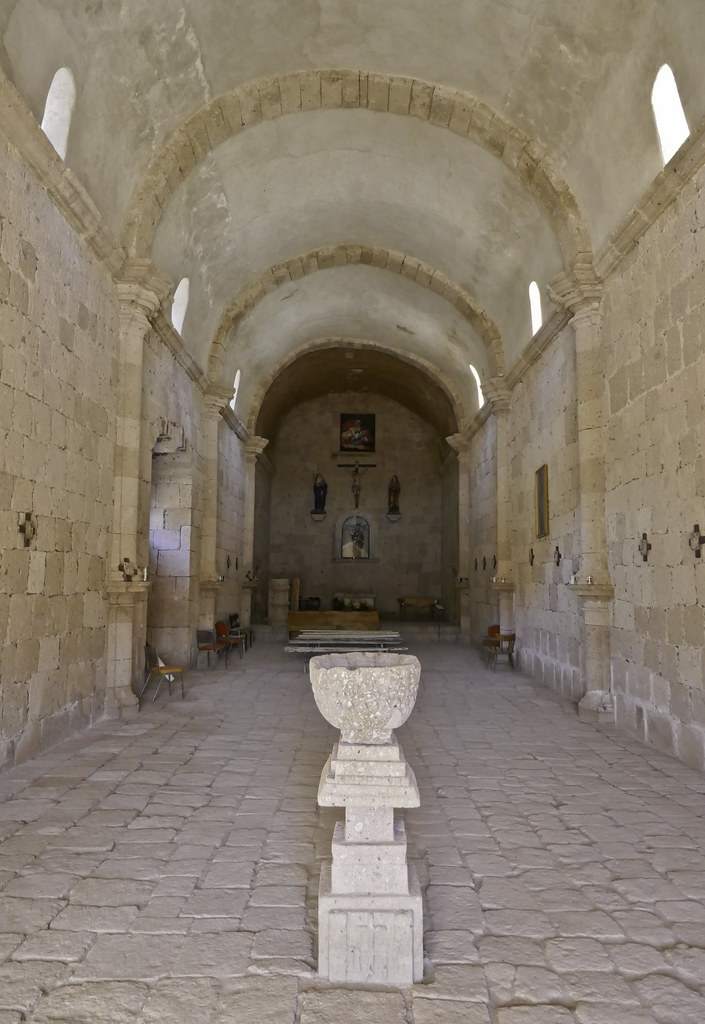 San Borja Nave by tomteske, on Flickr San Borja Nave by tomteske, on Flickr
 P1000946 by tomteske, on Flickr P1000946 by tomteske, on Flickr
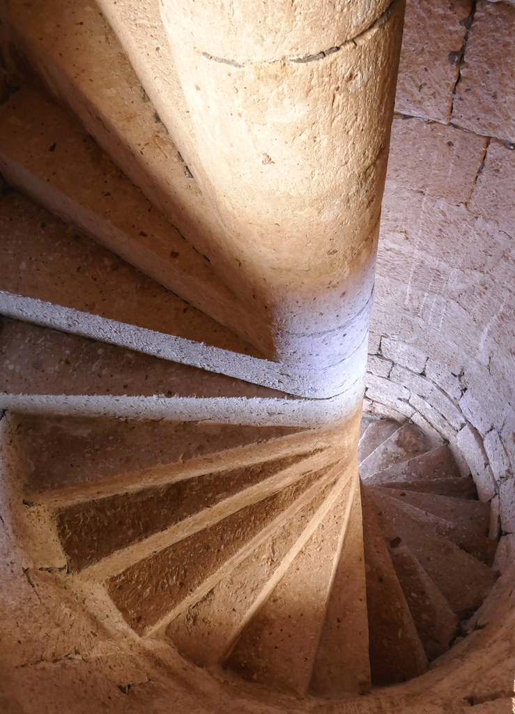 Spiral Staircase by tomteske, on Flickr Spiral Staircase by tomteske, on Flickr
Daren has a lot of pics of this mission taken before the 1997 renovation. He and his wife made it out on a dirt bike. No memory foam mattress and camp stove?? Yikes!
Can't wait to head back out. Enjoy! Tom
 Cirios by tomteske, on Flickr Cirios by tomteske, on Flickr
edited by tommy750 on 10/29/2016
edited by tommy750 on 10/29/2016 |
10/30/2016
Topic:
Bahia de Los Angeles Road Trip
tommy750
|
ziphius wrote:
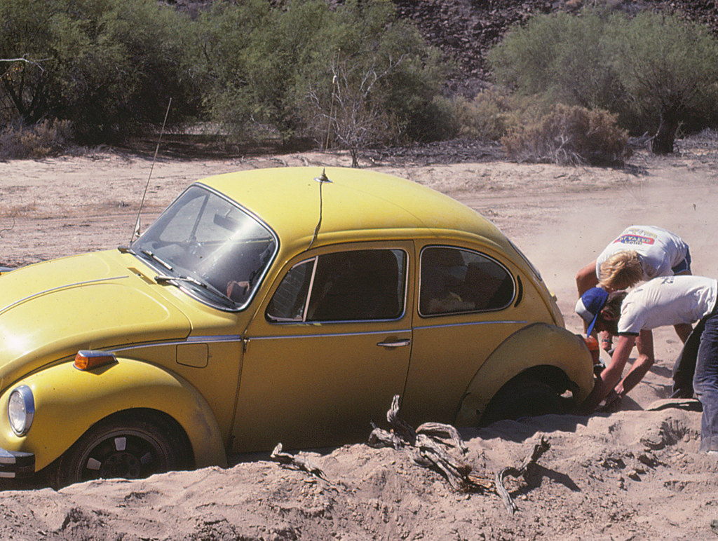
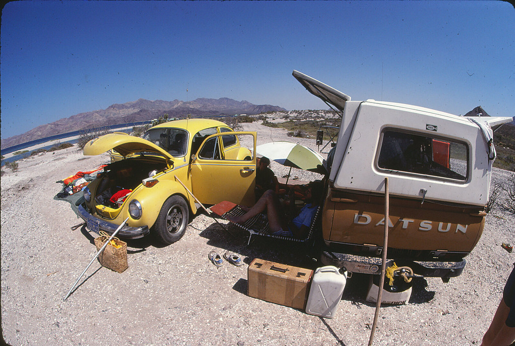
Great trip and photos Tom. I'm always amazed at where people used to drive their VW beetles (and managed to get them out every time). Looks like you got into photography at an early age too.
Definitely agree with you on the VW, Jim. Would never drive a 2WD where that Bug has been. |
10/30/2016
Topic:
Bahia de Los Angeles Road Trip
tommy750
|
anutami wrote:
Sure you don't want to put a small pop up truck camper in the bed of your tundra?
Was thinking about adding something. Even though sleeping in the back of the PU is nice, the dust is always an issue and still had mosquitoes buzzing around. Was thinking about a rooftop tent like this: http://tepuitents.com/collections/3-person-roof-top-tents/products/kukenam-sky-roof-top-tent Any thoughts??
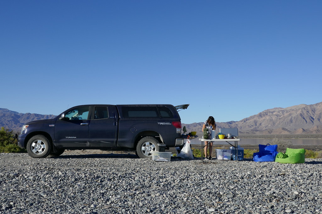
Never have had any problems with safety in Baja but understand your concern. |
10/30/2016
Topic:
Bahia de Los Angeles Road Trip
tommy750
|
dsefcik wrote:
Looks like a great trip Tom...I am somewhat envious...since you mentioned my photos, here is San Borja circa 1990 from a motorcycle trip with my wife when we toured BC...can't beleive there is now a road sign pointing the way...haha..and some (dstretched) pictos from San Javier, these are all film of course...
oh, how did **you** get a sunrise photo??
Those are great pics of the mission. A lot more tidied up now than when you were there and there's that fence...
As you well know, wasn't planning on any sunrise pics but the coyotes woke me up right before dawn and couldn't fall back asleep |
10/30/2016
Topic:
Bahia de Los Angeles Road Trip
tommy750
|
sddarkman619 wrote:
Very cool! The mission is a great site, thanks!
This one, San Javier, San Ignacio, San Luis Gonzaga are the ones I really like. Hear San Gertrudis is another nice one. Tom |
10/31/2016
Topic:
Bahia de Los Angeles Road Trip
tommy750
|
sddarkman619 wrote:
how old was that mission?
It was founded by the Jesuits in about 1762 ( a visita was there a little earlier) and turned over to the Dominicans a few years later when the Jesuits were booted from Mexico. The Dominicans (read Native Americans) built the stone structure in front of the Jesuit adobe mission and "completed"(it was never entirely finished and still missing the bell tower) work in 1801 just in time for imported disease to decimate the native population and result in the mission being abandoned by 1818.
Here's a great book on Baja Missions if you're interested: https://www.amazon.com/Las-Misiones-Antiguas-Missions-California/dp/0826331106/ref=sr_1_9?ie=UTF8&qid=1477946234&sr=8-9&keywords=baja+missions
There's an even newer book which I haven't seen yet: https://www.amazon.com/Baja-California-Land-Missions-David/dp/1495191214/ref=sr_1_5?ie=UTF8&qid=1477946305&sr=8-5&keywords=baja+missions |
10/31/2016
Topic:
Bahia de Los Angeles Road Trip
tommy750
|
rockhopper wrote:
Thanks for the memories! Great trip report and photos. The picto graphs were neat find. My friends and I spent a lot of time in Baja in the 1970's thru the 1990's also. Hey living here in San Diego I was on vacation and didn't even know it and Baja was our other "backyard".! hehe. Baja was like going back in time. I'll add some pics for fun.
This trip was from the 90's
edited by rockhopper on 10/31/2016
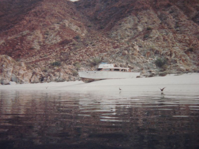
Nice pics Rockhopper. We used to camp right around the point from this boat when there were zero houses in the area. Great memories. Tom |
11/4/2016
Topic:
Tule Wind Project 2nd Phase Get's the OK
tommy750
|
Try superimposing these onto Google Earth to get an idea of what's coming. Don't forget to include the flashing red lights...
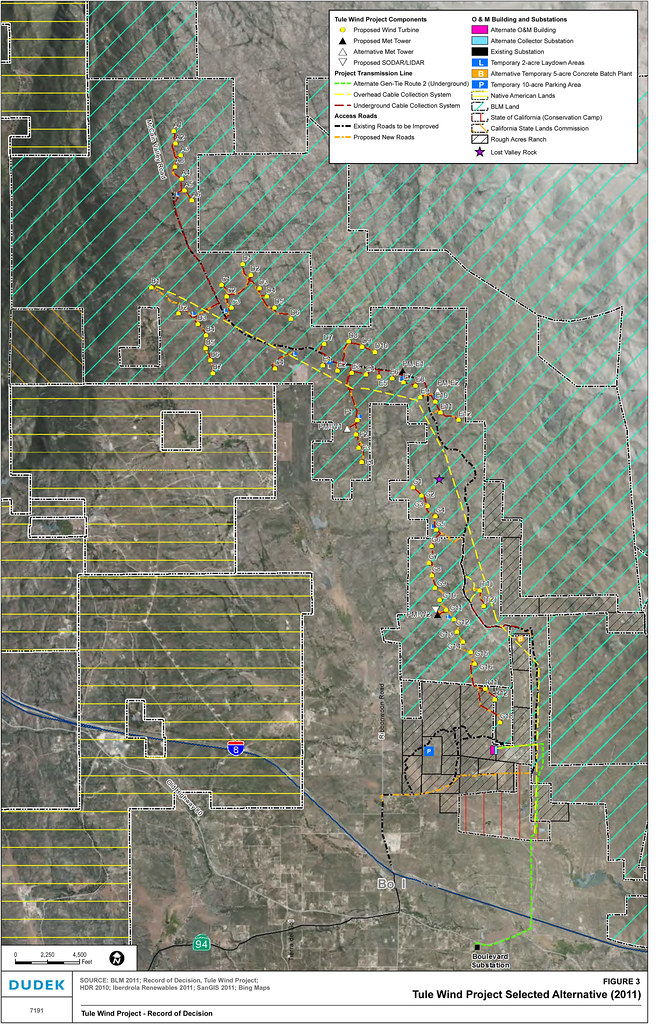 Signed Record of Decision: Tule Wind Project, Ancillary Facilities on Public Lands Supporting the Reduced Ridgeline Component, dated: January 17, 2014 by tomteske, on Flickr Signed Record of Decision: Tule Wind Project, Ancillary Facilities on Public Lands Supporting the Reduced Ridgeline Component, dated: January 17, 2014 by tomteske, on Flickr
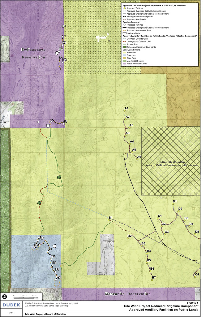 Signed Record of Decision: Tule Wind Project, Ancillary Facilities on Public Lands Supporting the Reduced Ridgeline Component, dated: January 17, 2014 by tomteske, on Flickr Signed Record of Decision: Tule Wind Project, Ancillary Facilities on Public Lands Supporting the Reduced Ridgeline Component, dated: January 17, 2014 by tomteske, on Flickr
edited by tommy750 on 11/4/2016 |
11/6/2016
Topic:
Tule Wind Project 2nd Phase Get's the OK
tommy750
|
sddarkman619 wrote:
HOW MANY are they going to put in?
and Canebrake rd from Mccain is that open to drive on?
Are they going to lock down McCain so we can't go hiking during construction and then after?
Check out the BLM Tule Wind website: http://www.blm.gov/ca/st/en/fo/elcentro/nepa/tule.html
Canebrakes Road is closed unless you're BP. |
11/16/2016
Topic:
Election Backpack
tommy750
|
Looks like a great trip, Jim. The shoe covers by S2 pic is unsurpassable! Any of those troughs/piping have springs with water attached to them?? |
11/16/2016
Topic:
Curious Coyote
tommy750
|
Nice coyote pics, Bob. Thanks |
11/17/2016
Topic:
Election Backpack
tommy750
|
ziphius wrote:
Nolan,
Yep, that's an inflatable pillow, love it (Sea to Summit brand). Except when I lift my head on a windy night and it blows out from under me (with a tent, no problem). Ocotillo is a small, rural town. Something tells me they've been pretty conservative for a long time.
anutami wrote:
Nice report and pics. Love the cowboy emblem pic. Nothing like pacifco and topo maps. Is that an inflatable camp pillow at your campsite? How comfortable is that thing? That is the single most reason why I never get a goods nite rest in the backcountry, can't seem to find anything that works. I wonder if the town of ocotillo has gone to the trump side because of all those wind turbines signed off by President Obama.
Happy trails
I have this pillow and love it. It does want to scoot around but will snug perfectly in the hood section of my mummy bag and stays put all night.
https://www.rei.com/b/exped/c/camping-pillows?r=b%3Bc&ir=brand%3Aexped%3Bcategory%3Acamping-pillows&page=1&gclid=Cj0KEQiAx7XBBRCdyNOw6PLHrYABEiQAJtyEQ9UQmn3AYFkiofmtX4gD5sUalLihBNHOStb9k1j5GFAaAqus8P8HAQ&s_kwcid=PS_Google%7C401_1326981%7Cexped+pillow%7CNB%7C7dab0ec8-c598-43da-84c3-02d05c533ff2%7Caud-196706897080%3Akwd-23864763103 |
11/22/2016
Topic:
June Wash marker
tommy750
|
rockhopper wrote:
I'll have to forward this to my friend in the paleo department at the ADBSP head quarters. Looks like a archeological off set marker??
The archaeo ones I've found have SDI-xxxx on them (in San Diego Co) and that looks like ASB?? |
11/22/2016
Topic:
Wind Turbine Catches Fire
tommy750
|
New drama at the Ocotillo Wind project:
http://www.eastcountymagazine.org/wind-turbine-collapses-ocotillo |
11/28/2016
Topic:
Davies Valley and Pinto Canyon
tommy750
|
Bob S wrote:
To bad you can't camp in Davies Valley anymore. it was fun while it lasted. 71 to 85.
Thanks for posting Bob S. Agree, would be a nice place to car camp. Still can backpack out there which I've pondered but that close to a somewhat porous border has to give one pause. |
2/15/2017
Topic:
Kofa Wildlife Refuge / Castle Dome Trip
tommy750
|
Glad I could join you guys out there in Kofa, Daren. The place is a giant mix of historic mining and prehistoric stuff in an amazing geologic setting. Definitely recommend a visit out there. Here's a few more pics:
 Daren and Petros by tomteske, on Flickr Daren and Petros by tomteske, on Flickr
 IMG_3176 by tomteske, on Flickr IMG_3176 by tomteske, on Flickr
 IMG_3186 by tomteske, on Flickr IMG_3186 by tomteske, on Flickr
 Old vs New by tomteske, on Flickr Old vs New by tomteske, on Flickr |
2/15/2017
Topic:
Sleeping Circles
tommy750
|
Always nice to find stuff like that out there. Looks like Google Earth is winning with sextuplets
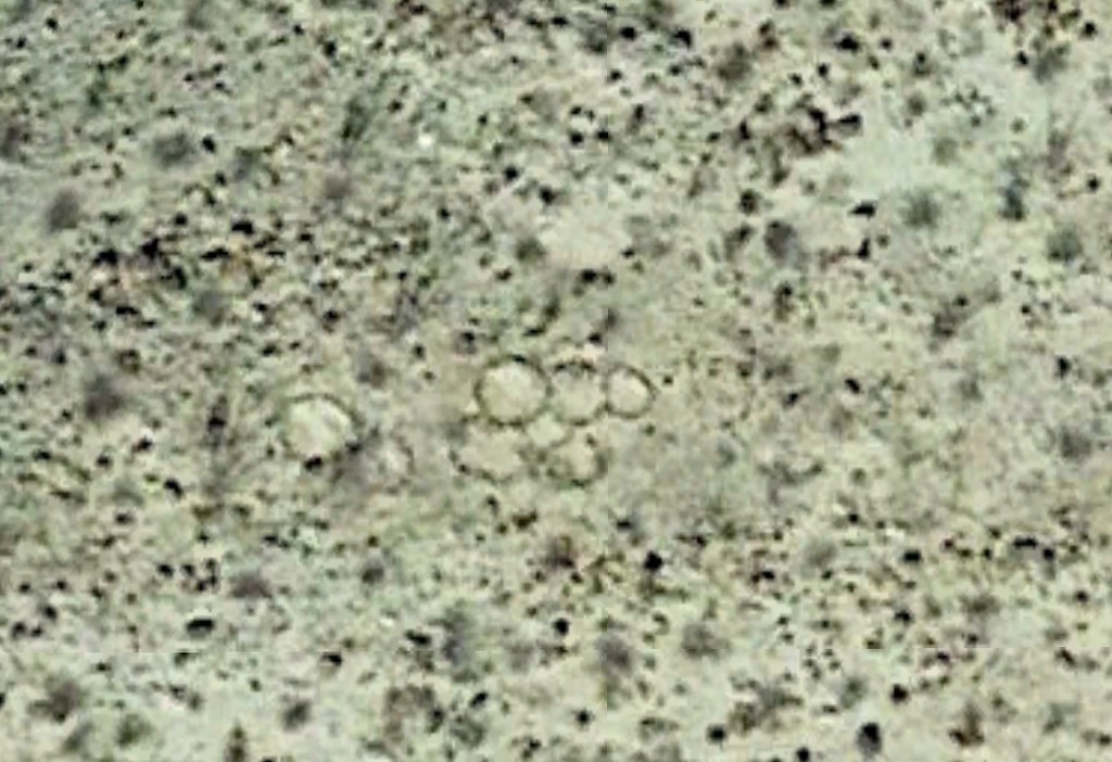 sextuplets and twins by tomteske, on Flickr sextuplets and twins by tomteske, on Flickr |
2/23/2017
Topic:
Mortero Palms and Piedras Grandes
tommy750
|
Great to see you're out and about, Nolan. Was over at Dave McCain Spring this past weekend and your pics of the clouds rolling in look very familiar. Nice to see water in the desert. BTW, the two wildlife guzzlers we visited were chock full which is encouraging. Looks like a great place to have a new house! Tom |
2/27/2017
Topic:
Flowers and Sleeping circles
tommy750
|
Great trip report Rockhopper. Was a few miles up the road from you this past weekend also checking out stuff visible on GE. Found a rock alignment and day hiked to check it out.
Rock alignment from space.
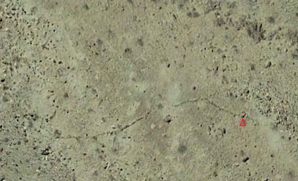 Rock Alignment1 by tomteske, on Flickr Rock Alignment1 by tomteske, on Flickr
A little harder to see up close and already ducked up by previous visitors. I'm standing on the rock above the red triangle for the photo. Amazed how you can easily pick out individual rocks on the satellite image and correlate them with what's on the ground. Sorry for jacking the thread!
 Rock Alignment by tomteske, on Flickr Rock Alignment by tomteske, on Flickr
Wilson??!!
 Wilson by tomteske, on Flickr Wilson by tomteske, on Flickr |
2/28/2017
Topic:
Flowers and Sleeping circles
tommy750
|
ziphius wrote:
Cool stuff Tommy. Keep hijacking. Was the petroglyph part of the rock alignment?
edited by ziphius on 2/28/2017
No petros near the alignment but occasionally by the trail leading out there. Hard to follow the native trails at present cuz they're all covered with darn grass and flowers. See above |
2/28/2017
Topic:
Flowers and Sleeping circles
tommy750
|
Rockhopper, I'm guessing on a lake that large, waves could crash pretty high with any storm. A tsunami is interesting since major faults run through the area but tsunamis are usually associated with subduction zones as opposed to our transform faults. That said, my little pool in El Centro lost about a foot of water during the 7.2 Easter quake in 2010 so you may be on to something. Now, back to hijacking your post...
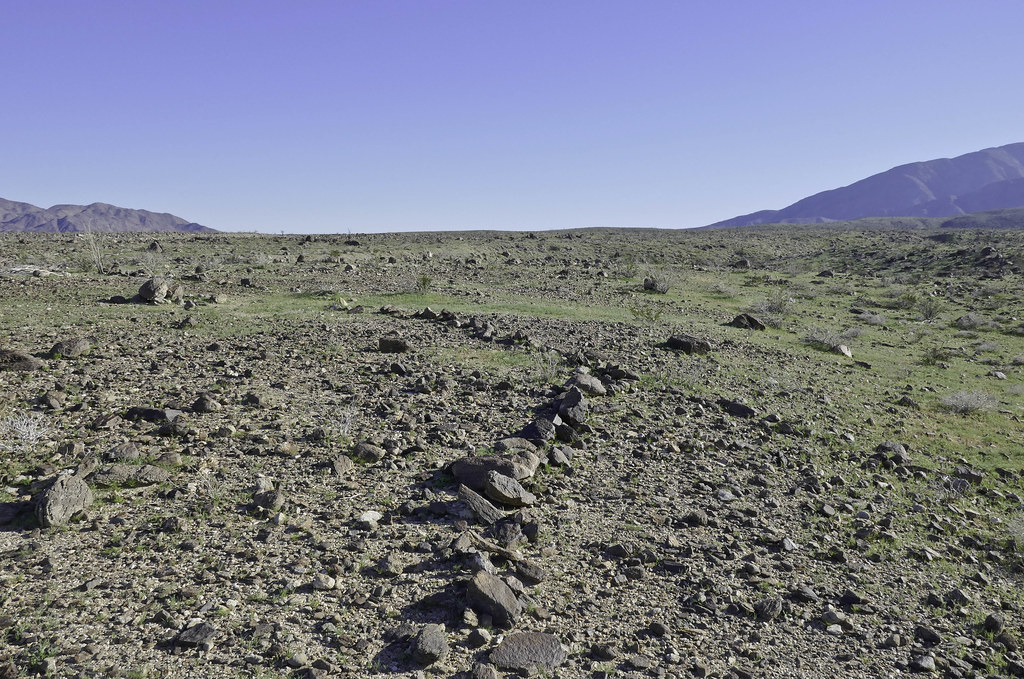
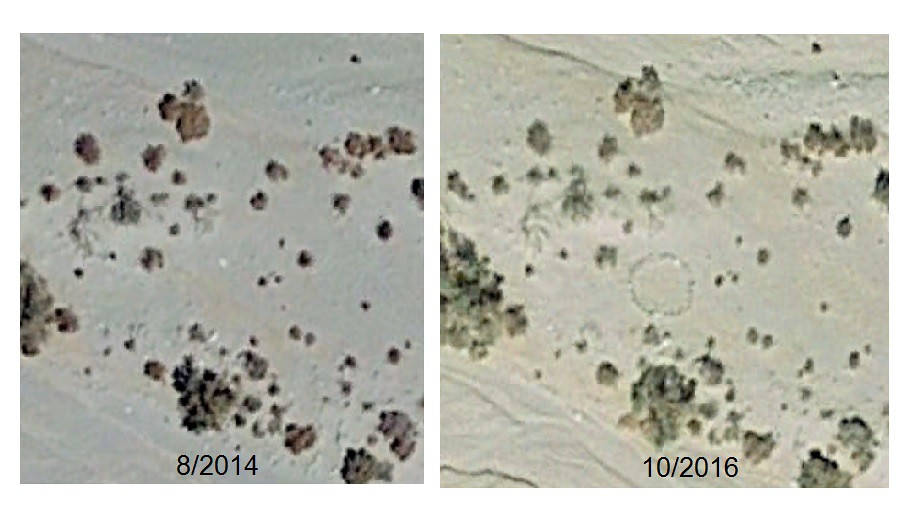
The other thing that's possible on GE these days is assessing change over time especially the past two satellite images over the Colorado desert in 8/2014 and 10/2016 which I think is using Landsat 8 stuff. I've noted a fair amount of crap show up in the desert that wasn't there a couple years ago, some of it obvious but some of it maybe not so obvious after sitting around for a few years. And speaking of rock circles, check out a couple examples below:
Near 17 Palms
 17 Palms ABDSP by tomteske, on Flickr 17 Palms ABDSP by tomteske, on Flickr
Near Rock House Canyon. The first pic is 2014 and the second one is 2016. This new addition might pass for a sleeping circle in a few years.
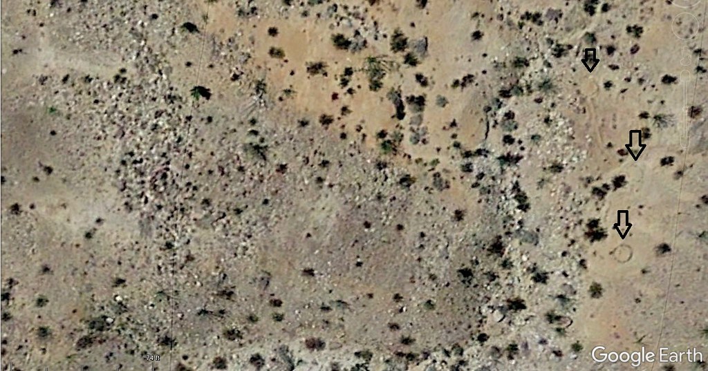 Rockhouse Circles 2014 by tomteske, on Flickr Rockhouse Circles 2014 by tomteske, on Flickr
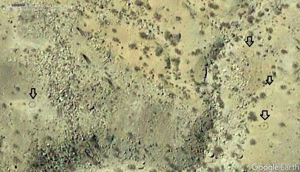 Rockhouse Circles 2016 by tomteske, on Flickr Rockhouse Circles 2016 by tomteske, on Flickr
Don't even dare look at Coyote Mt. That place is becoming a mess. Somewhat back on track, Cerro Prieto is the volcano whose lava flow purportedly provided the spillway that kept Ancient Lake Cahuilla's lake level at 40ish ft when full. Search "Cerro Prieto, Mexico" on GE and you can definitely see some rather amazing change with time in the latest two images. Okay, I'll stop! |
3/1/2017
Topic:
The boy's 1st backpack trip
tommy750
|
Wow, what a great intro to backpacking and the desert. Another Nolan on the forum??  |
3/2/2017
Topic:
Double survey markers
tommy750
|
rockhopper wrote:
I believe those double survey bench marks might be at a Section or Range, to account for the curvature of the earth. I need to go back and look at my old survey books or others please chime in.
Those are Public Land Survey System markers and they are designed to mark property boundaries. You'll find them at the four corners of every section you see on your topo map. Occasionally, you'll see them marking just the linear boundary of a section like the one pictured here. Assuming it was found along a boundary of section 18 west of the I-8 island. The GLO became the BLM post WWII so the newer ones should have BLM on them. These are different than Geodetic markers like the nearby Jacumba, Windy, Gasp etc which mark a specific vertical and horizontal spot on the earth's surface. |
3/3/2017
Topic:
Double survey markers
tommy750
|
rockhopper wrote:
I just noticed the Section 18 on the marker. So it is an alignment marker along a straight line of Section 18. Why two markers so close? 100 feet apart. I last surveyed about 35 years ago. We always set or next marker at the furthest distance possible. Tommy750 may know.
Late one Friday afternoon in 1924: "Hey Billy Bob, weren't you supposed to put this section marker way over on the far side of 18?" The end.  |
3/3/2017
Topic:
Double survey markers
tommy750
|
So that's a quarter section marker. The sections are supposed to be one square mile or 640 acres. When divided, it should be 4 sections of 160 acres or 16 quarter-quarter sections of 40 acres. Section 18 is a funky shape presumably because it's next to a county line and has 8 q-q sections and 4 slivers with only 362 acres. Here's a screen grab off GE with an overlay you can download temporarily from earthpoint.us or permanently if you pay. I find this quite fascinating in the GPS age and can't imagine the amount of craziness it took to put that one marker in that spot nearly 100 years ago.
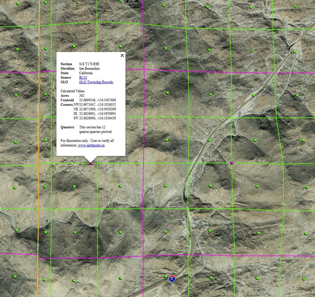 Section 18 by tomteske, on Flickr Section 18 by tomteske, on Flickr |
3/8/2017
Topic:
To the top of El Cajon Mountain aka "The Beast"
tommy750
|
Impressive video, Ziphius. Let the forum know when you do #100. If you ever consider something like per mile sponsors for your favorite charity, I'm in. |
3/8/2017
Topic:
Exploring the Service roads above the Carrizo R&R
tommy750
|
Agree, that's a neat place to explore. Think we may share the same taste in artifacts
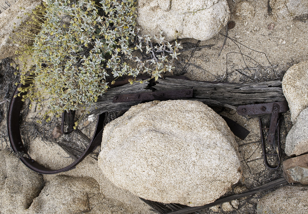 Yolk by tomteske, on Flickr Yolk by tomteske, on Flickr
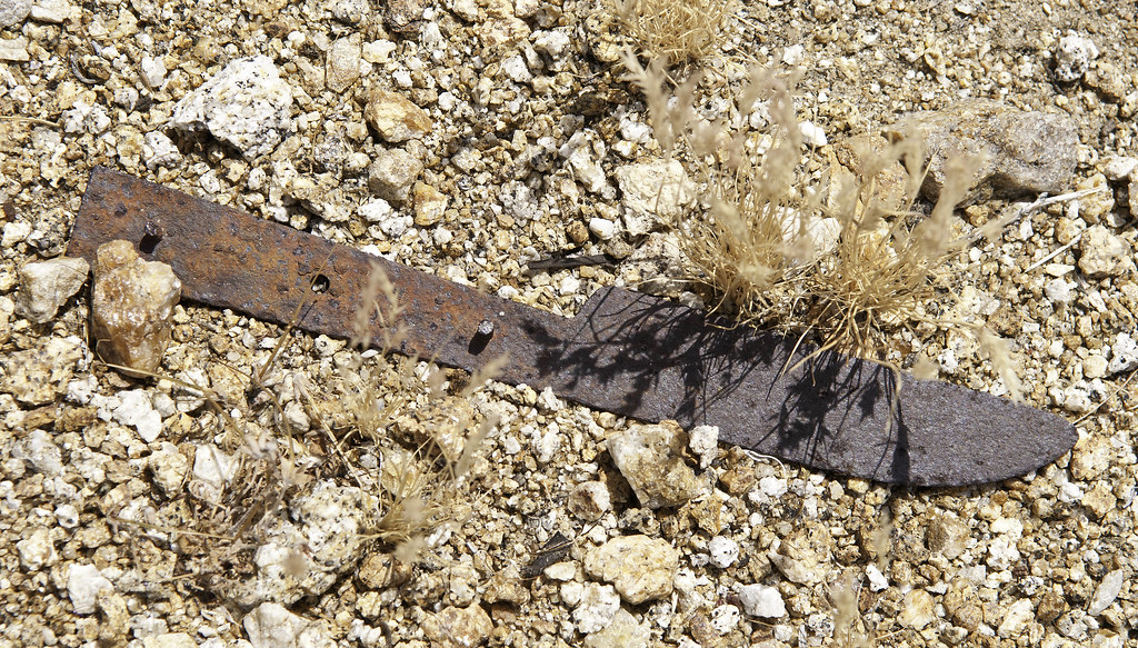 Knife by tomteske, on Flickr Knife by tomteske, on Flickr |
3/13/2017
Topic:
Red Tail and Kestrel going at it.
tommy750
|
Like it. Nice pics |
3/17/2017
Topic:
My Ride
tommy750
|
Yikes! Pinyon drop off?? |
3/18/2017
Topic:
Old Desert photography locations
tommy750
|
Tropical Storm Kathleen messed up Myers/Boulder Creek back in 1976. Here's a link to the one book documenting what happened: https://www.scribd.com/doc/9354989/Tropical-Storm-Kathleen
Great posting. Love the pics. Tom |
3/19/2017
Topic:
The "New" McCain Valley
tommy750
|
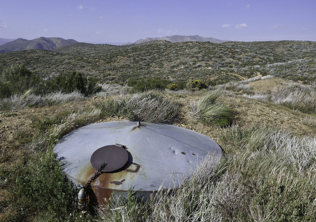
Decided to head out to McCain Valley yesterday since the desert floor was a little toasty for an overnighter. Was I in for a surprise! I knew Tule Wind was coming but wasn't expecting a tsunami. Sunrise Powerlink was one thing but this project is orders of magnitude more disruptive to the wilderness. 50 ft access road? That's the same as four lanes of I-5. Looks like a number of turbines will be sitting on the road with essentially zero setback. With a west wind, those blades will be slicing overhead every time you pass by.
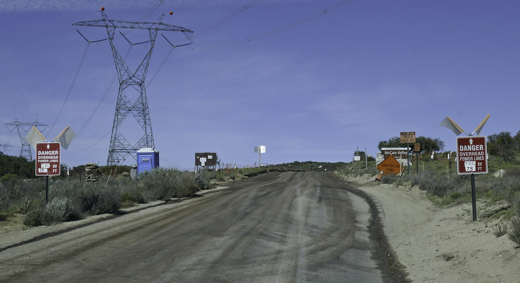 McCain Valley by tomteske, on Flickr McCain Valley by tomteske, on Flickr
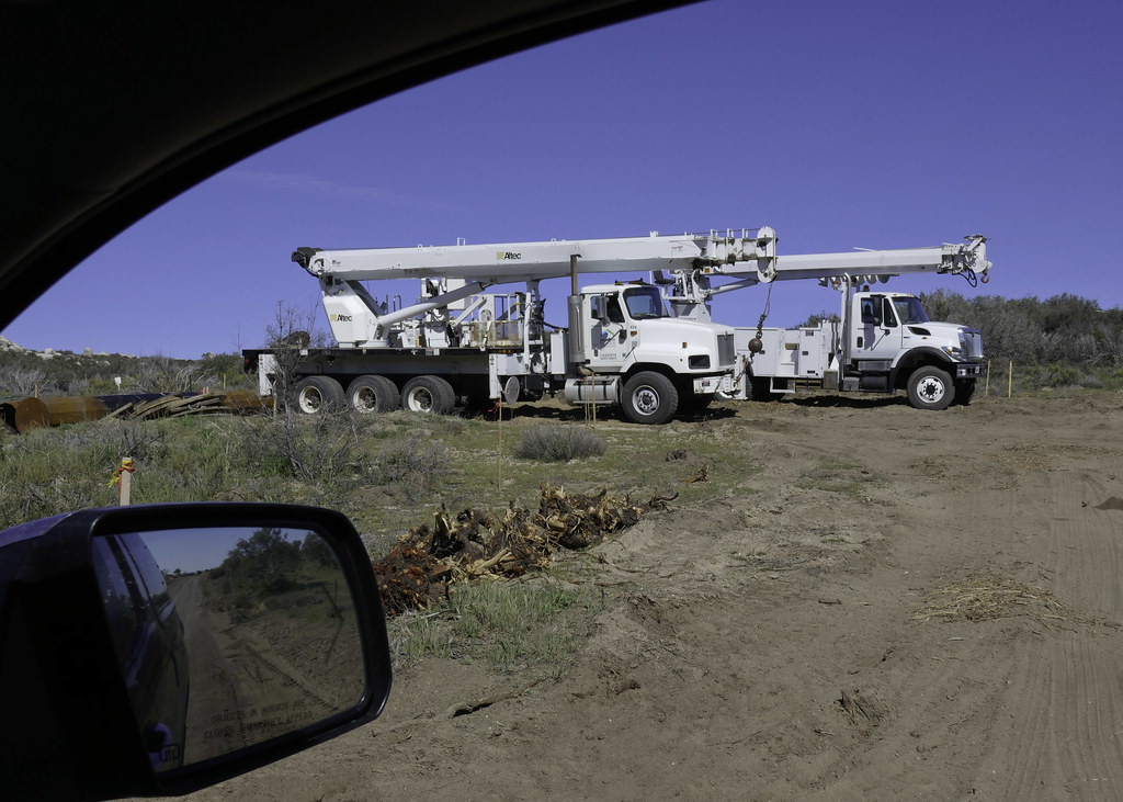 Trucks by tomteske, on Flickr Trucks by tomteske, on Flickr
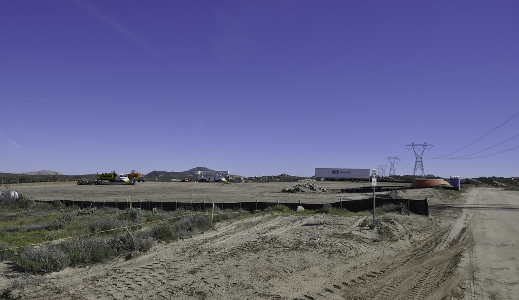 Clearing by tomteske, on Flickr Clearing by tomteske, on Flickr
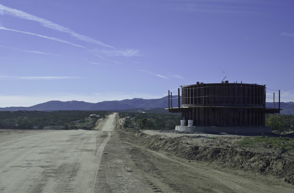 Turbine Foundation by tomteske, on Flickr Turbine Foundation by tomteske, on Flickr
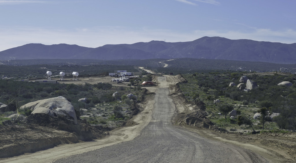 50 ft Swath by tomteske, on Flickr 50 ft Swath by tomteske, on Flickr
 Cottonwood by tomteske, on Flickr Cottonwood by tomteske, on Flickr
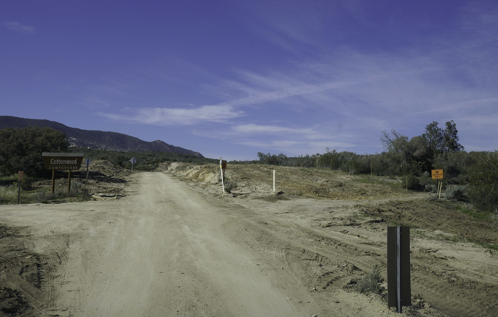
After paying my parking fee at Cottonwood, I headed north. You can still pretty much escape in Northern McCain Valley at least for now.
The view toward the Jacumba Mts
 Toward Jacumba by tomteske, on Flickr Toward Jacumba by tomteske, on Flickr
Balancing Act
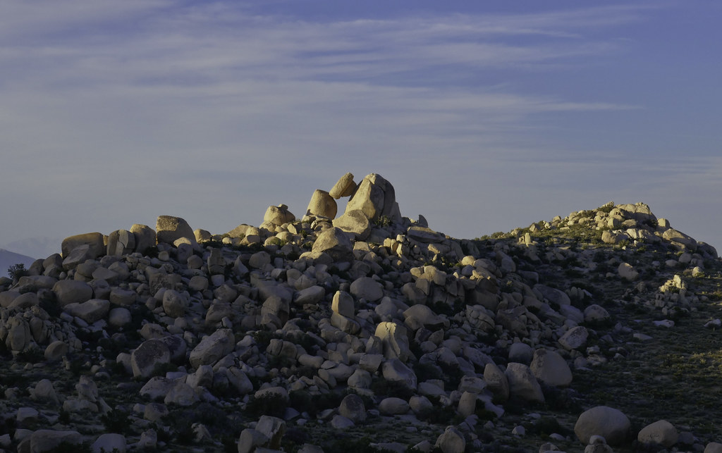 Balance by tomteske, on Flickr Balance by tomteske, on Flickr
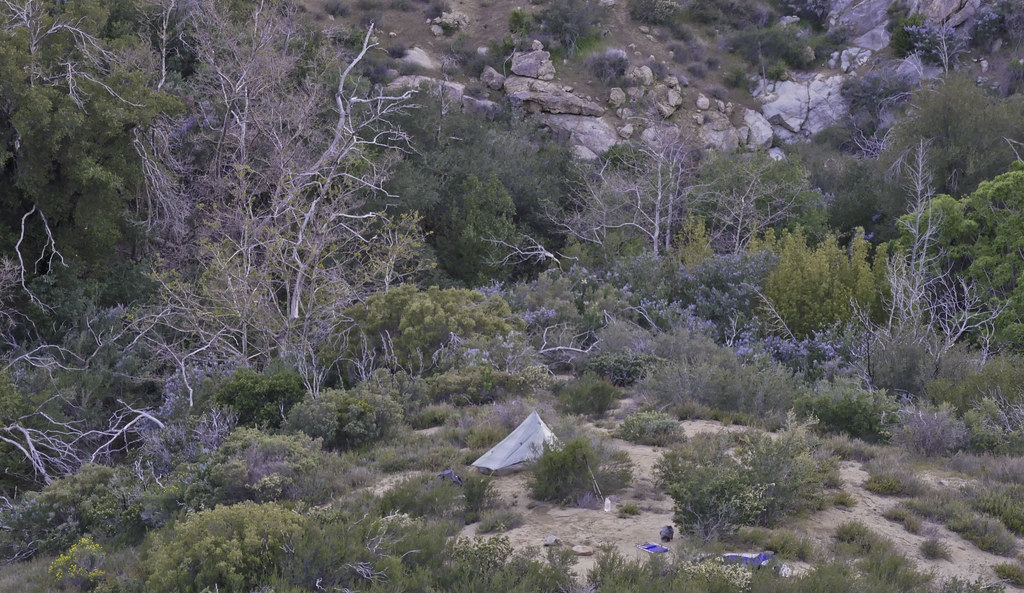
Obligatory lighted tent shot
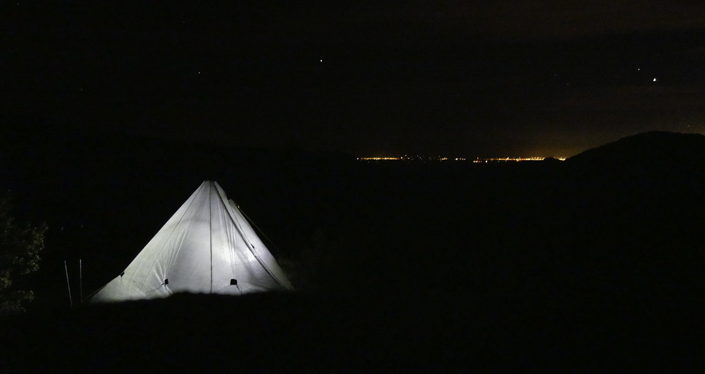 Campsite by tomteske, on Flickr Campsite by tomteske, on Flickr
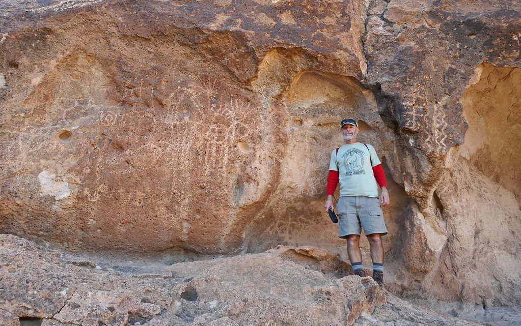
Did a little exploring this morning. Nice rock shelter with a small metate sitting on a rock and possibly a prayer stick.
 Rockshelter 300M North by tomteske, on Flickr Rockshelter 300M North by tomteske, on Flickr
A nearby broken metate
 Broken Metate 40M NE by tomteske, on Flickr Broken Metate 40M NE by tomteske, on Flickr
Faded pictograph panel
 C-636 Pictos_yrd by tomteske, on Flickr C-636 Pictos_yrd by tomteske, on Flickr
These almost look like orchids
 Desert Orchids by tomteske, on Flickr Desert Orchids by tomteske, on Flickr
Definitely flowing water out there for the first time in years. Lots of tadpoles in this pond
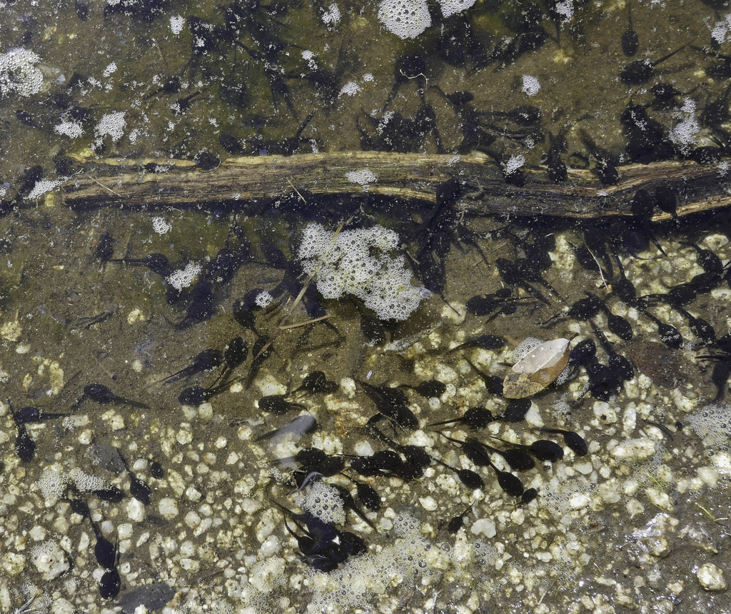 Tadpoles by tomteske, on Flickr Tadpoles by tomteske, on Flickr
Enjoy. Tom |
3/20/2017
Topic:
The "New" McCain Valley
tommy750
|
ziphius wrote:
Looks like fun Tommy. Too bad about 'progress'. Were the tadpoles part of a natural or 'improved' watering area?
The pond appeared to have been created when a small stream's drainage culvert under Canebrake Rd plugged with debris. Still had good flow as did a couple other streams which was really nice to see. Going to be the second plague redux in a few weeks |
4/2/2017
Topic:
Ranger Steve dies in shooting incident
tommy750
|
Tragic news. |
4/6/2017
Topic:
1968 Borrego Mtn. 6.5 Earth Quake Anniversary
tommy750
|
Ah, the good 'ol days! Nice pics, Rockhopper. |
4/25/2017
Topic:
Oriflame to Cottonwood Canyon 3 day BP
tommy750
|
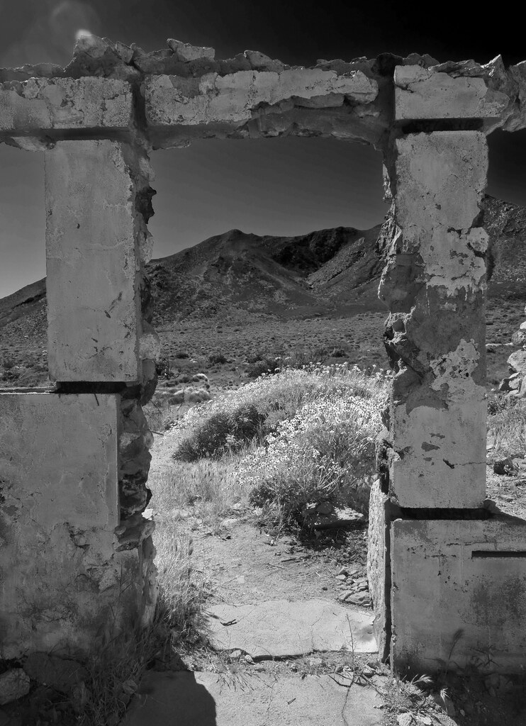
As a very sketchy Plan B to a cancelled Santa Rosas backpack trip three weeks ago, Gary and I, the last hikers standing after cancellations, decided to head out to Oriflame Canyon. The canyon, an entry to the Lagunas for centuries, was first traveled by a European in 1772 (San Diego Military Commander Pedro Fages chasing deserters) and later by postmen, miners and ranchers. We started at the old CCC Camp Hark where workers carved out the Mason Truck Trail in the 1930s.
Steps from an abandoned Camp Hark structure.
 Stairway to Oriflame by tomteske, on Flickr Stairway to Oriflame by tomteske, on Flickr
Heading up Oriflame Creek. Still nice and green with lots of flowing water.
 Oriflame Creek by tomteske, on Flickr Oriflame Creek by tomteske, on Flickr
Really spent only minutes looking at GE and a topo map to plan the hike and only had a few points on the GPS. We were to head upstream till we got past BM Roost and then head left up to a "plateau" behind Oriflame Mt. where we would explore old mining and ranching sites. Gary was pretty skeptical but brought the wrong topo map so was stuck with me leading the way. Finally bush whacked our way 1,000 ft up to the base of BM Roost aided by brush clearing from prior fires.
BM Roost on the right and Whale in the background.
 Boundary by tomteske, on Flickr Boundary by tomteske, on Flickr
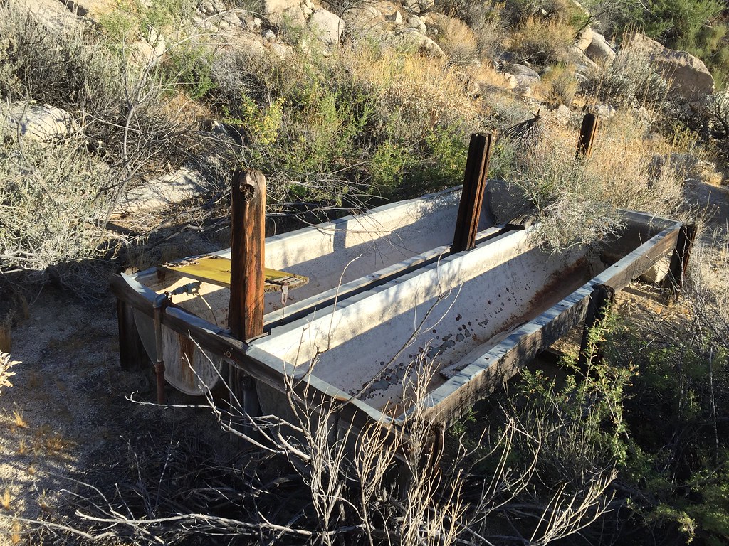
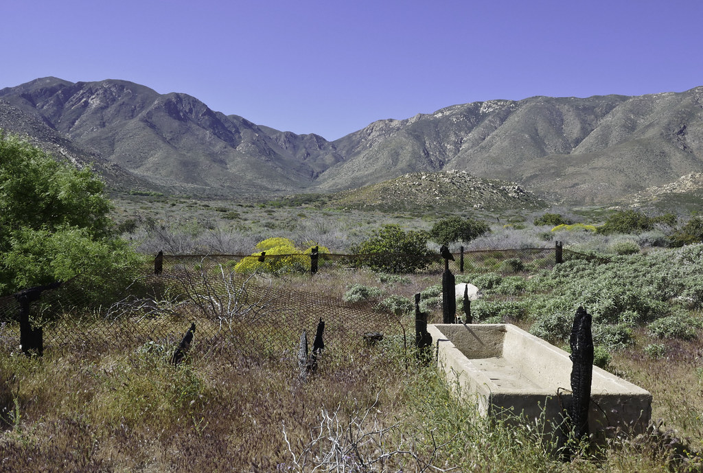
Lots of old troughs and feeder pipes leading mainly to tanks from the old ranching days.
 Tank by tomteske, on Flickr Tank by tomteske, on Flickr
Made our way toward some mines high in Oriflame Canyon passing by beautiful magenta purple colored bushes I don't know the name of.
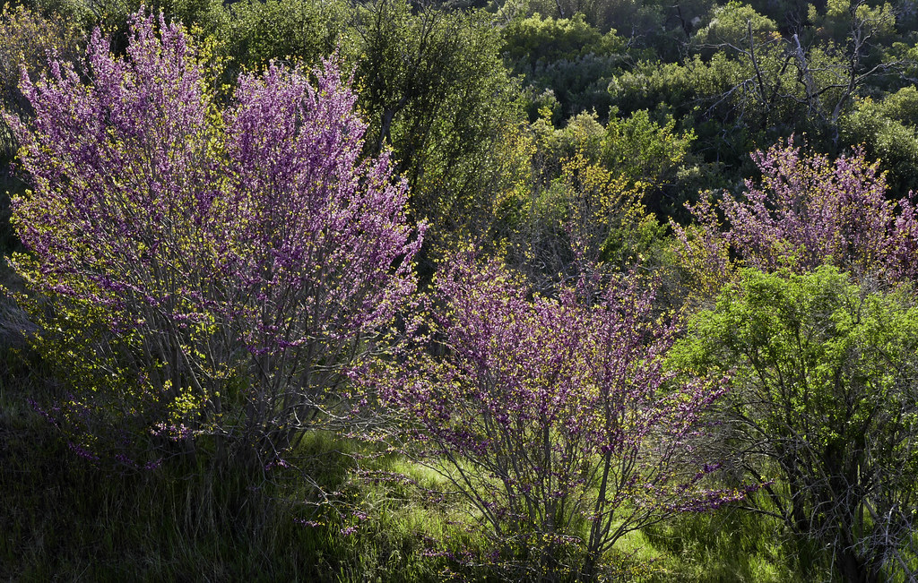 Magenta by tomteske, on Flickr Magenta by tomteske, on Flickr
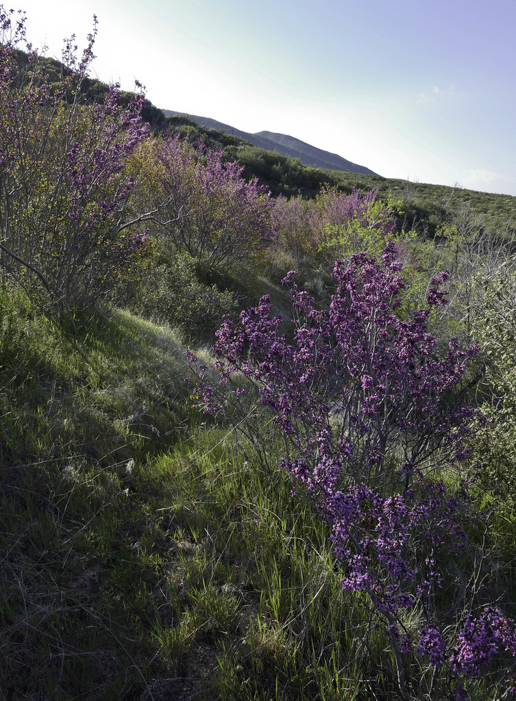 Magenta Bush by tomteske, on Flickr Magenta Bush by tomteske, on Flickr
Spent the night above a gurgling Oriflame Creek.
 Camp 1 by tomteske, on Flickr Camp 1 by tomteske, on Flickr
Never grow tired of this sound. Click to listen.
 P1020525 by tomteske, on Flickr P1020525 by tomteske, on Flickr
The next day, headed nearby to explore some old mining ruins.
The remains of an old mining shack destroyed by one of recent fires.
 Cabin Remnants by tomteske, on Flickr Cabin Remnants by tomteske, on Flickr
 Bed by tomteske, on FlickrOr Bed by tomteske, on FlickrOr
Nearby shafts.
 Mine Shaft by tomteske, on Flickr Mine Shaft by tomteske, on Flickr
 Shaft by tomteske, on Flickr Shaft by tomteske, on Flickr
Lots of bush whacking on old mining roads choked with brush and fallen trees. Gary heading through a nice meadow.
 Gary Grass by tomteske, on Flickr Gary Grass by tomteske, on Flickr
Made it to a old ranching site with an abandoned car.
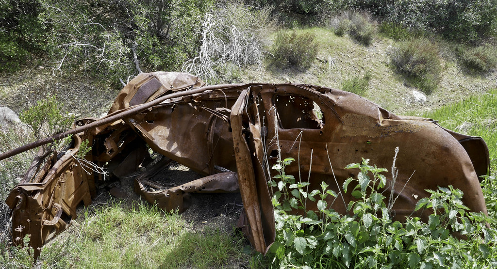 Wreck by tomteske, on Flickr Wreck by tomteske, on Flickr
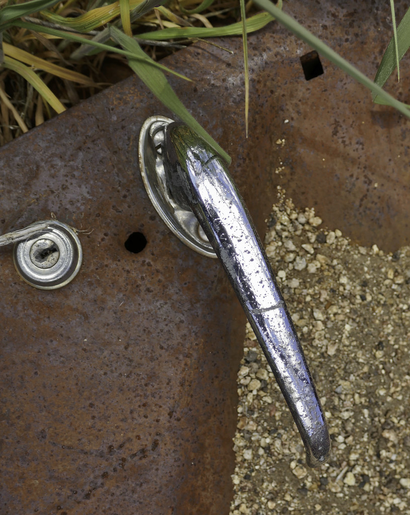 Door Handle by tomteske, on Flickr Door Handle by tomteske, on Flickr
Wandered a few feet away and stumbled onto lots of pottery and flakes and this nice green Desert Side Notch, abandoned before completion.
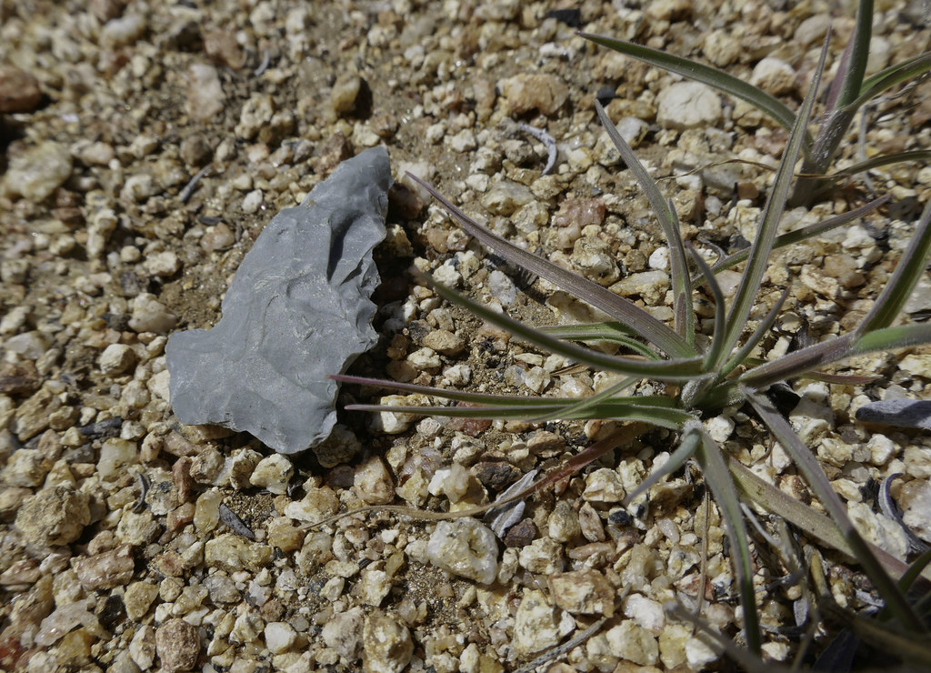 Green Point by tomteske, on Flickr Green Point by tomteske, on Flickr
 Unfinished by tomteske, on Flickr Unfinished by tomteske, on Flickr
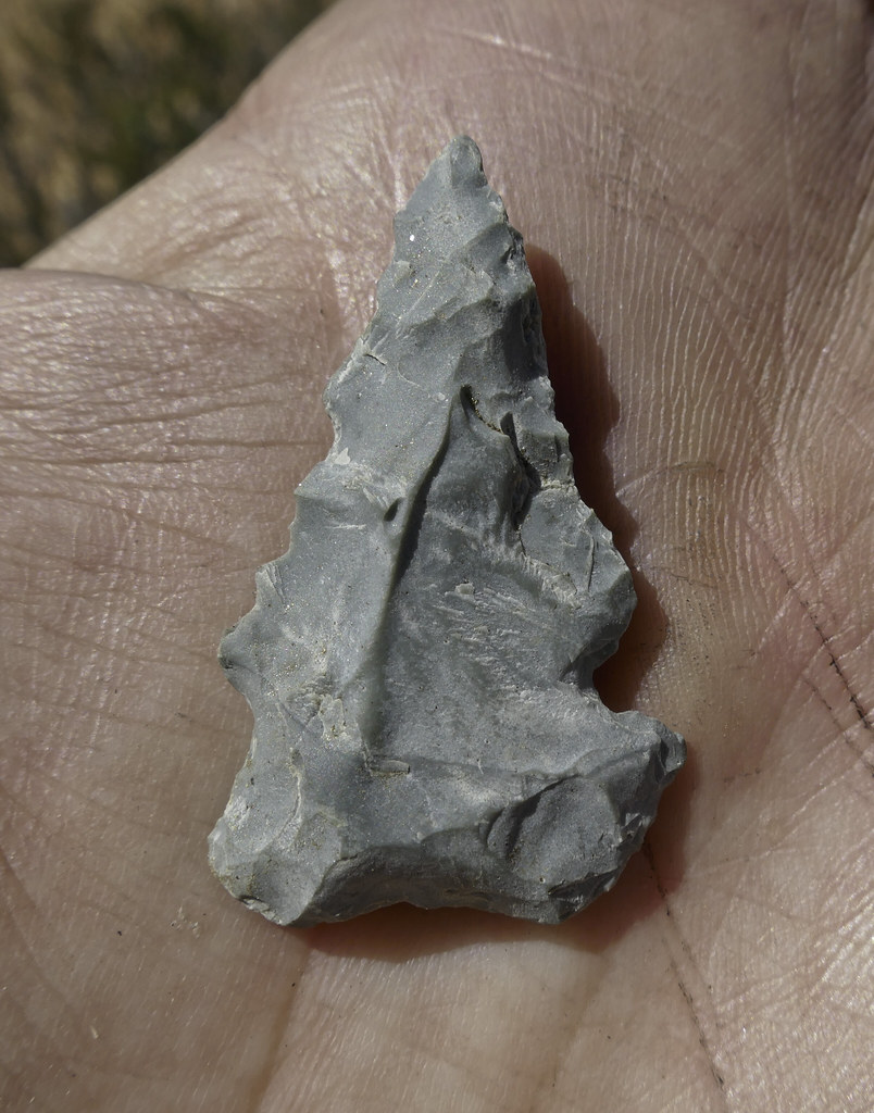
My smugness didn't last long when a little bit up the trail, Gary found an amazing Paleoindian Lanceolate point.
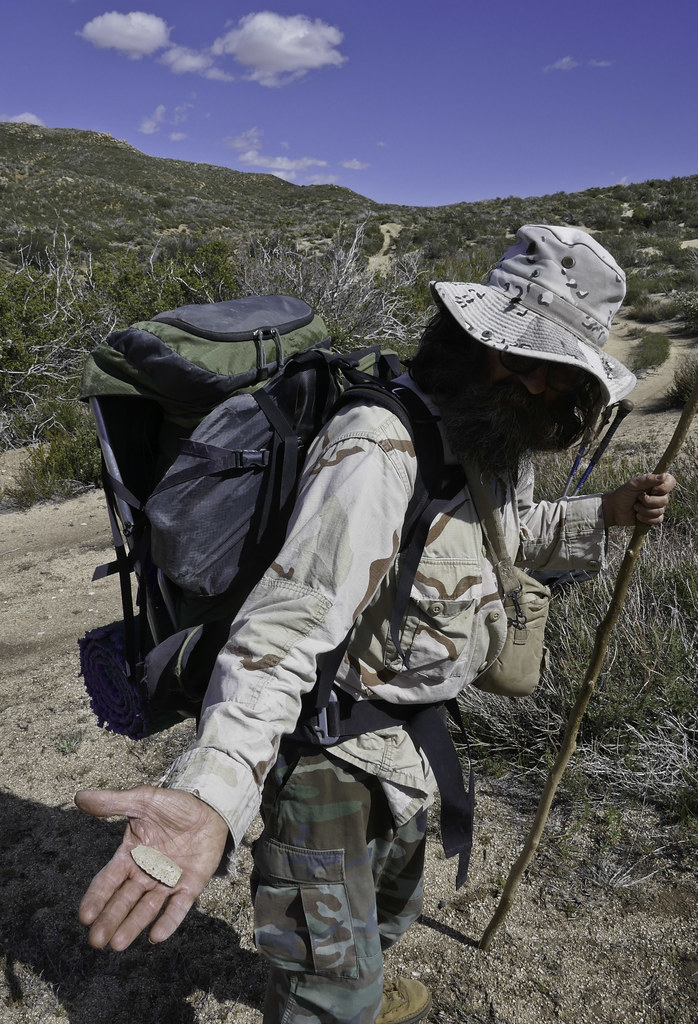 Paleo by tomteske, on Flickr Paleo by tomteske, on Flickr
Really weathered. Showed this pic to Jeff Sahagun, BLM Archaeologist, and he was quite impressed with Gary's find.
 Paleo Point by tomteske, on Flickr Paleo Point by tomteske, on Flickr
Finally made it to the top of Cottonwood Canyon. The old ranching road and now Cottonwood Hiking Trail would take us 2,000 ft to the canyon floor and our next camp next to the flowing Salt Creek.
 Cottonwood Canyon by tomteske, on Flickr Cottonwood Canyon by tomteske, on Flickr
 Tommy750 by tomteske, on Flickr Tommy750 by tomteske, on Flickr
Gary heading down.
 Lone Hiker2 by tomteske, on Flickr Lone Hiker2 by tomteske, on Flickr
Camping next the the flowing Salt Creek and serenaded by frogs all night.
 Salt Creek by tomteske, on Flickr Salt Creek by tomteske, on Flickr
On the final day, visited a rock art site Daren said was nearby. Interesting cupules with four vertical grooves.
 Pit and Groove by tomteske, on Flickr Pit and Groove by tomteske, on Flickr
Lots of old ranching and mining ruins on the valley floor. An old rock cabin partially hewn into the surrounding granite.
 Rock House by tomteske, on Flickr Rock House by tomteske, on Flickr
 Chimney by tomteske, on Flickr Chimney by tomteske, on Flickr
 Carved by tomteske, on Flickr Carved by tomteske, on Flickr
 View2 by tomteske, on Flickr View2 by tomteske, on Flickr
Looking west up Cottonwood Canyon.
 Cottonwood Canyon 2 by tomteske, on Flickr Cottonwood Canyon 2 by tomteske, on Flickr
The trip ended up being about 19 miles, 4K G/L. Multiple streams crossed and lots of green for a change.
Gary holding the cold beers he hid in Oriflame Creek for our return. Enjoy. Tom
 Three Cold Ones by tomteske, on Flickr Three Cold Ones by tomteske, on Flickr |
4/25/2017
Topic:
Oriflame to Cottonwood Canyon 3 day BP
tommy750
|
dsefcik wrote:
Nice trip Tom, wish I could have gone with you.
Yep, you would have enjoyed yourself. Didn't realize how big Cottonwood Canyon really is looking at GE. That alone would be a nice three day trip. |
4/25/2017
Topic:
Oriflame to Cottonwood Canyon 3 day BP
tommy750
|
ziphius wrote:
Great point finds too. Was this an out-an-back trip or a counter-clockwise loop going through Mason Valley eventually?
Always nice to find some artifacts especially since we were preceded by a zillion collectors and cattle hooves. We did a loop.
I'm thinking Gary's done the hide the beer in a stream thing before Great idea. |
4/26/2017
Topic:
Oriflame to Cottonwood Canyon 3 day BP
tommy750
|
rockhopper wrote:
Tommy and Gary,
Great adventure! Nice to see running water. That's a great place to find "cooler " temps when our desert heats up. Did you guys have to go thru a lot of poison oak? I am a magnet for that stuff down near the creeks. The Oriflame / Rodriguez loop is a neat one too. Nice arrow points you guys found! Gary's looks very unusual and old!!!! Material made of ?? Your green point is neat too. Obviously these ancient peoples were using what ever they could find to manufacture arrow/spear points when the ancient Lake Cahuilla covered the best local obsidian source. btw I found a green point near the coast years back. I think they used rhyolite??? or other semi chipping material.
edited by rockhopper on 4/26/2017
Very nice to see so much water. We carried 4L down into Cottonwood since we were skeptical we'd find water but ended up crossing streams multiple times and camping next to one. All those frogs going to make it through the hot summer?? We encountered some poison ivy while bushwhacking but Gary thought it was too early in the season to cause much reaction. Didn't have any problems fortunately. Gary's point was pretty neat and had to be in the thousands of years old and looked the part. Not really sure what it was made of but doesn't really look like stuff from around here. |
4/27/2017
Topic:
Oriflame to Cottonwood Canyon 3 day BP
tommy750
|
Andy wrote:
What a great trip with the bonus of water. Does anyone know if a hike down Cottonwood Canyon from the PCT/ Sunrise HWY is feasible?
Very feasible. The "trail" is a dirt road starting at Sunrise Hwy you can follow all the way down. Somewhere in the middle of your descent, there's going to be an area where the road is heavily channelized but you can just walk on either side. Should be about 3K elevation loss if you go all the way out to S2.
I think Schad mentions a hike down Cottonwood Canyon and is referring to a cross country route to the south down what the topo map labels as "Cottonwood Canyon."
edited by tommy750 on 4/27/2017 |
4/27/2017
Topic:
Ole Red... well a younger one
tommy750
|
Great pic. |
4/27/2017
Topic:
Oriflame to Cottonwood Canyon 3 day BP
tommy750
|
ziphius wrote:
Tommy, your magenta trees are Western Redbud! Very cool.
Awesome! Knew one of you would know what this was. Was a lovely color splash only along the banks of upper Oriflame Creek. Thanks, Ziphius! |
5/2/2017
Topic:
Oriflame to Cottonwood Canyon 3 day BP
tommy750
|
Britain wrote:
Did you stay in Oriflame all the way to Cottonwood? I've over nighted near the top of Oriflame but never went into Conttonwood. Really nice pack!
We climbed out of Oriflame Canyon and ended up near BM Roost but then later rejoined Oriflame till we got to the road into Cottonwood. Looks like there would be a great view from the top of Oriflame Mt.
The pack is a Zpack Arc Zip and I really like it. The cuben fiber is a bit delicate for the desert but is still holding up fairly well.
http://www.zpacks.com/backpacks/arc_zip.shtml |
5/2/2017
Topic:
Oriflame to Cottonwood Canyon 3 day BP
tommy750
|
Britain wrote:
Can you post tracks or a map? In 1980"s I hiked up with the kids. It was really over grown and difficult along the creek. I would like to give it a try in the future but don't want to end up being in a jungle. Almost like starting at the top of the Mason trail and going down. Haha in 2006 I lost a spare tire on my jeep on the Mason trail, the carrier broke loose and the tire went all the way down to the creek. Was a task getting the tire back.
We had the benefit of a previous fire that appeared to have been about 5-10 years ago but not sure which one. Initially walking on game trails by Oriflame Creek was working okay but it started to get pretty dense and we drifted up the south side of the canyon. This is a rough outline of our trip.
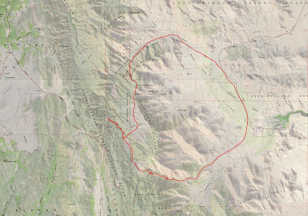 Oriflame Cottonwood by tomteske, on Flickr Oriflame Cottonwood by tomteske, on Flickr
Really nice pack!
Was a tad presumptuous thinking you were referring to MY pack. Gary's pack is probably from the Civil War |
5/3/2017
Topic:
Oriflame to Cottonwood Canyon 3 day BP
tommy750
|
Britain wrote:
I think the fire was in 2006 or 7. I hiked the area on top of Mason once the brush was taken out by the fire.
As best I can figure from the internet, the Oriflame area was burned out by the 2002 Pines Fire. A little of the descent into Cottonwood got hit by the 2013 Chariot Fire. Cause of the Pines Fire is kinda interesting: http://www.fire.ca.gov/cdf/incidents/Pines%20Fire_73/news_files/34_Causerelease.pdf Think it was some sort of drug interdiction mission looking for pot farms. |
5/4/2017
Topic:
Oriflame to Cottonwood Canyon 3 day BP
tommy750
|
Britain wrote:
Your probably right on the year. The brush was fairly cleared off in 2006
Daren pointed me to caltopo.com some years ago and they have a nice fire history overlay that is a lot easier to use than searching calfire's site (fire.ca.gov). Took me a while to figure out the Pines fire since it was so large a burn you have to zoom out to see the name.
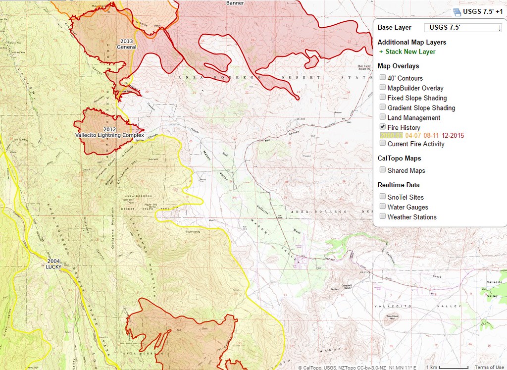 caltopo by tomteske, on Flickr caltopo by tomteske, on Flickr
Regarding private property boundaries, the whole north end of Cottonwood is pretty much private property. Caltopo has an overlay for that as well but it didn't correlate exactly with what Gary and I saw on the ground. Use your best judgment I guess.
Nice radio find. Tom |
5/7/2017
Topic:
Your Go To AB Book?
tommy750
|
Would definitely consider these four books in addition to what everyone else has mentioned. Regarding GE and caltopo, caltopo has a lot of features that are very helpful but you can pan/tilt/zoom or revert to prior satellite imaging on GE and that come in very handy at times. Love them both.
 delfina by tomteske, on Flickr delfina by tomteske, on Flickr
 strangers by tomteske, on Flickr strangers by tomteske, on Flickr
 all the wild by tomteske, on Flickr all the wild by tomteske, on Flickr
 Cover-HistoricBackcountryWe by tomteske, on Flickr Cover-HistoricBackcountryWe by tomteske, on Flickr |
5/12/2017
Topic:
Your Go To AB Book?
tommy750
|
Bought a signed (yeah, that's how I roll ) copy of Wray's book at the Desert View Tower a few years ago. Just called over there and they say they're sold out and can't get Chris to get them any more. Anyone know how the third edition differs from the prior one?? |
5/12/2017
Topic:
Your Go To AB Book?
tommy750
|
dsefcik wrote:
tommy750 wrote:
Bought a signed (yeah, that's how I roll ) copy of Wray's book at the Desert View Tower a few years ago. Just called over there and they say they're sold out and can't get Chris to get them any more. Anyone know how the third edition differs from the prior one?? What I remember was he updated some photos, added more GPS coordinates and I think he added more places/info...but I had that conversation over a year ago with him. When you order direct he will sign the book by name to you if you ask...8-)
Thanks for the update, Daren. Have to admit that book is a favorite and always refer to it with trip planning. |
5/13/2017
Topic:
Pinto Wash Petroglyphs
tommy750
|
Rocko1 wrote:
Is it considered safe to hike this area?
Guess it all depends on one's level of risk aversion. Have yet to see a single person on any hike I've done in Davies Valley/Pinto Canyon including BP. Have bumped into BP in Boulder and Myer Creek a lot. Suspect most of the cross border traffic occurs at night and that's my reason I've only day hiked there or anywhere south of I-8. Been wanting to head out there again for years but just haven't got around to it. |