|
tommy750 Posts: 1040
2/17/2021
|
Daren and Gary recently floated the idea of a 3-4 day trip to the crest of the Santa Rosas searching for the lost "Cave of The Seven Ollas," yet another magnificent tale, er, historical reality based on multiple anecdotal accounts. Using snow as a water source, a new area of interest would be searched and hopefully the mysterious cave relocated. In order to accommodate Randy and myself, the trip was delayed one relatively warm week with live satellite images showing a rapidly shrinking snow cover. As a warm up hike, Daren, his Marine buddy Yokes and I headed out to Canebrake for the weekend and descended the now literally Pepperwood Hiking and Dirt Bike Trail. Daren and Yokes decked out in camo spooked one group of riders but more were coming.
The faded picto panels in Pepperwood Canyon.
 Pepperwood Picto2 by tomteske, on Flickr Pepperwood Picto2 by tomteske, on Flickr
 Pepperwood Picto by tomteske, on Flickr Pepperwood Picto by tomteske, on Flickr
Daren and Yokes checking out a potential water source.
 Canebrake by tomteske, on Flickr Canebrake by tomteske, on Flickr
A nice incised pottery sherd and two Cottonwood points at a site overlooking the valley we all explored.
 IMG_5909 by tomteske, on Flickr IMG_5909 by tomteske, on Flickr
 IMG_5911 by tomteske, on Flickr IMG_5911 by tomteske, on Flickr
Another bunny.
 IMG_5907 by tomteske, on Flickr IMG_5907 by tomteske, on Flickr
Camped near an old spring and "trough" but the spring was only a wet spot even after the recent rains.
 IMG_5923 by tomteske, on Flickr IMG_5923 by tomteske, on Flickr
 IMG_5924 by tomteske, on Flickr IMG_5924 by tomteske, on Flickr
Marker pole on a hill overlooking the valley.
 IMG_5928 by tomteske, on Flickr IMG_5928 by tomteske, on Flickr
Had to filter water on the way out at Pepperwood Spring. That's Daren searching for the chlorine tabs to blunt the rich organic taste.
 IMG_5936 by tomteske, on Flickr IMG_5936 by tomteske, on Flickr
During the night, a kitty must have ascended the same trail we used. My boot for scale.
 IMG_5937 by tomteske, on Flickr IMG_5937 by tomteske, on Flickr
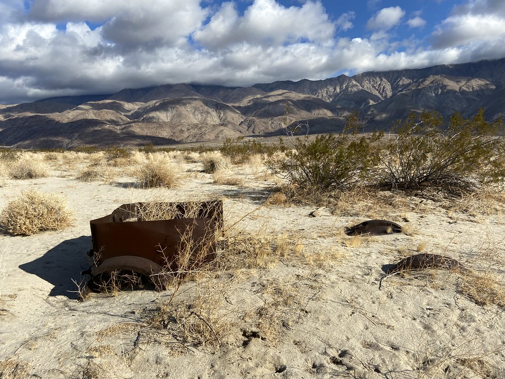
We met up the next weekend for the Santa Rosas hike. Parked our vehicles at the base of Coyote Mt. Was winding and rainy at the start but ended up a nice day. Old vehicles at an old homestead.
 IMG_5960 by tomteske, on Flickr IMG_5960 by tomteske, on Flickr
 IMG_5964 by tomteske, on Flickr IMG_5964 by tomteske, on Flickr
Nice view with about 2K left to climb.
 IMG_5969 by tomteske, on Flickr IMG_5969 by tomteske, on Flickr
Interesting village site with lots of rock circles and pottery sherds.
 IMG_5973 by tomteske, on Flickr IMG_5973 by tomteske, on Flickr
Painted sherds are always nice to find. These were actually painted on the inside and outside.
 Painted Sherd by tomteske, on Flickr Painted Sherd by tomteske, on Flickr
 Painted Rim Sherd1 by tomteske, on Flickr Painted Rim Sherd1 by tomteske, on Flickr
We made it to the ridge about half way between Dawns and Rabbit a little after 5 pm, a 5K climb from Clark Lake. Gary and Randy decided to camp lower down. Nice cool evening with great views of all the glimmering lights from the night sky and Ocotillo Wells...
The next morning before I got up, Daren search high and low for snow and found a tiny patch in about three miles of hiking. Since I was the lowest on water, I dutifully boiled it, filtered out the dirt and twigs and had yet another refreshing naturally flavored liter on the way down (tasted like Negroni if that's something you have tucked away in your liquor cabinet).
 IMG_5989 by tomteske, on Flickr IMG_5989 by tomteske, on Flickr
About 18 miles, 5300 ft g/l and maybe ten mylars. Enjoy!
 Santa Rosas From Clark by tomteske, on Flickr Santa Rosas From Clark by tomteske, on Flickr
|
|
|
+2
link
|
|
ziphius Posts: 911
2/17/2021
|
Good-looking trips Tommy. Nice lion track, looks like a right hind. That painted pottery shard is really nice. I've been regaled with the story of the Cave of The Seven Ollas by Gary while counting sheep with him. Hope you guys find it one day and never tell a soul. That's a lot of camo!
--
http://www.coyotelearning.org
|
|
|
link
|
|
Brian Posts: 221
2/17/2021
|
Is the Pepperwood Hiking and Dirt Bike Trail the one that starts in Cottonwood Campground? I haven't hiked it in years, but I remember it being too steep and slippery for a bike. Is it an official route for bikes now or was the group using it illegally?
|
|
|
link
|
|
tekewin Posts: 365
2/17/2021
|
That was quite a hike up to the ridge! I'm not familiar the Cave story, will Google.
Very impressive painted pottery shard. I'm usually not looking for them when I'm out, but should be. I can't imagine how hard it must have been to live on this land.
|
|
|
link
|
|
tommy750 Posts: 1040
2/17/2021
|
ziphius wrote:
Good-looking trips Tommy. Nice lion track, looks like a right hind. That painted pottery shard is really nice. I've been regaled with the story of the Cave of The Seven Ollas by Gary while counting sheep with him. Hope you guys find it one day and never tell a soul. That's a lot of camo!
I have about a dozen possible points on GE for the cave AKA CSO scattered all over the Santa Rosas, many provided by others. Gary sends out an article every once in a while and I try to make sense of it but every account is very different. Still fun searching.
Yeah, lots of camo these days. Gary, Randy, Daren and Yokes. I'm still trying to stick with solids 
|
|
|
link
|
|
tommy750 Posts: 1040
2/17/2021
|
Brian wrote:
Is the Pepperwood Hiking and Dirt Bike Trail the one that starts in Cottonwood Campground? I haven't hiked it in years, but I remember it being too steep and slippery for a bike. Is it an official route for bikes now or was the group using it illegally?
The Pepperwood trail is off limits to motorcycles but I have seen occasional tracks over the past five years. The last hike out was the worst. Someone even seems to be trimming the brush to widen the trail. I usually start at the end of McCain Valley Rd and drift NE to the start but you can easily get there from the campground.
|
|
|
link
|
|
tommy750 Posts: 1040
2/17/2021
|
tekewin wrote:
That was quite a hike up to the ridge! I'm not familiar the Cave story, will Google.
Very impressive painted pottery shard. I'm usually not looking for them when I'm out, but should be. I can't imagine how hard it must have been to live on this land.
Was definitely a good climb up there. Rarely find painted pottery and even less common to see the incised ones but definitely a neat find.
|
|
|
link
|
|
Rocko1 Posts: 588
2/17/2021
|
Fantastic finds! One question Tommy, how was the accent in the Santa Rosas(especially the last stretch to the saddle)? Was there much rock scrambling?
|
|
|
link
|
|
Buford Posts: 453
2/17/2021
|
Excellent stone points!
I too have heard Gary explain his quest to find the cave with the ollas.
That is tough work hauling overnight gear up to the Santa Rosa ridgeline. I am surprised there was any snow still up there on the dates of your trip. A couple days before your trip I was on the ridgeline and there was very little snow even above 6k. We also started at the base of Coyote Mountain but took different routes than your map.
--
Links to my photos: ABDSP photos, Bighorn sheep photos, ABDSP time lapse video, Wildlife photos (mainly birds)
|
|
|
link
|
|
tommy750 Posts: 1040
2/17/2021
|
Rocko1 wrote:
Fantastic finds! One question Tommy, how was the accent in the Santa Rosas(especially the last stretch to the saddle)? Was there much rock scrambling?
There was a little slip and slide from some sandy areas near the top but not too bad and nothing over Class 2. On occasion, you could imagine an old trail and there was pottery scattered all the way to the top.
|
|
|
+1
link
|
|
tommy750 Posts: 1040
2/17/2021
|
Buford wrote:
Excellent stone points!
I too have heard Gary explain his quest to find the cave with the ollas.
That is tough work hauling overnight gear up to the Santa Rosa ridgeline. I am surprised there was any snow still up there on the dates of your trip. A couple days before your trip I was on the ridgeline and there was very little snow even above 6k. We also started at the base of Coyote Mountain but took different routes than your map.
Yeah, carrying the extra 25-30-ish lbs to the top does add to the "fun." Buford, you brought water for the entire trip or used snow?
|
|
|
link
|
|
Buford Posts: 453
2/17/2021
|
@Tommy750 Carried all water required since it was a day hike. The search for the cave sounds like a good adventure even if it is a myth.
@Rocko1 The ridges to the main Santa Rosa crest from Clark Dry Lake area are brutally steep and can be loose but the ones I’ve tried stay class 2-3. Tommy750’s route looks as good or better than any other I’ve found online or tried myself. Depends on where you want to go once up on the crest.
--
Links to my photos: ABDSP photos, Bighorn sheep photos, ABDSP time lapse video, Wildlife photos (mainly birds)
|
|
|
+1
link
|
|
rockhopper Posts: 668
2/18/2021
|
Excellent expeditions! The painted pottery and stone points are just fantastic. The early peoples used that saddle as a trail pass! How high up was the stone circle / sleeping camp? Probably a temporary camp while traversing from either side of the Santa Rosas. Just amazing. Great trips!
Regarding the Cave of Seven Ollas. I remember reading in Lester Reeds book ( trying to find the quotes) about a cave with a group of ollas left by the old timers because it was too far away from the cattle camps. Good luck with your search!
edited by rockhopper on 2/18/2021
|
|
|
+1
link
|
|
Rocko1 Posts: 588
2/18/2021
|
Buford wrote:
@Tommy750 Carried all water required since it was a day hike. The search for the cave sounds like a good adventure even if it is a myth.
@Rocko1 The ridges to the main Santa Rosa crest from Clark Dry Lake area are brutally steep and can be loose but the ones I’ve tried stay class 2-3. Tommy750’s route looks as good or better than any other I’ve found online or tried myself. Depends on where you want to go once up on the crest.
Thanks. I looked at it on GE and this route does seem the best as far as steepness goes. Would you know how this or your routes compares to the old native route up towards Martinez Canyon out of Rockhouse Canyon?
Tommy, how far from the saddle did you camp? Looked like a couple of nice flat areas for that in the pics.
edited by Rocko1 on 2/18/2021
|
|
|
link
|
|
tommy750 Posts: 1040
2/18/2021
|
Rocko1 wrote:
Tommy, how far from the saddle did you camp? Looked like a couple of nice flat areas for that in the pics.
You can see where we camped on the gps route. It was right at the cliff edge on the west side of the ridge since the winds were howling on the east side.
|
|
|
+1
link
|
|
dsefcik Administrator Posts: 2609
3/7/2021
|
Nice pics Tom..! That Rosa trip was super,super windy...felt good to get out and hike and backpack again. Had there been snow for water I am certain we would have found the 7 ollas..!!
--
http://www.sefcik.com
http://www.darensefcik.com
http://www.carrizogorge.com
|
|
|
link
|