Talk about a trip you took out to Anza Borrego
N/E ABDSP Part II
|
rockhopper Posts: 668
12/30/2013
|
Hard to believe this was two weeks ago. But I made time between Family to up load more pics.
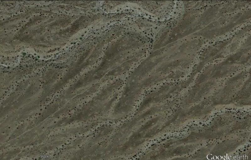
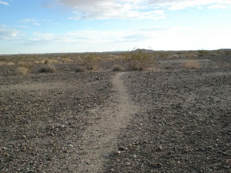
As before I was hiking around and near the ancient Lake Cahuilla shore line.
This was not a meteor crater !
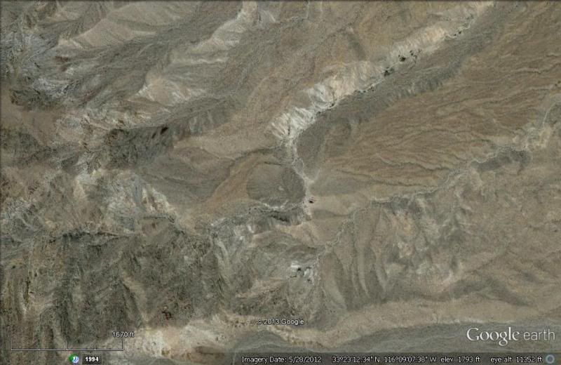
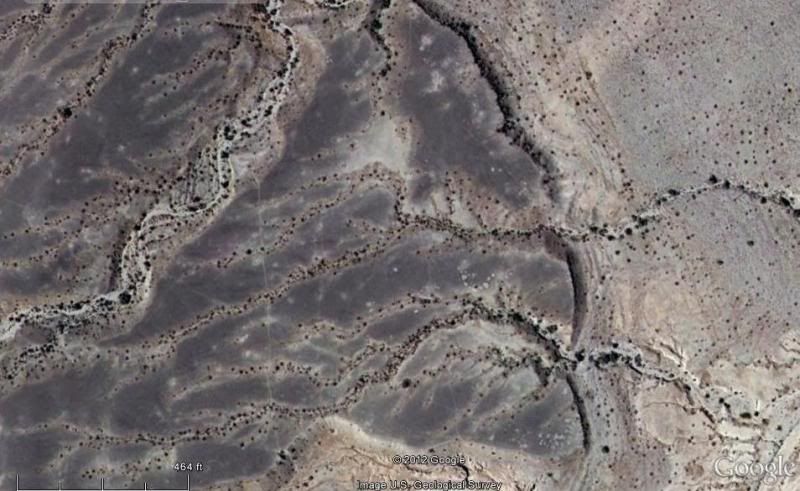
But, I followed a neat old trail to get there. G.Earth photo from about 1500 ft. up
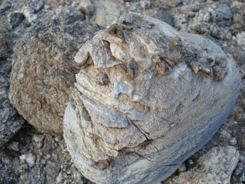
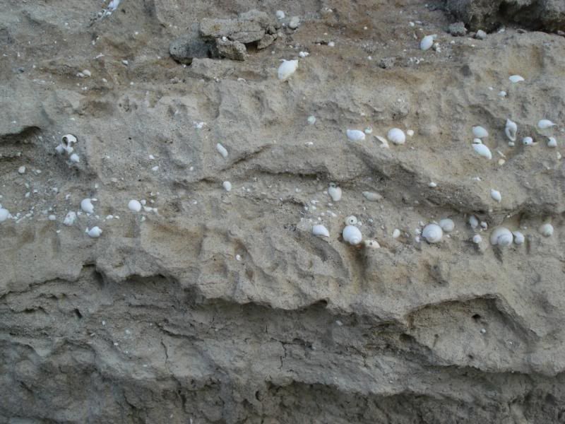
Slightly above the ancient shore line. Sea shell fossils from the much older Imperial Sea. 5MYA
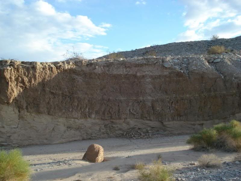
Slightly below the recent high water mark of the Ancient Lake Cahuilla. It's last full fill at around 600 years ago.
Smaller shells in silty shore sand.
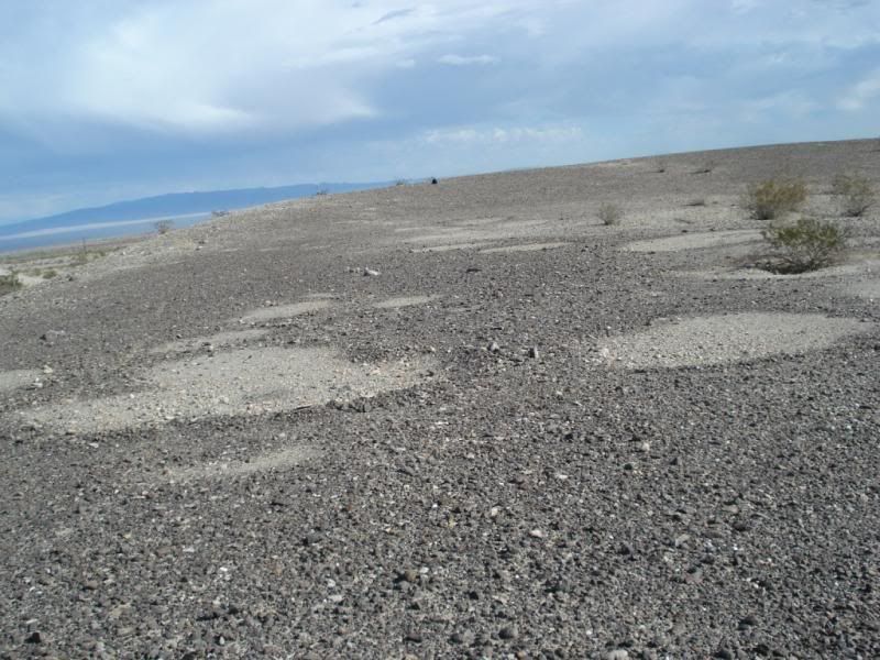
More sleeping circles near the shore line of Lake Cahuilla
View from G.Earth about 10,000 ft up
Evidence of uplifting going on the flat lake bed
The Main trail was about 100 yds from the edge of the lake. There were multiple trails. Hard to imagine but, the old shore line was a whopping 250 miles long! Only a tiny percentage of this trail remains
Did a big loop and came out through a lower wash and found
Futher back down found this in the sand wash
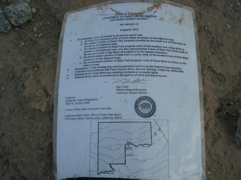
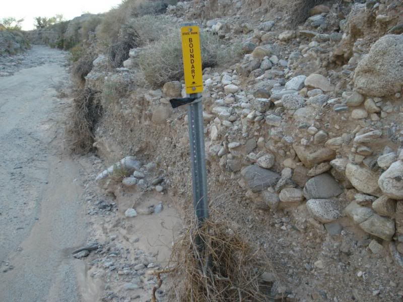
Yikes! This area is closed to all???
I can see banning 4x4, ATV, dirtbikes. (There has been some 4x4 and motorcycle damage to the fragile desert patina in some areas) but to hikers??
edited by rockhopper on 12/30/2013
edited by rockhopper on 12/30/2013
|
|
|
link
|
|
ziphius Posts: 911
12/30/2013
|
Pretty cool stuff rockhopper, it must be fun to get onto one of those trails and just follow it for however long you can. So... what is the mystery spot if it isn't a meteor crater? I looked at the same spot on the 7.5 topo maps and it looks like a big ice cream scoop of a hole.  Also found a few extremely straight trails out that way through the varnish, great way to scout for interesting trails. Any chance of a zoomed in photo of the closed area map? Also found a few extremely straight trails out that way through the varnish, great way to scout for interesting trails. Any chance of a zoomed in photo of the closed area map?
edited by ziphius on 12/30/2013
--
http://www.coyotelearning.org
|
|
|
link
|
|
rockhopper Posts: 668
12/31/2013
|
Jim,
The 5th photo up showing the ancient shore line was part of the closed area. You can see the sleeping circles and ancient trail on the photo. I had no idea the area was recently closed until hiking out. Again, I could see closing to ATV's etc. But to hikers????
The "Looks like meteor crater" on G. Earth was really a landslide. I stood in the center of it . It was about 1000ft across and about 200 feet deep and was a bowl on three sides. I followed an old trail up to that area. . Beyond where I stopped it looked like some extreme canyon climbing. Hard to imagine the Early Americans going back in there. But the most likley did!! Kinda like a Auga Alta canyon on seriods. It was about a 13 mile round trip hike. About half of the hike was on the old native trail ( 9th photo up) on the desert varnish with pot sherds and burial mounds along the way.
edited by rockhopper on 12/31/2013
|
|
|
link
|
|
dsefcik Administrator Posts: 2609
1/2/2014
|
Looks like a good trip, I still was not able to find it on the maps though....thanks for sharing...
--
http://www.sefcik.com
http://www.darensefcik.com
http://www.carrizogorge.com
|
|
|
link
|