|
hikerdmb Posts: 423
1/23/2011
|
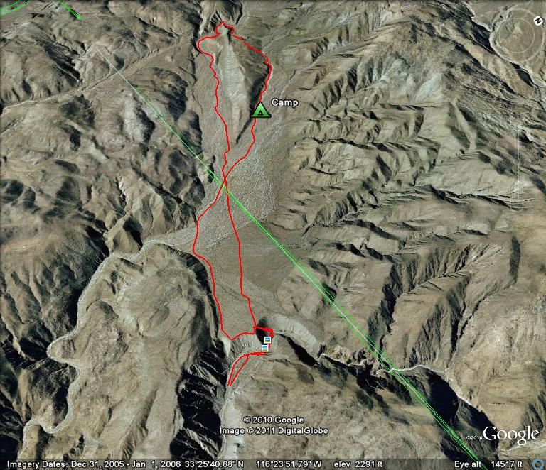
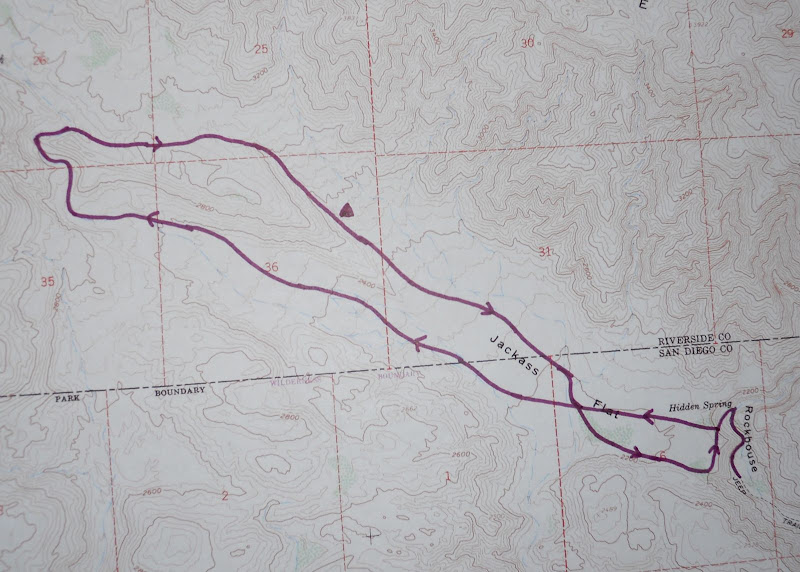
School was closed on Friday so I set out for a quick overnight trip in the northern part of ABDSP. Here is the Google Earth picture of the route I took on this two day trip. It was about a 9 to 10 mile hike through some beautiful and not often visited section of the desert.
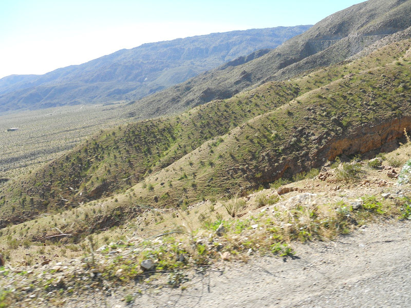
It was a beautiful drive out to the desert even with no top on the DesertTJ. The hills around Borrego Springs are starting to show lots of green grass. The air so so calm and clear that the Salton Sea was very visible to the east.

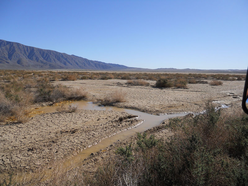
The plan was to make my way back up past Clark Dry Lake, I had been up there two weeks ago to find the petroglyphs. There was still a little water here.
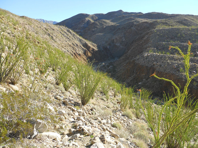
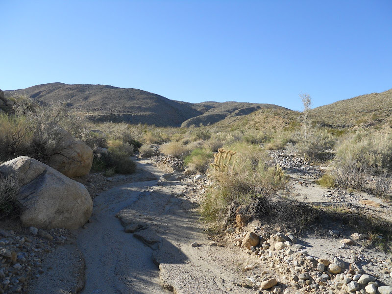
This time though I drove to the end of Rockhouse Canyon. Loaded my pack and headed up the canyon to Hidden Spring. The spring was dry, no standing water like last time I was here. Just down canyon from the spring I picked up the old Indian trail that led up the canyon wall to Jackass Flat, the site of an old Indian village. If you look close you can see the trail running diagonally down into Rockhouse Canyon. That is the Santa Rosa Mountains in the background on the left.
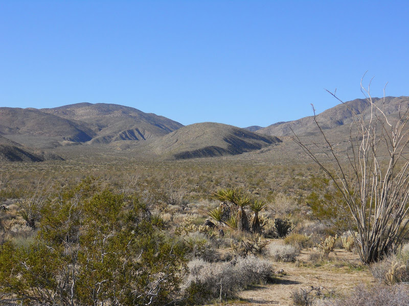
Once to the top of the ridge and on Jackass Flat I made a direct line northwest across the flat toward a large hill that comes down into the flat. After a mile or so I entered Dry Wash and proceeded up this was toward a twisty canyon. The hill is in the middle of this photo looking across the flat. I hiked up the wash to the left of this hill, around the backside, and then returned down the canyon/wash on the right.
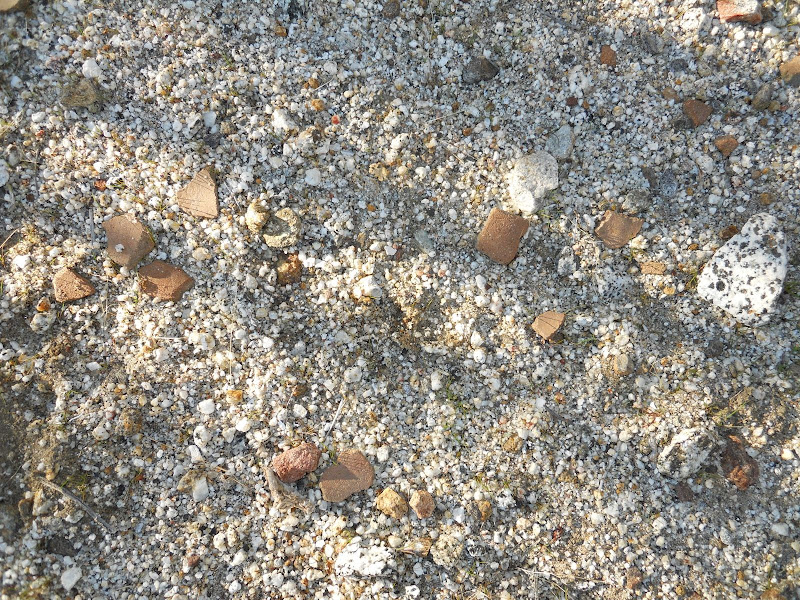
I saw a few morteros and some pottery pieces as I crossed the flat in this direction. The weather was perfect, nice and warm and no wind. I made my way up the wash and into the canyon. Along the way I spotted lots of mountain lion scat and tracks, as well as coyote tracks, sheep and/or deer tracks, but not a single boot print. There were also lots of Pinyon Pine cones scattered along the wash but I could not see a Pinyon tree anywhere. They must have traveled a long way to end up here. This is probably one of the most unvisited places I have been in the park,although part of this hike was out of the park boundary.
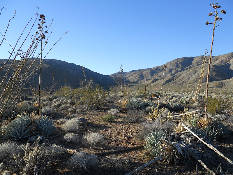
Once I got through the canyon I left the wash and headed up to the top of the ridge. The view from up here was amazing. Looking farther up into Dry Wash was very interesting and I would love to go back and check out this area. On this part of the hike the ground was very rocky and there was lots of cholla. I had originally planned to camp in this area but decided I would continue on down the next canyon/wash to a lower elevation and a better camp site. I also found a few pieces of pottery in this part of the hike. Here is the view up into the upper part of Dry Wash from my high point of the hike.
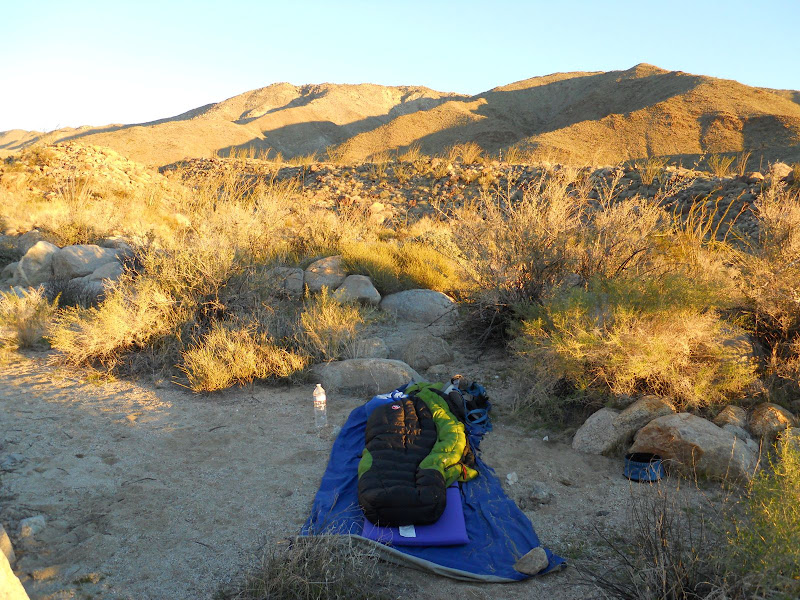
As I descended the canyon/wash, un-named on my map, I again spotted lots of wildlife tracks so I continued on until the canyon opened up a bit and I could find a spot to set up camp out of the wash. After about a mile or so going down the wash I found a great place to set up my camp. The day ended with calm winds and clear skies and then the moon came up and lit up the desert. Here is my camp with Buck Ridge behind. This ridge runs along the north side of Jackass Flat. Rockhouse Valley, with the three rock house ruins, is on the north side of this ridge.
I got an early start on Saturday morning and hiked down the wash until I met back up with Dry Wash. Then I followed this wash past the entrance to Butler Canyon and over to the other side of Jackass Flat. In this part of the hike I passed several areas like this with pottery pieces scattered all over the ground.
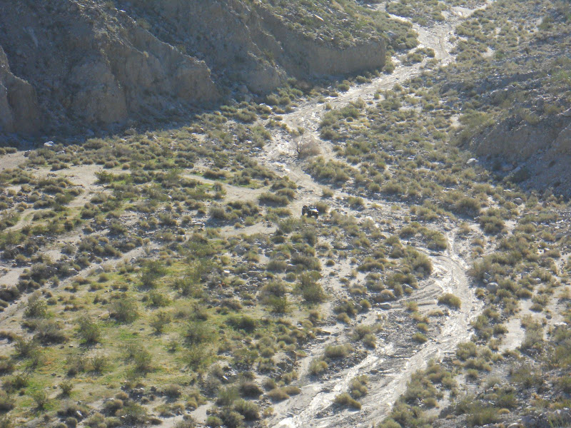
I could see the Desert TJ down there waiting for me when I reached the edge. I then traversed along the edge of the flat where it looks down on Rockhouse Canyon until I got back to the top of the old Indian trail down into the canyon.
Here is the map of my route.
It was a great hike with perfect weather. Can't wait to go out again.
|
|
|
link
|
|
dsefcik Administrator Posts: 2609
1/23/2011
|
Looks pretty sweet David, I almost went out again this weekend but decided to stay home and hang out with the kids and the dog instead. Next weekend should be close to a new moon and I was thinking of either backpacking out to Innner Pasture or up Sunset Mtn via Sunset wash...are you interested in going out next weekend?
BTW, looks like you are starting to get into the GE thing...looks good.
--
http://www.sefcik.com
http://www.darensefcik.com
http://www.carrizogorge.com
|
|
|
link
|
|
dsefcik Administrator Posts: 2609
1/24/2011
|
Another good trip would be to start at the same place you did and hike out thru RHC and when you get out to the valley cut east and circle back towards corps 395 and then up to the road. A two car setup might make this easier but both would need to be able to reach the trail head of hidden springs to avoid hiking another 3 miles up the wash.
--
--
http://www.sefcik.com
http://www.darensefcik.com
http://www.carrizogorge.com
|
|
|
link
|
|
surfponto Administrator Posts: 1362
1/24/2011
|
Hey David,
All the greenery makes me think that it will be a great wildflower season this year.
I have to start freeing up some weekends.
Been dying to get back out there.
Great post,
Bob
--
https://www.anzaborrego.net/


|
|
|
link
|
|
hikerdmb Posts: 423
1/24/2011
|
I just can't believe the weather out there the last few times out. It has been a great January with so little wind and all that early rain has lasted. I hope it rains again soon to keep things growing. I don't know about this weekend yet.
David
|
|
|
link
|
|
dsefcik Administrator Posts: 2609
1/25/2011
|
Hey David, do you think my bigass truck would make it out to the trail head at hidden springs?
--
http://www.sefcik.com
http://www.darensefcik.com
http://www.carrizogorge.com
|
|
|
link
|
|
hikerdmb Posts: 423
1/25/2011
|
Daren,
The last three miles are rocky and there are 3 or 4 spots that are narrow with boulders on each side of the road. I would not try to take my truck out there and it is a short bed version of your truck. The rocks are not bad but the road just gets really thin and the rocks are probably too big to put your tires on unless you have a big lift. Even in my jeep it took me half an hour to drive that last part and the whole time I was thinking I could walk some of it faster than I was crawling. I did take my old Dodge out there but that was a much smaller truck. I think you could get a mile or so up into the canyon before you came to a possible blocking point. You could always go until you can't and stop. There were plenty of places to park and turn around. Also I think Bob took is Land Cruiser up there maybe he can let you know how it did since it is wider and longer than my TJ.
David
|
|
|
link
|
|
surfponto Administrator Posts: 1362
1/25/2011
|
True we did manage to get the big Landcruiser wagon up there. Pretty slow going as David said.
Main concern would be the rocks on the side of the trail that are just waiting to dent in your quarter panels...
That being said, I think if you went really slow you could do it.
Bob
hikerdmb wrote:
Daren,
The last three miles are rocky and there are 3 or 4 spots that are narrow with boulders on each side of the road. I would not try to take my truck out there and it is a short bed version of your truck. The rocks are not bad but the road just gets really thin and the rocks are probably too big to put your tires on unless you have a big lift. Even in my jeep it took me half an hour to drive that last part and the whole time I was thinking I could walk some of it faster than I was crawling. I did take my old Dodge out there but that was a much smaller truck. I think you could get a mile or so up into the canyon before you came to a possible blocking point. You could always go until you can't and stop. There were plenty of places to park and turn around. Also I think Bob took is Land Cruiser up there maybe he can let you know how it did since it is wider and longer than my TJ.
David
--
https://www.anzaborrego.net/
|
|
|
link
|
|
dsefcik Administrator Posts: 2609
1/25/2011
|
Sweet, thanks for the info guys..the trail descriptions you give seem to reflect other info I have found on the Internet. Since I have pretty much already ruined the paint and dented up the right rear quarter panel from trips with Bob when he said "you can make it, no problem" I would be willing to drive out and try...I can always stop if it gets too sketchy. I think I tend to worry more about deep sand & mud, I really don't want to try and dig out my 4-1/2 ton truck.
--
http://www.sefcik.com
http://www.darensefcik.com
http://www.carrizogorge.com
|
|
|
link
|
|
dsefcik Administrator Posts: 2609
1/25/2011
|
Hey David, did you actually use a gps to record your tracks or did you just sketch in freehand the google earth tracks? Also, looks like Wiley made it out with you again..nice..
--
http://www.sefcik.com
http://www.darensefcik.com
http://www.carrizogorge.com
|
|
|
link
|
|
surfponto Administrator Posts: 1362
1/25/2011
|
Hey that's what a 4x4 is for. 
Your truck is awesome. Lots of potential for the perfect Borrego camper.
Plus its' a diesel
dsefcik wrote:
Hey David, did you actually use a gps to record your tracks or did you just sketch in freehand the google earth tracks? Also, looks like Wiley made it out with you again..nice..
--
https://www.anzaborrego.net/
|
|
|
link
|
|
hikerdmb Posts: 423
1/25/2011
|
Daren,
I don't have a GPS. I am a map and compass guy, plus I have an altimeter on my watch. Didn't really need that for this trip but it really comes in handy in the mountains when there is no trail. I just sketched in the trail on GE as close to where I went as possible. It is pretty accurate but not totally perfect. There were a lot of washes out there that split and rejoined again and again. Yeah Wylie went along. It was kind of hot on the way up the wash on Saturday afternoon so I even carried his pack for a few miles. So I guess it wasn't a completely solo trip.
David
|
|
|
link
|
|
dsefcik Administrator Posts: 2609
1/25/2011
|
A friend of mine wants to do a 3 day trip in March and I am thinking some variation of rockhouse valley so I will probably be driving up it then as long as the weather doesn't wash it out again.
Thanks guys!!
--
http://www.sefcik.com
http://www.darensefcik.com
http://www.carrizogorge.com
|
|
|
link
|