Talk about a trip you took out to Anza Borrego
Backpacking through Jackass Flat and Dry Wash
|
hikerdmb Posts: 423
1/23/2011
|
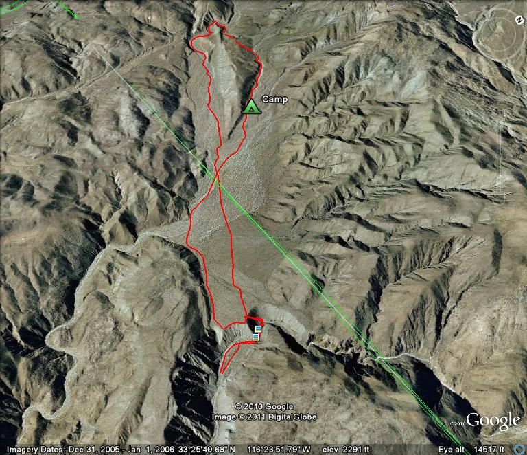
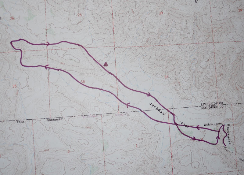
School was closed on Friday so I set out for a quick overnight trip in the northern part of ABDSP. Here is the Google Earth picture of the route I took on this two day trip. It was about a 9 to 10 mile hike through some beautiful and not often visited section of the desert.
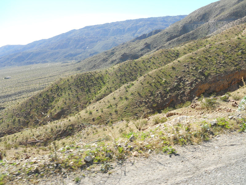
It was a beautiful drive out to the desert even with no top on the DesertTJ. The hills around Borrego Springs are starting to show lots of green grass. The air so so calm and clear that the Salton Sea was very visible to the east.

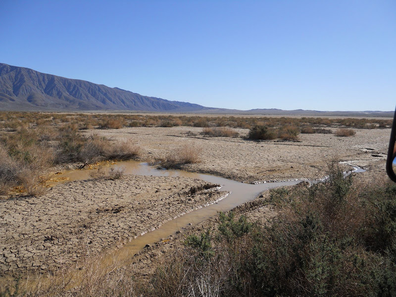
The plan was to make my way back up past Clark Dry Lake, I had been up there two weeks ago to find the petroglyphs. There was still a little water here.
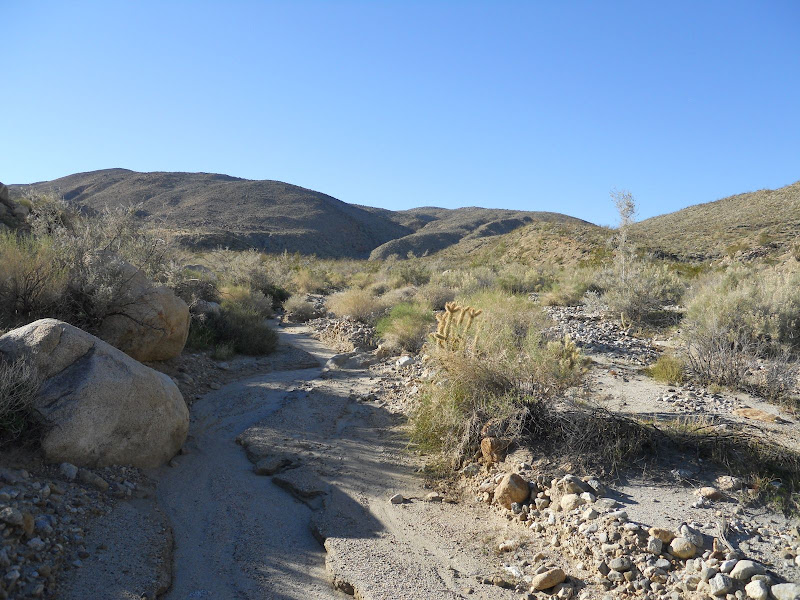
This time though I drove to the end of Rockhouse Canyon. Loaded my pack and headed up the canyon to Hidden Spring. The spring was dry, no standing water like last time I was here. Just down canyon from the spring I picked up the old Indian trail that led up the canyon wall to Jackass Flat, the site of an old Indian village. If you look close you can see the trail running diagonally down into Rockhouse Canyon. That is the Santa Rosa Mountains in the background on the left.
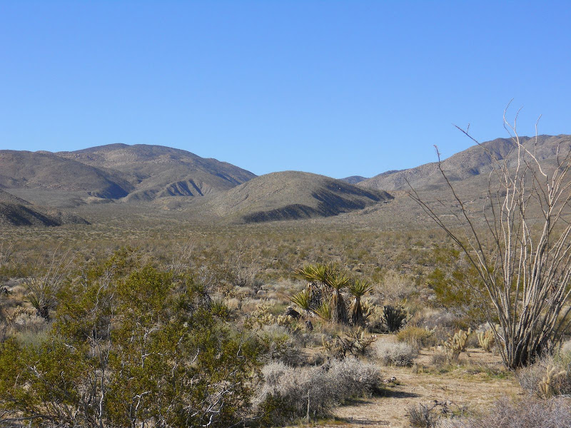
Once to the top of the ridge and on Jackass Flat I made a direct line northwest across the flat toward a large hill that comes down into the flat. After a mile or so I entered Dry Wash and proceeded up this was toward a twisty canyon. The hill is in the middle of this photo looking across the flat. I hiked up the wash to the left of this hill, around the backside, and then returned down the canyon/wash on the right.
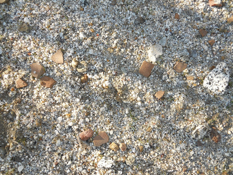
I saw a few morteros and some pottery pieces as I crossed the flat in this direction. The weather was perfect, nice and warm and no wind. I made my way up the wash and into the canyon. Along the way I spotted lots of mountain lion scat and tracks, as well as coyote tracks, sheep and/or deer tracks, but not a single boot print. There were also lots of Pinyon Pine cones scattered along the wash but I could not see a Pinyon tree anywhere. They must have traveled a long way to end up here. This is probably one of the most unvisited places I have been in the park,although part of this hike was out of the park boundary.
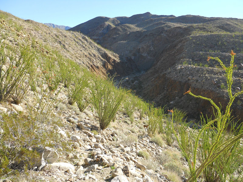
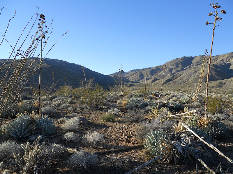
Once I got through the canyon I left the wash and headed up to the top of the ridge. The view from up here was amazing. Looking farther up into Dry Wash was very interesting and I would love to go back and check out this area. On this part of the hike the ground was very rocky and there was lots of cholla. I had originally planned to camp in this area but decided I would continue on down the next canyon/wash to a lower elevation and a better camp site. I also found a few pieces of pottery in this part of the hike. Here is the view up into the upper part of Dry Wash from my high point of the hike.
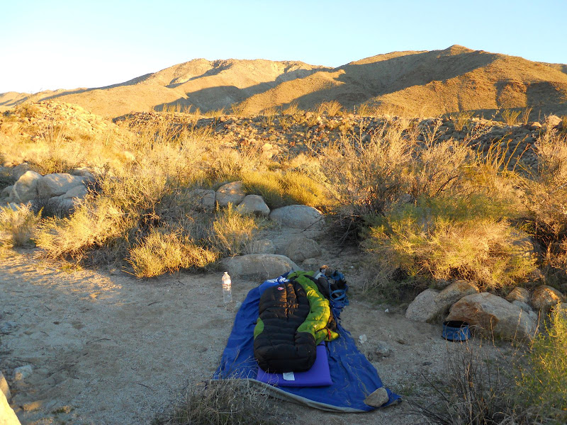
As I descended the canyon/wash, un-named on my map, I again spotted lots of wildlife tracks so I continued on until the canyon opened up a bit and I could find a spot to set up camp out of the wash. After about a mile or so going down the wash I found a great place to set up my camp. The day ended with calm winds and clear skies and then the moon came up and lit up the desert. Here is my camp with Buck Ridge behind. This ridge runs along the north side of Jackass Flat. Rockhouse Valley, with the three rock house ruins, is on the north side of this ridge.
I got an early start on Saturday morning and hiked down the wash until I met back up with Dry Wash. Then I followed this wash past the entrance to Butler Canyon and over to the other side of Jackass Flat. In this part of the hike I passed several areas like this with pottery pieces scattered all over the ground.
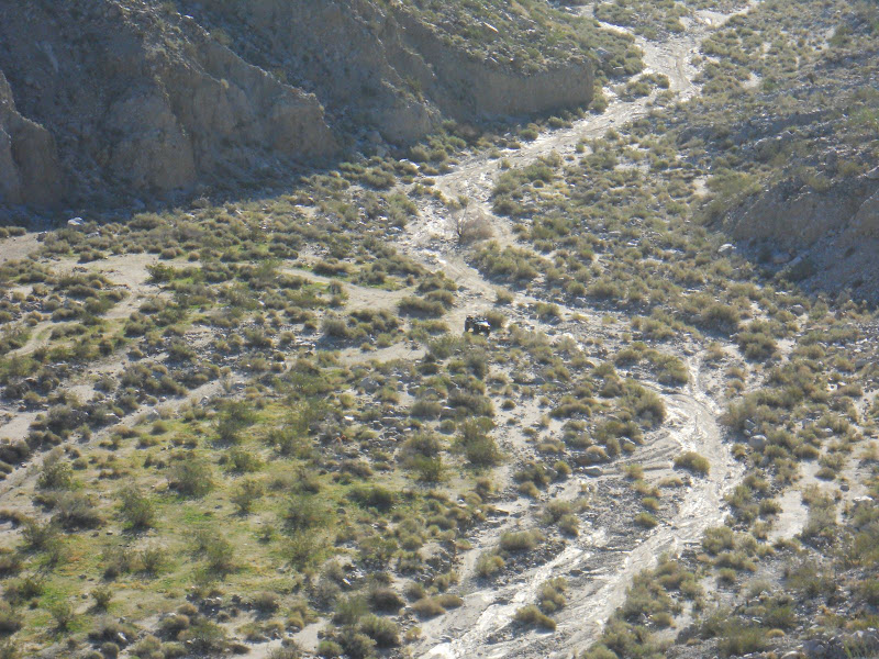
I could see the Desert TJ down there waiting for me when I reached the edge. I then traversed along the edge of the flat where it looks down on Rockhouse Canyon until I got back to the top of the old Indian trail down into the canyon.
Here is the map of my route.
It was a great hike with perfect weather. Can't wait to go out again.
|
|
|
link
|