|
dsefcik Administrator Posts: 2609
7/11/2012
|
This was my second year participating in the annual Anza Borrego Desert State Park Bighorn Sheep count and I feel very fortunate to have been selected to count at the Rattlesnake Spring site. My count partners were very knowledgeable about the sheep and great company for the 3 days we spent out in the triple digit temps. This years numbers were down across the board for all sites but we still were able to count 43 distinct sheep over the 3 day period.
If you would like to participate in the annual bighorn sheep count, contact the ABDSP Visitor Center and they can help direct you to the appropriate people, they are always looking for new volunteers.
More photos and videos can be viewed here http://smu.gs/NirpVu
Panorama of our count site, the water hole where the sheep will get water from is in the far left in the green shrubs and our count site is the small tarp on a small finger of a ridge on the far right

Here a couple of Ewes bash horns near the water hole, click the image to watch the video

A mother and her lamb look down at the water hole just after sunrise

One herd gathers near the water hole

Down at the water hole the sheep will crowd in to get a drink of the bee filled water

A lone ram rests near the water hole after getting a drink himself

After everyone gets water the herd heads out over a well used game trail

I camped out in Indian Valley on my way to the count and bagged a single mylar balloon

Total mylar balloons this trip - 1
More photos and videos can be viewed here http://smu.gs/NirpVu
You can check out the count site with this 360 degree virtual tour
https://sites.google.com/a/sefcik.com/virtual-tours/2012-bhs-count-site
http://www.sefcik.com/2012/07/2012-bighorn-sheep-count-abdsp.html
---
<em>edited by dsefcik on 7/12/2012</em>
--
http://www.sefcik.com
http://www.darensefcik.com
http://www.carrizogorge.com
|
|
|
link
|
|
dsefcik Administrator Posts: 2609
7/11/2012
|
I forgot to mention that on my way out I stopped at Myer Valley again to look for the second miner shack but saw nothing.
--
http://www.sefcik.com
http://www.darensefcik.com
http://www.carrizogorge.com
|
|
|
link
|
|
surfponto Administrator Posts: 1362
7/12/2012
|
I like the shot with the mother and the lamb.
The sheep look pretty healthy in your pics which is great to see.
Your tarp setup looks ideal. How far from your truck is it? I assume you are sleeping in the back of your truck?
--
https://www.anzaborrego.net/


|
|
|
link
|
|
dsefcik Administrator Posts: 2609
7/12/2012
|
surfponto wrote:
How far from your truck is it? I assume you are sleeping in the back of your truck?
About 5 miles. We backpacked in and out at night to avoid the heat and sun as it was pretty brutal. We camped about a 1/4 mile away from the count site.
The stars were amazing way out there, Scorpio was in full swing each night just hanging in the sky. With our spotting scope we could see the rings around Saturn and I saw some of the best shooting stars ever, brightly lit tails across the entire sky, very cool.
--
http://www.sefcik.com
http://www.darensefcik.com
http://www.carrizogorge.com
|
|
|
link
|
|
ziphius Posts: 911
7/12/2012
|
Very cool trip Daren. Does the team observe from sunrise to sunset, in shifts, to alleviate fatigue? Or is it basically all of you under the tarp searching all day? Some of my work involves counting migrating gray whales over 12-hr periods in 3-hr shifts, so I'm always curious how other wildlife teams accomplish their goals. You mention that sheep numbers were down compared with some previous years. I imagine that the sites are fairly standardized year-to-year, meaning that the same locations are counted every year. I imagine that sites like Rattlesnake Spring will be utilized every year by the sheep, but there are probably other, 'minor' springs that might get used only during certain years where rainfall allows for it. I could envision a scenario where the number of sheep at the standard count sites is "low" compared with previous years, but this could be due to greater dispersal of the sheep population to less-preferred sites. But I bet that the organizers of the count have this stuff pretty much figured out. Thanks for sharing your trip. - Jim
--
http://www.coyotelearning.org
|
|
|
link
|
|
dsefcik Administrator Posts: 2609
7/12/2012
|
ziphius wrote:
Very cool trip Daren. Does the team observe from sunrise to sunset, in shifts, to alleviate fatigue? Or is it basically all of you under the tarp searching all day? You mention that sheep numbers were down compared with some previous years. I imagine that the sites are fairly standardized year-to-year, meaning that the same locations are counted every year. I imagine that sites like Rattlesnake Spring will be utilized every year by the sheep, but there are probably other, 'minor' springs that might get used only during certain years where rainfall allows for it. I could envision a scenario where the number of sheep at the standard count sites is "low" compared with previous years, but this could be due to greater dispersal of the sheep population to less-preferred sites. But I bet that the organizers of the count have this stuff pretty much figured out. Thanks for sharing your trip. - Jim
There are many standard count sites but depending on how many volunteers they get determines how many sites get counted. They need backpack volunteers as the more remote sites require you to pack in and stay the duration. Others sites are just a quick hike or very little at all. Some sites will not get counted if there are not enough volunteers. We are asked to count from 7am-5pm for two days and about 7am-1pm the last day but each site is different, we did almost 3 days of 7-5 since we hiked out near dusk to avoid the heat. I am not sure there is really an expected number of sheep at each site, it seems to vary. The site I was at last year we saw a herd of 18 sheep each day, this year that same site reported not seeing any sheep at all.
I would recommend anyone interested in counting next year to contact the visitor center for more information.
Daren
--
http://www.sefcik.com
http://www.darensefcik.com
http://www.carrizogorge.com
|
|
|
link
|
|
tommy750 Posts: 1040
7/12/2012
|
Do they still do helicopter surveys for PBS? Does it correlate with what you guys find each year?
|
|
|
link
|
|
dsefcik Administrator Posts: 2609
7/12/2012
|
tommy750 wrote:
Do they still do helicopter surveys for PBS? Does it correlate with what you guys find each year?
Great question, they briefly talked about that this year. They used to do them with some regularity but not any more, some reasons why were financial and others political. That is why the volunteer program is even more important now. In the days past golf resorts were able to buy up land that took away from the sheep but golf resorts are now passe and instead green energy projects have moved in and are taking their place. When you look at the "peninsular" range they once used it has now become fragmented by development and roadways, their "range" has shrunk considerably.
--
http://www.sefcik.com
http://www.darensefcik.com
http://www.carrizogorge.com
|
|
|
link
|
|
DesertWRX Posts: 135
7/12/2012
|
Great photos Daren! That is one serious hike to get to your spot and I wish I was in that shape. You certainly didn't have to worry about another site seeing your sheep.
As far as aircraft counting sheep that is the only way they are able to count sheep away from the Borrego Valley and there's talk about more flights soon. If we have more volunteers I'm sure that southern areas could be staffed for the count as there are a lot of water sources down there.
I liked your spot for the cover. We were not in the right spot and were uncomfortable at our location at the 1st palm grove.
|
|
|
link
|
|
surfponto Administrator Posts: 1362
7/13/2012
|
True.
Back in 2008/2009 the Fish and WildLife Service de-designated a huge portion of their protected habitat.
Coincidentally some of it is where I believe the Ocotillo Wind Farm is currently being built.
Penninsular Bighorn Sheep threatened again
dsefcik wrote:
tommy750 wrote:
Do they still do helicopter surveys for PBS? Does it correlate with what you guys find each year?
Great question, they briefly talked about that this year. They used to do them with some regularity but not any more, some reasons why were financial and others political. That is why the volunteer program is even more important now. In the days past golf resorts were able to buy up land that took away from the sheep but golf resorts are now passe and instead green energy projects have moved in and are taking their place. When you look at the "peninsular" range they once used it has now become fragmented by development and roadways, their "range" has shrunk considerably.
--
https://www.anzaborrego.net/
|
|
|
link
|
|
tommy750 Posts: 1040
7/13/2012
|
dsefcik wrote:
tommy750 wrote:
Do they still do helicopter surveys for PBS? Does it correlate with what you guys find each year?
Great question, they briefly talked about that this year. They used to do them with some regularity but not any more, some reasons why were financial and others political. That is why the volunteer program is even more important now. In the days past golf resorts were able to buy up land that took away from the sheep but golf resorts are now passe and instead green energy projects have moved in and are taking their place. When you look at the "peninsular" range they once used it has now become fragmented by development and roadways, their "range" has shrunk considerably.
Thanks for the info. Great pics. Tom
|
|
|
link
|
|
hikerdmb Posts: 423
7/13/2012
|
Nice pics Daren, and video. I saw some cars and trucks parked along S-22 going down into Borrego Springs and I figured they were counting sheep too. It is great that you do this.
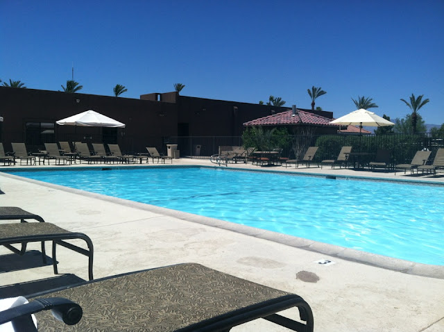
We were out there last weekend too but we were keeping cool by the pool. It was brutal but we managed.
David
|
|
|
link
|
|
surfponto Administrator Posts: 1362
7/13/2012
|
Wow that looks rough David 
Where was that?
Bob
hikerdmb wrote:
Nice pics Daren, and video. I saw some cars and trucks parked along S-22 going down into Borrego Springs and I figured they were counting sheep too. It is great that you do this.
We were out there last weekend too but we were keeping cool by the pool. It was brutal but we managed.
David
--
https://www.anzaborrego.net/
|
|
|
link
|
|
hikerdmb Posts: 423
7/13/2012
|
Bob,
That is the Borrego Springs Resort and Spa. It used to be Borrego Springs Resort and Country Club but they changed their name. Nice place and good summer rates. We got a king room for $79. Very relaxing place. We have been going there for many many years. Here's the link.
http://borregospringsresort.com/
David
|
|
|
link
|
|
surfponto Administrator Posts: 1362
7/13/2012
|
I thought so.
I have been inside there.
Looks like you had the pool to yourself?
hikerdmb wrote:
Bob,
That is the Borrego Springs Resort and Spa. It used to be Borrego Springs Resort and Country Club but they changed their name. Nice place and good summer rates. We got a king room for $79. Very relaxing place. We have been going there for many many years. Here's the link.
http://borregospringsresort.com/
David
--
https://www.anzaborrego.net/
|
|
|
link
|
|
dsefcik Administrator Posts: 2609
7/13/2012
|
hikerdmb wrote:
We were out there last weekend too but we were keeping cool by the pool
How do you keep cool "by the pool" ?? When I looked at the photo all I imagined was me in a floaty thing and a drink in my hand, not an empty pool!
--
http://www.sefcik.com
http://www.darensefcik.com
http://www.carrizogorge.com
|
|
|
link
|
|
surfponto Administrator Posts: 1362
7/14/2012
|
I agree

dsefcik wrote:
hikerdmb wrote:
We were out there last weekend too but we were keeping cool by the pool
How do you keep cool "by the pool" ?? When I looked at the photo all I imagined was me in a floaty thing and a drink in my hand, not an empty pool!
--
https://www.anzaborrego.net/
|
|
|
link
|
|
rockhopper Posts: 668
7/14/2012
|
Good show Daren! Great photos. You all had a very important and worthy expedition. I might be interested in the upcoming years if I can take the heat. I am the first person in the entire family and extended family to first break a sweat walking! The only time I saw a huge group of Big Horn sheep at one time was when I had my wide angle lens firmly attached to my camera. We all caught each other by surprise, as often with my experiences with the Big Horn. The film photos show the Big Horn sheep as tiny horned sheep. Of course this was hiking down above them decending in the 11,000 to 10,000 ft zone further up the state. Beautiful creatures. Again fantastic effort on your part.
I belive this is rattlesnake spring:
Photo taken at about the 3000ft elevation
[IMG]http://i67.photobucket.com/albums/h294/metalmeister/ABDSP/Copyofsantarosamtn016.jpg[/IMG]
edited by rockhopper on 7/14/2012
<em>edited by rockhopper on 7/14/2012</em>
|
|
|
link
|
|
dsefcik Administrator Posts: 2609
7/15/2012
|
That looks like it, did you take that photo from the ridge going up to Villager?
rockhopper wrote:
I belive this is rattlesnake spring:
Photo taken at about the 3000ft elevation
[IMG]http://i67.photobucket.com/albums/h294/metalmeister/ABDSP/Copyofsantarosamtn016.jpg[/IMG]
--
http://www.sefcik.com
http://www.darensefcik.com
http://www.carrizogorge.com
|
|
|
link
|
|
rockhopper Posts: 668
7/15/2012
|
Yes, It was May this year during my hike to Villager Peak. How is the hike going to rattlesnake spring? It looks like you could head off the Villager trail and down and up to the spring. The canyon trail must be interesting. I would like to camp out during a flash flood sometime, just to see some of these dry canyons flowing.
Those are some fantasic photos at Rattlesnake spring. The rear ends at the watering hole surrounded by bees made me chukle for two reasons. The bees being the other.
Did anyone go to the "Natural rock tanks" ?
dsefcik wrote:
That looks like it, did you take that photo from the ridge going up to Villager?
rockhopper wrote:
I belive this is rattlesnake spring:
Photo taken at about the 3000ft elevation
[IMG]http://i67.photobucket.com/albums/h294/metalmeister/ABDSP/Copyofsantarosamtn016.jpg[/IMG]
<em>edited by rockhopper on 7/16/2012</em>
|
|
|
link
|
|
dsefcik Administrator Posts: 2609
7/17/2012
|
rockhopper wrote:
Did anyone go to the "Natural rock tanks" ?
I did a couple of years ago, here are a few pics

---

---

--
http://www.sefcik.com
http://www.darensefcik.com
http://www.carrizogorge.com
|
|
|
link
|