11/28/2015
Topic:
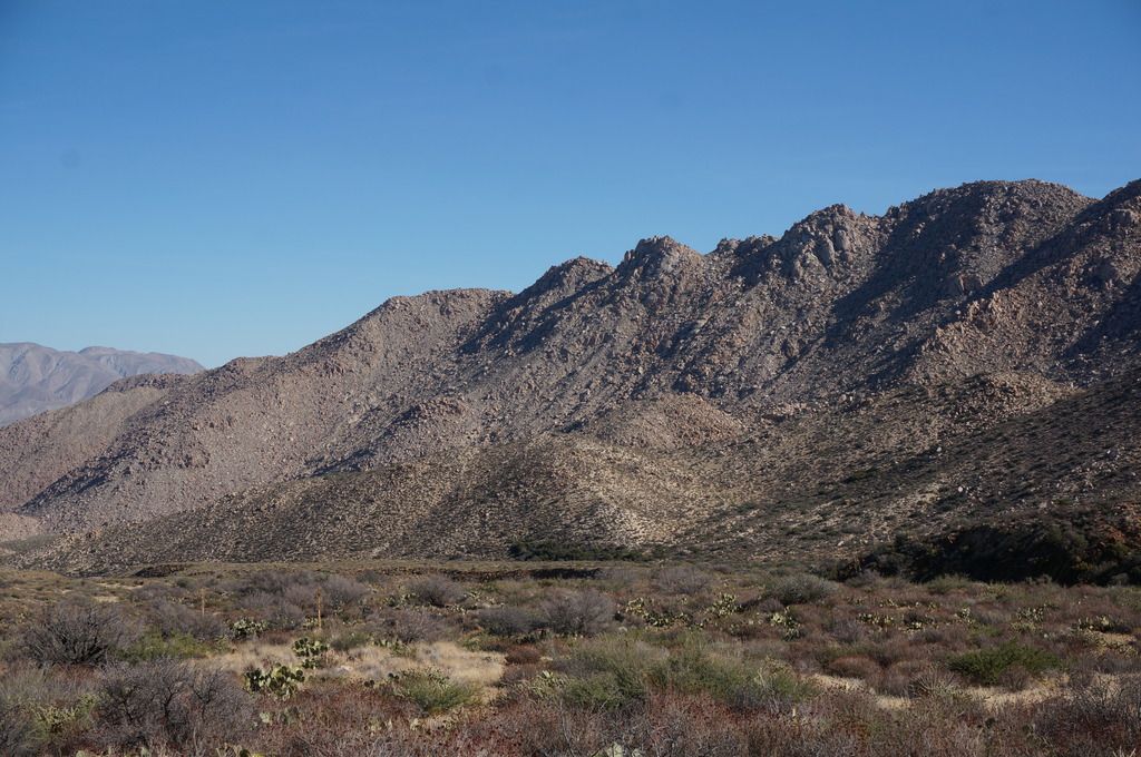
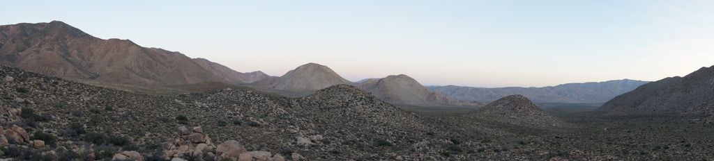
San Ysidro Mountain - East Approach
ziphius
|
Congrats on the summit Viper and welcome to the forum. That's another area I haven't traversed (seem to say that about most of the region). Any wildlife sightings? |
11/30/2015
Topic:
Martinez and Agua Alta Canyons Backpack
ziphius
|
Looks like a great area and fun time. Love the cabin-in-the-morning and frog photos. Whenever I hear of a pool of water being 'putrid green', my immediate thought is blue-green algae, which can contain some deadly toxins or at least stuff that won't make you feel good. Any photos of the putrid green pools? You guys obviously made it back alive! |
12/1/2015
Topic:
San Ysidro Mountain - East Approach
ziphius
|
Roughly, how many hours round-trip? |
12/9/2015
Topic:
Mojave National Preserve and other areas
ziphius
|
Nice trip report Nolan. Love the cactus stuck in the lava. - Jim |
12/12/2015
Topic:
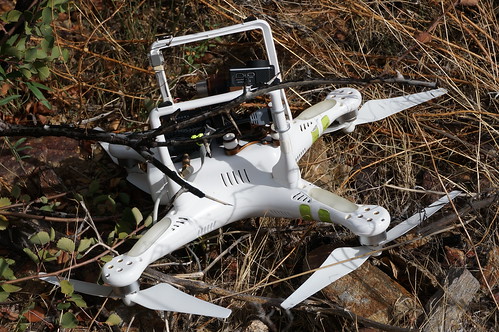
Drone use in the Park
ziphius
|
kylekai wrote:
Does this look like the air shots were taken with a drone? I think I can see the operator at about 40 seconds into it.
https://youtu.be/ljSsogtMiDg
Looks like it. Will be an uphill battle for the park for sure. I found an expensive drone with mounted GoPro camera overlooking Anza Borrego a couple of months ago. Checked the video card and the crash wasn't at all dramatic, just a slow descent into a bush. I don't think the pilot could see where it crashed, based on the video and the wicked 60-degree slope it came to rest on. I did my due diligence and checked craigslist, etc. for lost drone postings (there are lots), but no luck. I'm sure it won't be the first drone I find. 
edited by ziphius on 12/12/2015 |
12/13/2015
Topic:
Tabletop/Trestle/Mortero Palms/Dos Cabezas Spring
ziphius
|
How's the water flow at Dos Cabezas Spr? Looking forward to your photos, sounds very exciting. |
12/13/2015
Topic:
Tabletop/Trestle/Mortero Palms/Dos Cabezas Spring
ziphius
|
ImpatientHiker wrote:
Jim, the spring was a trickle the size of my finger. Same as the last couple times I've seen it, in summer & earlier. Plenty for me to filter the ~12 oz I needed. Some dummies were camping there with their tents right up in the bushes against the spring, had to step on a tent to get to water. Some people have no clue how truly special consistent water is in the desert. I'm usually quite comfortable being going solo, the moment I realized that the sheep (a professional cat-attack avoider) had recently been taken down was not one of them!
I'll admit to being creeped out during night hikes, but then I always remember that the drive to and from the trailhead is the most dangerous part of the day. |
12/19/2015
Topic:
3 Day Backpack through Vallecito, Canebrake and IP
ziphius
|
Managed to get out before the holidays for a 3-day counterclockwise loop beginning at Agua Caliente, through Vallecito, over the pass into Canebrake, into Inner Pasture and finally through Moonlight Canyon back to Agua Caliente. I ate well and used up most of the dehydrated meals that I'd prepared about 6 months ago.
Someone decorated Vallecito Valley for the holidays. 
There was evidence of recent rain in Vallecito. There were a few ‘birdbath’ water pockets, including this one with about a liter, reflecting the Sawtooth Mountains. Also a few morteros full of water, adjacent to others that were completely empty. 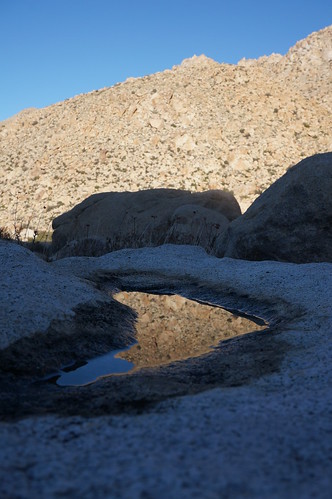
I know for sure you can’t easily drink solid water. Even the nearby spring / trough had a ½ inch layer of ice. 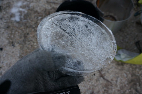
‘Developed campground’. 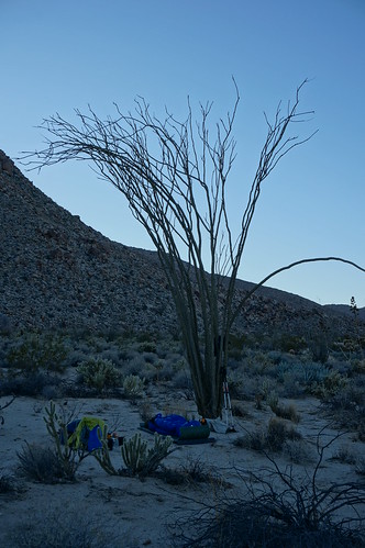
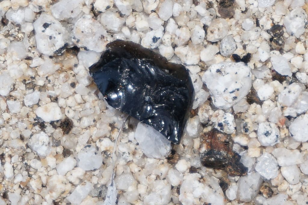
Crazy obsidian piece returned to its original location: 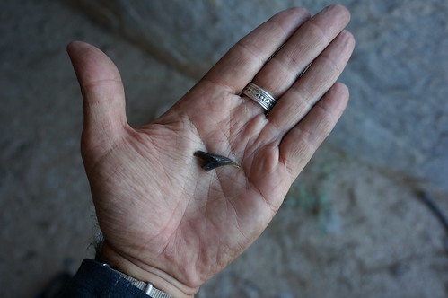
Kitchen pantry 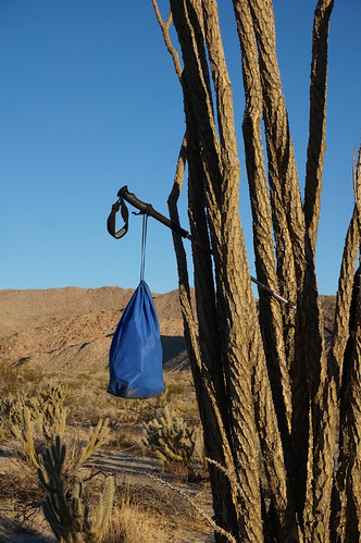
Red Top, been there, done that, not today. 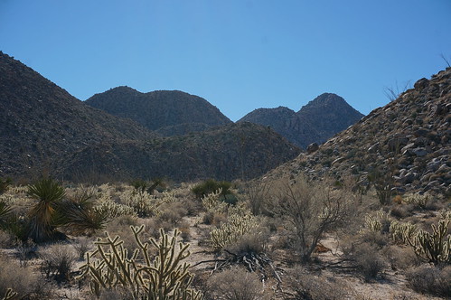
I was surprised to see ‘stealth slippers’ on the pass between Canebrake and Vallecito. Having hucked 9 liters of water and gear over that pass, I can say it’s not a cakewalk. There was additional evidence of migrant traffic in Vallecito. Dunno if the usual exit route (Pepperwood - Canebrake - Mile 41 canyon) is getting more Border Patrol attention and driving folks towards Vallecito instead. 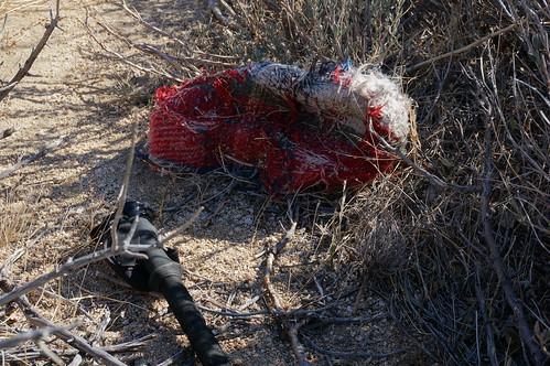
How many times have I done this? Squatted down onto my heels only to get a cholla in the ass. If a cholla is stuck to your boot heel and you don’t squat down, does it exist?
There are a pair of ravens in Inner Pasture that I see every visit. 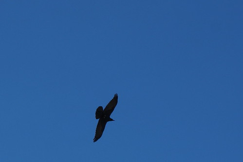
They are likely the same ravens each time, as they are territorial and live for up to 20 years. If you put down your pack anywhere, they are immediately overhead. I’m guessing they’re looking for goodies and I consider them more of a ‘threat to my stuff’ than any other animal out there. If you point a camera at them, they veer away. I’ve had to ‘play dead’ to get them to fly directly over me. For a good read on how smart they are, check out Ravens in Winter. Next time I'm out there, I'm going to leave a snack for the ravens and set up my camera on video mode to capture the action.
I saw deer on 2 occasions, a single animal at the 4000’ saddle between Vallecito and Canebrake and a pair bounding away near the floor of Canebrake. Other wildlife sightings included a peregrine falcon chasing some poor unseen bird in Inner Pasture. At night, a great horned owl, and a single yelping coyote.
2 product reviews. New Keen ‘Voyageur’ (not how I would spell it) boots are awesome. They feel like slippers and handled 35-40 lbs of pack weight over boulder-pocked terrain very well. They are also a little wider in the forefoot than most boots, which means that you have more surface area traction on rocks and they feel more like snowshoes over deep sand. They don’t provide much defense against cholla, but a pair of gaiters and more careful steps would help.
With night temperatures cold enough to freeze my water bottle and no tent, the Western Mountaineering Ultralight 20 degree bag (1.8 lbs) did a good job. It’s not as warm as my heavier 15-degree Marmot bag (3.8 lbs), but I was never ‘cold’. A few cool spots here and there where my body was compressing the down, but for its weight, it’s pretty darn warm. It would have been a different experience with any degree of wind, then I would have wanted a tent or boulder to hide behind. The forecast was for low wind, but I clearly gambled there.
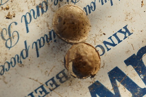
On the way home, I stopped at Culp Valley for one last stroll. Found some pottery pieces and these insect egg cases attached to perfect ‘habitat’. Not sure what they are.
edited by ziphius on 12/20/2015 |
12/20/2015
Topic:
3 Day Backpack through Vallecito, Canebrake and IP
ziphius
|
tommy750 wrote:
Nice Christmas tree, Jim That's a great area to visit. Heading out there Monday-Tuesday for a quick trip and hoping it won't get to freezing temps! I have a five year old Marmot 15 Long and it weights 46oz. Sure you didn't lose a couple rolls of quarters in yours??
Must be a case of Moore's Law applied to sleeping bag weights! My Marmot is considerably older. Or the digital scale I weighed it on is screwy. Have fun out there. |
12/20/2015
Topic:
3 Day Backpack through Vallecito, Canebrake and IP
ziphius
|
Forgot to post a few more from the trip. Cultural resources are still in good order:

and after I departed the backcountry, I spent an extra day in / around Borrego Springs. Even joined a group hike to Borrego Mtn, which I'd never been to. The volunteers / naturalists were great, I learned a lot about geology and met lots of nice folks. My first 'group' adventure and only evidence of such:
 |
12/21/2015
Topic:
3 Day Backpack through Vallecito, Canebrake and IP
ziphius
|
rockhopper wrote:
Nice photos and trip report. Did you have a thermometer? That's the money shot. Ha! I like the pic of your mitten holding the ice chunk! That makes it official, winter is here in ABDSP! Also great pictos in cave photo. Thanks for sharing.
Cheers
No thermometer rockhopper, besides, I wouldn't have wanted to move at all to read the thing before sunrise. Cold enough to get the job done though. |
12/25/2015
Topic:
Cattlemans Shack and Valley of the Moon
ziphius
|
Great post and trip. I see abstract Frankenstein, maybe not even so abstract. Very cool ruins in an area I've yet to get out to. - Jim |
1/2/2016
Topic:
McCain Valley / In-Ko-Pah Mts Last 2 months
ziphius
|
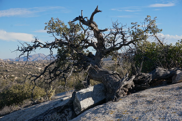
Ever since I saw this post with the spring, I thought it would be fun to try and go find it. I convinced Alex to go on the wild goose chase with me. A couple of context clues and a quick peek at Google Earth (yep, visible!) helped nail it. It looks like the spring area has been pruned back considerably since the summer. No evidence of the trail cam either.
We also found some frozen mortero water:

The rock formations in the area are way cool:
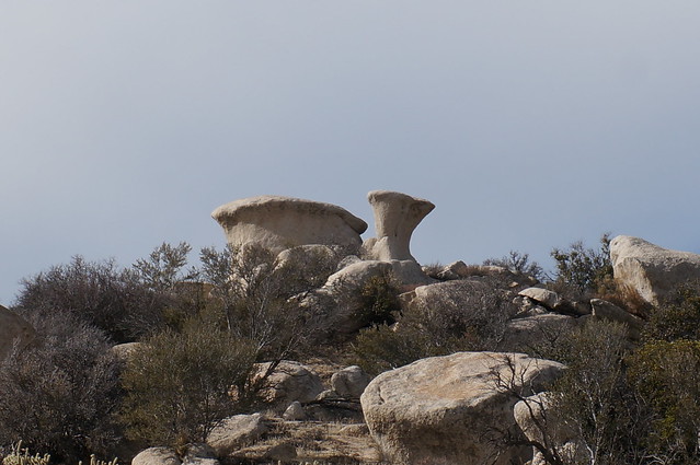

A very cool oak bonsai:
edited by ziphius on 3/12/2018 |
1/20/2016
Topic:
Pinyon Wash Overnight
ziphius
|
Nice trip Bob. Water-filled morteros are one of my favorite things. |
1/22/2016
Topic:
Anza Borrego Site Redo
ziphius
|
Looks great Bob. Appreciate all you do in maintaining this site. |
2/1/2016
Topic:
Any Interest in going to Pinto Canyon - early 2016
ziphius
|
sddarkman619 wrote:
got my backpack. Whaddya buy? |
2/3/2016
Topic:
Any Interest in going to Pinto Canyon - early 2016
ziphius
|
Tommy, you must be part of the vast government conspiracy to kill the ghost ship story. You *know* it's there and that it's filled with treasure and you just want to get to it first. Selfish.
tommy750 wrote:
surfponto wrote:
It is a pretty crazy story...cool though
http://www.robertmarcos.com/ghost-ship/
A great California tale for sure. Unfortunately, it quickly unravels with only a bit of fact checking:
1) You can't sail from the Sea of Cortez right into Ancient Lake Cahuilla since the lake level when full was 42ft and sea level is, well, zero.
2) There is some debate the lake contained water in 1612.
3) It's unlikely the ghost ship was trapped by sand bars because the water level of the lake rapidly dropped. It takes about 57 years for the lake to dry.
3) Sailing the 130 miles to Blythe against the mighty Colorado in a Spanish caravel seems a herculean task.
4) A point 300 ft SE of the farthest eastern point of the Superstition Mts would put the ghost ship about five miles from the nearest shoreline of Ancient Lake Cahuilla and over 300 ft above the highest 42 ft shoreline.
5) The supposed ship-like petroglyph in Pinto Canyon looks ship-like because the bottom half of the strange shape has been removed by the abrasive force of water flowing in the wash. Similar intact pictographs at El Vallecito look nothing like a vessel.
6) Finally, there is no Santa. Sorry. |
2/5/2016
Topic:
Tarantulas, Cahuilla Indians, & Johnny Cash
ziphius
|
all in the same article: http://www.cbsnews.com/news/tarantula-species-named-for-johnny-cash/ |
2/7/2016
Topic:
Tarantulas, Cahuilla Indians, & Johnny Cash
ziphius
|
The San Diego Natural History Museum has a list of spiders found in SD County and they list 4 Aphonopelma species (I wish they had common names and photos to go with these). I suspect the genetics crowd may identify more species in the future.
Looks like there are plenty of spider forums out there too, folks are into these things!
tommy750 wrote:
A. johnnycashi. Nice. So what are the main kinds of tarantulas we have around here, Jim? Thanks. |
2/8/2016
Topic:
Tarantulas, Cahuilla Indians, & Johnny Cash
ziphius
|
The hat didn't come with the truck?
dsefcik wrote:
Nice truck....
surfponto wrote:
I like Johnny Cash

ziphius wrote:
all in the same article: http://www.cbsnews.com/news/tarantula-species-named-for-johnny-cash/
edited by ziphius on 2/8/2016 |
2/8/2016
Topic:
Tarantulas, Cahuilla Indians, & Johnny Cash
ziphius
|
Ewwwww!
surfponto wrote:
I like Johnny Cash
ziphius wrote:
all in the same article: http://www.cbsnews.com/news/tarantula-species-named-for-johnny-cash/ |
2/13/2016
Topic:
President Obama designated three desert areas...
ziphius
|
Good news, though such designations can have the effect of removing the area's anonymity (= increased visitation). But it should protect the regions from enormous solar arrays, etc. |
2/14/2016
Topic:
President Obama designated three desert areas...
ziphius
|
Agreed on the remoteness. Monuments usually don't have the budgets to provide 'amenities' like parking and visitor centers, so I'm sure the area will remain quiet. Once things go from 'Monument' to 'National Park' (Joshua Tree), then all hell breaks loose.
railexplorer wrote:
I just took a look at the area that has been designated Mojave Trails National Monument, and all I can say is wow. I've spent a lot of time in that area, mostly spending time along the transcon rail line and route 66. Recently I've spent time at a couple of Patton's army camps. Due to its remoteness I seriously doubt there will be an increase in visitors. The area is way out there. |
2/15/2016
Topic:
Hapaha Flat and Harper Valley
ziphius
|
Nice trip Nolan. Good use of the umbrella. |
2/27/2016
Topic:
Palm Mesa High Point and nearby benchmarks
ziphius
|
Very cool area and trip. Welcome to the forum. |
2/27/2016
Topic:
Photo being used on new panels
ziphius
|
Great photo Nolan, glad they're using it. |
2/28/2016
Topic:
Stone Tools
ziphius
|
That's the kind of rock that most would not even glance at. The 2 on the right below your hiking pole might catch my attention, but nothing else would! So, there's a resident bobcat in the area too? Doesn't matter if the area is outside the ABDSP at all, this forum is all-inclusive. |
3/4/2016
Topic:
Anza Borrego Wildflower Update
ziphius
|
tommy750 wrote:
Here a link to today's latimes.com story on ABDSP wild flower enthusiasts:
http://www.latimes.com/science/la-sci-flower-stalkers-20160305-story.html
Nice article. |
3/6/2016
Topic:
Anza Borrego Wildflower Update
ziphius
|
Pretty good blooms going on north of DiGiorgio Road at the south end of Coyote Canyon, just returned. Lots of desert lilies there and also south of the S-22 opposite Clark Dry Lake. Tons of sphinx moth catepillars on the plants too. Alex has all the photos |
3/13/2016
Topic:
Stone Tools 2.0
ziphius
|
The lichens on the tools are a nice touch. Hey, can you tell us what material the 3rd photo is? I see that a lot (or something very similar) in flakes in Anza Borrego. - Jim |
3/16/2016
Topic:
Swainson's Hawk migration
ziphius
|
Nice story if you missed it. A lot of hawks in one place! They apparently are attracted to the Sphinx moth caterpillars.
edited by ziphius on 3/16/2016 |
3/25/2016
Topic:
Golf Courses and Bighorn Sheep
ziphius
|
I knew that sheep eating oleander was a problem up there, but I didn't know about the drownings. Golf... one of the dumbest and most environmentally-unfriendly pastimes. But golf courses are better than pavement I suppose.
edited by ziphius on 3/26/2016 |
3/28/2016
Topic:
Domelands in the Coyote Mountains Wilderness
ziphius
|
I haven't been out there Bob, only Fossil Cyn., which your photos remind me of. Looks like a great place to explore! |
3/31/2016
Topic:
Forum Thread Order
ziphius
|
Voted. Oldest. |
4/10/2016
Topic:
Hiking to the top of Viejas Mountain
ziphius
|
Nice trip Bob. Good luck on Whitney. Word is that Langley is less crowded (but not as high). |
4/17/2016
Topic:
Jacumba and Table Mountain Exploration
ziphius
|
Looks like a great trip. That stone in the lower right (4th photo) looks amazing, almost like it was intended to be a large point eventually.
Yonis.... I attended a lecture by Dr. Joan Schneider on Anza Borrego archaeology in March and I asked her about Yonis after her talk. She says they are natural geologic formations. Not to burst the bubble of Yoni believers, but she apparently knows her stuff. |
4/18/2016
Topic:
Getting Married in the Valley of the Moon.
ziphius
|
Nice ceremony Sandman. Is the bride wearing hiking boots? |
4/19/2016
Topic:
Getting Married in the Valley of the Moon.
ziphius
|
Whoops, sorry sddarkman619. I agree, the food at Jacumba Hot Springs is pretty good.
sddarkman619 wrote:
ziphius wrote:
Nice ceremony Sandman. Is the bride wearing hiking boots?
That's sddarkman619 not sandman.
and no she's wearing granny boots. |
4/24/2016
Topic:
Jacumba and Table Mountain Exploration
ziphius
|
Canebrake Jeff wrote:
Just because one archaeologist says Yonis are natural doesn't make it so. Lots of studies say otherwise. The local tribes themselves say they did it. Goggle Native American fertility yonis. Or you can buy a book (study paper) at the ABNHA store in Borrego Springs.
Jeff, is there a specific book you had in mind at the ABNHA store? I'd be interested in reading more. - Jim |
4/25/2016
Topic:
Peak 6582
ziphius
|
John,
Looks like a great time. Congrats on finding a speckled rattlesnake. I've only seen that species once. - Jim |
4/26/2016
Topic:
Moving to the desert
ziphius
|
Welcome to the forum Mark. Lucky man, living where you do. Jim
edited by ziphius on 4/26/2016 |
4/26/2016
Topic:
Jacumba and Table Mountain Exploration
ziphius
|
Geologists are such killjoys. Seriously, thanks for the info Tom!
tommy750 wrote:
Here's what little I know of this subject. The linear and oval indentations on granitic rocks in ABDSP reminiscent of the human vulva are often referred to as "yoni," a term first applied to these non-pictograph structures by Charlotte McGowan in her 1982 "Ceremonial Fertility Sites in Southern California." Others have subsequently made similar observations. The basic idea is natural rock features were worked or enhanced by the Kumeyaay and utilized during fertility rites. The ONLY ethnographic account of these structures linked to anything Kumeyaay or any type of fertility rite was relayed to Ken Hedges by an old rancher at the Crawford Ranch who stated a shaman approached him in 1935 asking to bury his dead relative on the ranch and mentioning in passing that women who could not conceive would visit "magic stones" in order to conceive. That's it! In 2012, Heather Thomson began giving lectures discussing her Masters Thesis which attempted to answer the question whether the granitic vulva-like structures were soley the result of natural weathering or was there evidence the structures had been worked or enhanced. I attended one of her lectures in 2013 at the San Diego Archaeological Center and basically she identified numerous typical examples of yonis (many with trinomials) and had five geologists examine them for any signs of enhancement and whether all the observed characteristics were a result of natural weathering. The unanimous opinion from the geologists was no enhancement and all characteristics a result of granitic natural weathering. I haven't read Heather Thomson's thesis but it sounds like an interesting read.
edited by tommy750 on 4/26/2016 |
4/30/2016
Topic:
Jacumba and Table Mountain Exploration
ziphius
|
dsefcik wrote:
General consensus from folks who study them say they are geological formations but then there are folks who listen to Coast to Coast every night and always stop to visit Coyote Jeff next to the Desert Tower...
Probably one of the best (entertainment) shows on radio. Drinking scotch under the stars listening to archived Art Bell episodes from my backyard.... a good use of a Saturday night. |
4/30/2016
Topic:
Jacumba and Table Mountain Exploration
ziphius
|
I'd be interested in searching for yonis in SEVERE terrain, where no village sites could have possibly been established, where the cost of human travel would have precluded the creation of yonis. If I started finding them in THAT kind of terrain, it would definitely tip my mind in favor of pure natural formations for sure. Or if the Mars rover 'Curiosity' starts finding them..... |
5/2/2016
Topic:
Santa Rosa Mnts / Martinez Canyon 12 Day Backpack
ziphius
|
Nice trip Daren. You always manage to find the best of nature and plane wrecks on your adventures. Hope all is well. Anytime you wanna listen to Art Bell and B.S., I'm in the neighborhood. - Jim |
5/2/2016
Topic:
Hiking to the top of Guatay Mountain
ziphius
|
Looks like a great trip Bob. If you're looking for Whitney training opportunities, the El Cajon Mtn. hike is a good one! - Jim |
5/2/2016
Topic:
Hiking to the top of Guatay Mountain
ziphius
|
Looks like a great trip Bob. If you're looking for Whitney training opportunities, the El Cajon Mtn. hike is a good one! - Jim |
5/3/2016
Topic:
Santa Rosa Mnts / Martinez Canyon 12 Day Backpack
ziphius
|
dsefcik wrote:
Gary was the only one who did not use a tent that trip AND he forgot his sleeping pad so he slept on a sheet of blue plastic on the hard dirt every night and the first night in the rain under a rock shelter full of rat crap.
This is why we spend time in the great outdoors! |
5/3/2016
Topic:
Hiking to the top of Guatay Mountain
ziphius
|
tommy750 wrote:
Better yet, summit El Cajon and bounce on over to Rock Mt for an extra 3 mile bonus still honoring the "uphill both ways" theme of El Cajon
'Bounce on over to Rock Mt' ?  I've thought about doing that numerous times, started towards it once, thick brush from the summit. I'm planning on heading up El Cajon Mtn Thurs or Fri if anyone wants to join up.... I've thought about doing that numerous times, started towards it once, thick brush from the summit. I'm planning on heading up El Cajon Mtn Thurs or Fri if anyone wants to join up.... |
5/4/2016
Topic:
Yoni
ziphius
|
Number 14/37 is my favorite because your buddy used duct tape to repair his sun hat. |
5/18/2016
Topic:
Rockhouse Cyn Wildflower Blooms in May
ziphius
|
Nice photos Daren. Is the cairn a random monument, or does it signify something more topographically significant? It looks like it is in the middle of nowhere. |
6/4/2016
Topic:
Canebrake Valley 3 Day BP
ziphius
|
Looks like another great trip, all the essentials: springs, snakes, points, camouflage, and '60% water'. Those small points are hard to find! Daren, I like your comment about you and Tom seeing completely different things while being 5 minutes apart. |
6/6/2016
Topic:
5-25th thru 5-28th mini road trip to cool off
ziphius
|
Nice trip rockhopper. What is the guess on the last dates of occupation of the 'little black square'? Anything interesting inside? |
6/12/2016
Topic:
To the top of El Cajon Mountain aka "The Beast"
ziphius
|
Bob, missed you by one day, just got back from the trail today. You chose the right day, the sun came out in full force up there today. I ran into a guy with a big pack at the summit who was training for Mt. Rainier. 4 hours round trip is a good clip.
edited by ziphius on 6/12/2016 |
6/13/2016
Topic:
To the top of El Cajon Mountain aka "The Beast"
ziphius
|
ImpatientHiker wrote:
4 hours round trip ain't bad! A night hike during a full moon would be nice this time of year with a great view of the lights Of Tijuana & San Diego. If you guys want to step up the adventure factor a bit, I'd be happy to finally meet you and lead you through a full moon point to point from El Monte Park (near the El Capitan reservoir dam) to El Cajon Mtn peak to Wildcat Cyn Rd. I'm guessing it'd take you maybe 30 mins to an hour more than your out & back from Wildcat.
-Robert
While the moonlight hike idea sounds like fun, it does flout the rules regarding when folks are allowed on that trail, which also passes through a shared roadway of the Blue Sky Ranch near Wildcat Canyon Road. I'd hate to give any of the rangers or Blue Sky Ranch itself any reason to further limit access (or revoke it) because we can't follow the rules. I already see a lot of cars parked outside of the Wildcat canyon gate prior to 7 am, which is the official 'opening time' for the Wildcat Canyon trailhead. I'm not trying to be a killjoy here, I have a vested interest in keeping that trail open for many years. It is my go-to hike, I've done the round-trip to the summit 75 times and would like to get to 100 soon. If enough people continue to ignore the rules, especially near the Blue Sky Ranch and the landowners decide enough is enough, then we're all hurt. Again, I'm all for radical moonlight scrambles myself, but not there. [ and Bob / Daren, if you guys want any company on another El Cajon Mtn. mission, let me know! ] Jim |
6/14/2016
Topic:
To the top of El Cajon Mountain aka "The Beast"
ziphius
|
ImpatientHiker wrote:
Jim, I also want to see our trails remain open & new ones allowed for all of us (including my kids)and I try to be an active participant in that regard. San Miguel is a prime example of rule flouting helping to close off incredible trails, possibly permanently. I was under the impression that only the parking lot had closed hours as I usually ride my bike there but a search of the county's website shows you are correct. Thanks for cluing me in.
The sunset closure rule for Laguna & Cuyamaca Mtn parking has always irked me because it means that it is effectively against the law to watch a sunset from any of OUR peaks as you'd have to reach your vehicle by sunset.
-Robert
Thanks for the follow-up Robert. I actually ran into a couple that had camped near the summit of El Cajon Mtn one morning. I'm not sure if they were aware of the rules and I didn't feel compelled to preach to them on the spot. I've spoken with the rangers a few times about the 'situation' on El Cajon Mountain in recent years. What I mean by 'situation' is that since the advent of meet-up groups and Yelp hiking reviews ("toughest hike in San Diego County!") the trail has become swarmed with knuckleheads and the unprepared. The rangers / Sheriff's Dept. conducts about a rescue per week I'm told, some of those at night, mainly because folks underestimate the trail, leave too late, aren't fit, or a combo of all three. It's a hard enough hike during the day, heh? I agree that the rules are sometimes too restrictive. We live in a crowded world now and I know personally that I prefer to go hiking at oddball hours too (Iron Mountain used to be quiet at 11 pm, but no more - if you build a parking lot, they will come!). As far as freedom in the backcountry is concerned, I feel like I was born 200 years too late. |
6/15/2016
Topic:
To the top of El Cajon Mountain aka "The Beast"
ziphius
|
tommy750 wrote:
El Cajon is closed in August because of the extreme heat. Showed up years ago in August with my now fiancée packing two liters each and made it to the four mile saddle before realizing we'd made a huge mistake. Was 93 that day and well over 100 in some spots. We laid in a ditch in the shade till late afternoon when my very annoyed older brother (contacted by phone) showed up packing the sweetest water I've ever drank. Still read the UT and sneer at the idiots getting airlifted off El Cajon but realize I was almost one of them.
Wow, she stayed with you all those years after that near-disaster? Anybody, no matter how fit, can get into trouble on that hill. The August closure never made sense to me, on average it is hotter in September, but probably fewer folks attempting it. I've done it a couple / few times in 95 degree weather, I always use an old Go-Lite hiking umbrella for those trips. Carrying it doesn't make you look tough, but it shaves 15 degrees of heat off of your experience. |
6/28/2016
Topic:
Spirit Cave on Table Mountain. EDIT: Spirit Sticks
ziphius
|
Interesting. Makes me wonder how recently they were leaned against the rock, given wind, earthquakes, etc. |
6/29/2016
Topic:
A trip to the past
ziphius
|
Looks pretty interesting! What are the rocks spelling out? "Goonies 11" ? Any fun fossil finds? |
7/4/2016
Topic:
Sheep Count 2016
ziphius
|
Nice use of the trail camera Daren, animals don't seem spooked by it at all. Good soundtrack. - Jim dsefcik wrote:
We had 40 unique sheep in Rattlesnake Spring, about 50% less than normal, weather was much cooler and sheep did not seem interested in drinking, many just lounged around the water hole all day without drinking at all. I did not take my heavy digital camera and 600mm lens this year, instead I just took a trail camera and hung on it on a mesquite nearby, here is my meager attempt at stitching together the hundreds of photos and videos it captured over the 3 day weekend.
|
7/5/2016
Topic:
Pinto Canyon Overnighter
ziphius
|
Interesting story. I wonder if the pot is still there. The description of its location is a bit detail-rich, the kind of clues that pot-hunters would take advantage of.
edited by ziphius on 7/5/2016 |
7/5/2016
Topic:
Sheep Count 2016
ziphius
|
The audio quality on that camera is good. I might buy one for my backyard / canyon. |
8/2/2016
Topic:
Aqua
ziphius
|
Quite the adventure! Thanks for stocking up the water tanks. |
8/10/2016
Topic:
Drone crash overlooking Vallecito Valley
ziphius
|
Found a drone several months back, just getting around to posting a video. 1 minute and 5 seconds in length. It's one of those $1,000 + models, white... I thought it was a pile of animal bones from a distance. Landed on a 45 degree slope on the desert side of the Laguna Mountains.
edited by ziphius on 8/10/2016 |
8/11/2016
Topic:
Drone crash overlooking Vallecito Valley
ziphius
|
Florian wrote:
Do you think it was being flown out from the mtns or up from the desert side?
The original video (which I edited) is quite long and shows the pilot launching it from the mountains. Based on the spot where I found it, he must have lost sight of it on the descent. There were several other videos from other regions, showing 'high-performance' flights in tough terrain. |
8/12/2016
Topic:
Drone crash overlooking Vallecito Valley
ziphius
|
tommy750 wrote:
It should have automatically flown back to the starting point if radio signal was lost. May have done a controlled landing before the batteries died. No ID on the drone? No fun throwing a $1,000 bill away  Nice view of Storm Canyon. Nice view of Storm Canyon.
It is a Phantom quad. I was *almost* able to read the pilot's license plate from one of the videos, haven't tracked him down. The drone had sat for awhile, components chewed on by rodents, etc. |
8/26/2016
Topic:
The Santa Rosas Sawmill Trail (Sort Of)
ziphius
|
I like the view from inside the kiln. Funny-sounding spring too. That tent is known for its head room big man. |
9/20/2016
Topic:
In Ko Pah Explorations and Monitoring
ziphius
|
Very cool trip and photos! Awesome point too. Any idea of the rock type it's made from? Seems amazing how many more pictographs there are in the region than petroglyphs. Pictographs kinda look like animal forms. Good job finding old stories and bringing them back to life. - Jim
edited by ziphius on 9/20/2016 |
10/1/2016
Topic:
Mount Whitney
ziphius
|
Nice job Bob! I imagine the caliber of folks going up nearby Mt. Langley is quite different from those attempting Whitney, just because the latter peak is a 'destination' landmark. |
10/4/2016
Topic:
Mount Whitney
ziphius
|
Cool pics rockhopper! |
10/17/2016
Topic:
Spanish sword found at Fish Creek Wash?
ziphius
|
Haven't heard about that one, but I was told by a ranger at Mission Trails Regional Park that a sword was found behind Old Mission Dam one year when it was dredged to remove the build-up of silt. |
10/20/2016
Topic:
Storm Canyon / Vallecito
ziphius
|
sddarkman619 wrote:
where is the day use parking? If you want to hike into the region via the 'hard man' route, you can pay the day use fee at Agua Caliente County Pk and then take the east-west canyon south of 'Burro Spring' that goes by the amphitheater near the day use parking. Some folks have parked at Vallecito County Park too. Or random spots along S2. |
10/21/2016
Topic:
Inner Pasture - Searching for the spring
ziphius
|
sddarkman619 wrote:
So camping is allowed in Inner Pasture? There's a section of it where it's state area the entry way from agua caliente, is that ok to camp as well? I'm introducing my daughter to backpacking and wanted to do something fairly easy and fun so I was thinking an overnight in inner pasture would be a great starting point.
You can camp in Inner Pasture, I wouldn't call it an easy introductory trip. There is also some migrant foot traffic through the southern and eastern portion of Inner Pasture. For an introductory backpack trip, you might try the Big Spring or the Culp Valley / Pena Spring areas off S-22, which have the benefit of available water. This will help lighten the packs and the trip will be more enjoyable for all. Bow Willow campground is also a good starting point for short backpacks into the Rockhouse Canyon area. |
10/29/2016
Topic:
Bahia de Los Angeles Road Trip
ziphius
|
Great trip and photos Tom. I'm always amazed at where people used to drive their VW beetles (and managed to get them out every time). Looks like you got into photography at an early age too. |
11/4/2016
Topic:
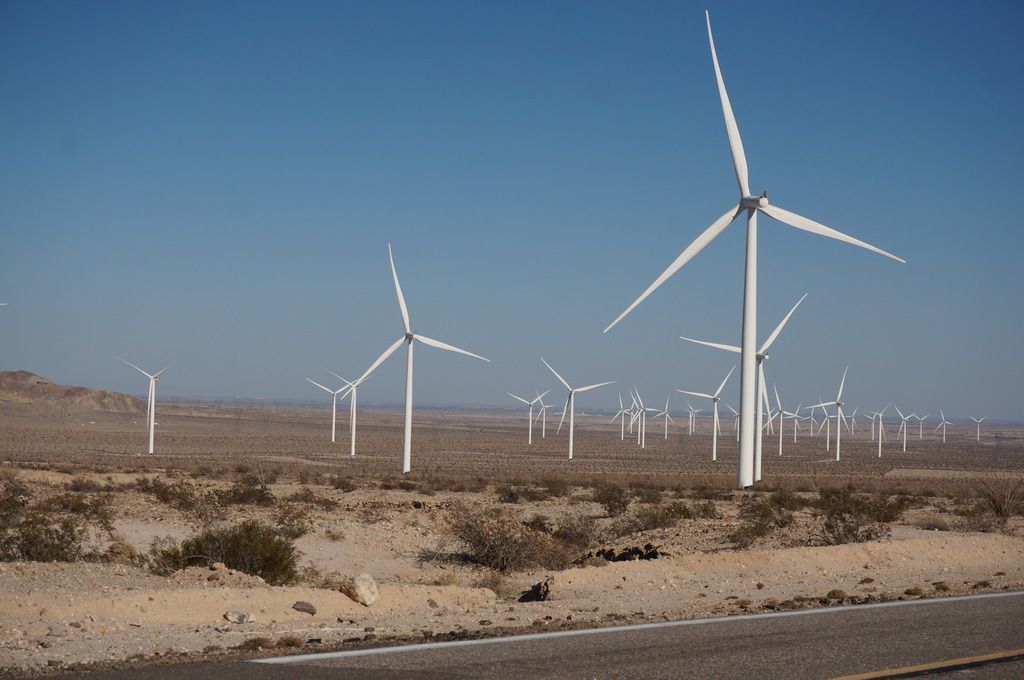
Tule Wind Project 2nd Phase Get's the OK
ziphius
|
Good thing you've spent time out there enjoying the current views. |
11/5/2016
Topic:
Tule Wind Project 2nd Phase Get's the OK
ziphius
|
The red lights will make nighttime navigation easier.
tommy750 wrote:
Try superimposing these onto Google Earth to get an idea of what's coming. Don't forget to include the flashing red lights...
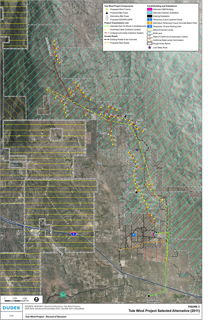 Signed Record of Decision: Tule Wind Project, Ancillary Facilities on Public Lands Supporting the Reduced Ridgeline Component, dated: January 17, 2014 by tomteske, on Flickr Signed Record of Decision: Tule Wind Project, Ancillary Facilities on Public Lands Supporting the Reduced Ridgeline Component, dated: January 17, 2014 by tomteske, on Flickr
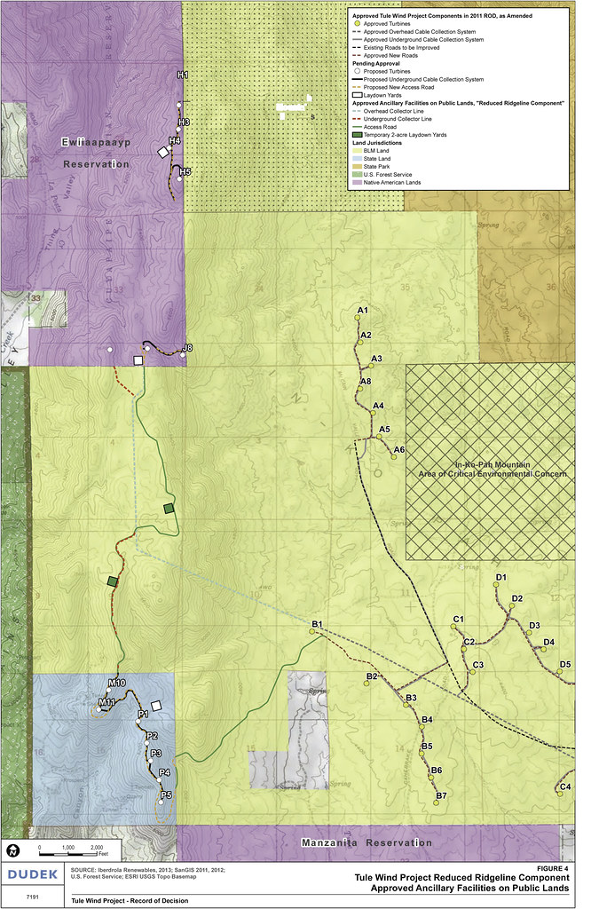 Signed Record of Decision: Tule Wind Project, Ancillary Facilities on Public Lands Supporting the Reduced Ridgeline Component, dated: January 17, 2014 by tomteske, on Flickr Signed Record of Decision: Tule Wind Project, Ancillary Facilities on Public Lands Supporting the Reduced Ridgeline Component, dated: January 17, 2014 by tomteske, on Flickr
edited by tommy750 on 11/4/2016 |
11/12/2016
Topic:
Parking in McCain Valley for Hiking
ziphius
|
This site might bring some peace of mind (for a small fee) when leaving your car in the area for multiple days. Not sure what others do. Or take the uphill approach from Bow Willow. That's one I'm planning. - Jim |
11/13/2016
Topic:
Parking in McCain Valley for Hiking
ziphius
|
I've parked there during day hikes. I bet there is a BLM page for Cottonwood as well.
sddarkman619 wrote:
ziphius wrote:
This site might bring some peace of mind (for a small fee) when leaving your car in the area for multiple days. Not sure what others do. Or take the uphill approach from Bow Willow. That's one I'm planning. - Jim
what about cottonwood campground? |
11/13/2016
Topic:
Election Backpack
ziphius
|
I spent Monday and Tuesday nights in Vallecito Valley, mainly to get away from TVs.
Drove out through Ocotillo and then north to Agua Caliente Co. Pk. to park.
Some pre-election sights on the way out.
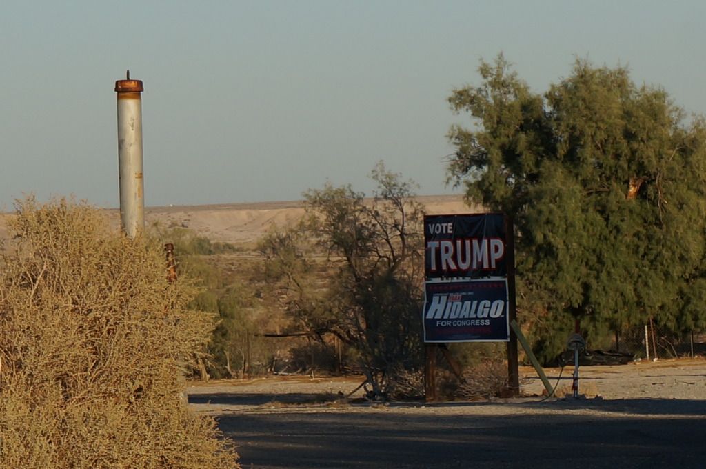
The ironic juxtaposition of Trump and Hildalgo names caught my eye.
I began my trip at Agua Caliente and took a canyon route into the valley. There are some natural trail markers along the way.
There were also several cairns / ducks which I knocked over. It's a canyon route for the love of God. Why spoon-feed the masses as to what route to take?
First lunch stop about 2.5 hrs into the hike.
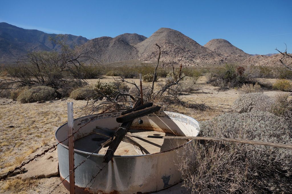
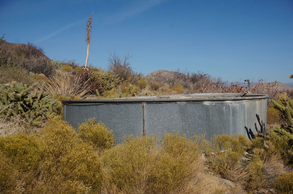
One of four water troughs I encountered.
Spent blooms of a Datura wrightii, or Jimson Weed. Highly hallucinogenic and dangerous.
Water supply. There was recent evidence of horse traffic here and someone had cut some vegetation away from outside of the trough, presumably to allow their horse to access the water. No signs of other traffic in the area for some time.
I picked a camp in a higher-than-normal spot, away from the water. Lets the wildlife come to the water unafraid and reduces the bugs.
Another view from camp.
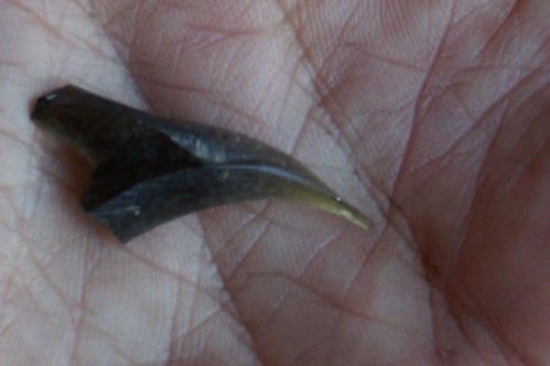
Piece of obsidian.
A dry trough in another part of the valley.
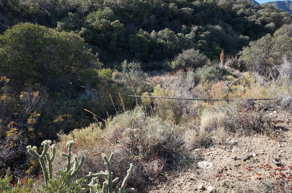
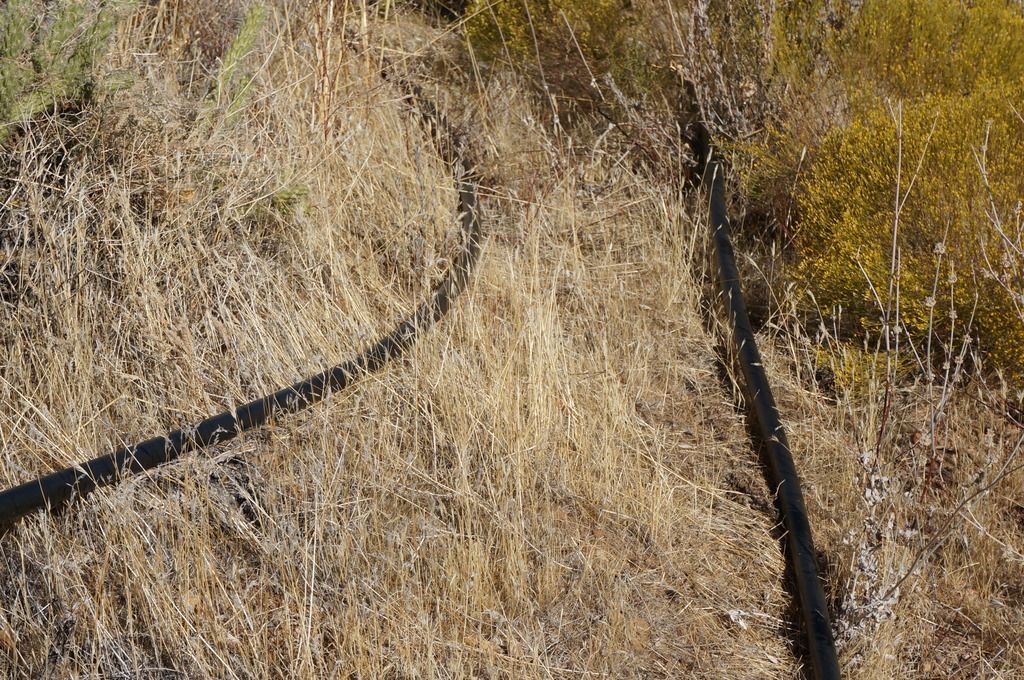
I followed some old plastic pipes from this trough uphill hoping for water, but didn't find water.
Sawtooth Mtns.
Piece of octotillo I think.
Election Day, wondering what is going on.
Election Night, still wondering.
Camp Views.
Wednesday morning, no idea who won.
Later in the morning, still no idea who won. No desire to leave. Blood pressure 115/65 I'm guessing.
Cowboy camp I stumbled upon.
The flag wasn't at half-mast when I returned to the car. Everything seemed normal.
Ocotillo bound.
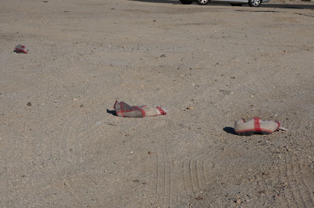
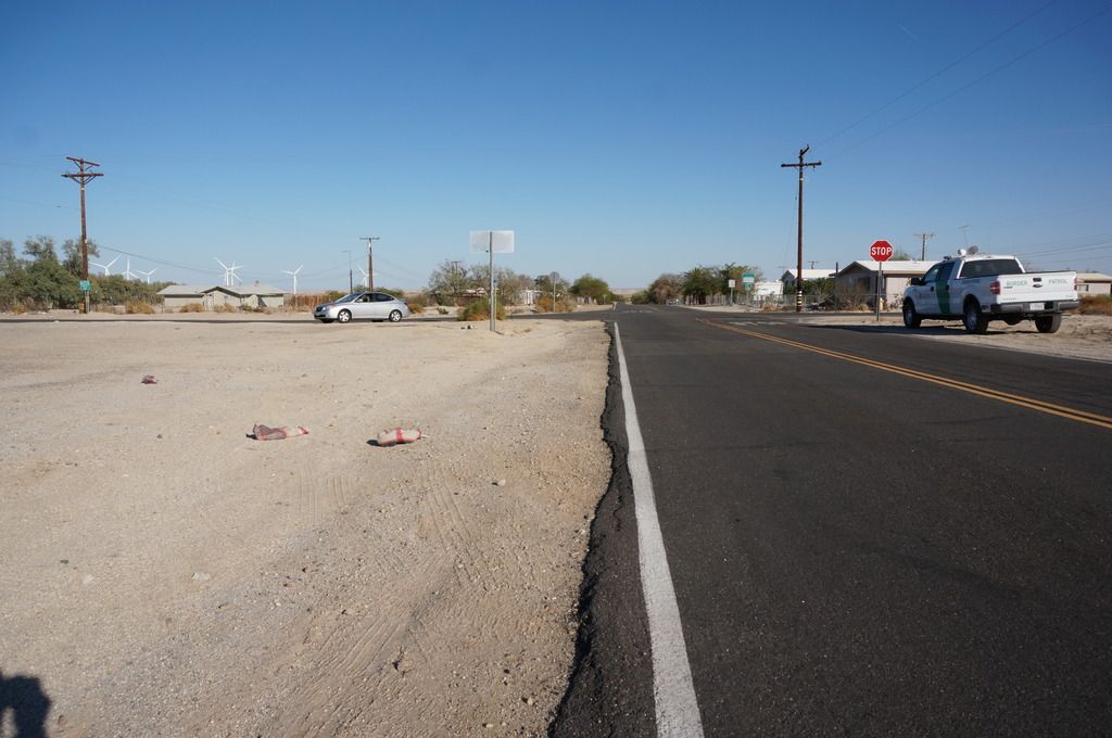
Migrant slippers.
and Border Patrol. I should have got a better photo, but I was making the agent nervous. Tommy would have taken a much better photo
I either missed this on the way out or more likely, it was placed there on Tuesday / Wednesday.
The first place I went to, at around 2:30 PM on Wednesday.
About 15-20 people were there, all cheerful. I ordered a Pacifico and sat at the bar for 30 minutes, without hearing a peep about the election. Finally, I guy at the end of the bar murmured something.
I turned on my barstool and caught his eye. "Who won?" I asked. The bar went silent. A woman turned toward me. "Trump". I said "Wow." The woman said, "I hope that isn't bad news for you."
I ordered another beer. "John" and I talked at the end of the bar for awhile, about America, about media, about camping. We talked about biased media. He said he didn't own a TV, but he trusted Google Search, said "it was fair" and reliable. He wanted to know where I had camped. My topo maps were in the car. I brought them in and laid them out on the bar with John, we looked them over. Everyone loves beer and topo maps. There were no lines of division between us, except for the ones on the map.
edited by ziphius on 11/13/2016 |
11/13/2016
Topic:
Election Backpack
ziphius
|
Working now. |
11/13/2016
Topic:
Election Backpack
ziphius
|
sddarkman619 wrote:
Nice TR and pics! Was that a lone piece of obsidian?
I wonder if it was brought there in trade with other tribes or?
Probably 'Obsidian Butte' near the Salton Sea was the source of most, if not all, the obsidian found in the area. |
11/14/2016
Topic:
Election Backpack
ziphius
|
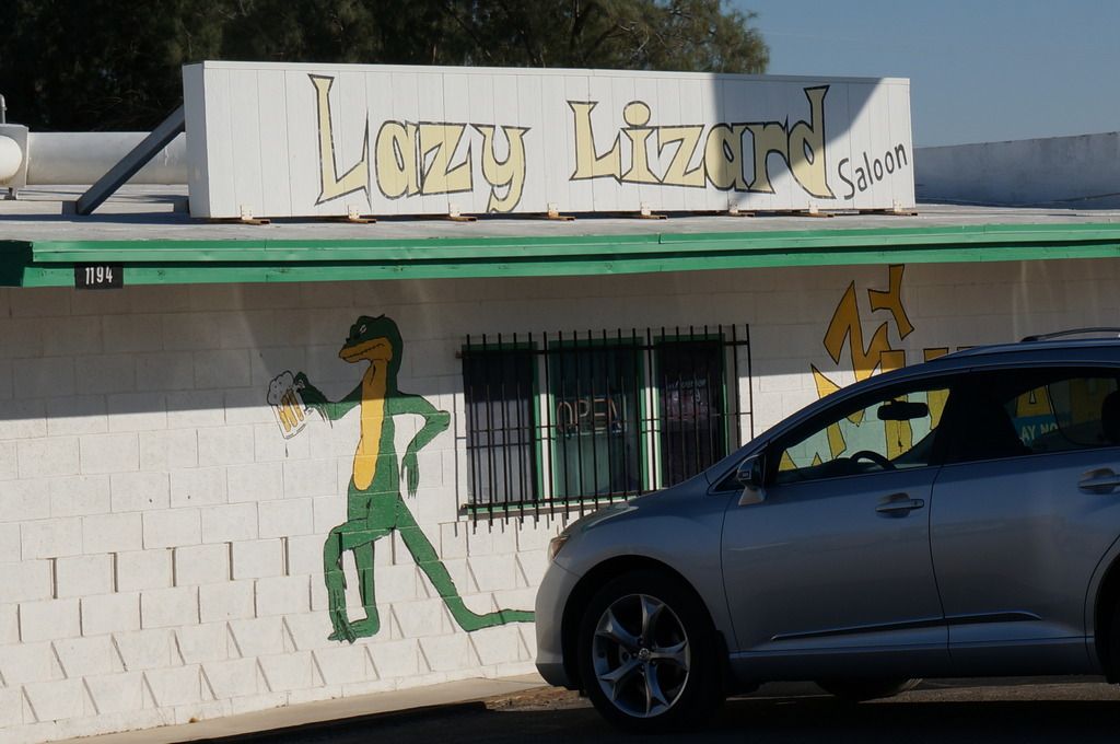
Tooting my own horn a bit, the Lazy Lizard Saloon story published online in The San Diego Reader today. They pay pretty decently for short news stories. |
11/15/2016
Topic:
Election Backpack
ziphius
|
Robert, thanks for the comments. I was looking at that ridge that drops off of Stephenson, thinking that must be the best way down / up.
ImpatientHiker wrote:
Great TR & pics! I just happened to be in that area Sunday and was quite surprised to see tracks, they must have been yours. It was a moonlit run Sat night from the PCT at Stephenson Peak down a ridge, across Vallecito Valley, up onto the Sawtooth ridgeline above Agua Caliente, back a short ways towards the Cuyamacas, and down to the valley floor. At that point, I was too tired to continue back up to the PCT so I just curled up and slept for an hour til sunrise when I found myself very close to where I think you camped. I even took a photo of the same view of the Sawteeth as you did. I was pretty surprised by the sheer volume and variety of pottery shards just uphill to the west of your camp. Posted some pics on Instagram @impatienthiker. I think that you had the smarter plan with your routing, timing, and a stop at the Lazy Lizard! Loved the election results story too, who doesn't love a good map!
-Robert |
11/16/2016
Topic:
Election Backpack
ziphius
|
First time there, I'll be back.
surfponto wrote:
Lazy Lizard is always a great way to end an Anza Borrego trip.
Great pics |
11/16/2016
Topic:
Election Backpack
ziphius
|
tommy750 wrote:
Looks like a great trip, Jim. The shoe covers by S2 pic is unsurpassable! Any of those troughs/piping have springs with water attached to them??
Tommy, thanks. None of the other troughs had water that I could find. I think anything we find with plastic piping is dead-on-arrival. As for the shoe covers, I should have gotten on my belly Daren-style with the camera, got the shoe covers sharp in the foreground, with a fuzzy Border Patrol truck in the background, but that would have required pointing the camera at the BP. |
11/16/2016
Topic:
Election Backpack
ziphius
|
Nolan,
Yep, that's an inflatable pillow, love it (Sea to Summit brand). Except when I lift my head on a windy night and it blows out from under me (with a tent, no problem). Ocotillo is a small, rural town. Something tells me they've been pretty conservative for a long time.
anutami wrote:
Nice report and pics. Love the cowboy emblem pic. Nothing like pacifco and topo maps. Is that an inflatable camp pillow at your campsite? How comfortable is that thing? That is the single most reason why I never get a goods nite rest in the backcountry, can't seem to find anything that works. I wonder if the town of ocotillo has gone to the trump side because of all those wind turbines signed off by President Obama.
Happy trails |
11/22/2016
Topic:
Wind tower collapses in Ocotillo
ziphius
|
It looks like it gave way about halfway up the tower. The warranty must have just expired.
http://www.eastcountymagazine.org/wind-turbine-collapses-ocotillo
edited by ziphius on 11/22/2016 |
11/23/2016
Topic:
Wind tower collapses in Ocotillo
ziphius
|
Sounds like the manufacturer, Siemens, has a history of bad turbines.
surfponto wrote:
Yep read about that. How the heck does that happen?
ziphius wrote:
It looks like it gave way about halfway up the tower. The warranty must have just expired.
http://www.eastcountymagazine.org/wind-turbine-collapses-ocotillo
edited by ziphius on 11/22/2016 |
12/6/2016
Topic:
Carrizo Gorge Railway - Does the Saga Ever End?
ziphius
|
rockhopper wrote:
Would be great if a Billionaire came along and made it happen again. Well, just because.
Hey, let's ask Congress to put this in their infrastructure spending budget! |
12/16/2016
Topic:
Trash in Mine Wash area
ziphius
|
Fred Melgert posted a photo of some large trash items dumped at 33.075278 -116.386944 [upper part of Mine Wash from No Pinyon Mtn. Rd] on the Friends of the Anza Borrego Desert Facebook group. If anyone is out in the area and can help remove some of it, the desert would appreciate it very much. I don't have a 4WD and never get out that way. |
12/18/2016
Topic:
Mt. Tule, Rozzie, Groan and Gasp
ziphius
|
Beautiful photos, tough terrain. Did you see any water during the trip? Thanks for posting. |
12/22/2016
Topic:
Coyote Creek 0.92", Borrego Springs 1.14". 24hr
ziphius
|
Yep, that was a lot of rain for Borrego Spr., even in winter! |
12/24/2016
Topic:
Travertine Point - West of the Salton Sea
ziphius
|
Nice trip. Also known as 'Travertine Palms'. From Diana Lindsay's book, Anza-Borrego A to Z: "Travertine Palms had been used by Cahuilla Indians as a resting place along a trail leading into the Santa Rosa Mountains from the Coachella Valley. Fig Tree John, a Cahuilla Indian recluse, was said to have used the oasis while working his alleged gold mine located somewhere nearby."
Any signs of surface water at the palms? - Jim
edited by ziphius on 12/24/2016 |
12/24/2016
Topic:
Travertine Point - West of the Salton Sea
ziphius
|
rockhopper wrote:
It is a fantastic area out there. I would like to return sometime in Spring 2017 to the caves about a mile from the Travertine oasis. Any takers?
I would gladly participate in that adventure. - Jim |
12/28/2016
Topic:
To the top of El Cajon Mountain aka "The Beast"
ziphius
|
Bagged the peak for the 80th time today. My daughter made a sign for me:
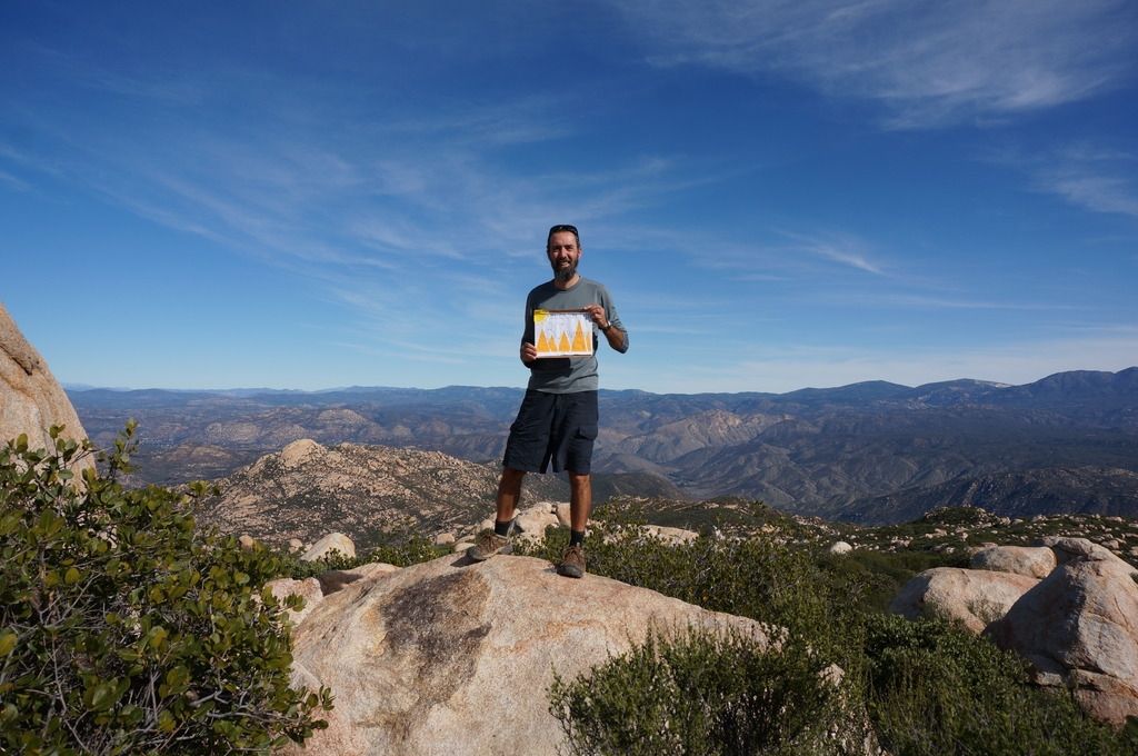
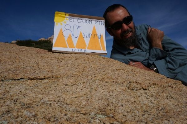
edited by ziphius on 12/29/2016 |
12/30/2016
Topic:
Ghost Mountain Article
ziphius
|
That's a great quote rockhopper. So true. |
12/30/2016
Topic:
To the top of El Cajon Mountain aka "The Beast"
ziphius
|
surfponto wrote:
Geesh I said I would never do it a second time :-)
I said the same thing after my first trip in 2002. Didn't do the 2nd trip until 2007. Then in late 2010, I started doing it on a regular basis. |
12/31/2016
Topic:
To the top of El Cajon Mountain aka "The Beast"
ziphius
|
dsefcik wrote:


I have 4 or 5 trips under my belt...nice work, going for 100??
Yep, going for 100. I never carried the weight you did up that peak though. |
1/1/2017
Topic:
McCain Valley Sunrise Power Link
ziphius
|
Update on McCain Valley Road vehicle / construction activity related to Tule Wind project. |
1/6/2017
Topic:
Route Advice for IP/Canebrake/Red Top
ziphius
|
I've done Red Top once from Inner Pasture, taking the wash that is due north of the summit. My trip report is here. That is a tough, vegetation-choked route and I ended up taking a slightly different route down, avoiding the wash and deciding to deal with more boulders. I was able to summit Red Top in February by leaving my tent in Inner Pasture at 0645, taking about 4 hrs to summit, made it back to my tent around 1400 hrs, and then hiked out to my car at Agua Caliente via Moonlight Canyon. If Red Top is your goal and you only have 1 overnight, then I'd park at Agua Caliente Co. Pk. and take the Moonlight Canyon Route into Inner Pasture. Pay the $3 day use fee and indicate where you're going and when you're due out. Your pdf topo proposed route looked ambitious for a one-night trip, but maybe you're an ultrarunner. Two nights, I think you would be fine, but then you are carrying more water. Water is a limiting factor, as there aren't any reliable springs in Inner Pasture, other than the one time I encountered running water in the aforementioned wash. There is private property as the topo map indicates for the Crawford Ranch area. Daren on this forum has a lot of miles in that part of Canebrake / Inner Pasture and will probably have good advice. The next time I attempt Red Top, I'd try the SE face, which puts you in Canebrake. Good luck. - Jim
edited by ziphius on 1/6/2017 |