|
anutami Posts: 491
2/28/2012
|
I guess there is a slice of ABDSP along Sunrise Hwy, but the Park is Closed. Does anyone know any history about why?
Headed north on sunrise hwy just passed Penny Pines

first section of the park on the West side of the road
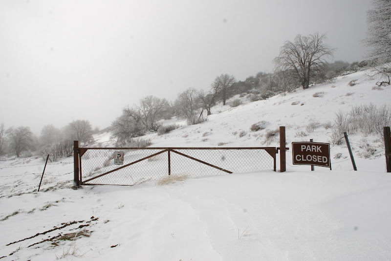
Right across the street there is a jeep trail, that I think goes north towards oriflamme canyon...anyone been on this?

lucky 5 ranch is a ways more north...Isn't first section of the ranch on ABDSP?

Across for the lucky 5 ranch gate (on the east side of sunrise hwy) there is another jeep trail. This is a cattle gate and not locked. Anyone explored this area?

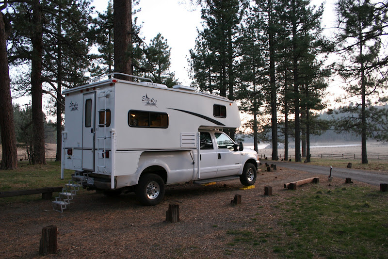
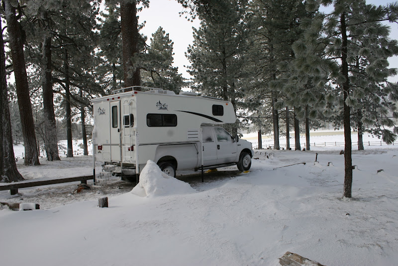
Looks like there was a light dusting on whale peak

Before the storm hit
and after
|
|
|
link
|
|
mrkmc Posts: 87
2/28/2012
|
I have walked down the road across from the ranch. I hiked out to Oriflamme Mountain and the Roost benchmark from there. I saw a camper back there. Looked like the person was living there. Uncle Rico? I think its in the state park. The PCT crosses the dirt road about 3/4 of mile from the gate. Great pictures of the fresh snow!
|
|
|
link
|
|
dsefcik Administrator Posts: 2634
2/28/2012
|
The PCT runs thru that area. I used to run ultra races and many of the courses went thru Lucky 5 down/up Oriflamme and over to Banner. One race started at Pinyon Wash and headed over thru Blair Valley, up Oriflamme and ended in Cuyamaca. We would also use the jeep roads, I know those trails pretty well.
Just like other parks, ABDSP continues to acquire land and it is not always available for public use until it is determined how human impacts will effect the area and what the best use for the land will be...that is my guess.
With a nice rig like yours a camping trip up to the snow would actually be enjoyable...nice! Thanks for sharing those pictures!
--
http://www.sefcik.com
http://www.darensefcik.com
http://www.carrizogorge.com
|
|
|
link
|
|
dsefcik Administrator Posts: 2634
2/28/2012
|
BTW, you can download a map of abdsp and it shows the boundaries pretty well:
http://www.parks.ca.gov/pages/638/files/ABDSPmap.pdf
--
http://www.sefcik.com
http://www.darensefcik.com
http://www.carrizogorge.com
|
|
|
link
|
|
dsefcik Administrator Posts: 2634
2/28/2012
|
Some more good reading regarding this and other land acquired for abdsp
http://theabf.org/what_we_do/saving_land/protected_land
http://www.parks.ca.gov/pages/638/files/anza-borrego%20desert%20state%20park%20magazine.pdf
San Felipe Valley
http://www.parks.ca.gov/pages/638/files/anza-borrego%20desert%20state%20park%20magazine.pdf
--
http://www.sefcik.com
http://www.darensefcik.com
http://www.carrizogorge.com
|
|
|
link
|
|
ziphius Posts: 911
2/29/2012
|
Great photos. You timed your visit well. Makes hot coffee all the more enjoyable. If I were Uncle Rico, I'd live back there somewhere. 
--
http://www.coyotelearning.org
|
|
|
link
|
|
herofix Posts: 30
3/1/2012
|
Isn't there a section of the Fages trail up near that area? I seem to recall hiking down to Oriflamme Canyon with the Boy Scouts from a mountain road like that...the pic with the caption "Right across the street there is a jeep trail, that I think goes north towards oriflamme canyon" looks familiar, as does the Lucky 5 Ranch view.
|
|
|
link
|
|
dsefcik Administrator Posts: 2634
3/1/2012
|
There is a dirt road that goes straight down thru Oriflamme out to the S2. Before it drops down into Oriflamme it also branches off north towards Banner. you can see old mining/milling sites out there, very interesting area.
--
http://www.sefcik.com
http://www.darensefcik.com
http://www.carrizogorge.com
|
|
|
link
|