|
tommy750 Posts: 1086
12/23/2012
|
Had enough shopping malls for this year so decided to head back to Pinto Canyon and locate the petroglyph sites I missed my last trip out (http://www.anzaborrego.net/anzaborrego/forum/topic373-pinto-wash-petroglyphs.aspx). Parked at the north end of Davies Valley and headed south.
Gate to Davies Valley
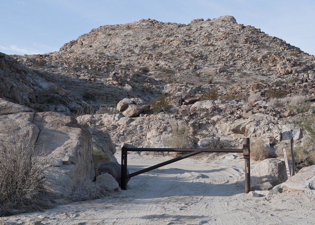
Davies Valley Gate by tomteske, on Flickr
Took one of several canyons ascending the long ridge on the western edge of the valley. The canyon mouth had an old General Land Office marker with a nice tower over it.
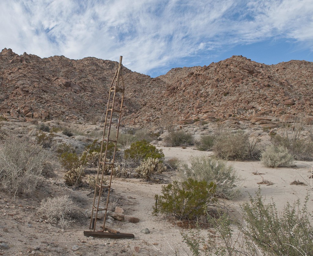
BM Tower by tomteske, on Flickr
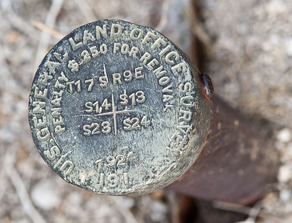
BM 1924 by tomteske, on Flickr
Wasn't sure what the markings meant so did a little internet research. This is a section marker in Township T17 S R9E and is located at the corner of Sections 14,13,23 and 24. The GLO was an agency set up by the Homestead Act and tasked with mapping government land in the west. It was subsequently absorbed by BLM.

Section 14 by tomteske, on Flickr
Halfway up the canyon looking toward Coyote Wells
Toward Coyote Wells by tomteske, on Flickr
Morteros at the top

Canyon Entrance Morteros by tomteske, on Flickr
Headed south on a well worn trail not needing the GPS at all.
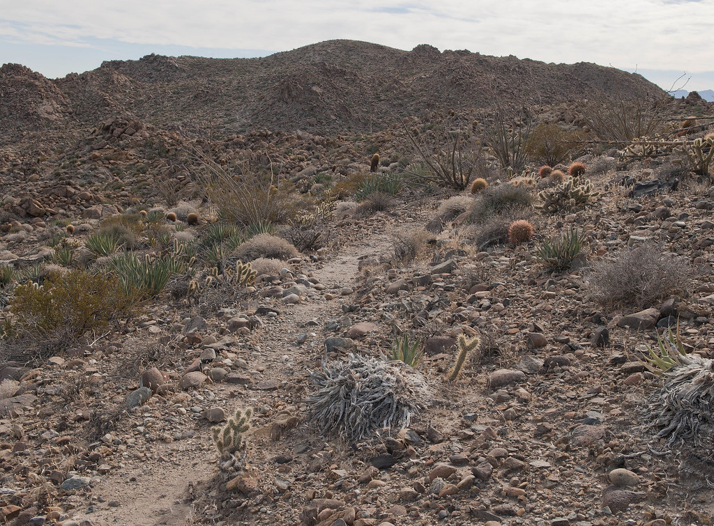
Immigrant Trail by tomteske, on Flickr
Nice view north toward Whale and San Jacinto beyond
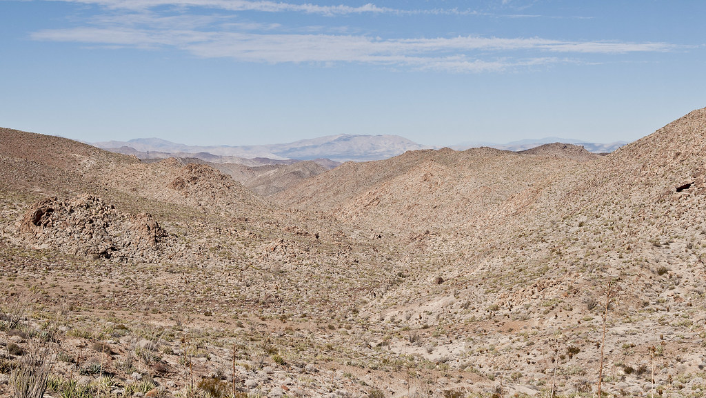
Toward Whale Peak by tomteske, on Flickr
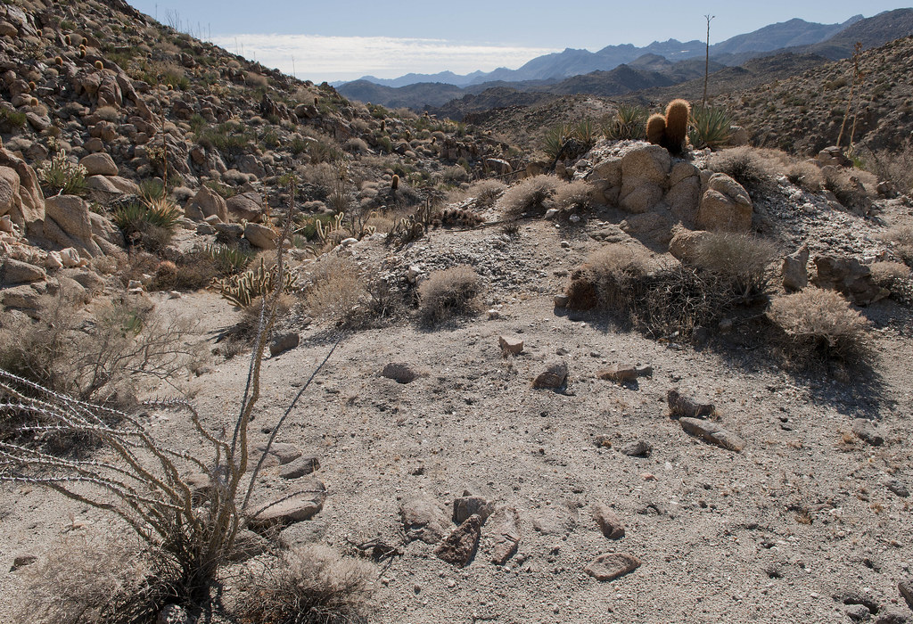
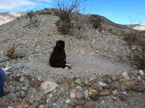
Stumbled onto a presumed sleeping circle overlooking the canyon leading south to Pinto. First one I've ever seen.
Sleeping Circle by tomteske, on Flickr
Sleeping Circle2 by tomteske, on Flickr
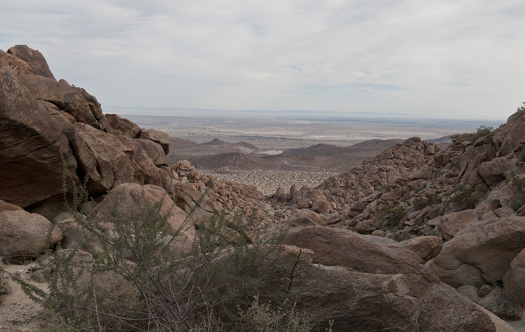
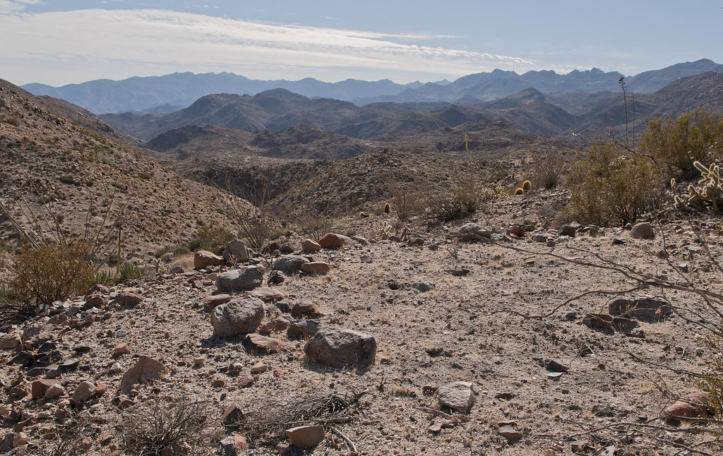
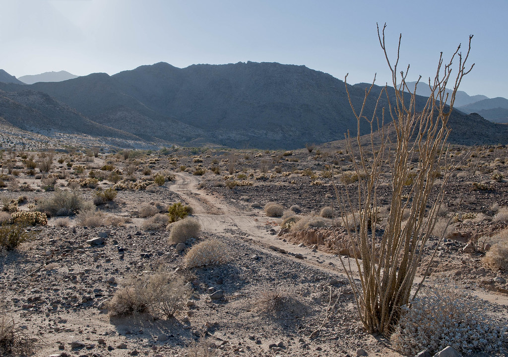
The canyon narrowed and steepened as it approached Pinto
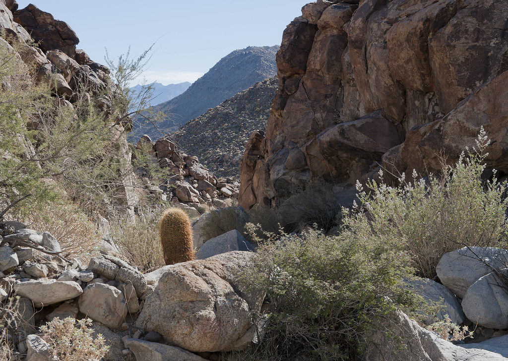
North of Pinto Canyon by tomteske, on Flickr
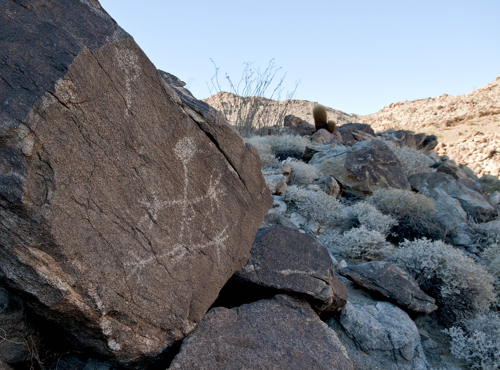
One of two modern pictographs I saw
Modern Pictograph by tomteske, on Flickr
Strange geoglyph by the trail
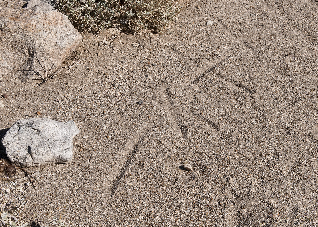
Modern Geoglyph by tomteske, on Flickr
Finally made it into Pinto Canyon. Took a brief peek at the palm oasis with the blue cross before heading downstream. No water there this time.

Cruz Azul Spring by tomteske, on Flickr
Mapped out a likely spot for the petroglyph site way downstream but something caught my eye
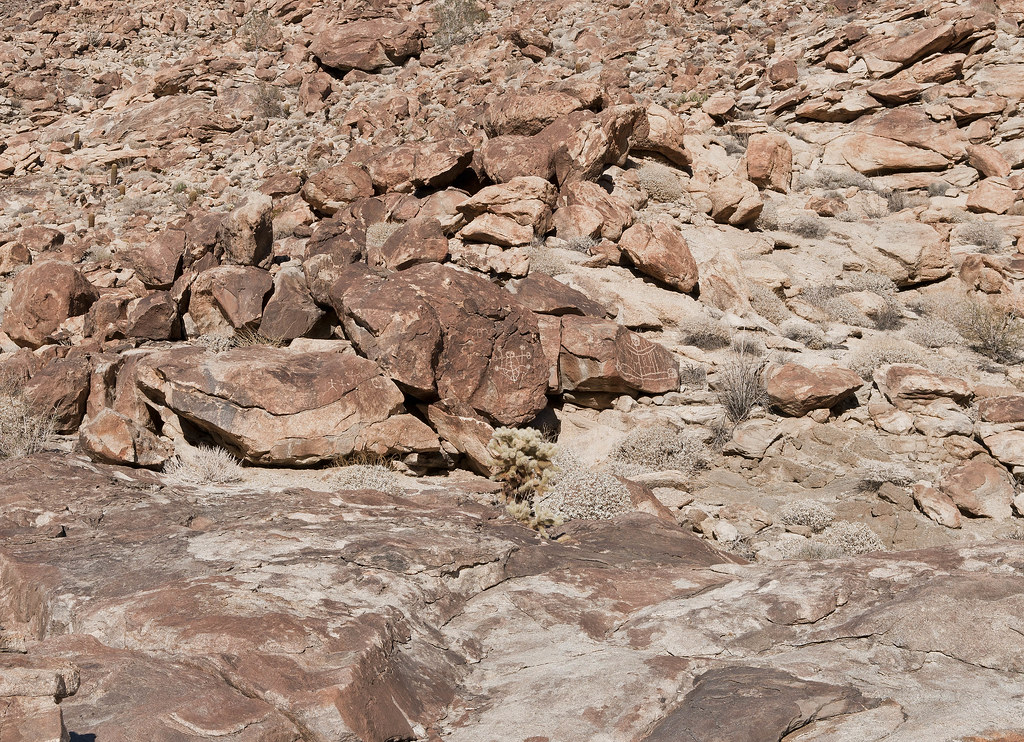
Site B by tomteske, on Flickr
Had walked right by the site last time out although it was pretty dark by then
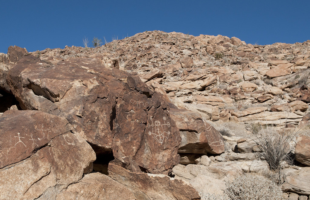
Site B2 by tomteske, on Flickr
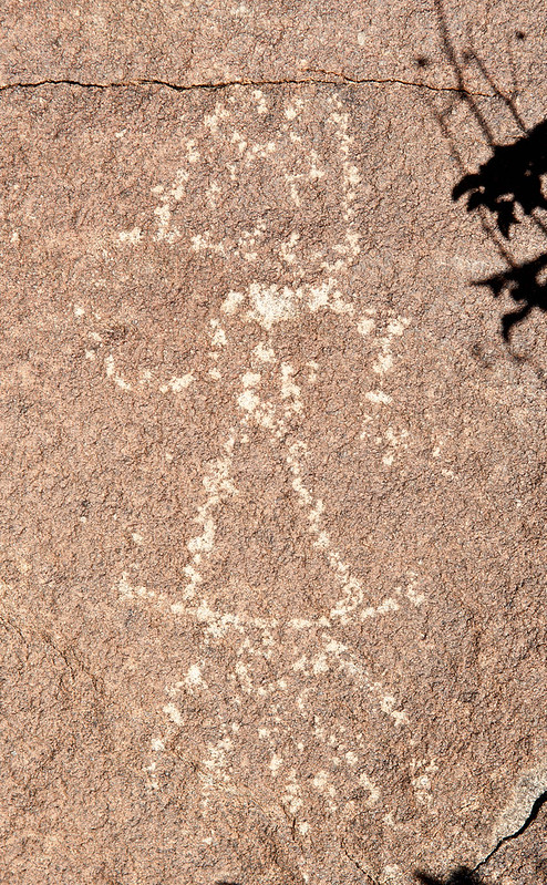
Pretty bizarre looking glyphs with even carved eye sockets
Site B Detail2 by tomteske, on Flickr

Site B Detail4 by tomteske, on Flickr
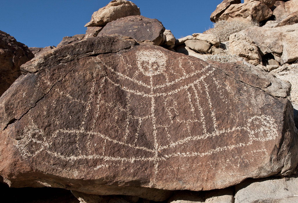
Across the canyon was another glyph location
Stie B Detail7 by tomteske, on Flickr
Didn't have time to look for another site between this one and the shelter cave with the boat-looking petroglyph farther upstream. Headed out of Pinto Canyon and into Davies Valley.
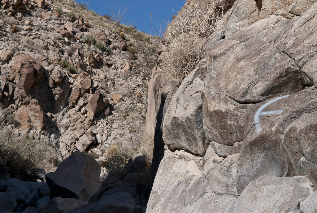
Looking back toward the mouth of Pinto Canyon
Mouth of Pinto Canyon by tomteske, on Flickr
Remnants of one of two completely destroyed vehicles next to the Davies Valley road
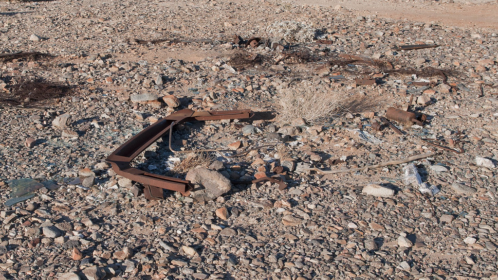
Davies Car by tomteske, on Flickr
Looking south down Davies Valley as the Sun fades
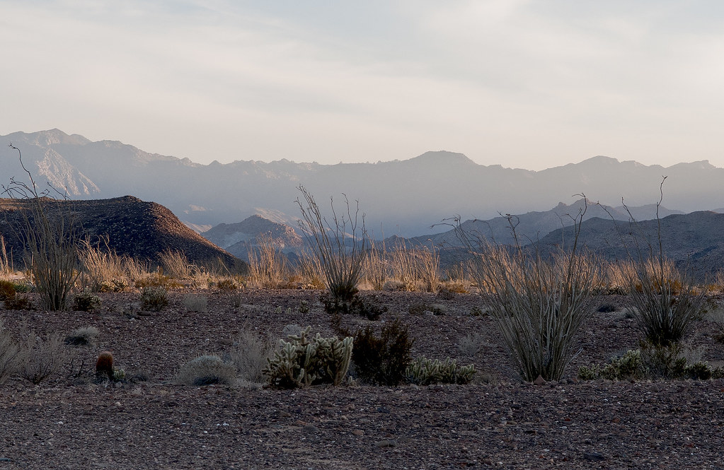
Davies Valley Looking South by tomteske, on Flickr
Have been watching the devolution of this Blazer over the past couple years
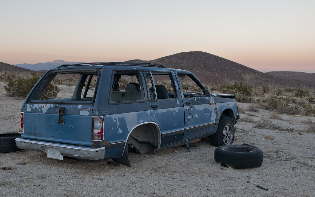
Davies Blazer2 by tomteske, on Flickr
Was rolled over on its side to harvest the rear end last time out but now upright again
Davies Blazer by tomteske, on Flickr
If you want to see it over the last couple years, here's a couple videos taken in Feb '11 and Feb '12
http://www.flickr.com/photos/tommy750/8301216511/
http://www.flickr.com/photos/tommy750/8302314224/
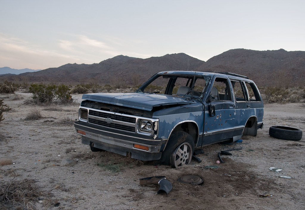
Father up, found another SUV, new since my last trip out 2/26/12
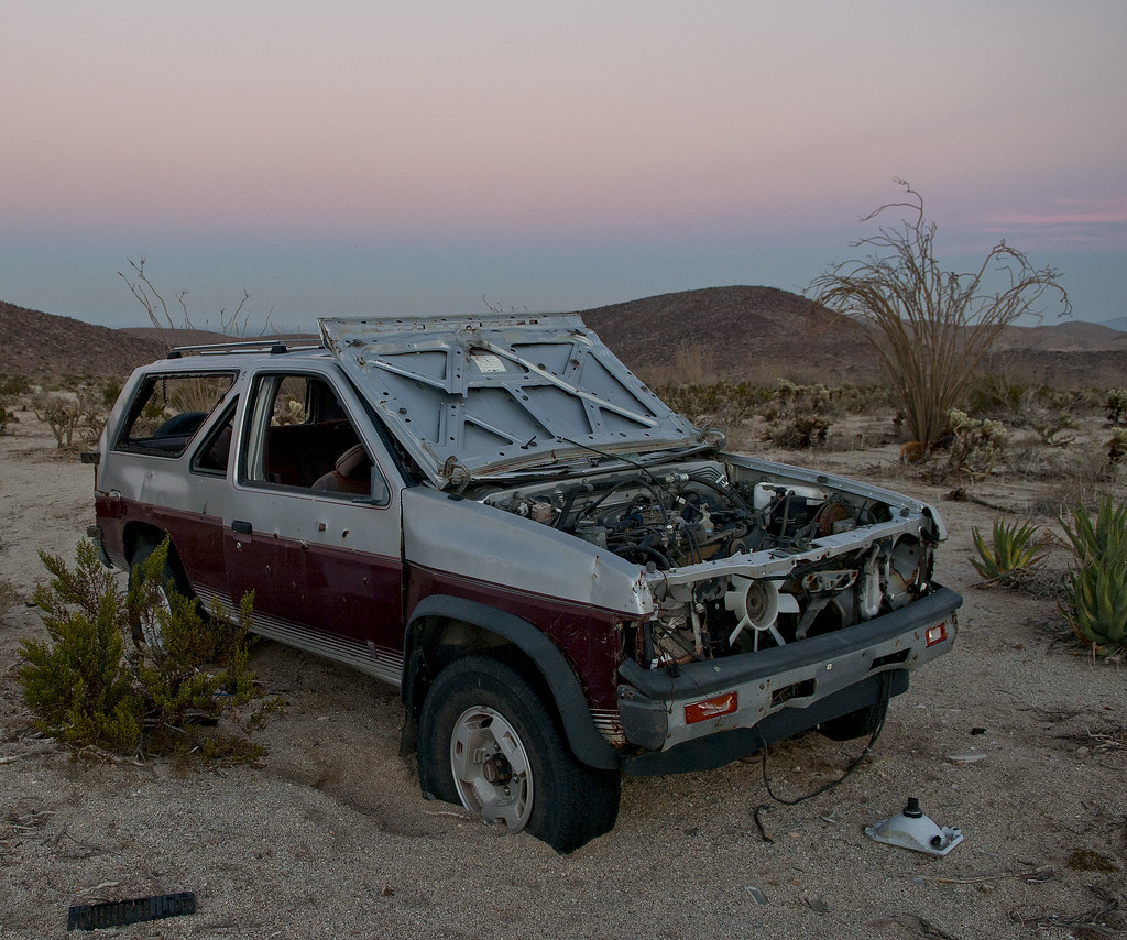
Davies Nissan by tomteske, on Flickr
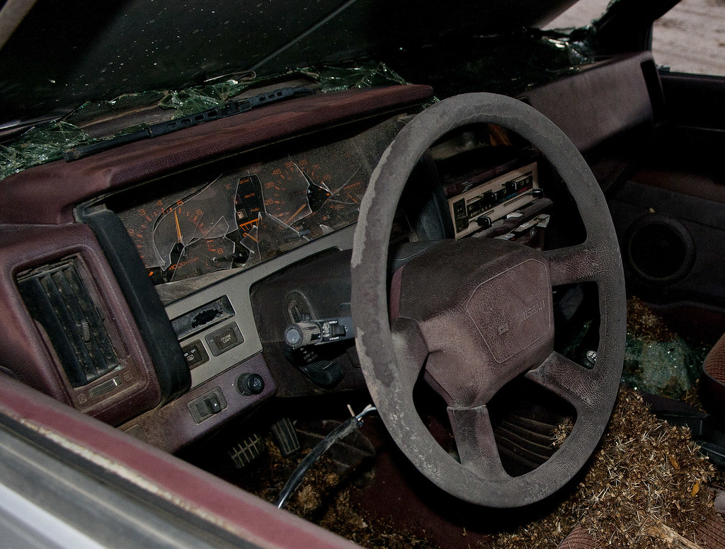
Davies Nissan2 by tomteske, on Flickr
Nice enjoyable time in the Jacumba Wilderness. Sixteen miles, five mylar balloons and zero fights over parking spaces  Happy Holidays. Tom Happy Holidays. Tom

Pinto Canyon From Davies Valley 12-22-12 by tomteske, on Flickr
edited by tommy750 on 12/23/2012
edited by tommy750 on 12/23/2012
|
|
|
link
|
|
surfponto Administrator Posts: 1369
12/23/2012
|
Looks like a great day Tom
I need to go check out that area
Feliz Navidad a ti tambien
--
https://www.anzaborrego.net/


|
|
|
link
|
|
mrkmc Posts: 87
12/23/2012
|
Is that gate ever open or is the area only accessible by foot?
|
|
|
link
|
|
tommy750 Posts: 1086
12/23/2012
|
mrkmc wrote:
Is that gate ever open or is the area only accessible by foot?
My understanding is it's always closed except to USBP (and the drivers of those two SUVs ).
|
|
|
link
|
|
dsefcik Administrator Posts: 2634
12/24/2012
|
Tom, that is just an awesome TR...!!
I have been looking at my maps for sometime thinking about a route close to that, now I am inspired to get out there. I have seen pictures of those glyphs before, glad you were able to find them. Seeing those two vehicles all shot up near the border like that all I could think of was the movie No Country for Old Men.....you didn't find any cash did you??
The sleeping circles are interesting, I have found many of them in the park, usually up on small hills that have small saddles overlooking a valley.
Thanks for Earthpoint lead, that looks interesting.
--
http://www.sefcik.com
http://www.darensefcik.com
http://www.carrizogorge.com
|
|
|
link
|
|
tommy750 Posts: 1086
12/24/2012
|
dsefcik wrote:
Tom, that is just an awesome TR...!!
I have been looking at my maps for sometime thinking about a route close to that, now I am inspired to get out there. I have seen pictures of those glyphs before, glad you were able to find them. Seeing those two vehicles all shot up near the border like that all I could think of was the movie No Country for Old Men.....you didn't find any cash did you??
The sleeping circles are interesting, I have found many of them in the park, usually up on small hills that have small saddles overlooking a valley.
Thanks for Earthpoint lead, that looks interesting.
Here's a route for you. Found it in Desert Magazine July 1946. Have been trying to reconstruct the path based on their clues and help from Google Earth and topos. It's quite a challenge. Would have to skip the dip into Mexico but the rest looks like it could be done. Have tried to find old maps with those springs but can't find any. Mortero and Juniper can be located by their description. Not sure about Mesquite. Caltopo etc doesn't seem to cover that area circa the 1940s. If you know a source, let me know.
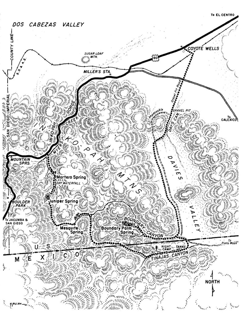
194607-DesertMagazine-1946-July(Pinto Canyon)-15 by tomteske, on Flickr
Yeah, that was one scary movie. Have daydreamed about that scenario on long hikes and just don't think I could pull off something like that. One of my favorite movie quotes is from Mickey Rourke speaking to William Hurt in Body Heat, "There's fifty ways to f#@* up every crime. If you think of 25, you're a genius, and you're no genius."
With regards to Earthpoint and the General Land Office marker, was embarrassed to discover the topo map has the township sections already marked off and numbered. Need to reread my Wilderness Navigation book! Tom
edited by tommy750 on 12/24/2012
|
|
|
link
|
|
anutami Posts: 491
12/24/2012
|
Nice report! Never heard of the sleeping circles, Do they have any significance other than a flat place to call home for the night? I bet I have passed by them not even knowing what they were. I really like the pic with the morteros. It is pretty rare to see granite boulders in the Desert w/out the desert varnish all over them. I wonder why they are so clean.
|
|
|
link
|
|
tommy750 Posts: 1086
12/24/2012
|
Nolan (anutami) wrote:
Nice report! Never heard of the sleeping circles, Do they have any significance other than a flat place to call home for the night? I bet I have passed by them not even knowing what they were. I really like the pic with the morteros. It is pretty rare to see granite boulders in the Desert w/out the desert varnish all over them. I wonder why they are so clean.
Apparently Malcolm Rogers is the archeologists in the late '20s and onward who found "8000" sleeping circles in the Desert Southwest. I can proudly say I've now found one (and maybe one more). Here's his book sleeve (with a few sleeping circles!) and an illustration describing some of the ones he discovered.
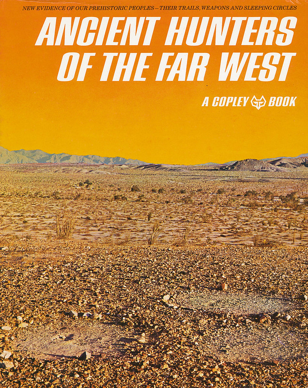
Malcolm Roger's Ancient Hunters by tomteske, on Flickr
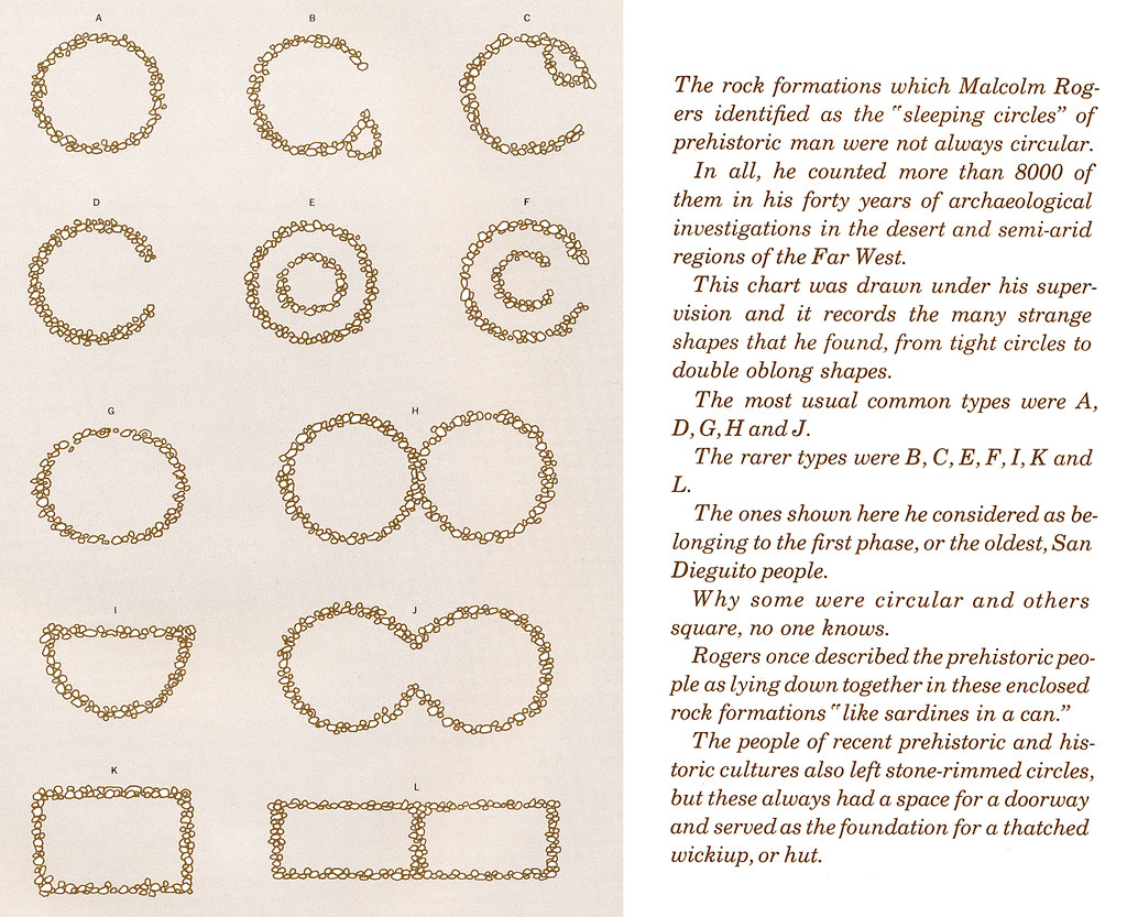
Sleeping Circles Doc2 by tomteske, on Flickr
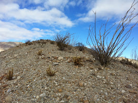
Here's my maybe sleeping circle farther down the same canyon
Sleeping Circle Maybe by tomteske, on Flickr
I'm thinking the chunk of granite has no varnish because it's in the stream bed and is getting sandblasted. Tom
|
|
|
link
|
|
anutami Posts: 491
12/24/2012
|
I wonder if this is one I found near the calcite mine area... seems kind of too big....maybe for hut or something
thanks for all the info

edited by anutami on 12/24/2012
|
|
|
link
|
|
dsefcik Administrator Posts: 2634
12/26/2012
|
tommy750 wrote:
Here's a route for you. Found it in Desert Magazine July 1946. Have been trying to reconstruct the path based on their clues and help from Google Earth and topos. It's quite a challenge. Would have to skip the dip into Mexico but the rest looks like it could be done. Have tried to find old maps with those springs but can't find any. Mortero and Juniper can be located by their description. Not sure about Mesquite. Caltopo etc doesn't seem to cover that area circa the 1940s. If you know a source, let me know. Thanks Tom, I want to follow up on the map after I get back from my trip this week. That article in Desert magazine looks interesting, I like the first pictures of Petroglyphs on page 4 that are titled Sand Tank Canyon AKA Renegade AKA Little Petroglyph Canyon. I have the same photos from my trip out a few weeks ago.
--
http://www.sefcik.com
http://www.darensefcik.com
http://www.carrizogorge.com
|
|
|
link
|
|
ziphius Posts: 911
12/26/2012
|
Thanks for sharing that awesome trip Tom. I was so mesmerized by the glyphs on the right of your 1st photo, that I completely missed the human figures to the left. Those petroglyphs are quite ornate and eeire. Yep, No Country For Old Men ran through my mind when I saw the bullet-ridden SUVs. I'd say you've found a 2nd sleeping circle for sure. Great trip. Jim
edited by ziphius on 1/4/2013
--
http://www.coyotelearning.org
|
|
|
link
|
|
DRT Lakeside Posts: 62
12/26/2012
|
Great trip and photos. I would love to check out that area as well. Nice to know about the gate as well. Maybe I could paint the samurai in USBP livery and mosey on through....though I fear that might only add one more to the # of bullet riddled vehicles out there.
Nice info on the Land Office marker as well. We found one near Superstition Mt. on Thanksgiving, and could only figure out that it was the corner of 4 sections, with a ton more marks on it. Now the mystery may be solved. I finally got ahold of the (bad) photo I took with my dads flip phone and it seems I only got a part of the marker in the photo. "Land Office" is there but no #s in the pic. We are going out to that area this weekend and I will try to find it again if it is not covered in blowing sand.
|
|
|
link
|
|
DRT Lakeside Posts: 62
12/26/2012
|
Saw this on our almost hike to the Diablo BM via June Wash and it was on a ridge/overlook/saddle area on the way up. Sleeping circle? or more modern? If I knew what it was, I wouldn't have let the dog on it.

dsefcik wrote:
Tom, that is just an awesome TR...!!
I have been looking at my maps for sometime thinking about a route close to that, now I am inspired to get out there. I have seen pictures of those glyphs before, glad you were able to find them. Seeing those two vehicles all shot up near the border like that all I could think of was the movie No Country for Old Men.....you didn't find any cash did you??
The sleeping circles are interesting, I have found many of them in the park, usually up on small hills that have small saddles overlooking a valley.
Thanks for Earthpoint lead, that looks interesting.
|
|
|
link
|
|
tommy750 Posts: 1086
12/26/2012
|
DRT Lakeside wrote:
Saw this on our almost hike to the Diablo BM via June Wash and it was on a ridge/overlook/saddle area on the way up. Sleeping circle? or more modern? If I knew what it was, I wouldn't have let the dog on it.
I've climbed that ridge to Diablo and saw that clearing. Had never heard of sleeping circles at the time and only thought what an awesome place to pitch your tent for the night. Sure looks like it could be a sleeping circle in retrospect. Tom.
|
|
|
link
|
|
tommy750 Posts: 1086
12/27/2012
|
Jim (ziphius) wrote:
Thanks for sharing that awesome trip Tom. I was so mesmerized by the glyphs on the right of your 1st photo, that I completely missed the human figures to the left. Those petroglyphs are quite ornate and eery. Yep, No Country For Old Men ran through my mind when I saw the bullet-ridden SUVs. I'd say you've found a 2nd sleeping circle for sure. Great trip. Jim
Those two large ones are the real iconic glyphs but a few others are nearby like this one:
Site B Detail5 by tomteske, on Flickr
|
|
|
link
|
|
tommy750 Posts: 1086
12/27/2012
|
DRT Lakeside wrote:
Great trip and photos. I would love to check out that area as well. Nice to know about the gate as well. Maybe I could paint the samurai in USBP livery and mosey on through....though I fear that might only add one more to the # of bullet riddled vehicles out there.
Nice info on the Land Office marker as well. We found one near Superstition Mt. on Thanksgiving, and could only figure out that it was the corner of 4 sections, with a ton more marks on it. Now the mystery may be solved. I finally got ahold of the (bad) photo I took with my dads flip phone and it seems I only got a part of the marker in the photo. "Land Office" is there but no #s in the pic. We are going out to that area this weekend and I will try to find it again if it is not covered in blowing sand.
I'm going to go out on a (short) limb and say your marker will have a cross with S12|S7 on top and S13|S18 below and above the cross T14S R10E. If it doesn't, I still don't have the township thing figured out
|
|
|
link
|
|
hikerdmb Posts: 423
12/27/2012
|
That looks like a great trip. We used to camp in Davies Valley all the time back in the days before the gate. On one trip we hiked up to the petroglyphs in Pinto Wash and as we approached I casually told my buddy, "If someone was way out here with a gun we would be easy targets." About a minute later we heard someone say, "You lookin' for these?" and there is a guy dressed all in camo sitting on top of the rocks where the glyphs were. He had a HUGE gun strapped to his leg. We checked out the glyphs and headed back down canyon walking in a serpentine manner. I don't know if anyone remembers or stayed in the campsites in Davies Valley but there were some sites with log books. The sites had names like Alpha Camp and Bravo Camp. Nice campsites but there were some interesting (strange) entries into those old log books.
David
|
|
|
+1
link
|
|
DRT Lakeside Posts: 62
12/27/2012
|
You are correct, there definitely was a cross with the 12,7,13,18 around it, but those were the only numbers we were able to remember, and my crummy pic did not help. I hope to grab a better picture, rubbing or something this weekend. I will definitely let you know if you have the hang of the Township stuff.
Dave
tommy750 wrote:
DRT Lakeside wrote:
Great trip and photos. I would love to check out that area as well. Nice to know about the gate as well. Maybe I could paint the samurai in USBP livery and mosey on through....though I fear that might only add one more to the # of bullet riddled vehicles out there.
Nice info on the Land Office marker as well. We found one near Superstition Mt. on Thanksgiving, and could only figure out that it was the corner of 4 sections, with a ton more marks on it. Now the mystery may be solved. I finally got ahold of the (bad) photo I took with my dads flip phone and it seems I only got a part of the marker in the photo. "Land Office" is there but no #s in the pic. We are going out to that area this weekend and I will try to find it again if it is not covered in blowing sand.
I'm going to go out on a (short) limb and say your marker will have a cross with S12|S7 on top and S13|S18 below and above the cross T14S R10E. If it doesn't, I still don't have the township thing figured out
|
|
|
link
|
|
tommy750 Posts: 1086
12/30/2012
|
dsefcik wrote:
tommy750 wrote:
Here's a route for you. Found it in Desert Magazine July 1946. Have been trying to reconstruct the path based on their clues and help from Google Earth and topos. It's quite a challenge. Would have to skip the dip into Mexico but the rest looks like it could be done. Have tried to find old maps with those springs but can't find any. Mortero and Juniper can be located by their description. Not sure about Mesquite. Caltopo etc doesn't seem to cover that area circa the 1940s. If you know a source, let me know. Thanks Tom, I want to follow up on the map after I get back from my trip this week. That article in Desert magazine looks interesting, I like the first pictures of Petroglyphs on page 4 that are titled Sand Tank Canyon AKA Renegade AKA Little Petroglyph Canyon. I have the same photos from my trip out a few weeks ago.
Just had a chance to see p. 4. Have you ever noticed differences between pics you've taken and historic photos you've seen? Tom
|
|
|
link
|
|
harmono Posts: 71
12/31/2012
|
I found some kind of circle of stones near Bow Willow on top of a knoll. I also found a really small circle of stones near the Nortero Canyon road. I thought it was just a trail marker. Both of them I thought were not pre-historic. I did not see a clearing like in those pictures, but maybe I didn't notice.
--

IMG_1032 by harmono619, on Flickr
|
|
|
link
|
|
DRT Lakeside Posts: 62
1/1/2013
|
Just got back last night from Superstition area, and long story short-I couldn't find the marker again. I didn't put it into the GPS/Phone and figured I could find it. No luck after driving and walking all over the area for an hour or so. It was getting very cold and the wind and rain was starting, so we gave up (for now) but I put it in the GPS this morning
FYI it rained hard on us Sunday night and on the way back home (monday) there was still snow on the north facing slopes directly across from the In-Koh-Pah offramp. Never seen that before
DRT Lakeside wrote:
You are correct, there definitely was a cross with the 12,7,13,18 around it, but those were the only numbers we were able to remember, and my crummy pic did not help. I hope to grab a better picture, rubbing or something this weekend. I will definitely let you know if you have the hang of the Township stuff.
Dave
tommy750 wrote:
DRT Lakeside wrote:
Great trip and photos. I would love to check out that area as well. Nice to know about the gate as well. Maybe I could paint the samurai in USBP livery and mosey on through....though I fear that might only add one more to the # of bullet riddled vehicles out there.
Nice info on the Land Office marker as well. We found one near Superstition Mt. on Thanksgiving, and could only figure out that it was the corner of 4 sections, with a ton more marks on it. Now the mystery may be solved. I finally got ahold of the (bad) photo I took with my dads flip phone and it seems I only got a part of the marker in the photo. "Land Office" is there but no #s in the pic. We are going out to that area this weekend and I will try to find it again if it is not covered in blowing sand.
I'm going to go out on a (short) limb and say your marker will have a cross with S12|S7 on top and S13|S18 below and above the cross T14S R10E. If it doesn't, I still don't have the township thing figured out
|
|
|
link
|
|
dsefcik Administrator Posts: 2634
1/2/2013
|
The whole Diablo BM area has many areas that look like roasting pits and sleep circles. It seems an odd location to me but if you explore the whole area you will find many, many of them.
DRT Lakeside wrote:
Saw this on our almost hike to the Diablo BM via June Wash and it was on a ridge/overlook/saddle area on the way up. Sleeping circle? or more modern? If I knew what it was, I wouldn't have let the dog on it.
--
http://www.sefcik.com
http://www.darensefcik.com
http://www.carrizogorge.com
|
|
|
link
|
|
dsefcik Administrator Posts: 2634
1/2/2013
|
tommy750 wrote:
Just had a chance to see p. 4. Have you ever noticed differences between pics you've taken and historic photos you've seen? Tom In this particular instance it looks to me like the photographer climbed up on the rocks for his photo where I was not allowed to and had to use a 300mm lens.
--
http://www.sefcik.com
http://www.darensefcik.com
http://www.carrizogorge.com
|
|
|
link
|
|
tommy750 Posts: 1086
1/2/2013
|
DRT Lakeside wrote:
Just got back last night from Superstition area, and long story short-I couldn't find the marker again. I didn't put it into the GPS/Phone and figured I could find it. No luck after driving and walking all over the area for an hour or so. It was getting very cold and the wind and rain was starting, so we gave up (for now) but I put it in the GPS this morning
FYI it rained hard on us Sunday night and on the way back home (monday) there was still snow on the north facing slopes directly across from the In-Koh-Pah offramp. Never seen that before
DRT Lakeside wrote:
You are correct, there definitely was a cross with the 12,7,13,18 around it, but those were the only numbers we were able to remember, and my crummy pic did not help. I hope to grab a better picture, rubbing or something this weekend. I will definitely let you know if you have the hang of the Township stuff.
Dave
tommy750 wrote:
DRT Lakeside wrote:
Great trip and photos. I would love to check out that area as well. Nice to know about the gate as well. Maybe I could paint the samurai in USBP livery and mosey on through....though I fear that might only add one more to the # of bullet riddled vehicles out there.
Nice info on the Land Office marker as well. We found one near Superstition Mt. on Thanksgiving, and could only figure out that it was the corner of 4 sections, with a ton more marks on it. Now the mystery may be solved. I finally got ahold of the (bad) photo I took with my dads flip phone and it seems I only got a part of the marker in the photo. "Land Office" is there but no #s in the pic. We are going out to that area this weekend and I will try to find it again if it is not covered in blowing sand.
I'm going to go out on a (short) limb and say your marker will have a cross with S12|S7 on top and S13|S18 below and above the cross T14S R10E. If it doesn't, I still don't have the township thing figured out
Tried to find another section marker last night next to BM Weak. Weak had been vandalized and the bronze disk was missing. Only found a splintered post where the section marker should have been. Wonder how many still even exist. Tom
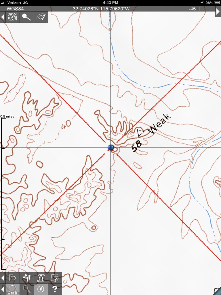
section marker by tomteske, on Flickr
|
|
|
link
|
|
Florian Posts: 129
4/9/2014
|
I didn't realize Davies Valley was closed to vehicles now. I've camped in Boundary Canyon years ago.
-Florian (who is reading through old posts)
|
|
|
link
|
|
tommy750 Posts: 1086
4/9/2014
|
Florian wrote:
I didn't realize Davies Valley was closed to vehicles now. I've camped in Boundary Canyon years ago.
-Florian (who is reading through old posts)
The Jacumba Wilderness was designated in 1994 but not sure exactly when the gates went up. Sure is peaceful. Have yet to see a single person while hiking out there. Tom
|
|
|
link
|
|
dsefcik Administrator Posts: 2634
4/10/2014
|
tommy750 wrote:
Have yet to see a single person while hiking out there. Tom Alive.....
--
http://www.sefcik.com
http://www.darensefcik.com
http://www.carrizogorge.com
|
|
|
link
|
|
Bob S Posts: 7
11/26/2016
|
To bad you can't camp in Davies Valley anymore. it was fun while it lasted. 71 to 85.
--
Big Sandy Shooter
|
|
|
link
|
|
tommy750 Posts: 1086
11/28/2016
|
Bob S wrote:
To bad you can't camp in Davies Valley anymore. it was fun while it lasted. 71 to 85.
Thanks for posting Bob S. Agree, would be a nice place to car camp. Still can backpack out there which I've pondered but that close to a somewhat porous border has to give one pause.
|
|
|
link
|
|
Britain Posts: 610
11/30/2016
|
I live in El Centro. One of my x-neighbors was a BP. in the years 2003-2004 made about 10 trips to Pinto. We drove in from Davis in BP vehicles also drove in from Myers, that trail dead ends about 1.5 miles from the west-northern part of Pinto. Haven't been back. Still do light packing from the Myers-8 and by Mountain springs.
--
Cant drive 55
Britain
http://icorva.com
|
|
|
link
|
|
Britain Posts: 610
8/19/2017
|
The map from 1946, the areas labeled as springs would they be water springs? I haven't been in the south-west corner yet. But will put this on the list of todo.
--
Cant drive 55
Britain
http://icorva.com
|
|
|
link
|
|
dsefcik Administrator Posts: 2634
8/20/2017
|
Britain wrote:
The map from 1946, the areas labeled as springs would they be water springs? I haven't been in the south-west corner yet. But will put this on the list of todo.
I would think so, I know there is water and springs up thru the different drainage's of Myer Creek.
--
http://www.sefcik.com
http://www.darensefcik.com
http://www.carrizogorge.com
|
|
|
link
|
|
tommy750 Posts: 1086
8/21/2017
|
Britain wrote:
The map from 1946, the areas labeled as springs would they be water springs? I haven't been in the south-west corner yet. But will put this on the list of todo.
I've seen water near one of the three springs (Juniper). Don't see any of them listed as springs on topo maps however.
edited by tommy750 on 8/21/2017
|
|
|
link
|
|
Britain Posts: 610
8/21/2017
|
tommy750 wrote:
Britain wrote:
The map from 1946, the areas labeled as springs would they be water springs? I haven't been in the south-west corner yet. But will put this on the list of todo.
I've see water near one of the three springs (Juniper). Don't see any of them listed as springs on topo maps however.
Thanks does appear they went through in winter. I'll check some of them out later.
--
Cant drive 55
Britain
http://icorva.com
|
|
|
link
|
|
sddarkman619 Posts: 153
12/5/2018
|
Anyone else want to try retracing that route on the old map?

|
|
|
link
|
|
Britain Posts: 610
12/5/2018
|
sddarkman619 wrote:
Anyone else want to try retracing that route on the old map?
I would Larry but prob not this year. Check with John? He mentioned going out to Pinto.
--
Cant drive 55
Britain
http://icorva.com
|
|
|
link
|
|
sddarkman619 Posts: 153
12/6/2018
|
Britain wrote:
sddarkman619 wrote:
Anyone else want to try retracing that route on the old map?
I would Larry but prob not this year. Check with John? He mentioned going out to Pinto.
I meant on just the map. But John, myself and Charles are heading there this Sunday at first light.
|
|
|
link
|
|
Britain Posts: 610
12/6/2018
|
The map would ab cool to do also.
--
Cant drive 55
Britain
http://icorva.com
|
|
|
link
|