|
tommy750 Posts: 1086
4/14/2013
|
John Rocque is a cartographer most famous for his 24 sheet map of London published in 1747, by far the most detailed to date. This map is the only known depiction of an inland sea past the confluens of the Colorado and Gila Rivers. It's felt by many to be a depiction of Ancient Lake Cahuilla although I wonder if it could be Laguna Salada. The final infilling of the lake not counting modern times commenced about 1600 with the lake empty by about 1700.
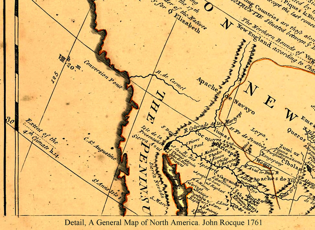
John Rocque A General Map of North America 1761 by tomteske, on Flickr
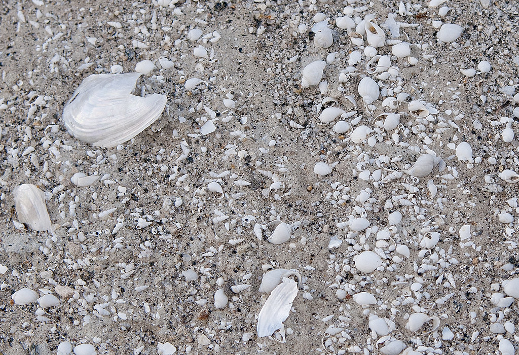
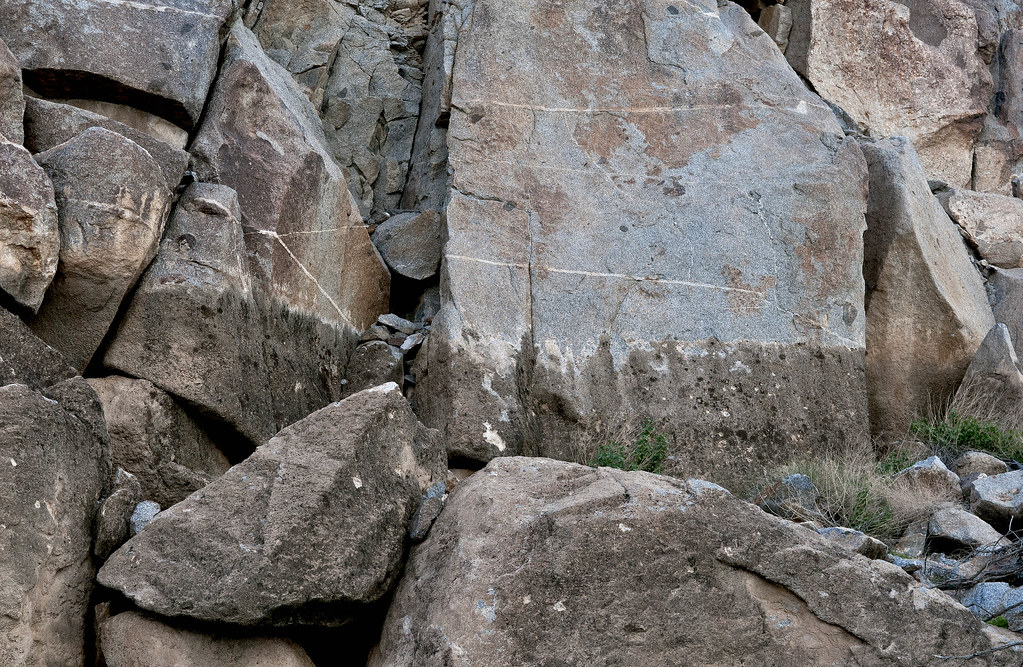
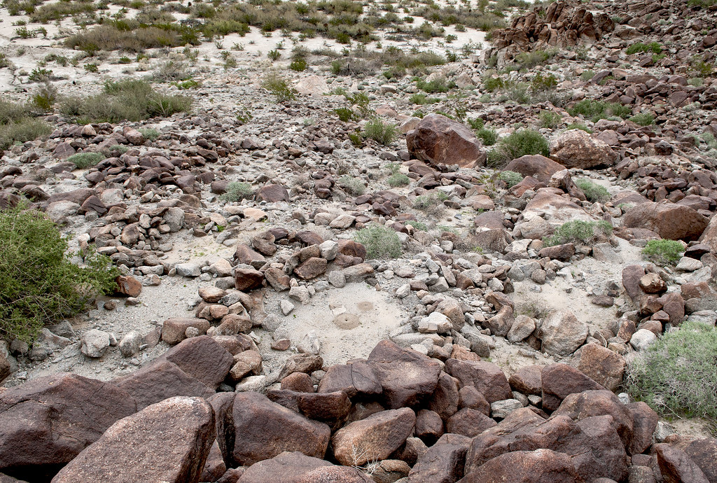
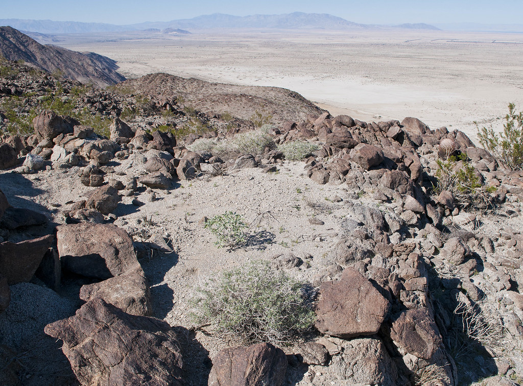
Decided to take a few trips out to the shoreline near Fish Creek Mts and see what was still there. Here's tumbled beach rock and shells in the middle of the desert. Pretty amazing.
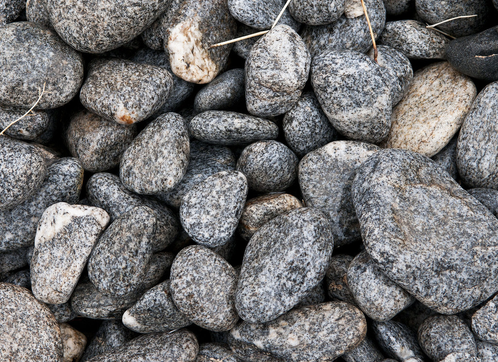
Polished Beach Rock by tomteske, on Flickr
Cahuilla Shoreline3 by tomteske, on Flickr
Cahuilla Beach by tomteske, on Flickr
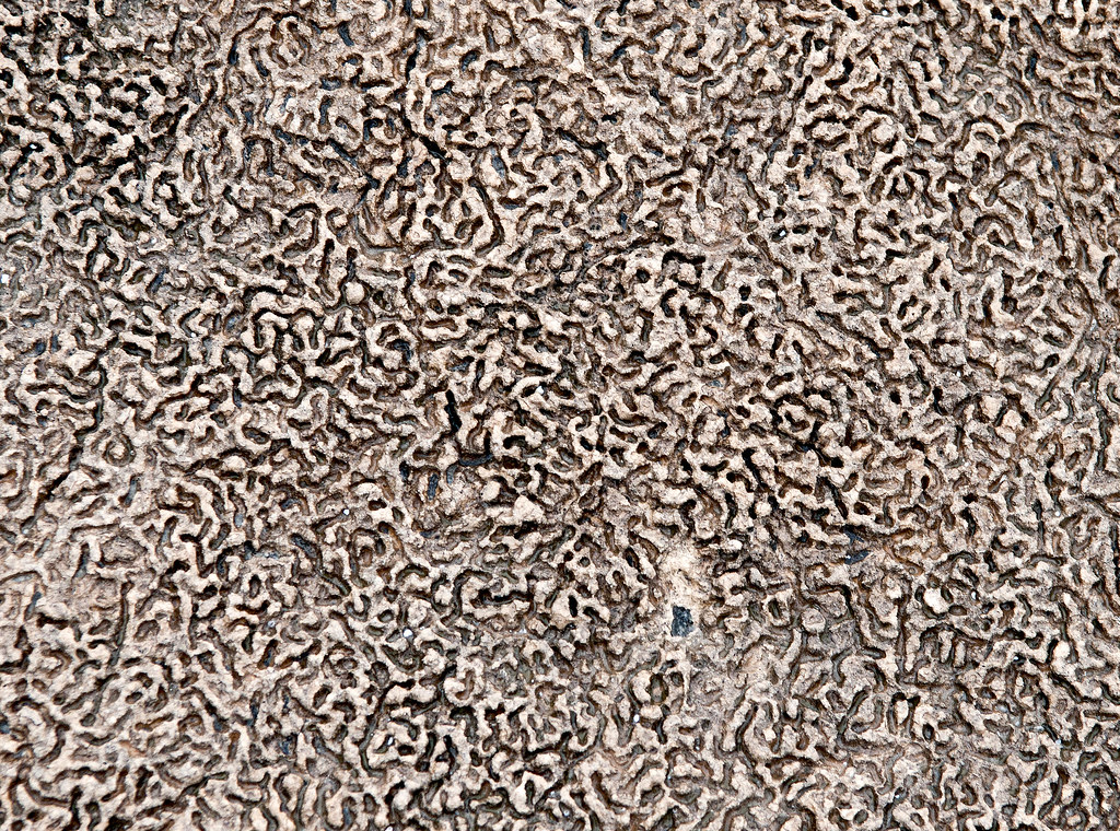
Up close, most of the rock is covered by a layer of tufa with a worm eaten appearance.
Tufa Line by tomteske, on Flickr
Cahuilla Concretions by tomteske, on Flickr
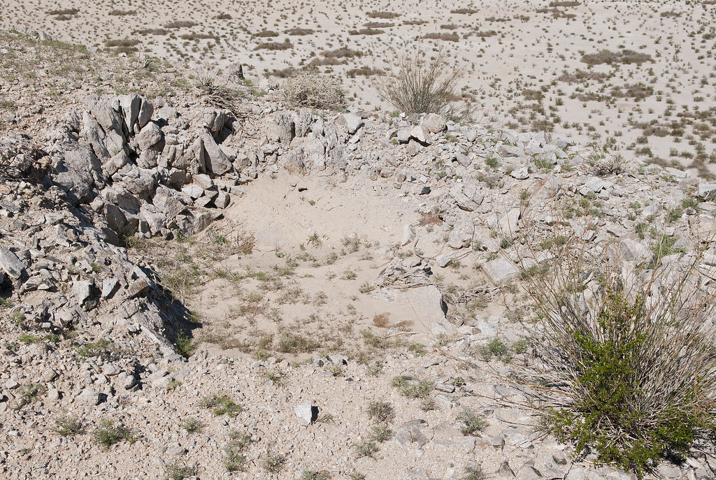
A number of circles are found on the actual shoreline and overlooking it. Thought they might be fish traps like Indio, but some look more like sleeping circles with clear floors. Not sure.
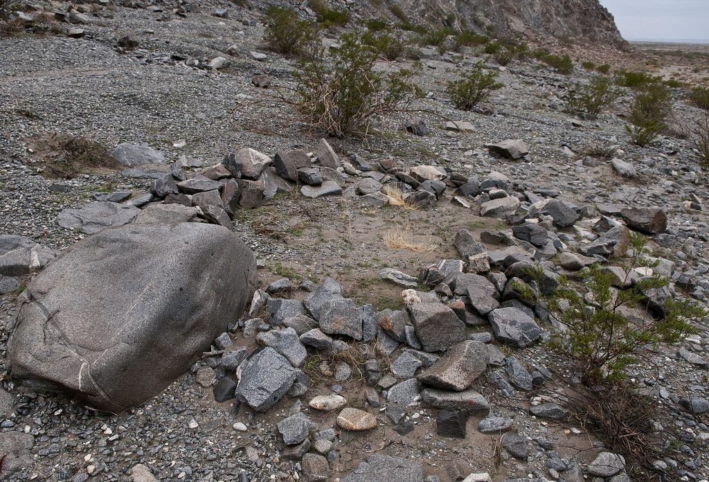
Fish Trap2 by tomteske, on Flickr
Middle Sleeping Circles by tomteske, on Flickr
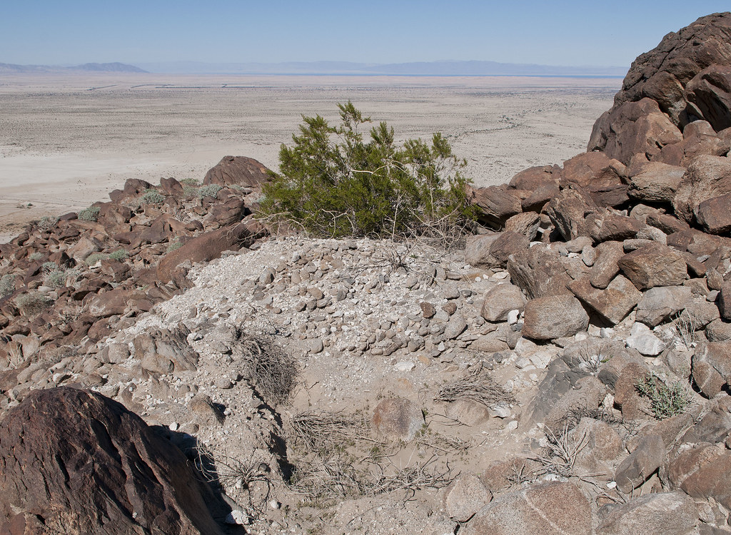
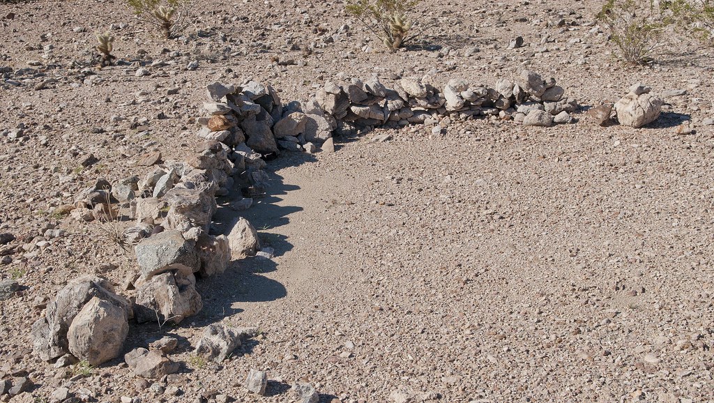
Above the shoreline in an alluvial fan, I found 10-20 circles in a group.
Sleeping Circles by tomteske, on Flickr
Another site up the shoreline had multiple circles and evidence of a previous archaeological investigation.
North Sleeping Circles by tomteske, on Flickr
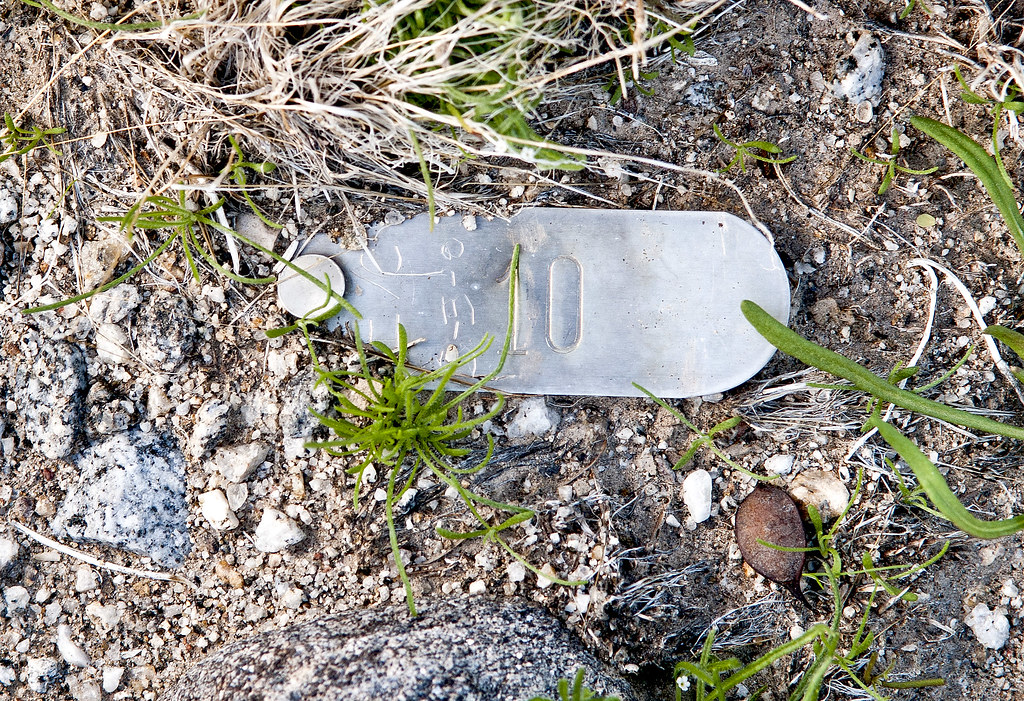
IVC 10 by tomteske, on Flickr
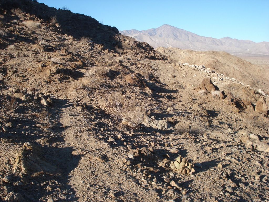
Back home, I noticed a trail arising from this last campsite and heading up into the Fish Creek Mts. Figured it was an old Indian trail and worth another trip.
Fish Creek Trail by tomteske, on Flickr
Here's the trail a couple hundred yards up.
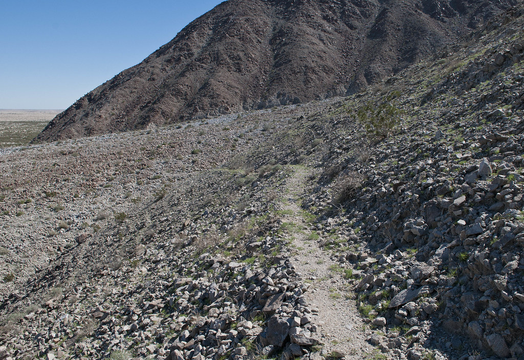
Trail by tomteske, on Flickr
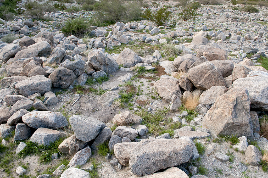
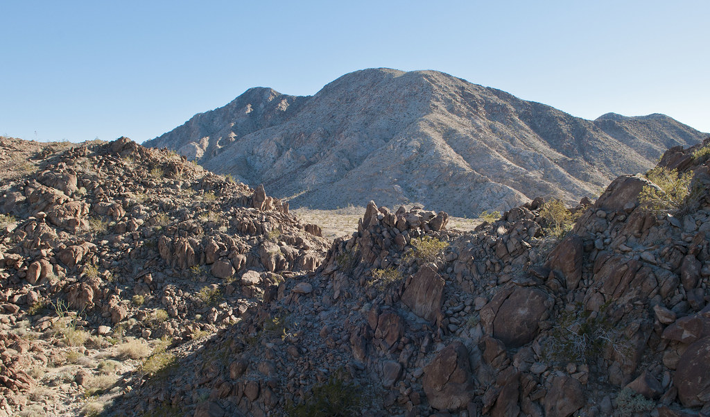
Higher up the trail, a nice view of the shoreline looking toward The Santa Rosas.
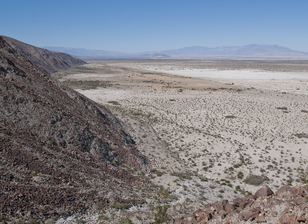
Cahuilla Beach by tomteske, on Flickr
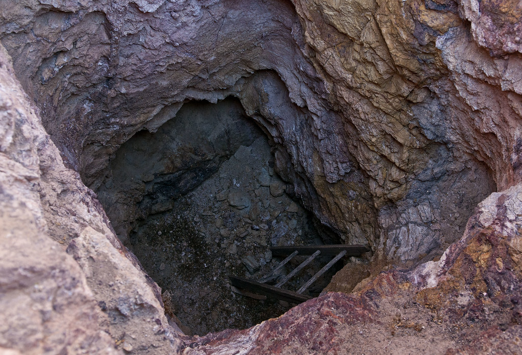
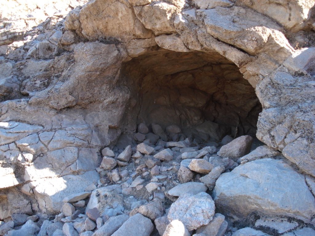
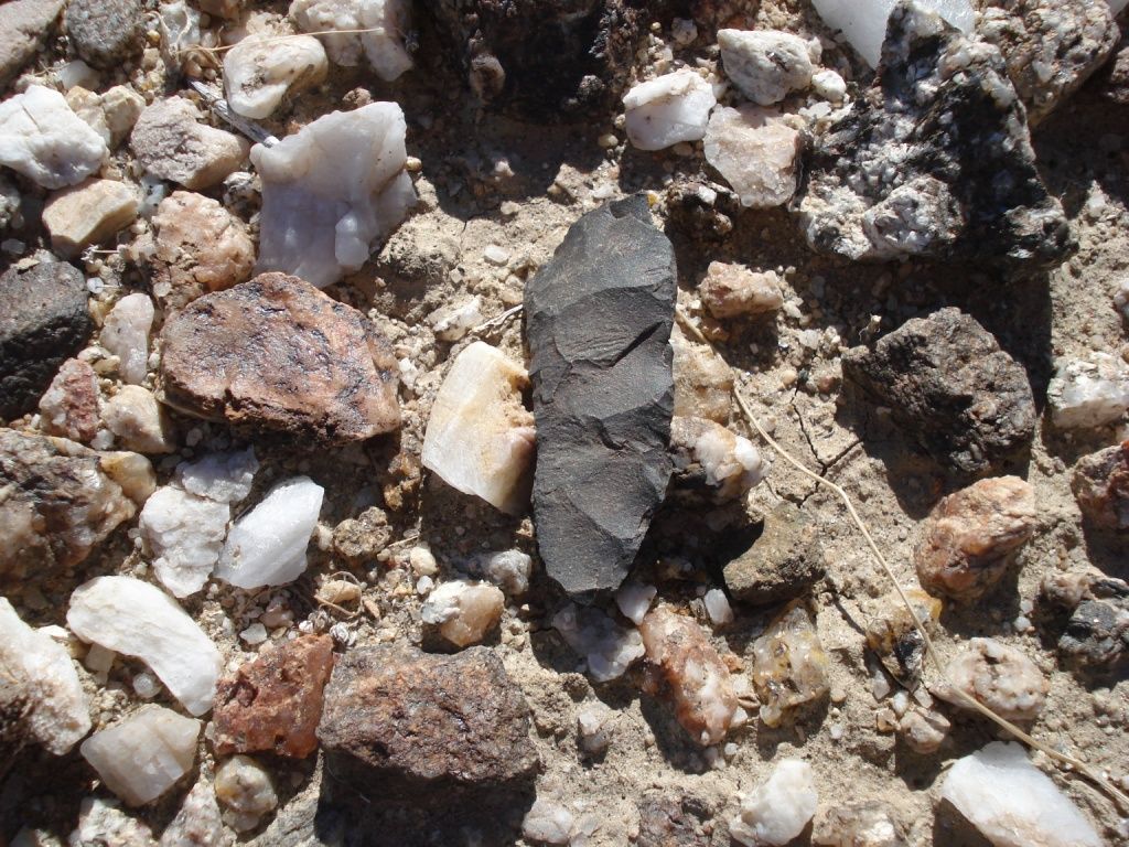
Found a pottery sherd so started thinking this definitely was an old native trail. Then I found several mine pits and realized it was actually an old mining trail.
Mine Pit1 by tomteske, on Flickr
Mine Pit by tomteske, on Flickr
However, found some sleeping circles higher up just off the trail, so who knows.
Two Sleeping Circles by tomteske, on Flickr
The only petroglyph I saw 
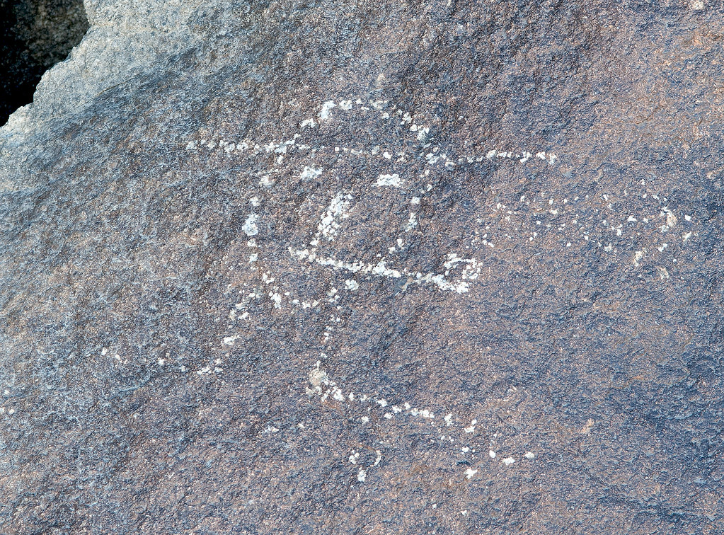
The Pipe by tomteske, on Flickr
On top, several mines. Not sure what they were mining but some of the tailings had pretty colors.
Mine2 by tomteske, on Flickr
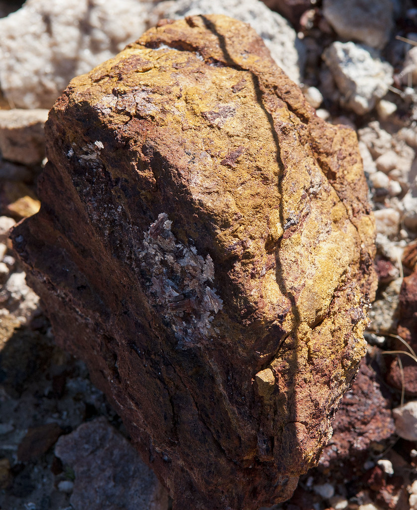
Mine2 Tailings by tomteske, on Flickr
Old windbreak maybe for a tent since no ruins were seen. Lots of old tin cans were strewn about.
Mine1 Windbreak by tomteske, on Flickr
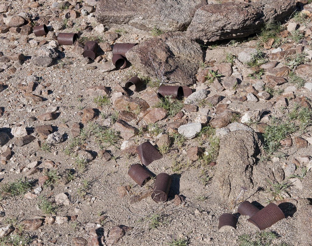
Mine1 Cans by tomteske, on Flickr
Headed further West and came across this in an isolated canyon. Is this what they mean by a "pot drop" as in dropped pot? Think you could piece this olla back together.
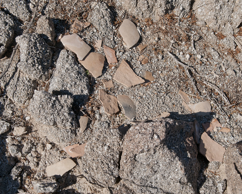
Olla by tomteske, on Flickr
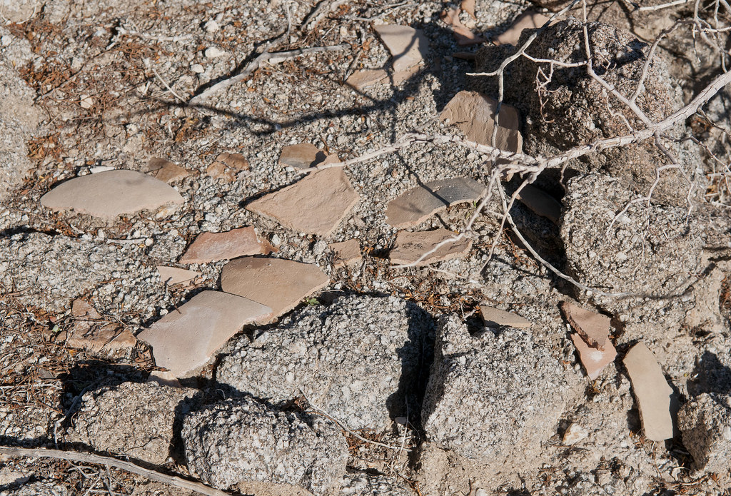
Olla2 by tomteske, on Flickr
A few feet further, a view of BM Eagle in the foreground. The little clearing is the start of Red Rock Canyon to the right and a tributary of Barrett Canyon to the left.
Toward BM Eagle by tomteske, on Flickr
The only traces of ordinance I found on top.
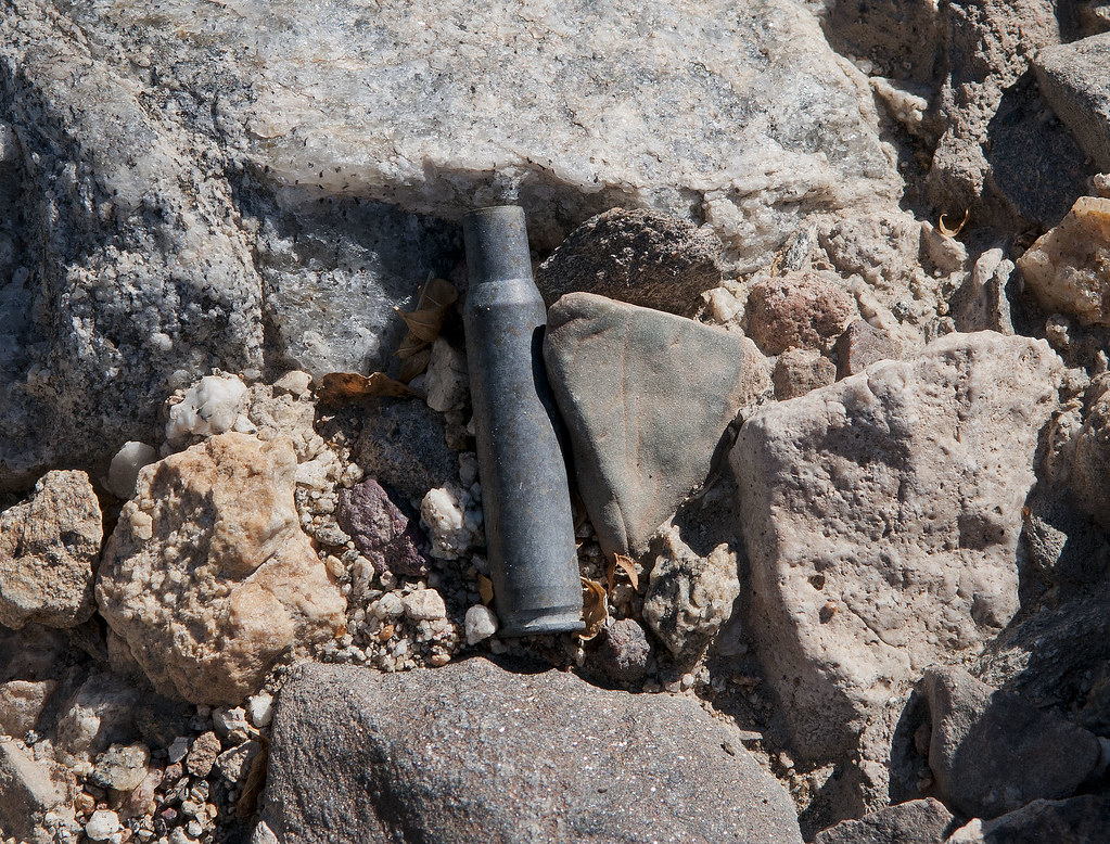
Shell by tomteske, on Flickr
At the Eastern flank of Fish Creek Mts, the US Gypsum mining railroad is still quite active. There are several old spurs on the West side of the tracks in areas that look like beach rock was being mined.
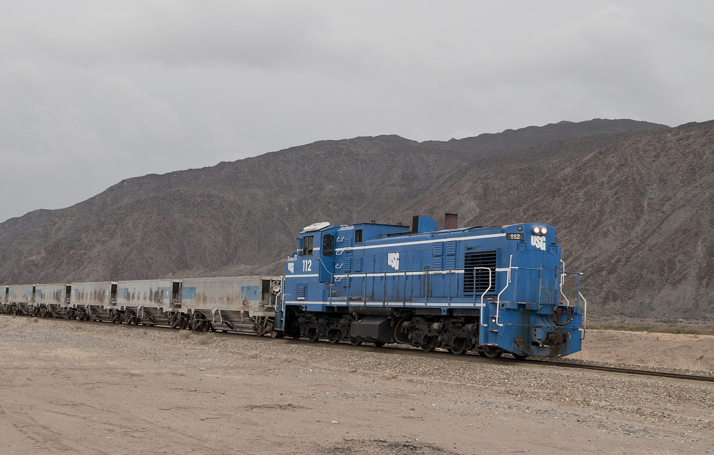
USG Train by tomteske, on Flickr
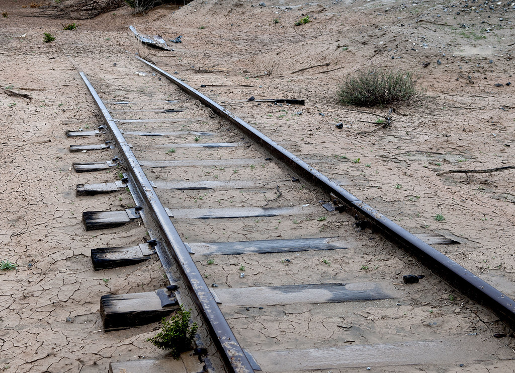
Mining Railroad by tomteske, on Flickr
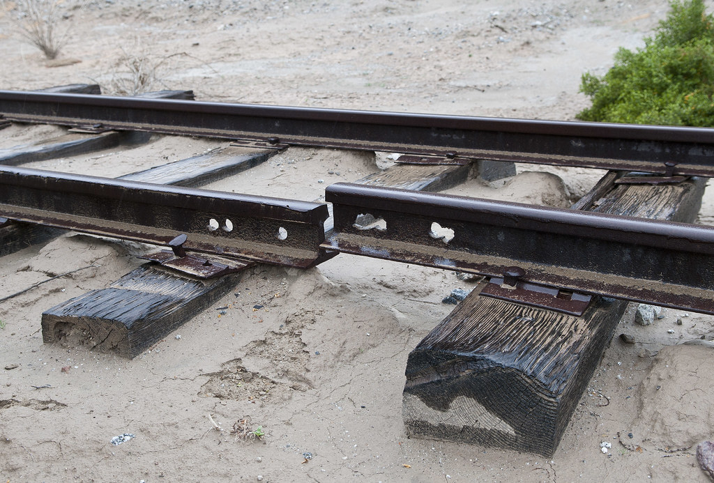
Broken Rail by tomteske, on Flickr
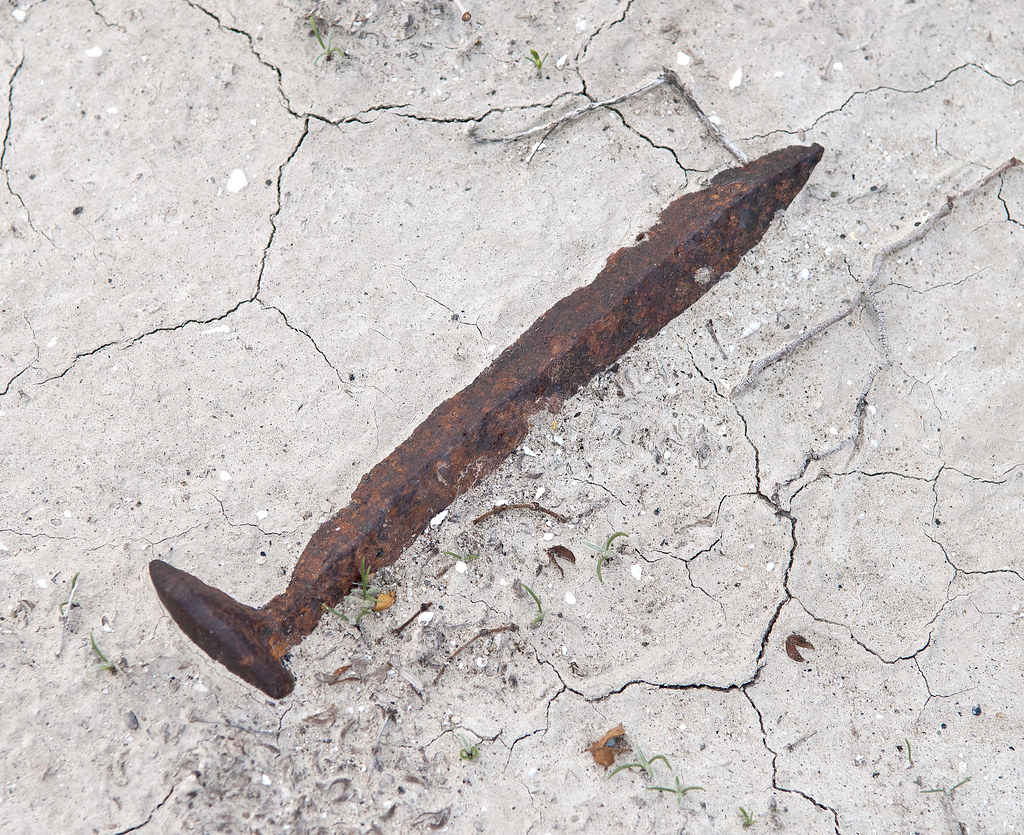
Fish Creek Mts Spike by tomteske, on Flickr
The trestle at Carrizo Creek. Was surprised to see one of the graffiti artists is a client of mine. Tisk, tisk! Enjoy you weekend.
P.S. I promise to never post on Lake Cahuilla again! Tom
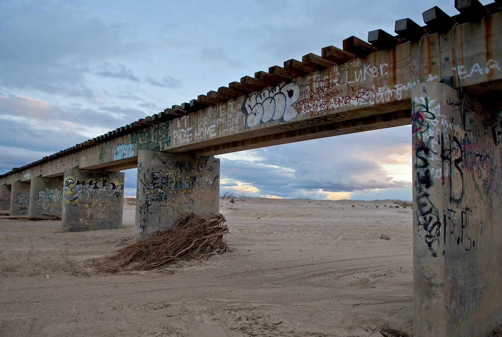
The Bridge by tomteske, on Flickr
|
|
|
link
|
|
DesertWRX Posts: 135
4/14/2013
|
I really like these pictures! I really want to load up my buggy and head out that way for an overnight trip soon.
|
|
|
link
|
|
hikerdmb Posts: 423
4/14/2013
|
Great pics. That trail looks like it took you up to a nice area and some very interesting stuff. Good find. Red Rock and Barrett Canyons are great places.
|
|
|
link
|
|
dsefcik Administrator Posts: 2634
4/15/2013
|
Great stuff Tom, I enjoy reading your trip reports and photos. Great subject, post all you want, it is inspiring and makes me want to head out that way. Some of those circles looked pretty small, almost uncomfortably small to sleep in....hard to tell though from the photos.
--
http://www.sefcik.com
http://www.darensefcik.com
http://www.carrizogorge.com
|
|
|
link
|
|
ziphius Posts: 911
4/15/2013
|
I agree, please post more on Lake Cahuilla! You gave a great history of the area in these last couple of posts. Few of us make it that far east, so this post is like water for thirsty desert explorers. - Jim
--
http://www.coyotelearning.org
|
|
|
link
|
|
anutami Posts: 491
4/15/2013
|
Jim (ziphius) wrote:
I agree, please post more on Lake Cahuilla! You gave a great history of the area in these last couple of posts. Few of us make it that far east, so this post is like water for thirsty desert explorers. - Jim
couldn't have said it any better!!! I have always been fascinated by the lake. Thank You!!
|
|
|
link
|
|
rockhopper Posts: 678
4/15/2013
|
Fantastic map of 1761. Great trip. Thanks for sharing.Those first rock circles look like fish traps. I love the rounded beach rock photo. Definately a pot drop right there!Those miners were a tough bunch. Looks like they gave up too!
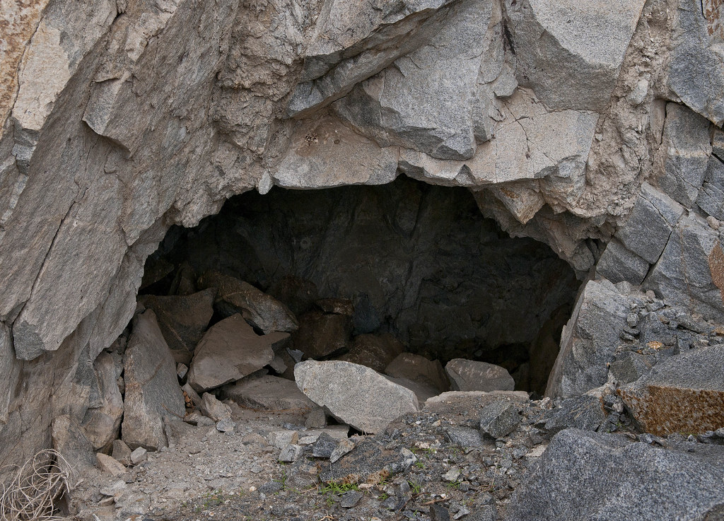
I've traced the ancient shores line(s) on Google Earth and on foot over the years. From articles out there on google searchs the lake has been filling and evaporating for hundreds of thousand of years. Taking about 50 years to go dry. The high water mark has changed over time due to the pull apart basin and tectonic uplfting. It is a very interesting area indeed! Some more photos to add in.


Ancient shore line along the western edge further north. You can see trails and camp sites .
Unfortunately there has been a lot of 4x4 activity near and around these areas, However there are still many areas
you can hike on for hours which are still "pristine" . Many trails end abruptly at an erosion only to continue on beyond:-)

Trail along shore line
Trails above the shore line
One of many caves near shoreline
edited by rockhopper on 4/15/2013
edited by rockhopper on 4/15/2013
|
|
|
link
|
|
tommy750 Posts: 1086
4/15/2013
|
hikerdmb wrote:
Great pics. That trail looks like it took you up to a nice area and some very interesting stuff. Good find. Red Rock and Barrett Canyons are great places.
The trail was still pretty intact with only a couple bad spots. Nice plateau on top which would make a nice camp spot. Started way too late to make it into any of the canyons. Care to elaborate on "Red Rock and Barrett Canyons are great places?" Thanks. Tom
|
|
|
link
|
|
tommy750 Posts: 1086
4/15/2013
|
dsefcik wrote:
Great stuff Tom, I enjoy reading your trip reports and photos. Great subject, post all you want, it is inspiring and makes me want to head out that way. Some of those circles looked pretty small, almost uncomfortably small to sleep in....hard to tell though from the photos.
Agree, some of the circles look snug. Could be the flat bottoms are merely Indio-style traps filled with sand. The two clusters of circles on the alluvial fans are above the lake level and presumably campsites. There's someone named Jerry Schaefer who's written multiple articles about West Mesa and the Fish Creek Mts shoreline but I can't seem to find any of his papers online. Tom
|
|
|
link
|
|
tommy750 Posts: 1086
4/15/2013
|
Jim (ziphius) wrote:
I agree, please post more on Lake Cahuilla! You gave a great history of the area in these last couple of posts. Few of us make it that far east, so this post is like water for thirsty desert explorers. - Jim
Thanks for the upvote! Tom
|
|
|
link
|
|
hikerdmb Posts: 423
4/15/2013
|
tommy750 wrote:
hikerdmb wrote:
Great pics. That trail looks like it took you up to a nice area and some very interesting stuff. Good find. Red Rock and Barrett Canyons are great places.
The trail was still pretty intact with only a couple bad spots. Nice plateau on top which would make a nice camp spot. Started way too late to make it into any of the canyons. Care to elaborate on "Red Rock and Barrett Canyons are great places?" Thanks. Tom
Those canyons are beautiful, especially Red Rock. Can't legally go in there. I will see if I can find any old pics from the days before digital cameras. I haven't been there in many years.
|
|
|
link
|
|
tommy750 Posts: 1086
4/15/2013
|
rockhopper wrote:
Fantastic map of 1761. Great trip. Thanks for sharing.Those first rock circles look like fish traps. I love the rounded beach rock photo. Definately a pot drop right there!Those miners were a tough bunch. Looks like they gave up too!
I've traced the ancient shores line(s) on Google Earth and on foot over the years. From articles out there on google searchs the lake has been filling and evaporating for hundreds of thousand of years. Taking about 50 years to go dry. The high water mark has changed over time due to the pull apart basin and tectonic uplfting. It is a very interesting area indeed! Some more photos to add in.
One of many caves near shoreline
edited by rockhopper on 4/15/2013
edited by rockhopper on 4/15/2013
Thanks for the photos and maps. Your second map is interesting since it seems to be showing Cahuilla with the glacial lakes? Found a couple mine shaft right at the old waterline. Indio supposedly has a shelter cave right above the traps but I never saw it. Thanks. Tom
Fish Mt Mine Shaft by tomteske, on Flickr
|
|
|
link
|
|
AdventureGraham Posts: 170
4/16/2013
|
I love this stuff! Keep posting! I've always been very interested in Ancient Lake Cahuilla. On one of our last trips into the desert, driving along the west side of the Salton Sea, I was pointing out to my wife how you could see the water line from the old lake up on the hills.
It may not be until fall but I plan on checking out the ancient shorelines and beaches out there!
|
|
|
link
|
|
anutami Posts: 491
4/21/2013
|
Tom, thanks for the inspiration. Took ec085 coming home from el centro on Friday and checked a few things out
You were not joking, there are shells out there


High water mark on lake cahuilla

It looks like a war zone out there

Bullet hole in the Tufa

New tahoe performed great! Started from dunaway road off the 8 freeway and ended up at split mountain rd. there was some sketchy soft sand rutted out sections on ec085

|
|
|
link
|
|
tommy750 Posts: 1086
4/21/2013
|
Nice pics, Nolan! So bizarre to see those delicate shells deep in the desert. Agree, EC085 is a great way to get to Split Mt/Fish Creek from I-8 AND bypass the Hwy 86/78 USBP checkpoint . Definitely agree with you on the sandy areas and can't imagine getting through after a rain. My favorite "war zone" pic was returning from an Anza Borrego Foundation trip in Fish Creek and seeing this guy on EC085. Like the Tahoe bull bars
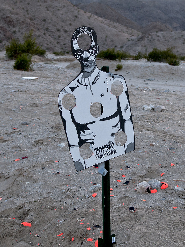
Zombie by tomteske, on Flickr
edited by tommy750 on 4/21/2013
|
|
|
link
|
|
anutami Posts: 491
4/29/2013
|
Forgot about this video....
The Railroad in action...
|
|
|
link
|
|
DesertWRX Posts: 135
5/11/2013
|
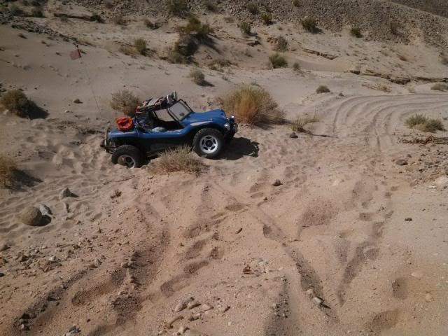
Drove out 085 2 days ago and got fixated on seeing the border of the Carrizo Impact area. Drove under the trestle and went up the wash to the warning signs. looked around some and wanted to get up on a hill and look for a camping spot. Heading up a sandy off-camber section I failed!
Nailed it and slid off into a sandy ravine. After lots of jacking, shovelling, and rock piling called it quits.
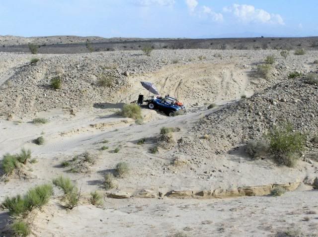
Set up camp
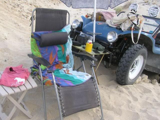
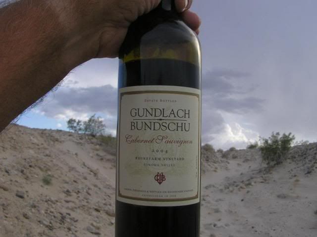
Had wine
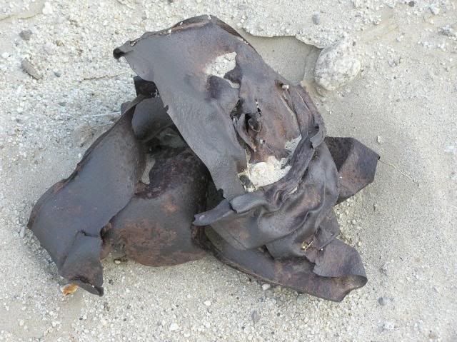
Exploded practice bomb pieces everywhere
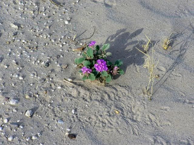
Sand Verbena!
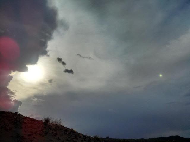
Looked like it might rain
Help arrived the next day. My wife and her Jeep.
edited by DesertWRX on 5/11/2013
edited by DesertWRX on 5/11/2013
edited by DesertWRX on 5/11/2013
edited by DesertWRX on 5/11/2013
edited by DesertWRX on 5/11/2013
|
|
|
link
|
|
dsefcik Administrator Posts: 2634
5/12/2013
|
Good story, looks like some lizards or such were near your verbena....
DesertWRX wrote:
Drove out 085 2 days ago and got fixated on seeing the border of the Carrizo Impact area. Drove under the trestle and went up the wash to the warning signs. looked around some and wanted to get up on a hill and look for a camping spot. Heading up a sandy off-camber section I failed!
Sand Verbena!
--
http://www.sefcik.com
http://www.darensefcik.com
http://www.carrizogorge.com
|
|
|
link
|
|
DesertWRX Posts: 135
5/12/2013
|
Yes, there was a nice big one that came out to look at me a couple times. Lots of tail dragger marks too. Here's a track from My Tracks of my trip from the gypsum mine to my stuck area... https://maps.google.com/maps/ms?msa=0&msid=214727587460963019902.0004dc877c5285d1d62d7
Just above my stuck area you can see a defined road heading to the top... that is now a deep ravine thanks to last summer's storm that dropped 2" in an hour in that area.
edited by DesertWRX on 5/12/2013
|
|
|
link
|
|
dsefcik Administrator Posts: 2634
5/12/2013
|
So is where you went largely a passable road in a regular 4wd truck? I have wanted to go out that way but was not sure of the "roads".
DesertWRX wrote:
Yes, there was a nice big one that came out to look at me a couple times. Lots of tail dragger marks too. Here's a track from My Tracks of my trip from the gypsum mine to my stuck area... https://maps.google.com/maps/ms?msa=0&msid=214727587460963019902.0004dc877c5285d1d62d7
Just above my stuck area you can see a defined road heading to the top... that is now a deep ravine thanks to last summer's storm that dropped 2" in an hour in that area.
edited by DesertWRX on 5/12/2013
--
http://www.sefcik.com
http://www.darensefcik.com
http://www.carrizogorge.com
|
|
|
link
|
|
Bill Haneline Posts: 13
5/13/2013
|
Once you get by the bottomless dust pits on the road following the train tracks (you have to carry some speed through the deep silt) the route is fine. Cross under the trestle and follow the wash to the no entry signs and you'll be in the bombing area.
|
|
|
link
|
|
tommy750 Posts: 1086
5/13/2013
|
Glad you made it out okay, DesertWRX. Kinda warm out there to get stranded for too long!
|
|
|
link
|
|
tommy750 Posts: 1086
5/13/2013
|
dsefcik wrote:
So is where you went largely a passable road in a regular 4wd truck? I have wanted to go out that way but was not sure of the "roads".
Daren, you shouldn't have any trouble with your rig. Some areas of soft sand and silt but not a problem with 4WD. If it has recently rained, wouldn't go near that road! Tom
|
|
|
link
|