|
hikerdmb Posts: 423
1/10/2011
|
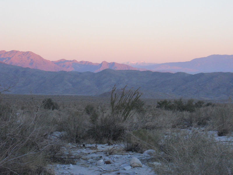
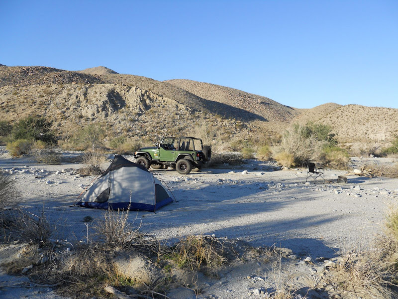
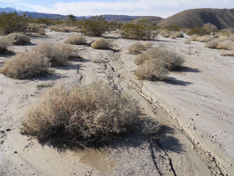
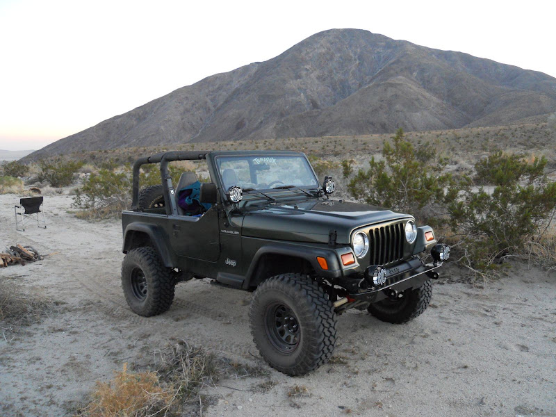
We took off on Friday afternoon and headed for Pinyon Wash off Highway 78. Then turned up Nolina Wash and headed for a campsite I had spotted at the end of Bighorn Canyon to Nolina Canyon hike from before Christmas. Unfortunately that spot was taken so we found another a half mile or so lower in the wash. We arrived after dark so it was good to see that the new lights on the Desert TJ worked great. We awoke on Saturday morning and could see the snow covered top of Mount San Jacinto off to the north.
Our camp was in a nice level spot in Nolina Wash.
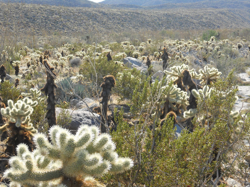
There was a Cholla garden just out of the wash.
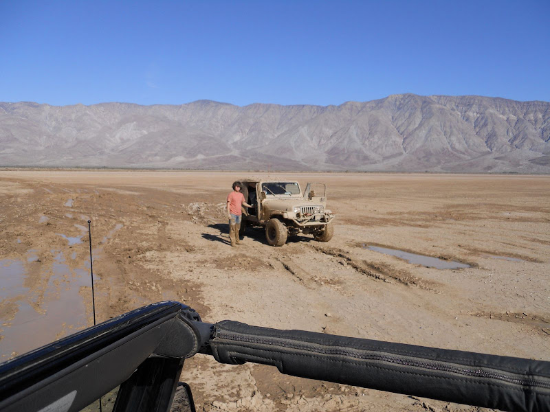
After we broke camp we headed toward Clark Dry Lake. It was not quite dry yet from the rain a couple of weeks ago. We found this guy, he looked to be about 16 years old with 3 other boys who were much younger, on the lake bed. He had been stuck for quite a while and had been digging when a group came by just before us and winched him out. Now he had to go back to the campground and face his folks. The jeep was buried to the frame and muddy inside and out.
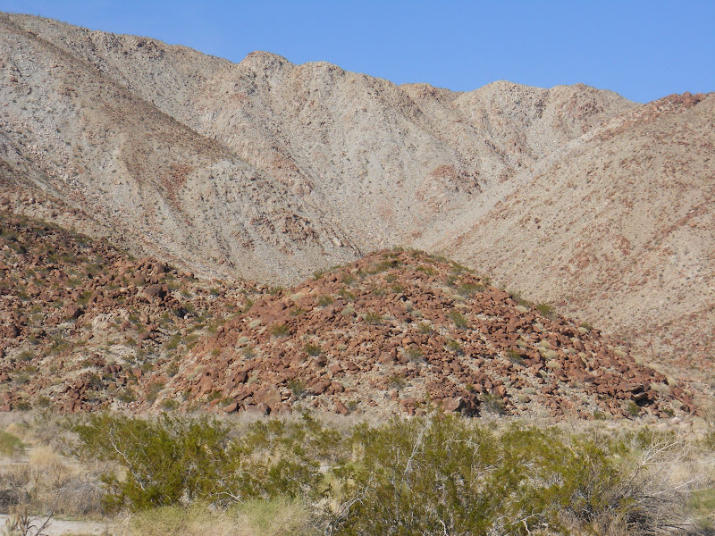
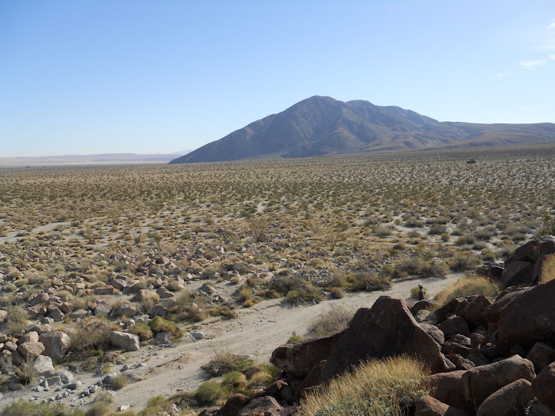
We made it across the lake very easily by staying to the far west shore. No mud and good traction. We went on up the road to just north and east of Coyote Mountain and found a place to park. Then we headed off to the north to cross Clark Valley. We found the "Corp" marked on the topo map and matched the lines on the map with the terrain to the north and picked our spot to head of toward.
As we crossed Clark Valley we saw lots of evidence that it had rained in this part of ABDSP.

We eventually made it closer to the mound where we hoped to find the petroglyphs. It was probably less than 2 miles across the valley to this mound.
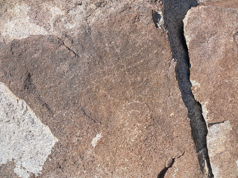
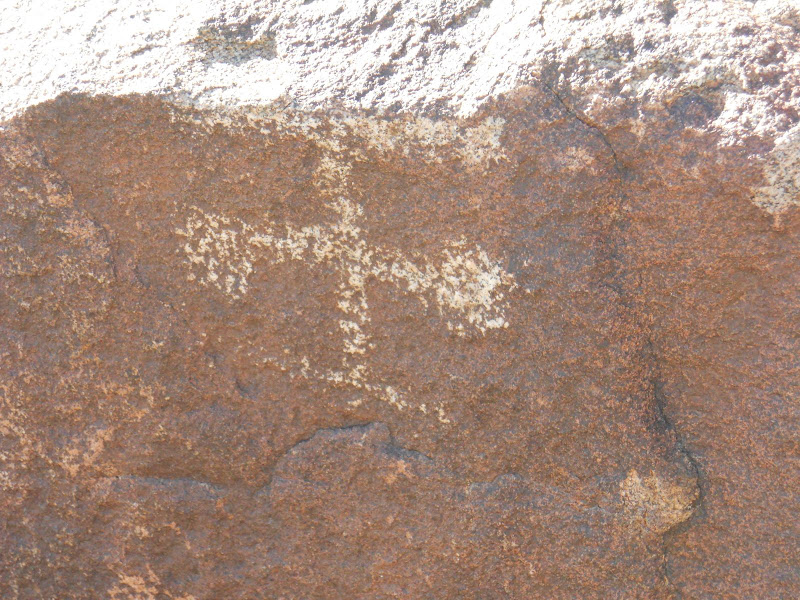
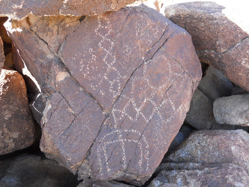
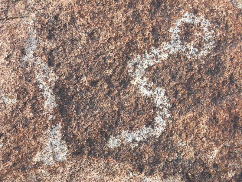
The first petroglyphs were a little faint, but it was right where we had expected.
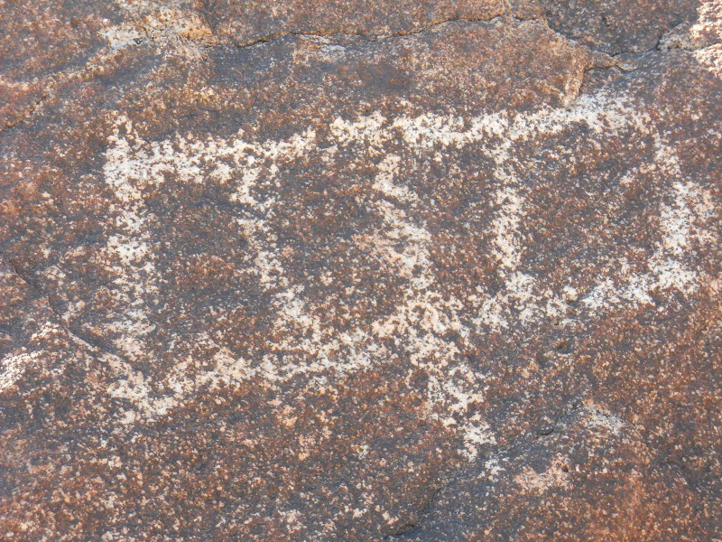
Then after a little looking we found many more that were much easier to see.

I climbed up the little hill where the glyphs were and looked back toward Coyote Mountain. We had park close to there pretty much in a direct line with the summit. I made sure to take a compass reading before we left and then follow it back to the jeep, also since not many people come this way we could also easily follow our footprints.
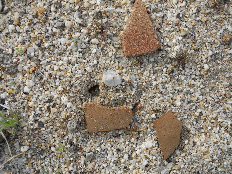
On the way back to the jeep I found some nice pottery pieces. These are still laying there so whoever goes this way next will be able to see them.
Started to make camp here in Clark Valley but a whacked out dude stopped in and wanted to camp with us. After he asked if we could see the two moons that were out tonight we started to wonder about him.
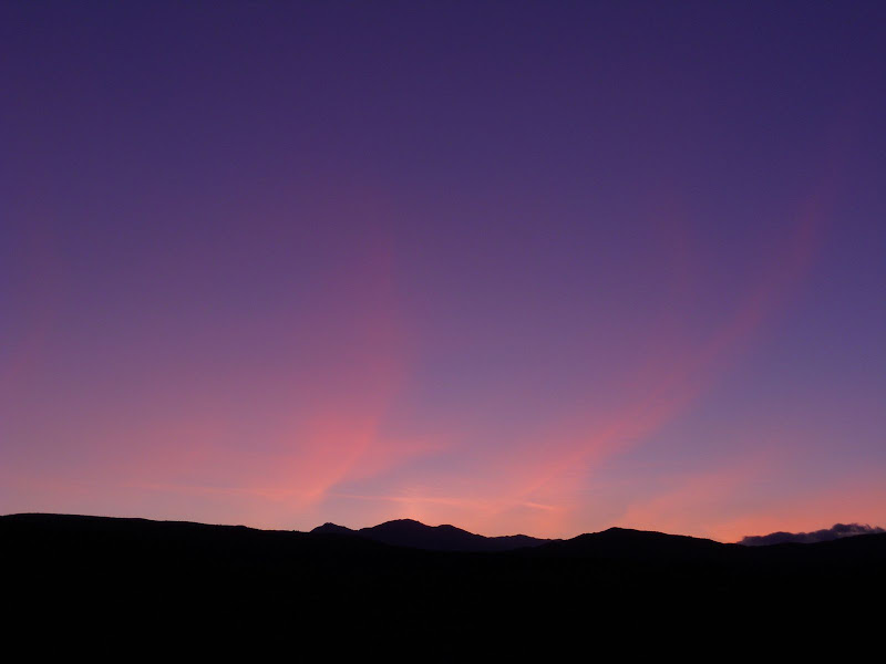
Then when we looked at the sunlight on the clouds after sunset and he asked if we could hear the Northern Lights that he saw we decided we would move on to another location. Does this look like the Northern Lights to anyone else? Can you hear them?
We ended up heading over to Palo Verde Wash and it gave me another chance to use the new lights. Again they worked great! Had a great night in Palo Verde Wash and headed home on Sunday morning. I had been up this way a few times but this was the first time I had made it out to the petroglyphs. Definitely worth the effort to see these and they are located right where the topo shows them.
edited by hikerdmb on 1/17/2011
edited by hikerdmb on 1/7/2013
edited by hikerdmb on 1/7/2013
|
|
|
link
|
|
dsefcik Administrator Posts: 2634
1/11/2011
|
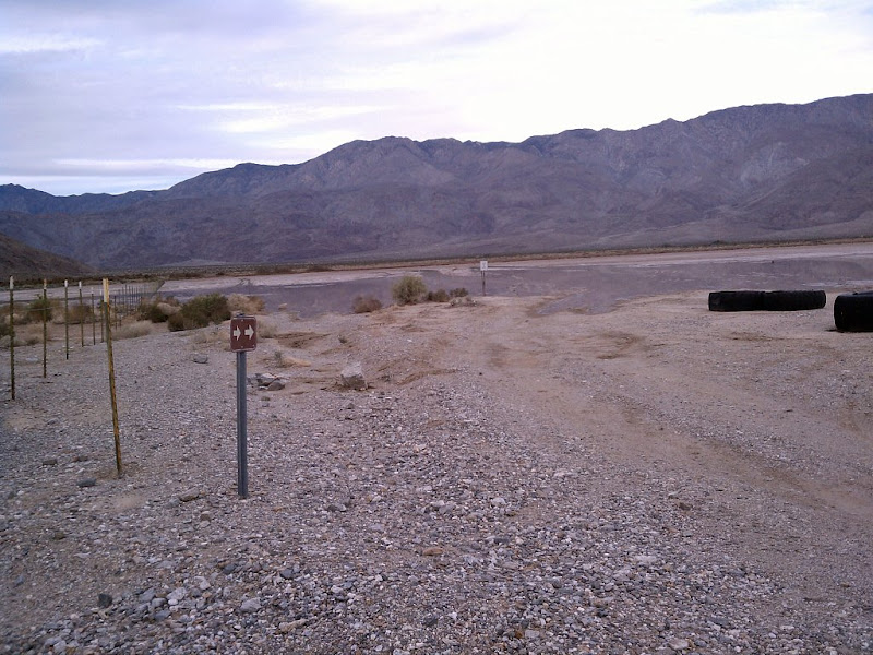
Nice trip..that kid reminds me of me about 30 years ago when I got my first car, a CJ5. I promptly got it stuck in a big mud pit thinking it was invincible...haha..I was actually just looking at my CDL pics and was trying to remember if the entrance/road thru that gravel yard place allowed us to drive thru to get to the more west'ish side of the road where it was dry but I cannot remember now..is that where you drove thru to get around the lake? I stayed on the marked rd and there was a sign indicating that you should veer right thru the lake/mud area and it was flooded out for me. Also, I believe (from reading various articles) there are more indian occupation artifacts further into the hills and valley areas near there and I will be trying to get out there soon to explore once the road clears up enough for me to get thru.
This is where I stopped (and I think you found the stuck jeep), did you go left from here thru the fenced area and follow the road to the foothill? Google Earth clearly shows a road there.
--
http://www.sefcik.com
http://www.darensefcik.com
http://www.carrizogorge.com
|
|
|
link
|
|
hikerdmb Posts: 423
1/11/2011
|
Daren,
That does look like the place where the young guy was stuck. In your pic there is a white sign just at the edge of the water. The jeep got stuck out there somewhere and he was to the right of that sign. We stayed to the just to the right of the fence and drove on fairly dry lake bed. Others had definitely been this way before us. We didn't go on the other side of the fence. As for the other artifacts around the petroglyphs, there was a nice ducked trail up into the hills to the north east of the rock art. We followed it about a quarter mile and it kind of petered out. We didn't see anything up there but maybe we just didn't go far enough up that way. I didn't see anything that would cause you to have trouble getting up there in your truck. My jeep is still mud free after this trip.
David
|
|
|
link
|
|
dsefcik Administrator Posts: 2634
1/11/2011
|
I bet the ducks you saw are a path up to peak 6582 (which I posted about here)
The artifacts I am thinking of are much further north-west, towards rockhouse valley but not quite there. I do want to get out there and am trying to make plans this weekend. My son may go with me so I will see.
--
http://www.sefcik.com
http://www.darensefcik.com
http://www.carrizogorge.com
|
|
|
link
|
|
hikerdmb Posts: 423
1/11/2011
|
That is definitely the direction the ducks went off toward. I heard there were some other things in a small valley off to the east side of Rockhouse Canyon a half mile or so before you enter the main part of Rockhouse Valley where the 3 rock houses are located. Is that what you are thinking? Good luck if you try that climb. It is a long way up there and looked very rugged for sure.
David
|
|
|
link
|
|
surfponto Administrator Posts: 1369
1/11/2011
|
Wow those petroglyphs are a lot nicer than i thought.
I thought I had read somewhere that they were pretty faded but those look great.
Going to have to take a trip out in a few weeks to check them out.
Love the jeep story. Once got my Toyota FJ40 high centered somewhere up above Pine Valley on a jeep road thinking I could never get stuck.
--
https://www.anzaborrego.net/


|
|
|
link
|
|
6kmclimber Posts: 13
1/13/2011
|
hikerD,
You are one step ahead of me. I was planning heading out to that exact spot after CDL was passable. Even planning to park in the same area!
Anyway great photos and great story of the muddy kids, their stuck jeep and the desert traveler from the planet with two moons LOL . Maybe a ghost of one
of the Clark brothers work hands traveling over alcoholic pass. Super glyph pics. Makes we wonder about thier significance. Shakey ground right there. Right on the San Jacinto fault! Nice pot sherds too. Some of the seldom traveled canyons are loaded with them still to this day. I have some old photos and will need to post.
|
|
|
link
|
|
hikerdmb Posts: 423
1/13/2011
|
6km
The lake is definitely passable, just stay to the left and you won't even get muddy. Also as we were climbing all over the boulder pile with the petroglyphs, we had a discussion about all the earthquakes in that area in the past few months and hoped we would not have one then. Some of the It was a great trip and we met two very interesting people, one young and learning and one total space cadet. It's always cool to find old artifacts no matter where you are. Kind of helps put things into perspective on our place in time.
David
|
|
|
link
|
|
Missy Posts: 2
2/22/2011
|
Found the petroglyphs in Clark Valley about 2 yrs ago-- they were in much better condition than I'd heard, but it took a while to find that Corp marker!! We also found lots of pottery and an old 50mm casing. I'd post pics from our trip out there but I don't know how... so I added them to a Photobucket album- http://s29.photobucket.com/albums/c283/SoCalDiveGirl/Anza%20Borrego%202009/
|
|
|
link
|
|
hikerdmb Posts: 423
2/22/2011
|
Nice pics Missy. Those are much clearer than the ones I posted. We didn't look for the benchmark but I know there are people that like to hunt for those things.
David
|
|
|
link
|
|
dsefcik Administrator Posts: 2634
2/22/2011
|
Missy wrote:
Found the petroglyphs in Clark Valley about 2 yrs ago-- they were in much better condition than I'd heard, but it took a while to find that Corp marker!! We also found lots of pottery and an old 50mm casing. I'd post pics from our trip out there but I don't know how... so I added them to a Photobucket album- http://s29.photobucket.com/albums/c283/SoCalDiveGirl/Anza%20Borrego%202009/
Thanks for sharing those photos! Looks like you were able to visit many different areas of the park, Indian Hill included.
--
http://www.sefcik.com
http://www.darensefcik.com
http://www.carrizogorge.com
|
|
|
link
|
|
surfponto Administrator Posts: 1369
2/22/2011
|
Great photos Missy,
I will have to go check out those Petroglyphs.
You have some great Desert Bighorn shots.
Sorry this forum software i am using is pretty limited. 
Not very intuitive to add photos.
Bob
Missy wrote:
Found the petroglyphs in Clark Valley about 2 yrs ago-- they were in much better condition than I'd heard, but it took a while to find that Corp marker!! We also found lots of pottery and an old 50mm casing. I'd post pics from our trip out there but I don't know how... so I added them to a Photobucket album- http://s29.photobucket.com/albums/c283/SoCalDiveGirl/Anza%20Borrego%202009/
--
https://www.anzaborrego.net/
|
|
|
link
|
|
Missy Posts: 2
2/22/2011
|
Thanks for the comments  Bob, I added more pictures of the bighorn to the album, most were taken within 20-60ft of a group of them. Also added other random pics of Piedras Grandes, trestle, Fonts, Clark, etc.... http://s29.photobucket.com/albums/c283/SoCalDiveGirl/Anza%20Borrego%202009/#!cpZZ1QQtppZZ20 Bob, I added more pictures of the bighorn to the album, most were taken within 20-60ft of a group of them. Also added other random pics of Piedras Grandes, trestle, Fonts, Clark, etc.... http://s29.photobucket.com/albums/c283/SoCalDiveGirl/Anza%20Borrego%202009/#!cpZZ1QQtppZZ20
Clark Valley is a nice hike, flat & easy.. The pictos are easy to find, they're right on the sunny face of the rocks which has faded them through the years- not in any type of shelter.
|
|
|
link
|