|
rockhopper Posts: 679
2/27/2017
|
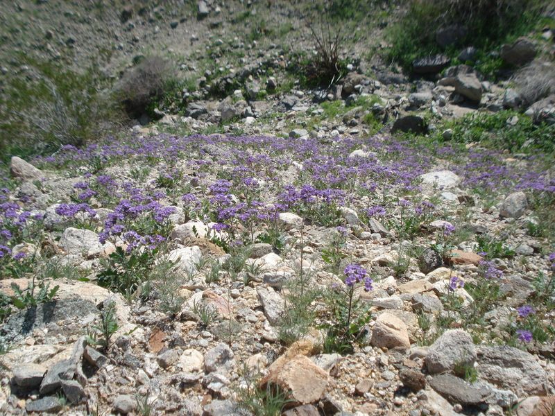
Hello all, took a two day trip out to the desert after the recent rains.
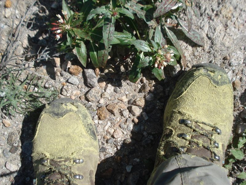
I hear the bees......
Pollenated boots
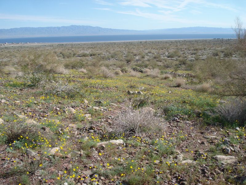
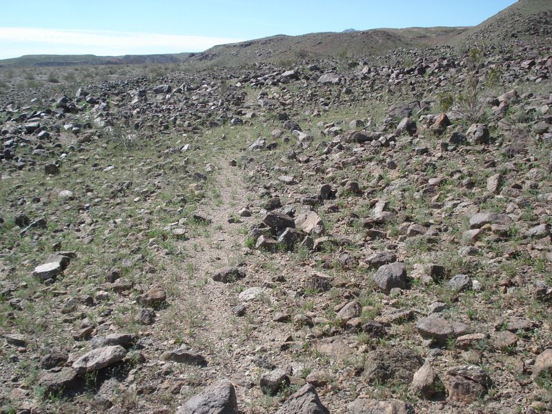
Ancient trail above the old lake Cahuilla shoreline.
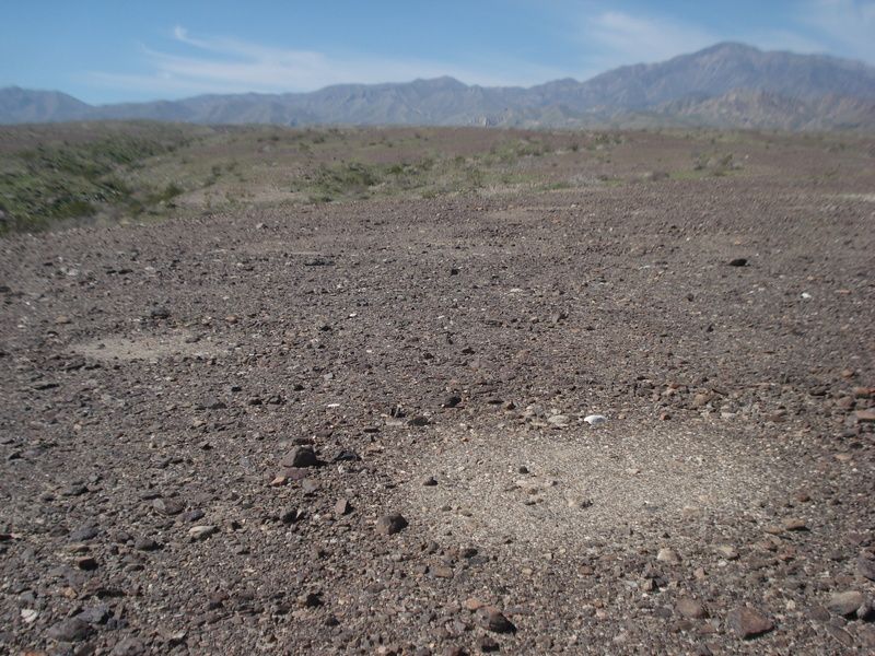
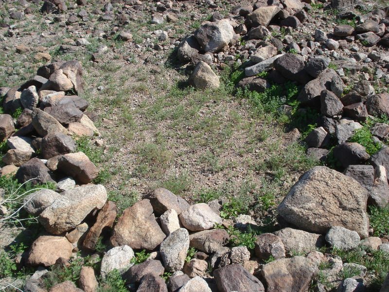
Sleeping circles on the desert patina
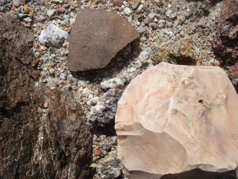
Pot drop
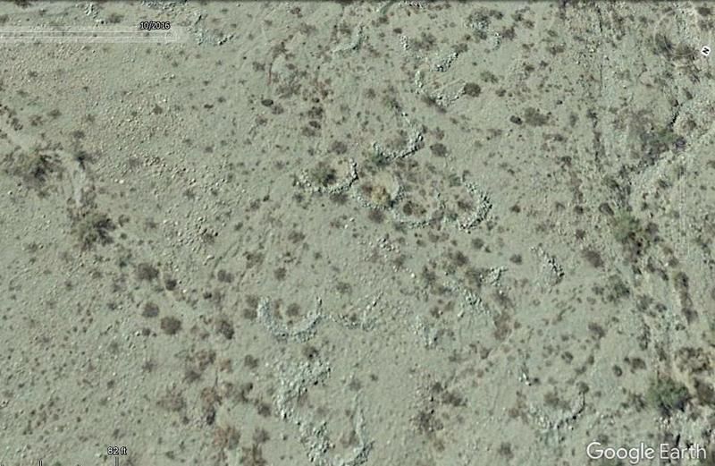
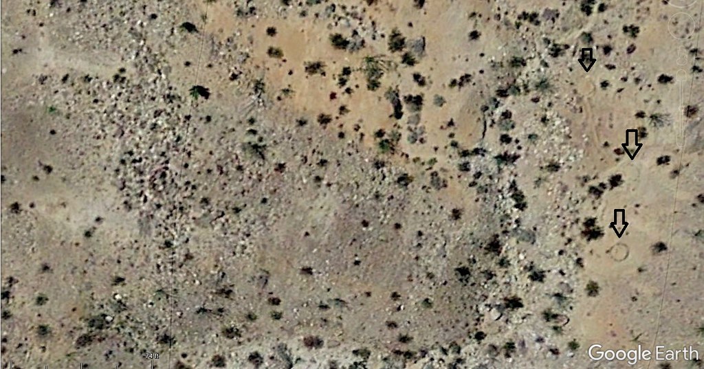
Google Earth photo of sleeping circles
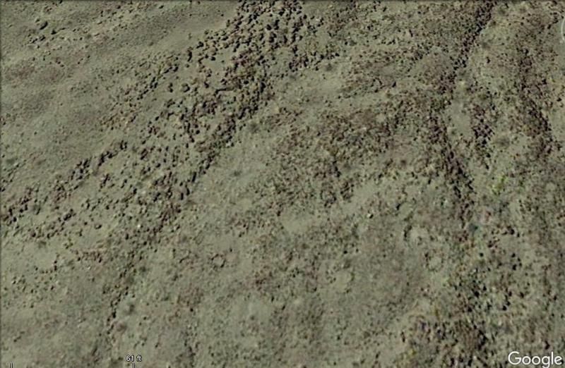
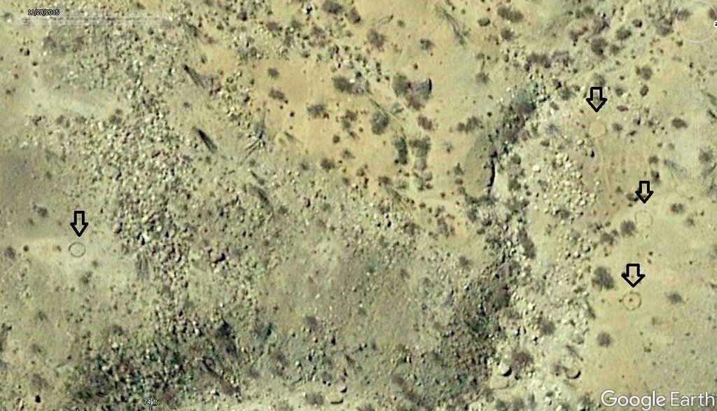
Same circles on the ground
Back on the trail...
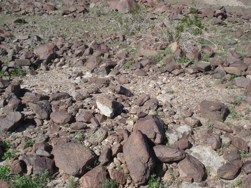
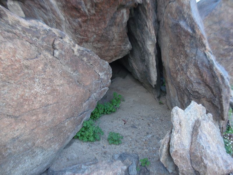
Deep cave taken over by animals with pot shards out front.
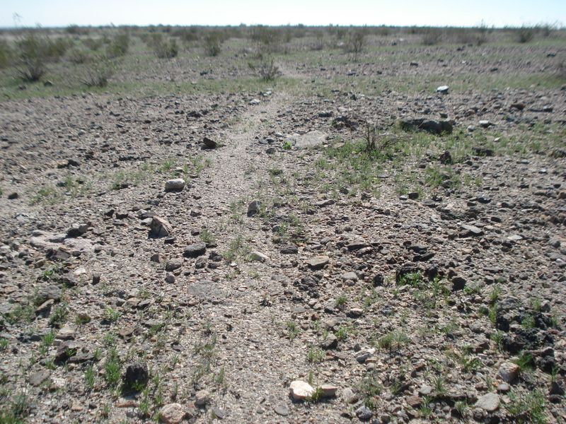
Desert pavement near sleeping circles.
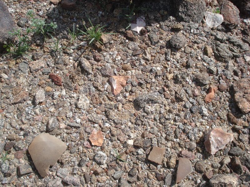
How old? 200yo, 400yo ???
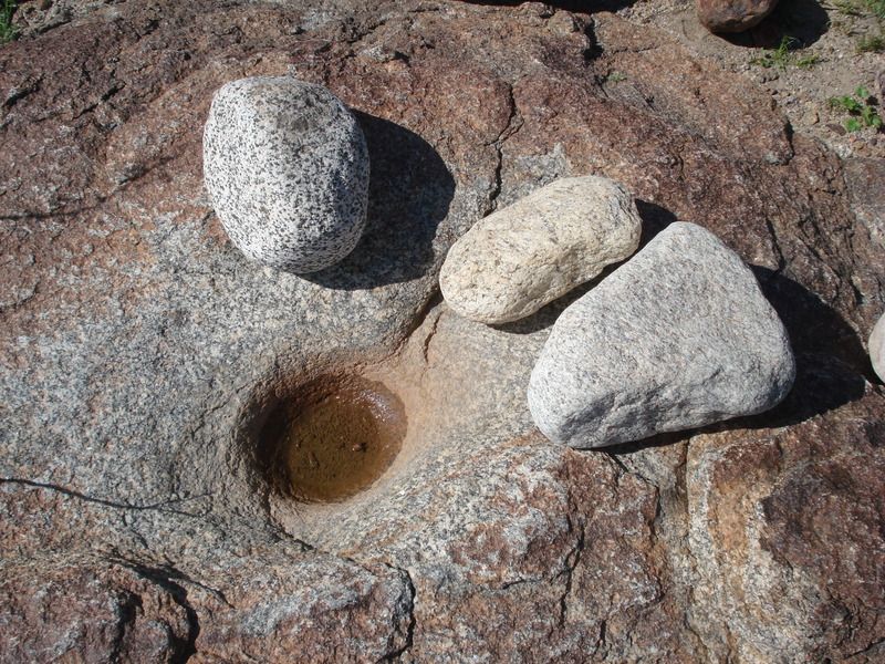
Ok, this was the surprise of day for me. There were about 5 grinder stones scattered within a few feet of this Mortero. I rearranged for the photo of these and put back. Different stone per individual I assume?
These fish traps show up better on G.E. They are declining in elevation from 47 feet to 23 feet as they were chasing the last evaporating shoreline about 400 years ago.
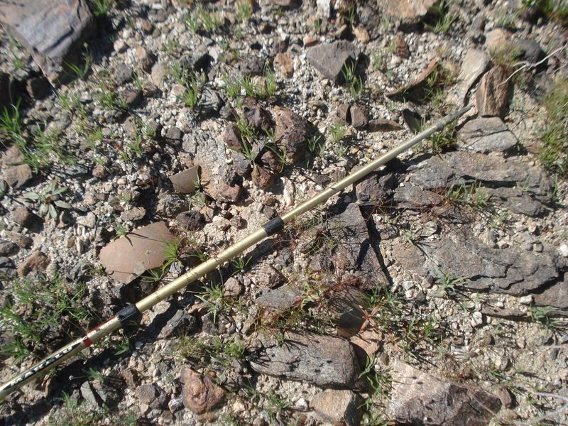
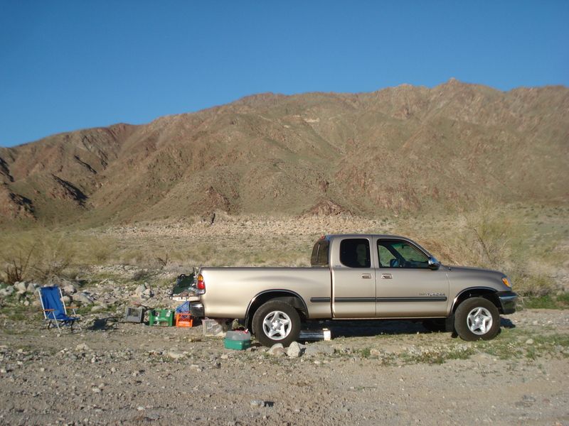
Plush star gazing in the bed of my truck "Dexter" with a 4" foam pad.
Cheers!
edited by rockhopper on 2/27/2017
edited by rockhopper on 2/27/2017
edited by rockhopper on 2/27/2017
edited by rockhopper on 2/27/2017
edited by rockhopper on 2/28/2017
|
|
|
link
|
|
ziphius Posts: 911
2/27/2017
|
Great trip rockhopper. I'm always still amazed when I find a grinding stone with the mortero. I've been doing flyovers with G-Earth lately too, looking for interesting things. 
--
http://www.coyotelearning.org
|
|
|
link
|
|
surfponto Administrator Posts: 1369
2/27/2017
|
Looks like a great trip. Nice camp setup. Very cool find on the grinding stones.
edited by surfponto on 2/27/2017
--
https://www.anzaborrego.net/


|
|
|
link
|
|
Florian Posts: 129
2/27/2017
|
Nice photos. I have the same blue chair as yours. It's great for stargazing but i often fall asleep in it.
edited by Florian on 2/27/2017
|
|
|
link
|
|
tommy750 Posts: 1089
2/27/2017
|
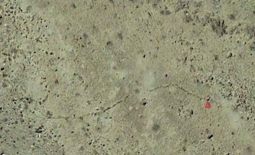
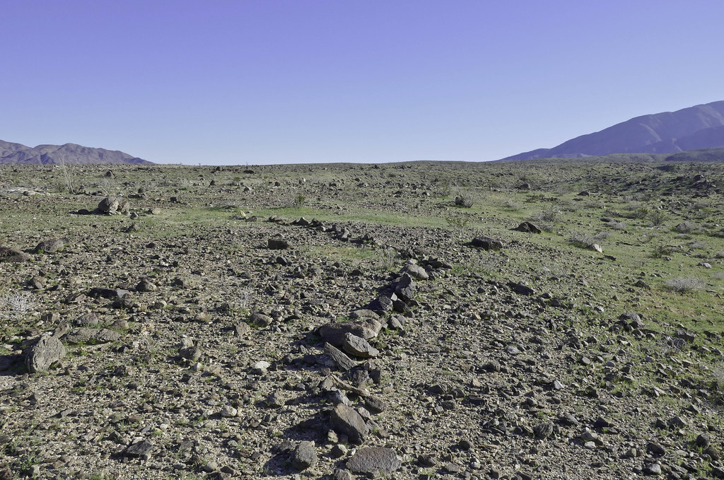
Great trip report Rockhopper. Was a few miles up the road from you this past weekend also checking out stuff visible on GE. Found a rock alignment and day hiked to check it out.
Rock alignment from space.
 Rock Alignment1 by tomteske, on Flickr Rock Alignment1 by tomteske, on Flickr
A little harder to see up close and already ducked up by previous visitors. I'm standing on the rock above the red triangle for the photo. Amazed how you can easily pick out individual rocks on the satellite image and correlate them with what's on the ground. Sorry for jacking the thread!
 Rock Alignment by tomteske, on Flickr Rock Alignment by tomteske, on Flickr
Wilson??!!
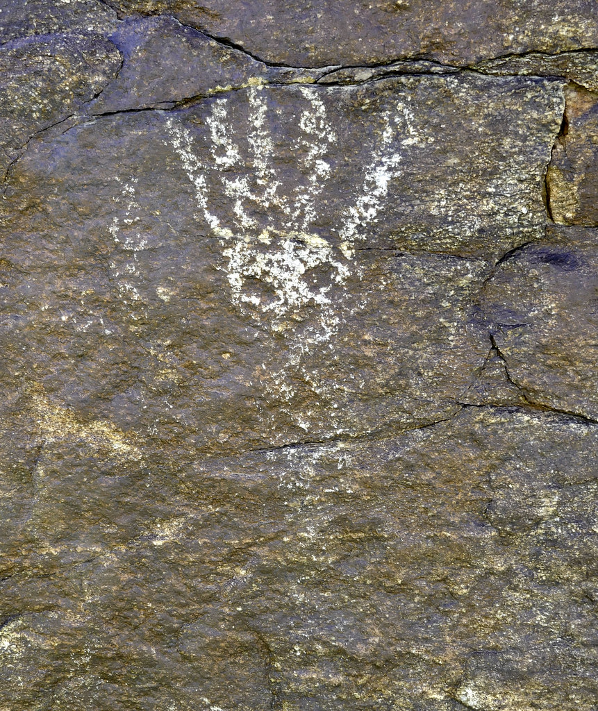 Wilson by tomteske, on Flickr Wilson by tomteske, on Flickr
|
|
|
link
|
|
ziphius Posts: 911
2/28/2017
|
Cool stuff Tommy. Keep hijacking. Was the petroglyph part of the rock alignment?
edited by ziphius on 2/28/2017
--
http://www.coyotelearning.org
|
|
|
link
|
|
tommy750 Posts: 1089
2/28/2017
|
ziphius wrote:
Cool stuff Tommy. Keep hijacking. Was the petroglyph part of the rock alignment?
edited by ziphius on 2/28/2017
No petros near the alignment but occasionally by the trail leading out there. Hard to follow the native trails at present cuz they're all covered with darn grass and flowers. See above
|
|
|
link
|
|
rockhopper Posts: 679
2/28/2017
|
I haven't seen the desert this green in years! Yes, it makes finding the old trails a little harder. I fixed pic no.5 above with the sleeping circles on the desert patina. Thanks for the comments, no worries about hijacking thread. We are all together on this journey of expedition. Yes Google Earth is a great tool. No doubt. In fact I rank it up there with the invention of the bicycle. Well, almost. Some thing else from my trip.
1. I noticed most of the native "campsites" near the ancient shore line ( Elev. 47'+/-) were not near the shore trail. The sites were mostly about 30 feet in elevation above the old lake level. 2. Also while scrambling up the mountain on the last picture, I noticed chunks of travertine deep in rock crevices above the 47 ' elevation. 1+2 = Could the ancient ones have witnessed a lake Cahuilla tsunami and moved their sleeping locations to higher ground? Neat thought. Also finding multiple grinding stones at the grinding rock near the old shore line was real neat. I haven't seen a grinding rock that close to the old shore before.
Cheers
edited by rockhopper on 2/28/2017
edited by rockhopper on 2/28/2017
|
|
|
link
|
|
tommy750 Posts: 1089
2/28/2017
|
Rockhopper, I'm guessing on a lake that large, waves could crash pretty high with any storm. A tsunami is interesting since major faults run through the area but tsunamis are usually associated with subduction zones as opposed to our transform faults. That said, my little pool in El Centro lost about a foot of water during the 7.2 Easter quake in 2010 so you may be on to something. Now, back to hijacking your post...
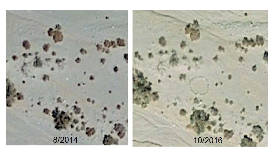
The other thing that's possible on GE these days is assessing change over time especially the past two satellite images over the Colorado desert in 8/2014 and 10/2016 which I think is using Landsat 8 stuff. I've noted a fair amount of crap show up in the desert that wasn't there a couple years ago, some of it obvious but some of it maybe not so obvious after sitting around for a few years. And speaking of rock circles, check out a couple examples below:
Near 17 Palms
 17 Palms ABDSP by tomteske, on Flickr 17 Palms ABDSP by tomteske, on Flickr
Near Rock House Canyon. The first pic is 2014 and the second one is 2016. This new addition might pass for a sleeping circle in a few years.
 Rockhouse Circles 2014 by tomteske, on Flickr Rockhouse Circles 2014 by tomteske, on Flickr
 Rockhouse Circles 2016 by tomteske, on Flickr Rockhouse Circles 2016 by tomteske, on Flickr
Don't even dare look at Coyote Mt. That place is becoming a mess. Somewhat back on track, Cerro Prieto is the volcano whose lava flow purportedly provided the spillway that kept Ancient Lake Cahuilla's lake level at 40ish ft when full. Search "Cerro Prieto, Mexico" on GE and you can definitely see some rather amazing change with time in the latest two images. Okay, I'll stop!
|
|
|
link
|
|
rockhopper Posts: 679
3/2/2017
|
Tommy sounds like we were hiking pretty close to each other doing the same basic thing. (Finding locations on the terra firma that we viewed from above.) Maybe there should be a G.E. thread of interesting locations to explore?
Anyway, I posted some Youtube videos from this recent trip. Enjoy!
https://www.youtube.com/watch?v=DuBeuCJN9SE
https://www.youtube.com/watch?v=4fhUPPa44aU
https://www.youtube.com/watch?v=e5fkfJhB53Y
https://www.youtube.com/watch?v=xAWYO0I1dRg
edited by rockhopper on 3/2/2017
|
|
|
link
|
|
Britain Posts: 613
3/3/2017
|
"Wilson" haha I'm out.
Nice finds!
--
Cant drive 55
Britain
http://icorva.com
|
|
|
link
|