|
tommy750 Posts: 1089
3/19/2017
|
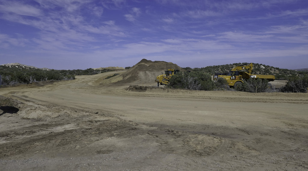
Decided to head out to McCain Valley yesterday since the desert floor was a little toasty for an overnighter. Was I in for a surprise! I knew Tule Wind was coming but wasn't expecting a tsunami. Sunrise Powerlink was one thing but this project is orders of magnitude more disruptive to the wilderness. 50 ft access road? That's the same as four lanes of I-5. Looks like a number of turbines will be sitting on the road with essentially zero setback. With a west wind, those blades will be slicing overhead every time you pass by.
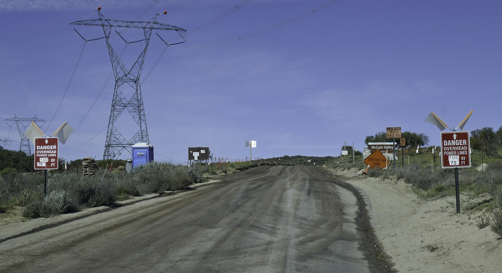 McCain Valley by tomteske, on Flickr McCain Valley by tomteske, on Flickr
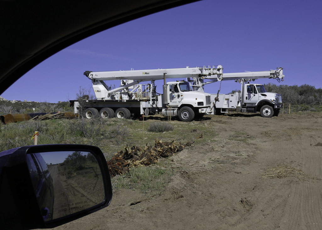 Trucks by tomteske, on Flickr Trucks by tomteske, on Flickr
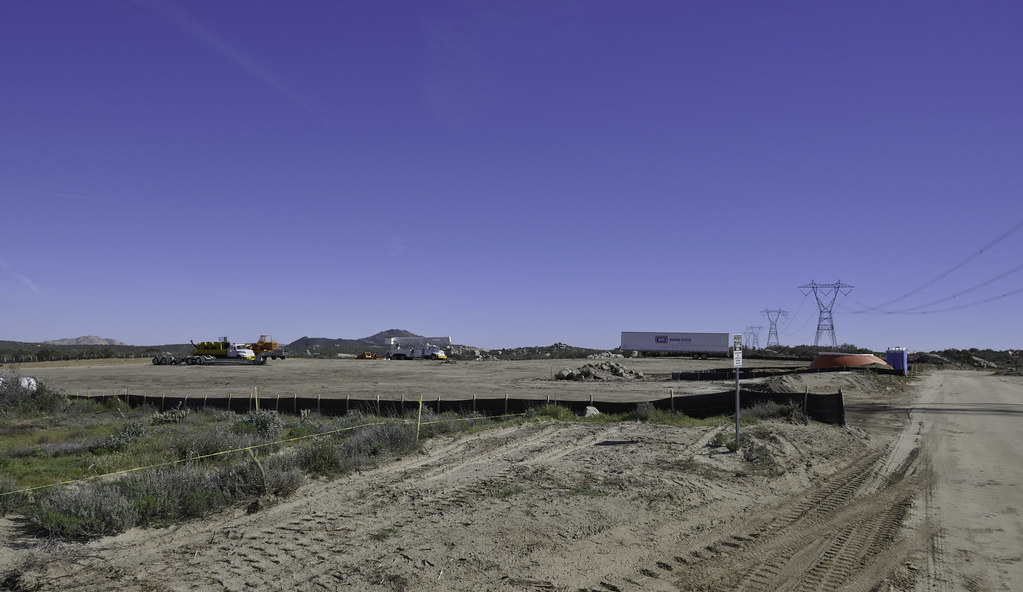 Clearing by tomteske, on Flickr Clearing by tomteske, on Flickr
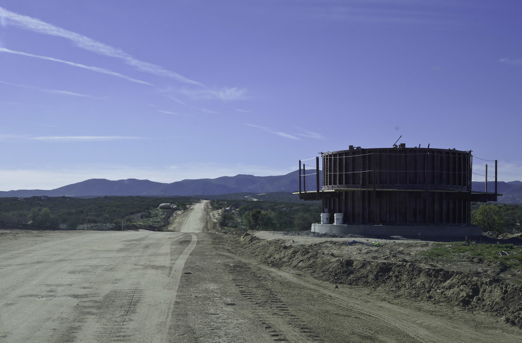 Turbine Foundation by tomteske, on Flickr Turbine Foundation by tomteske, on Flickr
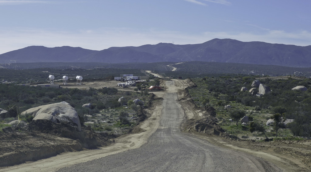 50 ft Swath by tomteske, on Flickr 50 ft Swath by tomteske, on Flickr
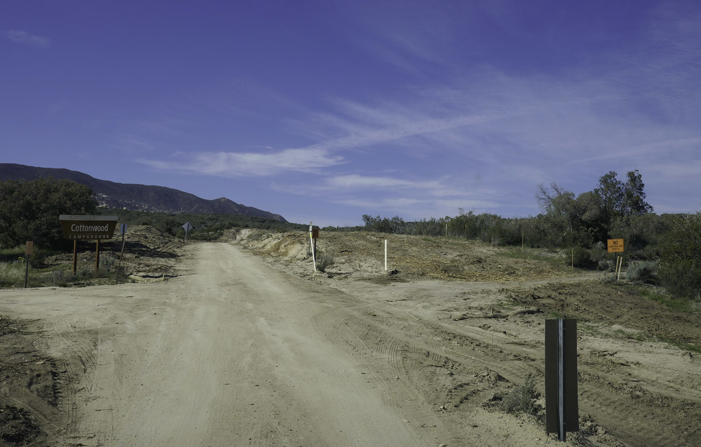 Cottonwood by tomteske, on Flickr Cottonwood by tomteske, on Flickr
After paying my parking fee at Cottonwood, I headed north. You can still pretty much escape in Northern McCain Valley at least for now.
The view toward the Jacumba Mts
 Toward Jacumba by tomteske, on Flickr Toward Jacumba by tomteske, on Flickr
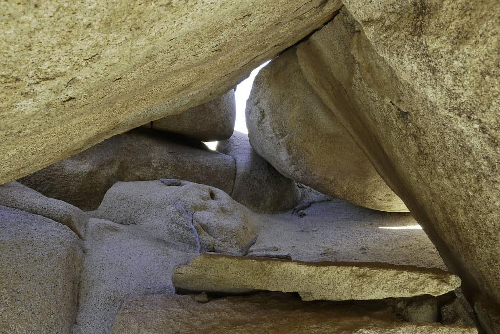
Balancing Act
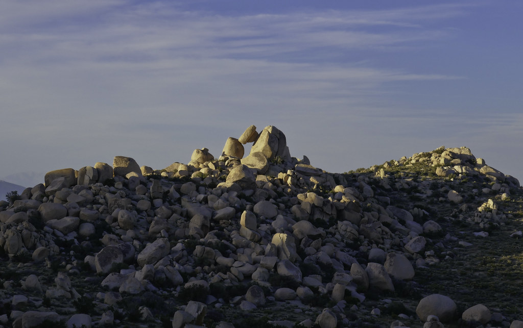 Balance by tomteske, on Flickr Balance by tomteske, on Flickr
Obligatory lighted tent shot
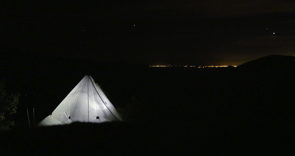 Campsite by tomteske, on Flickr Campsite by tomteske, on Flickr
Did a little exploring this morning. Nice rock shelter with a small metate sitting on a rock and possibly a prayer stick.
 Rockshelter 300M North by tomteske, on Flickr Rockshelter 300M North by tomteske, on Flickr
A nearby broken metate
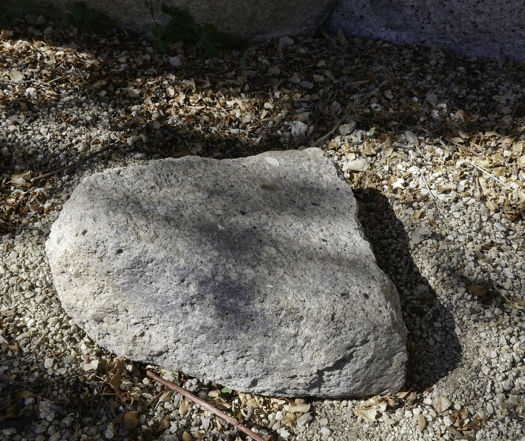 Broken Metate 40M NE by tomteske, on Flickr Broken Metate 40M NE by tomteske, on Flickr
Faded pictograph panel
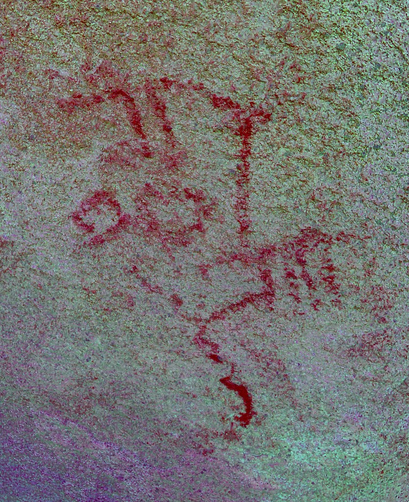 C-636 Pictos_yrd by tomteske, on Flickr C-636 Pictos_yrd by tomteske, on Flickr
These almost look like orchids
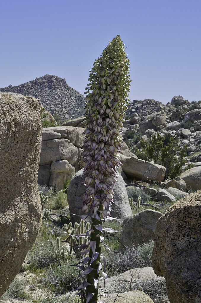 Desert Orchids by tomteske, on Flickr Desert Orchids by tomteske, on Flickr
Definitely flowing water out there for the first time in years. Lots of tadpoles in this pond
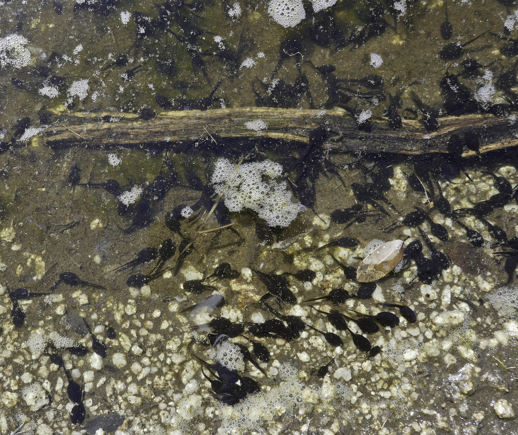 Tadpoles by tomteske, on Flickr Tadpoles by tomteske, on Flickr
Enjoy. Tom
|
|
|
link
|
|
surfponto Administrator Posts: 1369
3/20/2017
|
Great trip but really sorry to see that project ramping up. :-(
edited by surfponto on 3/20/2017
--
https://www.anzaborrego.net/


|
|
|
link
|
|
rockhopper Posts: 679
3/20/2017
|
Nice trip Tommy. Thanks for posting. Some neat finds there.
|
|
|
link
|
|
ziphius Posts: 911
3/20/2017
|
Looks like fun Tommy. Too bad about 'progress'. Were the tadpoles part of a natural or 'improved' watering area?
--
http://www.coyotelearning.org
|
|
|
link
|
|
tommy750 Posts: 1089
3/20/2017
|
ziphius wrote:
Looks like fun Tommy. Too bad about 'progress'. Were the tadpoles part of a natural or 'improved' watering area?
The pond appeared to have been created when a small stream's drainage culvert under Canebrake Rd plugged with debris. Still had good flow as did a couple other streams which was really nice to see. Going to be the second plague redux in a few weeks 
|
|
|
link
|
|
Bob S Posts: 7
7/12/2017
|
My first time out to McCain Valley was in 1965. Have camped out there many times over the years. Spent Monday night at Cottonwood and more than likely won't be back. RIP McCain Valley.
--
Big Sandy Shooter
|
|
|
link
|
|
dsefcik Administrator Posts: 2634
7/12/2017
|
Bob S wrote:
My first time out to McCain Valley was in 1965. Have camped out there many times over the years. Spent Monday night at Cottonwood and more than likely won't be back. RIP McCain Valley. Amen.....however you can still venture off into some remote areas if backpacking or distance hiking. The sights of evolution are discouraging to say the least.
--
http://www.sefcik.com
http://www.darensefcik.com
http://www.carrizogorge.com
|
|
|
+1
link
|
|
tommy750 Posts: 1089
7/12/2017
|
Was last out there in May doing an overnight in Canebrake and again couldn't believe the additional destruction since I posted this in March. Agree, really sad to see. Lark Canyon OHV is starting to look pristine in comparison.
Bob S, was Cottonwood campground even around back in 1965? Things must have looked very different! Thanks for posting.
 New McCain Valley by tomteske, on Flickr New McCain Valley by tomteske, on Flickr
|
|
|
link
|
|
Bob S Posts: 7
7/18/2017
|
When I was 14 I went on a day quail hunting trip with my uncle and his friends. I couldn't get out there again until about 1970 when I could drive. We never camped in Cottonwood at the time because there were so many other remote places to camp. I'm sure Cottonwood was there in 65. Sometime we would cruise Cottonwood just to check thing out. The campground was always well maintained (not like today) there use to be these really nice heavy duty redwood picnic tables in all the camp sights. Seldom did we ever see anybody camping in Cottonwood because at that time you could camp anywhere you wanted to as long as were not on private property. There use to be another campground about a mile south of Cottonwood called White Arrow. It wasn't vary popular because there were no shade trees. When 1980 came around out of the blue the BLM closed down just about everything east of McCain Valley Rd. All of are former camp sights are a thing of the past like Davies Valley and Sheephead Mt. Rd.
--
Big Sandy Shooter
|
|
|
link
|
|
dsefcik Administrator Posts: 2634
7/18/2017
|
@Bob S: I really enjoy reading about old memories of how things were....any further stories you care to share about how things "used to be" out in the desert and surrounding areas would be great to hear about....your accounts of names that never made it to the maps or books is valuable to know about..thank you for sharing...
--
http://www.sefcik.com
http://www.darensefcik.com
http://www.carrizogorge.com
|
|
|
link
|
|
tommy750 Posts: 1089
7/19/2017
|
Actually hiked up the access road to White Arrow a couple years ago but had no idea what it was at the time. Only get one hit on the internet for that name in an old BLM document from 1979. Thanks for the info, Bob S.
|
|
|
link
|