7/10/2012
Topic:
2012 Annual Bighorn Sheep Count
dsefcikAdministrator
|
DesertWRX wrote:
Notice the damage to the top of the right horn on the left ram. Pretty major stuff
We had a 4-5 year old ram on one of our days with perfect horns, one of my count partners nicknamed him "pretty boy" and called him a wuss. |
7/11/2012
Topic:
2012 Bighorn Sheep Count
dsefcikAdministrator
|
This was my second year participating in the annual Anza Borrego Desert State Park Bighorn Sheep count and I feel very fortunate to have been selected to count at the Rattlesnake Spring site. My count partners were very knowledgeable about the sheep and great company for the 3 days we spent out in the triple digit temps. This years numbers were down across the board for all sites but we still were able to count 43 distinct sheep over the 3 day period.
If you would like to participate in the annual bighorn sheep count, contact the ABDSP Visitor Center and they can help direct you to the appropriate people, they are always looking for new volunteers.
More photos and videos can be viewed here http://smu.gs/NirpVu
Panorama of our count site, the water hole where the sheep will get water from is in the far left in the green shrubs and our count site is the small tarp on a small finger of a ridge on the far right

Here a couple of Ewes bash horns near the water hole, click the image to watch the video

A mother and her lamb look down at the water hole just after sunrise

One herd gathers near the water hole

Down at the water hole the sheep will crowd in to get a drink of the bee filled water

A lone ram rests near the water hole after getting a drink himself

After everyone gets water the herd heads out over a well used game trail

I camped out in Indian Valley on my way to the count and bagged a single mylar balloon

Total mylar balloons this trip - 1
More photos and videos can be viewed here http://smu.gs/NirpVu
You can check out the count site with this 360 degree virtual tour
https://sites.google.com/a/sefcik.com/virtual-tours/2012-bhs-count-site
http://www.sefcik.com/2012/07/2012-bighorn-sheep-count-abdsp.html
---
<em>edited by dsefcik on 7/12/2012</em> |
7/11/2012
Topic:
2012 Bighorn Sheep Count
dsefcikAdministrator
|
I forgot to mention that on my way out I stopped at Myer Valley again to look for the second miner shack but saw nothing. |
7/12/2012
Topic:
2012 Bighorn Sheep Count
dsefcikAdministrator
|
surfponto wrote:
How far from your truck is it? I assume you are sleeping in the back of your truck?
About 5 miles. We backpacked in and out at night to avoid the heat and sun as it was pretty brutal. We camped about a 1/4 mile away from the count site.
The stars were amazing way out there, Scorpio was in full swing each night just hanging in the sky. With our spotting scope we could see the rings around Saturn and I saw some of the best shooting stars ever, brightly lit tails across the entire sky, very cool. |
7/12/2012
Topic:
2012 Bighorn Sheep Count
dsefcikAdministrator
|
ziphius wrote:
Very cool trip Daren. Does the team observe from sunrise to sunset, in shifts, to alleviate fatigue? Or is it basically all of you under the tarp searching all day? You mention that sheep numbers were down compared with some previous years. I imagine that the sites are fairly standardized year-to-year, meaning that the same locations are counted every year. I imagine that sites like Rattlesnake Spring will be utilized every year by the sheep, but there are probably other, 'minor' springs that might get used only during certain years where rainfall allows for it. I could envision a scenario where the number of sheep at the standard count sites is "low" compared with previous years, but this could be due to greater dispersal of the sheep population to less-preferred sites. But I bet that the organizers of the count have this stuff pretty much figured out. Thanks for sharing your trip. - Jim
There are many standard count sites but depending on how many volunteers they get determines how many sites get counted. They need backpack volunteers as the more remote sites require you to pack in and stay the duration. Others sites are just a quick hike or very little at all. Some sites will not get counted if there are not enough volunteers. We are asked to count from 7am-5pm for two days and about 7am-1pm the last day but each site is different, we did almost 3 days of 7-5 since we hiked out near dusk to avoid the heat. I am not sure there is really an expected number of sheep at each site, it seems to vary. The site I was at last year we saw a herd of 18 sheep each day, this year that same site reported not seeing any sheep at all.
I would recommend anyone interested in counting next year to contact the visitor center for more information.
Daren |
7/12/2012
Topic:
2012 Bighorn Sheep Count
dsefcikAdministrator
|
tommy750 wrote:
Do they still do helicopter surveys for PBS? Does it correlate with what you guys find each year?
Great question, they briefly talked about that this year. They used to do them with some regularity but not any more, some reasons why were financial and others political. That is why the volunteer program is even more important now. In the days past golf resorts were able to buy up land that took away from the sheep but golf resorts are now passe and instead green energy projects have moved in and are taking their place. When you look at the "peninsular" range they once used it has now become fragmented by development and roadways, their "range" has shrunk considerably. |
7/13/2012
Topic:
2012 Bighorn Sheep Count
dsefcikAdministrator
|
hikerdmb wrote:
We were out there last weekend too but we were keeping cool by the pool
How do you keep cool "by the pool" ?? When I looked at the photo all I imagined was me in a floaty thing and a drink in my hand, not an empty pool! |
7/15/2012
Topic:
2012 Bighorn Sheep Count
dsefcikAdministrator
|
That looks like it, did you take that photo from the ridge going up to Villager?
rockhopper wrote:
I belive this is rattlesnake spring:
Photo taken at about the 3000ft elevation
[IMG]http://i67.photobucket.com/albums/h294/metalmeister/ABDSP/Copyofsantarosamtn016.jpg[/IMG]
|
7/17/2012
Topic:
The Search For Geocache "Yoni"
dsefcikAdministrator
|
Nice trip, I want to get back out there also as I have a lot things I still want to check out. There are still several guzzlers you did not see near your travel area(s). Those white markers seemed to surround the quarry area from what I remember. That small bone fragment does look skull like, there could be burial grounds out here, did the bone have a blueish color to it? I am no bone expert but I have seen both deer and bighorn out there so your guess is as good as mine on the spine.
Why would anyone want to get rid of a 40gb hard drive?
BTW, you drove right past the boulders with the pictos I posted awhile back on your last TM post.
Daren |
7/17/2012
Topic:
2012 Bighorn Sheep Count
dsefcikAdministrator
|
rockhopper wrote:
Did anyone go to the "Natural rock tanks" ?
I did a couple of years ago, here are a few pics

---

---
 |
7/17/2012
Topic:
Dream Find!!!
dsefcikAdministrator
|
Very nice, that looks like maybe a film photo you had printed and then photographed to share with us? I have heard reports of recent olla finds so they are still there. |
7/17/2012
Topic:
The Search For Geocache "Yoni"
dsefcikAdministrator
|
PS, I liked the video... definitely some 4WD road out there. |
7/17/2012
Topic:
Big Ram in Coyote Canyon!
dsefcikAdministrator
|
Borregolinda wrote:
Bill and I are stewards in ABDSP so we went out to Coyote Canyon today to do some clean up. While we were cleaning up an old fire site near 2nd crossing this big Ram passed nearby. He was on his way to get a drink. When he was done drinking he stopped right in front of me and stared! Bill had the camera trying to get a shot of him drinking so I didn't have a picture of it! He then climbed up the hill and looked around for a long time. Pretty cool.
He has some cojones for sure, nice shot!
I am the steward for Inner Pasture, I am guessing we have met at some point...? |
7/17/2012
Topic:
Best Mylar Ballon Trip
dsefcikAdministrator
|
DesertWRX:
Thanks for the update, hopefully we are slowly getting rid of the damn things..! |
7/17/2012
Topic:
Big Ram in Coyote Canyon!
dsefcikAdministrator
|
DesertWRX wrote:
Daren are you in the same group as we are? The Adopt a Trail/Wash?
No, CDAS site stewardship program.
http://www.parks.ca.gov/?page_id=24530 |
7/17/2012
Topic:
Big Ram in Coyote Canyon!
dsefcikAdministrator
|
I am sure both stewardship programs are equally rewarding and I know both are badly needed so thank you for your volunteer efforts!! |
7/18/2012
Topic:
Border Angels
dsefcikAdministrator
|
Last year as part of a project with the school I work at we took a day trip with the Border Angels. It is somewhat related to ABDSP since many of the undocumented travelers pass thru ABDSP and and some of the various humanitarian agencies provide water drops for thirsty desert travelers, undocumented or not, I am sure you have all seen the blue or white water barrels within the park. This post is not about advocating for or against immigration rights, only some photos and story of my visit with the group. You can learn more about the Border Angels on their website http://www.borderangels.org/
We first met at their headquarters in La Mesa (an older church) and then drove caravan style out to Myer Creek which would be our first stop. Enrique Morones spoke about the undocumented immigrants and the many stories that accompany them. Our first stop of the day was to visit Myer Creek and drop off some water jugs. This is a highly used area by the undocumented immigrants.

As we placed water jugs in the creek we also found jugs from other groups, one such group is the Social Justice organization.

Other groups exist that feel the opposite about undocumented immigrants and instead of leaving water will destroy the water jugs by puncturing them with knives and such. Enrique indicated one such organization is the Minutemen http://sandiegominutemen.com/sdmm/index.php.
Our next stop was a graveyard in Holtville. Enrique talks about the unmarked graves from either undocumented persons who have died attempting to cross the border or other unfortunate souls found in the desert. There were over 600 sites at the time of our visit.

One of the group placing a hand made cross on the grave site

Most of the grave sites will get a John or Jane Doe brick for a headstone

No Olvidados, "Not Forgotten"

Our next stop was the physical and political "border" that has divided not just "Mexicans" and "Americans" but also the indigenous people of the Kumeyaay descent. Ironically I think I was the only person who noticed the boulder with several morteros and pottery on the ground next to it as we walked towards the fence.

If you have never stopped to check out the fence you should, it is kinda interesting. Some sections are large enough to allow a slim person to slip thru and other sections are solid. My understanding is that the numbers painted on the fence allow the Border Patrol to quickly report a trouble area, for example they call in a problem at "631" and they know exactly where section 631 is. Some of the metal used for the fence is scrap from the Vietnam war aircraft landing strips.

---

I should also note that the high temps for the day we visited was 116, it was hot.
Anyway that's it..thought maybe some of you would enjoy seeing a different aspect of what happens in the desert.
Daren
<em>edited by dsefcik on 7/18/2012</em> |
7/18/2012
Topic:
Best Mylar Ballon Trip
dsefcikAdministrator
|
tommy750:
Amazing how they don't give a ****...just a job to them..I have seen SD city workers toss spray paint cans into the bushes...sigh....
Thank you to everyone who has stepped up and collected the garbage on your ventures in the park and elsewhere..!!
BTW, this BFM crap is the fake green stuff you see sprayed all over construction areas. |
7/19/2012
Topic:
Best Mylar Ballon Trip
dsefcikAdministrator
|
Bingo! Thanks for sharing that, I missed it.
rockhopper wrote:
I saw this today. Not in ABDSP, but in the same county!
5,000 with-out power due to Metallic balloon.
http://www.utsandiego.com/news/2012/jul/19/more-than-2250-without-power-in-vista/
edited by rockhopper on 7/19/2012 |
7/19/2012
Topic:
Older Anza Borrego maps
dsefcikAdministrator
|
Great thread..I love maps.
Caltopo has "Historic" map layers when available. Try it out http://caltopo.com/
In the upper right hand corner you can click the drop down and select the Historic map layers. It also has a transparency slider....great stuff, thanks mrkmc for showing us this! |
7/19/2012
Topic:
Older Anza Borrego maps
dsefcikAdministrator
|
surfponto wrote:
Yep the mysterious Jeep Trail still shows up on the CalTopo maps 
You know they have really fenced that trail off now right?? Lots of wood posts all around that area now. |
7/19/2012
Topic:
Border Angels
dsefcikAdministrator
|
surfponto wrote:
That fence is crazy. I didn't realize you could slip through it.
Is that the fence near Jacumba?
Yes, just turn south on the dirt road west of the library/park...can't miss it. When you park and walk out, look for the boulder with morteros, it is almost obscured by the surrounding modernization. |
7/20/2012
Topic:
Border Angels
dsefcikAdministrator
|
ziphius wrote:
Nice report Daren. Who is responsible for the big blue water barrels along S-2 ? After I read that the high temp was 116 on the day you went to the border, I couldn't help but noticing how many people were NOT wearing sun hats. But, they are young, immortal. - Jim
edited by ziphius on 7/20/2012
I know these guys do it http://www.desertwater.org/ |
7/21/2012
Topic:
Dream Find!!!
dsefcikAdministrator
|
tommy750 wrote:
Looks like there still is lots of stuff out there. Check out this link: http://www.tucsonsentinel.com/local/report/050812_borderpatrol_artifacts/agents-discover-archaeological-artifacts-west-tucson/
Interesting story, if you ever run across agents out in the field, take a moment to talk with them, they are out there every day and generally know the terrain pretty well. I have had agents tell me where to find rock art in the past and recently one agent described to me where they always see bighorn sheep. |
7/21/2012
Topic:
Border Angels
dsefcikAdministrator
|
Apparently the Border Patrol have been seen destroying some water jugs also.
http://www.10news.com/news/31291349/detail.html |
7/21/2012
Topic:
Border Angels
dsefcikAdministrator
|
ziphius wrote:
After I read that the high temp was 116 on the day you went to the border, I couldn't help but noticing how many people were NOT wearing sun hats. But, they are young, immortal.
Several of them had problems with the heat, the poor young girl holding on to the border fence looking down had thrown up a couple of times and spent a lot of the time in the car with the A/C running.
Put your mindset on how do the undocumented immigrants pass thru that rough terrain in extreme heat with little supplies? |
7/23/2012
Topic:
California State Parks Director Resigns
dsefcikAdministrator
|
ABF Director has sent an official reply:
I am writing in response to some upsetting news on Friday from Sacramento that more than $50 million in surplus funds were hidden by California State Parks. Of the nearly $54 million, $20.3 million is in a fund for the Department of Parks and Recreation, while $33.5 million is in a fund for the Division of Off Highway Motor Vehicle Recreation.
Whether this act was an oversight or deliberate we are concerned and disappointed on behalf of thousands of donors, members and partners who support Anza-Borrego Desert State Park through their donations to ABF in these challenging times.
Nonetheless the challenges facing Anza-Borrego Desert State Park in the next few years persist. The balance in this discovered fund in Sacramento will have very little affect out here in Anza-Borrego, if the balance even stays with the Department of Parks and Recreation at all.
Anza-Borrego Foundation remains dedicated to the preservation and well-being of California’s largest state park, right here in Southern California. In fact, contributions to the Foundation stay here in Anza-Borrego and are used where they are needed most for Anza-Borrego Desert State Park.
ABF takes our donations very seriously and strive for transparency. You can view our financial records on Better Giving San Diego, and you can be assured that donations are used for protection of the park. Our funding comes from individuals, businesses and foundations that care about this park, and we receive no state or federal funding.
I know this is difficult news to hear, as it was for me too. Together we will see how our leaders in Sacramento will resolve this. In the meantime, know that your support of Anza-Borrego Desert State Park and Anza-Borrego Foundation is more important than ever – and more appreciated than ever. We are only able to preserve Anza-Borrego because of the support of you and others like you who care choose to support this park, because you love this park.
Sincerely,
Ralph Singer
President, Anza-Borrego Foundation |
7/23/2012
Topic:
Fish Creek Wash Rd Conditions
dsefcikAdministrator
|
I was thinking of driving out the Fish Creek Wash road to Sandstone canyon in the next week or so. I have never been there and wondered if anybody could tell me what the road is like and if my big crewab 4wd diesel would make it. I have driven it out to the end of Carrizo Gorge several times and Rockhouse canyon, it does well on hard rocky surfaces but deep sand may be problematic.
TIA,
Daren |
7/23/2012
Topic:
Older Anza Borrego maps
dsefcikAdministrator
|
rockhopper wrote:
Scientists have confirmed the the deserts have move North approx. 100 miles in the past 100 years.
Do you have any good online reference(s) to this subject? |
7/24/2012
Topic:
Hydration and Desert Hiking
dsefcikAdministrator
|
I can speak a bit about endurance athlete performance and drinking.....the problem is not drinking before you are thirsty, the problem is drinking too much. Most endurance athletes know their body very well and can regulate water intake as needed. People not used to stressing their bodies beyond what is considered normal may not recognize when water is needed or when they have had too much to drink and/or have created an imbalance in their electrolytes and fluids. Over drinking can be as problematic as not drinking enough. |
7/24/2012
Topic:
Fish Creek Wash Rd Conditions
dsefcikAdministrator
|
Great, thanks! I was afraid it would be deep sand. Wasn't the rock fall from the Easter earthquake a couple of years ago? |
7/25/2012
Topic:
Older Anza Borrego maps
dsefcikAdministrator
|
lcota wrote:
There is a nice open-source data base of USGS 7.5 minute maps at link. You can search for maps using feature names or by feature type.
I have been using libremap.org for years, great resource.
Welcome as well....! |
7/25/2012
Topic:
Older Anza Borrego maps
dsefcikAdministrator
|
Not sure if anyone has have ever used the USGS NHD system. I have watched it evolve over the years and it is interesting, not sure I have gotten the hang of it though.
http://nhdgeo.usgs.gov/viewer.htm
USGS has some inline resources also http://www.usgs.gov/pubprod/maps.html
They have some historical maps there http://cida.usgs.gov/hqsp/apex/f?p=262:1 |
7/26/2012
Topic:
Fish Creek Wash Rd Conditions
dsefcikAdministrator
|
BorregoLinda:
Thanks...I don't mind a few scrapes and bruises to the sides, Bob has already christioned my truck in Indian Valley to that. I did not get out there last week, I am hopeful this weekend. |
7/30/2012
Topic:
Trains and Pictographs in Carrizo Creek
dsefcikAdministrator
|
anutami wrote:
You should take him to the Campo Train StationThey have a whole yard of trains to look at and they give you a tour.
Daren, thanks so much. I had no idea this existed. I am so taking Brett here.
They are celebrating their 100th birthday on August 11th, check out the PDF flyer here http://sdrm.org/SP2353-B-Day-Flyer-Final.pdf |
7/30/2012
Topic:
Fish Creek Wash Rd Conditions
dsefcikAdministrator
|
Borregolinda wrote:
Well, Fish Creek got 1.9" of rain this afternoon!
So yesterday I started out to drive to Fish Creek and as I dropped down into Ocotillo (about 90 miles from home) my wife called me and an emergency at home required me to head back. I was thinking maybe next week I may get out there. Let me know if you see or hear of any conditions that might make it not advisable.
Thanks!! |
7/31/2012
Topic:
Fish Creek Wash Rd Conditions
dsefcikAdministrator
|
Borregolinda wrote:
Talked to Ranger Steve today. Split Mtn. rd is closed right now. Lots of mud. Had to rescue someone by helicopter from Wind Caves area after his vehicle became mired in muck. Wouldn't recommend attempting that trip for a bit, another week anyhow! We'll let you know if we hear anything else!
Great, thanks...!
So what was Steve's joke lineup for today? |
8/1/2012
Topic:
Fish Creek Wash Rd Conditions
dsefcikAdministrator
|
Borregolinda wrote:
Talked to Ranger Steve today. Split Mtn. rd is closed right now. Lots of mud. Had to rescue someone by helicopter from Wind Caves area after his vehicle became mired in muck.
Here is the story http://www.10news.com/news/31322575/detail.html
I think I will wait awhile until no more flash floods will occur, can't say I want my truck to look like that. |
8/2/2012
Topic:
Dogs search for remains on wind farm project
dsefcikAdministrator
|
Thanks for posting, even though several media outlets have reported on this story it has had no impact on stopping the OWEF project from moving forward. |
8/2/2012
Topic:
Best Mylar Ballon Trip
dsefcikAdministrator
|
I can't believe how many of these damn things there are, more balloon bagging in Indian Valley
 |
8/2/2012
Topic:
Looking for tinajas on San Clemente Island
dsefcikAdministrator
|
Very cool...
I now have a new item on my list for next years BHS count, a measuring stick...we wanted to measure the volume of water in the spring but could only guess while the bees swarmed us.
That document you linked to suggests an occupation period of 10,000 years on the island and with European artifacts found it dates into the historic period. Have you found any evidence of human habitation?
I am also very curious about any wildlife you see there, your post does not mention any wildlife.
Very cool, thanks for posting.
Daren |
8/4/2012
Topic:
Looking for tinajas on San Clemente Island
dsefcikAdministrator
|
Pretty cool seeing some of the other places you guys are visiting, I enjoy looking at the photos and it gives me some new ideas about places to explore. Thanks for posting! |
8/5/2012
Topic:
Looking for tinajas on San Clemente Island
dsefcikAdministrator
|
rockhopper wrote:
Wow, San Nicolas looks like a totaly different geology. I did a report on the channel islands back in the 1970's in high school. I have only set foot on Catalina several times.
There is great history on the channel islands. Imagine back in 1542 when Cabirllo encountered "numerous" natives on canoes circling his boat at the "islands". Heck he even died there. He is supposed to be buried on Anacapa but some say Catalina. His burial mound has never been found.....
http://socalhistory.org/biographies/juan-rodriguez-cabrillo.html
Great reading, I also looked at the islandpackers site and the NPS Channel Island site http://www.nps.gov/chis/index.htm which really makes you want to pack up and go there! |
8/5/2012
Topic:
Looking for tinajas on San Clemente Island
dsefcikAdministrator
|
Great story if true..sad ending though....
surfponto wrote:
Speaking of San Nicolas Island here is an interesting story
The Lone Woman of San Nicolas Island
Apparently she lived alone there for 18 years |
8/5/2012
Topic:
Perseid meteor shower this weekend
dsefcikAdministrator
|
Anybody going out to the desert to watch the show? I am going to try and FINALLY get out there this weekend and do some exploring and watch the meteor showers. |
8/5/2012
Topic:
Zion Bighorns
dsefcikAdministrator
|
Looks like she has some thick ring grooves to her horns, nice.... |
8/5/2012
Topic:
Horseshoe Canyon Rock Art Site
dsefcikAdministrator
|
All very cool.....
I like hidden sheep on the chest picto. DStretch is pretty cool, glad you are using it.
Are any of those photos stitched panoramas or are they just wide angle distance shots? I like how they look. |
8/5/2012
Topic:
Perseid meteor shower this weekend
dsefcikAdministrator
|
hikerdmb wrote:
I'll be in the Sierra one more time before school starts. I am hoping it will be great viewing.
David
Once again jealous....have a great time. |
8/5/2012
Topic:
Take a Stand in Ocotillo this Saturday July 11'th
dsefcikAdministrator
|
If you want to show your opposition to the HUGE wind facility being built in Ocotillo please see the attached information and plan to join us this Saturday in Ocotillo.
====================================================
STOP THE DESTRUCTION OF OCOTILLO!
TAKE A STAND IN THE SAND
Saturday, August 11 at 7 a.m.
Meet at the Ocotillo Community Center Park
Directions: I-8 to exit S-2 (Ocotillo exit). The park is about 1 mile north of Ocotillo.
It’s time for us all to stand up and say “This must stop!”
40 million acres of public lands are targeted for destruction. Ocotillo is the beginning –
and must be the end. San Diego mountains and wilderness are next for industrial energy
projects.. Help save these beautiful places—and send a message to our leaders:
Stop destroying public lands for private profits by big energy corporations
Stop bulldozing our deserts and blasting tops off mountains
Stop desecrating Native American sacred sites: respect sacred lands
Stop endangering health and safety of residents. Infrasound is dangerous.
Stop the wind scam. Stop the bulldozers.
Stop killing our wildlife. Protect their habitats—and our peace and quiet.
Stop stealing our children’s heritage. Public lands should be protected for us all!
Our Governor says opposition to big energy projects must be “crushed.” We are the people!
Our voices will not be “crushed.” We must stand together to save Ocotillo. There is a better
way. Solar on rooftops and parking lots is cheaper and cleaner.
OCOTILLO IS GROUND ZERO. STAND UP TO DEMAND PROTECTION FOR OUR COMMUNITIES
AND OUR PUBLIC LANDS!
Bring: A crowd of friends. Show posters opposing this destruction and supporting rooftop
solar. Bring water, sunscreen, food, hat, chairs, and stand up for what’s right!
=========================================================== |
8/5/2012
Topic:
Perseid meteor shower this weekend
dsefcikAdministrator
|
I am crying with envy...look forward to any photos....
hikerdmb wrote:
I just got back myself from 14 days in Yosemite, Nevada, Utah, Colorado, and Arizona. Great weather everywhere with cool thunderstorms in the Rockies. Spent most of the time in southwestern Colorado. I'll share some pics when I get them posted.
David |
8/6/2012
Topic:
Zion Bighorns
dsefcikAdministrator
|
I am no expert but she looks older from the look of her growth rings.
I have looked thru this book online and it looks like a pretty good reference for bighorn, it has a whole section on identification of the horns.
The Desert Bighorn: Its Life History, Ecology, and Management |
8/7/2012
Topic:
Mt. Laguna and Blair Valley
dsefcikAdministrator
|
Modest accommodations, a good fire, good company and your dog....can't go wrong there. Love your story and your wife's pictures. |
8/7/2012
Topic:
Split Mountain/Sandstone Canyon after the Rains!
dsefcikAdministrator
|
Thanks for the update, maybe I will just take my enduro bike out. I feel bad for the truck owner, I have to ask though is there any kind of liability for leaving your truck washed out in a state park?? Anybody who has been skeptical of flash floods and the danger, there is your proof....damn.... |
8/8/2012
Topic:
Perseid meteor shower this weekend
dsefcikAdministrator
|
Troutbum wrote:
I was thinking about taking the family out to see the shower. We have gone on some day trips and have had a great time but never have camped there. Any suggestions where to camp? Thanks, Stephen
It will be hot this weekend, I hope your family enjoys triple digit temps and muggy weather. Blair Valley is probably a good choice, it is a higher altitude and fairly dark there. |
8/8/2012
Topic:
Perseid meteor shower this weekend
dsefcikAdministrator
|
Troutbum wrote:
Thanks for the info! May show up a little before dark set up camp and leave first thing in the morning... Any problems getting a camp site?
No, not at all. Blair Valley is huge and I would be surprised if you saw anyone there except me this time of year. Look for a big red dodge crew cab with a shell, I may also head out there Sat night. |
8/9/2012
Topic:
Perseid meteor shower this weekend
dsefcikAdministrator
|
tommy750 wrote:
Some friends and I will be out in Fish Creek Saturday afternoon and somewhere out in the desert to watch the meteor shower later that night. Will stop by if we see your truck in Blair Valley. Tom
Will you not be at the Ocotillo Wind Energy protest? If I make it out to BV I will most likely be near the road where you turn right towards the Marshal South parking area, that is my usual spot.
Would love to go out to Fish Creek also but committed myself to the protest, what time are you going out? |
8/11/2012
Topic:
Perseid meteor shower this weekend
dsefcikAdministrator
|
tommy750 wrote:
I'm planning on making out to Ocotillo tomorrow morning to join you. Will be heading out to Fish Creek sometime in the mid afternoon. The agenda for the protest? Travelling elsewhere or in Ocotillo? Tom
Sorry Tom, I was not able to get away from home for the protest. If you catch this on your phone while you are out there I will still be in BV today/tonight, will be leaving this afternoon |
8/11/2012
Topic:
Take a Stand in Ocotillo this Saturday July 11'th
dsefcikAdministrator
|
Glad you could make it tom, I am driving out now. |
8/12/2012
Topic:
More Split Mountain Flash Flood
dsefcikAdministrator
|
Great pics, too bad for that truck and owner!
You said the bighorn had "nubs" (or I think asked that..), it looks like maybe an older ewe and not a lamb.
It was great meeting you and your companions even though I doubt I would be able to recognize any of you in the daylight
I will post up some pics later of the meteor shower and my tour of the OWEF as soon as I can. I managed to get a few good shots and some with meteors in them.
Great meteor shower for sure and I was in total disbelief of how many people were camping out there.
Daren |
8/12/2012
Topic:
Perseid Meteor Shower 2012
dsefcikAdministrator
|
So somewhere between the beer, Jack Daniels and good company of Tom and his friends who joined me late in the evening in Blair Valley I managed to get a few photos of the meteors. I arrived at Blair Valley around 7pm and was surprised to see maybe 20 cars or so right at the first camp area. I thought maybe the Sierra Club's Culp Valley star gazing event had moved to Blair Valley because of the Chiuaua fire but I am not sure. Most of the valley and even Little Blair was full of campers, not something I was expecting but I guess the meteor showers was a big event.
Lots of airplanes in the sky but even more stars, it was an excellent night for star gazing and there were plenty of meteors for everyone there to watch.
Someone over in Little Blair fired off a single fire work and my camera triggered at just the right time to capture it. That is an airplane streak on the left

Two airplanes in the top left and right corners and a meteor in the center inside the Milky Way. The bright red on the foreground bush is the illumination from the lights from Tom's caravan around 11pm

7mm Fisheye Lens, f/3.5, 1600 ISO
Ghost Mtn on the right side. Milky Way in the center and a meteor streak on the far right lower corner

7mm Fisheye Lens, f/3.5, 1600 ISO
Milky Way and a meteor in the center right

Same photo as above but cropped and zoomed in on the meteor

A time lapse video from about midnight until sunrise can be seen here:
http://www.darensefcik.com/Photography/Anza-Borrego-Desert-State-Park/Blair-Valley-08-11-2012/24724274_9Q9hcj#!i=2022277626&k=65scDw9&lb=1&s=L
I know none of these are as geat as that guy who has his photo of the meteors all over the news but I tried....
Did I mention there were a lot of stars out?? Definitely a great night for star gazing!
http://www.sefcik.com/2012/08/perseids-meteor-shower-august-2012.html
---
<em>edited by dsefcik on 8/16/2012</em> |
8/13/2012
Topic:
Perseid Meteor Shower 2012
dsefcikAdministrator
|
tommy750 wrote:
Very nice. What exposure lengths were you using? Tom
7mm Fisheye Lens, f/3.5, 1600 ISO, 30 second exposure |
8/13/2012
Topic:
Storms and fires
dsefcikAdministrator
|
Sam Webb who is an ABDSP site steward, great photographer and all around great guy sent me these pictures and with his permission I am posting here.
Current fire burning up in the mountains behind Borrego. ABDSP iconic taco shop Jilbertos is framed for reference

Lightning above Indianhead on Sat

Nice work Sam! |
8/13/2012
Topic:
OWEF
dsefcikAdministrator
|
Can we boycott the Ocotillo Fuel Mart?

Turbine #94 and some garbage that looks like a leaking bottle of oil

Close up of the leak and garbage

Another turbine foundation being built

Creosote gasping for a breath of air for survival after the bulldozers

Our new "Desert Safety Protection Service" watching me photograph the OWEF project
 |
8/14/2012
Topic:
OWEF
dsefcikAdministrator
|
anutami wrote:
Crazy! What is with the protection service? Are they basically hired security guards? Did you speak with them at all?
Never seen them before, have to believe they are hired by Pattern to stop people form vandalizing. He basically followed me out there and then when I got out to take some sky panorama photos he turned around and parked right in front of me. I had to walk 50 yards or so to get him out of my pictures.
Awesome thunderstorm clouds in Ocotillo, click the image for a larger picture.
 |
8/15/2012
Topic:
Storm Canyon / Vallecito
dsefcikAdministrator
|
A hike out into Storm Canyon before the Perseid Meteor Shower. Temperatures on my truck thermometer showed a high of 110 degrees. The humidity was thick.
Big thunderstorm clouds over the south part of the canyon, you can see Monument and Garnet Peaks off in the distance. I did get rained on and saw many lightning strikes. This is a 360 degree panorama photo.
Here is a link to the virtual 3D tour https://sites.google.com/a/sefcik.com/virtual-tours/storm-canyon

Found 2 old Coke bottles. Based on some research I did I believe they are probably from the early 1970's, bottle evolution #14. On one side is the name in script and on the other is only the word Coke. They are the 6.5 ounce bottles.

---

There was a nice rock shelter with a single mortero out in front

Descending an unnamed small peak I saw some morteros at the base of the ridge

I love finding bony scat, here is a great find! Probably coyote

Here is a zoomed in shot, notice what looks like an entire limb with the joint and what looks like a couple of black whiskers poking out above to the right

The question nobody seems to be able to answer every time I ask is why do animals always crap in the holes in rocks or right on rocks obviously out of the way? This scat is beginning to take on the same colors as the rock around it

Rock Art comes in a variety forms, here is an example of a very controversial form known as a Yoni. You can decide for yourself, Yoni or not

Other forms are more widely accepted, modern or pre-historic

He looked like he was painted blue at some point so I DStretched him

Something a little more authentic

---

I think this a Burrowing Owl burrow but I am no expert. For size reference you could probably roll a softball down this hole

Can't go hike in the desert without finding some mylar balloons, this was a 5 balloon wreck in the cactus

Total Mylar balloons this trip - (7)
http://www.sefcik.com/2012/08/storm-canyon-vallecito-abdsp.html
---
<em>edited by dsefcik on 8/15/2012</em> |
8/16/2012
Topic:
Storm Canyon / Vallecito
dsefcikAdministrator
|
mrkmc wrote:
I saw this one last time I was in that area. Is the man with the crossed legs around there?
Crossed Leg Man was more up into Storm Canyon, not too far away though. That is a great area, worthy of some overnight backpack trips. |
8/16/2012
Topic:
Ranchita Fire
dsefcikAdministrator
|
Saw this photo posted on ECM this morning http://www.eastcountymagazine.org/node/10729
 |
8/16/2012
Topic:
Storm Canyon / Vallecito
dsefcikAdministrator
|
mrkmc, you are correct. I had thought about that before and figured I would park in the small turn out area south of the Vallecito Stage Station on the east side of the road and hike in from there. I have car camped there several times en route to other areas of the park. The hike in from the horse trailer parking area is not bad during cooler months. Of course like you said, you could just park on the side of the highway instead and save a couple miles. |
8/18/2012
Topic:
Storm Canyon / Vallecito
dsefcikAdministrator
|
mrkmc wrote:
Would be a great place for a backpack and its BLM, but I think the typical trail head is state park, and day use only. I guess you could park on the highway and walk in for an overnight trip. I got my eye on peak 3902 for this coming season. (I dont head out in triple digits like you brave souls )
Anything special with that peak? That could make an interesting loop trip thru Storm and Potrero Canyons. |
8/19/2012
Topic:
Storm Canyon / Vallecito
dsefcikAdministrator
|
Looks like Google Earth has it mislabeled as Troutman Mtn. Peakbagger.com has it unofficially named as Storm Canyon Mountain. Last summit was on 5-12-2012 from Peakbagger.com. |
8/22/2012
Topic:
Storm Canyon / Vallecito
dsefcikAdministrator
|
ziphius wrote:
This large scat had deer hooves in it.
Any details on the mileage of your trip? Water / salt consumption? Looks like you did some uphill walking, judging from the panorama. - Jim
Ahhh, the 'ol scat with hooves in it...nice...
Wasn't a big trip out, only had a few hours before it got dark so it was maybe 5-6 miles of poking around the base of the mountains with some scrambling up and down small outcrops. Probably drank about a gallon of water, no food or salt, didn't work that hard. Would like to go back and explore of that area. |
8/22/2012
Topic:
The Destruction of Ocotillo Ca
dsefcikAdministrator
|
Thanks to Photographer Phillip Colla and the LightHawk System you can see aerial photos of the destruction of the Ocotillo desert from the wind energy facility being built.
http://www.oceanlight.com/ocotillo/web_gallery/
From the ECM online news source:
http://www.eastcountymagazine.org/node/10780 |
8/22/2012
Topic:
Bachelor Party in Early May Help...
dsefcikAdministrator
|
Always love your trip reports with the kids, they are great....now we have your dog also...!
While the old ranger station had some charm..(cough, cough..) the new one is way better, I have spent an hour or so in there with my son on several trips....and they have bathrooms now.
For your May trip (a long way away) what kind of "hiking" does he/you/they like? Trail, freestyle, peak bagging, wildlife, etc..??
Maybe Rabbit/Villager or Inner Pasture/Red Top or go down the length of Carrizo Gorge or Pinyon Wash and over Sunset Mtn or Coyote Cyn or....??? |
8/23/2012
Topic:
Best Scat Finds
dsefcikAdministrator
|
This may be off the edge for most folks so I would understand if nobody posts to this thread.....
Never found out what animal this came from but I found it many times on the trail last time I went up Telescope Peak

---

---

This looks like a cough pellet probably from an owl, crow or hawk. This is in Chollas Creek

Pretty big mountain lion scat, fresh. El Cajon Peak trail

Some random scat photos from different areas of ABDSP

---

---

---

---

---

---

---

---

---

Out in Jacumba

Bighorn scat near Indian Hill

This is in the San Dieguito River Valley, it was on a steel grate next to the sidewalk

Need more scat? I have more http://www.darensefcik.com/Photography/Scat/24933274_rKk7Td |
8/23/2012
Topic:
Bachelor Party in Early May Help...
dsefcikAdministrator
|
ziphius wrote:
I vote for Inner Pasture on Day 1, via Agua Caliente and Moonlight Canyon. Set up camp and have a nice meal on the floor of the Pasture, preferably the northern end where it seems to be free of migrant activity. Day 2, start early and bushwhack and boulder-scramble your way up to the summit of Red Top. If THAT hasn't tired him out, Sawtooth Peak is adjacent to Red Top and you can bag that one too.
Then on your way home, stop at Chipotle's Mexican Grill for a giant burrito which you will both be craving.
 |
8/23/2012
Topic:
The Destruction of Ocotillo Ca
dsefcikAdministrator
|
mrkmc wrote:
Several of those pictures (#'s 88-102) appear to be of an existing materials facility that has been there for years.
I believe they have been using that facility. The destruction is happening, they are erecting turbines now. |
8/25/2012
Topic:
The Destruction of Ocotillo Ca
dsefcikAdministrator
|
If you want to see the day-to-day destruction from the eyes of an Ocotillo resident take a look at this site where he uploads daily photos.
http://saveocotillo.picturepush.com/album/225256/p-OWEF-08252012.html
It is heart wrenching to anyone that loves the desert. |
8/27/2012
Topic:
Yuha Well and Geoglyphs
dsefcikAdministrator
|
I would go with side winder and desert iguana |
9/6/2012
Topic:
Gettin the itch...
dsefcikAdministrator
|
My summer has been all work, not much time to get out to the desert...I am bummed. I am hoping by the end of Sept I can go spend some time out there. One of my trip plans include a 2-3 day backpack wandering the Carrizo Gorge/Bow Willow/Jacumba boulder areas. Just want to start hiking and camp out somewhere while exploring all those boulders you see off the 8 freeway. This could be a good 2 car point to point trip. Another one I planned but never did was to pick up where my friend and I left off after hiking Carrizo Gorge at Egg mtn and start hiking the old indian trail thru Bow Willow, thru Torote cyn, into Canebrake, head west, camp and the next day go up and over Red Top and down into Inner Pasture and either back out at marker 41 or into Moonlight cyn. I have tons of trips thought out, just need to go do them. |
9/11/2012
Topic:
Plane Crash
dsefcikAdministrator
|
Yeah, I saw that the other day on a different news site, thanks for posting. |
9/16/2012
Topic:
After The Rains
dsefcikAdministrator
|
DesertWRX wrote:
Plus someone can make a lot of money pulling tourists out of Fonts Wash!
It was 2-3 years ago it rained a lot at Christmas and I went out to Pyramid Peak and remember seeing a Jeep stuck up to the floor boards 2 feet off the pavement right at the Fonts Wash turn off. |
9/17/2012
Topic:
Short McCain Valley Trip
dsefcikAdministrator
|
Crap...you found my cooler...! I really thought the duct tape would last until I got out there again...gonna buy Gorilla tape next time!
McCain Valley is a great place to find snakes, I have seen many out there. Is the old shack up on El Cajon mtn also a radio shack like the one in McCain Valley? |
9/18/2012
Topic:
Short McCain Valley Trip
dsefcikAdministrator
|
tommy750 wrote:
Was pretty well fenced in the last time I walked by so didn't really get a feel for what it was.

---
 |
9/18/2012
Topic:
Short McCain Valley Trip
dsefcikAdministrator
|
ziphius wrote:
Daren, your second photo implies a climbing of the barbed / razor wire?!! Or good technique with the long lens...
Neither, I just slipped thru the opening of the gate. |
9/18/2012
Topic:
Hike & Hops Happy Hour
dsefcikAdministrator
|
Probably not here....sounds too social for me.... |
9/18/2012
Topic:
Sequoia
dsefcikAdministrator
|
Beautiful, thanks for posting...love the redwoods, it has been a few years since I have been out there. |
9/18/2012
Topic:
Short McCain Valley Trip
dsefcikAdministrator
|
tommy750 wrote:
So what do you think it was for? Isn't there a fair amount of stuff outside the fenced-in shack? Used to pass by the shack on my way up/down El Cajon as a short cut to avoid losing that 300ft after you make the saddle at 4 miles. But the brush grew back after the fire and made cross-country impractical. Tom
Yeah, there is a lot of cement foundation type stuff there, I have found only little reference to it as a "radio shack". |
9/19/2012
Topic:
Book Review - Old Time Cattlemen of ABDSP Area
dsefcikAdministrator
|
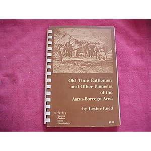
Old Time Cattlemen and Other Pioneers of the Anza-Borrego Area by Lester Reed
I purchased the original 1963 edition of this book on Amazon but I believe it is available in town at the ABDNHA Store. It was a bit crumbly and yellowed but a great book. If you enjoy reading about the history of ABDSP then you should get this book. The book is basically a reflection of events and people from Lester Reed as he remembers them while pioneereing the cattle drives in and around the desert areas. There are some great historical facts about how certain places were named and changed over time. For example, Collins Valley was for many years known as Joel Reed Valley until the name was lost to a family by the name of Collins. Monkey Hill was named by a Warner Ranch cowboy because it reminded him of a similar hill on the Warner Ranch.
Lester Reed knew many of the old time pioneers with familiar names such as the Clark brothers, John McCain, Baily and more. He recounts many adventures and stories of cattle drives thru the desert and also how the families of the desert evolved over time. The book has many photos of the pioneers and personal annotations by the author.
This is a short but very fun book to read, I reccomend it to all who are interested in the history of ABDSP.
If you think going for a hike in ABDSP is tough, read this book and try to imagine how early pioneers covered 10 miles a day in wagons trying to find water and food for themselves, horses and cattle while trying to traverse hundreds of miles in harsh desert terrain.
<em>edited by dsefcik on 9/19/2012</em> |
9/22/2012
Topic:
Wilderness Advanced First Aid (WAFA) course
dsefcikAdministrator
|
ziphius wrote:
Our instructor concluded our course by making fun of the tendency of campers and hikers to put more thought into what they are going to eat on their trip than issues like what is actually in their first aid kit. Or if they are even carrying a first aid kit. - Jim
Last year I finally put a first aid kit in my pack...still wondering what I will use those alcohol pads and sunscreen for....a roll of duct tape, a staple gun and a bandanna might still be the best kit I have. Of course the Jack Daniels compliments the staple gun and duct tape. |
9/22/2012
Topic:
Wilderness Advanced First Aid (WAFA) course
dsefcikAdministrator
|
anutami wrote:
You forgot the Item most important than even duct tape or Jack Daniels TWEEZERS!
Actually I just carry a razor blade, it has multiple functions like gouging out something tweezers would work hard at......and if you gouge too deep you always have the duct tape and staples to fix it...... |
9/24/2012
Topic:
It's Not a 4WD But It Does More!
dsefcikAdministrator
|
That thing has been for sale for years. |
9/27/2012
Topic:
Borrego Badlands
dsefcikAdministrator
|
Welcome John...I have enjoyed reading your trip reports on your blog, you guys get out to some great 4WD areas.
The plane wreckage and indian "ruins" in that area are pretty cool, plane debris can be found in several locations. One story I heard was one of the two planes crashed up on the hillside and then the gov dragged it down into the wash and buried it. At one location you can still find a shovel tossed into juniper tree that was used to try and uncover the wreckage. |
9/30/2012
Topic:
My Jeeps (and past rides)
dsefcikAdministrator
|
So I had to dig a bit to find these but here you go.....
My first Jeep, a CJ 5 that was rusted out completely so I tore it apart and rebuilt everything and put in new body panels

My wife and I down in San Quintin Baja with our Jeep

Another shot in San Quintin but also with my Yamaha XT 500

Now, some of you may notice the Baja plates on it, I tore all the smog crap out of it and registered it in Baja to avoid CA laws. I even had a Baja drivers license. |
10/2/2012
Topic:
Ocotillo Express Wind Energy Project Progress
dsefcikAdministrator
|
After almost 2 months of not being able to get out to the desert I finally took a day off and went out to enjoy one of the last hottest days of summer we will have. Temps showed 108 on my truck in Ocotillo, not really hot but I will take it....Here are some photos of the progress of the Ocotillo Wind project, it pretty much made me sick and broke my heart. I feel so bad for the residents of Ocotillo.
Welcome to Ocotillo Ca, home to the new Wind Energy Facility

Yes these are being constructed right next to peoples homes. This is at the sharp left curve as you leave town.

Ummm..yeah, pretty much limited now...thanks BLM...

I pretty much got lost on Dos Cabezas Rd not recognizing anything since they have modified it so heavily, here is where I was supposed to turn but could not because of the burm build up, ended up back tracking and going another way.

Bob...here is what the desert looks like now from your morning coffeee spot in Piedras Grandes

I have more on Piedras Grandes but will post that separately.
Daren
<em>edited by dsefcik on 10/4/2012</em> |
10/2/2012
Topic:
Ocotillo Express Wind Energy Project Progress
dsefcikAdministrator
|
Oh yeah, I should probably show a picture of Bob drinking coffee on the rock in the last picture I posted -- pre wind turbines --
Ironically this is a photo from last October the morning after we attended a BLM meeting to stop the project. One year later despite everyone's efforts it is now reality....
 |
10/3/2012
Topic:
Ocotillo Express Wind Energy Project Progress
dsefcikAdministrator
|
surfponto wrote:
I wolud like to see some shots of the view from Piedras Grandes if you have taken any?
Bob
Well that shot is from where we camped and you and I drank coffee....the view 1/4 mile down the road is pretty much the same. They are building right on the park boundry, I have some panoramic photos I need to stich together and will post when ready. |
10/4/2012
Topic:
Ocotillo Express Wind Energy Project Progress
dsefcikAdministrator
|
Worked on a few more photos and a couple of "Virtual Tours" of the area. You will need to click the links to see the full size images and tours.
May 17th 2012 destruction begins - Dos Cabezas Rd
Oct 3rd 2012 at least 28 turbines have been erected - Dos Cabezas Rd
Oct 3rd 2012 view from Shell Canyon Rd
View from Piedras Grandes using a 300mm lens (click image to view/download original full size)
 |
10/6/2012
Topic:
Ocotillo Express Wind Energy Project Progress
dsefcikAdministrator
|
borrego wrote:
This is not about energy, it's about money. If this was the beach it would never have happened, it's just that there are few of us who love the desert....... which is part of it's magic, but we just have no voice...
 |
10/15/2012
Topic:
Border patrol finds artifacts
dsefcikAdministrator
|
Pretty cool.....I had an agent tell me where some pictos were out in ABDSP once when I was out just wandering around exploring. He was out on patrol with a Camelbak and all. |
10/15/2012
Topic:
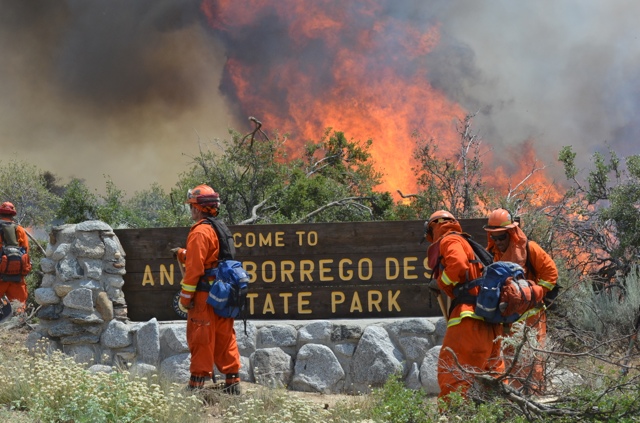
Culp Valley Fire
dsefcikAdministrator
|
Was this the fire that was started by a camper who dumped the campfire ashes from his/her metal fire container into the adjacent shrubs? Sad...
anutami wrote:
anyone know what this is?
I am gonna go with his/hers.... |