2/3/2012
Topic:
Cougar Canyon Conditions?
Buford
|
Found this forum a while ago looking up info for Borrego. Good info. I have spent a lot of time in Anza Borrego, just not recently.
I have never been to Cougar canyon and was planning on going this weekend. Is the stream in the canyon year round? Don't want to hike all the way over there to find it dry. My car can't make it past boulder alley so it's a long walk. I called the visitor center and they said they didn't know this afternoon. They did say the canyon burned in a fire over the summer, but it didn't burn too bad.
Thanks for any info. |
2/3/2012
Topic:
Marshal South Cabin
Buford
|
I can't still can't believe they lived there. I haven't been up ghost mountain since I was a kid, brings back memories. Cool pics. |
2/3/2012
Topic:
Cougar Canyon Conditions?
Buford
|
Thanks. Probably going to backpack it if there is water. If not hike back.
I have ridden the old coyote clunker mountain bike route through there. Not too interested in riding the route. |
2/5/2012
Topic:
Cougar Canyon Conditions?
Buford
|
Plenty of water from the mouth of cougar up. Fire burned the south side. Didn't make it as far into the canyon as I would have liked, girlfriend isn't too comfortable off trail scrambling. Didn't get a chance to check out sheep canyon either. I'll have to come back.
Lower willows had more water than December.
The road still goes over boulder alley, although I think boulder alley is way more tame than I remember from 15 years ago. Still a tough climb, watched a jeep struggle. I think keeping crowds down is better. Those motivated will find a way.
Thanks for the information, had a great time. |
2/20/2012
Topic:
Anza Borrego Wildflower Report ?
Buford
|
Cool Baja pics. I have never been down there during flower season. I really enjoy the scenery between El Rosario to just past Catavina, but have never stopped to explore the area. |
3/3/2012
Topic:
Cougar Canyon Conditions?
Buford
|
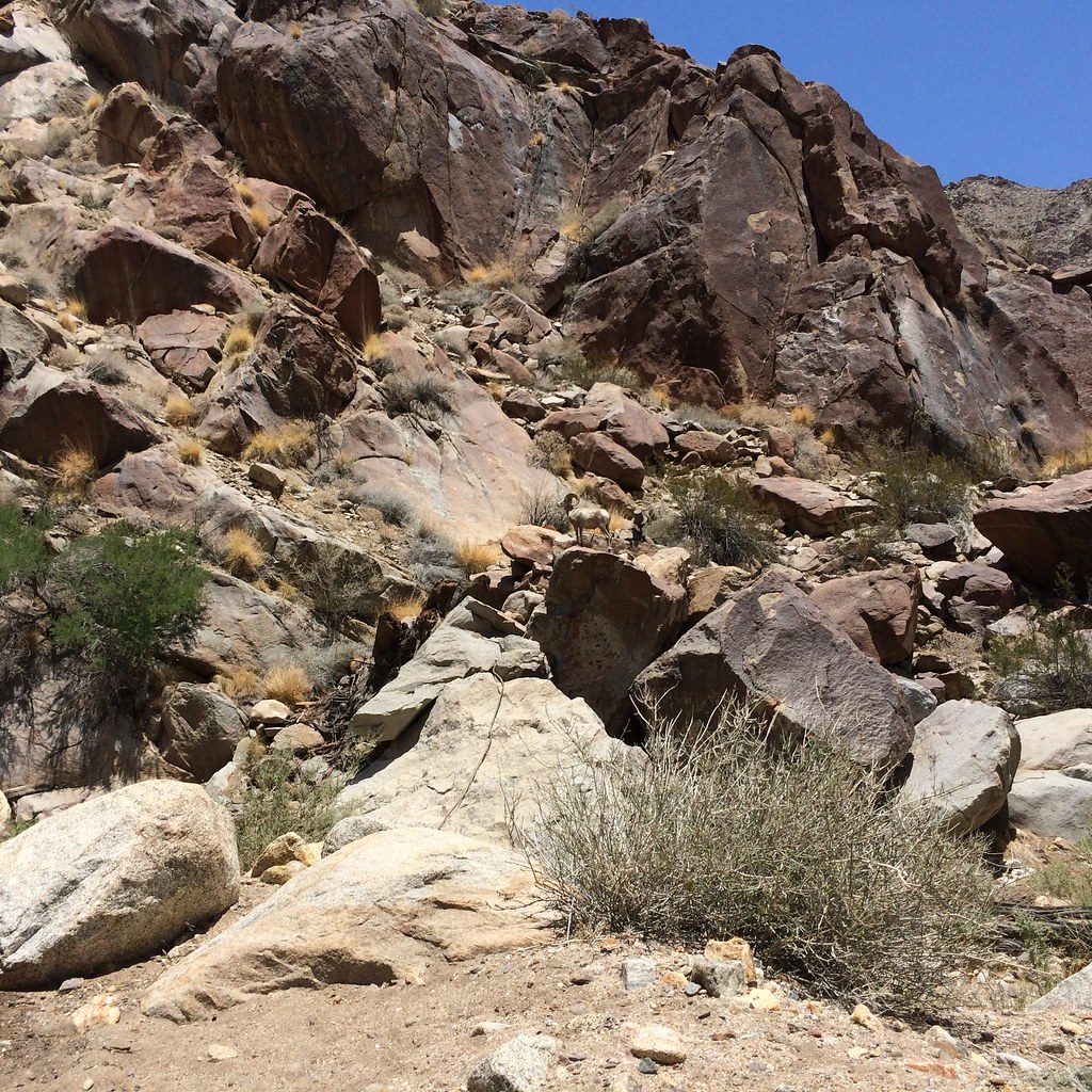
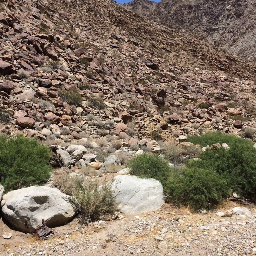
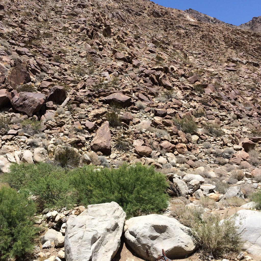
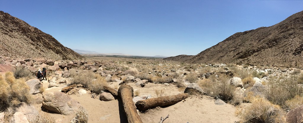
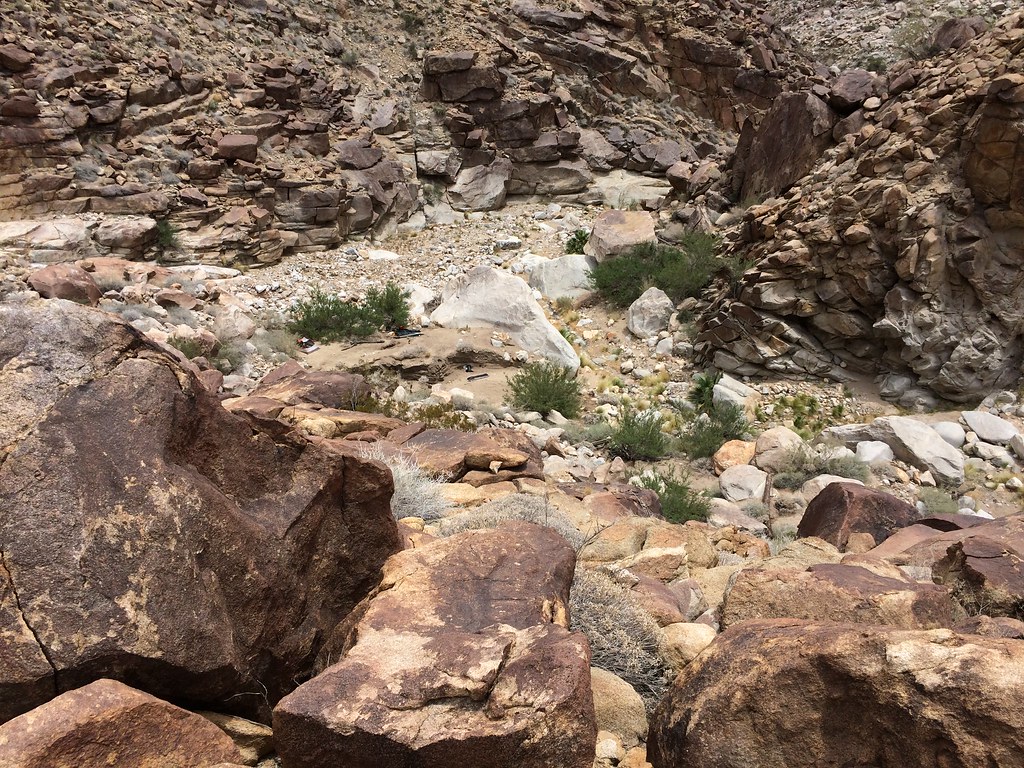
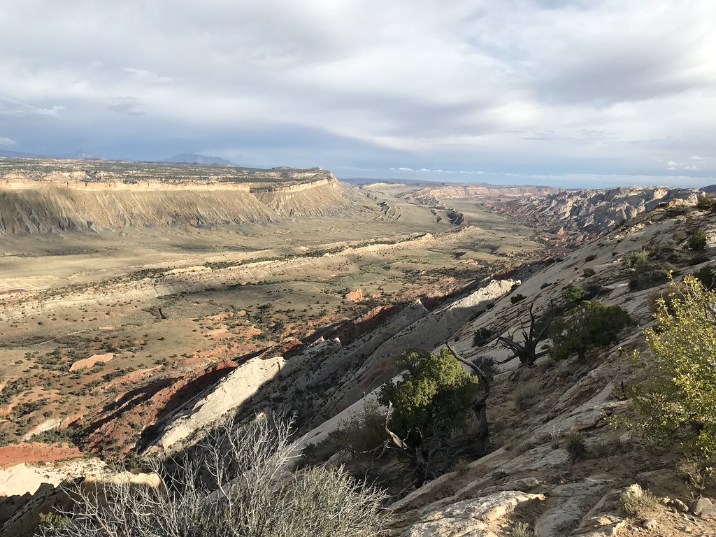
Some pics from last weekend. Hiked in and Sheep canyon day 1, Cougar canyon and out day 2. Hiked in from the gates before 3rd crossing.
A couple from sheep canyon
[IMG]http://i145.photobucket.com/albums/r203/evilclone619/IMG_4191.jpg[/IMG]
[IMG]http://i145.photobucket.com/albums/r203/evilclone619/IMG_4203.jpg[/IMG]
[IMG]http://i145.photobucket.com/albums/r203/evilclone619/IMG_4209.jpg[/IMG]
[IMG]http://i145.photobucket.com/albums/r203/evilclone619/IMG_4210.jpg[/IMG]
Cougar canyon
[IMG]http://i145.photobucket.com/albums/r203/evilclone619/IMG_4228.jpg[/IMG]
[IMG]http://i145.photobucket.com/albums/r203/evilclone619/IMG_4256.jpg[/IMG]
[IMG]http://i145.photobucket.com/albums/r203/evilclone619/IMG_4239.jpg[/IMG]
[IMG]http://i145.photobucket.com/albums/r203/evilclone619/IMG_4252.jpg[/IMG]
<em>edited by Buford on 3/3/2012</em> |
9/18/2012
Topic:
Sequoia
Buford
|
I was there last week too. Only my second visit. Amazing place. Cool to see pics of the trees.
I did a backpacking trip out of Kings Canyon along with sightseeing and day hiking in Sequoia.
You could still drive to Moro rock/Crescent Meadow and under the tree, just not during the weekends or during peak seasons and hours. |
9/18/2012
Topic:
Gettin the itch...
Buford
|
First trip will probably be in October and a mellow car camp and sightseeing trip to some easier trails.
Been lurking on this forum for cool trip ideas. This year I would like explore some of the following new to me areas on day hikes or backpacking trips:
Indian Head
Sheep Canyon, south fork
Alder canyon
Indian Canyon to Palm Canyon traverse
Pinyon Ridge/Wilson trail
Flatcat canyon
Villager Peak
Even if I only do a couple of those it will be a good year for me. I would like to revisit some old favorites too. |
10/25/2012
Topic:
Squaw Tit, Table Mountain and 10 other Benchmarks
Buford
|
Thanks for the pictures. That is very similar to a trip I plan on doing this winter.
I camped at Blair Valley a few weeks ago, but just relaxed at camp instead of exploring too much.
I have never had problems with the border patrol checkpoints, although they did have the drug dog sniff all over my truck once. |
10/29/2012
Topic:
Culp Valley to Palm Canyon
Buford
|
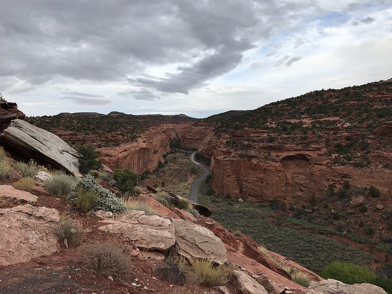
I got a shuttle this weekend so I could cheat and hike downhill only.
Started in Culp Valley and took the California Riding and Hiking trail down, then continued and hiked up Palm Canyon to the Indian Head turn off Before turning back and staying in the campground.
The always nice view to the bottom
[IMG]http://i145.photobucket.com/albums/r203/evilclone619/IMG_5112.jpg[/IMG]
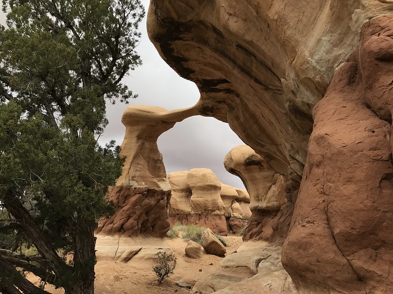
Palms in Flat Cat Canyon. I will try this hike when the canyon likely has water as an alternative to the crowded Palm and Hellhole canyons
[IMG]http://i145.photobucket.com/albums/r203/evilclone619/IMG_5128.jpg[/IMG]
First grove in Palm canyon was dry, flowing water started about a half mile further up.
[IMG]http://i145.photobucket.com/albums/r203/evilclone619/IMG_5143.jpg[/IMG]
The light over the ridge had a cool effect that almost came out in the picture
[IMG]http://i145.photobucket.com/albums/r203/evilclone619/IMG_5136.jpg[/IMG]
A couple weeks ago there was a perfect sunset from Blair Valley with the storm over the mountains. I only got a crappy cellphone picture.
[IMG]http://i145.photobucket.com/albums/r203/evilclone619/92AE4A40-74DD-4507-AEED-CA0AF87567E0-790-00000392F003F127.jpg[/IMG] |
10/29/2012
Topic:
Rockhouse Canyon 4 Day Backpack TR
Buford
|
Thanks for the report and Pictures. That looks like an awesome route. Good to know there is a spring in the area. |
10/30/2012
Topic:
Culp Valley to Palm Canyon
Buford
|
dsefcik wrote:
I think I was on part of that trail when I did the BHS count in 2011. I camped at Culp Valley and then hiked about a mile east before heading down the canyon wall near Maidenhair Falls, that is where we counted from.
Was much of that side of Culp Valley burned? I know the south side was pretty bad.
The last fire never crossed montezuma road. It stayed on the pinyon ridge side, which looks completely burnt out. The north side of the road is fine.
Peña spring had flowing water too.
It was cool seeing the planes fly over the parade in borrego springs from up high. |
11/13/2012
Topic:
Whale Peak, Pinyon Mountain Road
Buford
|
I plan on hiking up Whale Peak soon. Since I haven't done it before, I plan on the less adventurous route from Pinyon Mountain Road, which brings me to my question.
How Passable is Pinyon Mountain Road for a 2wd truck, to the 3.8 mile mark at least? I understand that at ~3.8 miles, it gets too rocky for 2wd, so I will have to walk a couple miles on the road, no big deal. Since my truck is 2wd, I have a little better clearance than a car, but I sink in soft sand much worse.
Thanks |
11/14/2012
Topic:
Whale Peak, Pinyon Mountain Road
Buford
|
Thanks for the information everyone. Blair Valley as a starting point is plan B. I can do it, but it would make it more difficult to explore north of the road too.
I am not sure of exactly when I will try this. Maybe even in the next week. I asked at the visitor center a few weeks ago, the people there at the time weren't much help. I don't always trust their road reports either as I have found them to be innaccurate both ways.
I have no illusions of getting past the rocks at ~3.8 miles. If I can get near there I will hike it the rest of the way. |
10/21/2013
Topic:
Hike from Culp Valley to Maindenhair Falls to road
Buford
|
+1 on the info from dsefcik. Last year I did the walk from Culp Valley to the Hellhole canyon trail to Palm Canyon. The CRHT was easy to follow and had some great views of the desert floor from Culp Valley to the maidenhair falls trail. 5-6 miles sounds about right. |
1/21/2014
Topic:
Illegal camping
Buford
|
That sucks. People seem to think they can do what they want since it is only the desert.
Last weekend on Villager Peak I was surprised to find some well used fire rings and the few trees near them obviously scavenged for wood to burn. There isn't much up there to burn.
In Blair valley a couple months ago the ranger came by every campsite to check for metal fire containers. This was after earlier in the day a different ranger busted some people for doing donuts in the dry lake bed in their trucks and shooting off rockets and fireworks. |
7/7/2014
Topic:
Bighorn Sheep Count 2014
Buford
|
Thanks for the sheep count info. Looks like fun to me.
I have always wanted to participate in the count since I heard about it as a kid. Next year I will try and make it happen. |
11/25/2014
Topic:
Mortero Palms to Goat Canyon Trestle & Indian Hill
Buford
|
Nice report.
Those must have been your groups footprints I followed today doing an out and back from Mortero Palms to the trestle. |
1/3/2015
Topic:
Gear Reccomendations
Buford
|
Some thoughts:
The sleeping pad is just as important as the bag. It doesn't matter how warm the bag is if you are bleeding heat into the ground. A pad with a good R value is needed at low temps.
Katabatic gear is not cheap, but is really nice. I use the 15 degree version of their quilt and like it, they also make a 0 version. Some like quilts, some don't. When it gets cold a down hood is needed since the quilt has no hood. I use their bivy too, but sometimes get condensation. I want to add a strip of mesh down the top middle of it.
Everyone sleeps different, a 20 degree bag for one might be 10 for another. Eating a lot of calories right before bed helps, especially fat and protein. Midnight snacks help keep the internal heat going.
I have no experience with "feathered friends" or "western mountaineering" bags but I use and like their jackets. Alot of people really like their bags. At the temps you are talking about a lot of people that prefer quilts switch to mummy bags.
Hope some of this helps. Sorry if I covered stuff you already knew. |
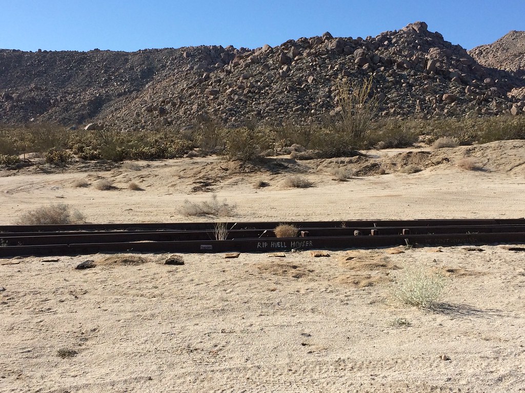
1/7/2015
Topic:
Carrizo Gorge Railway - Does the Saga Ever End?
Buford
|
Not surprising. Thanks for the link.
I was surprised that when I was out there a couple days before christmas, that a rail car had definitely been on the tracks near the trestle recently. It had rained 2 days before, and I could see where the rail wheels indented the sand since the rain.
Made me start to wonder how much a ticket would be for hiking along the tracks.
edited by Buford on 1/7/2015 |
1/7/2015
Topic:
Fish Creek Wash Fossil Beds
Buford
|
Cool trip. You have some lucky kids. That is an area of the park I have yet to explore. Thanks for the pictures. |
1/7/2015
Topic:
Gear Reccomendations
Buford
|
I have also used a zpacks bag. They are good, but I think the Katabatic bag is better. If I were to get a zpacks bag again, I would make sure to get longer, wider, and warmer than expected. Zpacks bags are so light because they are cut really slim and lack anything extra.
I use an Xtherm sleeping pad, but worry about cacti. I like the idea of idiot proof foam pads, but they are too bulky to pack and not warm enough for me. I would freeze if I were to sleep out there below freezing and just had a ridgrest pad under me.
Welcome Justin. |
3/9/2015
Topic:
Indian Canyon to Borrego Palm Canyon Traverse info
Buford
|
The Palm canyon to coyote canyon traverse looks fun. I have wanted to do it for a couple years.
I would take anything the well meaning but not always informed volunteers say at the visitors center with a grain of salt. I think they tend to err on the side of extreme caution to keep people out of trouble.
I can't say 100% because I haven't been there this year, but I would be 99% sure there is water there. Especially after the last rain left quite a bit in that drainage. I even found running water there one October of a dry year when it hadn't rained in 6+ months. |
3/9/2015
Topic:
Southern Anza Borrego Flower Report 2015
Buford
|
Cool pics. I was out in Henderson canyon in all the rain the week before. Flowers were starting to look really good then. Sunday got quite a bit of rainfall so hopefully the flowers stick around. On the desert floor it looked like the cactus were just starting to bloom in that area, with most other things already in bloom. |
5/13/2015
Topic:
Sheep count 2015?
Buford
|
Any news yet? I didn't find anything through a Google search. I know it is always 4th of July weekend. Usually around now they start to look for volunteers and schedule the orientation. |
5/18/2015
Topic:
Bighorn Sheep Count 2015 Volunteers Needed !!
Buford
|
Thanks for posting. On my calendar. 90% sure I can participate this year for the first time. |
6/3/2015
Topic:
Bighorn Sheep Count 2015 Volunteers Needed !!
Buford
|
I signed up. Looking forward to June 20th and the 4th of July weekend. |
6/29/2015
Topic:
Bighorn Sheep Count 2015 Volunteers Needed !!
Buford
|
I got assigned to head up Palm Canyon with a group. Looking forward to it. I saw our site hasn't been counted every year. I also looked at previous counts and thought it was interesting how some years a site has 0 and the next year that site might have 15.
It will be weird to backpack and not worry about cold temps at night. |
6/30/2015
Topic:
Bighorn Sheep Count 2015 Volunteers Needed !!
Buford
|
They actually had enough backpackers this year from what I heard. Some people who volunteered for backpacking were not getting backpacking assignments. At least that is what I thought I heard.
I got assigned 2nd grove. |
7/6/2015
Topic:
Bighorn Sheep Count 2015 Volunteers Needed !!
Buford
|
dsefcik wrote:
Hey Buford, did you go? I was at the maint yard until about 4pm...if you made it out, how was the count? I will post up pics and a TR from our site in the next couple of days.
I participated. Some things were very different than anticipated. We never saw any sheep go down to the water at our site. We did see a couple sheep high on the ridgines around us. I'll post a mini report later. |
7/6/2015
Topic:
Sheep Count 2015
Buford
|
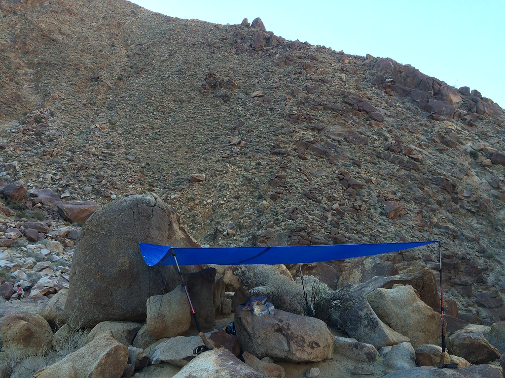
I am comfortable in the Anza-Borrego Desert, having been camping there since I was a child. After hearing about the sheep count for the first time on a family trip as a kid, I have always wanted to participate. As a hiker/backpacker/peak bagger I filled out the sheep count orientation and volunteered for a backpacking assignment.
The sheep count orientation was worth attending for anyone that has any interest in sheep. At the orientation I got assigned to Palm Canyon, 2nd grove. I have been up past 2nd grove many times, and knew from previous count data that sheep were almost always spotted there. I also met the other members assigned to the count site, another experienced desert hiker/SAR member, and a married trail running couple who had never camped before but were very into sheep made up our team of four. All of us first timers for the count.
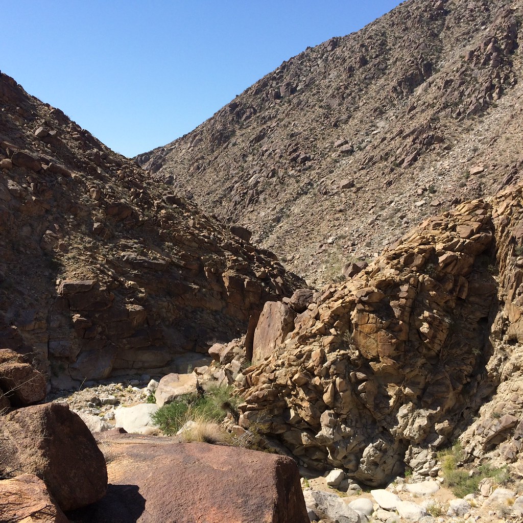
I arrived at checkin right before 3pm the day before the count, and the rest of our team was there and ready to go. I briefly talked to someone that had counted from 2nd grove before to get info on the count site. The info and the topo map in our packet made it really easy to find our count spot. We hiked up Palm Canyon and spotted quite a few sheep before 1st grove on the way up.

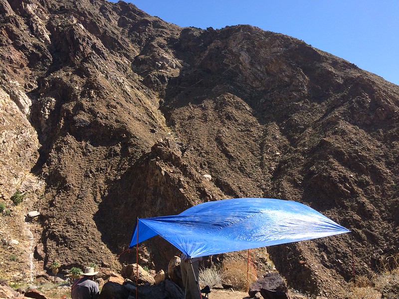
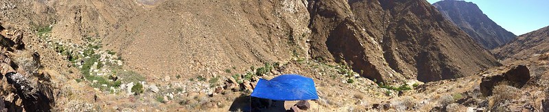
There was plenty of water at first grove trickling down into a pool created by a man made stick and sand wall. After 1st grove, there was no water all the way up past our count site. Just past our site, there was a good pool of clear frog filled water being fed by a trickle from the rocks. We were happy we had filterable water close by, and didn't have to hike far each day to refill.
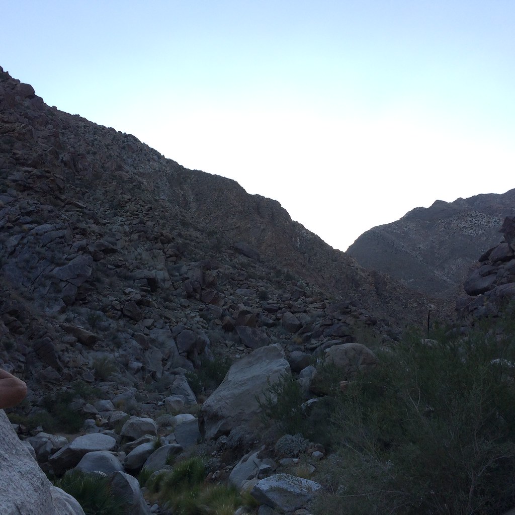
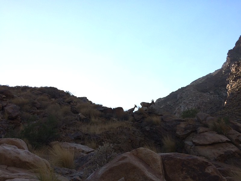
Our count site was a little hill on the side of the canyon with a good view up and down canyon, including a vantage point for the water source up stream. We setup our shade tarp the first day and looked for sheep near the water, only to hear rockfall on the Indianhead ridge line behind us. One of our team members quickly spotted our first sheep due to the rockfall, and I saw the little one with it minutes later. Spotting them without binoculars would have been impossible. Later in the day we saw a different sheep up on the ridge line. That was it for day 1. One member of our team had a camera with a good telephoto lens, hopefully his pictures came out well.
Sheep were on the ridge line behind our site:

Day 2 was a big blank. One member of our team finally saw a sheep at 7pm, when it didn't count, on a very distant ridgeline up canyon. It was perfectly outlined against the sky and again only visible with binoculars.
There is a sheep on the little saddle of the left distant ridge line:
Day 3 was almost a blank. I spotted a single sheep glassing down canyon. Turns out that sheep was soon spotted by 1st grove right after it left our line of sight. We finished with only 4 official sheep over 3 days of counting, plus some bonus sheep on the hike up and back.
There is a sheep somewhere on the 3rd hill back. Only visible with binoculars or a long lens.
We started the hike out a couple minutes before noon. We saw plenty of sheep below 1st grove of course.
I was prepared for the heat, and it was not a problem. Hiking and counting in the heat were not an issue. The heat would get uncomfortable, but the shade made it doable. I knew our site almost always saw sheep in years past. I was glad we didn't go 3 days and see no sheep like some teams. That would be difficult. The hardest part for me was sitting there for hours looking and seeing nothing without being able to go out and explore the area. It would be much easier to sit and look if there were more sheep in front of us. Our team was excellent. At least we had great people to hang with and talk to for hours of not seeing sheep.
Despite having gallons of good clear water, not one sheep went down to it during the count. This was surprising to me. Overall a good experience. I just wish we counted more sheep.
Sorry about the cell phone snapshots, I am not a photographer.
edited by Buford on 7/6/2015 |
7/6/2015
Topic:
Sheep Count 2015
Buford
|
For sleep I brought a bivy and sleeping pad. I thought the bugs might be an issue. At worse, they were a minor annoyance. Water was too far away for bugs to bother us at camp. Bivy not needed. Another in our team brought their tent, no rain fly. Others didn't even bring sleeping pads/bags. We camped on a nice sandy beach. They just laid down beach towels.
Our camp from the count site:
Count hours were from 0700 to 1700, and on the last day 0700 to 1200. Sheep before or after don't count.
I missed you at checkin, I think I talked to one of the people on your team though. Can't wait to see the pictures from Rattlesnake spring. I did meet another forum member at check out.
I likely would count again.
edited by Buford on 7/6/2015 |
7/7/2015
Topic:
Sheep Count 2015
Buford
|
Great pics from rattlesnake. I've been meaning to check it out in the winter. I've only seen it from the Villager ridge line.
Cool that you guys had lots of lambs. We got lucky and saw one of the only lambs counted in our area.
Can't believe the bees were that bad. We had a swarm go by, sounded like a jet, but no issues. There were a lot of bugs when we went to get water, but again no issues. |
1/24/2016
Topic:
Sheep Canyon, South Fork Sheep Canyon, Cougar Cany
Buford
|
I know it is a little late, but there was plenty of water back there last weekend (January 16-17) after all the rain. |
2/9/2016
Topic:
Villager Peak trailhead vandalism
Buford
|
That sucks.
Hope this does not become a thing out here. I haven't heard of this too much in Borrego before.
That is one of my fears, coming back to find a vehicle gone or destroyed and no cell reception. |
6/6/2016
Topic:
Proposed closures in ABSP, read and act now
Buford
|
Thanks for posting this. I just sent in comments, for whatever it's worth. There must be a better way than banning all off trail access in these areas. Hard to define what an official "trail" is in some of these areas to begin with. |
6/9/2016
Topic:
Proposed closures in ABSP, read and act now
Buford
|
I got the same notice in my email. I am likely to show up. I don't have much hope. These things tend to steamroll through unless there is significant public outcry. Even then sometimes they have already decided, public comment is just for show.
I found actual boundary maps of the current cultural preserves, I'll post them later.
I am guessing the reason for this is because of damage like at Carey's castle in JT. Some people are the reason we can't have nice things.
I bet if SDG&E/Sempra wanted to run a power line through some of these areas they could get approved. |
6/13/2016
Topic:
Proposed closures in ABSP, read and act now
Buford
|
The best maps I could find of the CPs were here:
http://www.parks.ca.gov/pages/21299/files/final_abdsp_cultural_preserve_management_plan_112612.pdf
The maps start at page 97. The thing that concerns me is the wording.
Boardwalks, roads, and trails are one thing; even if what constitutes a trail is somewhat hazy. What are "other designated routes?" Did anyone see that info anywhere?
http://www.parks.ca.gov/pages/1324/files/proposed_ccr_language_web.pdf
Is the way into Cougar Canyon classified as a trail? A "designated route?" Or would foot travel there be banned? What about Mortero Palms to the trestle? Smuggler Canyon to Whale Peak? Even if those "routes" and others like them stay open, losing the ability to just simply walk around and explore is a big loss.
They will probably say that the CPs are only 8% of the park area, but it is a big portion of the most interesting areas to explore.
I know JT is national park with different governance and rules than the state parks. They recently enacted foot traffic closures there, and I wonder if the cause of the closure, and potential reasoning behind them is the same in Anza-Borrego.
About the Powerlines, I know public outcry was the only reason the routing was better for the park. Sorry I didn't word that clearly at all. |
6/13/2016
Topic:
Sheep Count 2016
Buford
|
Any word on the orientation this year? I know the dates of the count are set. I searched and didn't find any info online for the orientation or the count.
I am looking forward to doing the count again. Last year was my first year and I enjoyed it enough to want to come back.
edited by Buford on 6/13/2016 |
6/13/2016
Topic:
Sheep Count 2016
Buford
|
Thanks. Signed up again. I am actually looking forward to it and wondered if they were ever going to post this year. |
7/4/2016
Topic:
Sheep Count 2016
Buford
|
3rd and 4th Groves Palm Canyon we had 21 sheep. In Palm Canyon it seemed more sheep than last year, and for sure more lambs. More water than last year too. Weather was actually pleasant, for July in Borrego anyway.
edited by Buford on 7/4/2016 |
3/12/2017
Topic:
Anza Borrego Super Bloom crowds
Buford
|
I was out today. We had the trip planned for months on this date. We avoided the crowds very successfully until the drive home. We were at Dudley's at 8:00 am. I have been at Dudley's at 8:00 am many times this season heading out for camping and peak bagging trips and never seen anyone else there. There was line of people getting pastries and bread already.
Hellhole parking lot was jammed. Ranger Steve and a partner were directing traffic at the base of Montezuma Grade, not letting anyone turn towards the visitor center at ~8:45 am. People were parked solid all the way from Montezuma Grade to Christmas Tree Circle already and walking back towards the visitor center. We breezed through. Traffic was not bad yet.
We got out of Borrego Springs immediately and never came back. We pulled out a stuck truck at one of the statues. Amateur hour in full effect. Immediately headed up a less well known road that is still passenger car friendly. Full of flowers and few people. Hiked around in relative solitude with our group. Headed to the Badlands for lunch and different types of flowers. Not too many people either.
Scoped out the route to 6582 after lunch. Really nice flowers in the area with no one around.
If you know your way around it was easy enough to go from place to place without going through town and Christmas Tree Circle.
I have never seen that many people in Borrego in 30 +years. Last two years have actually had really good flowers but not hyped enough I guess. Exactly one year ago the Hellhole parking lot was empty enough to do donuts during peak flower season on Sunday. I guess this is the first hyped bloom in the social media age?
Drove up Grapevine Canyon from Yaqui Well into Ranchita. S2 North was at a complete standstill from Montezuma grade until it ends at the 79. Probably spent an hour in traffic on that couple mile stretch of road. The only time crowds and traffic really impacted us all day. Ramona was also a disaster.
I was in the Southern end of the park a couple weeks ago and things were just starting to bloom. Probably a good alternative to the Borrego Springs area.
S*** Show and Cluster **** describe it very well.
A couple cell phone snapshots:

edited by Buford on 3/12/2017
edited by Buford on 3/12/2017
edited by Buford on 3/12/2017 |
3/12/2017
Topic:
Red Tail and Kestrel going at it.
Buford
|
Very cool. Thanks for posting those! |
3/28/2017
Topic:
Be careful for what you wish for.
Buford
|
I've found a couple spiders in summit registers bolt out and make me jump.
I don't like stumbling on geocaches. I think of them as litter.
I don't mind summit registers. I don't know if the rangers see a distinction though? |
3/31/2017
Topic:
Ranger Steve dies in shooting incident
Buford
|
That is terrible news.
I don't know what to say. |
4/13/2017
Topic:
Ranger Steve dies in shooting incident
Buford
|
Very sad. Looks like a memorial will be held May 1st.
http://www.sandiegouniontribune.com/communities/north-county/sd-no-ranger-bier-20170413-story.html |
5/7/2017
Topic:
Ranger Steve dies in shooting incident
Buford
|
Thanks for posting the videos for those of us unable to attend.
So sad. I last talked to Ranger Steve in February when I ran into him on patrol. He will be missed. |
5/7/2017
Topic:
Your Go To AB Book?
Buford
|
caltopo.com
San Diego 100 peaks list
Google Earth
Are always good for ideas. |
5/8/2017
Topic:
Your Go To AB Book?
Buford
|
dsefcik wrote:
Buford wrote:
caltopo.com
San Diego 100 peaks list
Google Earth
caltopo.com - almost indispensable to me, matt has really made this a #1 map resource.
100 peaks - great all round so cal reference for hiking, derek has covered and documented some great areas to explore.
We might be referring to a different 100 peaks website. Peakbagger has the Sierra Club San Diego 100 list with reports:
http://peakbagger.com/list.aspx?lid=5058
Even if you don't peakbag, if a peak is in the area someone has been there and likely posted some kind of report.
As for caltopo, I agree with the trouble/fun. "Those lines are far enough apart, that route has to be doable." |
5/9/2017
Topic:
What do you do with found artifacts?
Buford
|
I always leave them where I found them. I would never take it home, ever. Period.
If it is notable I take a picture.
I appreciate museums, and the fact they protect things forever. I am uncomfortable that museums vacuum up artifacts and take away someone's else's joy of discovery in the wild.
I would be very upset if an artifact I left in the wild was poached and taken home by someone. I also would not be thrilled if it was taken by a museum and stored in a closet in perpetuity.
I know there are still mostly intact Ollas out there that have been left by like minded people. I have not found one myself, yet.
I agree with Ziphius. I stumbled on an online artifact collecting forum once looking up Borrego info. What people had looted and taken home made me sick. |
5/15/2017
Topic:
Villager Peak
Buford
|
Everyone goes through different amounts of water. 2G sounds like more than enough to me, but everyone is different.
I agree, sunrise from the ridge is awesome. It can be very cold up there though.
It is basically a trail to Villager. Hard to call it a cross country route. |
5/15/2017
Topic:
What footwear do you use for desert hiking?
Buford
|
Whatever footwear is comfortable to you.
Some like trail runners for lightweight and flexibility. Some like heavy boots for protection and durability.
I use trail runners or similar light hiking low tops with Dirty Girl gaiters even off trail. I wear the tread flat in <8 months. |
6/18/2017
Topic:
2017 Sheep Count info
Buford
|
ziphius wrote:
Looking forward to my 1st count. 
Nice. 
I will be back for the third year. I think it is cool how some people have done it for 30+ years.
After orientation yesterday I hiked up to just before 3rd grove Palm Canyon. It was a little warm. |
6/19/2017
Topic:
2017 Sheep Count info
Buford
|
I'll be in upper Palm Canyon, currently looking like 4th grove. It looked like they might have to reshuffle us around as some people were not sure they could commit and might bail out. |
6/22/2017
Topic:
2017 Sheep Count info
Buford
|
As mentioned, the sheep don't need water until it gets hot. Also as it gets hot water holes dry up and there are fewer of them that need to be staked out. The count is also ideally before the monsoon rains later in summer.
The other reason is Lamb mortality. They want the count to be after the die off of lambs. Part of the count data compares ewe counts vs lamb and yearling counts to check survival rates since every ewe gives birth to a single lamb every spring.
I think the San Gabriel mountains do a sheep count at a different time of year. |
6/25/2017
Topic:
2017 Sheep Count info
Buford
|
I have counted in upper Palm Canyon twice. We always have water from the stream to filter. Probably about 6L/person/day.
I volunteer for Upper Palm Canyon because even if we see no sheep at our count site, there are almost always sheep on the hike in and out. The other thing I like is there is always something interesting in Palm Canyon. Lots of birds, insects, coyotes, frogs, toads, lizards. Last year we even saw a ring-tailed cat during the count.
Some people keep coming back. There are teams that always have the same counters at the same site each year. Most people do not return after counting once. Only way to find out is to do it.
My 3rd year and I have seen few repeat volunteers in upper Palm Canyon. The temperatures, boredom, rough hike in and improper packing probably have a lot to do with it. Most pack too heavy and are not ready for the off trail portion of the hike, as mild as Palm Canyon is.
Not all sites see sheep each year. That has something to do with people returning as well.
Stay safe everyone. So far the forecast looks relatively mild. |
7/3/2017
Topic:
2017 Sheep Count info
Buford
|
Well, the forum ate my first post and I had to start over.
It was an interesting count for this year.
The three other people in our group were good people to hang out with for three days, which is always a plus for randomly assigned strangers.
The upper Palm Canyon count sites do not have a trail to them and require bouldering, talus hopping, loose steep slopes and bushwhacking to hike to. Add in a full pack and the high temperatures and it is even more difficult. I cannot stress this enough for someone that wants to count these sites. All three years I have done this there has been someone assigned to count in upper Palm Canyon who is not prepared for the hike in and out and really suffers. This year was no exception.
We saw the same general group of sheep each day. They would start the day high on the slope opposite the count site and would work down to the canyon bottom by midday. They traveled down canyon out of sight. After count hours they would come back towards camp on the opposite slope from their starting point, then cut though camp and climb up to where they started.
Some cell phone pictures of the count are below. Some pictures are from the count site, others from camp. All zoom pictures were obtained by holding the 10x binoculars in one hand with the cell phone in the other with the camera sort of centered in the eye piece. I was surprised it worked at all.
Old Major:
Tagged ewe through binoculars:

Tagged ewe closer to camp this time:
Ram from camp through binoculars:
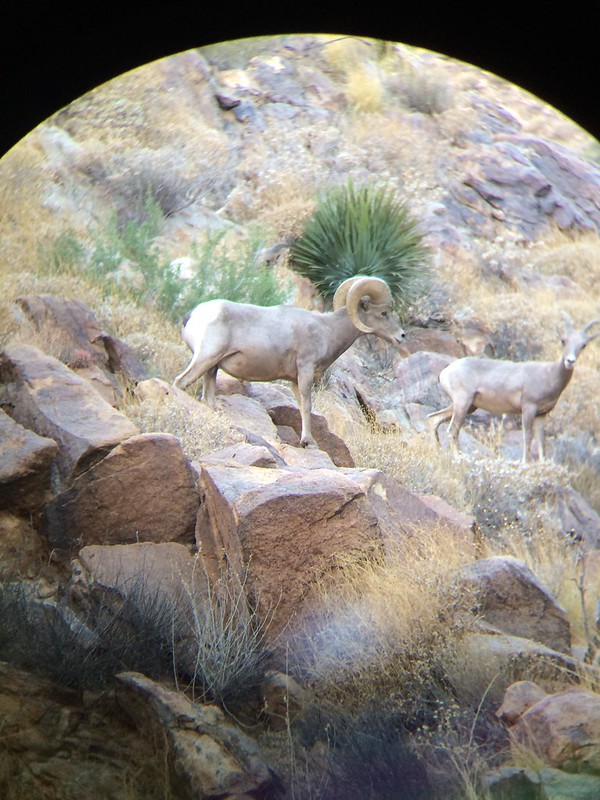
Count site, most sheep were seen high on the slope across the canyon from us:
Panorama from count site:
edited by Buford on 7/3/2017
Added a picture and clarification
edited by Buford on 7/3/2017
edited by Buford on 7/3/2017 |
7/3/2017
Topic:
2017 Sheep Count info
Buford
|
Ziphius, I must have missed you at checkin. We were a little late to checkout.
I was at 4th. Gary Was at 3rd and had to stay late waiting for us so we could reconcile counts.
Daren, I heard about your groups adventures from Mike when he walked us out. Ouch. He speculated some of the seismic activity might have shutoff the water supply to the spring.
Glad everyone made it out safe.
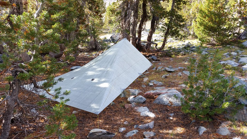
No exotic wildlife for us this year. Lots of frogs, water bugs, white preying mantis, lizards and some hawks. The hummingbirds kept trying to get nectar out of our orange tarp lines, confused things. Lots of other small birds but no birders in our group.
edited by Buford on 7/3/2017 |
7/9/2017
Topic:
2017 Sheep Count info
Buford
|
The reporter that was interviewing people and tagging along put up her report:
https://ww2.kqed.org/news/2017/07/09/volunteers-brave-extremes-to-count-bighorn-sheep-in-the-desert/
There are some minor differences between the audio and written report, but the gist is the same. |
7/14/2017
Topic:
Photo hosting recommendations
Buford
|
Flickr works well so far. |
8/6/2017
Topic:
The Island
Buford
|
Nice. I've yet to explore the island.
I don't think I've found a summit register in Borrego without the Monday Maniacs in it. |
8/6/2017
Topic:
Perseid Meteors
Buford
|
The Perseid Meteor shower is on. It should peak August 11-12. It won't be as good as it could be this year due to the bright moon, but is probably worth a trip. |
10/10/2017
Topic:
Thorny desert weed
Buford
|
Haha. Horrible stuff. Extracts a blood toll when you bushwhack through it.
According to the scientists it is good for sheep, it flowers and holds leaves later than most plants giving them food in the dry months.
edited by Buford on 10/10/2017 |
12/5/2017
Topic:
Exploring Coyote Canyon w/o 4wd or High Clearance
Buford
|
Usually you can get a passenger car to Desert Gardens or maybe 2nd crossing. From there it is ~4.5 miles into some of the west side canyons with water.
I don’t know what the road conditions are this year. The road got hit by a flash flood in September and might be worse than normal. Usually the volunteers and Rangers at the visitor center are overly cautious with their road reports.
I plan on hitting the area sometime this winter to explore.
Backpacking or biking in would expand your range. |
12/5/2017
Topic:
A different desert
Buford
|
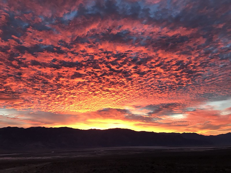
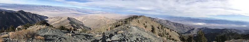
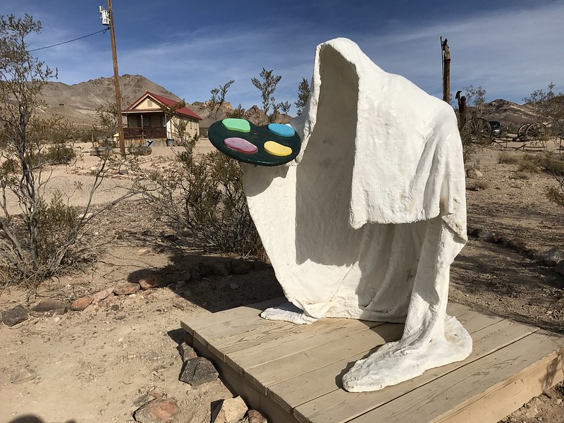
I was really disappointed I missed out on a planned trip exploring Borrego with some others in mid November. In late November I got to make up for it some with a trip to DVNP.
Saw some of the tourist things and got off the beaten path as well.
Sunsets were nice:

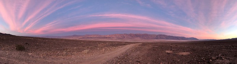
So were sunrises:

Low points:
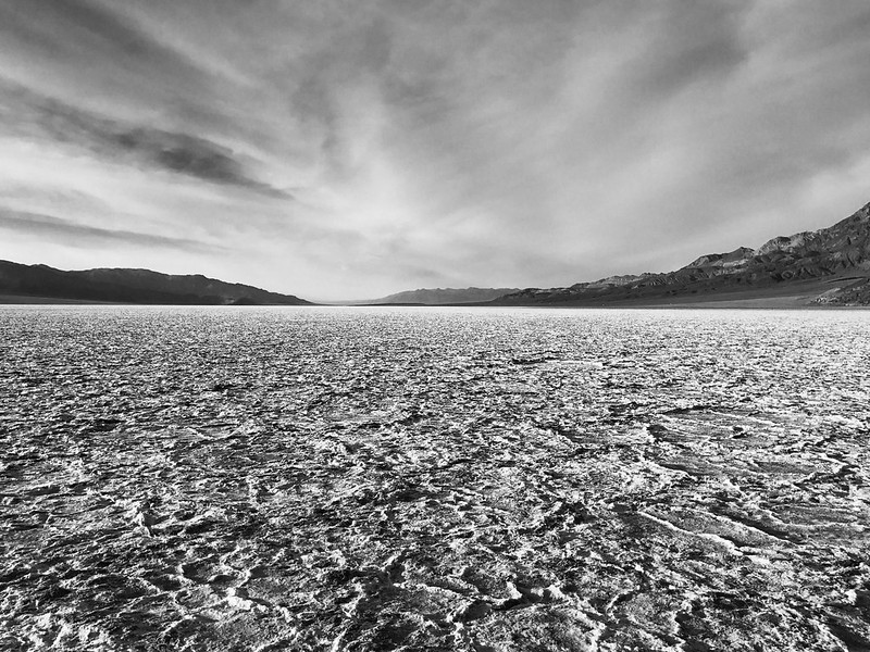
High Points:

The weird:

The lonely road:

Someone was here before us:
I can’t wait to hit the desert again
edited to add the pictures.
edited by Buford on 12/5/2017
edited by Buford on 12/5/2017
edited by Buford on 12/5/2017
edited by Buford on 12/5/2017
edited by Buford on 12/5/2017 |
12/5/2017
Topic:
Exploring Coyote Canyon w/o 4wd or High Clearance
Buford
|
dsefcik wrote:
Last I heard there were pretty sandy conditions in that area and others. I would check in with the VC before driving a Fit down that way....however I once saw a Fit parked up at the Telescope Peak trailhead, never would have guessed that!
It is funny you mentioned that. I was just putting up some pictures from DVNP in a different report. I saw a Honda Fit, Honda Odyssey and a Hyundai Elantra at Telescope a couple weeks ago. |
12/5/2017
Topic:
A Red Desert
Buford
|
In early fall we visited the four corners area.
Chaco was cold and clear:

It's too bad they have to put so many restrictions on hiking in the area. Too many looters.
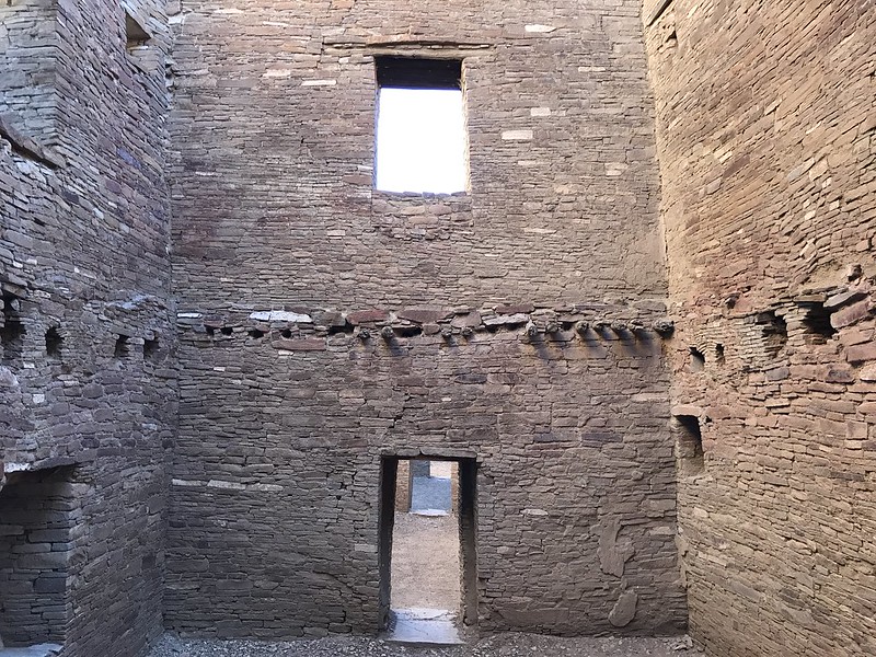
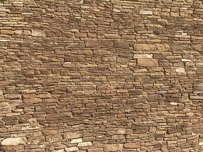
The masonry was better than home:
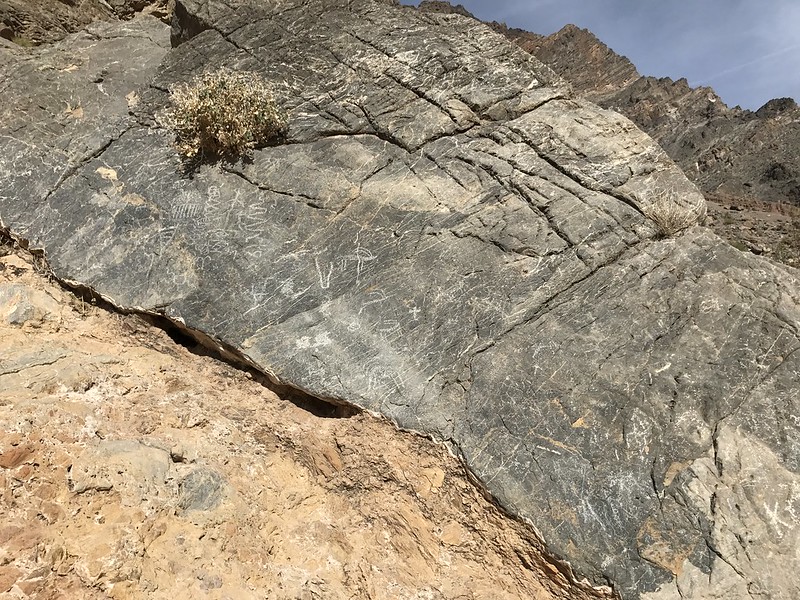
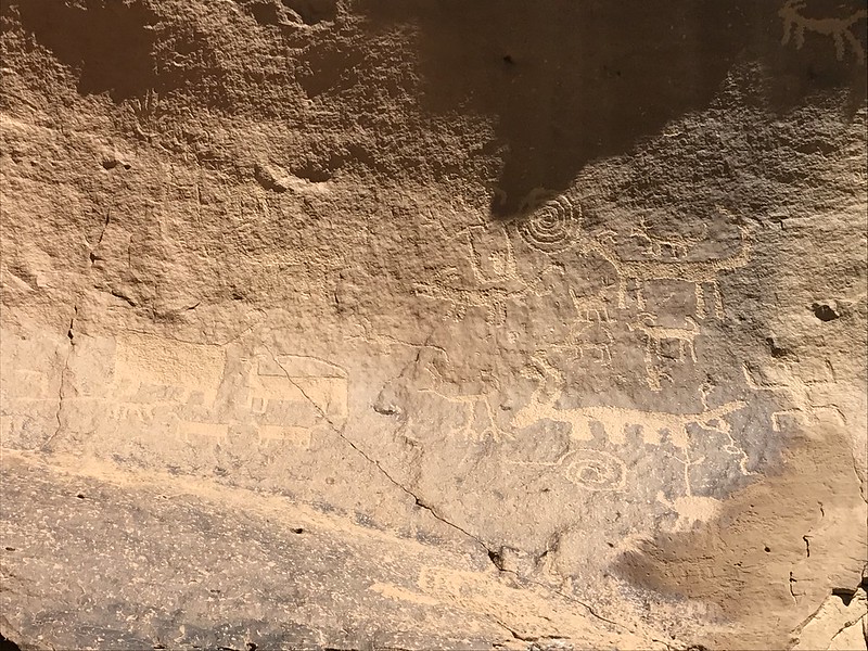
Rock art everywhere, people on this forum would love it:
RIP Bears Ears:

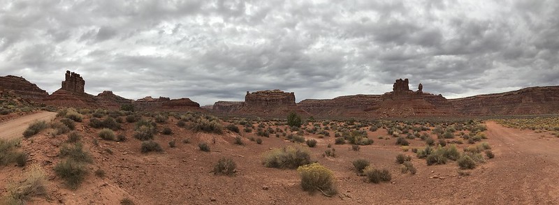
Pictures do Valley of the Gods no justice:
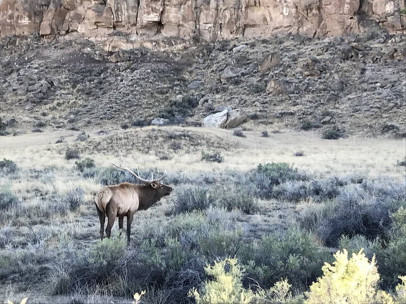
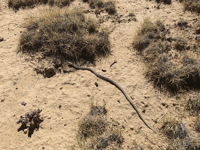
There was wildlife in many places:
Atop the water pocket fold:
Zionesque but with no people:
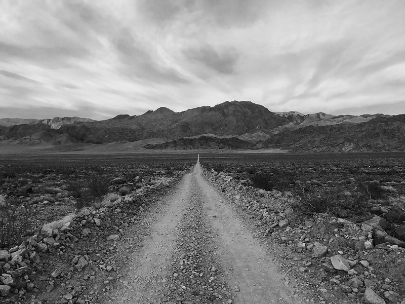
Arches are everywhere, RIP Staircase/Escalante:
Those early settlers were tough, no modern vehicle is going down Hole-in-the-Rock anytime soon:
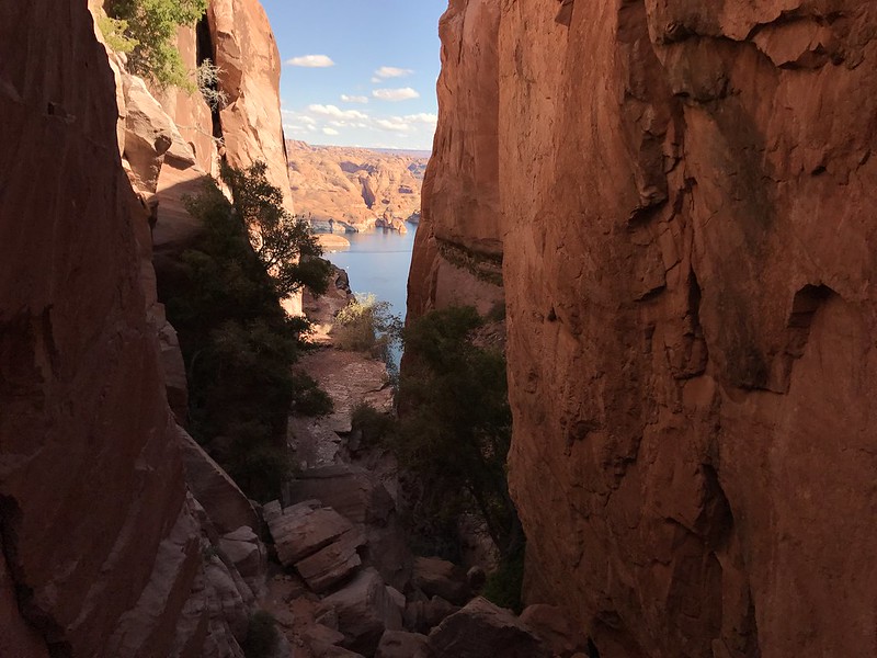
Slots:
A fun week in a very different desert. |
12/5/2017
Topic:
Moan Benchmark and I found a roasting pit.
Buford
|
I think I saw that pit on the way up Moan.
The Groan benchmark on the topo map is mislabeled "Moan" on the ground. |
12/5/2017
Topic:
Red Hill
Buford
|
Nice. I have yet to hit Red Hill.
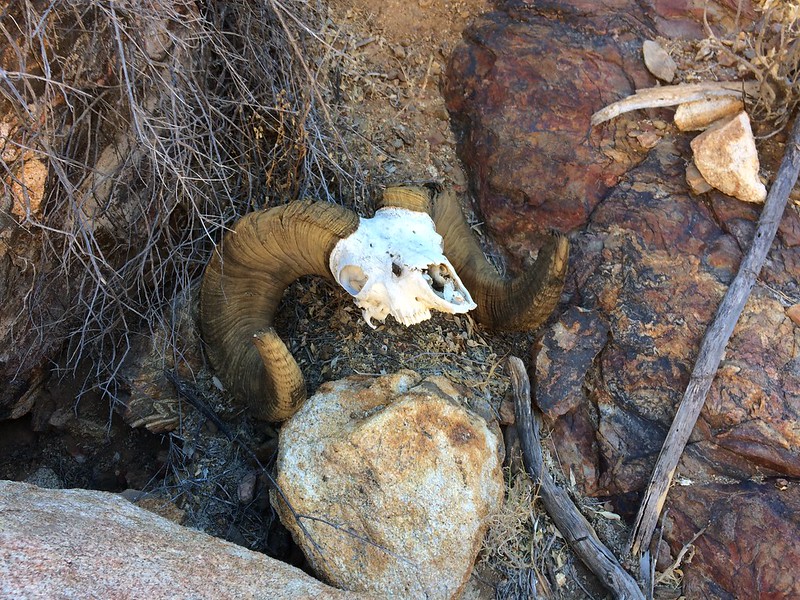
Any idea how many sheep DFG was able to tag? |
12/6/2017
Topic:
Exploring Coyote Canyon w/o 4wd or High Clearance
Buford
|
That road is the Turkey Track Grade. Unless there have been huge changes, it is not remotely close to 2wd or passenger car accessible. Someone else might have more recent info, I have not been in the area recently.
The road actually goes all the way down to the Fig Tree Valley, Bailey's Cabin and Upper Willows area.
This might help:
https://www.parks.ca.gov/pages/638/files/abdsp_Park_Map201704.pdf
https://www.parks.ca.gov/pages/638/files/Road%20Conditions%2012.5.17.pdf
edited by Buford on 12/6/2017 |
12/6/2017
Topic:
Rockhouse / Buck Ridge
Buford
|
Cool pictures and good to see all the water. Always an area I wanted to explore.
Really wish I could of joined, my bag was packed but I was stuck a couple time zones away. |
12/10/2017
Topic:
A trip started in the desert
Buford
|
Owens Valley is a desert right?
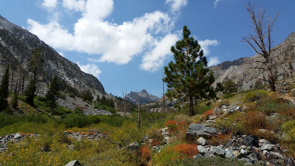
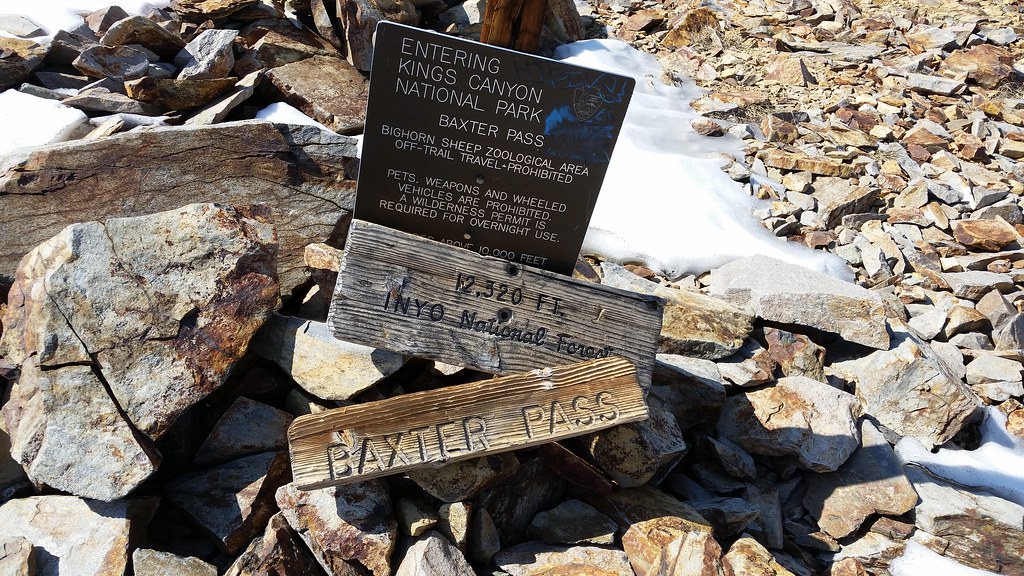
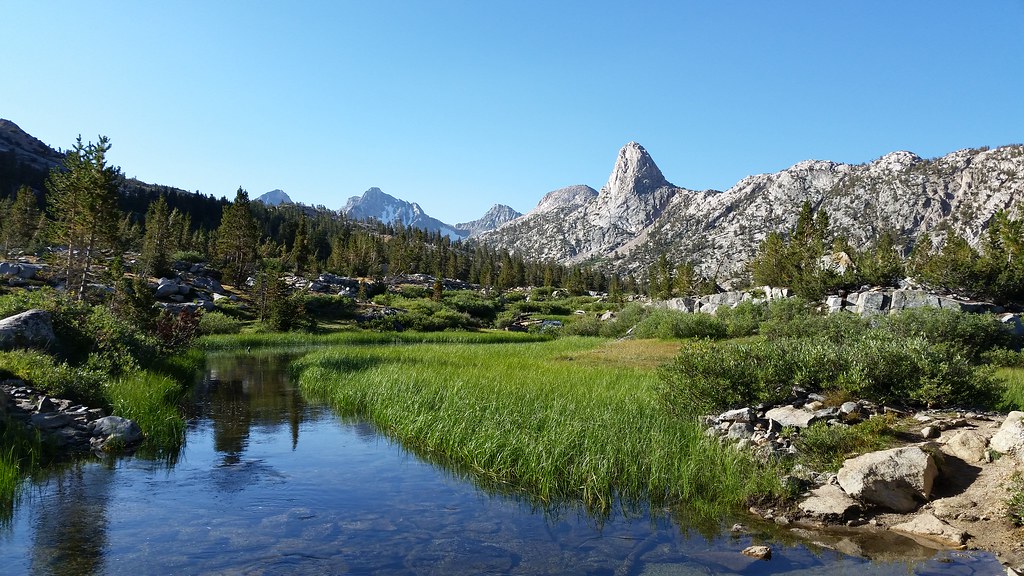
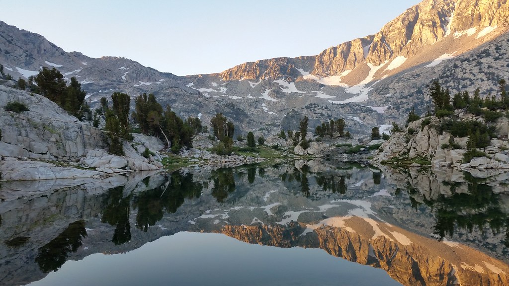
Quick backpacking trip over Labor Day. To avoid crowds and make permits easier, I did a lollipop loop in and out over one of the less traveled east side passes of the Sierra.
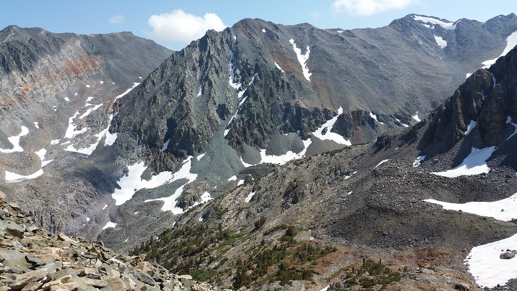
Nothing like waking up at sea level at 3:00 am, picking up a permit at Lone Pine at 8:00 am, hitting the trail at 9:30 am at 6k of elevation, and going over a 12k pass right after lunch:
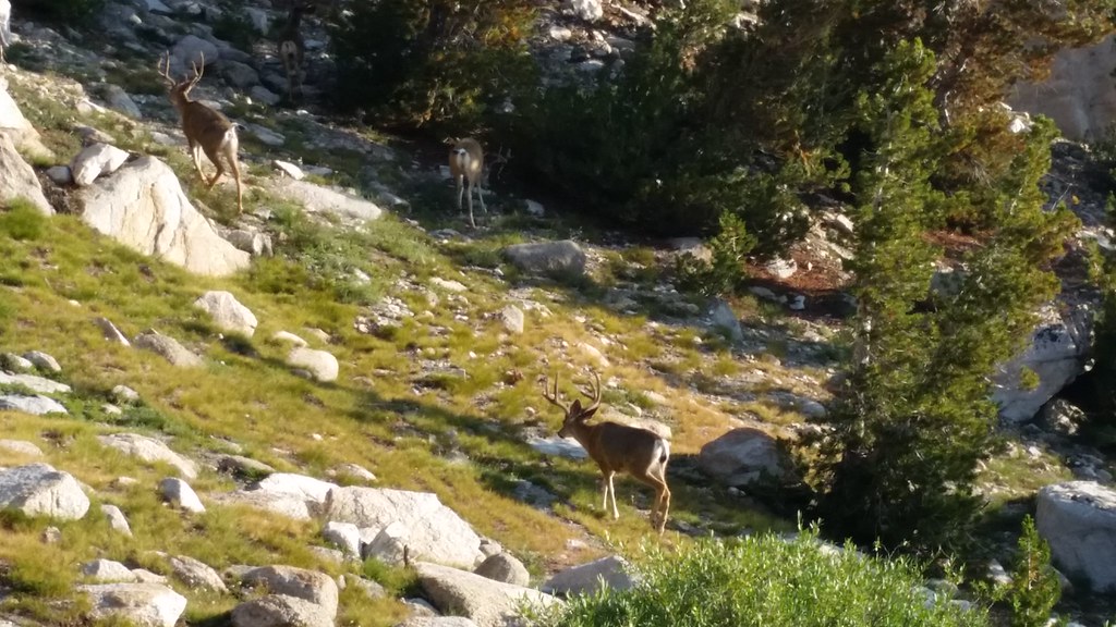
I looked for Bighorn in a couple likely places on this trip and did not see any. I have yet to see them in the Sierra, guess I'll have to go back :
Spent about a mile on the Pacific Crest Highway, snapped the stereotypical shot and left the trail:
There must have been sixty lakes in the basin:
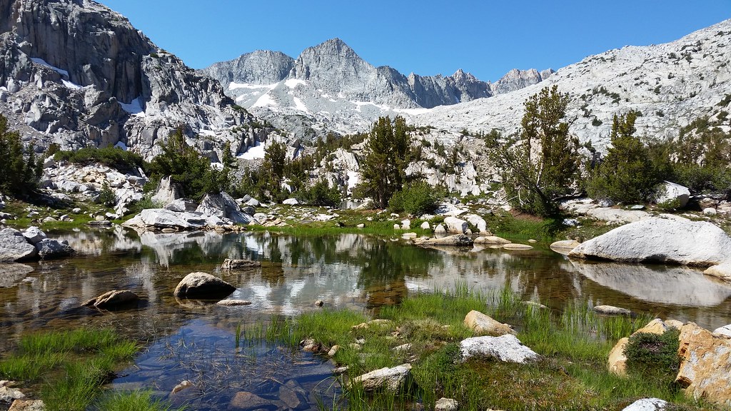
Upper most lake was still partially frozen over in September:
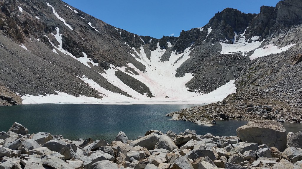
Calm winds, good reflections, flying bloodsuckers all go hand-in-hand:
Less than sixty lakes in this basin, but greater than 60 people meant time to move on quickly:
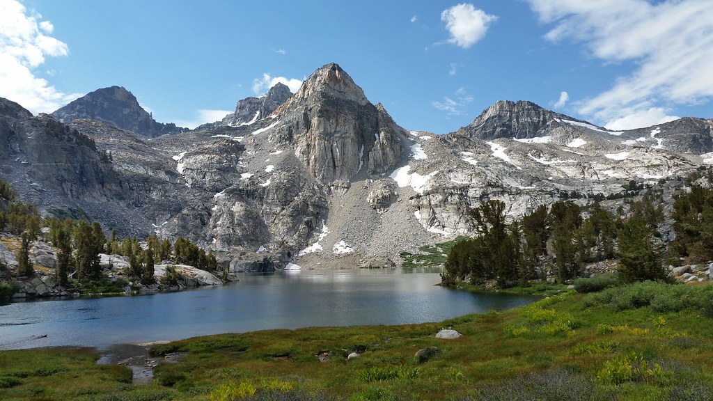
No dragons at the lake, no Bighorn Sheep either. There was other life:
Incoming storms alter plans to go over cross country passes and bag peaks. Incoming storms make great sunsets. Cellphone cameras don't capture sunsets well:
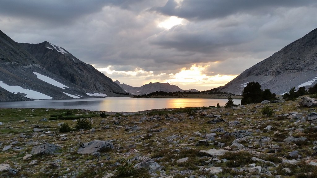
Hammered by rain all night, had to put up the shelter:
One last view from the pass:
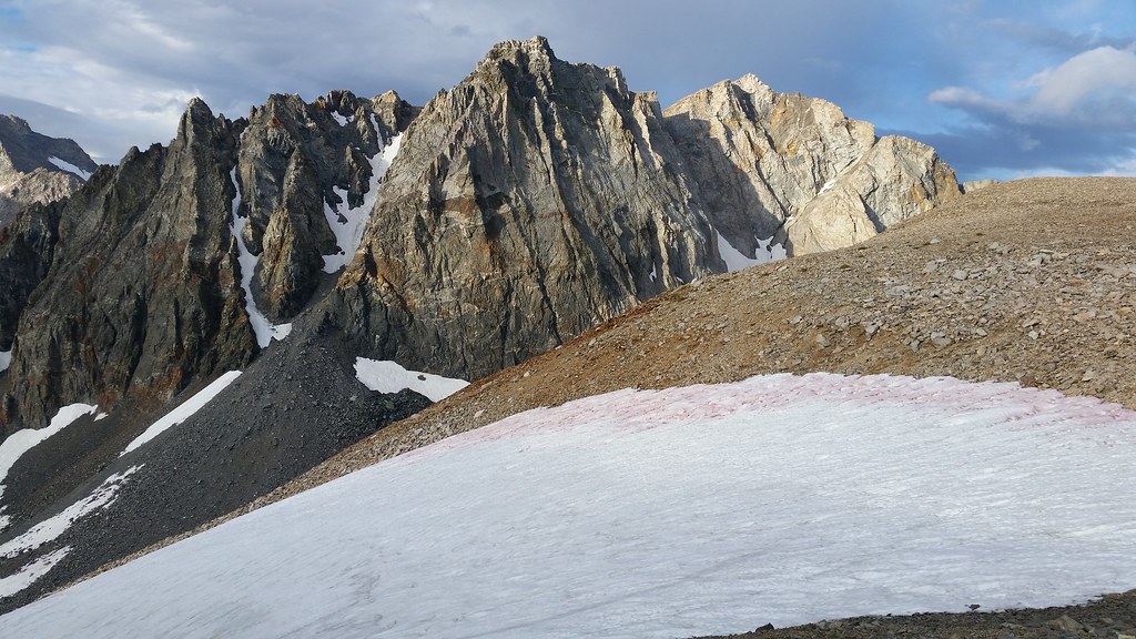
Hopefully I make it back to Borrego next weekend. |
12/10/2017
Topic:
A trip started in the desert
Buford
|
Nice rockhopper! Did you get into Gardiner Basin? I wanted to but the incoming weather kept me from wanting to cross between Sixty Lakes and Gardiner. I saw few other people, except for the short section of PCT/JMT. I entered Sixty Lakes from the cross country notch and exited on the trail. |
1/11/2018
Topic:
Sombrero and False Sombrero
Buford
|
I too thought the view from the “other” Sombrero was much better.
There was a register on the real Sombrero in February 2017. We had a hard time finding it. It was near the slightly lower summit block, not the one with the crack climb.
edited by Buford on 1/11/2018 |
1/11/2018
Topic:
Borrego Rainbow
Buford
|
Nice! Montezuma grade area always has the best rainbows during storms. I have seen more good rainbows there over the years than anywhere else. |
1/14/2018
Topic:
Bucksnort Area Backpacking
Buford
|
Check out some of the pct water resource pages. I don’t have any links handy but have stumbled on those pages in the past researching trips Near the pct. A google search should bring them up. Where there is water, there might be grow sites you don’t want to find. |
1/15/2018
Topic:
More Impossible RR News
Buford
|
but this time it will be different. |
1/15/2018
Topic:
Carrizo Gorge East Side
Buford
|
Nice point! In all my desert time I have yet to see one that good. |
1/15/2018
Topic:
McCain Valley Sunrise Power Link
Buford
|
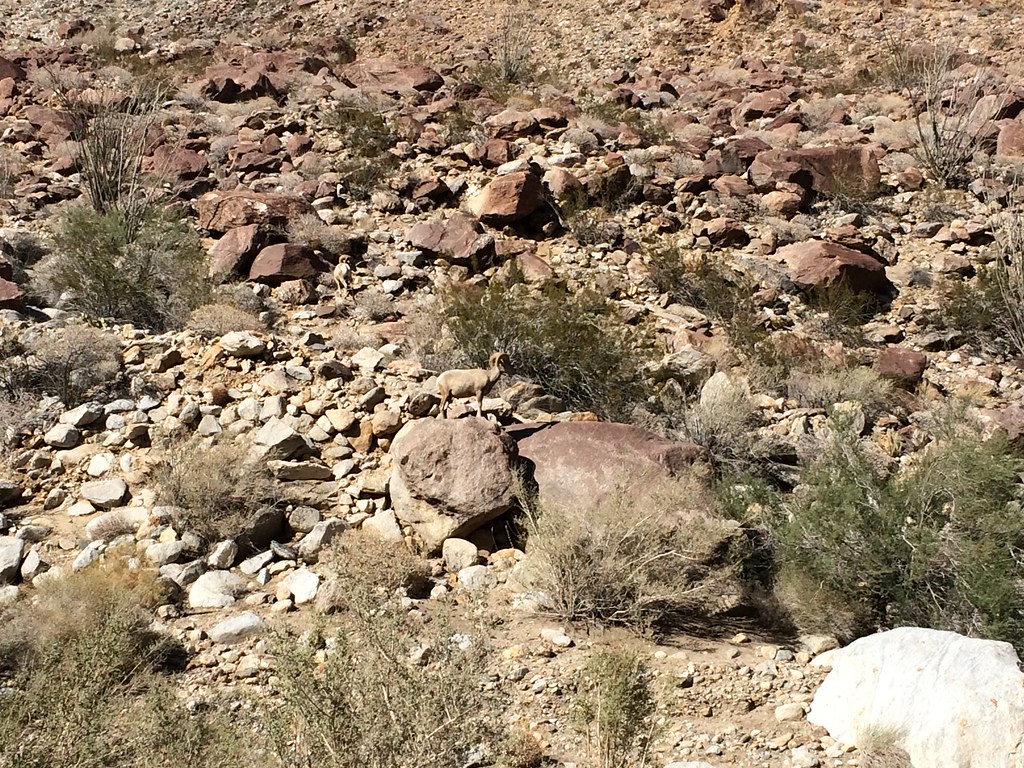
I was in McCain Valley today. What a mess. Got stuck behind a 10+ truck convoy. Had to wait for roadwork as well. At least the Sacatone overlook is still scenic. Saw some sheep on the desert floor earlier in the day.
edited by Buford on 1/15/2018 |
1/17/2018
Topic:
More Impossible RR News
Buford
|
They followed it up with this a day later:
http://www.sandiegouniontribune.com/news/environment/sd-me-desert-line-negotiations-20180116-story.html |
2/12/2018
Topic:
Pyramid-Villager Loop
Buford
|
Nice work. That is a long, tough day. I have seen your signature in a couple remote registers in Borrego.
I have been planning on doing the same loop soon,minus Villager (already bagged it), if I can find the time and cooperative weather. |
2/12/2018
Topic:
Pyramid-Villager Loop
Buford
|
If I do the loop, the decision between heading down Rattlesnake or the Villager ridge will depend on what I see when I get there. I saw a report somewhere that Rattlesnake Canyon is passable all the eay down with a couple dry falls to contend with.
I think I saw your blog in the Goat BM register recently and just made the connection with the post here. |
2/15/2018
Topic:
Gasp and Grunt BM's
Buford
|
Instead of topping out on the Gasp or Grunt ridgelines into the McCain area, I am pretty sure you can go almost straight between the two. It looked passable when I was on Gasp. I have not done Grunt.
I have done the Tule, Rozzie, Groan, Gasp loop similar to the one posted here:
http://www.peakbagger.com/climber/ascent.aspx?aid=376374
I will say it is quiet a climb out of the side canyon of the Gorge up Gasp. Nothing technical that I can remember though.
edited by Buford on 2/15/2018 |
2/18/2018
Topic:
Pyramid-Villager Loop
Buford
|
Tekewin’s post got me motivated enough to do the loop today. Thanks for posting the route!
Started at 6:45 am, a little later than planned.
Bagged Pyramid at 8:30 after a straight forward climb.
I was surprised at how good the use trail was going to Rosa.
Made it to Rosa Point about 10. The final stretch was rough.
Summited Mile High at noon.
Dropped down to the saddle at the top of Rattlesnake Canyon. Decided to hit the Villager ridge line for the superior views.
Climbed the Villager ridge line and topped out at 1:00.
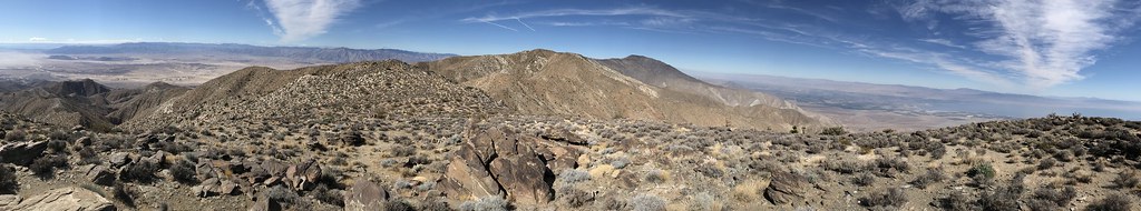
Realized I was ahead of schedule and had plenty of food and water and could hit Villager again since it was only 1k of gain and a mile away, but then realized I was ahead of schedule and could get to Dudley’s before closing. Immediately went downhill and out.
Back At the car at 3:00, Dudley’s about 4:15.
No sheep on the hike, but plenty of signs of them. I did see a ram cross Montezuma grade this morning about 6:00 am.
Tons of roasting pits along the route.
There was an icy wind up high. I had to find a sheltered spot on each summit to sign the register and eat a snack. A couple gusts were strong enough to affect my footing. The cold wind helped cut down on water needs.
Edit, can’t get pictures to show up from mobile. I’ll add a few later.
edited by Buford on 2/18/2018
edited by Buford on 2/18/2018 |
2/18/2018
Topic:
From The Unpublished Series
Buford
|
Cool! It sure can get windy enough out there. |
2/19/2018
Topic:
Pyramid-Villager Loop
Buford
|
Glad I did it after looking at the route for the last year or so but never committing to it.
Almost to Pyramid:
Almost at Rosa:
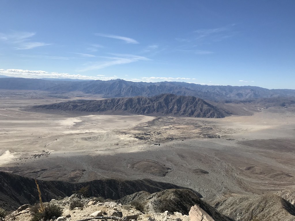
The view from Rosa Point looking at Rabbit and Mile High:
Looking at Coyote from the Villager ridgeline:
 |
2/23/2018
Topic:
Ghost Mountain with Huel
Buford
|
I took a similar picture a while ago:
 |
3/1/2018
Topic:
Grunt BM
Buford
|
Looks like a cool trip. Those ridges are tough.
rockhopper wrote:
Grunt is a great name for that bench mark. I see surveyors have a sense of humor.
I agree that area has the best benchmark names. Grunt, Gasp, Puff, Moan , Groan and Windy.
I might hit Puff soon. |
4/4/2018
Topic:
Canyon west of Moan
Buford
|
Nice. I recognize 3053 in those pictures near Moan. |
4/11/2018
Topic:
Awesome Trip report
Buford
|
ziphius wrote:
A billiard table at Dos Cabezas. Now I can say I've seen everything.
Haha. That table was put there around March 11 judging by the signatures on it. We played a round after a hike when we stumbled on it. The surface isn’t exactly flat. It was surreal to play a game of pool out there  |
4/23/2018
Topic:
No Big Horn this year seen during hiking
Buford
|
I bet bighorn have seen you.
I have seen sheep in Indian Gorge and crossing Montezuma Grade this year. I am sure they have spotted me on more occasions. |
4/27/2018
Topic:
2018 Sheep Count
Buford
|
For those interested in testing hydration strategies and maybe spotting bighorn sheep in the heat:
Orientation is June 16th
Count dates are June 28th (checkin) to July 1st |
4/29/2018
Topic:
2018 Sheep Count
Buford
|
I'll be back this year. Count site TBD.
I heard those rumors about Rattlesnake...
Curious if Rattlesnake will have water this summer. There was a decent earthquake with an epicenter near the spring a couple days ago. |
4/29/2018
Topic:
Burrowing Owl
Buford
|
Nice shot! Keep posting them.
I agree, that Dos Cabezas lightning shot is awesome. |
4/30/2018
Topic:
McCain Valley
Buford
|
Cool trip. Were the water sources enough to filter? Not having to carry all the water is a huge bonus.
I was out there Sunday morning. It sure was windy. Tule wind project is down according to a news article online.
Was that one of your vehicles at Cottonwood? |
6/12/2018
Topic:
2-3 Day Trip Recommendation?
Buford
|
Another problem is reliability of water sources, especially in the summer. Sources that used to be reliable, may not be anymore due to drought, seasons, earthquakes, human intervention, or other causes. Not many people hike in Borrego in the summer either so info is more limited.
No one wants to send someone with unknown outdoors ability who they’ve never met in person to a potentially dry source the person might be relying on for survival.
Edit:
I actually don’t know the exact location of any year round water sources that are “secret.” I know some people here do. Another thing would be to search them out in winter with old Topo maps and google earth followed by some exploring on the ground.
edited by Buford on 6/12/2018 |
6/17/2018
Topic:
Not enough rangers
Buford
|

http://www.sandiegouniontribune.com/communities/north-county/sd-no-park-staffing-20180531-story.html |
6/21/2018
Topic:
2-3 Day Trip Recommendation?
Buford
|
Britain wrote:
dsefcik wrote:
Thanks ziphius for catching this post, I missed it somehow.
I do not know your experience or capabilities, especially in the desert...in the summer...however for most folks, venturing out 8+ miles for a backpack trip into the desert in the summer with 105+ temps and relying on a water source to provide is a risk for anyone of any skill or knowledge level. When we head out for trips where water sources may be suspect we always, always bring enough to get us in to the first source and back in case it is dry. That may demand carrying 8 liters the first day.
This. I've lived in Imperial Valley for a long time. Used to do hikes in the heat mostly for photo ops around active springs. Like scuba diving I never went alone. It also pays to look at the weather temps for those hikes. I used to also carry an umbrella on my pack. This weeks temps not hot but dangerously hot.
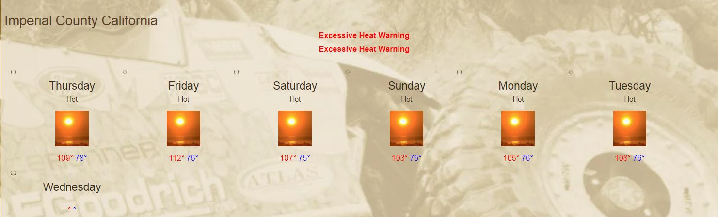
Looks like sheep count weather. |
6/21/2018
Topic:
Not enough rangers
Buford
|
I worry about the resources being abused and trashed. Even with the full ranger staff there was too much abuse of the area. |
7/2/2018
Topic:
2018 BHS Count Results
Buford
|
I’ll put up some pics and report later. I counted at 3rd Grove. I led a team of three newbies. Everyone got out safe, but we ended up counting as a team of 2. My post from last year is still relevant:
The upper Palm Canyon count sites do not have a trail to them and require bouldering, talus hopping, loose steep slopes and bushwhacking to hike to. Add in a full pack and the high temperatures and it is even more difficult. I cannot stress this enough for someone that wants to count these sites. All three years I have done this there has been someone assigned to count in upper Palm Canyon who is not prepared for the hike in and out and really suffers. This year was no exception. |