6/8/2011
Topic:
Peak 6582
DHeuschele
|
I am interested if you did this hike. If I had seen this earlier I may have been interested but I have been too busy and did not do a single ABSP hike/backpack this season.
I have done 6582 twice, once using the Schad (who is very sick) route and once from Rock House Canyon. Rock House Canyon is the eaiser route especially if you have a high clearance vehicle that can make it far up the road (we took a camper and did not make it that far up the road).
The petrogylphs are pretty easy to find where the flat first gets to the rocks. If you are looking for them you will not miss them.
I have also done the Sheep Camp to Palm Canyon hike (not sure what the Sheep/Palm/Cougar Canyon loop is). It is much easier hike than 6582 with a somewhat reliable water source. Starting at Sheep Camp there is one initial climb and then all down hill. Also a few years ago they had a 100 year storm that cleared out much of the wash and not long before the storm they had a fire that cleaned out the backside of the initial climb. It has made this hike fairly easy to do as a day hike assuming that you have a vehicle that can make it up Bolder Alley. I have done it recently in a stock (no skid plates and no lockers) small 4x4 pickup, but I have a fair amount of 4X4 experience. I would recommend most people have skid plates and possibly lockers. |
6/10/2011
Topic:
Peak 6582
DHeuschele
|
I agree it is too late to do 6582 in large part because of the elevation until the last mile (too low = too hot). I would be interested in considering doing the hike next season, but there are many hikes to choose from.
My feelings on Schad are similar to yours. I have also used his books for about the same length of time. I keep track of my hikes in his books and look to them regularly for hikes. I likely have a hiking book on every area that he has written about (I even have his Picacho del Diablo map and did that peak a couple years ago).
I sent him email when I first heard he was sick indicating that I hoped that he was on the trails soon but from what I hear that will not be happening.
I am a little surprised to see the Roam-O-Rama is still be produced and I believe this week's was not in any of his books. |
7/5/2011
Topic:
New to the forum
DHeuschele
|
I recommend these four Mud caves for novices:
Park at the big open area ~1.9 miles from the start of Arroyo Tapiado.
Chasm Cave: Directly across from the parking area, follow the use trail. This is a long cave that can be done by virtually anyone on their feet the entire way. It empties into a nice slot canyon that has E-Ticket cave off of it (not recommended for novices).
Carey’s Big Mud Cave: Very similar to Chasm. If time is short skip one of Carey’s Big Mud or Chasm as they are that similar. It empties into a nice slot canyon that has Skylight and oxbow caves integrated with the slot canyon. ~0.15 miles from the recommended parking area towards the start of the Arroyo on the same side of Arroyo as Chasm cave.
Hidden cave: This is narrower than Chasm and Carey’s Big Mud Cave (any narrower and I would not recommend it for novices). It is ~0.1 mile further up the Arroyo from the prom the parking spot on the opposite side of the Arroyo than Chasm and Big Carrey. The entrance is small and hidden, but the cave drops ~40” immediately (so the entrance looks smaller than it is). It can be done by many/most their feet to the recommended turn around point, but some people may have to crawl some of it. Fairly deep in the cave is a 15-20’ vertical with a rope. I recommend turning around either at the bottom or top of this climb. Progress after this point is slow with little reward. The rope help me (~190 lbs) last season, but check that it can hold your weight before using it as it would not be easy to extract someone with a broken leg from Hidden Cave. The length of time this cave takes is mostly a function of the agility of the spelunker (some can move very fast and some quite slow through this narrow cave).
Plung Pool cave: ~0.1 mile beyond Hidden Cave on same side of Arroyo as hidden cave. This is a shorter cave that opens into a high area justifying the name of the cave. It can be done by virtually anyone on their feet the entire way and takes much less time than the other 3 recommended caves.
If more caves are desired after exploring these caves it is fairly easy to find use trails to many more caves in the area.
Happy Spelunking. |
7/6/2011
Topic:
New to the forum
DHeuschele
|
dsefcik wrote:
I liked hidden cave..last year there was a group of like 8 million girl scouts coming out when we went in...imagine that awkward passage!
I brought part of a cub scout pack (maybe 12-15 kids) out there 2 seasons ago but we left people at the entrance of Hidden to let others know because of the difficulty in passing a large number of people in that narrow windy passage (also some of the parents were not interested after looking at the entrance). |
7/6/2011
Topic:
Peak 6582
DHeuschele
|
Not sure who has seen the Roam-O-Rama this week but it is titled "End of the Trail". It has been the one article I read every week in the Reader (I read it on-line but you know what I mean). I am so sorry to see the article end, but it actually continued longer than I expected (I have known for some time that he has been seriously ill).
He has introduced me to many hikes and I keep track of my Schad hikes. He and John Robinson are my favorite hiking authors. I have so many Schad books that I could be a Schad Library.
His map of San Pedro Martir is the best resource on that Park. His Afoot and Afield books are classic hiking books on Southern Californial. I believe Peak 6582 was his contribution to the Skip Ruland book on San Diego backpack trips. |
8/8/2011
Topic:
High Elevation Camping
DHeuschele
|
I agree Culp Valley is significantly cooler than Borrego Valley but for me this allows June camping but not regular July/August camping. For me you need a hike with either a predawn start or my preference a night hike for the lower elevations. Rabbit, Villager, and Whale are all good choices. Indian Head is borderline. 6582 (Dawn's) probably should only be attempted by someone who does not need this information (advanced desert hiker).
Good luck |
8/8/2011
Topic:
Camping over Labor Day....too hot?
DHeuschele
|
ABSP is supposed to be for street legal vehicles only and not a motocross area. I realize that street legal could still be very motocross like but really those that are looking to tear it up on their bikes for the most part do it outside of ABSP.
I think Blair Valley should have little of that noise and going at that time of the year there will be even less noise and people than the other seasons (I mostly avoid the desert in Sept).
Have fun. |
8/8/2011
Topic:
Plane Wrecks
DHeuschele
|
i am not thinking North end of ABSP because the mountains with that level of remoteness such as the Santa Rosas do not have that level of rock (at least the parts of the Santa Rosas that I have been to).
Hard to tell though as there are not a lot of pics of the surroundings and it is one big park. |
10/11/2011
Topic:
Borrego Days 2011 Poll
DHeuschele
|
I voted no don't really care but really the no is the accurate part. I already have plans that weekend, a trip to Santa Barbara with the wife. Plus I will be camping in ABSP this weekend (backpack to wind caves in the Domelands). It will be my 3rd weekend camping in the last 4 weekends and all without the wife so I will be going to Santa Barbara that weekend (plus the hotel is already booked) . |
10/11/2011
Topic:
MTB TR on the Carrizo Gorge Railway
DHeuschele
|
Not sure if I am in shape for DeAnza to Ocotillo MTB but Carizo Gorge road (the road leading to Indian Hill) to Ocotillo would be interesting. I have hiked to the Goat Canyon Trestle via this route with a heavy pack (different story) but returned the same way (did not go to Ocotillo).
Also crossing the trestles on MTB could be interesting especially Goat Canyon. i could always walk it if I do not have the huevos . |
10/13/2011
Topic:
Whale Peak / Inner Pasture / Goat Cyn Trestle
DHeuschele
|
I agree with surfponto's comments virtually 100% except I already have a MTB (old with no suspension so it would be a rough ride). I have wanted to do that MTB ride for about a decade but have yet to do it.
It sounds like a great weekend that was very packed.
I will be backpacking to the Domelands this weekend (~6 miles RT) with my 9 year old (his second backpack trip). |
10/13/2011
Topic:
The *new* Desert Magazine online
DHeuschele
|
The "get" worked great for me also. I reposted it in the blog on the Desert Magazine site to help others.
Anyone find an easy way to search the PDFs for particular stuff? For example I was thinking of doing the North ABSP Rock House Canyon loop this season and wanted to see if they had more info than Afoot and Afield on the various ruins and springs. I found a crude map of one set of the ruins in the Jan 1968 version (somewhat by luck) and the associated article indicated that further exploration would follow.
I tried the Windows search in files and it did not find even the article that I had already found. There is quite a bit of material to go through if I need to look in each magazine separately (which I will do if there is no better option).
Ideally I could search for "Rock House" and find every file that uses that text. Then I would only need to search those magazines. |
10/14/2011
Topic:
The *new* Desert Magazine online
DHeuschele
|
Thanks as the cygwin grep did not work well for me from Windows (darn MS). I searched for Rock and it only found it in a couple of files when I suspect that word would be in a majority of the desert magazines.
Maybe a different grep (not cygwin grep) would work better from Windows but it may simply be the unlying OS that is the problem. Can you tell I am not an MS fan? |
10/31/2011
Topic:
Whale Peak / Inner Pasture / Goat Cyn Trestle
DHeuschele
|
dsefcik wrote:
DHeuschele wrote:
I will be backpacking to the Domelands this weekend (~6 miles RT) with my 9 year old (his second backpack trip).
How did that trip go? I did not see a TR for it. Curious to know if your son enjoyed it and if you guys saw any wildlife there.
My son and I loved it. There were ~50 people (~40 kids). The view I would best compare to Fonts Point but still different (not as tight canyons). You can almost imagine the Grand Canyon (there were some natural monuments). The caves were awesome and the kids came up with many names for them. The high one that is entered through the bridge that you first see when you get there they called the Penthouse as it is maybe 12-15' in the air with a short traverse to get to (a few boys slept here). A pair of caves just to the left of that bridge they called the Exclamation Point (obviously it looks like an exclamation point). There was one with just a couple of small toe holes that I would guess was 10-11' up they called the climbers loft and some kid slept in the climbers loft (I could not get into it in my Krocs and did not try in boots but even in boots it would be quite challenging - the boy managed to get up there with his sleep gear).
A handfull of the kids went all the way to the bottom of the badlands.
We saw very little wild life. We saw a single lizzard when we disturbed the rock that he was under. I do not even remember seeing a bird.
When we were packing up to return from the campsite a couple men came to the site. They left just before us but we quickly passed them. They were the only people we saw after leaving the trailhead. At the trailhead there were some people who were shooting the clay targets. Those are hard to clean up but the shooters looked like they only put forth a little effort to clean their mess (at least they put forth some effort). There was also significant trash at the trailhead that had been there for a while (not likely left by these shooters). We cleaned up a little of it but it still had some trash there when we left (it would take maybe an 30-60 minutes with our size group to clean up but we were not prepared - no gloves, trashbags, etc.).
The downside (besides the mess at the trailhead) was my pack weighed ~70 lbs as we had the youngest kids carry only 1 qt of water so the older kids and parents needed to pick up the difference so I had 3 gallons of water (also 4 jars of salsa, and 2 packs of tortillas (heavy food) for the group dinner).
We found 2 geo caches that were on the Geo Cache site and another geo cache by chance that was not on the site and had not been logged by anyone. Curious if the person who placed it simply forgot to ever enter it.
I was in Santa Barbara previous weekend (10/21-10/23), Salt Lake City last week (10/24-10/29), and San Jacinto peak yesterday (10/30: with my 9 year old) so I have not done a trip report but I want to post some of the pics (not that they comare to dsefcik - I use a rugadized point and shoot that does not handle glare or light contrast (light near dark) well).
My son indicated the Domeland trip was better than yesterday' San Jacinto trip. We had a great time. I am slightly surprised there was a hike in Schad AFAF that was as good as this hike that I had not done previously. It was awesome and the caves make great shelters. |
10/31/2011
Topic:
Toyota LandCruiser 80 Series Snorkel Install
DHeuschele
|
surfponto wrote:
I decided to install a snorkel on my Borrego beast.
I have considered one for my 5th gen 4Runner trail. I question if it would hit my Gobi rack that extends virtually to the front roof line.
Is that an awning on the drivers side? |
11/2/2011
Topic:
Indian Hill, again.
DHeuschele
|
TR wrote:
Does someone have a GPS fix on the cave? Because I don't seem to be able to find it on my own.
I feel OK posting this as both sets of information here are published.
Most Topo maps including those from National Geographic Topo! have the wrong hill marked as Indian Hill. Schad in AFAF SD does indicate it is mislabeled on the Topo map but this is easy to forget/miss (i missed it my first time trying to find the cave). It is the hill in the same vicinity as the one marked on the Topo map as Indian Hill and the cave is on the North East side (Schad).
Lindsay in Anza Borrego Desert Region (p. 206) lists the hill as UTM 5-77.6E 36-24.1N (Northeast corner of Topo section 29) and also points out that it is mislabeled on the Topo maps.
My first time out to find the cave I searched the wrong hill (likely the same one you were searching - the one labeled on the Topo map as Indian Hill) for quite a while before giving up and heading to the Goat Canyon trestle which was a great destination so all was not lost. I searched the wrong hill even though I had 2 references indicating the hill was mislabled on Topo maps (I must have glanced over that part or thought my topo magically had it correct). Also if you are searching the wrong hill and then head for the RR tracks you hit the RR Camp (bunch of kegs). |
11/4/2011
Topic:
Santa Rosa Peak Baggers special
DHeuschele
|
I am considering doing a Santa Rosa Peak Baggers hike this desert season (i.e. before May). It would include the following:
- Pyramid Peak
- Rosa
- Mile High
- Villager
- Rabbit (optional)
- 6582/Dawns Peak (for the masochists)
Note the first 4 are on or near the loop. At some point it will be easier to go forward than backwards.
I have done Villager, Rabbit, and Dawns Peak before, so the part that I am unfamiliar with would be Pyramid, Rosa, and Mile High loop. I have the Sierra Club GPS route for the loop containing those peaks but I wonder if anyone on this forum can shed some light on the quality of the "trail". I am not expecting much of a trail, certainly not as much of a trail as Villager/Rabbit. What I am questioning: is the trail like to 6582 (poor but followable) or virtually non-existant (like Rabbit to 6582)?
I am thinking a single over night somewhere near Villager.
I only plan to stash water at the bottom of the Villager ridgeline. The rest of the water is to be carried (at least 2 Gal per person with the lead (me?) carrying a little reserve (when I led the 6582 hike I carried 0.5 gal reserve and ended up distributing the half gallon).
So first day would be Pyramid, Rosa, Mile High and camp near Villager. Second day would be Villager, Rabbit (optional), 6582 (Masochist), and on down. If we go for 6582 (which I doubt) we would head out Rockhouse Canyon and not down the Villager ridge which would require a short car shuttle and imply the water stash would not be used.
I did consider doing the hike in the opposite direction (up the Villager ridge) but I want to do the unfamiliar/worse trail when freshest.
Obviously this hike will not be easy as I suspect this hike to be in excess of 30 miles (maybe approaching 40 miles), waterless, with questionable quality trail everywhere except the Villager/Rabbit ridge, and ~9K' of total gain (Rabbit alone is 8300' gain). The one good aspect is that it is quite easy to eliminate Rabbit if we are beaten or real low on water.
Has anyone on this forum done the Pyramid, Rosa, Mile High loop? Anyone have any suggestions on the planned trip? |
11/5/2011
Topic:
Santa Rosa Peak Baggers special
DHeuschele
|
dsefcik wrote:
Will this be a solo trip or are you looking for others to join you?
I have a group that I was hoping to get at least 2 people interested but so far the people from that group are not interested. One suggested a hike from Toro->6582->Rabbit->Villager. My issue with this hike is that Toro is drivable and I and most of this group have already done the other 3 peaks.
So this means I may be looking for someone but I do not know yet. If I am looking for someone I will post it here for volunteers. Also for myself I do not know whether I would do the Rabbit part. One person from my original planned group had not done Rabbit. My view of Rabbit is that it is a lot of work for a peak with quite limited views (Villager and 6582 have much nicer views). |
11/5/2011
Topic:
Santa Rosa Peak Baggers special
DHeuschele
|
dsefcik wrote:
I think adding Rabbit/6582 would be pushing it..the lack of water would be a problem. It would be interesting to do the trip as you kinda suggested, a one way back down into Rockhouse Cyn.
I was actually thinking Rockhouse Canyon exit only if we included 6582. The ridge line down Villager/Rabbit is a more gradual decent than exiting Rock House Canyon (easier on the knees) and I expect it to be barely longer than Rock House and does not require the shuttle. In my view Rockhouse is the obvious way back from 6582 regardless of the Rouse listed in AFAF SD.
I do agree that without Rabbit and 6582 it is already very challenging and well in excess of 20 miles, with no water resupply, and rough terrain. So I was including Rabbit mainly for anyone who desired it but I was thinking that I was likely to pass unless I was feeling very good (mostly because I have done it once and do not consider it good enough to warrant doing a second time especially not as an extension to this type of hike). |
11/5/2011
Topic:
Domeland and Wind caves - Oct 2011
DHeuschele
|
Scout Troup 680 was kind enough to invite Webelos from the various local cub scout packs on a backpack trip to the Domelands. They got good Webelo participation and the entire group was ~50 people (we had an exact count but I did not memorize it: ~10 adults, ~39 boys, and 1 girl).
The plan was to have a majority of people sleep in the wind caves. The idea was also to not over burden the younger scouts with weight and water is heavy. This implied that the older scouts and adults needed to carry more water than their expected usage.
We first met at the troop regular meeting location and agreed to all meet at the gas station south of hwy 8 near Ocotillo and caravan to the trail head (TH) from the gas station. The dirt road to the TH was too much for low clearance passenger vehicles, but it got too rough for them fairly close to the TH. The TH had some people shooting skeets and there was quite a bit of trash there. The people shooting the skeets did clean up much of their mess but those things break into many pieces and doing a proper cleanup would take significant time. So the TH can use a good cleanup but we were not prepared for this type of cleanup (no gloves and garbage bags); I did cleanup a couple of the bigger items.

Passenger car having problems with the road.
The scout leaders distributed food and water to the various people. My pack would be heavier than it has been for a long time (~70 lbs including 3.5 gal of water, tortillas and salsa for the group dinner). Good thing it was a short hike. Unfortunately though it was quite hot, my watch thermometer had it at 102.5 in the sun about 12:30 (we were about ¾ of the way to destination at this time).

Final load up before starting the hike to the Domelands.
The hike starts off fairly flat but immediately after crossing a fairly deep ravine (maybe 12-15’ deep) the trail headed up a hill that the scouts had called “Little Scout Killer” hill (meaning Webelo killer hill). Well the little scouts had less difficulty on this hill than the parents. I was at the front of the pack so I did not see most of the difficulty but heard that at least 1 adult needed their pack carried up this hill.
We passed some minor wind caves about 0.25 miles before hitting our destination. Our destination was great. There were many wind caves. The cave that is first visible is actually a bridge and it has a natural table. The natural table had about a dozen fossils on it when we arrived. The kids added a few more but were more interested in playing than finding fossils.
On the backside of the bridge is a traverse (slightly high off the ground) to a cave that the kids named the Penthouse. The Penthouse is maybe 16-20' up in the air. When we arrived there was some graffiti (not a pictograph or petroglyph) in the penthouse but because it was sand stone it was fairly easy for me to remove.

This is the bridge cave that leads to the Penthouse.

The Penthouse is the big cave up high.
To the left of the bridge opening entrance (the exit goes to the Penthouse) was two caves the kids called Exclamation Point.

The Bridge cave and the Exclamation Point can be seen in this picture.
Another cool cave the kids named the Climbers Loft. The Climbers Loft was ~10’ up and had some fairly small toe holes that someone placed in the sandstone to get a start. I tried to climb into it wearing Crocs and could not. I am not sure that I could have gotten into it if I was wearing my boots. Well a boy slept in it but I do not know how he got his gear into it.

My son's cave shelter with my pack cluttering up the abode.

Various wind caves in the area.
The views from the camp (looking North) of the Badlands is slightly similar to Fonts Point but with more monuments. You could almost imagine being at the Grand Canyon. Beyond the Badlands was the Carrizo Impact Zone. We could see the Santa Rosa Mtns to the far North.


Overlooking the badlands.
We went Geo Caching and found 2 that we had obtained the info from the Geo Cache site and one that we happened across that did not have a single entry. I do not know if it was placed and the person forgot to enter its data on the Geo Cache site.

Finding a Geo Cache.
Some of the adults and boys climbed down into the Badlands. We were planning on taking a larger group down into the Badlands the next morning to find some more Geo Caches but our water supply dictated that we pack up and head out the next morning without doing more exploring. As we were packing up two men came. They were the only other people we saw after leaving the TH. They left on their return hike just before we did and we quickly passed them.

The entire group before departing from the domelands campsite.
The only wildlife I saw on the trip was a single lizard that was disturbed when my son picked up the rock that he was taking shelter under and a dragon fly.

The dragonfly.
This troop does something that they call Roses, Thorns, and Buds. Roses are things you like, Thorns are things that did not go well, and Buds are things to do different.
There were so many roses and they varied significantly but the Badlands view and the caves were listed many times (the food was also listed quite a bit as was the cold water in the ice chest when we got back to the cars).
The Thorns also varied but the prevailing complaint was the heat. My Thorn was literally a thorn as my Neo Air Thermorest that I absolutely love got a thorn hole (very slow leak). I was not the only one with this thorn.
Having more ice water at the car was the most common Bud. My Bud was that I would break such a large hiking group into at least two groups based on expected hiking speed. It seemed like I spent at much time waiting on people to catch up as I did hiking.
Overall it was a great backpack trip with great views and great natural shelters. My son and I had a great time.
Mylar balloon count 0. After leaving the TH the entire trip was litter free.
edited by DHeuschele on 11/6/2011
edited by DHeuschele on 11/6/2011
edited by DHeuschele on 11/6/2011
edited by DHeuschele on 11/6/2011
edited by DHeuschele on 11/6/2011
edited by surfponto on 4/1/2016
edited by surfponto on 4/1/2016
edited by surfponto on 4/1/2016 |
11/7/2011
Topic:
Domeland and Wind caves - Oct 2011
DHeuschele
|
dsefcik wrote:
Looks like it was great trip, it is nice to see kids are still getting outdoors. I remember a trip a couple years ago to the mud caves and there were a couple hundred girl scouts..they were everywhere!
I am puzzled by the heat you mention, I haven't seen those high of temps in Oct so far.
That weekend was hot but my temperature reading is also in the direct sun. I suspect the official temps (non direct sunlight) were likely 10 degrees cooler (not sure if they have offiicial temps for Ocotillo).
A couple years ago I took a partial cub scout pack to the mud caves. We included Hidden Cave (Plunge and Carey also) and it was way too crowded, but it was part of the adventure. Basically there are very few passing places in Hidden so we pretty much all had to wait at the rope room for everyone to get to the rope room. We were packed pretty tight in the rope room.
It was after a recent mud storm so there was mud in some of the canyons for the kids to play in and get totally covered. My son still talks about this mud adventure even though he has been to the mud caves maybe 6 times this trip was special because the mud was mud instead of dried mud.
Everyone had a great time. |
12/5/2011
Topic:
Met Diana Lindsay near the San Pascal Battlefield.
DHeuschele
|
I met Diana Lindsay at the archaelogical museum for the San Pascal battle reenactment yesterday.
I am a fan of her Anza Borrego knowledge and books.
She has a newer book on the various sculptures. It had great photos and I was very tempted to purchase the book but I am trying to limit myself to out of print books or eBooks because I have an entire wall of books and most are non-fiction. I do read and enjoy those books, but I do not want to keep aquiring such books (for out of print books there likely will never be an eBook option so I am making an exception for those).
Of course this book is a good one to have in actual book form (versus eBook) because the photos are great.
I enjoyed meeting her and our brief conversation.
<em>edited by DHeuschele on 12/5/2011</em> |
12/5/2011
Topic:
Met Diana Lindsay near the San Pascal Battlefield.
DHeuschele
|
>Was the reenactment at San Pascal? I heard they may be shutting down that museum/park.
It was at a dirt lot directly on the other side of the road from the archilogical center that is a little East of the Battlefield visitor center. I had not heard about it possibly closing down but I have been there when it was not the day of the reenactment and there was not many people there so I would understand at least it being considered for closure as this was only my second time there and I have been in San Diego 47 years this month. Yesterday, with the reenactment, it was fairly crowded. In addition to the reenactment they had various displays that were there just for the one day such as candle making, a camp, etc. The actual reenactment was unwhelming and I hoped for more. Still I was glad that I found the time to go but having seen it once I likely will not go again.
>I have quite a few Sky Art sculpture pictures on my website http://www.darensefcik.com/Photography/Anza-Borrego-Desert-State-Park/Sky-Art/16733252_WcCZts
I have seen some/most of your photos of the sculptures and you also have some very nice photos of the sculptures and your photos would compare nicely with the ones in the book (both your photos and the book are very nice photos). |
12/19/2011
Topic:
Whale Peak Via Pinyon MTN Road
DHeuschele
|
I like the fact that you got them to the top at that early of an age. I have a 9 year old who went on his first backpack trip at about the age of the little boy. Today my 9 year old can out hike virtually all adults and on almost all types of terrain. He can hike San Jacinto without breaks. He mostly ran a 10 mile hike this weekend. I struggle to keep up with him on some hikes and I have been hiking for decades on a fairly regular basis (probably 20-30 hikes a year including a few backpack trips).
I think starting them young, make sure that most outings are fun for the child, and doing outings fairly regularly (I do an outing every other week or so with my child) will hook the child for life on the adventures of the outdoors (at least I hope so because mine is hooked now - the life part is still to be determined).
It looks like a great trip and a great memory. |
12/20/2011
Topic:
New user-New Years Options
DHeuschele
|
You were not very clear on the age of the "we" but I think the following are worthy of consideration:
- Arroyo Tapiado mud caves. Park at the real wide opening (football size) and look for use trails and you can find a few of the best of the mud caves including Chasm, Big Carey, Hidden, and Plung. There are at least 22 mud caves in Arroyo Tapiado but if you visit Chasm, Hidden, and either Chasm or Big Carrey you would have a very good sampling. Chasm cave empties into a pretty good slot canyon.
- Domelands is a little south of Agua Caliente and requires some hiking but is neat for the wind caves and the view of the badlands. I like this view of these badlands better than the view of the Badlands from Fonts Point in the Northern part of the park. I recently posted a trip report on this trip.
- Indian Hill area. I have posted coords on this site before to the hill.
- Goat Canyon as you are already aware. Very neat tressle and can do it from the same area as Indian Hill if you do not honor the railroad property rights (personnal choice).
- Hike from Aqua Caliente to Squaw Pond (no pond but can be marshy) and beyond.
- Smugglers Canyon near Blair Valley and the overlook, various petrogylphs, etc. I have been planning on doing a trip report on a recent trip here (Nov) but have not done so yet.
Some of these require research before going out there (especially Indian Hill and Arroyo Tapiado mud caves). |
12/21/2011
Topic:
ABDSP vs death valley NP
DHeuschele
|
I would choose Death Valley and the primary reason is the length of time that you have for the trip and not so much the quality of the attractions (both have enough to explore to easily spend a week just to scratch the surface).
I can drive to ABSP in 1 hour (near scissors crossing) to 2 hours (both South end and far North East end) so I can explore a small region well on a weekend. I can do this quite a few times in a year (maybe 5-8 times between Oct and May when the ABSP weather is most to my liking)
Death Valley takes me over 6 hours to drive and in the season when Death Valley weather is most to my liking this does not provide me enough time at the park to justify only a weekend in large part due to the shortened days of the winter.
I will be in Death Valley Jan 27-Jan 29 and plan to climb Telescope Peak on the 28th (alpine conditions at the top). Note it is only a 3 day period which is less than I desire to justify such a drive in the winter but this is the only period I can squeeze Death Valley in.
I have no issue going to the Sierras in the Summer for just 3 days which is about the same drive but the days are longer in the Summer (so I fit in more each day).
So I would definitely choose Death Valley if I were you and I would try to squeeze in other shorter opportunities to ABSP. |
12/23/2011
Topic:
New user-New Years Options
DHeuschele
|
DRT Lakeside wrote:
Awesome. Thanks a bunch. If we find the correct cave is there a way we will know it is the correct one?
There are pictures on the web. The Desert Girls have pictures in their blog: http://dzrtgrls.com/indian_hill_pictographs/IndianHillPictographs/index.html.
There are also pictures here
I will be exploring Southern Utah next week (Bryce, Zion, Canyonlands, Bridges, Arches, Capitol Reef, Escalante).
Have fun.
edited by surfponto on 12/24/2011 :fixed link
<em>edited by surfponto on 12/24/2011</em> |
1/6/2012
Topic:
New Years Trip-Scratching the Surface
DHeuschele
|
I am interested in the dead hawk. Was there any visible injury resulting in the death?
I saw 2 hawks fighting over hwy 15 once and they both came all the way down and were history. Unfortuante.
For Borregos I recommend Borrego Palm Canyon noticably before dusk. I have only seen the borregos once else where (the once elsewhere was the best though as they were putting on a show with some real hard head butts) but I have seen them a few times in Borrego Palm Canyon and barely missed them a couple other times. The borregos seem to know the people in that canyon are not a threat and likely provide some protection from the lions. They leave before dusk due to the lion danger. They usually do not move much and blend somewhat with the surroundings. I bet I have walked by them without seeing them quite a few times in my various hikes. |
1/12/2012
Topic:
ABDSP vs death valley NP
DHeuschele
|
anutami wrote:
Still debating if I could get my truck through boulder alley. Probably will just park it and walk in. One of my buddies took his jeep out there and said I could make it. When he was out there a guy in a brand new Audi Allroad went through boulder Alley and dinged it up pretty bad. I am trying to get him to send me some pictures he took and will post them.
I do not know if you meant the truck with the camper on or off.
I have been up bolder alley a few of times but not in the last couple years and I would be very surprised if you could get any where close to making it with the camper.
The truck without the camper is possible as I have been up it in stock stock older 4X4 Explorere (before the Explorer was being built on a car frame) and stock Toyota 4X4 Pick up (no lockers, no skid plates, etc.). However safest is to have some extra clearance, lockers, and skid plates. I would not recommend it for SUVs built on car frames.
Also it was not that easy with either of those two rigs. I have also been up in in a wrangler that had larger than stock wheels (no locker, minimal skid protection) and it was fairly easy. This was to retrieve the Toyota PU (one way hike) and we passed people who where commenting that the Toyota PU made it up it (they were surprised). |
1/17/2012
Topic:
Hidden gem Lycium Wash
DHeuschele
|
anutami your boy and vehicle (at a distance) look so much like my boy and vehicle that the photos look like they could be from me a couple years ago.
What is the vehicle and does it have a rack? I have Silver 4Runner Trail with Gobi rack and ladder.
My boy is a little bigger now (9 years old) but he still looks a lot like the picture and still loves his camoflage outfits.
I am at least 3 trip reports behind that I want to find time to post. If I post my Utah dessert trip there will be a photo of my vehicle as it got covered from top to bottom in mud (still dropping mud over a week after returning).
If I do not post this weekend it will not happen for a while as I am going to Death Valley the following weekend (going to try a winter summit of Telescope Peak and my boy has not seen the DV sites - he loves ghost towns, hiking, hot springs, it will be tough to choose what to see in a weekend where one day will be spent entirely hiking Telescope). |
1/25/2012
Topic:
Milky Way
DHeuschele
|
I agree that you will get some light polution from Borrego Springs and possibly the camp ground but I suspect the view you will have will still be fabulous compared to what you see closer to San Diego city. It is all relative. The further from light polution and air polution the better the Milky Way will appear. San Diego city not so good, Borrego Palm Canyon pretty good, Blair Valley or Bow Willow area quite good.
Culp Valley is not too far from Borrego Palm Canyon and has the advantage of elevation. It would be easy to drive there from Borrego Palm Canyon to see if it is better than Borrego Palm Canyon area. |
2/3/2012
Topic:
Cougar Canyon Conditions?
DHeuschele
|
I have read that they have rerouted the road to bypass Boulder Alley but I have not been out there personally to verify. I have mixed feelings if what I read was true as having a difficult 4x4 section help minimize the people going back to that area (Sheep/cougar canyons). On the other hand why should it be only for those with rigs that can handle boulder alley or willing to go a couple miles each way self propelled (walk or bike)? |
2/15/2012
Topic:
Best spots to camp
DHeuschele
|
karmiclife wrote:
I would love you hear of your favorite spots.
Probably not what you are looking for but favorite are on summit of Whale Peak, the saddle below Villager, and a saddle just out of Borrego Palm Canyon near where you would exit to climb Indianhead (I woke to a snow covered desert when I camped here a few years ago).
In reality I think the best campsite depends on what you are looking for in a campsite.
When it gets a little warm I like Culp Valley due to its elevation.
The rest of the time I choose the site by what I desire to do and how isolated I desire to be.
For most campers I think Agua Caliente is a good choice as it has good luxuries including the pool, store, and showers, decent hikes, a stream with frogs, and many things to do nearby (mud caves, Indian hill, Goat Canyon Trestle hike, slot Canyon, badlands, etc.)
<em>edited by DHeuschele on 2/15/2012</em> |
2/20/2012
Topic:
Red Top via Inner Pasture via Agua Caliente
DHeuschele
|
dsefcik wrote:
I have a couple of questions, is there a fee to park overnight at Agua Caliente just if you are hiking or backpacking to Inner Pasture?
The last time I was there if you entered the park with your auto you paid a fee but there was a parking area just outside the entrance area to the camp ground. I would like to believe there is no fee for walking through the park if you park outside the park (never tried it though). |
3/6/2012
Topic:
Solo Backpacking in Rockhouse Valley
DHeuschele
|
One of the desert magazines has a crude hand drawn map of many of the ruins. I have looked at the map and find it a little confusing as something seemed wrong at the time but I do not remember what it was right now. If I remember when I get home I will look for it and post a reference.
Schad Rockhouse loop map also has the location of 2 separate rockhouse sites but I do not know if either is the one that you could not find.
I am signed up to do a backpack in Rockhouse Canyon in 2 weeks. It is via a meetup group. The description states 20 miles which is close to the Schad Rockhouse hike so I suspect it may be somewhat the same as the Schand hike . I will be just going where the leader has planned but I will bring the map from the Desert magazine and if I have any energy I may do some additional exploration.
The backpack will be a little heavy with water (but should not be heavy as my last ABSP backpack when I carried water for some kids - See my Domelands trip report from Sept?), I am thinking 8 qts as nothing is worse than running out of water. |
3/7/2012
Topic:
Solo Backpacking in Rockhouse Valley
DHeuschele
|
bobmc wrote:
I am leading the trip mar 17 to find the ones in Nicolas canyon and maybe look at the mining ruins also. We will also visit the other rockhouses in the valley. Maybe go to the petroglyphs if we have time.
So I bet the trip I am going on in 1.5 weeks is with you :=). I hope it is not hot.
The desert magazine that has the poor map of the rockhouse info is the Jan 1968 magazine "The Rock House Mystery in Anza-Borrego" . Map is on p 13. There are 4 rock house locations on the map and a 5th point that is not specifically mentioned by the point name in the article but I suspect is the petroglyphs near the seep spring. One of the things that bothers me about the map is that it seems to indicate that the rock house locations are 2 miles East of Hidden Spring. Unless there is another "Hidden Spring" this does not jive with other info that I have seen (I knew there was something about the map that I thought did not seem correct just could not remember what it was). |
3/16/2012
Topic:
Solo Backpacking in Rockhouse Valley
DHeuschele
|
Unfortunately the Rockhouse Canyon backpack trip planned for this weekend has been cancelled due to the rain forecast (more specifically the mud that results from rain).
Also my backup hike for this weekend (Whale Peak) also was cancelled due to the weather forecast.
I had thought of a Baldy climb but I suspect the drive and conditions on the mountain will be bad.
Looks like it will be a honey-do weekend for me. Unfortunately it is the only weekend until early June that I had pretty much free to hike, backpack, etc. I will need to see if can move something to allow at least one more backpack this desert season. |
3/16/2012
Topic:
Solo Backpacking in Rockhouse Valley
DHeuschele
|
surfponto wrote:
Probably a good idea to cancel
I know but I am still a little disappointed. I have wanted to do a fairly thorough trip into that area for a while and this trip fit on my calendar.
I really do not have too much to complain about. This desert season I have done a backpack in ABSP (Domelands area), a day hike of the Blair Valley area (including a petroglyph site I had not known about), a very thorough trip to DV including a summit of Telescope Peak (we pretty much did all the highlights in DV except Saline Valley area (hot spring, sand dunes, etc.), a trip of the South Utah parks (including Zion, Bryce, Escalante, Capitol Reef, Monument Valley) and a hike up Pima Canyon (Tucson). Plus in early June I have a Grand Canyon rim to rim (North to South) planned. Lots of desert trips this season and quite a bit of variety.
Still a Rock House Canyon trip would have been the icing on the cake :=). Whale Peak would have been an OK alternative (I like Whale Peak but I have done it which is what I meant by OK alternative, it is a great desert peak). |
3/26/2012
Topic:
Coyote Canyon "Boulder Alley"
DHeuschele
|
It looks a lot easier than when I was last up it a few years ago. It looks like some of the biggest rocks have been either removed or broken into smaller pieces.
Last time I was up there is would be a real challenge for most stock 4X4 SUVs. Now it looks like most stock 4x4 SUVs should not have much difficulty. |
4/11/2012
Topic:
Where the wild flowers weren't.
DHeuschele
|
herofix wrote:
Great pics, thanks for sharing. Love your tongue-in-cheek reporting on the (lack of) flowers, too.
I also found the reporting of the flowers funny. Great Pics. I have had pretty good success (3 times out of 10 maybe trips - they go up high near dusk and some of the 10 trips have been at dusk were there is virtually no chance to see them) seeing the sheep on the Borrego Palm Canyon trail (and fairly close - maybe 20') but that is the only trail in ABSP that I have seen the sheep.
I was fortunate enough to see ram butting heads at the bottom of the Vivian Trail coming down from San G a few years ago. The display of power was impressive. There were 3 males and we watched for maybe 15 minutes and they were still doing it when we left them. We told a ranger of them and he went up to see them. When he got there they were still butting heads but they had been joined by a fourth one that we never saw (he may have been there all along but just blended in to the background). They were maybe 150' away and all any of us had were point and shoot cameras (we had just hiked the whole divide hitting all 9 summits so we were not carrying an SLR). Even at that distance it was awesome.
I have wondered many times how many times I have passed within view of them without seeing them. |
5/15/2012
Topic:
Villager Peak
DHeuschele
|
I did Villager and Rabbit a few years ago (probably 7 or 8 years ago) in late May. It was hotter than we planned (there were 3 of us but I was the only one that made it to Rabbit). It was not good as I was conserving water for much of the route between Villager and Rabbit which put my electrolites off which caused me to have to rest often on every uphill on the way back from Rabbit to Villager (the route between Villager and Rabbit has significant uphill in both directions) so I ended up doing an unplanned bivy. When I got back to the desert floor the next day the car thermometer which was in the sun (so hotter than official temps) stated 107 degrees.
Shortly afterwards I had a physical unrelated to the hike. The blood test showed some irregularities due to the experience. Fortunately there was not any permanent issues resulting from the hike, but it took weeks for the effects to not show in my blood work.
I have not gone back to attempt Rabbit under more favorable conditions. I may never because while Villager has nice views the summit of Rabbit is broad and does not present a very good view. So it is a lot of work for a not very impressive view. Still I may try it again maybe using a different route (maybe come in from Rock House Canyon which I have used for 8652 (Dawns/Lorrenzos)).
So while I have done peaks that are likely harder than Rabbit (Picacho del Diablo, Williamson, maybe 6582, etc.), doing Rabbit when I did it (late May) pushed me harder than any other peak. It can definitely present some issues and is harder than a 6666' peak would seem. |
8/23/2012
Topic:
Bachelor Party in Early May Help...
DHeuschele
|
Looks like a great trip to LLV. It has been too long since I have been there. I had a backpackers trio planned there a year ago but we cancelled due to weather. It was the same weekend as the Whitney storm that stuck on Whitney (so we made the right choice).
My recommendation would be Whale going up one route and down another (car shuttle). It offers a lot... nice peak, island in the sky, petroglyphs, nice camp location at the top. Usually no one else camping there.
I am not a big fan of Rabbit; a lot of effort for not a very spectacular summit (Villager is better). If you want a challenging peak somewhat similar to Rabbit I recommend Dawns Peak (6582). It gets much less people, has better view than Rabbit, and has perhaps the best summit marker in ABSP (7-8' cairn).
Indian Head is nice but the top camp location is not far up Borrego Palm Canyon. Has water at top camp spot.
Indian Canyon to Borrego Palm Canyon is nice and has water at likely camp locations. This is a easier hike than indicated in AF&AF.
I have not done this one but have wanted to ... Rock House Canyon (the one North not the one near Bow Willow). You can go in search of the old houses/villages.
There are many good choices but Whale is my top recommendation. Have fun. |
8/23/2012
Topic:
Bachelor Party in Early May Help...
DHeuschele
|
anutami wrote:
He said he wants it to be difficult and I was thinking either bagging a peak, or a trek through a canyon. I like the idea of a whale peak loop, carrizo gorge or inner pasture/red top. I will leave it up to him (uncle rocco).
I rrecommended Whale but in my view it is not that difficult. It can easily be done in a day.
If you want hard Dawns qualifies (as does Rabbit but I do not like Rabbbit much).
I have done Dawns 2X and our group was the only ones there. Beautiful view in direction of Rockhouse Canyon. Great cairn. Not only qualifies as difficult but it is also seldom bagged.
Have fun. |
11/5/2012
Topic:
Plaster Blaster & Salvation Mtn
DHeuschele
|
My first trip to the local desert this season was yesterday (Sunday).. We only drove through ABSP.
We got to Plaster Blaster near Plaster City just in time to see the last few larger rockets launch. It was our first time to Plaster Blaster. We all agred that we would have liked to have seen more lauches but we should have got out of the house before 9AM (going Sat was not a possibility due to our schedule).
On the way out there we saw the wind farm. There are quite a few and they are building more of them.
After Blaster Plaster we went to Salvation Mtn. It was our first time and has beeen on my desert to do list for quite a few years (maybe a decade). Just by good fortune it happened to be Leonard's birthday (the person who created Salvation Mtn) so he was there. He is confined to a wheelchair but looked to be enjoyinv himself even though he left a little early. The mountain was what I expected. The water towers were bonus.
We spent a small amount of time looking for the hot spring. We found what I will call the shower well but did not find the hot spring. We may have been looking in the wrong area and we did not look for long.
We drove through ABSP on the way home (Scissors Crossing). We stopped at Moms pie in Wynola area and got home shortly before dark. |
11/8/2012
Topic:
Nov 9 Piedras Grandes to Carrizo Gorge
DHeuschele
|
I am interested in how it works out. I have used the trespassers route (i.e. walking the tracks) but it is significantly longer than the milage that you believe would be required using this route. |
12/21/2012
Topic:
Dos Cabezas advice
DHeuschele
|
Jim (ziphius) wrote:
Never been to the Dos Cabezas area. Is is advisable / possible with a 2WD sedan, given either of the two routes I've outlined below? Any other tidbits of info are welcome. Jim
I have not been out there this season but I have been out there quite a few times where, with a little bit of caution, there would be little risk to a typical clearance sedan. I would not recommend if for anything that has little clearance (low profile tires, etc.). Also keep in mind conditions change out there (last year someone I was with got stuck in sand on a dirt road in ABSP (or maybe just outside it) that has been driven many times with similar vehicles. |
2/6/2013
Topic:
Presidents Day Weekend Backpack Anyone Interested?
DHeuschele
|
dsefcik wrote:
Was going to try and do a 3-4 or maybe 5 day backpack trip somewhere next weekend, no definite plan yet. Some ideas I have are:
Rockhouse Cyn/Dawns Peak
Sawtooth Mtns/Inner Pasture/Canebrake
Mortero Palms/Carrizo Gorge
If anyone is interested in joining me for one of the above or something different let me know.
I would like to do the Rockhouse Canyon hike some day with someone that knows the canyon well (like you) but I already have a backpack trip in JTNP planned for that weekend. I have done Dawns twice which really is enough (I wonder how many people have done in more than twice) but I could always wait in the shade of one of the rock houses while you climb almost 3K ft in a mile (LOL). Dawns does have a nice view (South) and a really nice cairn (~7').
Also I have some concerns about the duration of the trip; we would need to have some reliable water source.
Basically I am saying I would like to do Rockhouse some day but not next weekend (Some other time maybe). |
2/11/2013
Topic:
Looking For a Ride
DHeuschele
|
That is quite a trek. 11 miles to Rabbit then off trail to Dawns for probably less than 1 mile but it will likely seem like more, then that steep initial descent down from Dawns and then back to Rockhouse TH.
BTW without getting all the way to the end of the Rockhouse Canyon Road the hike to Dawns is 16 miles RT, maybe 14 miles RT from road end.
So you have 11 + 1 (off trail) + 7 = ~19 miles with quite a bit of gain.
Good luck. |
1/16/2014
Topic:
Trans Anza traverse of ABSP
DHeuschele
|
Weekend of Jan 25. Someone else has the route but it is in the low 30 miles with significant X-country.
edited by DHeuschele on 1/17/2014 |
1/18/2014
Topic:
4 Day Backpack in Rockhouse Canyon / Dawns Peak
DHeuschele
|
rockhopper wrote:
Good show! Dawns peak 3x in a season must be some kind of record.
A few years ago I did Dawns twice in a season and I speculated that no one had done it more in a season. I think it is very unlikely someone has done it more than 3 times in a season. |
1/25/2014
Topic:
Trans Anza traverse of ABSP
DHeuschele
|
I had to pull out due to the wife having surgery but my 11 year old son is on the trip now. They left last night. 3 adults, 5 boys and 1 girl. They plan to cover 6-8 miles last night in the dark, 15-18 miles today, and ~8 miles tomorrow. I provided my son a camera but we will see if he actually uses it. Water is always a concern in the desert on 3 day trip. Rattlers a little less concern. I wish I could have gone. |
1/25/2014
Topic:
Illegal camping
DHeuschele
|
Not to be ignorant and definitely not to justify the fire pit, camping so close, being a ass, etc. but what made it an illegal camp spot.? Was it that they drove off road?
My worse back country experience was in the Sierras. My nephew and I were sleeping at some seldom visited alpine lakes when some Yahoos came in to setup camp ~100' from us. Of course they were loud and for longer than I hoped for when I had not bothered to get up and tell them to keep it down. When I woke up in the morning I found our firewood had been hauled to their site and mostly burned. I was still thinking the best of them and that they had not seen us. However when I went to retrieve our breakfast from the counter balance the stick I had used and left propped against the tree immediately below our food was gone.
I went to their "camp" and there was my stick on the fire. They were camped in their bags by the fire with their food right next to them. I was peaved and woke their asses up. They were apologetic and indicated they had not seen our tent initially when they made all the noise. I then asked about why used my wood and one of the 2 indicated they had not but the other remained silent (so one was probably innocent but definitely not both as the wood was gone). Then I asked about the counter balance log which I had fetched from a few hundred yards away. They indicated they had not seen the food until after the log was on the fire. I asked did they think the only long stick around had just happened to be propped against a nice big tree and had not considered someone left it there for a reason. They then tried to attribute it to the 10 mile hike in last night. I asked where they had come from and it was the TH we had come in on which was nearly 6 miles (I can see being off 1 or 2 miles out of 6 but ...).
I lectured them on everything they had done that was rude including not properly storing their food. I told them that they were the rudest people I had yet to encounter in the back country.
The entire time my teenage nephew had stayed silent in the tent. He enjoyed telling my Dad (his grandpa) how I had woken and ripped into the Yahoos.
edited by DHeuschele on 1/25/2014 |
1/26/2014
Topic:
Illegal camping
DHeuschele
|
So the fire pit was illegal as was the wood but the campsite was illegal only if driven to (off road)? If they walked to the "campsite" and did not use the campfire pit or wood then it would be a legal campsite?
As I understand the ABSP camp rules they are quite lenient for back country camping. No camping at water source or artifact sites. Leave no trace which implies no damage to vegetation and if you build a wind block when you leave it should be impossible to tell.
Loosely related no ground fires and bring your own firewood. I was once told that the fire container should not have the fire part on the ground but there is no enforcement (I.e. Pie pans do not meet the container rules but the ranger will typically inform you of the rule but not make you go without the fire - when backpacking I think they know requiring to carry more than pie pan and duralog is too much (duralogs are heavy)). |
1/26/2014
Topic:
Trans Anza traverse of ABSP
DHeuschele
|
The trip is a backpack traverse of ABSP (Trans Anza). They should finish today (Sunday) in the late afternoon. The car shuttle was established at the start of the trip (1.5 hrs to setup) so the drive back to one car is on the way back home.
Maybe I should have titled it "Trans Anza - A backpack traverse of ABSP". |
1/26/2014
Topic:
Trans Anza traverse of ABSP
DHeuschele
|
The TH was on the Overland Stage Route in Earthquake Valley (Topo quadrant 12). They started on the Pinyon Mtn Valley trail and camped at trail end. Went through Pinyon Canyon connecting with the jeep trail near the Split Rock Petroglyphs. Followed it through Hapaha Flat and Fish Creek Wash. They camped near the confluence of North Fork Fish Creek Wash. They continued down Fish creek wash through Split Mountain to the boundary of ABSP. Mileage is estimated at low 30s. They did not see any rattlers but they did kick loose a large boulder that bounced over one of the children. They also had a few run-ins with cholla. My child indicated he did not need to use the chop sticks much (but did need them a little) and never needed the tweezers.
He had no issues with water but accidentally lost a 1 gallon empty that he had tied (obviously not very well) to the outside of his pack.
He took a few photos - maybe 15 which was actually more than I had expected. Seems I missed a great trip but there was no way I was able to go. |
1/27/2014
Topic:
4 Day Backpack in Rockhouse Canyon / Dawns Peak
DHeuschele
|
Where did you get the 7 oz titanium loppers? Thank |
1/30/2014
Topic:
Egg Mountain: Island in the sky Paradise
DHeuschele
|
Jim (ziphius) wrote:
Hey, anybody know if the road up into Bow Willow is 2 wheel drive friendly?
edited by ziphius on 1/29/2014
I have not been to bow willow in a couple years but I have been there about a dozen times and it has not required 4 wheel drive.
edited by DHeuschele on 1/30/2014 |
2/11/2014
Topic:
Subject: Presidents Weekend
DHeuschele
|
If you want an easy backpack that is great for kids I recommend the wind caves. I took my son when he was 8 but I literally started him backpacking before he could walk. Now that he is 11 we are planning jmt and he does 20 miles/day easily.
The caves are cool but so is the view over the badlands. I prefer the view over the Fonts Point badlands view. |
2/14/2014
Topic:
Salvation Mountain’s creator Leonard Knight dies at 82
DHeuschele
|
Just over a year ago I went to salvation mountain and by good fortune it was Leonard's birthday so he was there. There were reporters, etc so I did not get to talk with him. I wonder if it was his last trip to the mountain. |
2/14/2014
Topic:
Sold my truck
DHeuschele
|
tommy750 wrote:
Forget the monster trucks, Daren. Your motorcycle background and "go light" philosophy means this just might be the one! With the Ural Gear-Up's 2WD, gazillion mpg and that new fancy winch, the desert is your oyster Tom
http://www.imz-ural.com/2013-ural-gear-up/
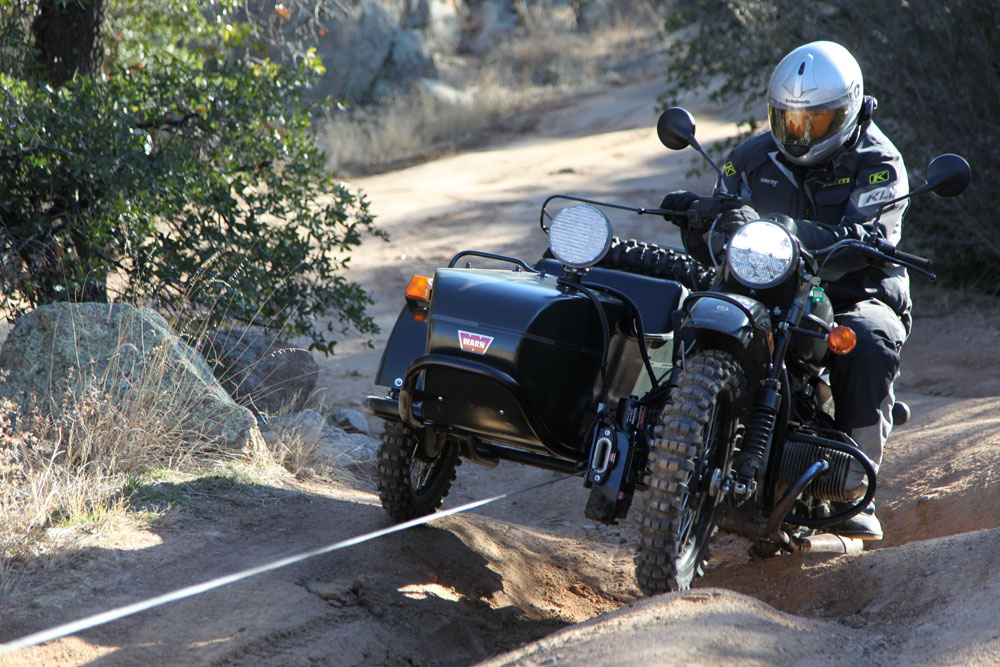
warn_ural_lead by tomteske, on Flickr
It looks similar to my rokon and side car that I never get a chance to use. I should consider trading it in for a dual sport but it is just too cool. |
2/23/2014
Topic:
Subject: Presidents Weekend
DHeuschele
|
dsefcik wrote:
Borregolinda wrote:
A must see in my book is Fonts Pt. Gives you a beautiful view of the Badlands. I have still never been there...just goes to show how vast of an area the park is..it is on my list though..soon!!
I am very surprised. It is somewhere I bring all the newbies that I bring out for a day. It is a good view (but I like the Badlands from wind caves better) and very easy to get to.
1 borrego canyon
2 flowers along Henderson canyon in season
3 fonts point
4 mud caves arroyo tapiada
5 marshal south cabin
5 pictograph site
- 1 good newbie day |
2/25/2014
Topic:
Show us your Cholla bomb photos
DHeuschele
|
mrkmc wrote:
Not me, but I love this pic:

I have gotten nailed bad but never close to that bad. |
2/26/2014
Topic:
Chuckwalla Mountains, The Bradshaw Trail
DHeuschele
|
Not a desert fox but the fox of Catalina are bold and will jump on your sleeping bag when you are sleeping. I had used an ursack which I think peeved the fox as he got food from almost everyone else and came back nightly to try to get my food. |
1/23/2015
Topic:
Indian Canyon to Borrego Palm Canyon Traverse info
DHeuschele
|
In March I was considering an Indian Canyon to Borrego Palm Canyon Traverse with side trip up Indian Head. I have done the traverse before and Indian Head before.
A while back they graded Bolder Alley (maybe 3 years ago). I was wondering how difficult that stretch is now. My vehicle could handle Boulder Alley pre-grade but I need to make sure we have another vehicle that can handle that stretch.
If I do not do Indian Canton to Borrego Palm Canyon I may do Anza to upper Coyote Canyon traverse. Anyone have an idea of how long that shuttle would be? I was thinking maybe 4 hours with the slow speed getting down from the upper part of Coyote Canyon (Upper part being as high as the road currently goes). Due to the expected shuttle time I am heavily leaning toward the above trip. |
3/9/2015
Topic:
Indian Canyon to Borrego Palm Canyon Traverse info
DHeuschele
|
I have an additional request for information. Anyone know what the water situation is up Borrego Palm Canyon especially at the junction for Indian Head (we plan to camp here). Currently I have a beginning tier and advanced tier. The advanced tier will come from Indian Canyon. The beginning tier will be coming up via Borrego palm Canyon. I had been thinking there would be water there (I have never not had water there this time of year but we are in the midst of a multi-year drought) but the lady I talked to state park visitor center indicated she would not rely on there being water. Carrying water could be tough on the advanced tier. The beginning tier could probably make do with 3 quarts each but the advanced tier would likely need 5 quarts (including climbing Indian Head). |
3/29/2015
Topic:
Indian Canyon to Borrego Palm Canyon Traverse info
DHeuschele
|
We did the Indian Canyon to Borrego Palm Canyon traverse (with a small subset doing Indian Head) this weekend.
I have seen Boulder Alley worse but I would not say it is doable by any 4X4. There were moderate size holes. Moderate size loose rocks and not many vehicles going up it. In our group we used 3 cars to go up it (2 4Runners and an older pathfinder) which required some shuttling. We did not take vehicles like Honda Pilot, Ford Explorer, etc. up it.
One group (the group that ended up being slower) started at 9:30 AM and the other group at 10 AM.
The hike was noticably harder than when I last did this hike. I am virtually certain we are the first to do hike this season. The going rate for the first mile after the confluence (there was plenty of water) was real slow (below 0.5 miles an hour). In addition we had a 2 small groups turn back that resulted in lost time for gear exchange, etc. Consequently instead of making it to the Indian Head spur to camp we camped about 1 mile below the confluence. We were in 2 groups. The second/slower tier got to our chosen camp area (versus planned camp area) after 8PM (yes they were going down that thing in the dark). Once they started past the confluence there was no place to camp until our location.
The next morning the group first to arrive at camp left around 7AM and the other group was to leave within 30 minutes. The further down canyon we got the better the trail as the people coming up from Borrego Palm Canyon all have different turn around points but apparently none recently ventured as high as our current campsite.
The first group got to the Indian Head spur before 8:30 but the second group got there close to 10 AM (they left later than planned and were moving slowly). I had decided at 8:30 to skip Indian Head but by 10 quite a few people from the front group who were planning on going (including my son) had changed to not go (it was already quite hot by 10AM).
So only 4 of our strongest hikers decided to include Indian Head (1:30 up, 1:15 down).
So if anyone was considering doing the hike this may be the time as I had ~20 hikers break trail so the trail has not been better this year (maybe in a few years). However, it took us ~10.5 hours for the faster group to make it the 8.5 miles to the Indian Head spur (some of that was dealing with those turning around). Last time it took me 9 hours but the "trail" was a little better back then and I was in better condition. I think with the trail we made 9 hours could be done much easier than for our group.
I had a mixed bag on liking or hating (one called it the worse hike of his life) the hike. Very few people in between. Mile 2 (start of the hill) through 7 were all tough; it was much nicer about 1 mile above the Indian head spur and of course the palm grove trail is like a freeway.
About half of this group is doing C2C next weekend (not me). I think in some way this was harder than they will find C2C (certainly not in every way).
So now is the time to take the hike but even with the trail we broke this is a hard hike.
edited by DHeuschele on 3/29/2015 |
3/29/2015
Topic:
Indian Canyon to Borrego Palm Canyon traverse
DHeuschele
|
Indian Canyon to Borrego Palm Canyon traverse with subgroup doing Indian Head Peak.
See report under "Upcoming Trips" (entry from today): http://www.anzaborrego.net/anzaborrego/forum/topic970-indian-canyon-to-borrego-palm-canyon-traverse-info.aspx. |
11/13/2015
Topic:
San Ysidro - East approach
DHeuschele
|
I have not done the route you describe but I have looked at it from the Indian Head trail - last time was in spring.
It looks rough but not chock full of vegetation. Of course I will caveat this with everything looks smaller from a distance. I would expect it to be slow going and fairly difficult. I would expect it to be about the same as being off the use trail up Indian Head which is slower than being on the use trail but allows fairly steady progress.
Hopefully someone who has done the route can provide better intel. |
12/18/2015
Topic:
Sheep Canyon, South Fork Sheep Canyon, Cougar Cany
DHeuschele
|
I was considering doing one or more of the hikes in the subject tomorrow and was wondering if anyone had recent water intel. I would choose different hikes if there is no water flowing in the canyons.
Thanks |
1/30/2017
Topic:
24 hour traverse of ABSP
DHeuschele
|
My 14 year old son led a 24 hour traverse of ABSP this weekend. There were 7 people who had planned to do the entire route and all 7 finished (one person had planned to do the first 10 miles then hike out the 10 miles solo). There were some route issues. We missed the 2nd water drop (second of only two) all together. We also did maybe 5 additional miles due to the route issues. But no serious injuries (some cactus wounds) and,even with the route issues, the hike finished in under 24 hours.
I may post more details later. |
1/30/2017
Topic:
24 hour traverse of ABSP
DHeuschele
|
Next up my child is leading a slightly easier 2 day backpack in Joshua Tree next month (low 20 miles if we can make it down rattle snake canyon - around 30 miles if we cannot). In May he wants to lead an attempt at the A16 3 Peak challenge weekend version (actually he wants the single day version but but I do not want to try the day version (I'm 53 years old and a little beaten (legs a little and feet a little but nothing major) from the ABSP 24 hour traverse). |
1/31/2017
Topic:
24 hour traverse of ABSP
DHeuschele
|
Route: We started at pinyon canyon trail just off highway. Our first water stash was just past the squeeze. Maybe 1 to 2 miles after hapaha flats we went up an east trending ridge I would guess 300' gain. This was the first ridge on left that was attainable after hitting the canyon. We followed the ridge a short ways, maybe 0.5 miles. This is where our route differed from the plan. We intended to get in an East trending wash after a duration of ups and downs and hook into north fork fish creek where our second water stash was. This planned route would have been ~30 miles with ~2 miles off trail. Instead we got a south East wash that we climbed out of for scouting a few times but the route to where we wanted to be was badland like (full of deep washes to cross - would have resulted in many ups and downs). The south east trending wash merged with a north south wash. We were now significantly south or where we wanted to be. We sent scouts north and south. The north wash quickly petered out. The south wash would hit the main fork of fish creek wash road. So we decided to go further South. We hit the road 1.5 miles due south of our second water stash. We calculated about 6 miles to water stash following the road (requiring backtrack going west on north fork of fish creek) or 8 miles to vehicles parked at the start of fish creek road. We did a water survey. 1 person was short, 5 were about ideal for the finish and two had basically 2 quarts having started with 3 quarts at the squeeze (so they had way more water than they would need). We distributed water to the person short. We decided to skip the water drop and go to car. Wrong route I suspect was ~35 miles with maybe 5 miles off trails but some of that was in good wash.
After the trip I looked at the pictures my son had and know that if I was navigating I would not have stayed in the south east trending wash. During the trip I had not looked at those pictures and was hoping for an easier route than what we kept finding when we climbed out of a wash for a look. The issue was by the time we did this scoutingvwe were already too far south. The east traverse is to happen as soon as you come down the ridge. Once you go a little ways south you are in badlands.
We slept at cars and the next morning fetched our water stash.
As is typical on these types of trips there are some side stories that are interesting.
Summary: planned route ~30 miles with 2 miles off trail. Actual route used ~35 miles with ~5 miles off trail but these 5 in general were not as rough as the two planned). |
12/25/2017
Topic:
Domelands/badlands backpack tomorrow
DHeuschele
|
Planning on doing Domeland/carrizo badlands tomorrow with my son and nephew.
We have done this hike a few times and have good familiarity with the wind caves, many of the various fossils (including the 3 giant urchin like shells) and the slot canyon into the badlands.
We plan to stay in the Penthouse Cave if it is available.
I am interested in other interesting things to do in the area. I have heard there is a giant chock rock in the area that is worth seeing.
Does anyone know where the chock rock is or have other recommendations for us to check out? |
12/25/2017
Topic:
Your Go To AB Book?
DHeuschele
|
Archives of desert magazine is good for finding long forgotten info. Just do not rely on the maps too much. I have found them to be very rough (not to scale, lacking significant detail, etc). |
1/14/2018
Topic:
Bucksnort Area Backpacking
DHeuschele
|
I have not been to that area in a few years but sheep and cougar usually have water. Hopefully someone who has been there this season could provide more recent info and possibly include condition of Boulder Ally. I would like to make it into one or both of those canyons this year but my next trip is already planned to Domelands (I went less than a month ago but different group of people). |
1/18/2018
Topic:
Carrizo Gorge East Side
DHeuschele
|
I saw a lantern last year that had maybe 20 dead lizards in it (I do not think I took a picture). Apparently the lizards had no problem finding their way into it but could not find their way out.
I did a 12 day backpack in NM in late summer. One of the boys found a spear head that was in similar shape to that arrow head (both are in near the shape at the time of the creation). I did shoot a photo of the spear head as it was special because I have not personally found a spear head and it was in great condition. You found a very nice arrow head. |
1/25/2019
Topic:
Can you see Goat Canyon Trestle from McCain?
DHeuschele
|
I think it is cool you want to experience the view of the trestle with your Dad. My Dad's knees have been going for the last few years. It has gotten so bad that this year he declines my invites to the basketball games due to the stairs at Viejas Arena. My Dad turns 77 in a few months. He has started consultations for knee replacements.
I once experienced the trestle via small plane. It was a special plane that made the experience even better (a Grumman that the canopy pulled back exposing the cockpit to the elements) but any plane would do. The view of the trestle could only be beat by hiking to the trestle; the view from the start of the bend is amazing.
Good luck on experiencing this with your Dad. |
4/25/2019
Topic:
Hike Suggestions?
DHeuschele
|
My favorite: Domelands and the associated slot canyon. I think I have now done this almost as often as borrego palm canyon.
In addition to 6582/Dawn’s, Indian head peak up borrego palm canyon and down the scramble, cougar canyon, sheep canyon, rabbit, maiddnhair Falls (looks so out of place).
Day challenge: Trans Anza traverse is a day. I think I posted route info from my trip 2 years ago.
Maybe hard for a day, Indian canyon to borrego palm canyon traverse. When I did this last (3 years ago) we got whooped at the confluence (0.5 miles/hr for over 1 mile). Good thing I planned it for 2 days.
I did Coyote canyon toward Anza this year and did not like it as much as the ones listed above. |
5/2/2019
Topic:
Hike Suggestions?
DHeuschele
|
For San G, I prefer the Fish Creek Route over the Vivian route and not only because the knees have gotten old with lots of miles. Fish creek may be more miles and take a bit longer but I find it to be easier and I like the route better. Not sure if the road to fish creek is open yet.
Water secret spot: the mine on a good snow year like this one is likely to have water (snow) into July or August. It is maybe 100 yards off trail. |
12/20/2019
Topic:
Sheep, Coyote & Rabbit
DHeuschele
|
I question if from the hill separating Indian Canyon and Borrego Palm Canyon you may be able to get a Sheep, Coyote, and Rabbit without a single animal with a wide angle shot (panorama). if it were not for the ridge on South Side of Sheep extending so far, it would definitely be possible. |
12/29/2019
Topic:
Good places for rainy days
DHeuschele
|
deborah wrote:
ziphius wrote:
Inner Pasture is always a nice place and the walking investment usually means you have it to yourself. Red Top is no rainy day stroll and my perspective comes from having done El Cajon Mountain 103 times.
Inner Pasture is now on my list. So many places to see...
El Cajon Mountain 103 times! Nice!!
El Cajon Mtn is my least favorite hike in Afoot and Afield. To each their own. |
1/7/2020
Topic:
Weekend trip
DHeuschele
|
You are very good photographer. Sweet. |
1/7/2020
Topic:
24 hour traverse of ABSP
DHeuschele
|
Considering doing this traverse "correctly" this time. Same person (my son) will be the navigator so never know. Actually he is a fairly good navigator, this is the only outing that I can think of that he messed up the navigation. We are not planning on doing this in 24 hours this time (not even close). We plan to start Friday night and hike to a little past the Squeeze then sleep. Next day hike to the next water stash and sleep/play there. Then short hike to vehicles the next day (Sunday) and drive home early enough to get lunch on the road (maybe Miners Diner in Julian). ~30 miles with ~2 miles off trail. |
3/22/2021
Topic:
Rabbit/Village Peak Water Strategy
DHeuschele
|
I’ve stashed water dozens of times in deserts and have yet to have animals noticeably mess with the water. This includes in the fragile gallon jugs.
The camp location I use is at the descent just prior to villager. Next day is short hop to villager, then the roller coaster to Rabbit and then return to camp, pack, and descend. I do this to minimize carrying the camp gear, carried camp gear is never carried down to subsequently be carried up, it is a good campsite location, it starts day 2 with a descent. Note I usually start late on day 1. Day 2 is slightly long, but all uphill is without the backpack.
Good luck |
3/22/2021
Topic:
book recommendations?
DHeuschele
|
Not a book, but relevant to the reference to Ghost Mountain and the South family, Desert Magazine. I used to have them all (?) digital. Not sure I can still access, but I should check and place on CD/DVD. |
3/12/2024
Topic:
Crowds
DHeuschele
|
Retired January 2022. I seem to be as busy as ever and not taking as many trips as I did pre retirement. Will be going out tomorrow to check out the flowers. May do fonts point and the serpent. I typically do a stop at the serpent. |
3/12/2024
Topic:
Wildflowers starting to bloom around June Wash
DHeuschele
|
Heading out tomorrow to check the flowers near borrego springs (Henderson canyon and coyote canyon) with the wife. Taking the wives little Range Rover so will not be doing any 4x4 road. Two of my beast vehicles are down right now. Son managed to break a piece out of torsion bar, a king shock, and break an axel on the LC100 (4th axel he has broke in 2 years). I try to tell him the skilled drivers do not need to ram the car to do challenging 4x4 roading.
So flowers, fonts point, lunch, and serpent is probably all we will be doing.
Looking forward to it as I have not been out to ABSP yet this season. I had 2 hiking trips planned this season but had to cancel on both.
edited by DHeuschele on 3/12/2024 |