|
Britain Posts: 611
3/15/2017
|
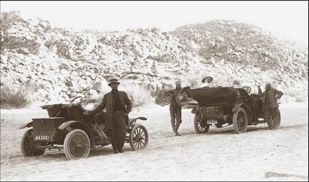
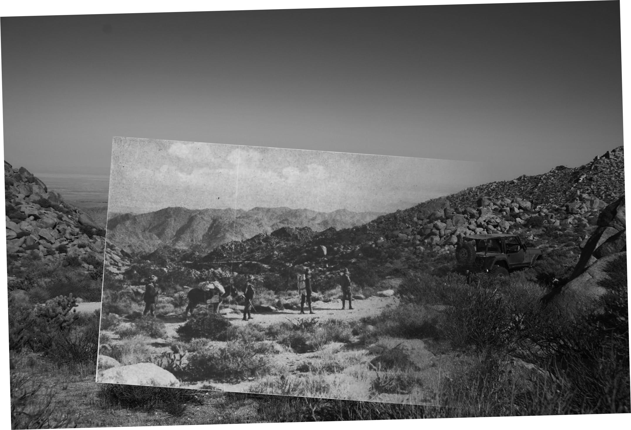
One of the things I like to do is find locations of old desert photography. Ralph Stineman was an early San Diego photographer from around 1910. He enjoyed his trips to and from Imperial County. First picture is Ralph and Friends in the desert. Ralph is on the left in this picture. Picture from www.sandiegohistory.org. This picture's location took about 3 years to find. I used to carry a paper copy of the images around with me, now the ipad.
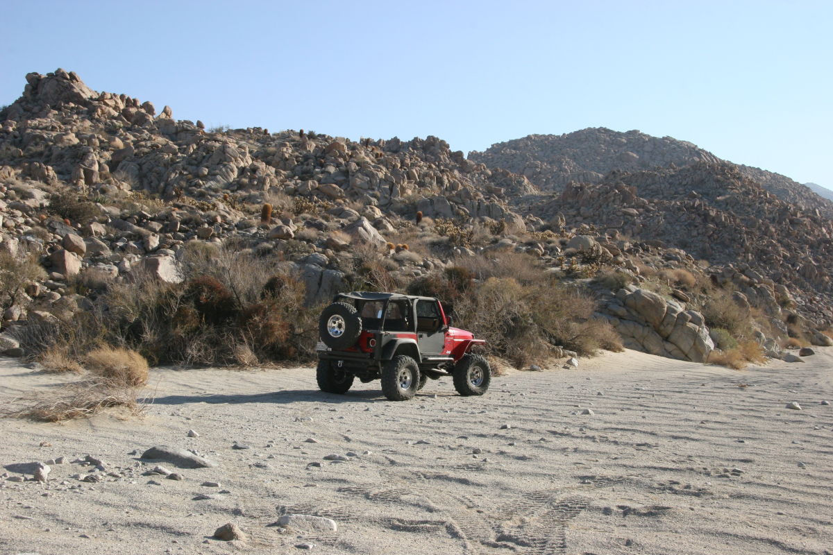
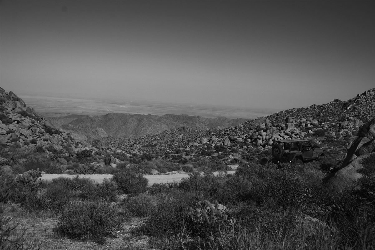
Here's the location the picture was taken from.
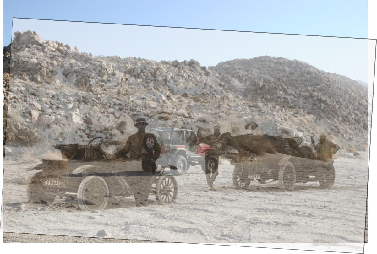
An overlap of the 2 pictures. I think I'll join these ghosts for a ride.
--
Cant drive 55
Britain
http://icorva.com
|
|
|
link
|
|
dsefcik Administrator Posts: 2634
3/15/2017
|
I like it....I was doing something similar with carrizo gorge and the railroad camps and such.
--
http://www.sefcik.com
http://www.darensefcik.com
http://www.carrizogorge.com
|
|
|
link
|
|
ziphius Posts: 911
3/15/2017
|
Very cool. Forensic photography. Devil's Canyon?
--
http://www.coyotelearning.org
|
|
|
link
|
|
Britain Posts: 611
3/15/2017
|
About 1/2 mile out of the entrance of the bottom section of Devils.
--
Cant drive 55
Britain
http://icorva.com
|
|
|
link
|
|
Britain Posts: 611
3/15/2017
|
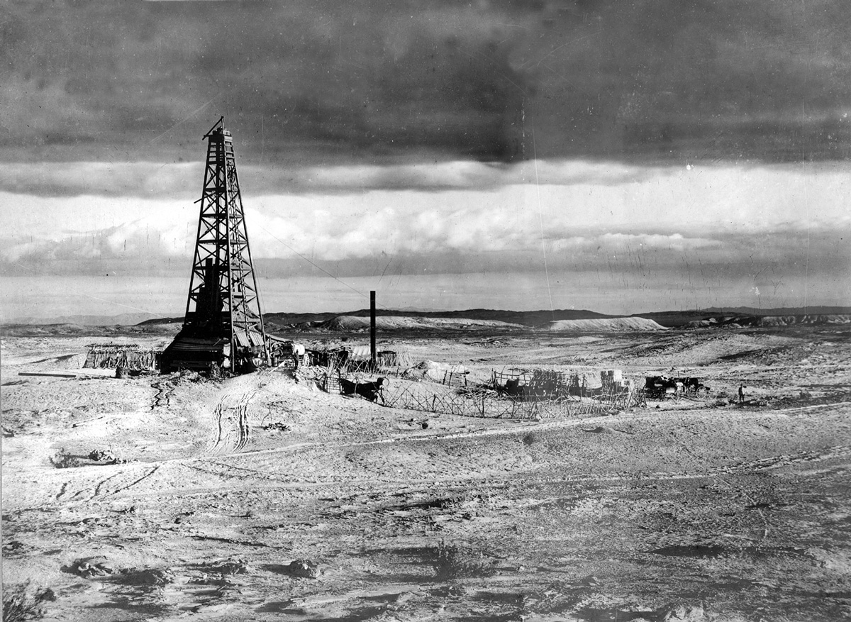
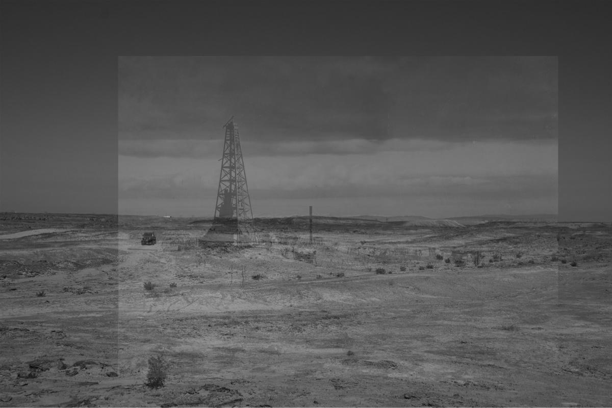
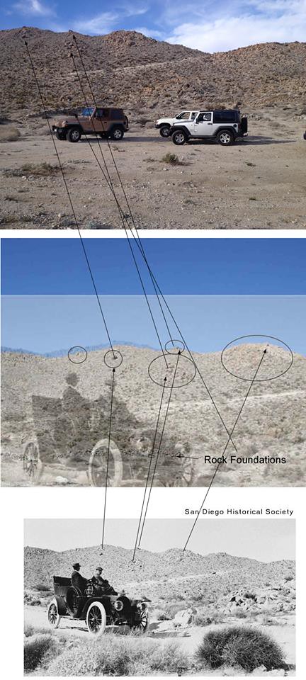
In the late 1800's some folk thought that could be oil in the Yuha desert. With oyster shell bed there must be some. Right?
Here's the oil well.
Here's the location

Here's the overlay
edited by Britain on 3/15/2017
--
Cant drive 55
Britain
http://icorva.com
|
|
|
link
|
|
Britain Posts: 611
3/15/2017
|
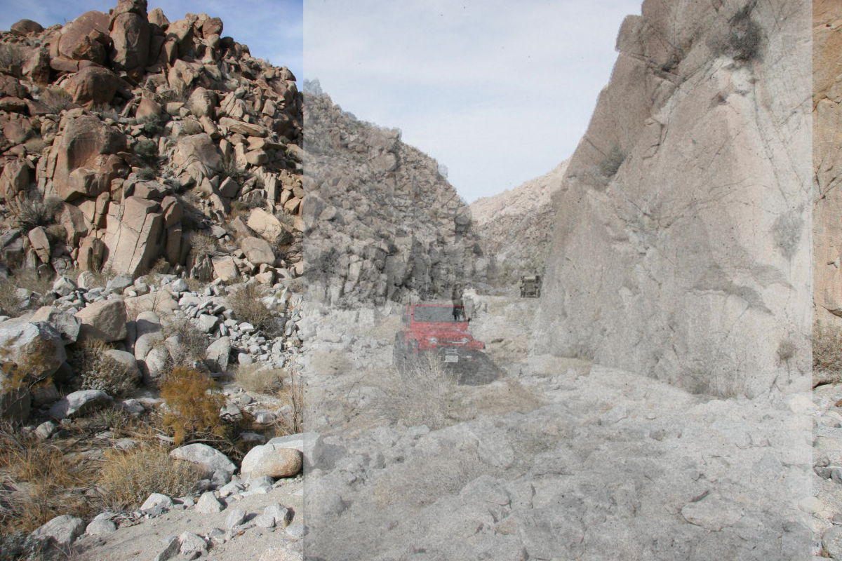
One more.
Ladies looking around Devils Canyon
The ladies
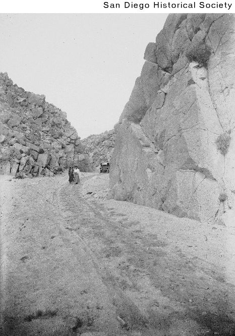
The location
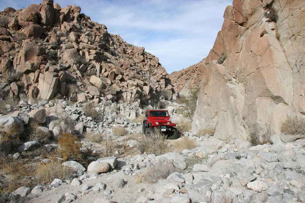
The overlay
--
Cant drive 55
Britain
http://icorva.com
|
|
|
link
|
|
ziphius Posts: 911
3/16/2017
|
Wow, the amount of 'new' rock debris in the 'ladies' photo is impressive.
--
http://www.coyotelearning.org
|
|
|
link
|
|
Britain Posts: 611
3/16/2017
|
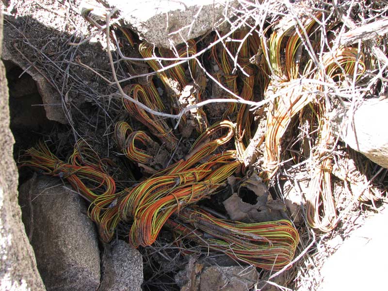
In the late 1970's a hurricane came through, the canyon got washed out. I have photos of a bus from around 1910, the same area has dropped 10 ft.
The 1980 BLM maps show the trail straight through the canyon. 1990 the BLM maps show the trail at Mountain springs ending, then at the bottom in the desert picking up again. Some regulations changed how trails were maintained on maps. Trail is open by permit for wheelers. But during my exploration of the canyon in 2000 I found a lot of explosives. When the BLM open the trail by permit I had to inform them that they best get rid of the explosives first. The detonators from the numbers on them dated to 1880-1890 a German trigger. The stuff under it I didn't have the nuts to dig into,
Bada Boom!
edited by Britain on 3/16/2017
--
Cant drive 55
Britain
http://icorva.com
|
|
|
link
|
|
surfponto Administrator Posts: 1369
3/16/2017
|
Very cool.Keep posting ;-)
--
https://www.anzaborrego.net/


|
|
|
link
|
|
rockhopper Posts: 678
3/17/2017
|
I really like the old photos. The overlays are interesting. Thanks for sharing.
|
|
|
link
|
|
tommy750 Posts: 1086
3/18/2017
|
Tropical Storm Kathleen messed up Myers/Boulder Creek back in 1976. Here's a link to the one book documenting what happened: https://www.scribd.com/doc/9354989/Tropical-Storm-Kathleen
Great posting. Love the pics. Tom
|
|
|
link
|
|
Britain Posts: 611
3/18/2017
|
Locals used to use the canyon to come back from hunting at table mountain. After the storm it was no longer passable. Great article!.
edited by Britain on 3/18/2017
--
Cant drive 55
Britain
http://icorva.com
|
|
|
link
|
|
Britain Posts: 611
3/18/2017
|
Here's a bus. The wheel broke off.
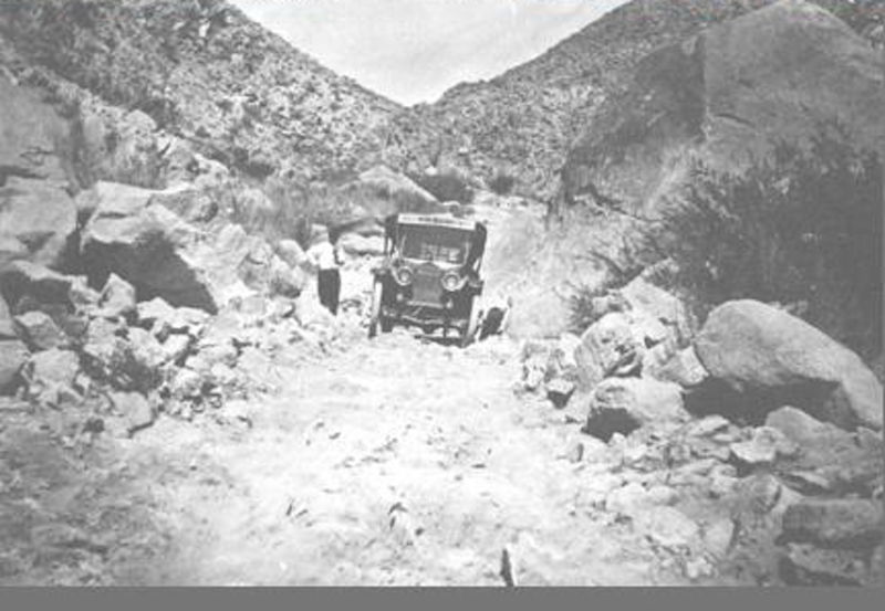
Here's the same place. My friend is guiding his wife up out of the hole. This location is under the first bridge coming out of the desert on hwy 8
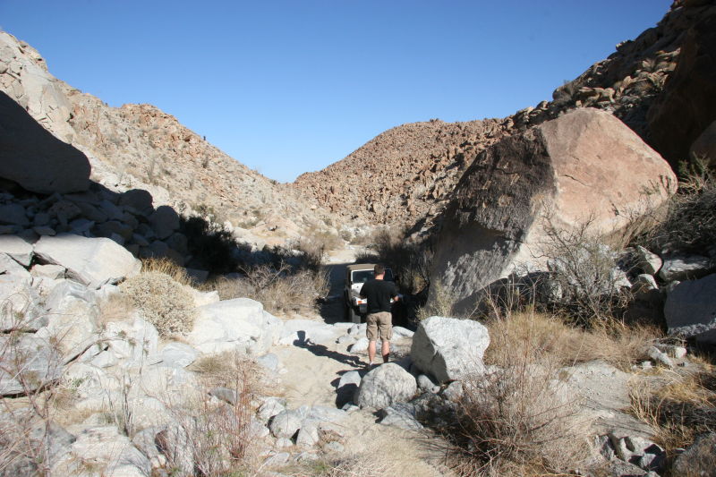
No overlay, I'm out of position on the shot.
--
Cant drive 55
Britain
http://icorva.com
|
|
|
link
|
|
surfponto Administrator Posts: 1369
3/19/2017
|
Very impressed that you can line up these shots and make out the landscape
Can't believe they took that "bus" out through that.
Britain wrote:
Here's a bus. The wheel broke off.
Here's the same place. My friend is guiding his wife up out of the hole. This location is under the first bridge coming out of the desert on hwy 8
No overlay, I'm out of position on the shot.
--
https://www.anzaborrego.net/
|
|
|
link
|
|
rockhopper Posts: 678
3/19/2017
|
Is that bus driver wearing a tie? Oh my what a place to be in a jamb. I think I would have chosen a mule for that journey back then.
|
|
|
link
|
|
Britain Posts: 611
3/20/2017
|
Talk about mules. Here's some guys with a mule. I understand from a story they sold the mule somewhere around Superstition mountain.
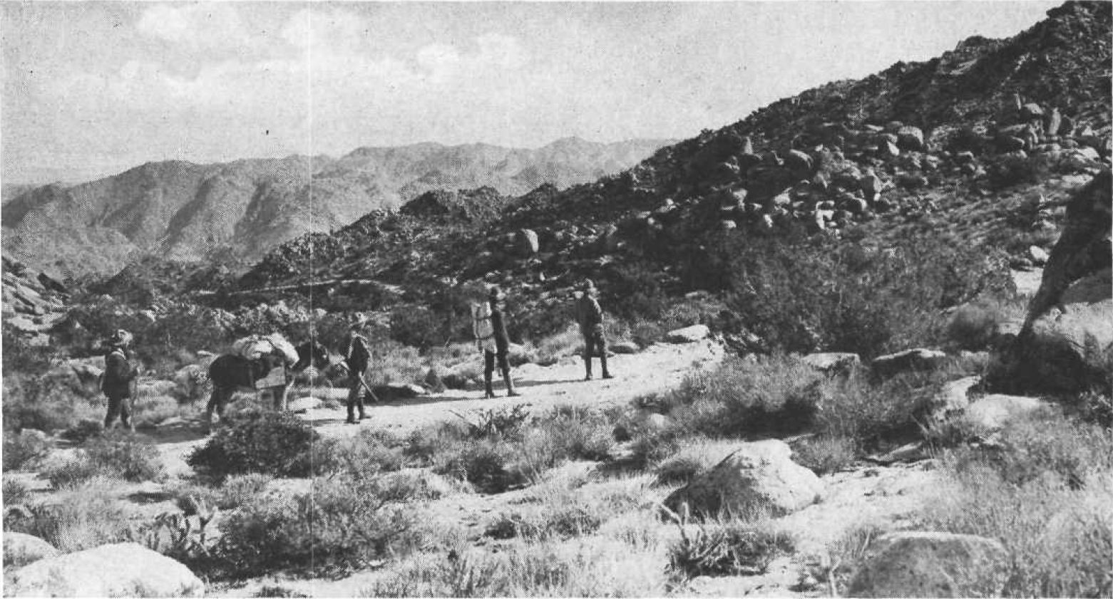
Here's the location. Its Table mountain.
And the overlay. I'm a bit out of position on the shot.
--
Cant drive 55
Britain
http://icorva.com
|
|
|
link
|
|
railexplorer Posts: 71
3/20/2017
|
Great photos. I had to laugh to see your jeep vs. their old cars.
|
|
|
link
|
|
dsefcik Administrator Posts: 2634
3/24/2017
|
Great photos..I really like them, thanks for posting. I was in that exact same spot near table mtn a couple weeks ago, was gonna go down to the spring but stopped near where that photo is taken and hiked around a bit. That was the weekend of the mass crowds in ABDSP, I didn't see a single sole that whole day out there though.
--
http://www.sefcik.com
http://www.darensefcik.com
http://www.carrizogorge.com
|
|
|
link
|
|
Britain Posts: 611
3/25/2017
|
dsefcik wrote:
Great photos..I really like them, thanks for posting. I was in that exact same spot near table mtn a couple weeks ago, was gonna go down to the spring but stopped near where that photo is taken and hiked around a bit. That was the weekend of the mass crowds in ABDSP, I didn't see a single sole that whole day out there though.
I like hiking the area thats north of that. The trail dead ends into some kind of nature preserve. Its in the North east corner of Table. In 2005 my wife lost her cell phone while we were on a hike. A few years later I went in to back track the track to find the cell and lost the GPS. ( Belt clip came off)
Two years ago we went back in and found the cell back tracking the tracks. Will probably go back in the next couple weeks and snoop around for the GPS.
--
Cant drive 55
Britain
http://icorva.com
|
|
|
link
|
|
sddarkman619 Posts: 153
4/6/2017
|
Here's mine from the old stage road behind Table Mountain
and here's a GREAT article about the area of the old Stage Road including time tables:
http://www.sandiegohistory.org/wp-content/uploads/2016/05/V62_1Streetman.pdf
 old-stage-coachroad by sddarkman619, on Flickr old-stage-coachroad by sddarkman619, on Flickr
|
|
|
link
|
|
Britain Posts: 611
4/7/2017
|
Seen that one. I tried to place but I think the freeway is in the way.
--
Cant drive 55
Britain
http://icorva.com
|
|
|
link
|
|
sddarkman619 Posts: 153
4/16/2017
|
nope, the freeway is next to it. if you want to check it out sometime let me know I'll take you there.
From Jacumba.
|
|
|
link
|
|
Britain Posts: 611
4/18/2017
|
I have the same picture, I believe for correct alignment the original photographer was on the freeway. Thats trail coming down from table mountain. But I could be wrong been many years.
--
Cant drive 55
Britain
http://icorva.com
|
|
|
link
|