|
tommy750 Posts: 1086
5/13/2012
|
According to Manfred Knaak's "The Forgotten Artists," ABDSP has three main rock art styles: Western Petroglyph, San Luis Rey and La Rumorosa. I've never actually seen the first style and like many, have only seen the Little Blair Valley example of San Luis Rey. Have enjoyed the wonderful Indian Hill and Carrizo Canyon examples of La Rumorosa style and decide to investigate this style further. The name comes from a Kumeyaay site in Northern Baja with "La Rumorosa Style" being coined by Ken Hedges in the early '70s. He described it as:
"characterized by the presence of digitate anthropomorphs (human figures with the fingers
and/or toes represented), sauromorphs (lizard forms), sunbursts, circles, and rectangular
grids as defining elements. Although both representational and abstract forms are present,
it is the occurrence of the representational elements, particularly the digitate
anthropomorph, which sets this style apart from others in southwestern California.
Designs occur in at least four colors – red, black, white, and yellow – with most sites
having at least two colors."
(Rock Art in Southern California. Pacific Coast Archaeological Society Quarterly 9(4):1-28)
Decided to head down to La Rumorosa (El Vallecito) site and see what he was talking about. The girlfriend and I made our way south through Mexicali and headed west on Hwy 2. If you enjoy the I-8 grade entering/leaving the Imperial Valley, La Rumorosa grade is that times 5. Here's a link to a 2 min video from yesterday while driving down the grade:
[flash=http://www.flickr.com/apps/video/stewart.swf?v=109786]width="400" height="225" flashvars="intl_lang=en-us&photo_secret=4697bcb88b&photo_id=7192676762" bgcolor="#000000" allowFullScreen="true"[/flash]
The exit sign from Hwy 2. You'll need to head north on an unmarked dirt road for about a mile and will arrive at the archeological site. It's open Wed-Sun till 4pm. The caretaker said Sunday is crowded. We saw two other small groups the entire time we were there on Saturday. The fee is a few bucks each. You're given a simple map of the site and off you go. Expect 1-2 miles of walking and containers are not allowed although the locals all had them. The site was quite clean and well-ordered (Daren, even the morteros were poop-free).
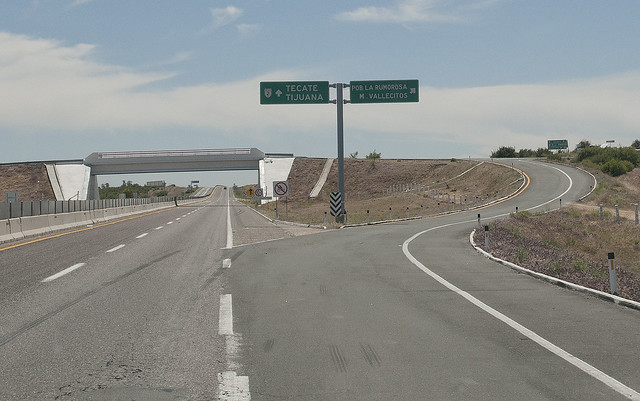
Vallecitos Exit by tomteske, on Flickr
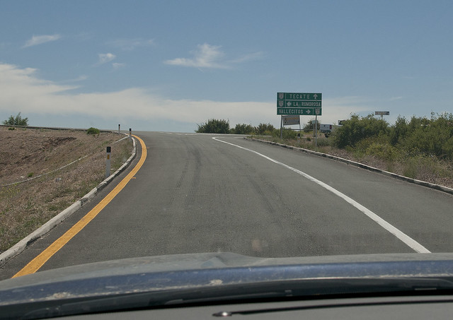
Vallecitos Exit by tomteske, on Flickr
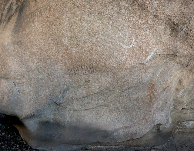
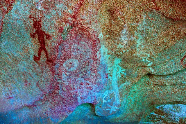
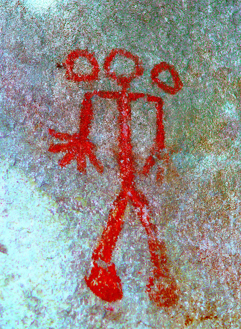
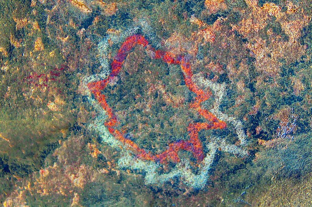
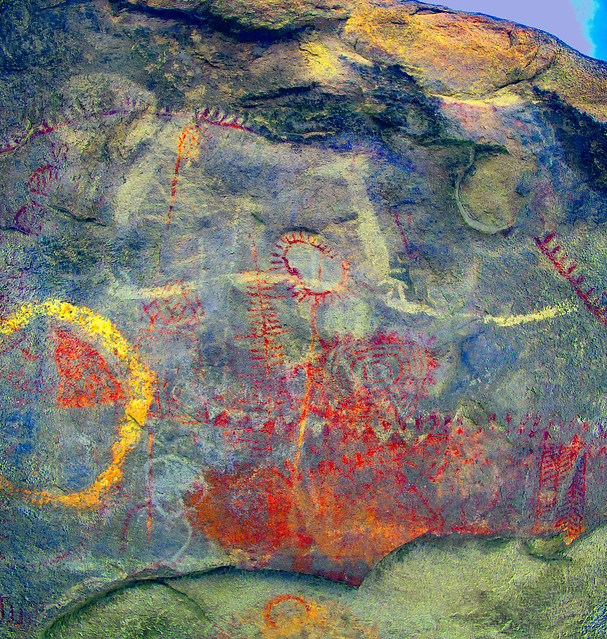
There's about 14 named sites but only five are accessible to the public: El Tiburon (the rock looks like a shark), El Diablito/Solstice Cave, El Hombre Enraizado (man with roots), El Indio/El Hongo (again, the rock looks like a mushroom) and Los Solecitos (little suns)/Wittinnur (someone's name?). The last two sites are stupendous.
The Shark Cave. Only a few glyphs including one that reportedly looks like a butterfly.
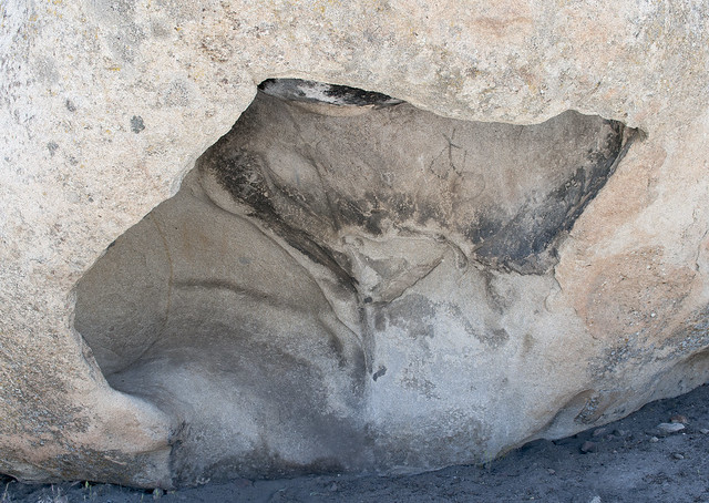
Cueva de Tiburon by tomteske, on Flickr
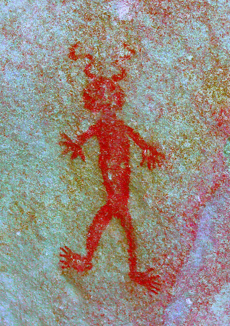
Diablito/Solstice Cave. Apparently, the winter solstice sunrise illuminates the little devil's eyes.

Cueva del Diablito o Solsticio by tomteske, on Flickr
Cueva del Diablito o Solsticio by tomteske, on Flickr
El Diablito by tomteske, on Flickr
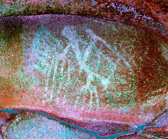
El Diablito DStretched.
El Diablito o del Solsticio by tomteske, on Flickr
Cueva del Diablito o Solsticio Panel by tomteske, on Flickr
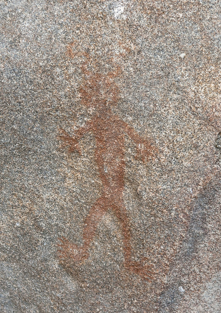
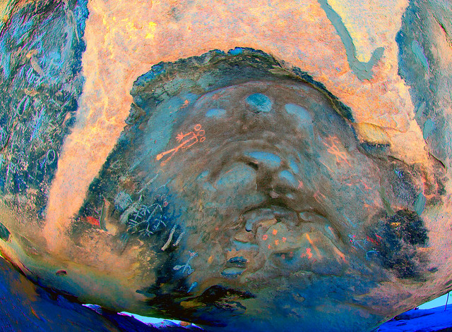
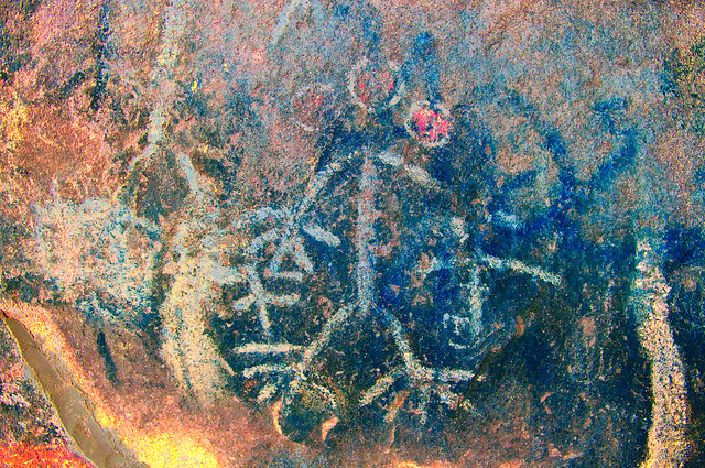
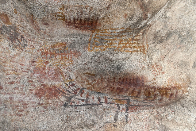
Rooted Man Cave. This figure looked like a pictograph/petroglyph combination. A strange symbol is present in an adjacent cave.
Cueva del Hombre Enraizado by tomteske, on Flickr
El Hombre Enraizado DStretched.
Cueva del Hombre Enraizado by tomteske, on Flickr
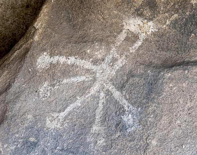
Cueva del Hombre Enraizado by tomteske, on Flickr
On the way to the next cave, a couple of rock circles were obvious. The caretaker said these were original to the site but other rocks arranged into symbols were later additions.
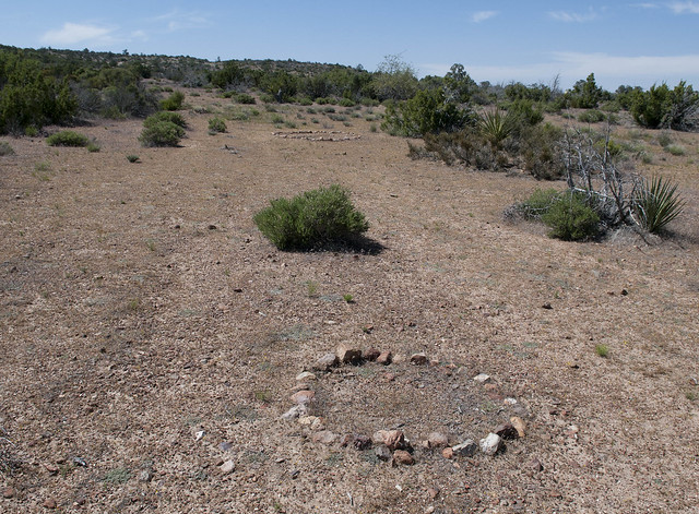
Rock Circles by tomteske, on Flickr
Didn't see any snakes this trip.
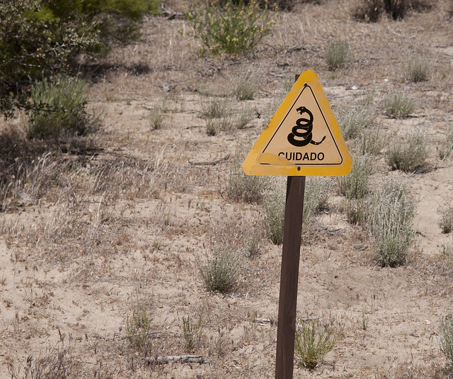
Cuidado by tomteske, on Flickr
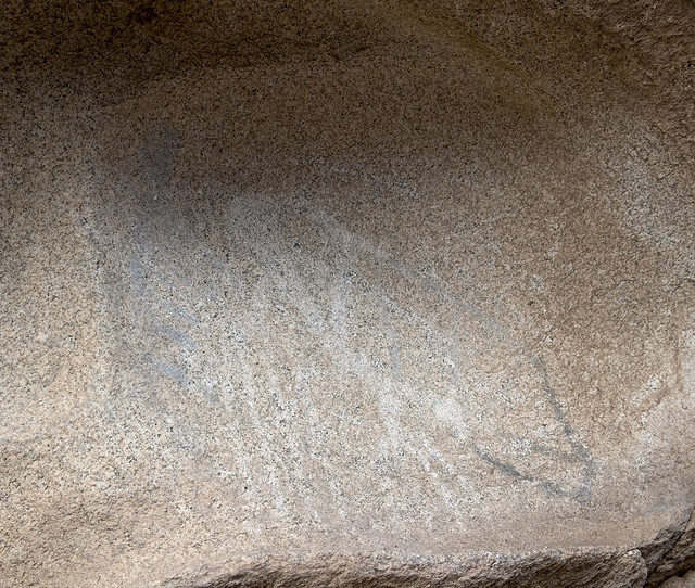
The Indian/Mushroom Cave was stunning. Here's a few DStretched images.
Cueva del Indio o El Hongo West by tomteske, on Flickr
Cueva del Indio o El Hongo West by tomteske, on Flickr
Cueva del Indio o El Hongo West by tomteske, on Flickr
Scotoma_lds by tomteske, on Flickr
Cueva del Indio o Hongo East by tomteske, on Flickr
The last cave was The Little Suns/Wittinnur. Also an amazing site.

Los Solstices o Wittinnur Panel by tomteske, on Flickr
Solstice Cave by tomteske, on Flickr
Kind of a long post, but there was an incredible amount of cave art to see. Although now artificially separated from the Kumeyaay sites we routinely encounter on our side of the border, El Vallecito is only about five miles due south of Blue Angels Peak and 15 miles south of Indian Hill. Would definitely recommend a visit if you're looking for a great day trip. Here's a link to more Vallecito pics if you're interested. Tom
http://www.flickr.com/photos/tommy750/sets/72157629714899716/
|
|
|
link
|
|
dsefcik Administrator Posts: 2634
5/13/2012
|
Nice...very nice!
DStretch brings a whole new dimension to rock art doesn't it??
I have seen a video of the solstice sun shining on the eyes of the diablito.
I will be looking a bit more closely at all of the photos you posted, I have always wanted to get down there.
I have found so many pictos just taking pictures of (blank to me looking at them) rock surfaces and then running them thru DStretch later that it is amazing.
Great post Tom, thanks for sharing that!
Daren
--
http://www.sefcik.com
http://www.darensefcik.com
http://www.carrizogorge.com
|
|
|
link
|
|
tommy750 Posts: 1086
5/13/2012
|
dsefcik wrote:
Nice...very nice!
DStretch brings a whole new dimension to rock art doesn't it??
I have seen a video of the solstice sun shining on the eyes of the diablito.
I will be looking a bit more closely at all of the photos you posted, I have always wanted to get down there.
I have found so many pictos just taking pictures of (blank to me looking at them) rock surfaces and then running them thru DStretch later that it is amazing.
You should definitely go down there. You're right, DStretch is incredible. Thanks for the link. I need to paypal DStretch a donation!
Great post Tom, thanks for sharing that!
Daren
|
|
|
link
|
|
surfponto Administrator Posts: 1369
5/14/2012
|
Awesome trip Tom.
Really like the El Diablito pictograph.
We went by there a few years back to camp at the hot springs in Guadalupe Canyon.
Wish I had know about thsoe pictos then
I guess there is also a famous picto cave down near Catavina that is suppose to be pretty cool.
Thanks for posting the pics of your adventure
Bob
--
https://www.anzaborrego.net/


|
|
|
link
|
|
ziphius Posts: 911
5/14/2012
|
Awesome pictos, thanks for sharing. The contrast between the normal and D-stretched versions is amazing. I'll definitely pay more attention to 'smudges' on rocks in the future. I was near Escalante Utah this spring and saw a few pictos high on cliff walls that I wouldn't have seen otherwise if I hadn't been looking through my binoculars for birds.
--
http://www.coyotelearning.org
|
|
|
link
|
|
tommy750 Posts: 1086
5/14/2012
|
surfponto wrote:
Awesome trip Tom.
Really like the El Diablito pictograph.
We went by there a few years back to camp at the hot springs in Guadalupe Canyon.
Wish I had know about thsoe pictos then
I guess there is also a famous picto cave down near Catavina that is suppose to be pretty cool.
Thanks for posting the pics of your adventure
Bob
The caretaker at El Vallecito had a cool El Diablito tshirt which sold at the site until two years ago when they quit making them  There's another site at "mile marker 57" that looks like the great mural sites of central Baja. Was going to check it out but was getting late. Not sure if it's on the toll road or the old road but suspect the latter. Recall driving by the Catavina site but it was closed when I last was there. Its online pics look pretty cool. Check out this link to a pictograph cave above Canyon Guadalupe: There's another site at "mile marker 57" that looks like the great mural sites of central Baja. Was going to check it out but was getting late. Not sure if it's on the toll road or the old road but suspect the latter. Recall driving by the Catavina site but it was closed when I last was there. Its online pics look pretty cool. Check out this link to a pictograph cave above Canyon Guadalupe:
http://www.scahome.org/publications/proceedings/Proceedings.22Porcayo2.pdf Tom
|
|
|
link
|
|
tommy750 Posts: 1086
5/14/2012
|
ziphius wrote:
Awesome pictos, thanks for sharing. The contrast between the normal and D-stretched versions is amazing. I'll definitely pay more attention to 'smudges' on rocks in the future. I was near Escalante Utah this spring and saw a few pictos high on cliff walls that I wouldn't have seen otherwise if I hadn't been looking through my binoculars for birds.
Glad Daren sent me the link (www.dstretch.com). And at FREE, the price is unbeatable. Tom
|
|
|
link
|
|
dsefcik Administrator Posts: 2634
5/15/2012
|
tommy750 wrote:
Decided to head down to La Rumorosa (El Vallecito) site and see what he was talking about. The girlfriend and I made our way south through Mexicali and headed west on Hwy 2. If you enjoy the I-8 grade entering/leaving the Imperial Valley, La Rumorosa grade is that times 5. Here's a link to a 2 min video from yesterday while driving down the grade:
It has been a few years since I have driven in Mexico but I thought it was interesting all of the rest areas were on the **left** side of the highway.
--
http://www.sefcik.com
http://www.darensefcik.com
http://www.carrizogorge.com
|
|
|
link
|
|
dliponi Posts: 5
5/7/2013
|
Thank you for the photos and the info. Are the panels locked up - I assume the caretaker unlocks them during the day?
Is there anyway to see more of the panels than the few they have on display [like hire a local guide?], etc.
Thanks, Tommy, very nice display.
Don Liponi
|
|
|
link
|
|
tommy750 Posts: 1086
5/11/2013
|
dliponi wrote:
Thank you for the photos and the info. Are the panels locked up - I assume the caretaker unlocks them during the day?
Is there anyway to see more of the panels than the few they have on display [like hire a local guide?], etc.
Thanks, Tommy, very nice display.
Don Liponi
There's about 18 sites if I recall correctly but less than half are open to the public. There is a caretaker at the site and with a small fee you get a map and as much time as you want to view the various pictographs. Hours are Wed-Sun 0800-1700. Here's the map. Tom

Zona Arqueologica El Vallecito by tomteske, on Flickr
|
|
|
link
|