Talk about a trip you took out to Anza Borrego
Memorial Day Weekend: Palo Verde/Blythe Intaglios
|
tommy750 Posts: 1040
5/29/2012
|
Palo Verde Point and Blythe Intaglios are just a wee bit outside ABDSP and Kumeyaay territory, but they're so cool you have to see these sites. Both sites, for better or worse, are mere yards from major desert highways. Both have signage and barriers in place. Had some free time yesterday so headed toward the river to see the Palo Verde petroglyphs, a series of stunning panels carved in limestone along ancient trails on the west side of the Colorado. Unfortunately, they're being eroded rather rapidly and blasting at a quarry straddling the site has probably led to some collapses.
This Chevy, easily seen on Google Earth, marks the approximate southern extent of the site and is less than 10 miles south of Palo Verde.
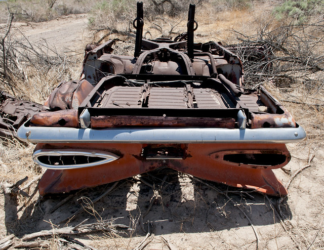
Wreck From Space by tomteske, on Flickr
Numerous panels are present in various arroyos over the next mile. As you can see, the highway is very close in places.
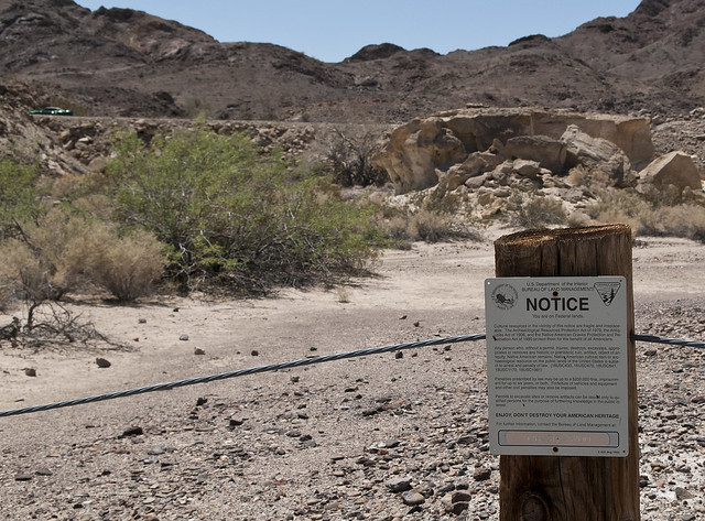
Blythe South Sign by tomteske, on Flickr

Blythe South Panel2 by tomteske, on Flickr
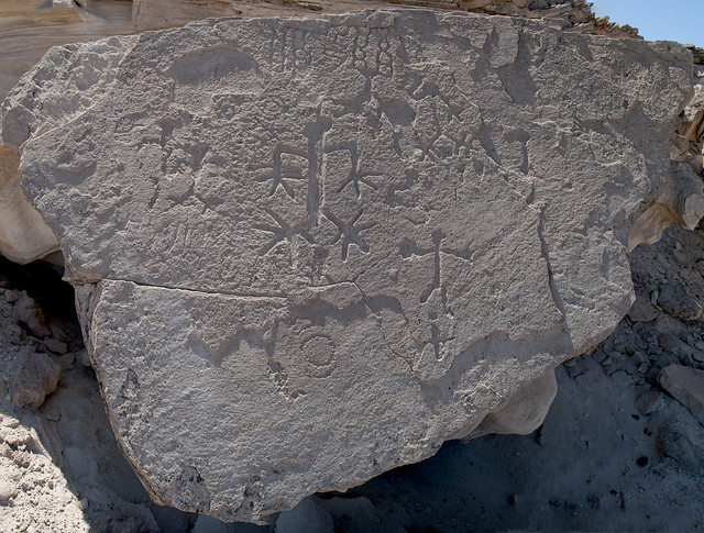
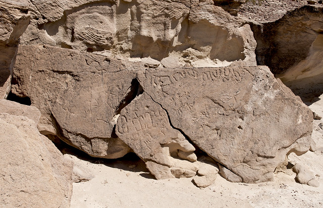
Blythe South Anthromorph Panel by tomteske, on Flickr
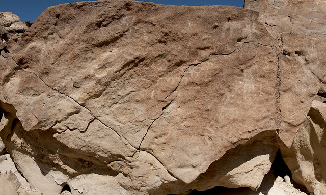
Blythe South Panel 2 by tomteske, on Flickr
Blythe South Panel3 by tomteske, on Flickr
Although these petroglyphs are somewhat to the East of Kumeyaay territory, they still have stylistic similarities and contain my favorite glyph, the "digitate anthromorph."
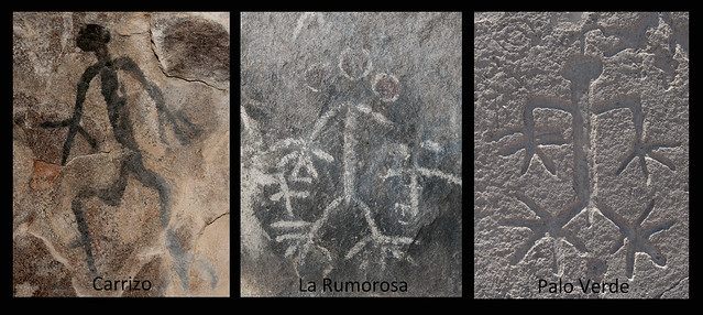
Digitate Anthromorphs by tomteske, on Flickr
A detailed description of the site by archeologist Ken Hedges is here: http://www.scahome.org/publications/proceedings/Proceedings.18Hedges.pdf
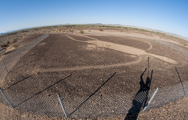
The Blythe Intaglios were discovered in the 1930's when a local pilot noticed them returning from Las Vegas. There are multiple sites, both anthromorphic and zoomorphic and are really cool to see. The desert pavement is very smooth and very varnished at this site which creates the stark contrast.

Blythe Intaglio Sign by tomteske, on Flickr
Not sure how the Indians viewed these except close up. The nearest hill is about a mile away. My technique for photographing these was sticking the camera at the top of my monopod and holding it as high as possible. Still not the best aerial view.
Blythe Intaglio by tomteske, on Flickr
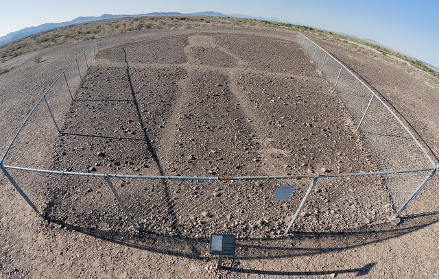
Blythe Intaglio2 by tomteske, on Flickr
The BLM link is below. Enjoy. Tom
http://www.blm.gov/az/st/en/prog/cultural/intaglios.html
|
|
|
link
|