|
tommy750 Posts: 1086
6/18/2012
|
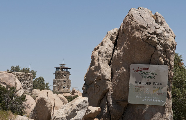
Decided to post SOMETHING cuz a little warm spell seems to be keeping the Borrego crowd away. It's still officially Spring, folks! Built in the 1920's, everyone has seen this desert landmark. If you haven't actually stopped for a visit, you're missing a panoramic view of the Colorado Desert and 20th Century Americana.
Desert View Sign by tomteske, on Flickr
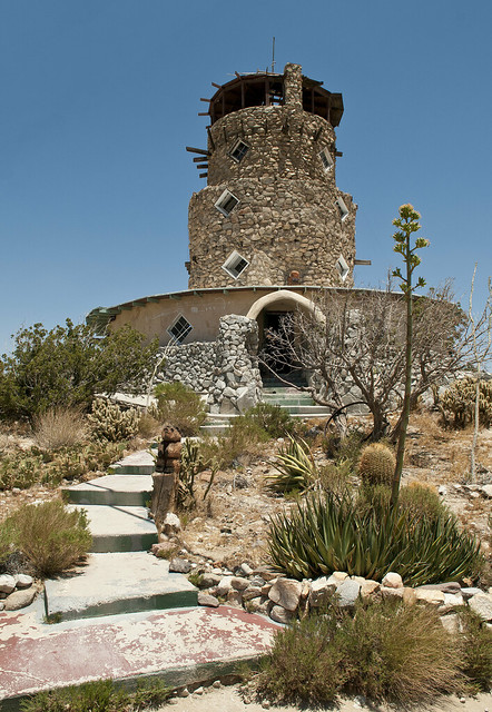
Desert View Tower by tomteske, on Flickr
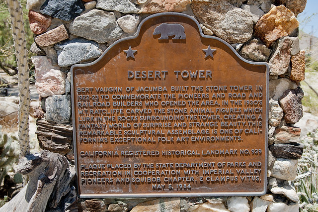
Desert Tower Sign by tomteske, on Flickr
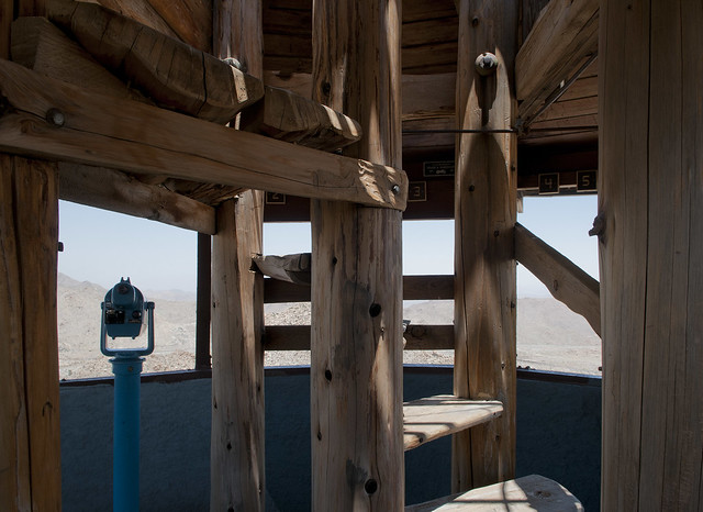
The tower's views of the desert are matched only by its eclectic content ranging from books, art, taxidermy to Indian artifacts and old photographs. Presumably a post card with one of the many taxidermy specimens.
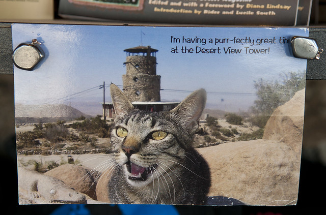
Tower Cat by tomteske, on Flickr
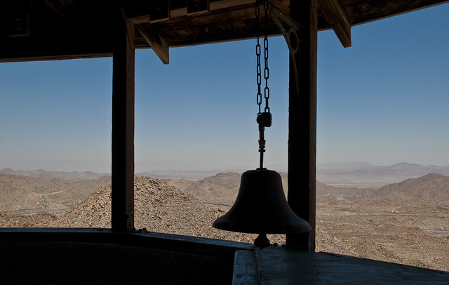
The view from the top provides a nice view of the Valley below and the many remnants of previous roads up the grade.

Desert View3 by tomteske, on Flickr
Desert View2 by tomteske, on Flickr
Desert View by tomteske, on Flickr
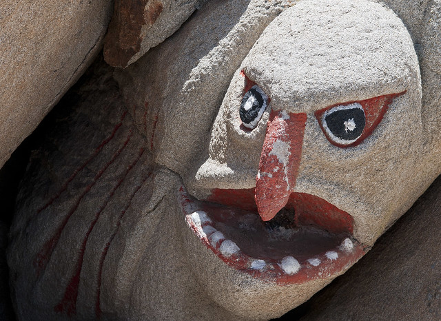
The whimsical rock art in back of the tower was carved in the 1930's.

Rock Art by tomteske, on Flickr
Rock Art2 by tomteske, on Flickr
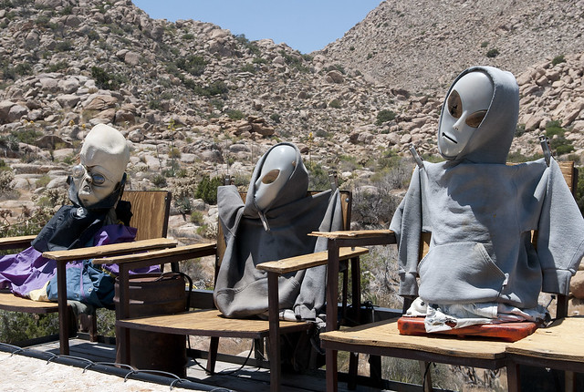
On your way to the tower, you can't but see some really eclectic Americana strategically placed by the road. Apparently the owner didn't appreciate alien paparazzo and marched out yelling at me. Decided it was time to head to Table Mountain.
In Ko Pah Aliens by tomteske, on Flickr

In Ko Pah Alien by tomteske, on Flickr
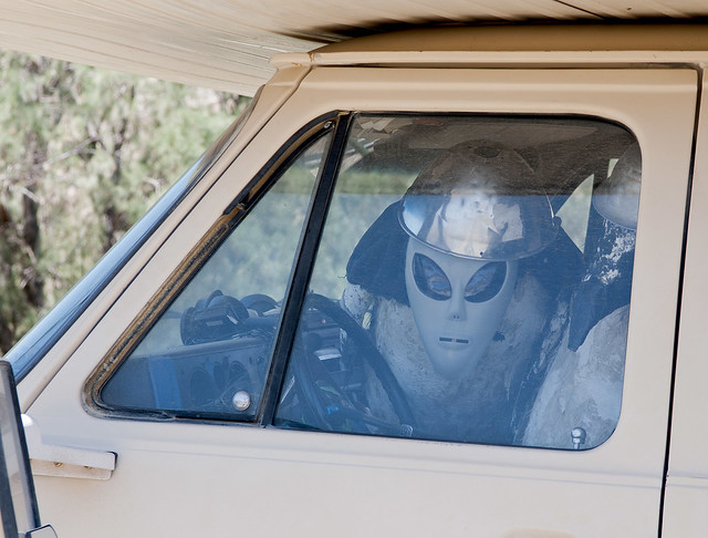
In Ko Pah Alien Camper by tomteske, on Flickr
Table Mountain is partly in ABDSP so this is still a legitimate post! According to Lawrence Hogue in "All The Wild and Lonely Places", Table Mountain was home to at least two Kumeyaay villages and is "one of the most abused places in the Anza-Borrego region." Used by cattle ranchers till the 1970's, it was the site of the infamous 1880 "Jacumba Massacre" when natives were confronted by ranchers about slaughtered cattle. Will McCain along with 4-19 nameless Kumeyaay were killed. This marked the end of Kumeyaay presence in the area. The area is now dotted with abandoned mines and a few houses.
The road to Table Mountain.
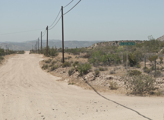
Mica Gem Mine Rd by tomteske, on Flickr
Cross under I-8 and you're on your way.

Mica Gem Mine Rd and I-8 by tomteske, on Flickr
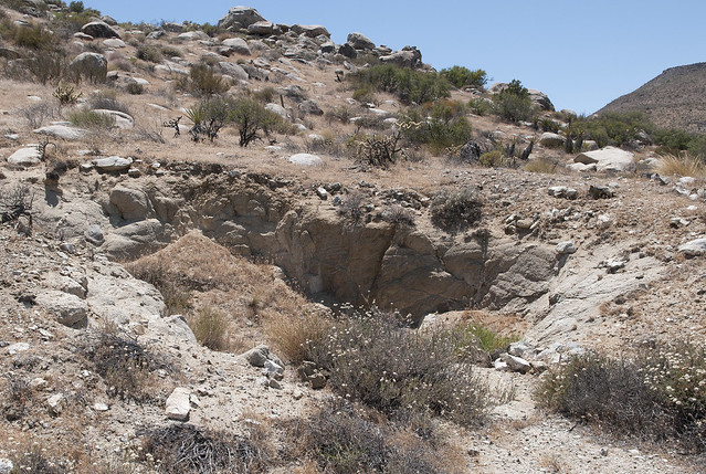
The Mica Gem Mine ruins. The shaft is filled in.
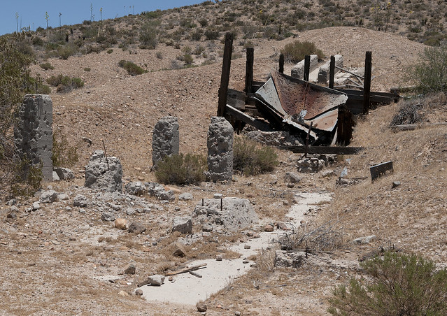
Mica Gem Mine2 by tomteske, on Flickr
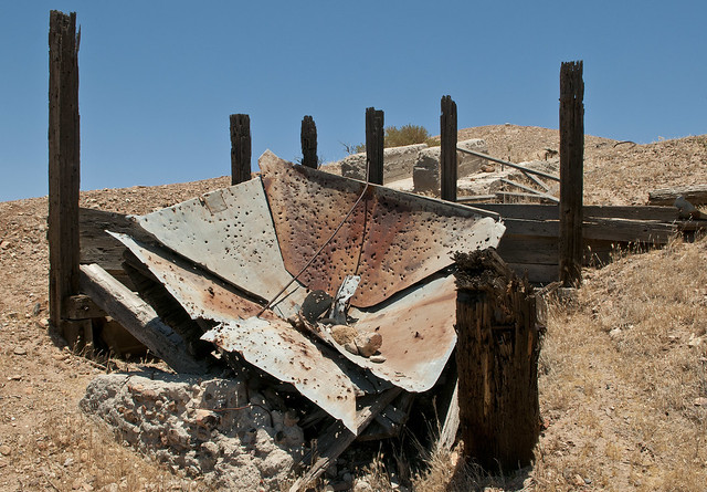
Mica Gem Mine by tomteske, on Flickr
Some of the dirt roads lead to private property. Spelling apparently is not a requirement for the outback.
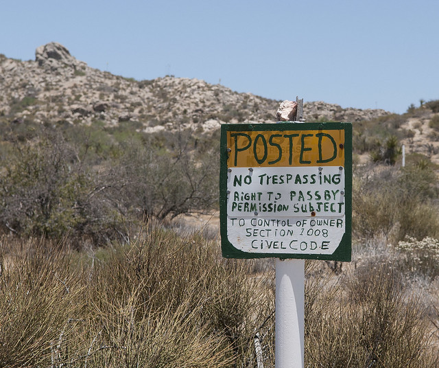
Civel Code by tomteske, on Flickr
The Little Randsburg Mine ruins. Only a few pieces of wood and an old barrel are nearby.
Little Randsburg Mine by tomteske, on Flickr
Wanted to head up the road to the top of Table Mountain and check out the Indian village sites but was stymied. With the temperature at 85 degrees and only an empty coke can in the truck, figured I'd walk up the road to scout out the area for a return trip.
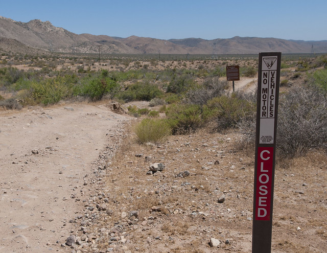
Closed by tomteske, on Flickr

Table Mt Sign by tomteske, on Flickr
A half mile or so up the road didn't reveal much more so called it quits for now. Although the road is "closed," looks like someone is up there with a big antenna on the back of their truck.

Table Mt Road by tomteske, on Flickr
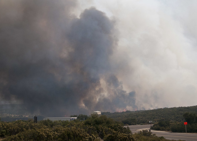
Here's a couple of unrelated pics on the drive home of the fire at Golden Acorn Casino which was threatening I-8 Sunday afternoon.
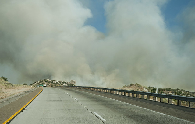
Golden Acorn Fire2 by tomteske, on Flickr
Golden Acorn Fire3 by tomteske, on Flickr

Golden Acorn Fire by tomteske, on Flickr
|