|
tommy750 Posts: 1086
3/25/2013
|
For some reason I became curious about Ancient Lake Cahuilla and made six trips in the last couple months looking for what still remains. There appears to be a lot! Started by heading out to West Mesa to check out the amazing beach clearly visible from Google Earth. Actually, you can pretty much trace the entire shoreline on Google with little difficulty.
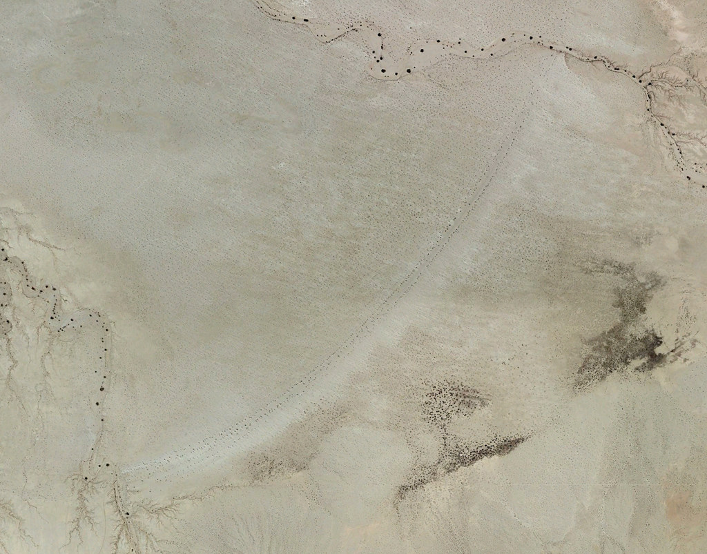
Beach by tomteske, on Flickr
Took the road North from Plaster City. Lots of signage starts to appear.
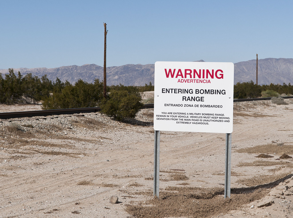
Bombing Range by tomteske, on Flickr
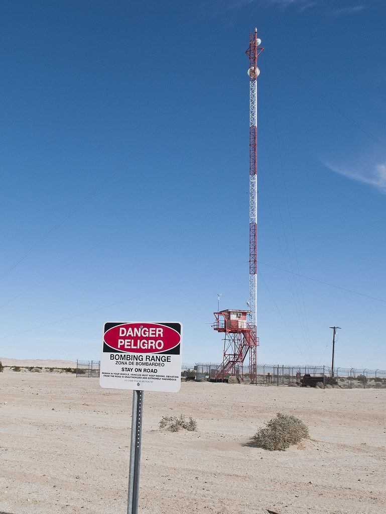
Spotting Tower by tomteske, on Flickr
A few miles in and on the right, a fenced area contains used practice munitions.
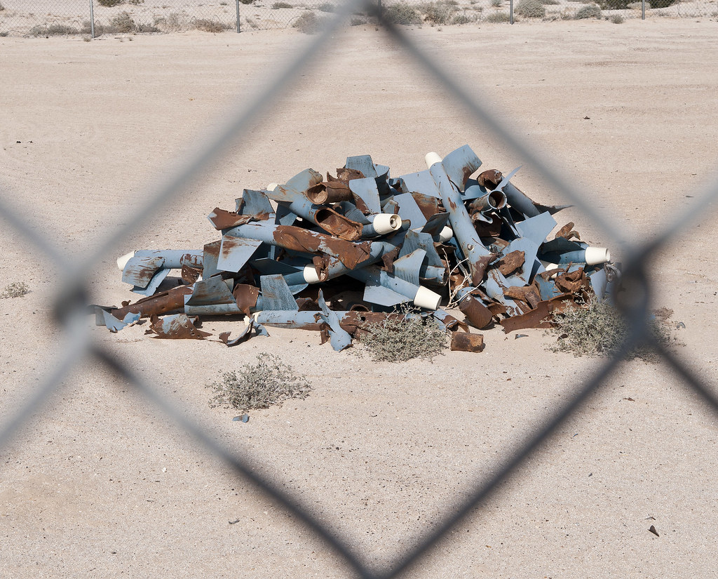
Practice Missiles by tomteske, on Flickr

Practice Bombs by tomteske, on Flickr
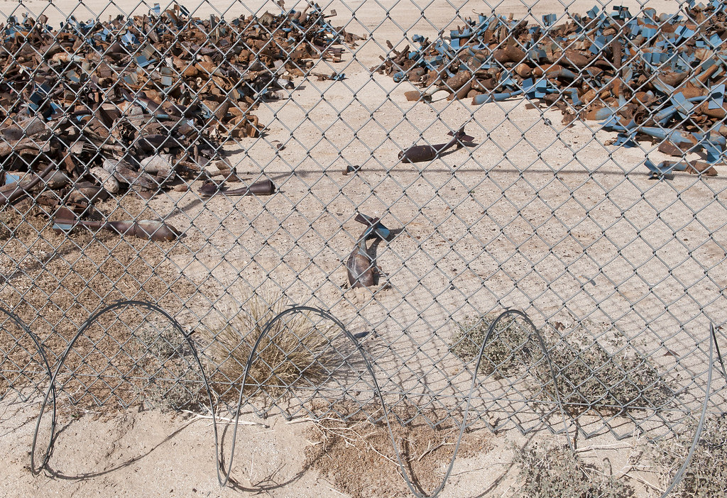
Practice Junk by tomteske, on Flickr
Off to the left, aerial target markers.
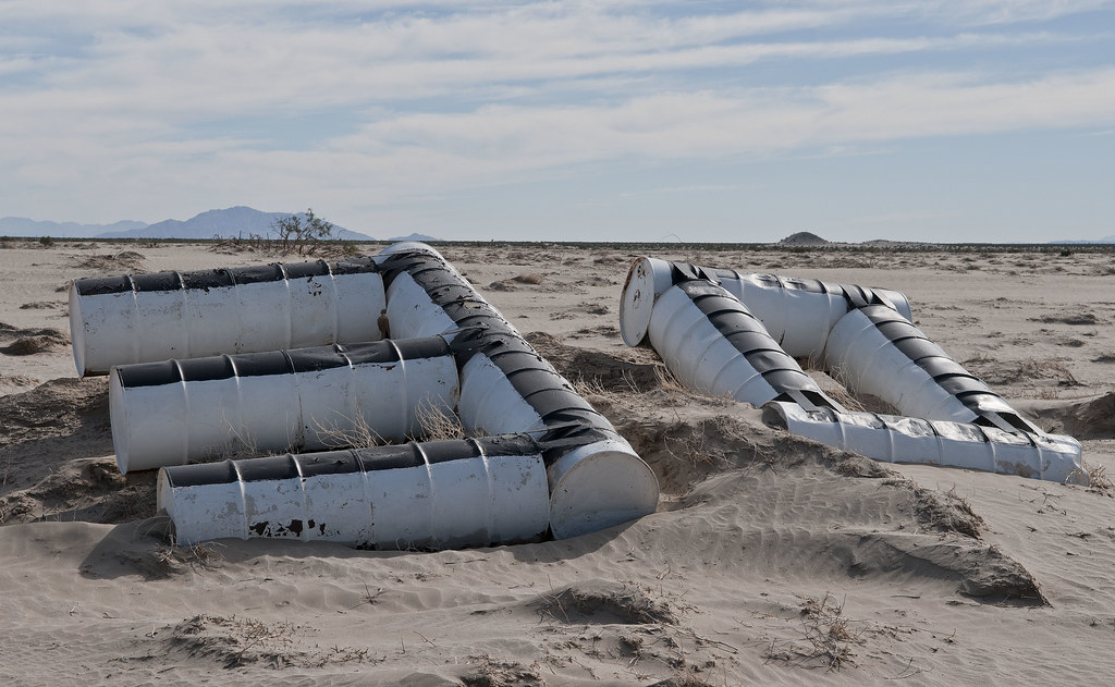
30 Range by tomteske, on Flickr
Nearing Fish Creek Mts. The beach is between these and Superstition Hills.
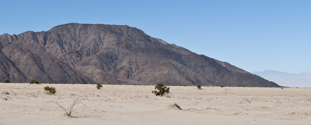
Fish Creek Mts by tomteske, on Flickr
Winding across mud flats and through a few arroyos, finally end up at the ancient beach. The maximum height of Ancient Lake Cahuilla was 42ft. Then it would overflow to the South and re-enter the Colorado River channel.
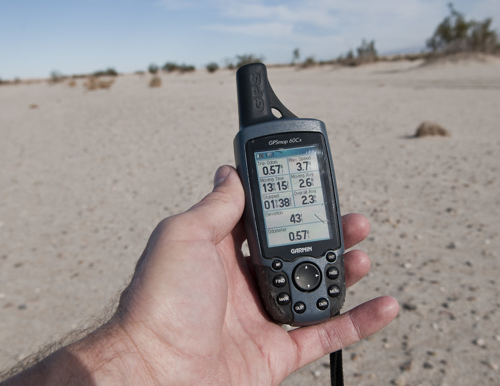
43 Feet by tomteske, on Flickr
Lots of the beach vegetation was in nice parallel rows easily visible from the satellite image. Not sure what this plant is but there were a lot of them on the sandy shore and they had a bonsai kind of appearance.
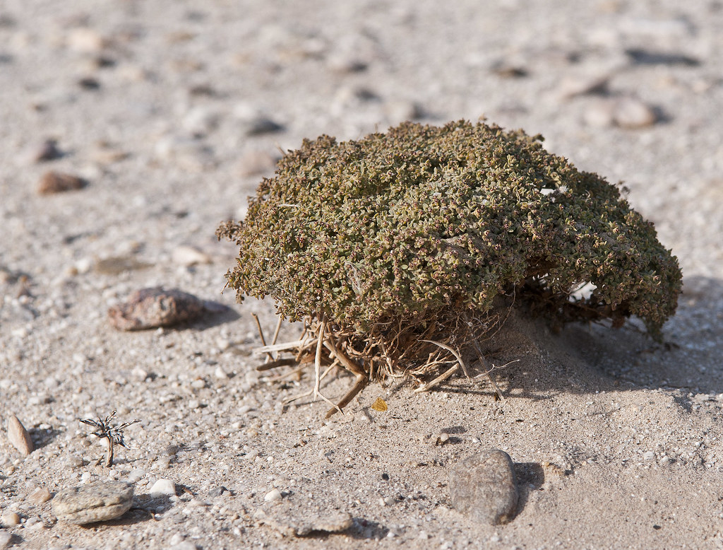
Beach Plant by tomteske, on Flickr
Walked the length of the beach and found lots of sherds on the sandy bluffs above the beach.
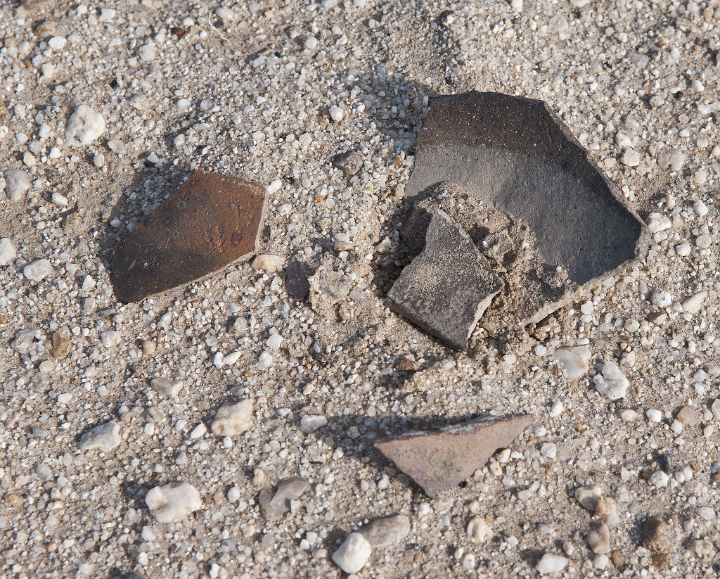
Beach Sherds by tomteske, on Flickr
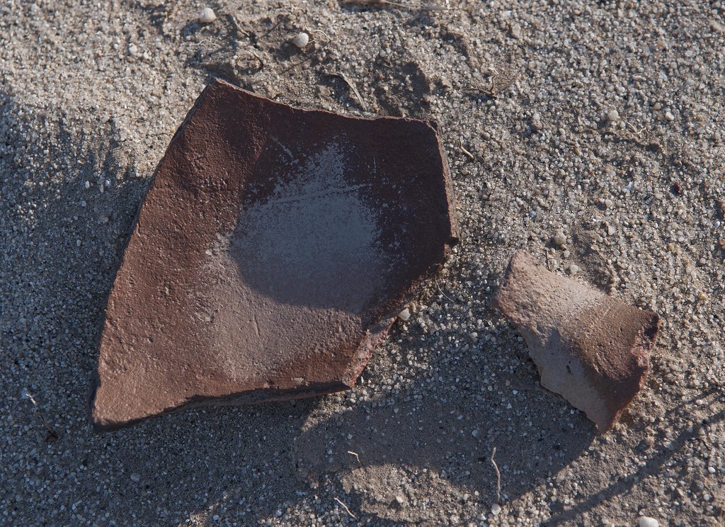
Beach Sherds2 by tomteske, on Flickr
At the far East end of the beach is a wash entering the lake with a nice exposed cross section of a fault.

Uplift by tomteske, on Flickr
Cut across the lake bed on the way back and found lots of shells.
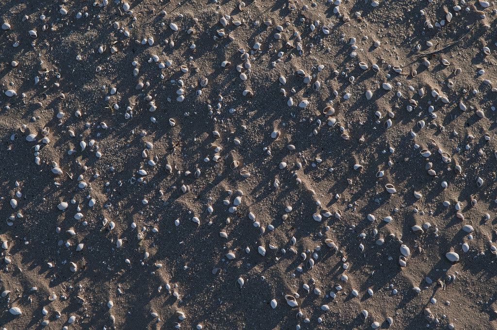
Cahuilla Shells by tomteske, on Flickr
Mandatory mylar photo.
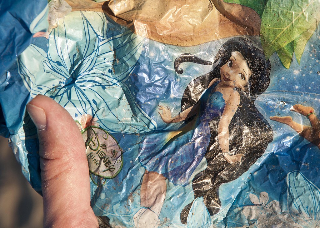
Disney Fairie by tomteske, on Flickr
View of the shoreline from inside the lake bed.
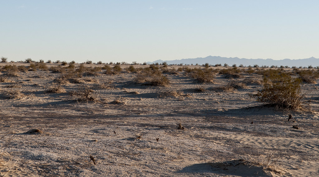
Beach View by tomteske, on Flickr
Time to head home. Toward Carrizo Wash from the beach. Will post more on other interesting parts of the lake. Enjoy. Tom
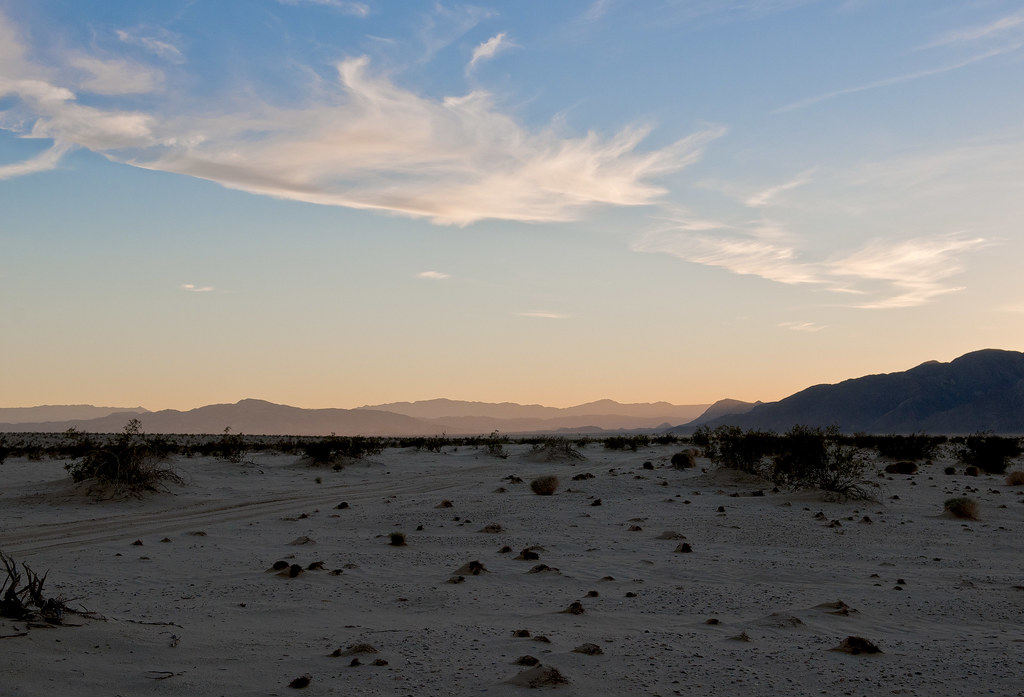
Toward Carrizo Creek by tomteske, on Flickr
|
|
|
link
|
|
herofix Posts: 30
3/26/2013
|
Fascinating! Thanks for posting, with all your excellent (as usual) pics and descriptions. That's an area waaaay beyond my range, so I'd never see it but for your report.
Dan
|
|
|
link
|
|
ziphius Posts: 911
3/26/2013
|
Very educational and beautiful Tom. I'd be interested in seeing a KML outline of the ancient lake boundary as viewed from GE. Or is it just portions / fragments that appear to be visible? - Jim
--
http://www.coyotelearning.org
|
|
|
link
|
|
tommy750 Posts: 1086
3/26/2013
|
Jim (ziphius) wrote:
Very educational and beautiful Tom. I'd be interested in seeing a KML outline of the ancient lake boundary as viewed from GE. Or is it just portions / fragments that appear to be visible? - Jim
You can actually follow almost all of shoreline on GE except for a few areas that have been graded or washed out. Always being at 42ft elevation helps when the outline isn't clear. The KML outline would be great. I just don't know how to do it Maybe you or someone else does? Maybe you or someone else does?
|
|
|
link
|
|
tommy750 Posts: 1086
3/26/2013
|
herofix wrote:
Fascinating! Thanks for posting, with all your excellent (as usual) pics and descriptions. That's an area waaaay beyond my range, so I'd never see it but for your report.
Dan
Thanks, Dan. What's your usual range? Tom
|
|
|
link
|
|
tommy750 Posts: 1086
3/26/2013
|
Jim (ziphius) wrote:
Very educational and beautiful Tom. I'd be interested in seeing a KML outline of the ancient lake boundary as viewed from GE. Or is it just portions / fragments that appear to be visible? - Jim
Ok, here's my novice attempt to show the lake level near the beach. The view is toward Fish Creek Mts. The edges get pretty rough if you zoom out too far. Tom
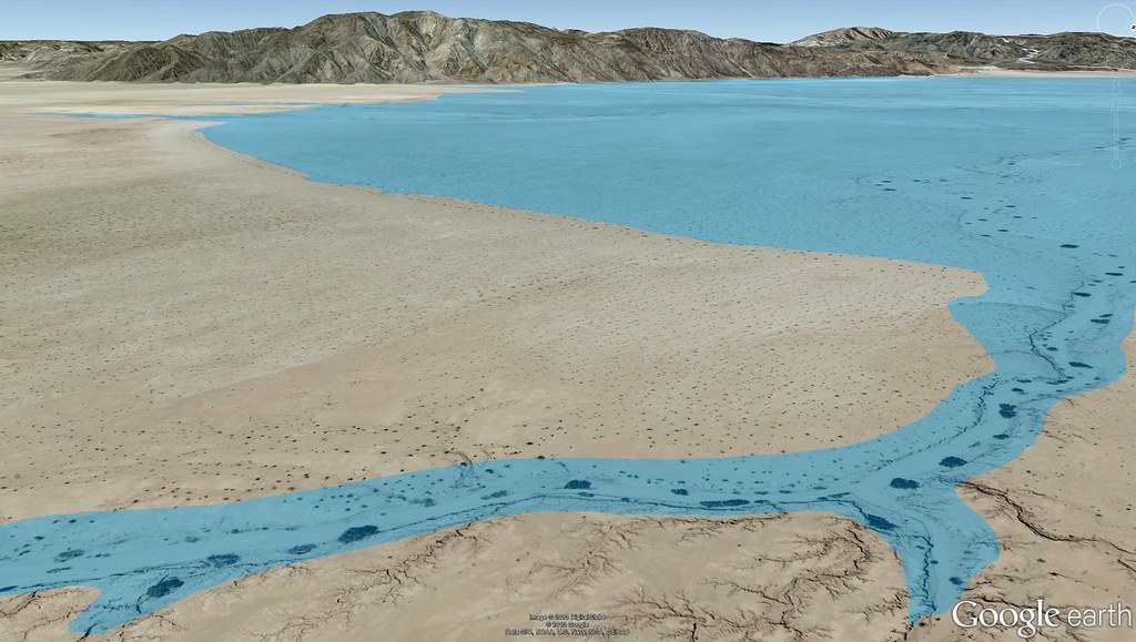
Cahuilla Beach by tomteske, on Flickr
edited by tommy750 on 3/26/2013
|
|
|
link
|
|
ziphius Posts: 911
3/27/2013
|
Awesome Tom, that's what I was interested in seeing!
--
http://www.coyotelearning.org
|
|
|
link
|
|
dsefcik Administrator Posts: 2634
3/27/2013
|
That's all very cool Tom...I like the sea shell photo. Thanks for sharing all that info!
--
http://www.sefcik.com
http://www.darensefcik.com
http://www.carrizogorge.com
|
|
|
link
|
|
waning moon Posts: 34
3/27/2013
|
Tom,
This is Fish Creek Beach and Dunes, "Ancient Beach Line" extensive long term Cahuilla village site, still hundreds of shards, chip and flake throughout the area. When I first started visiting, 1966 or 67, there were still metates and manos buried in the dunes, picked up a few beautiful wonderstone (rhyolite) and agate arrowheads mostly laying on the mud flats. I theorize bow fishing and waterfowl.
I do not know how far West you made it but it looks like your photos are just past the Gyp railroad trestles? where Fish Creek and Carizzo wash join?


|
|
|
link
|
|
anutami Posts: 491
3/28/2013
|
Tom, were you able to find the "bathtub" rings on any boulders on the ancient water line?
|
|
|
link
|
|
tommy750 Posts: 1086
3/28/2013
|
Nolan (anutami) wrote:
Tom, were you able to find the "bathtub" rings on any boulders on the ancient water line?
Wasn't around a rocky shoreline this particular trip, but here's a shot from Fish Creek Mts a couple miles West. Tom
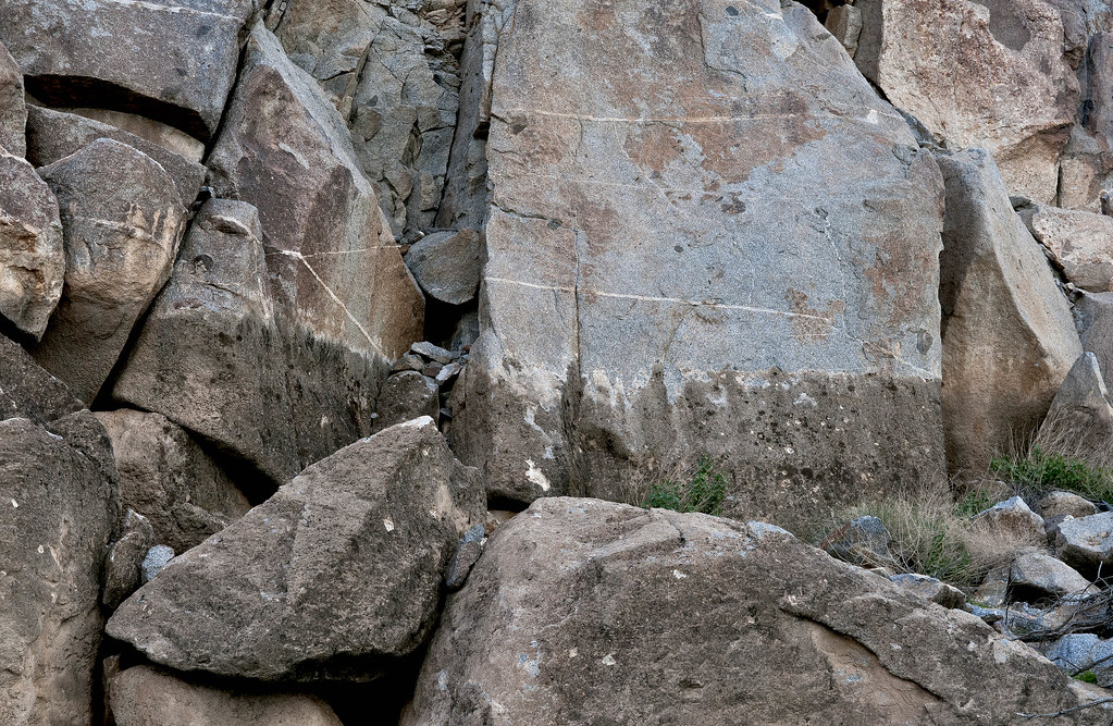
Tufa Line by tomteske, on Flickr
|
|
|
link
|
|
tommy750 Posts: 1086
3/29/2013
|
waning moon wrote:
Tom,
This is Fish Creek Beach and Dunes, "Ancient Beach Line" extensive long term Cahuilla village site, still hundreds of shards, chip and flake throughout the area. When I first started visiting, 1966 or 67, there were still metates and manos buried in the dunes, picked up a few beautiful wonderstone (rhyolite) and agate arrowheads mostly laying on the mud flats. I theorize bow fishing and waterfowl.
I do not know how far West you made it but it looks like your photos are just past the Gyp railroad trestles? where Fish Creek and Carizzo wash join?
Thanks for the pics. Haven't been that far North yet to see the village site. Definitely want to head up that way. When was the last time you were out there? Still look about the same?
The Cahuilla beach I walked on is between Fish Creek Mts. and Superstition Hills. Here's a screen shot from Google Earth. Tom
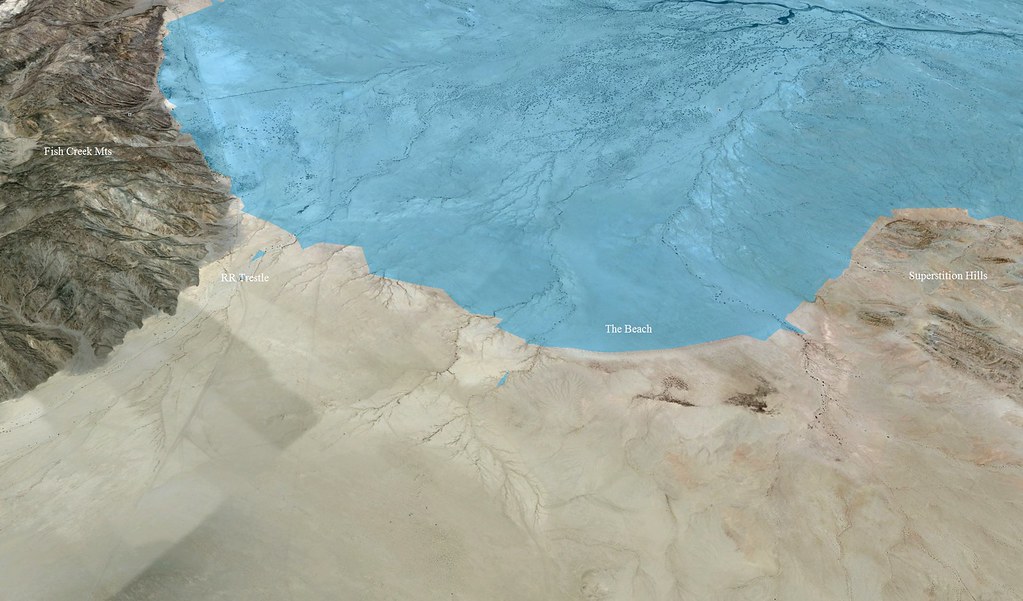
The Beach by tomteske, on Flickr
|
|
|
link
|
|
dsefcik Administrator Posts: 2634
3/29/2013
|
Thats all pretty cool...how about the fish traps, do you have any pics of those?
--
http://www.sefcik.com
http://www.darensefcik.com
http://www.carrizogorge.com
|
|
|
link
|
|
rockhopper Posts: 678
3/30/2013
|
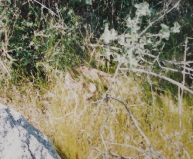
Here are the fish traps located on the old USGS topo maps taken a few years back.


We had just spent several days up in Martinez canyon and saw this hiking out. Sorry for the shaking camera. He was a mov'n!
edited by rockhopper on 3/30/2013
|
|
|
link
|
|
hikerdmb Posts: 423
3/30/2013
|
Very interesting area. Thanks for sharing all the info.
|
|
|
link
|
|
dsefcik Administrator Posts: 2634
3/31/2013
|
Interesting..they are much deeper than I thought..thanks..
rockhopper wrote:
Here are the fish traps located on the old USGS topo maps taken a few years back.
--
http://www.sefcik.com
http://www.darensefcik.com
http://www.carrizogorge.com
|
|
|
link
|
|
dsefcik Administrator Posts: 2634
3/31/2013
|
%3Cdiv%3EInteresting..they%20are%20much%20deeper%20than%20I%20thought..thanks..%3C/div%3E%3Cdiv%3E%3Cbr%3E%3C/div%3E%5Bquote%3Drockhopper%5DHere%20are%20the%20fish%20traps%20located%20on%20the%20old%20USGS%20topo%20maps%20taken%20a%20few%20years%20back.%20%3Cbr%3E%3Cimg%20src%3D%22http%3A//i67.photobucket.com/albums/h294/metalmeister/fishtraps20_zpsbfbfbe8b.jpg%22%3E%20%5B/quote%5D%3Cbr%3E%3Cbr%3E
--
http://www.sefcik.com
http://www.darensefcik.com
http://www.carrizogorge.com
|
|
|
link
|
|
waning moon Posts: 34
4/1/2013
|
Tom,
The photos are from a month or two ago, while I was out photographing wildflowers. The area has changed greatly since I first saw it, heavily used for offroad, drive right through the old camps, full on morons. The area is semi closed now, vehicle travel on established trails only, almost no one goes there anymore. I usually fill a 30 gal trash bag everytime I visit and could continue until I am dead and never make a dent. Sad
When I camped there we would be gone all day, to Carrizo Stage Station following the Overland Stage route on West to Palm Ssprings and back, or the Superstions, or shell beds NW of Plaster City
Well enough, rememberances, doubt you could make that run with Rangers in the Air now
tommy750 wrote:
waning moon wrote:
Tom,
This is Fish Creek Beach and Dunes, "Ancient Beach Line" extensive long terrm Cahuilla village site, still hundreds of shards, chip and flake throughout the area. When I first started visiting, 1966 or 67, there were still metates and manos buried in the dunes, picked up a few beautiful wonderstone (rhyolite) and agate arrowheads mostly laying on the mud flats. I theorize bow fishing and waterfowl.
I do not know how far West you made it but it looks like your photos are just past the Gyp railroad trestles? where Fish Creek and Carizzo wash join?
Thanks for the pics. Haven't been that far North yet to see the village site. Definitely want to head up that way. When was the last time you were out there? Still look about the same?
The Cahuilla beach I walked on is between Fish Creek Mts. and Superstition Hills. Here's a screen shot from Google Earth. Tom
The Beach by tomteske, on Flickr
|
|
|
link
|
|
tommy750 Posts: 1086
4/1/2013
|
waning moon wrote:
Tom,
The photos are from a month or two ago, while I was out photographing wildflowers. The area has changed greatly since I first saw it, heavily used for offroad, drive right through the old camps, full on morons. The area is semi closed now, vehicle travel on established trails only, almost no one goes there anymore. I usually fill a 30 gal trash bag everytime I visit and could continue until I am dead and never make a dent. Sad
When I camped there we would be gone all day, to Carrizo Stage Station following the Overland Stage route on West to Palm Ssprings and back, or the Superstions, or shell beds NW of Plaster City
Well enough, rememberances, doubt you could make that run with Rangers in the Air now
Thanks for the update. Agree, there's unfortunately a lot of trash around there. Tom
|
|
|
link
|
|
DesertWRX Posts: 135
4/5/2013
|
http://www.scahome.org/publications/proceedings/Proceedings.08Laylander.pdf
|
|
|
link
|
|
dsefcik Administrator Posts: 2634
4/5/2013
|
Interesting document...thanks for the info!
--
http://www.sefcik.com
http://www.darensefcik.com
http://www.carrizogorge.com
|
|
|
link
|
|
DesertWRX Posts: 135
4/5/2013
|

|
|
|
link
|
|
tommy750 Posts: 1086
4/6/2013
|
DesertWRX wrote:
http://www.scahome.org/publications/proceedings/Proceedings.08Laylander.pdf
I read that article. Laylander has a couple more worth reading on SSTB and its archaeological survey prior to its closing. Thanks. Tom
|
|
|
link
|