|
hikerdmb Posts: 423
11/26/2013
|
My friend and I did the Bradshaw Trail a couple of years ago. When we did the trail we pretty much went straight through, west to east. While on that trip we saw lots of roads joining the trail and vowed to go back and check some of them out. This was our first trip back to that area. On this trip we circumnavigated the Orocopia Mountains. It was a beautiful loop. We were in a Toyota Tacoma and it was just the right size for the Red Canyon Jeep Trail section of this trip. My Dodge would have made it but there were a few spots that would have been way more difficult in a full size rig. Even though the majority of the trip was outside ABDSP, we did spend the first night of this trip in the park, so I posted the TR in this section of the forum.
School was out at 2:23 on Friday and I was out of the parking lot by 2:30. Is that wrong? We were on the road by 3:30. Stopped in Borrego Springs for a burrito and then off to find a spot to camp. Palo Verde Wash was a bit wet so we headed down the Truckhaven Trail to find a spot to spend the night. When we got to our campsite it was still raining but not too much. There was little to no wind on Friday night and once the rain stopped it was a very pleasant night. Here is the view down to Clark Dry Lake in the morning. If you look closely you can see snow covered Toro Peak just above the clouds on the right side of the picture.

On Saturday morning we headed east to the Salton Sea and then around its north end to Mecca. We took the road through Box Canyon and made our way to Interstate 10. The clouds were beautiful as we made our way through the canyon.
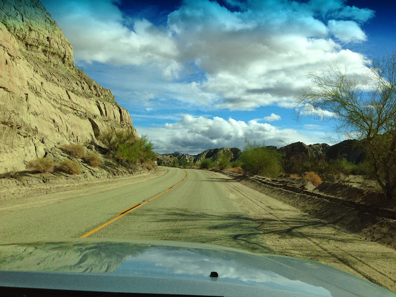
Once we reached I-10 we went a few miles to the east on the frontage road and then took off south on the Red Canyon Jeep Trail. We were headed toward the Bradshaw Trail. This was the first time I had been on this trail and the views were spectacular the entire length of the trail.

After a couple of hours and lots of stops to enjoy the scenery we finally got to the edge of Red Canyon. Here is a shot looking back up to the Orocopia Mountains from the rim of the canyon.

Here is a pic from the same spot, looking east to the Chuckwalla Mountains.

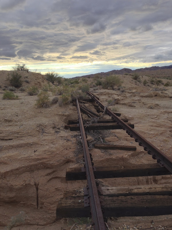
We found a nice place to camp at the junction of the Red Canyon Trail and the Bradshaw Trail. The Eagle Mountain Railroad goes right through here and we went over to check it out. There was a nice washout visible from our camp. The culvert that went under the tracks on the left was plugged with silt on the other side of the tracks. The water followed the path of least resistance and took out all the earth from under the tracks. Here is a shot of the tracks and then from on the tracks looking across the washout to the west.
A little bit west of our campsite was this incredible cliff. On the backside you could walk right up it. It is located on the northeast corner of the intersection of Red Canyon and Salt Creek Wash.

We enjoyed a nice sunset and another night with little to no wind.

Woke up Sunday morning to another beautiful day with no wind and warmer temps. My tent was totally wet from moisture in the air but it dried quickly.

After a slow morning around camp we headed west on the Bradshaw Trail and enjoyed great views to the south into the Chocolate Mountains. These mountains are closed because they are in the center of an aerial gunnery range. But they are very rugged and beautiful.

We saw a few smoke trees that were blooming and some nice green ocotillo but no blooms on them. Here is looking back to the north to the Orocopia Mountains.

As we neared the western end of the Bradshaw Trail we passed under the bridge for the Eagle Mountain Railroad. 
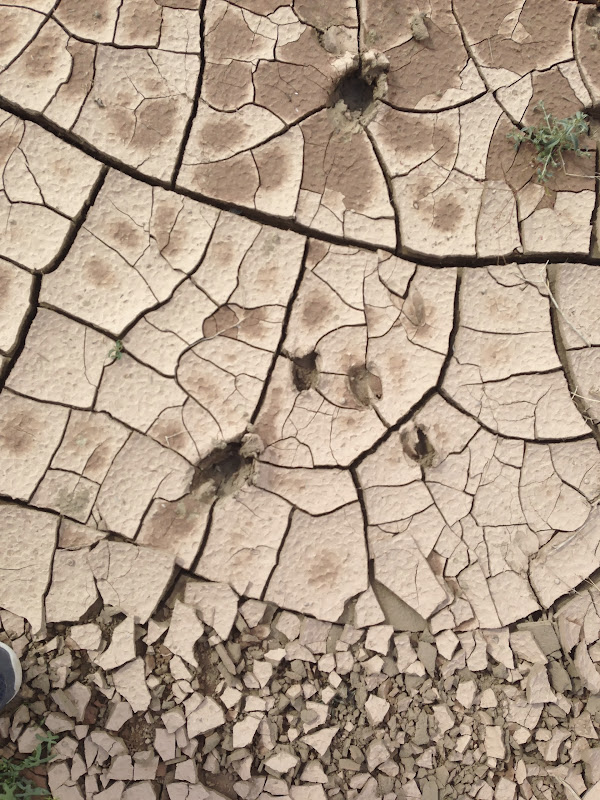
We stopped here for lunch and I took a little walk and found some nice bighorn tracks in the mud.
Once we went under the bridge, the Bradshaw Trail follows the Coachella Canal for about 10 miles back to highway 111.

Here is a picture of our route around the Orocopia Mountains. We went clockwise. The Red Canyon Jeep Trail is the section heading south from I-10 near Chiriaco Summit.
.
A great trip to start the Thanksgiving break.
|
|
|
link
|
|
surfponto Administrator Posts: 1369
11/26/2013
|
Wow that looks like a great trip.
I don't know if it is the write-up, the pictures or both, but now I want to go check out that area. 
Looks like there are a lot of great camping areas and some beautiful scenery.
Thanks for posting David,
Bob
--
https://www.anzaborrego.net/


|
|
|
link
|
|
rockhopper Posts: 678
11/26/2013
|
Looks like you all had a great trip! Did you stop at the Dos Palmas spring? I understand that was an important water stop
for hundreds (thousands) of years. I spent a lot of time in the Cuckwallas years back prospecting on my CR480 dirt bike motorcycle. Stoped by the famous mines, The Red Cloud mine, the Aztec mines and others. Corn springs, cabins etc.. I follwed the old miners foot paths that traversed through the mountians. Lots of mineralization, Copper, Gold, Silver but no reliable water source. Those old miners were tough! That area has been mined by the native americans for thousands of years( some figure) just like down in the Picacho mtns to the south. Also found a lot of military shells waaaay outside of the impact zone. yikes!! Found a lot of neat ore( hot rocks) pieces with my back pack metal detector I still have. Found a metorite too! That whole area is just amazing and little traveled out there up in the mountians. I also followed the Kaiser rail road. They hauled the iron ore down from Eagle mtn. to the rails along the Salton Sea and then on the the Kaiser steel mills in Fontana. Does anyone remember the old steel mills? The smog in Fontana back then was like China today.
Thanks for sharing the report and great pics.
BTW feel free to claim the entire desert south west in this fourm. 
|
|
|
link
|
|
dsefcik Administrator Posts: 2634
11/27/2013
|
Nice trip David...Orocopia has been on my list for awhile also...the cloudy skies make that whole area look best.
--
http://www.sefcik.com
http://www.darensefcik.com
http://www.carrizogorge.com
|
|
|
link
|
|
tommy750 Posts: 1086
11/27/2013
|
Very nice! Tried to do Bradshaw Rd couple years ago west to east but the road from 111 was closed. Wasn't sure what happened till read an article the nearby area was wired with explosives for seismic testing. Need to get out there. Really like the railroad track/sunset pic. Tom
|
|
|
link
|
|
ziphius Posts: 911
12/1/2013
|
Boy, that looks like a great area to explore! I like the tracks in the mud, wonder how many sheep are out in that area? Too bad the Chocolate Mtns. are off-limits, they will never get all the ordnance out of that area.... closed forever. 
edited by ziphius on 12/3/2013
--
http://www.coyotelearning.org
|
|
|
link
|
|
AdventureGraham Posts: 170
12/7/2013
|
Beautiful photos and great write up! I've been through the Bradshaw Trail myself once and would like to head back one day to explore all the side trails.
|
|
|
link
|