|
dsefcik Administrator Posts: 2634
9/6/2017
|
Copy/Pasted from my blog...took me two visits to find this one.
============================
The Island - PAH BM
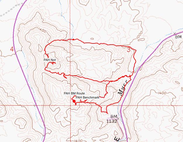
A couple of weeks ago when the temperatures in Ocotillo were hovering around 108 degrees Tom and I set out to try and find the PAH BM which lies on one of the final bumps of the north end of The Island....or so we thought. I was using a link from Peakbagger and CalTopo maps to locate the BM but they are not correct on those maps and Tom and I found out the hard and Hot way that afternoon.
We met up at Millers Garage and took the old highway until it turned into the sandy wash road wich would cross under 2 bridges until the road ended at our steep rocky climb up.


At a flat open sandy spot near the top Tom was looking for rock art while I was checking out the view


At the top of peak 1740 we looked around for the PAH BM for about an hour and finally conceded it wasn't there, we must be looking in the wrong place. We found some shade and rested a bit, my thermometer in the shade showed 107.6. While we were discussing where the BM could possibly be my radio caught a SURCOM dispatcher call in a downed motorcycle 5 miles east of Ocotillo Wells and then changed it to 5 miles east the Border Patrol, Tom says "that would make it in the Salton Sea"....well the rest of the dispatch was kinda funny
It was hot and we called it a day and headed back home empty handed except for the one mylar balloon we found, a Mothers Day left over.
With Tom's help I found the correct listing on the USGS site for the PAH BM and this last weekend I tried again to find it, in another 107 degree day.

I think I finally found a BM that the Monday Manics have not visited..!!


There are some great views of Ocotillo and the windfarm...and a Turkey Vulture flew into view and buzzed close enough I could take a photo with my phone


I decided to try a selfie of me blending in with the desert environment

Driving home I noticed it looked like they finally replaced the Old Highway Cafe sign in Ocotillo
--original sign

--New sign

Total Mylar Balloons for both trips - 2
--
edited by dsefcik on 9/6/2017
edited by dsefcik on 9/6/2017
--
http://www.sefcik.com
http://www.darensefcik.com
http://www.carrizogorge.com
|
|
|
link
|
|
surfponto Administrator Posts: 1369
9/7/2017
|
Yep 2010. Chargers missed the playoffs ;-)
I'm liking your Desert attire Daren,
Bob
--
https://www.anzaborrego.net/


|
|
|
link
|
|
Britain Posts: 611
9/7/2017
|
PAH, I havent been on the northern end but I also show 2 positions for this. One on the far North and the other near where the 2 sides of the freeway are closest. Which one ?
--
Cant drive 55
Britain
http://icorva.com
|
|
|
link
|
|
dsefcik Administrator Posts: 2634
9/7/2017
|
Britain wrote:
PAH, I havent been on the northern end but I also show 2 positions for this. One on the far North and the other near where the 2 sides of the freeway are closest. Which one ? It is the peak across from 1740, near the power line towers
--
http://www.sefcik.com
http://www.darensefcik.com
http://www.carrizogorge.com
|
|
|
link
|
|
Britain Posts: 611
9/7/2017
|
dsefcik wrote:
Britain wrote:
PAH, I havent been on the northern end but I also show 2 positions for this. One on the far North and the other near where the 2 sides of the freeway are closest. Which one ? It is the peak across from 1740, near the power line towers
OK got it. Doesn't look like any easy way up.
--
Cant drive 55
Britain
http://icorva.com
|
|
|
link
|
|
dsefcik Administrator Posts: 2634
9/7/2017
|
Britain wrote:
OK got it. Doesn't look like any easy way up.
Wasn't too bad actually...the route Tom and I took was worse
--
http://www.sefcik.com
http://www.darensefcik.com
http://www.carrizogorge.com
|
|
|
link
|
|
Britain Posts: 611
9/7/2017
|
Yes looks like the way I'll drive up to the end of what you can do on the side of 8 , The Calif Topo I use has the correct location . Its free. You can get it here. Loads on my Garmin fine and Base camp.
https://www.gpsfiledepot.com/
--
Cant drive 55
Britain
http://icorva.com
|
|
|
link
|
|
dsefcik Administrator Posts: 2634
9/7/2017
|
Britain wrote:
Yes looks like the way I'll drive up to the end of what you can do on the side of 8 , The Calif Topo I use has the correct location . Its free. You can get it here. Loads on my Garmin fine and Base camp.
https://www.gpsfiledepot.com/
Yeah, I have that map also but I sold my garmin awhile ago, may get another. Also used the Arizona map from there.
--
http://www.sefcik.com
http://www.darensefcik.com
http://www.carrizogorge.com
|
|
|
link
|
|
Britain Posts: 611
9/7/2017
|
What are you using now for the tracks and item locations?
--
Cant drive 55
Britain
http://icorva.com
|
|
|
link
|
|
dsefcik Administrator Posts: 2634
9/7/2017
|
AlpineQuest on my phone....I had a Garmin 680 and it would freeze or reboot several times on each trip, I had it replaced with a new one and same thing, different versions of firmware, same thing...so I sold it. May get another model though, phone batteries just don't last out in the field for days at a time.
--
http://www.sefcik.com
http://www.darensefcik.com
http://www.carrizogorge.com
|
|
|
link
|
|
Britain Posts: 611
9/7/2017
|
My first was a Garmin 60csx , bright screen battery life good. Busted the screen climbing in the rocks then lost it on the eastern mesa of table mountain. No freeze ups worked great. I now have the Garmen Oregon 500. Screen brightness sucks rocks but can be read. Have 4 maps loaded, Baja, Italy , California and the stock map. No freeze ups, battery life soso depends on how many times I pull up the screen. Will last 16 hrs. Always carry spare batts. Can load satellite image overlays but only through Garmen. I use it more for tracks, trip meter and marking items. I'll use the compass with way points (added before) for getting to and from in rough stuff. Has funky camera never use it.
--
Cant drive 55
Britain
http://icorva.com
|
|
|
link
|
|
tommy750 Posts: 1086
9/7/2017
|
Was kinda warm that day but the desert is a four season adventure! Here's a few more pics:
Already about 100 degrees
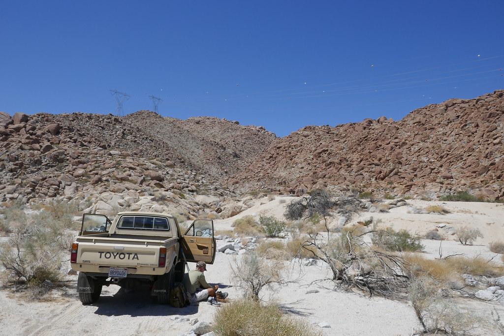 P1030206 by tomteske, on Flickr P1030206 by tomteske, on Flickr
Here's the "rock art" I was admiring in that large boulder:
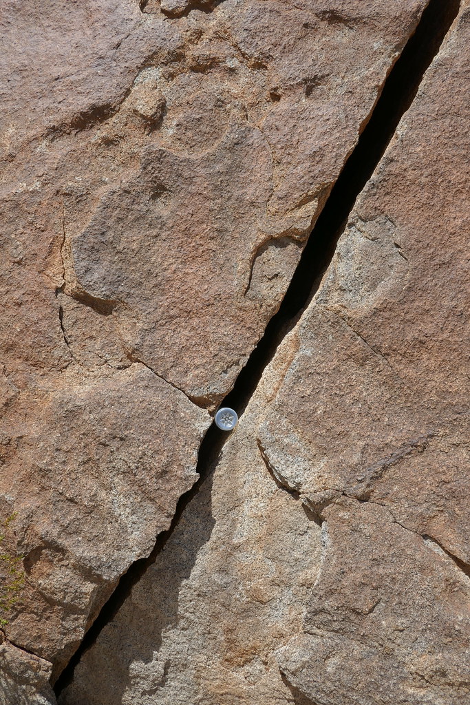 P1030214 by tomteske, on Flickr P1030214 by tomteske, on Flickr
The turbine view about halfway up to BM Not PAH
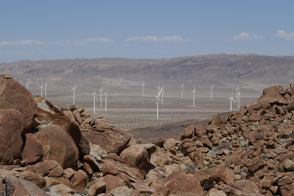 P1030208 by tomteske, on Flickr P1030208 by tomteske, on Flickr
Daren admiring the view
 P1030210 by tomteske, on Flickr P1030210 by tomteske, on Flickr
 P1030213 by tomteske, on Flickr P1030213 by tomteske, on Flickr
The Island's named BMs are DEVIL, INKO, PAH (those easy ones Daren did) and then the really tough ones, SPRING and LOAF. Bagged SPRING with a brutal 15ft RT 1ft G/L death march. LOAF is a few feet from the #1 westbound lane of I-8. Was blocked from LOAF by the wife who forbade me from dashing across both lanes last Friday night because of the holiday Zonie invasion that made crossing riskier than a Widlebeest fording the Mara River during a Serengeti migration 
 IMG_3902 by tomteske, on Flickr IMG_3902 by tomteske, on Flickr
 BM Spring by tomteske, on Flickr BM Spring by tomteske, on Flickr
|
|
|
link
|
|
dsefcik Administrator Posts: 2634
9/8/2017
|
Britain wrote:
My first was a Garmin 60csx , bright screen battery life good. Busted the screen climbing in the rocks then lost it on the eastern mesa of table mountain. No freeze ups worked great. I now have the Garmen Oregon 500.
I wonder how many 60csx units are buried out in the wilderness....I lost one out in a canyon in Canebrake, another hiking buddy lost one coming down from 6582. I had the Oregon before the Montana and it worked great, I gave it to Gary. Was looking at the watch ones but again battery life is dismal.
--
http://www.sefcik.com
http://www.darensefcik.com
http://www.carrizogorge.com
|
|
|
link
|
|
dsefcik Administrator Posts: 2634
9/8/2017
|
tommy750 wrote:
The Island's named BMs are DEVIL, INKO, PAH (those easy ones Daren did) and then the really tough ones, SPRING and LOAF. Bagged SPRING with a brutal 15ft RT 1ft G/L death march. LOAF is a few feet from the #1 westbound lane of I-8. Was blocked from LOAF by the wife who forbade me from dashing across both lanes last Friday night because of the holiday Zonie invasion that made crossing riskier than a Widlebeest fording the Mara River during a Serengeti migration 
yep...still a few more BM's to go find.....
--
http://www.sefcik.com
http://www.darensefcik.com
http://www.carrizogorge.com
|
|
|
link
|
|
rockhopper Posts: 678
9/8/2017
|
Those surveyors back in 1958 probably found a few artifacts hiking all over the back country back then. Those guys were tough! So are you guys. Hiking in 108 degree temps! Whew. Thanks for sharing.
|
|
|
link
|
|
ziphius Posts: 911
9/8/2017
|
Looks like a fun trip guys. Too bad about the inaccurate locations on topos. Yep, the NOAA data explorer is a good tool to find these things. Go NOAA !
--
http://www.coyotelearning.org
|
|
|
link
|
|
Britain Posts: 611
9/8/2017
|
So what was that stuck in the rock crack? Looks like a bullet casing.
--
Cant drive 55
Britain
http://icorva.com
|
|
|
link
|
|
tommy750 Posts: 1086
9/8/2017
|
Britain wrote:
So what was that stuck in the rock crack? Looks like a bullet casing.
Someone shoved a water bottle in the crack.
|
|
|
link
|
|
Britain Posts: 611
9/8/2017
|
tommy750 wrote:
Britain wrote:
So what was that stuck in the rock crack? Looks like a bullet casing.
Someone shoved a water bottle in the crack.
Haha crack is bigger then it appears! .
--
Cant drive 55
Britain
http://icorva.com
|
|
|
link
|
|
Britain Posts: 611
9/9/2017
|
Who names these things. Spring? Was there a Spring there? I may hopp across the freeway to look at LOAF on the way out Sunday.
--
Cant drive 55
Britain
http://icorva.com
|
|
|
link
|
|
Britain Posts: 611
9/9/2017
|
Prob short for Mountainsprings.
--
Cant drive 55
Britain
http://icorva.com
|
|
|
link
|
|
dsefcik Administrator Posts: 2634
9/9/2017
|
And LOAF maybe from Sugarloaf nearby?
--
http://www.sefcik.com
http://www.darensefcik.com
http://www.carrizogorge.com
|
|
|
link
|
|
Britain Posts: 611
9/9/2017
|
Seen where you went up today to POH. Bee line!. LOAF yup Sugarloaf.
--
Cant drive 55
Britain
http://icorva.com
|
|
|
link
|
|
tommy750 Posts: 1086
9/9/2017
|
Britain wrote:
Who names these things. Spring? Was there a Spring there? I may hopp across the freeway to look at LOAF on the way out Sunday.
Well, here it is. Or isn't. Looks like BM LOAF got replaced with a generic disk. Too bad.
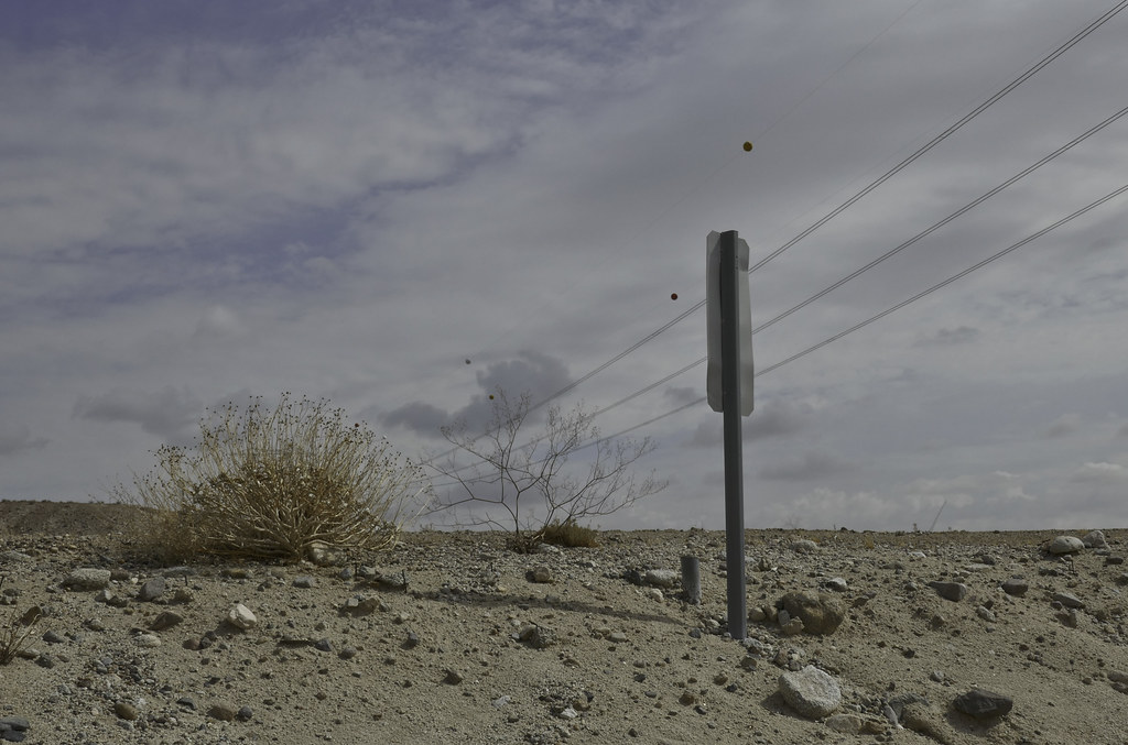 BM LOAF by tomteske, on Flickr BM LOAF by tomteske, on Flickr
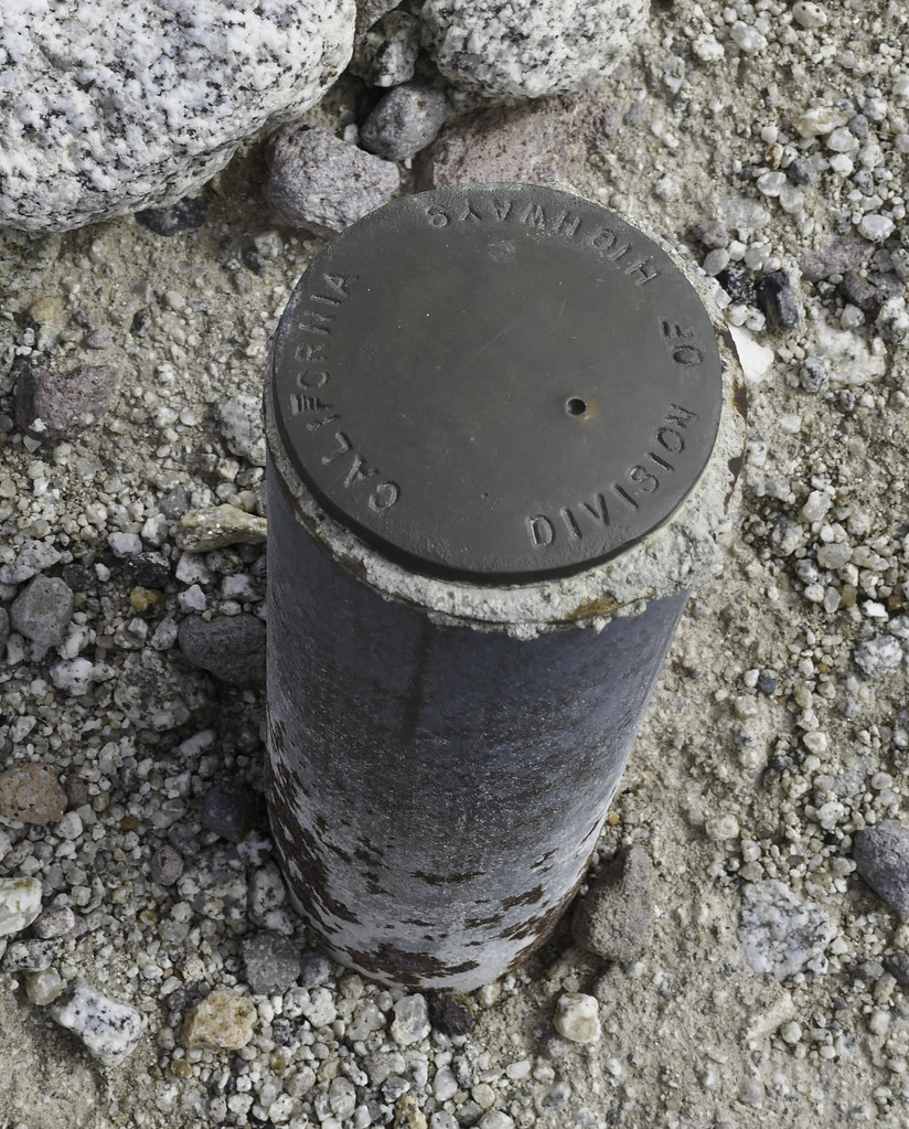 Missing LOAF by tomteske, on Flickr Missing LOAF by tomteske, on Flickr
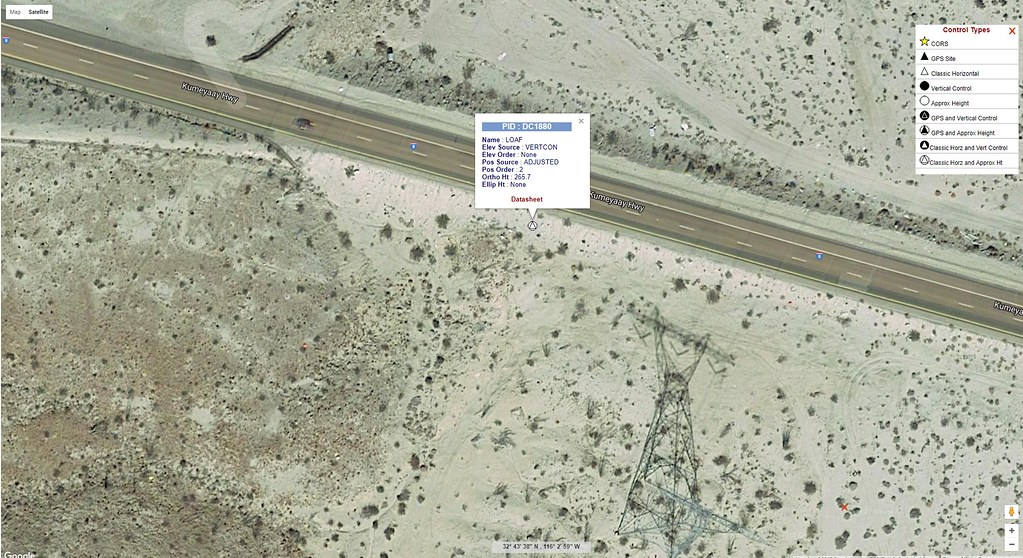 LOAF Local by tomteske, on Flickr LOAF Local by tomteske, on Flickr
|
|
|
link
|
|
Britain Posts: 611
9/9/2017
|
Guess I wont run across the freeway after all.
--
Cant drive 55
Britain
http://icorva.com
|
|
|
link
|
|
Britain Posts: 611
9/10/2017
|
Well I bagged that tough Spring BM today. Heck of a hike! 
--
Cant drive 55
Britain
http://icorva.com
|
|
|
link
|
|
tekewin Posts: 386
9/10/2017
|
This was an awesome report and PAH is going on my list! Way to stick with the research.
Darren, if you wouldn't mind, could you email Terry Flood through Peakbagger with the correct coordinates of PAH so he can fix the entry? He was the one who added it to the Peakbagger and I'm sure he would be happy to fix it. That's probably faster than contacting Greg Slayden who runs Peakbagger. I (and a lot of people) rely on accurate data there and you could save someone else the wild goose chase.
|
|
|
link
|