|
Britain Posts: 612
12/4/2019
|
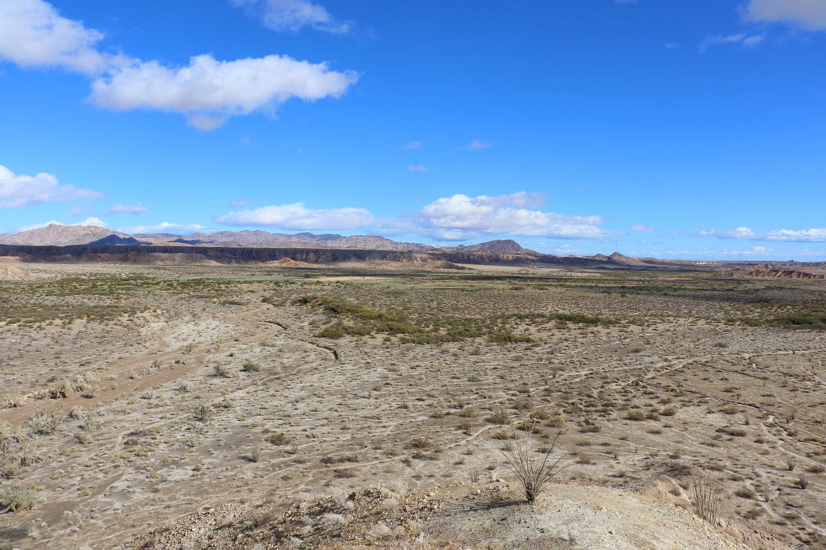
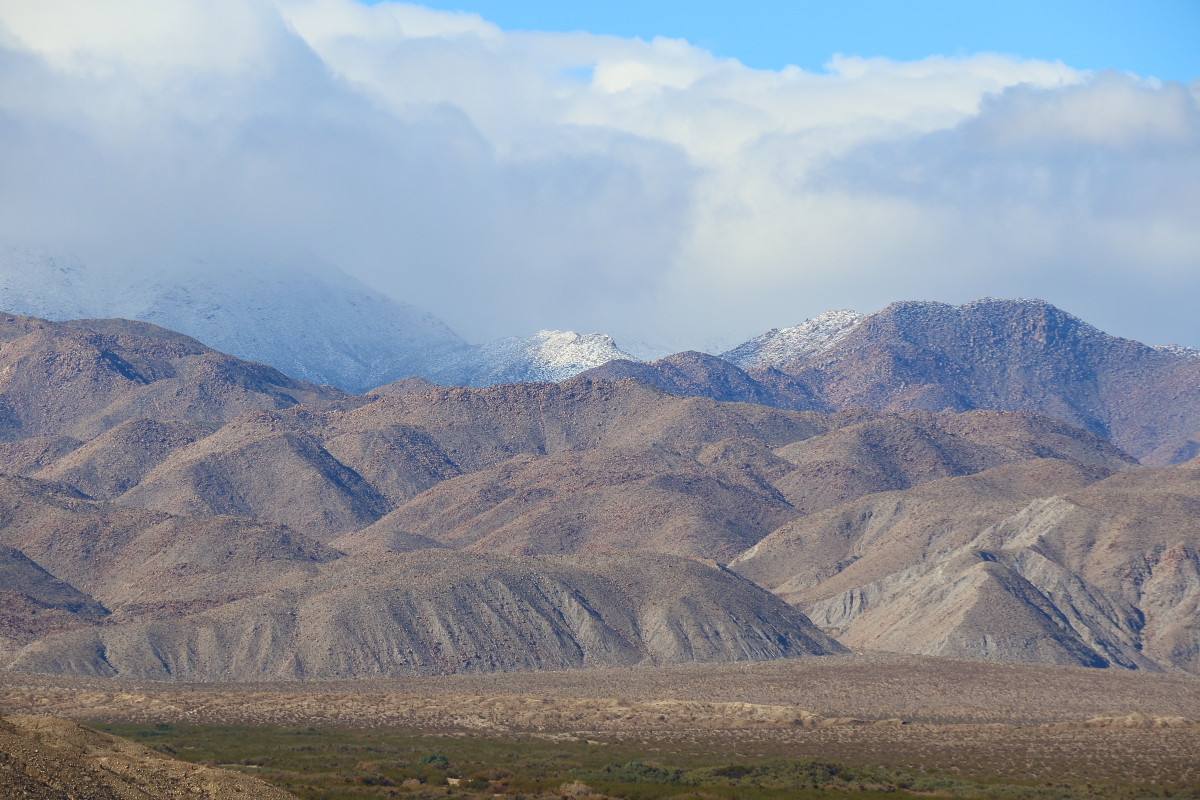
Day after Thanksgiving wife and I went out to the creek. My goal was to follow the ridgeline on the south side then drop down head across to the stage station ruins and then up the hill just north where the square ground item is. Probably wasn't a great idea to do this after a winter storm. But fun nevertheless.
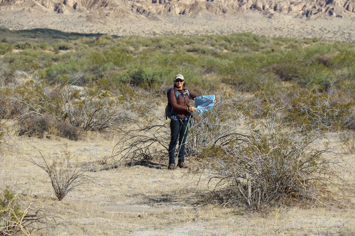
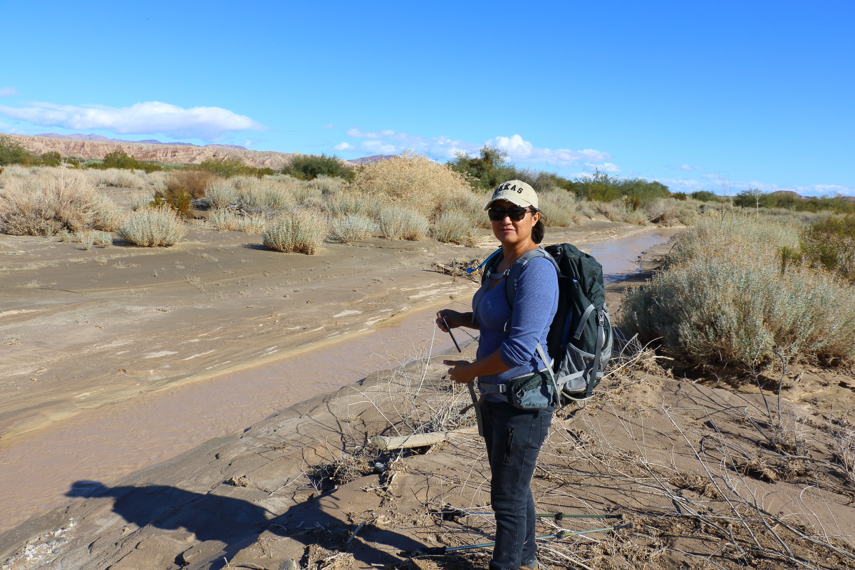
Wife getting the first of 6 mylars. We probably could have ended up with around 12 of them.
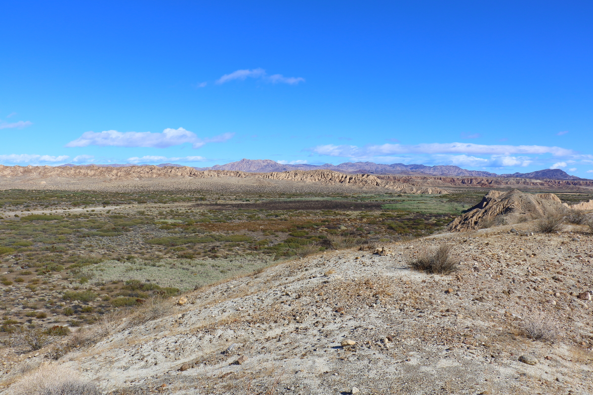
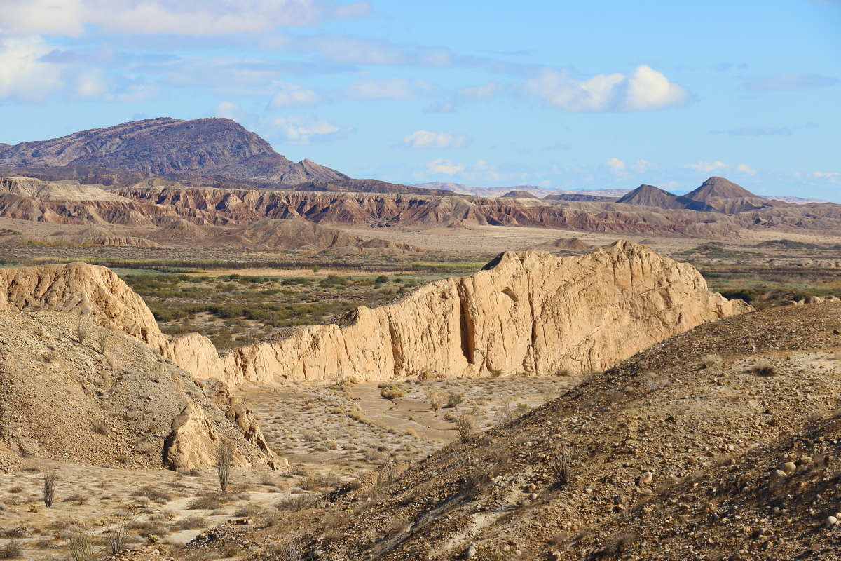
Some pictures of the creek area from the ridgeline.
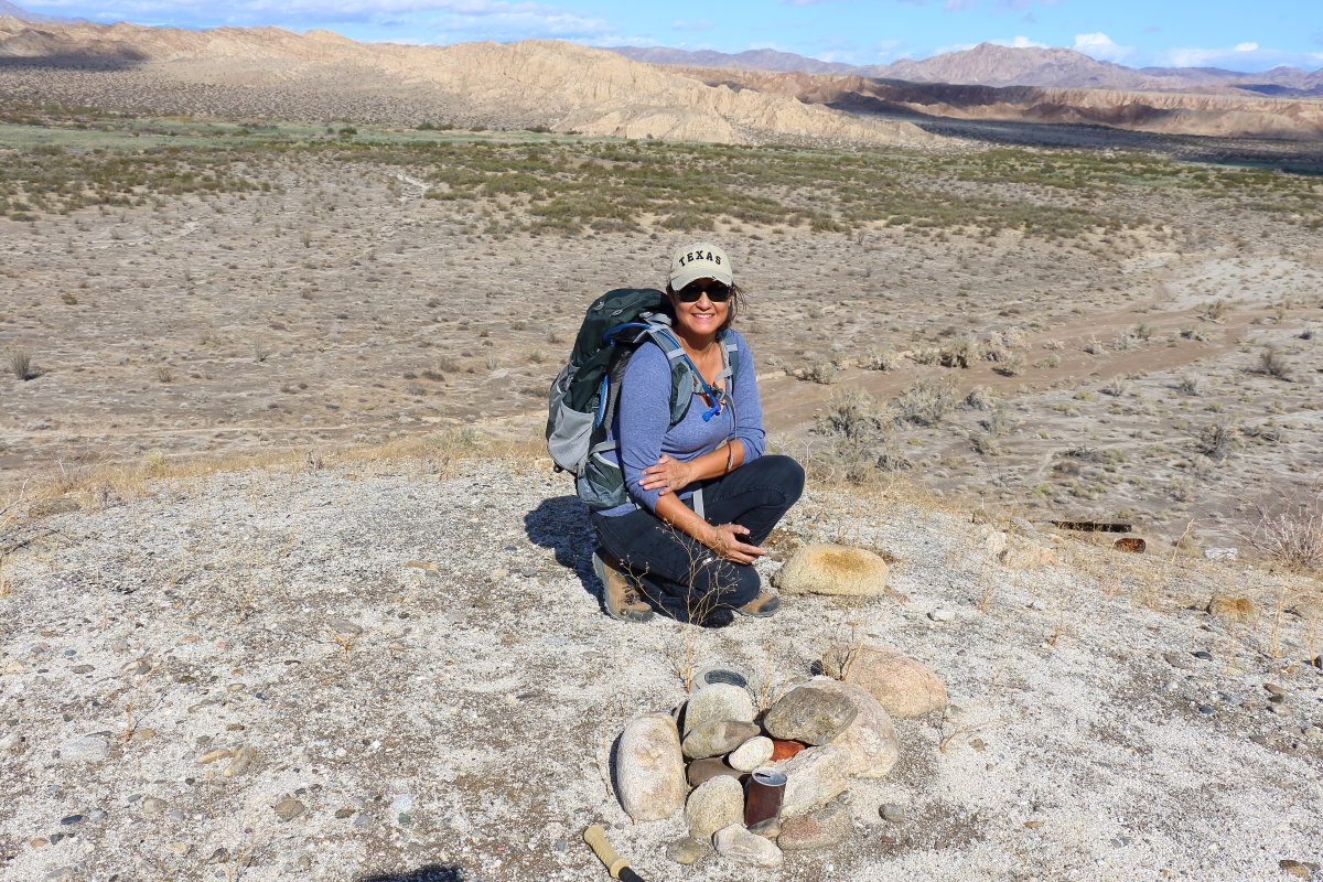
Wife never gives up a Geo Marker. So as we passed Leckie she had to go up and get it.
We will go a bit east then cross over the station. Well, that was the plan. About 3/4 of a mile we hit the wash area a 6 foot drop into a mess of
Tamarisk. I didnt have any cutting tools so we headed east a bit and gave up crossing.
Turned around and west along the creek until we found an area to cross. Some of the tamarisk came back with revenge and some didn't. But we found the raging carrizo creek at flood stage. Crossed it found the jeep trail. Late in the day so we headed back to the jeep we parked in canyon sin nombre. The jeep trail soon was underwater. Most of the mud was about 2 inches deep some much deeper. Both sides of the trail clogged with either tamarisk or catsclaw. We crossed back over the jeep trail headed south. Found a loan pair of boot tracks headed east. Ended up at the corner of the ridge just north of Leckie and proceded west along the bottom of it. That was clogged in areas now with catsclaw so at time we were back in the swampbog.
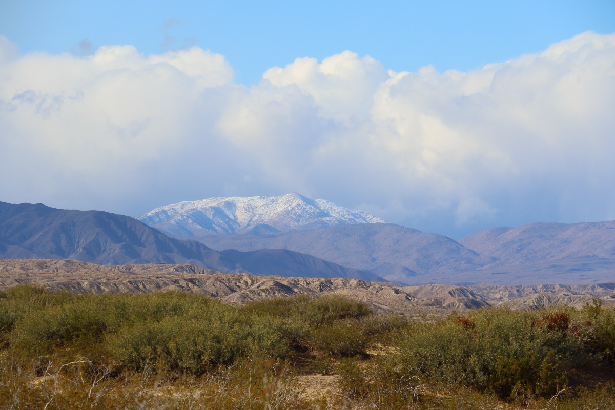
On the way out snapped a picture of Granite off in the distance. It was a fun hike. Got in over 6 miles and the mended ankle did well. Ready for more.
--
Cant drive 55
Britain
http://icorva.com
|
|
|
+2
link
|
|
rockhopper Posts: 678
12/4/2019
|
Glad you getting out there and your ankle is getting stronger. Looking at those photos ,I am imaging the thousands and thousands of travelers which for thousands of years took that same route from the Colorado river toward the coast and points beyond. More recently ( past 400 years or so ) Settlers, immigrants and dreamers followed the same trails from Fort Yuma toward San Francisco and other destinations to the North, South and West. Great Granite peak photo too!
edited by rockhopper on 12/4/2019
|
|
|
link
|
|
Britain Posts: 612
12/4/2019
|
rockhopper wrote:
Glad you getting out there and your ankle is getting stronger. Looking at those photos ,I am imaging the thousands and thousands of travelers which for thousands of years took that same route from the Colorado river toward the coast and points beyond. More recently ( past 400 years or so ) Settlers, immigrants and dreamers followed the same trails from Fort Yuma toward San Francisco and other destinations to the North, South and West. Great Granite peak photo too!
edited by rockhopper on 12/4/2019
Someone told me near the station theres a grave of Frank Fox. Need to read up on him. Had 25 lbs in the pack felt good. Yes its good to get out!
--
Cant drive 55
Britain
http://icorva.com
|
|
|
link
|
|
Rocko1 Posts: 622
12/4/2019
|
Great pictures. Granite looks fantastic with snow!
|
|
|
link
|
|
Britain Posts: 612
12/4/2019
|
Rocko1 wrote:
Great pictures. Granite looks fantastic with snow!
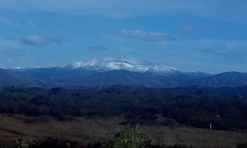
Seemed like everything had snow on it.
Whale Peak
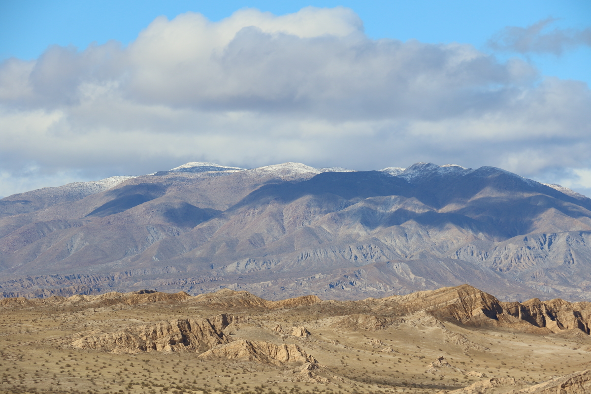
Looking over at the entrance to Indian Gorge
--
Cant drive 55
Britain
http://icorva.com
|
|
|
+1
link
|
|
Rocko1 Posts: 622
12/4/2019
|
Britain wrote:
Rocko1 wrote:
Great pictures. Granite looks fantastic with snow!
Seemed like everything had snow on it.
Whale Peak
Looking over at the entrance to Indian Gorge
Those are great too. What a storm that was.
|
|
|
link
|
|
deborah Posts: 115
12/4/2019
|
Great pictures! It sounds like it took some work to get around the mud and vegetation in places. On the ridge it looks nice and open. Thanks for sharing.
|
|
|
link
|
|
Britain Posts: 612
12/5/2019
|
deborah wrote:
Great pictures! It sounds like it took some work to get around the mud and vegetation in places. On the ridge it looks nice and open. Thanks for sharing.
Well, there was an opening on the west side I'm sure if time allowed Id find one on the east side. Its a low impact hiking area so I plan a couple more trips through the area. The daughter wants to take up hiking so it will be a good start for her.
--
Cant drive 55
Britain
http://icorva.com
|
|
|
link
|
|
Rocko1 Posts: 622
12/5/2019
|
What camera/lens did you use?
|
|
|
link
|
|
Britain Posts: 612
12/6/2019
|
Rocko1 wrote:
What camera/lens did you use?
Haha I pack an assorted of lenses. The camera is a Canon 7D2. I have a quick release system mounted on the pack shoulder strap so I can get to it quickly and it keeps it from dangling. The lenses I use are 18-135mm 10-18mm,, 100mm macro and 100-400mm.. Most of these were with the 18-135mm. Weight of the lenses comes in at about 10lbs.
--
Cant drive 55
Britain
http://icorva.com
|
|
|
link
|
|
tommy750 Posts: 1086
12/6/2019
|
Nice trip Britain. Was out there five years ago (how time flies) in the midst of the tamarisk abatement ( http://www.anzaborrego.net/AnzaBorrego/Forum/topic948-carrizo-badlands.aspx ). Looks like Leckie gained a few rocks and a soda can since I was there. So how much water did you see in Carrizo at "flood stage?"
|
|
|
link
|
|
Britain Posts: 612
12/7/2019
|
tommy750 wrote:
Nice trip Britain. Was out there five years ago (how time flies) in the midst of the tamarisk abatement ( http://www.anzaborrego.net/AnzaBorrego/Forum/topic948-carrizo-badlands.aspx ). Looks like Leckie gained a few rocks and a soda can since I was there. So how much water did you see in Carrizo at "flood stage?"
I remember your trip I think Thanksgiving? If we got an earlier start I would have found a place east to cross. I would guess how deep the flood stage would be how washed out it was in that area. Mud was only about 2 inches deep though some area per trek pole was much deeper. Ill go back later but with an earlier start.
--
Cant drive 55
Britain
http://icorva.com
|
|
|
link
|
|
Britain Posts: 612
12/7/2019
|
tommy750 wrote:
Nice trip Britain. Was out there five years ago (how time flies) in the midst of the tamarisk abatement ( http://www.anzaborrego.net/AnzaBorrego/Forum/topic948-carrizo-badlands.aspx ). Looks like Leckie gained a few rocks and a soda can since I was there. So how much water did you see in Carrizo at "flood stage?"
On another note, I notice your Leckie marker was above ground ours was at ground level.
--
Cant drive 55
Britain
http://icorva.com
|
|
|
link
|
|
dsefcik Administrator Posts: 2634
12/8/2019
|
Very nice photos...! yes, snow everywhere...Gary and I were out in Pine Valley area, looking towards Cuyamaca
--
http://www.sefcik.com
http://www.darensefcik.com
http://www.carrizogorge.com
|
|
|
link
|