|
tommy750 Posts: 1086
2/17/2021
|
Daren and Gary recently floated the idea of a 3-4 day trip to the crest of the Santa Rosas searching for the lost "Cave of The Seven Ollas," yet another magnificent tale, er, historical reality based on multiple anecdotal accounts. Using snow as a water source, a new area of interest would be searched and hopefully the mysterious cave relocated. In order to accommodate Randy and myself, the trip was delayed one relatively warm week with live satellite images showing a rapidly shrinking snow cover. As a warm up hike, Daren, his Marine buddy Yokes and I headed out to Canebrake for the weekend and descended the now literally Pepperwood Hiking and Dirt Bike Trail. Daren and Yokes decked out in camo spooked one group of riders but more were coming.
The faded picto panels in Pepperwood Canyon.
 Pepperwood Picto2 by tomteske, on Flickr Pepperwood Picto2 by tomteske, on Flickr
 Pepperwood Picto by tomteske, on Flickr Pepperwood Picto by tomteske, on Flickr
Daren and Yokes checking out a potential water source.
 Canebrake by tomteske, on Flickr Canebrake by tomteske, on Flickr
A nice incised pottery sherd and two Cottonwood points at a site overlooking the valley we all explored.
 IMG_5909 by tomteske, on Flickr IMG_5909 by tomteske, on Flickr
 IMG_5911 by tomteske, on Flickr IMG_5911 by tomteske, on Flickr
Another bunny.
 IMG_5907 by tomteske, on Flickr IMG_5907 by tomteske, on Flickr
Camped near an old spring and "trough" but the spring was only a wet spot even after the recent rains.
 IMG_5923 by tomteske, on Flickr IMG_5923 by tomteske, on Flickr
 IMG_5924 by tomteske, on Flickr IMG_5924 by tomteske, on Flickr
Marker pole on a hill overlooking the valley.
 IMG_5928 by tomteske, on Flickr IMG_5928 by tomteske, on Flickr
Had to filter water on the way out at Pepperwood Spring. That's Daren searching for the chlorine tabs to blunt the rich organic taste.
 IMG_5936 by tomteske, on Flickr IMG_5936 by tomteske, on Flickr
During the night, a kitty must have ascended the same trail we used. My boot for scale.
 IMG_5937 by tomteske, on Flickr IMG_5937 by tomteske, on Flickr
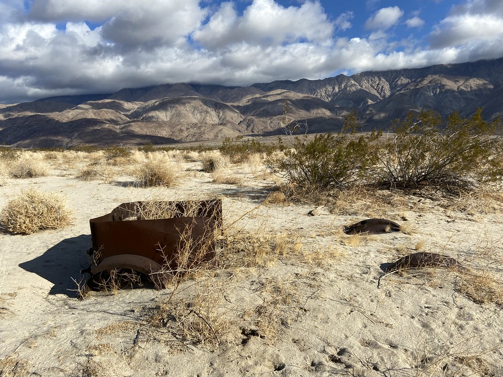
We met up the next weekend for the Santa Rosas hike. Parked our vehicles at the base of Coyote Mt. Was winding and rainy at the start but ended up a nice day. Old vehicles at an old homestead.
 IMG_5960 by tomteske, on Flickr IMG_5960 by tomteske, on Flickr
 IMG_5964 by tomteske, on Flickr IMG_5964 by tomteske, on Flickr
Nice view with about 2K left to climb.
 IMG_5969 by tomteske, on Flickr IMG_5969 by tomteske, on Flickr
Interesting village site with lots of rock circles and pottery sherds.
 IMG_5973 by tomteske, on Flickr IMG_5973 by tomteske, on Flickr
Painted sherds are always nice to find. These were actually painted on the inside and outside.
 Painted Sherd by tomteske, on Flickr Painted Sherd by tomteske, on Flickr
 Painted Rim Sherd1 by tomteske, on Flickr Painted Rim Sherd1 by tomteske, on Flickr
We made it to the ridge about half way between Dawns and Rabbit a little after 5 pm, a 5K climb from Clark Lake. Gary and Randy decided to camp lower down. Nice cool evening with great views of all the glimmering lights from the night sky and Ocotillo Wells...
The next morning before I got up, Daren search high and low for snow and found a tiny patch in about three miles of hiking. Since I was the lowest on water, I dutifully boiled it, filtered out the dirt and twigs and had yet another refreshing naturally flavored liter on the way down (tasted like Negroni if that's something you have tucked away in your liquor cabinet).
 IMG_5989 by tomteske, on Flickr IMG_5989 by tomteske, on Flickr
About 18 miles, 5300 ft g/l and maybe ten mylars. Enjoy!
 Santa Rosas From Clark by tomteske, on Flickr Santa Rosas From Clark by tomteske, on Flickr
|