|
Britain Posts: 611
12/28/2021
|
Been following a trail from Indian Hill in the direction of North-East. Its hit or miss where off-roaders mangled it up. But you can still follow by the way the rocks are pushed aside. The area pf the Piepkorn slot area is its just disappears. I thought perhaps it dropped into the wash north of Red Hill. Nope. This weekend I found more. Trail tags the bluff north of the wash. There's 2 miles of it. Drops down where the Jojoba wash crosses S2. Wonder why these trails are usually always on hill sides or on the crest of the hill and not in the washes? Wheres is the final destination ?
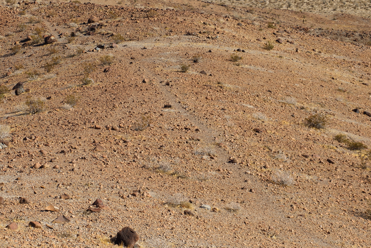
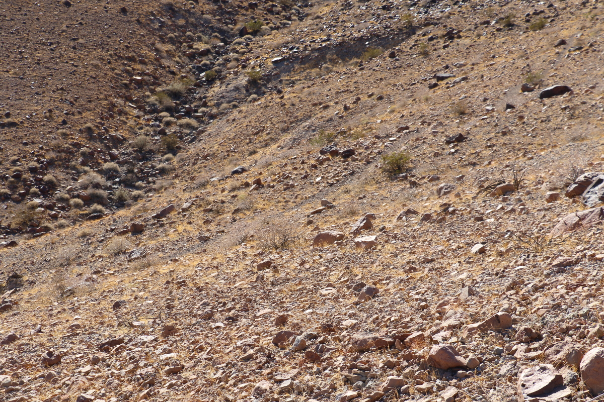
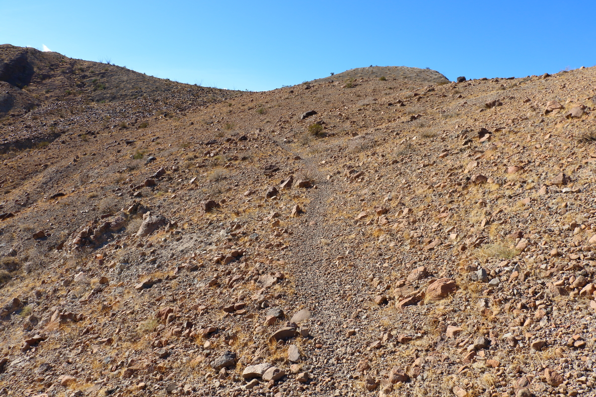
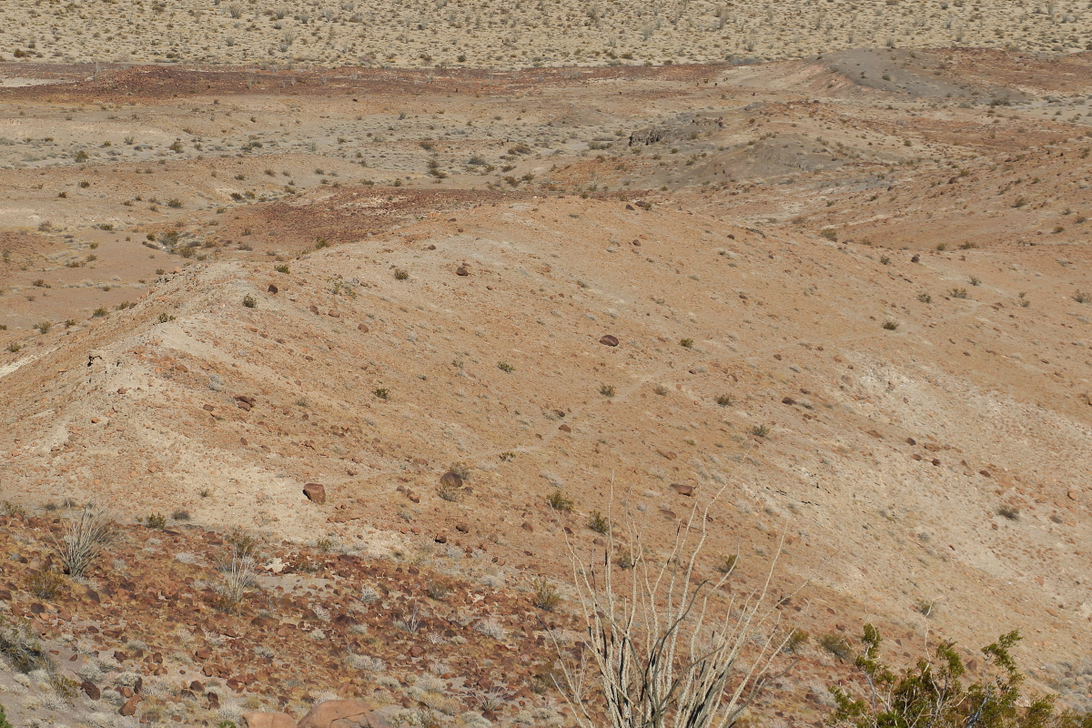
Its a well defined trail disappears in lava rocks but it can be picked up afterwards.
--
Cant drive 55
Britain
http://icorva.com
|
|
|
+2
link
|
|
Rocko1 Posts: 622
12/28/2021
|
I just read about this in Schads book-natives chose ridges over washes because ridges rarely change-washes are constantly changing from flash floods, debris, and erosion-since efficiency is the key it makes sense to be up high and avoid the ever changing/challenging washes and have a clearer line of site.
edited by Rocko1 on 12/28/2021
|
|
|
link
|
|
Britain Posts: 611
12/28/2021
|
Rocko1 wrote:
I just read about this in Schads book-natives chose ridges over washes because ridges rarely change-washes are constantly changing from flash floods, debris, and erosion-since efficiency is the key it makes sense to be up high and avoid the ever changing/challenging washes and have a clearer line of site.
edited by Rocko1 on 12/28/2021
Thanks good to know.
--
Cant drive 55
Britain
http://icorva.com
|
|
|
link
|
|
rockhopper Posts: 678
12/29/2021
|
What Rocko1 said is exactly correct. Many desert trails are thousands of years old and still exist in areas of low erosion.
|
|
|
+1
link
|
|
Rocko1 Posts: 622
12/29/2021
|
rockhopper wrote:
What Rocko1 said is exactly correct. Many desert trails are thousands of years old and still exist in areas of low erosion.
Is the compaction of soil from years of foot traffic what caused plants not to grow on the paths?
|
|
|
link
|
|
rockhopper Posts: 678
12/29/2021
|
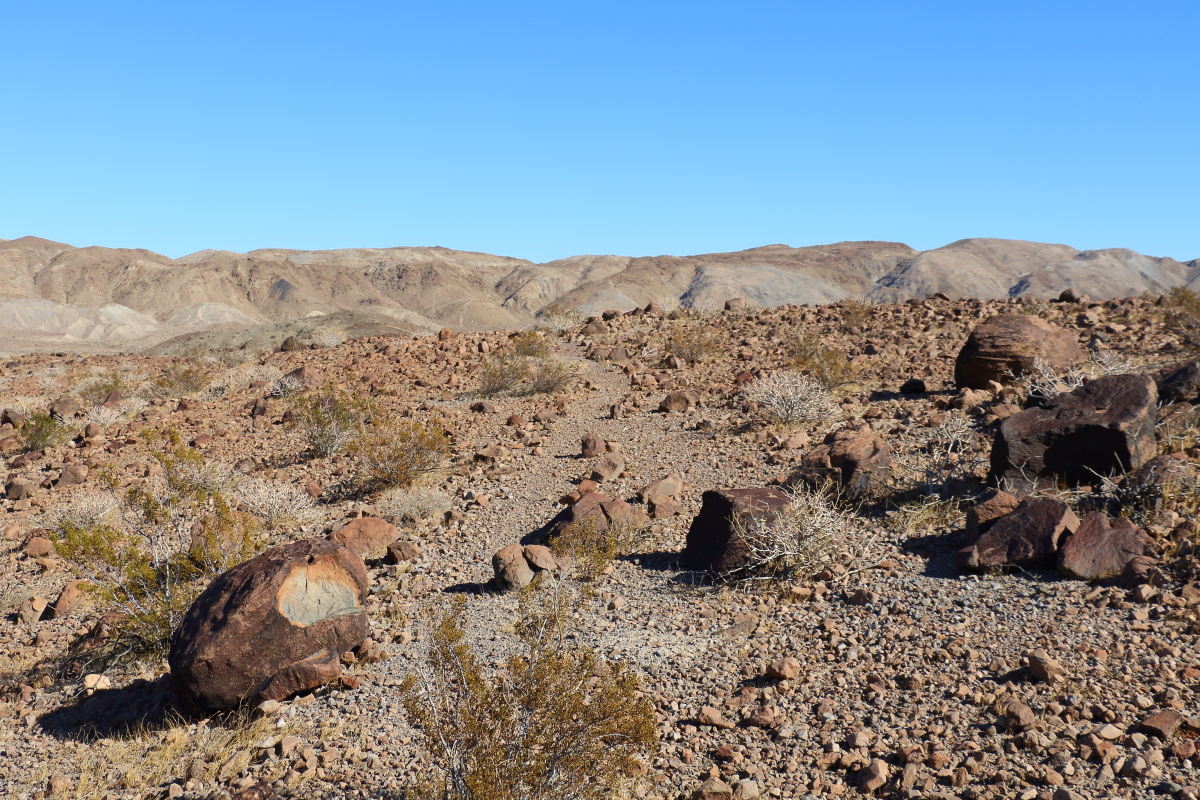
This is one of my favorites. The crossing. The trails are washed away in deep and wide arroyos in the distance and then continue on beyond.

|
|
|
link
|
|
rockhopper Posts: 678
12/29/2021
|
Rocko1 wrote:
rockhopper wrote:
What Rocko1 said is exactly correct. Many desert trails are thousands of years old and still exist in areas of low erosion.
Is the compaction of soil from years of foot traffic what caused plants not to grow on the paths?
Not always. hehe

|
|
|
+1
link
|
|
Britain Posts: 611
12/29/2021
|
Been interested in the trails to and from the Indian hill area. Some I figure were the super highways. Some just to and from food gathering areas. This one I think goes over or around the Coyotes. Havent seen any track on the backside of the mountain yet. But for sure above the northside badlands of the Carrizo creek . South Mesa area there's another long one I found. Perhaps part of this highway. West of the Indian hill, on the west side of Moan, theres a trail cutting across the hill side and going up. Lost it at the top but on the way down it passes a few well defined roasting pits.Perhaps part of one of the highways.
--
Cant drive 55
Britain
http://icorva.com
|
|
|
link
|
|
Rocko1 Posts: 622
12/29/2021
|
Britain wrote:
Been interested in the trails to and from the Indian hill area. Some I figure were the super highways. Some just to and from food gathering areas. This one I think goes over or around the Coyotes. Havent seen any track on the backside of the mountain yet. But for sure above the northside badlands of the Carrizo creek . South Mesa area there's another long one I found. Perhaps part of this highway. West of the Indian hill, on the west side of Moan, theres a trail cutting across the hill side and going up. Lost it at the top but on the way down it passes a few well defined roasting pits.Perhaps part of one of the highways.
Would be great to have a map of these ancient trails in the park. They are really fascinating.
|
|
|
link
|
|
Britain Posts: 611
12/29/2021
|
rockhopper wrote:
This is one of my favorites. The crossing. The trails are washed away in deep and wide arroyos in the distance and then continue on beyond.
Needs a yield sign.....cool shot
--
Cant drive 55
Britain
http://icorva.com
|
|
|
link
|
|
Buford Posts: 468
12/29/2021
|
Rocko1 wrote:
Britain wrote:
Been interested in the trails to and from the Indian hill area. Some I figure were the super highways. Some just to and from food gathering areas. This one I think goes over or around the Coyotes. Havent seen any track on the backside of the mountain yet. But for sure above the northside badlands of the Carrizo creek . South Mesa area there's another long one I found. Perhaps part of this highway. West of the Indian hill, on the west side of Moan, theres a trail cutting across the hill side and going up. Lost it at the top but on the way down it passes a few well defined roasting pits.Perhaps part of one of the highways.
Would be great to have a map of these ancient trails in the park. They are really fascinating.
I agree it would be a good thing to have a map of all the old trails. I know some people on this board have a knowledge of a lot of them. Some of the really old maps show routes that still exist on the ground but have been removed from newer maps. I am always surprised where I find remnants of old trails. Most recently was in the Split Mountain area.
@rockhopper, that is a great picture
--
Links to my photos: ABDSP photos, Bighorn sheep photos, ABDSP time lapse video, Wildlife photos (mainly birds)
|
|
|
link
|
|
Rocko1 Posts: 622
12/30/2021
|
Buford wrote:
Rocko1 wrote:
Britain wrote:
Been interested in the trails to and from the Indian hill area. Some I figure were the super highways. Some just to and from food gathering areas. This one I think goes over or around the Coyotes. Havent seen any track on the backside of the mountain yet. But for sure above the northside badlands of the Carrizo creek . South Mesa area there's another long one I found. Perhaps part of this highway. West of the Indian hill, on the west side of Moan, theres a trail cutting across the hill side and going up. Lost it at the top but on the way down it passes a few well defined roasting pits.Perhaps part of one of the highways.
Would be great to have a map of these ancient trails in the park. They are really fascinating.
I agree it would be a good thing to have a map of all the old trails. I know some people on this board have a knowledge of a lot of them. Some of the really old maps show routes that still exist on the ground but have been removed from newer maps. I am always surprised where I find remnants of old trails. Most recently was in the Split Mountain area.
@rockhopper, that is a great picture
I did see some on the historic maps on Caltopo-they seem to be pretty rough as far as exact locations of the trails but give you a sense of where to start looking on google earth.
|
|
|
link
|
|
Britain Posts: 611
12/30/2021
|
Interesting on the Caltopo. To bad theres not enough maps listed. I sometimes dont like running across the trails. They always disrupt what I was out hiking for in the first place. End up chasing them down. Did a hike that Tom did a few years back NE of the stage station.Theres a sq rock formation above the bad lands. Stumbled on a trail missed the sq formation had to doubleback and find it. Simple hike ended up a 15 miler.
--
Cant drive 55
Britain
http://icorva.com
|
|
|
link
|