|
hikerdmb Posts: 423
11/20/2011
|
I have been to Harper Flat many times over the years, but never this way. When I did the hike to the Harper Cabin a couple of weeks ago, I looked across the flat to the top of Harper Canyon. That is when I decided to try this trip, since I had never hiked into the flat from that canyon. I started near the Cactus Garden south of Highway 78. The turn off to the Cactus Garden is on the opposite side of the highway and just east of the turn off to Butte Pass. There was lots of traffic on the way out to this part of the desert but once I turned off the highway I did not see another person until I got back to the highway about 5 hours later.
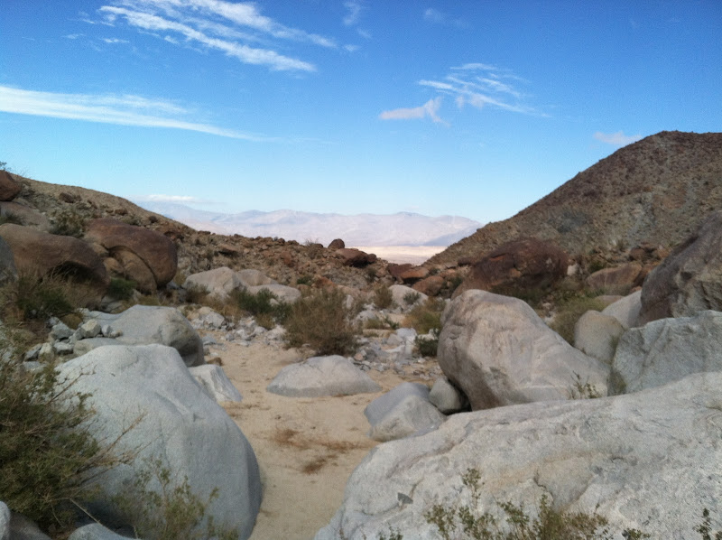
Here is the view up toward the entrance of Harper Canyon from just off Highway 78.

I had to park right near the point where the road drops down into the wash coming out of Harper Canyon. The road gets pretty rough after this and I knew my big truck wouldn't be able to get much closer than this point.
My hike started in the wide wash and I walked quite a way until I got to the entrance to the canyon.

Harper Canyon starts out pretty wide and full of ironwood trees.

After a couple of miles the canyon begins to narrow and the walls steepen.

There are also some pretty rugged side canyons coming into the main canyon.
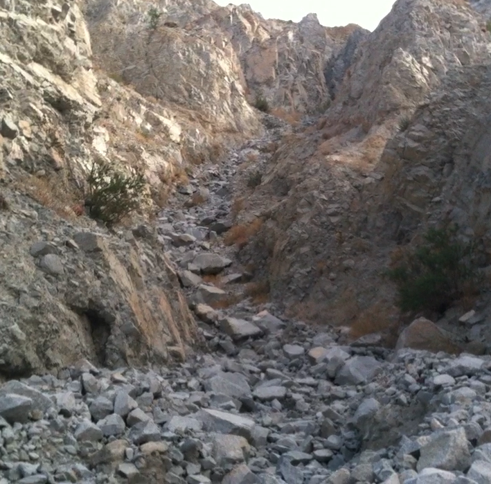
The canyon continues to narrow and becomes more and more scenic.

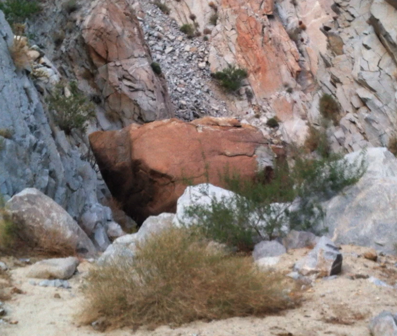
Most of this hike is easy walking on a sandy wash but there are several places along the way where it get steeper and some scrambling is neccessary to make your way farther up the canyon. There are also some areas with evidence of recent rockfall. A huge boulder has fallen and blocked the canyon floor except for an 18 inch wide crack on the east side that you can squeeze through.
Here is the boulder looking down the canyon.
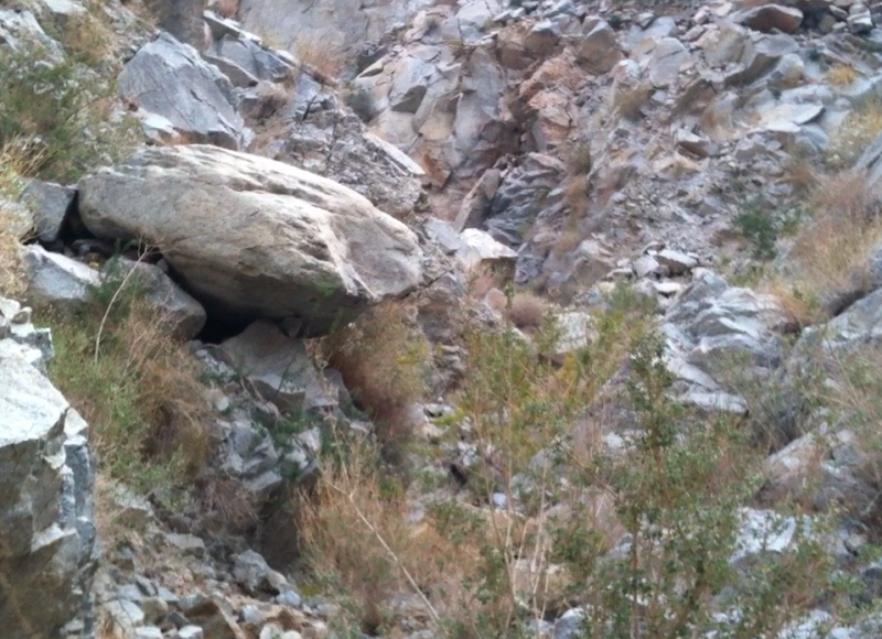
This is an up close view of the way through. Notice the different colors where chips were broken off when the rock fell.

The areas just before and after the huge boulder are some of the roughest sections of this hike. Once passed the choke stone though you will know you are just about to Harper Flat.
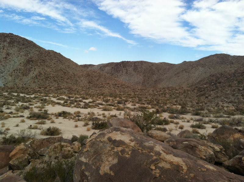
After almost 2 hours of hiking, climbing, and scrambling I made it to Harper Flat. This is the view from the top of a rock outcropping in the flat looking across to Whale Peak.

I spent a few minutes snacking and enjoying the view before turning around and heading back down the canyon. Here is the view looking back towards the top of Harper Canyon.
Heading down the canyon was much easier and also there were some great views looking north toward the Santa Rosa Mountains.

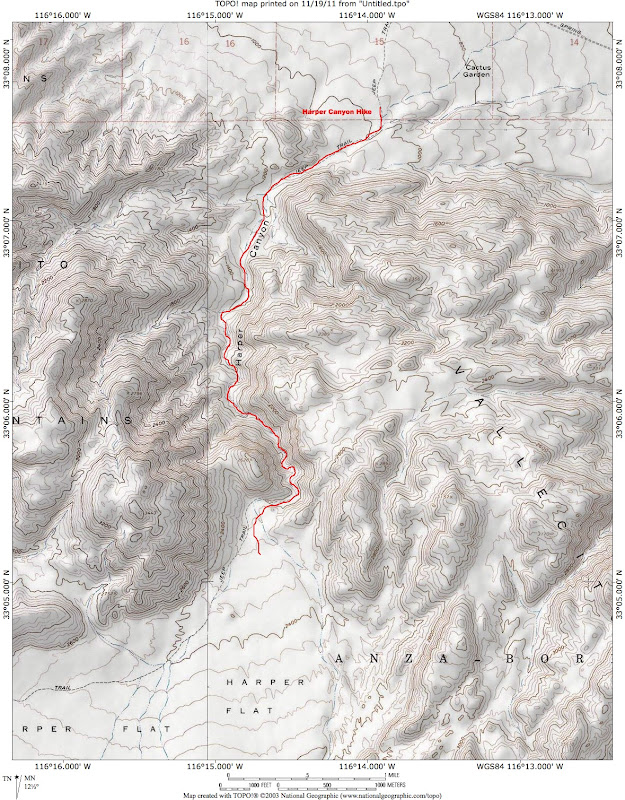
Finally here is a map of my route. It turned out to be a little over 4 miles in each direction with an elevation gain of about 1,300 feet.
edited by hikerdmb on 11/20/2011
edited by hikerdmb on 11/20/2011
<em>edited by hikerdmb on 11/21/2011</em>
|
|
|
link
|
|
dsefcik Administrator Posts: 2634
11/26/2011
|
That looks like a great hike, it is a lot like Alma Wash which I did with my son on Monday/Tuesday. I would like to do a point-to-point trip that goes from Alma Wash > Starfish Cove > Vallecito Mtns > Harper Flat > Harper Cyn. Would you be interested in that?
--
http://www.sefcik.com
http://www.darensefcik.com
http://www.carrizogorge.com
|
|
|
link
|
|
hikerdmb Posts: 423
11/26/2011
|
Are you thinking of something like this?

<em>edited by hikerdmb on 11/26/2011</em>
|
|
|
link
|
|
dsefcik Administrator Posts: 2634
11/26/2011
|
yeah. pretty much..i haven't mapped it out but i would guess it is somewhere around 15 miles total. it was about 5.5 miles from the trailhead to where we camped in starfish cove.
--
http://www.sefcik.com
http://www.darensefcik.com
http://www.carrizogorge.com
|
|
|
link
|
|
hikerdmb Posts: 423
11/27/2011
|
Daren,
When are you thinking for rhis trip? How about late winter or early spring? Looking at google earth it looks like a few rough parts. Do you have some pics or a TR from Srarfish Cove? I am interested in how that canyon looks.
David
|
|
|
link
|
|
dsefcik Administrator Posts: 2634
11/28/2011
|
I was thinking maybe end of July or middle of August, that way I don't need to bring all of my cold weather gear...haha...really, whenever...it only took me year to go to Alma Wash so throw out some dates.
You can see pictures from our trip to Alma Wash here http://smu.gs/tz658b
or on the TR I posted here http://forums.anzaborrego.net/travel/anzaborregoprevious/forum/messages.aspx?TopicID=181
--
http://www.sefcik.com
http://www.darensefcik.com
http://www.carrizogorge.com
|
|
|
link
|
|
dsefcik Administrator Posts: 2634
11/28/2011
|
There are also some areas with evidence of recent rockfall. A huge boulder has fallen and blocked the canyon floor except for an 18 inch wide crack on the east side that you can squeeze through.
What do you think is "recent", 10 years, 50 years, 500 or last week?
What does it sound like when something like that falls and hits the ground?
There was a spot in Alma Wash that also had "recent' boulders fall down into the wash, I wonder if they happened as the result of the same seismic activity.
--
http://www.sefcik.com
http://www.darensefcik.com
http://www.carrizogorge.com
|
|
|
link
|
|
hikerdmb Posts: 423
11/30/2011
|
I am not sure when recent was but if I had to guess I would say in the last 10 years or so. But that is just a guess. I wish I had stopped and spent a bit more time looking around to see what was growing from under the rock but I didn't want to stay too long. When I am solo in a place like this I always think of the Aron Ralston and his book "Between a Rock and a Hard Place." In this book he carves into the canyon wall where he is trapped, and I think he is quoting Edward Abbey, something like "geologic time includes now." There was also a couple other areas that showed some recent rockfall in Harper Canyon, but much smaller rocks, about 2-3 feet diameter. But there were lots of them this size. Again I moved pretty quickly through those areas because geologic time includes now.
|
|
|
link
|