|
Buford Posts: 468
2/3/2012
|
Found this forum a while ago looking up info for Borrego. Good info. I have spent a lot of time in Anza Borrego, just not recently.
I have never been to Cougar canyon and was planning on going this weekend. Is the stream in the canyon year round? Don't want to hike all the way over there to find it dry. My car can't make it past boulder alley so it's a long walk. I called the visitor center and they said they didn't know this afternoon. They did say the canyon burned in a fire over the summer, but it didn't burn too bad.
Thanks for any info.
--
Links to my photos: ABDSP photos, Bighorn sheep photos, ABDSP time lapse video, Wildlife photos (mainly birds)
|
|
|
link
|
|
anutami Posts: 491
2/3/2012
|
Not sure, I was going to do a backpack trip but have yet to get out there. We have got some rain so more than likely it should be flowing. You could mountain bike the 3 miles.
|
|
|
link
|
|
mrkmc Posts: 87
2/3/2012
|
This trip report is from a few weeks ago. He has a video of water flowing somewhere in Cougar Canyon. I was in Sheep last weekend. There is water about half a mile up the canyon from the campground. Have fun!
|
|
|
link
|
|
DHeuschele Posts: 87
2/3/2012
|
I have read that they have rerouted the road to bypass Boulder Alley but I have not been out there personally to verify. I have mixed feelings if what I read was true as having a difficult 4x4 section help minimize the people going back to that area (Sheep/cougar canyons). On the other hand why should it be only for those with rigs that can handle boulder alley or willing to go a couple miles each way self propelled (walk or bike)?
|
|
|
link
|
|
Buford Posts: 468
2/3/2012
|
Thanks. Probably going to backpack it if there is water. If not hike back.
I have ridden the old coyote clunker mountain bike route through there. Not too interested in riding the route.
--
Links to my photos: ABDSP photos, Bighorn sheep photos, ABDSP time lapse video, Wildlife photos (mainly birds)
|
|
|
link
|
|
Buford Posts: 468
2/5/2012
|
Plenty of water from the mouth of cougar up. Fire burned the south side. Didn't make it as far into the canyon as I would have liked, girlfriend isn't too comfortable off trail scrambling. Didn't get a chance to check out sheep canyon either. I'll have to come back.
Lower willows had more water than December.
The road still goes over boulder alley, although I think boulder alley is way more tame than I remember from 15 years ago. Still a tough climb, watched a jeep struggle. I think keeping crowds down is better. Those motivated will find a way.
Thanks for the information, had a great time.
--
Links to my photos: ABDSP photos, Bighorn sheep photos, ABDSP time lapse video, Wildlife photos (mainly birds)
|
|
|
link
|
|
surfponto Administrator Posts: 1369
2/5/2012
|
Sounds like a good day.
Did you get any pictures of the canyon?
Feel free to post them here
Welcome to the Forum 
Buford wrote:
Plenty of water from the mouth of cougar up. Fire burned the south side. Didn't make it as far into the canyon as I would have liked, girlfriend isn't too comfortable off trail scrambling. Didn't get a chance to check out sheep canyon either. I'll have to come back.
Lower willows had more water than December.
The road still goes over boulder alley, although I think boulder alley is way more tame than I remember from 15 years ago. Still a tough climb, watched a jeep struggle. I think keeping crowds down is better. Those motivated will find a way.
Thanks for the information, had a great time.
--
https://www.anzaborrego.net/


|
|
|
link
|
|
anutami Posts: 491
2/5/2012
|
Might be heading out for a backpack trip very soon and Might try and take the Xterra through boulder alley so the kids don't have to hike the 3 miles in. Thanks for the report on water being present, that helps a lot. If you have any pics would love to see them.
|
|
|
link
|
|
Buford Posts: 468
3/3/2012
|
Some pics from last weekend. Hiked in and Sheep canyon day 1, Cougar canyon and out day 2. Hiked in from the gates before 3rd crossing.
A couple from sheep canyon
[IMG]http://i145.photobucket.com/albums/r203/evilclone619/IMG_4191.jpg[/IMG]
[IMG]http://i145.photobucket.com/albums/r203/evilclone619/IMG_4203.jpg[/IMG]
[IMG]http://i145.photobucket.com/albums/r203/evilclone619/IMG_4209.jpg[/IMG]
[IMG]http://i145.photobucket.com/albums/r203/evilclone619/IMG_4210.jpg[/IMG]
Cougar canyon
[IMG]http://i145.photobucket.com/albums/r203/evilclone619/IMG_4228.jpg[/IMG]
[IMG]http://i145.photobucket.com/albums/r203/evilclone619/IMG_4256.jpg[/IMG]
[IMG]http://i145.photobucket.com/albums/r203/evilclone619/IMG_4239.jpg[/IMG]
[IMG]http://i145.photobucket.com/albums/r203/evilclone619/IMG_4252.jpg[/IMG]
<em>edited by Buford on 3/3/2012</em>
--
Links to my photos: ABDSP photos, Bighorn sheep photos, ABDSP time lapse video, Wildlife photos (mainly birds)
|
|
|
link
|
|
surfponto Administrator Posts: 1369
3/3/2012
|
That looks really nice
I have yet to hike up Cougar Canyon but plan to do so at some point :-)
Thanks for sharing
Bob
--
https://www.anzaborrego.net/
|
|
|
link
|
|
dsefcik Administrator Posts: 2634
3/3/2012
|
Definitely looks like a nice area, any other hikers out?
--
http://www.sefcik.com
http://www.darensefcik.com
http://www.carrizogorge.com
|
|
|
link
|
|
hikerdmb Posts: 423
3/4/2012
|
That looks beautiful. I have not been up there in a while. Thanks for sharing those great photos.
David
|
|
|
link
|
|
anutami Posts: 491
3/6/2012
|
Nice pics! Thanks for posting. I can't wait to make it out there! Do you know when they close the gate for no entry? Isn't it sometime in May or June?
|
|
|
link
|
|
bobmc Posts: 7
3/6/2012
|
We went to salvador and upper willows recently. Cal fire did road improvements when the fire burned up there to get equipment in. Including making the third crossing perpendicular to the trail and about 30 ft to the west of the old crossing. It is now very easy. Boulder alley has also been filled and the big rock that was hard to get around has been blasted or something. It is know possible to get up there with a standard 4x4 forerunner with running boards. Ir is still bumpy though. The 4 wheelers are actually quite ****ed about this because it is really not a challenge anymore.
|
|
|
link
|
|
bobmc Posts: 7
3/6/2012
|
the gate is closed june 1st to september 30
|
|
|
link
|
|
dsefcik Administrator Posts: 2634
3/6/2012
|
bobmc wrote:
the gate is closed june 1st to september 30
Bighorn Sheep drinking period....
--
http://www.sefcik.com
http://www.darensefcik.com
http://www.carrizogorge.com
|
|
|
link
|
|
anutami Posts: 491
3/26/2012
|
Took a day trip out last week to check it out, plenty of water, and solitude

Snow capped toro peak
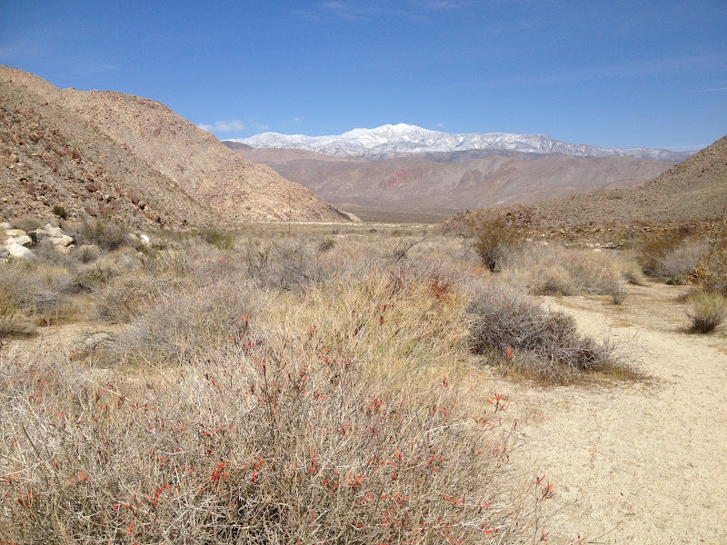
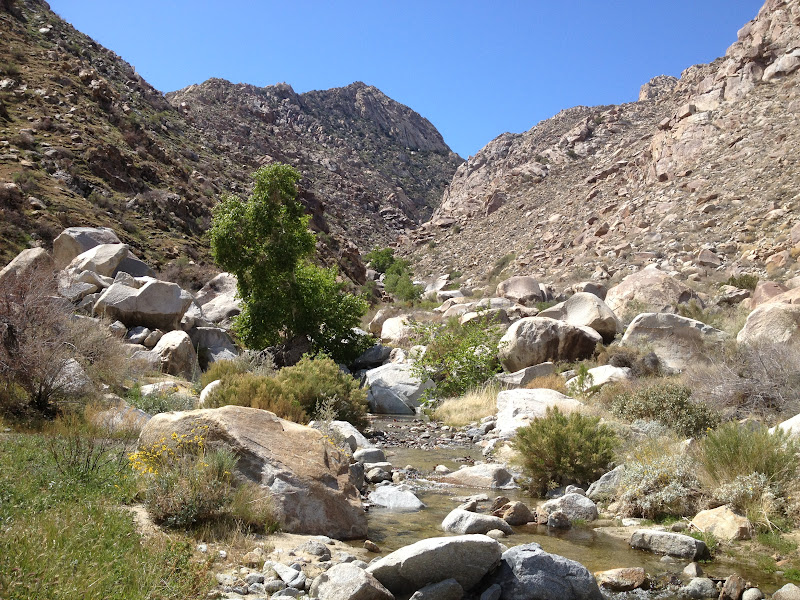
Plenty of water

|
|
|
link
|
|
surfponto Administrator Posts: 1369
3/26/2012
|
Nice pictures. Looks very quiet
We are hoping to head out next weekend.
Maybe we will head up that way
Bob
--
https://www.anzaborrego.net/
|
|
|
link
|
|
anutami Posts: 491
4/23/2012
|
I posted a quick video of the water flowing. there is cool cave you could explore
|
|
|
link
|