|
anutami Posts: 491
3/11/2012
|
Took a nice solo trip out to the calcite mine slot canyons. Forgot my camera but luckily I have my iphone. If you have not been out there it is an awesome place. Make sure you bring a lot of water and a good map.
Entrance to the canyons I took the north canyon this time as I had already been through the south section

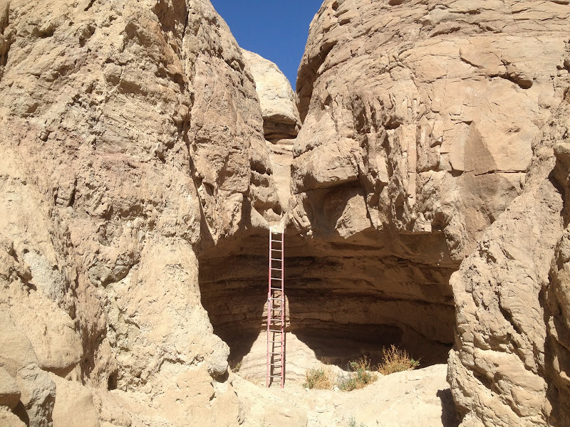
Pretty crazy ladder section that turned out to be a dead end if you do not have climbing aid

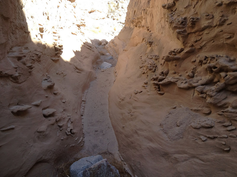
Should be named dragon canyon


Rope section


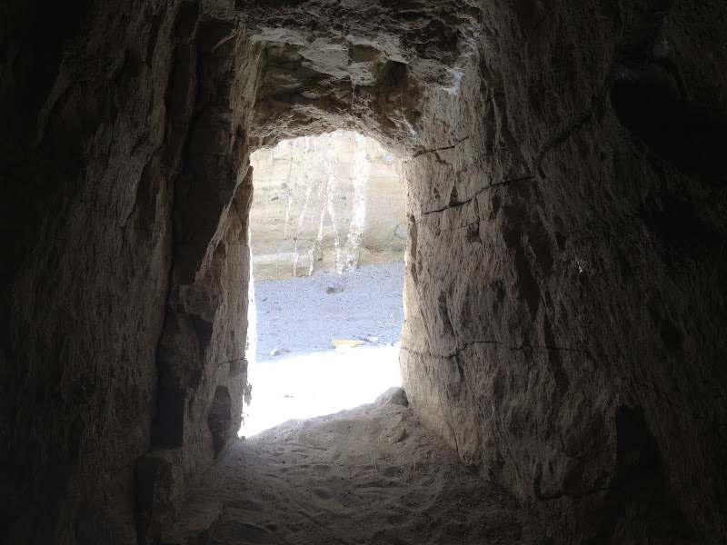

Ancient Indian Trail

Not sure what this is??? Some kind of campsite?

Nice view looking back down the wash

Looped around northeast to an unamed wash

No footprints in this wash 

Daren, This one is for you

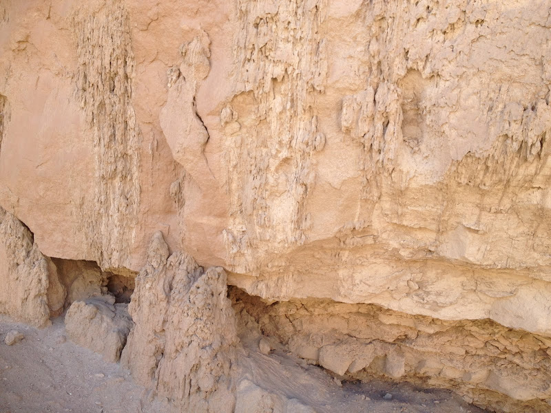
Natural dribble castles
every turn has different forms and shapes
<em>edited by anutami on 3/11/2012</em>
|
|
|
link
|
|
dsefcik Administrator Posts: 2634
3/11/2012
|
damn mylar balloons..we will rid the desert of them one-by-one...
i do not recognize some of those canyons, do you have a map of where you went exactly? i was out in the canyons a couple years ago but is was more on the west side of the calcite mine road.
--
http://www.sefcik.com
http://www.darensefcik.com
http://www.carrizogorge.com
|
|
|
link
|
|
ziphius Posts: 911
3/12/2012
|
Great trip! It sounds like you climbed that crazy ladder, heh? The rectangular 'campsite' thing is a UFO footprint. Not your typical UFO shape, but a UFO nonetheless. Nice mylar balloon, a classic.
--
http://www.coyotelearning.org
|
|
|
link
|
|
anutami Posts: 491
3/12/2012
|
dsefcik wrote:
damn mylar balloons..we will rid the desert of them one-by-one...
i do not recognize some of those canyons, do you have a map of where you went exactly? i was out in the canyons a couple years ago but is was more on the west side of the calcite mine road.
Still trying to figure out how to do the google map screen shot w/ the route, but It looks like I went through Palm Wash. There is the south fork which is west of the calcite mine rd, and Palm wash due east and north east of the rd. Then there is the North fork which is way east of the calcite mine road. When I looped back around I was about in the middle of the North Fork and main Palm Wash.
|
|
|
link
|
|
anutami Posts: 491
3/12/2012
|
dsefcik wrote:
damn mylar balloons..we will rid the desert of them one-by-one...
i do not recognize some of those canyons, do you have a map of where you went exactly? i was out in the canyons a couple years ago but is was more on the west side of the calcite mine road.
Still trying to figure out how to do the google map screen shot w/ the route, but It looks like I went through Palm Wash. There is the south fork which is west of the calcite mine rd, and Palm wash due east and north east of the rd. Then there is the North fork which is way east of the calcite mine road. When I looped back around I was about in the middle of the North Fork and main Palm Wash.
You can also take the main Palm wash and it forks. If you stay to the left (this is the route I did last year), there is some great slot canyons there as well.
Here is a video of that section
|
|
|
link
|
|
dsefcik Administrator Posts: 2634
3/12/2012
|
anutami wrote:
Still trying to figure out how to do the google map screen shot w/ the route, but It looks like I went through Palm Wash.
I just import the .gpx file from my gps or phone app into google earth and then under the File menu I select Save > Save Image
You can use gpsbabel to convert all kinds of gps formats to/from google earth, download it here http://www.gpsbabel.org/
When I went I went up south palm wash and then came down thru the middle palm wash. Some of you rphotos look familiar, like the ladder drop off..except there was no ladder and I also don't remember there being any rope. Here are some pics from the trip I did http://www.sefcik.com/2011/01/smoke-tree-canyon-calcite-mine-area.html
--
http://www.sefcik.com
http://www.darensefcik.com
http://www.carrizogorge.com
|
|
|
link
|
|
surfponto Administrator Posts: 1369
3/13/2012
|
Looks like a great area. Have not been on that hike before. Loks very similiar to some of the side canyons around Arroyo Tapiado or Canyon Sin Nombre
How were the flowers looking when you were out there?
Bob
anutami wrote:
Took a nice solo trip out to the calcite mine slot canyons. Forgot my camera but luckily I have my iphone. If you have not been out there it is an awesome place. Make sure you bring a lot of water and a good map.
<em>edited by surfponto on 3/13/2012</em>
--
https://www.anzaborrego.net/


|
|
|
link
|
|
kylekai Posts: 82
9/3/2012
|
Just going thru some old posts, getting reading for desert camping. I noticed you used an iPhone to take your pictures? If so, then the pictures (usually) also have the GPS coordinates attached to the image. I use my iPhone almost exclusively for taking pictures now, as it helps me remember where I took the picture. On my Macintosh computer, using the app Preview, I can open a picture and easily view the picture's location. Or I upload them to Flickr which also displays a map with the image location -- see this example: http://www.flickr.com/photos/modesitt/7127141619/in/set-72157629565943292/. Wouldn't it be great if we could click on a photo in this forum and it takes us to a Google map using the GPS coordinates associated with the picture?
anutami wrote:
Still trying to figure out how to do the google map screen shot w/ the route, but It looks like I went through Palm Wash. There is the south fork which is west of the calcite mine rd, and Palm wash due east and north east of the rd. Then there is the North fork which is way east of the calcite mine road. When I looped back around I was about in the middle of the North Fork and main Palm Wash.
edited by kylekai on 9/3/2012
<em>edited by kylekai on 9/3/2012</em>
|
|
|
link
|
|
surfponto Administrator Posts: 1369
9/4/2012
|
Yeah I really need to update this forum software. It is getting very dated
Bob
kylekai wrote:
Just going thru some old posts, getting reading for desert camping. I noticed you used an iPhone to take your pictures? If so, then the pictures (usually) also have the GPS coordinates attached to the image. I use my iPhone almost exclusively for taking pictures now, as it helps me remember where I took the picture. On my Macintosh computer, using the app Preview, I can open a picture and easily view the picture's location. Or I upload them to Flickr which also displays a map with the image location -- see this example: http://www.flickr.com/photos/modesitt/7127141619/in/set-72157629565943292/. Wouldn't it be great if we could click on a photo in this forum and it takes us to a Google map using the GPS coordinates associated with the picture?
anutami wrote:
Still trying to figure out how to do the google map screen shot w/ the route, but It looks like I went through Palm Wash. There is the south fork which is west of the calcite mine rd, and Palm wash due east and north east of the rd. Then there is the North fork which is way east of the calcite mine road. When I looped back around I was about in the middle of the North Fork and main Palm Wash.
edited by kylekai on 9/3/2012
edited by kylekai on 9/3/2012
--
https://www.anzaborrego.net/
|
|
|
link
|
|
anutami Posts: 491
10/2/2012
|
Here is GPS location of the canyon for this report
Latitude: 33.298000° N Longitude: 116.107167° W
kylekai wrote:
Just going thru some old posts, getting reading for desert camping. I noticed you used an iPhone to take your pictures? If so, then the pictures (usually) also have the GPS coordinates attached to the image. I use my iPhone almost exclusively for taking pictures now, as it helps me remember where I took the picture. On my Macintosh computer, using the app Preview, I can open a picture and easily view the picture's location. Or I upload them to Flickr which also displays a map with the image location -- see this example: http://www.flickr.com/photos/modesitt/7127141619/in/set-72157629565943292/. Wouldn't it be great if we could click on a photo in this forum and it takes us to a Google map using the GPS coordinates associated with the picture?
|
|
|
link
|
|
kylekai Posts: 82
10/2/2012
|
anutami wrote:
Here is GPS location of the canyon for this report
Latitude: 33.298000° N Longitude: 116.107167° W
Great! Here's the Google link for those coordinates: http://goo.gl/maps/3VQIp
|
|
|
link
|