|
tommy750 Posts: 1086
2/8/2014
|
Decided to take take a drive yesterday up EC085 from Plaster City to Split Mt Road and maybe do some hiking along the way. Have been through there a bunch but still lots to see.
Closed gate looking through the bombing range toward Carrizo Mt. If you zoom in, a nice target in the distance.
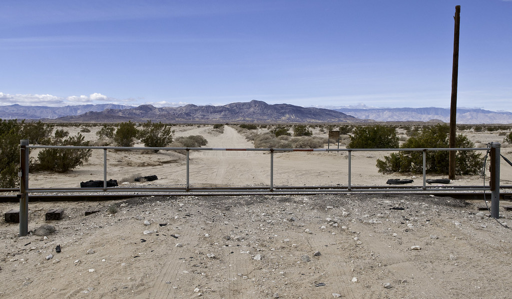
Bombing Range Gate by tomteske, on Flickr
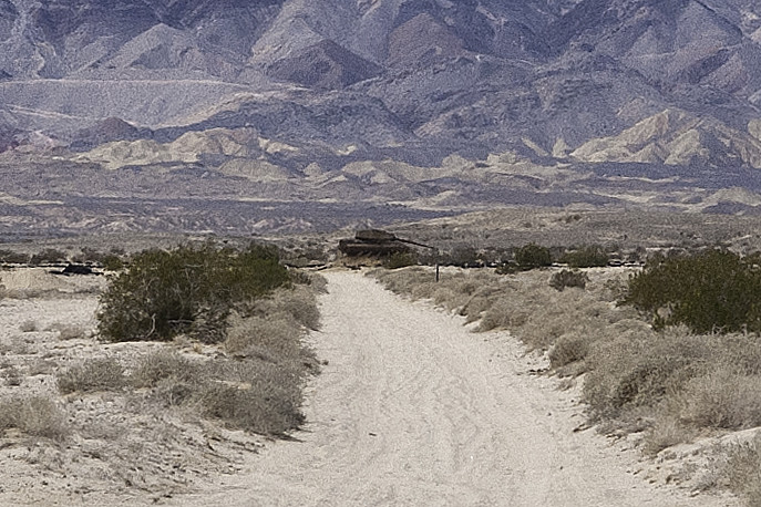
Tank by tomteske, on Flickr
Still find the Ancient Lake Cahuilla remnants fascinating. A rocky prominence was too difficult for the Kumeyaay to skirt when the lake was at maximum fill, so they built a trail over it which is still visible.
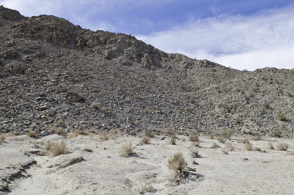
Point Trail by tomteske, on Flickr
The trail and ridge with the lake at its 43ft maximum on GE
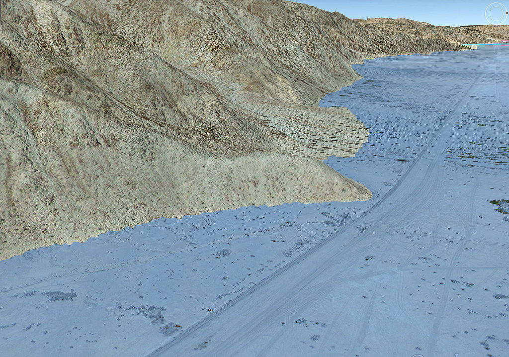
Point Trail by tomteske, on Flickr
The trail leads to a site with three slicks, the only ones I've seen along the Fish Creek Mts shoreline. The ridge is visible in the background along with a nice beach.

Three Slicks by tomteske, on Flickr
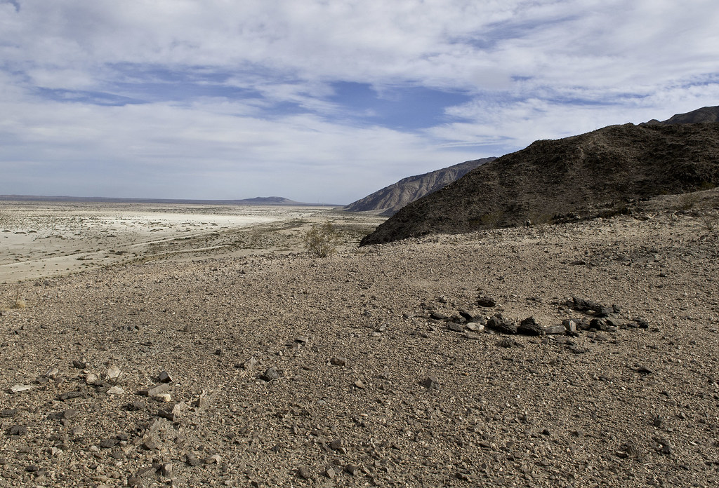
Went a few miles further NW and decided to explore the last place the shoreline touches Fish Creek Mts before the alluvial fan of Fish Creek pushes it eastward. Climbed up a 300ft ridge and found BM Whit.
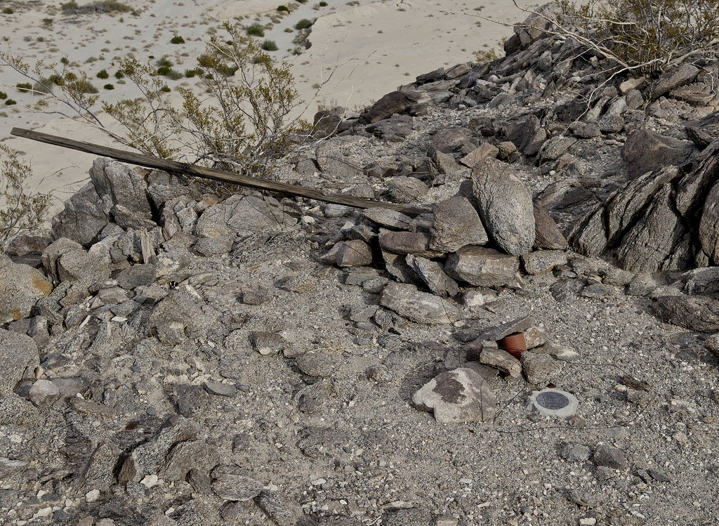
BM Whit by tomteske, on Flickr
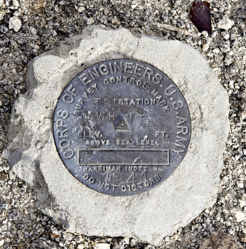
BM Whit2 by tomteske, on Flickr
First entry in 1997. Last entry was 2011.
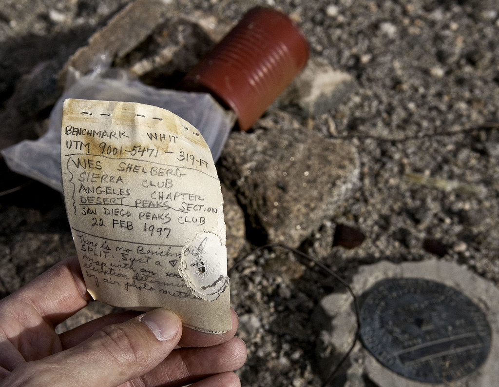
BM Whit3 by tomteske, on Flickr
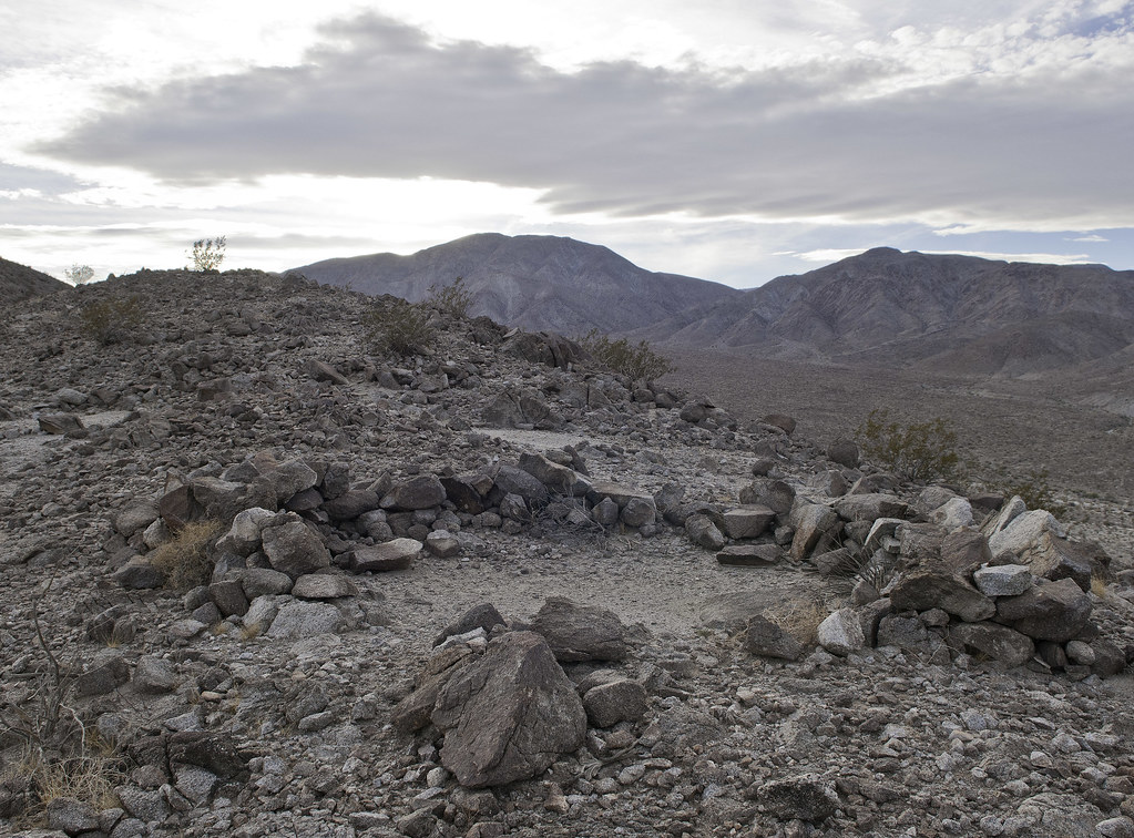
One of a pair of rock circles looking toward Superstition, both visible on GE.
Rock Circle by tomteske, on Flickr
Mandatory sherd pic.
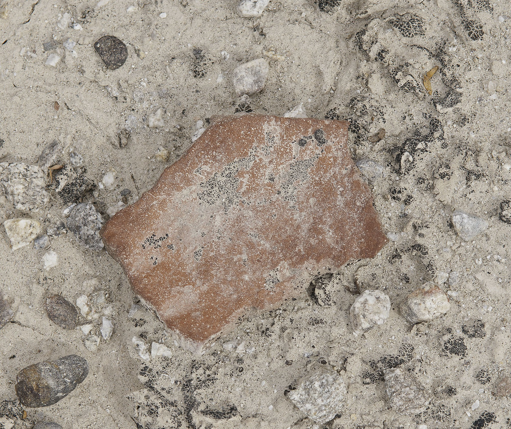
Weathered Sherd by tomteske, on Flickr
On the way down, another desert memorial with libation vessels evident.
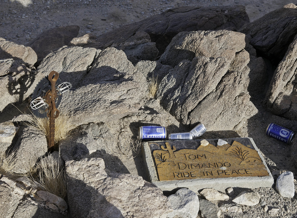
Tom Dimando by tomteske, on Flickr
Innovative cross.
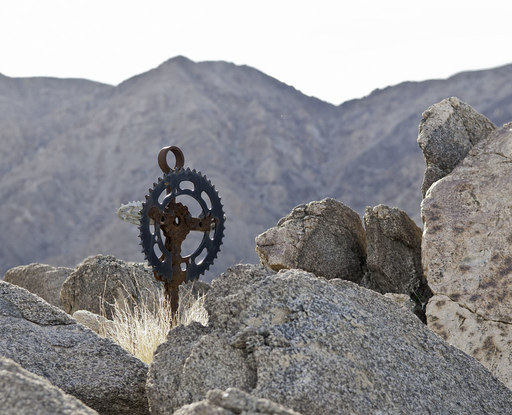
Tom Dimando Cruz by tomteske, on Flickr
Everything was dried up except this lovely flower. Thinking this is the Southwestern Prickly Poppy.
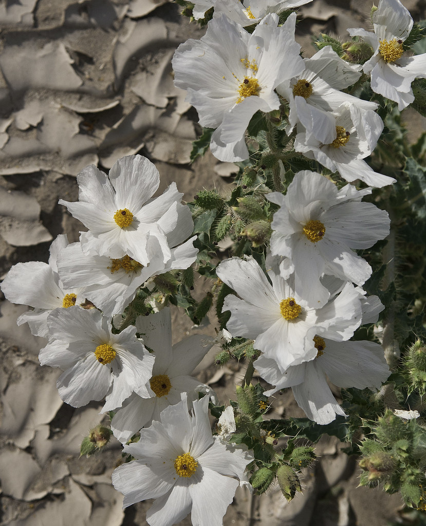
Flowers by tomteske, on Flickr
Decided to keep heading north to visit a site Daren had said had a bunch of sleeping circles.
Ridge Circle by tomteske, on Flickr
Some of them looked modified and maybe miners were responsible since historic trash was a few feet downhill.
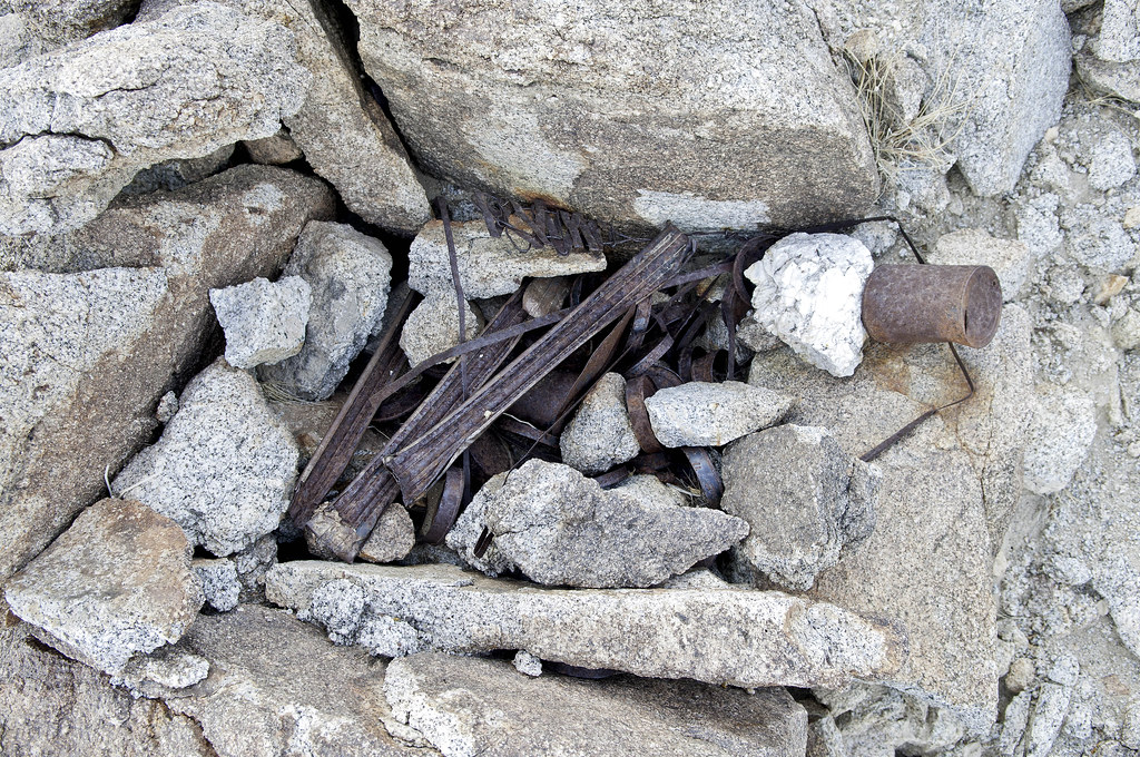
Refuse by tomteske, on Flickr
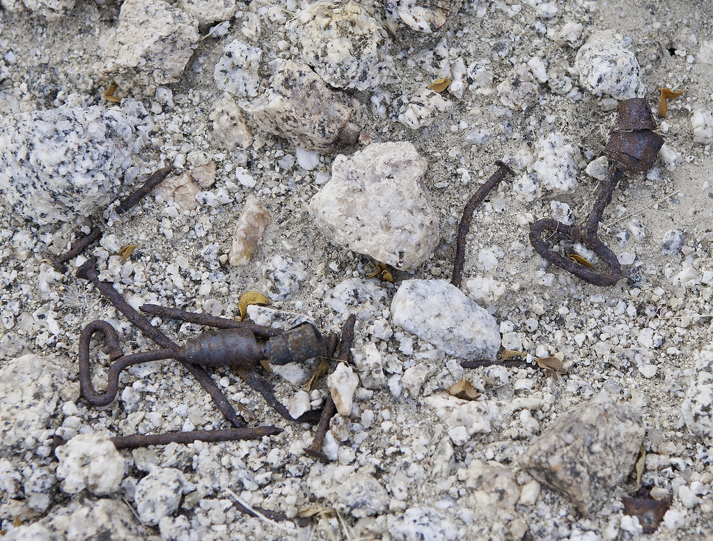
Trash by tomteske, on Flickr
Nothing fantastic but a great way to spend your day off and put in 6-7 miles of hiking. Enjoy. Tom
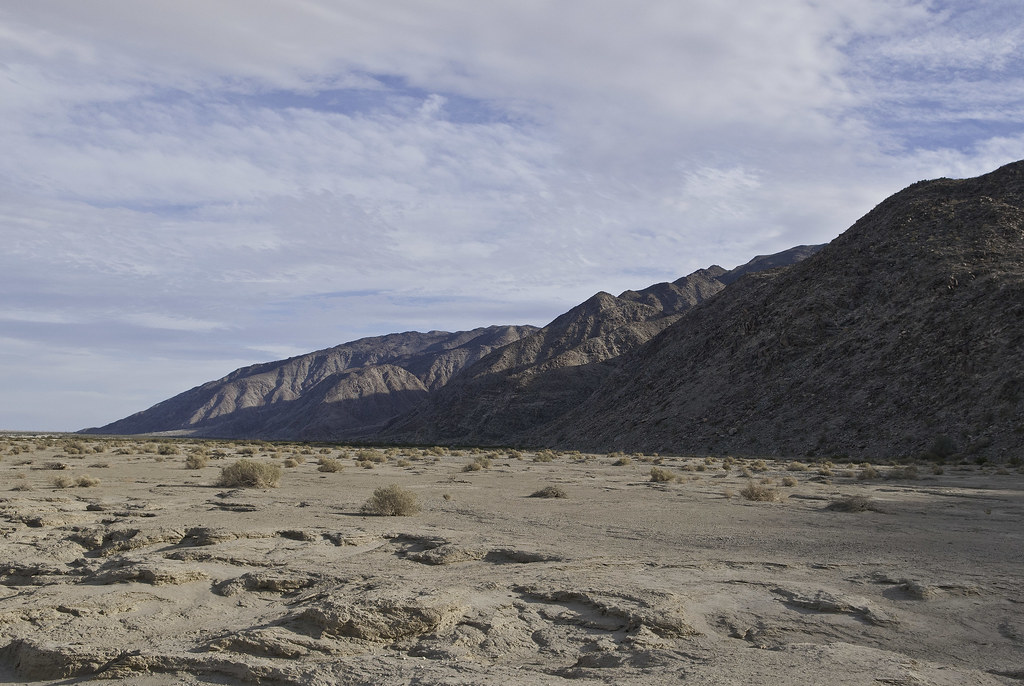
Fish Creek Mts by tomteske, on Flickr
|
|
|
link
|
|
dsefcik Administrator Posts: 2634
2/8/2014
|
Looks like some fresh tracks going off towards the target. I have heard from a credible source that those circles I mentioned were used by 1960-70's desert hippie kooks...but who knows. Wish I was able to get out there with you...
--
http://www.sefcik.com
http://www.darensefcik.com
http://www.carrizogorge.com
|
|
|
link
|
|
rockhopper Posts: 678
2/8/2014
|
Ditto on the old indian trails above the old shoreline. Some references state the Lake Chauilla filled multiple times going back thousands of years. It's neat hiking on those old trails. I've seen that trail you hiked on Google E. Need to hike those trails in that area still .There was a lot of prospecting and mining in that area in the last 1800's and 1900's
edited by rockhopper on 2/8/2014
edited by rockhopper on 2/8/2014
|
|
|
link
|
|
ziphius Posts: 911
2/8/2014
|
Nice tour Tom. Is that memorial something you just happened to stumble upon, or is there some history that led you to search for it?
--
http://www.coyotelearning.org
|
|
|
link
|
|
Florian Posts: 129
2/8/2014
|
Really nice series of images! I've never explored that area of the AB. Thanks for sharing.
-Florian
|
|
|
link
|
|
Florian Posts: 129
2/8/2014
|
Is there a legal vehicle route all the way through from Plaster City to Fish Creek? I'm assuming there is you went to the Whit BM. I was somehow thinking was closed to vehicles.
-Florian
edited by Florian on 2/8/2014
|
|
|
link
|
|
dsefcik Administrator Posts: 2634
2/8/2014
|
Florian wrote:
Is there a legal vehicle route all the way through from Plaster City to Fish Creek? I'm assuming there as you went to the Whit BM. I was somehow thinking was closed to vehicles.
-Florian I think EC085 is the road, I have not been on it but those who have describe it as a very sandy 4wd only road.
--
http://www.sefcik.com
http://www.darensefcik.com
http://www.carrizogorge.com
|
|
|
link
|
|
tommy750 Posts: 1086
2/8/2014
|
rockhopper wrote:
Ditto on the old indian trails above the old shoreline. Some references state the Lake Chauilla filled multiple times going back thousands of years. It's neat hiking on those old trails. I've seen that trail you hiked on Google E. Need to hike those trails in that area still .There was a lot of prospecting and mining in that area in the last 1800's and 1900's
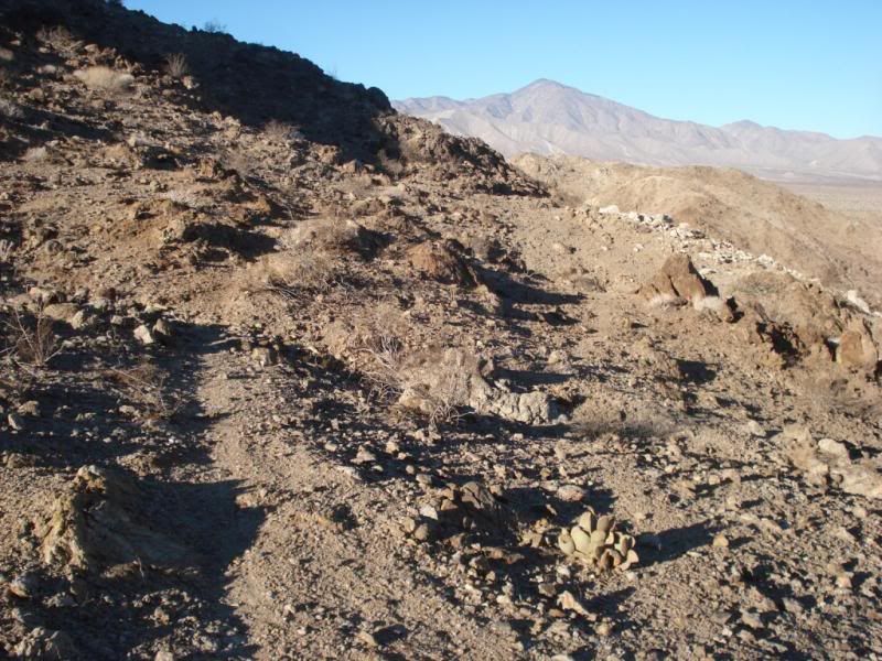
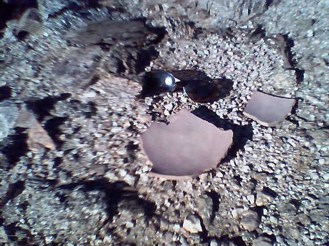
Here's a pic of a trail above the ancient shoreline to the north I hiked recently.
sunglass for scale of sherds
edited by rockhopper on 2/8/2014
Is that ascending from the desert floor or further up in the Fish Creek Mts? The only other one I've been on is a couple miles up and is an old mining trail heading to about three mines on the top of the mountains. Nice potsherds! Tom
|
|
|
link
|
|
tommy750 Posts: 1086
2/8/2014
|
Florian wrote:
Is there a legal vehicle route all the way through from Plaster City to Fish Creek? I'm assuming there is you went to the Whit BM. I was somehow thinking was closed to vehicles.
-Florian
edited by Florian on 2/8/2014
EC085 is the way! Just east of the covered parking at Plaster City off Evan Hewes Hwy is the entrance from the south or make a left onto it while heading south on Split Mt Rd just past Fish Creek. It's twenty-five miles of nice smooth road that will take you less than an hour to travel with a few areas of deep sand and a few areas of deep silt. Wouldn't recommend 2WD unless you're really talented or have a 4X4 right behind you 
|
|
|
link
|
|
tommy750 Posts: 1086
2/8/2014
|
Jim (ziphius) wrote:
Nice tour Tom. Is that memorial something you just happened to stumble upon, or is there some history that led you to search for it?
Just stumbled on it. Googled the name and some hits on a guy in Oceanside but don't really know. Tom
|
|
|
link
|
|
tommy750 Posts: 1086
2/8/2014
|
dsefcik wrote:
Looks like some fresh tracks going off towards the target. I have heard from a credible source that those circles I mentioned were used by 1960-70's desert hippie kooks...but who knows. Wish I was able to get out there with you...
Yes, they looked fresh. Can't imagine aerial bombing practice a few hundred yards from a public road but who knows. Have seen some F-18s making low passes through that area before but didn't see any ordinance. Tom
|
|
|
link
|
|
rockhopper Posts: 678
2/8/2014
|
Tommy750,
Not near Fish Creek , but up near the northern boundry of the ABDSP where the ancient lake met the mountians also is where there are quite a few cross mountianous terrain trails are also. I'll post a "best of" picks from my recent hikes.
Still praying for big rains in the Santa Rosa mtns.
|
|
|
link
|
|
anutami Posts: 491
2/9/2014
|
tommy750 wrote:
EC085 is the way! few areas of deep silt. Wouldn't recommend 2WD unless you're really talented or have a 4X4 right behind you
Thanks for the TR! When we were out there over New Years people were shooting towards the mountains and made it impossible to hike around. Someone even brought a. 50 cal. and was blasting away! Its seems to be a very popular place to shoot out there. What is your strategy for the deep silt areas? Do you take them straight on or try and detour around? I would not even attempt in 2wd, it felt scetchy to me in 4WD plus I lost my camper out their so I have a lot of respect for that road!!!! Have you talked to any Border Patrol about how often the drug runners use that road? It seems that would be a very popular route.
|
|
|
link
|
|
rockhopper Posts: 678
2/9/2014
|
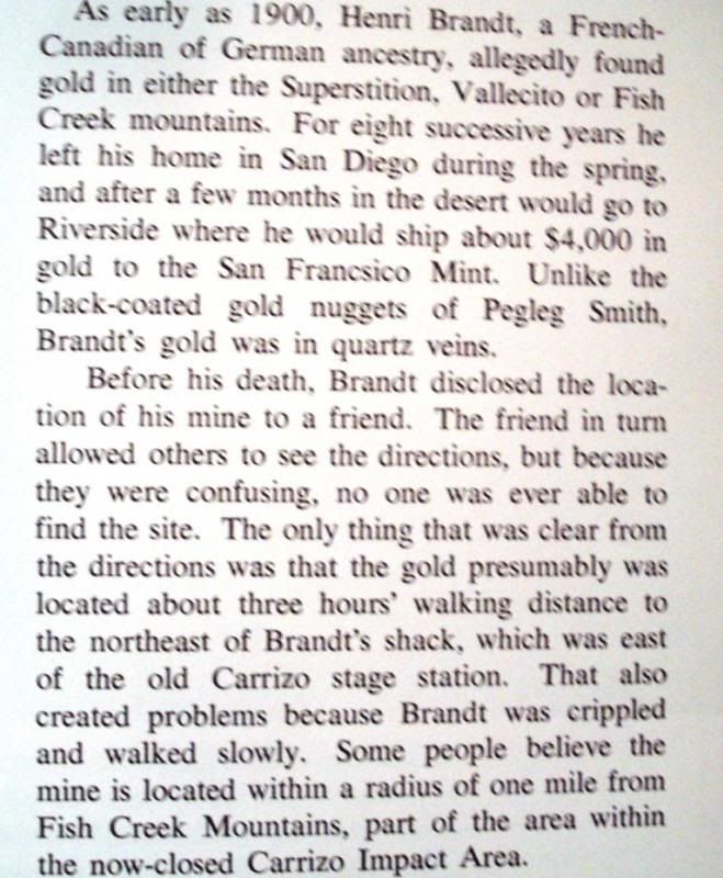
Found this in a book ("Our historical desert" Lindsay) describing the mining in the area maybe?
edit to make picture post
edited by rockhopper on 2/9/2014
|
|
|
link
|
|
Florian Posts: 129
2/9/2014
|
tommy750 wrote:
EC085 is the way! Just east of the covered parking at Plaster City off Evan Hewes Hwy is the entrance from the south or make a left onto it while heading south on Split Mt Rd just past Fish Creek.
Thanks for the info! I want to visit the Whit BM too.
-Florian
|
|
|
link
|
|
tommy750 Posts: 1086
2/9/2014
|
Nolan (anutami) wrote:
tommy750 wrote:
EC085 is the way! few areas of deep silt. Wouldn't recommend 2WD unless you're really talented or have a 4X4 right behind you
Thanks for the TR! When we were out there over New Years people were shooting towards the mountains and made it impossible to hike around. Someone even brought a. 50 cal. and was blasting away! Its seems to be a very popular place to shoot out there. What is your strategy for the deep silt areas? Do you take them straight on or try and detour around? I would not even attempt in 2wd, it felt scetchy to me in 4WD plus I lost my camper out their so I have a lot of respect for that road!!!! Have you talked to any Border Patrol about how often the drug runners use that road? It seems that would be a very popular route.
The shooters were out in force about 3/4 mile further north when I was hiking around BM Whit. Looked like they were firing NW into a hillside. One of them even has a small cannon. My strategy for silt is to find the shallowest track and go for it. There are now about 3-4 parallel tracks through that area and some aren't really bad. About a month ago I was heading through the silty stretch and nearly swapped ends a couple times when I tried driving on the steep slope right next to the tracks. I get stopped about every other time I go through there by the BP. Got stopped on Friday and the agent wanted to peek in my shell and back seat. An agent last year said coyotes run immigrants straight through the Fish Creek Mts on 1-2 day trips which must be really tough since the terrain is terrible. BTW, saw an abandoned PU shell by the side of the road on EC085. Tom
|
|
|
link
|
|
tommy750 Posts: 1086
2/9/2014
|
rockhopper wrote:
Found this in a book ("Our historical desert" Lindsay) describing the mining in the area maybe?
edit to make picture post
edited by rockhopper on 2/9/2014
That is a great story! Here's all the mines I've found the couple times I've climbed into the Fish Creek Mts. Looks like they could be three hours NE of the stage station 
Fish Creek Mines by tomteske, on Flickr
|
|
|
link
|
|
rockhopper Posts: 678
2/10/2014
|
I think the "shack" shown as a pinned photo on G.E. near the Carrizo stage station maybe Brandts shack.
|
|
|
link
|
|
surfponto Administrator Posts: 1369
2/10/2014
|
Great trip post Tom
You always find some great places and give great descriptions.
Hmmm Gold .....
--
https://www.anzaborrego.net/


|
|
|
link
|
|
anutami Posts: 491
2/10/2014
|
rockhopper wrote:
Found this in a book ("Our historical desert" Lindsay) describing the mining in the area maybe?
edit to make picture post
edited by rockhopper on 2/9/2014
Wow! I did the math and if that were today $4000 worth of gold in 1900 is approx. 190 ounces of gold today or $241,965. Not bad for a few months of work each year! Maybe I should start a prospecting career
|
|
|
link
|
|
tommy750 Posts: 1086
2/10/2014
|
rockhopper wrote:
I think the "shack" shown as a pinned photo on G.E. near the Carrizo stage station maybe Brandts shack.
As best as I can determine from LIndsay and Wray, the rock house west of the stage station was built by the Graves Family out of El Cajon in the early 1950s. The land was deeded to ABDSP and the place fell into disrepair. The Brandt cabin was supposedly four miles east of the stage station somewhere between the mouths of Deguynos and Barrett Canyons. Regardless, Desert Mag has the "exact" location and it's smack dab in CIA. The full article is in the July 1966 issue and is actually a response to an October 1964 article that suggest an approximate location. Again, thanks for the great story. Tom
X marks the spot!
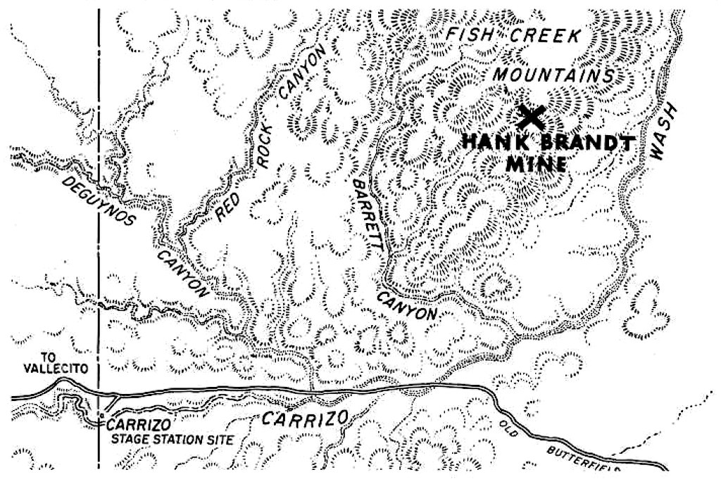
Hank Brandt Mine by tomteske, on Flickr
|
|
|
link
|
|
anutami Posts: 491
2/11/2014
|
Speaking of the stage station, I tried to head out there but the Road was closed. There were many tracks ignoring the closure. I decided to turn around but was very tempted to continue on.

Is this because of the wind farm?

As soon as I saw the police line I didn't want to get in trouble.

|
|
|
link
|
|
dsefcik Administrator Posts: 2634
2/11/2014
|
@anutami: Yeah, I know they (park) are doing a bunch of different things out at the stage station, Tamarisk removal, station restoration, etc.
@tommy750: Now I know where Graves Ave in El Cajon got it's name from.
--
http://www.sefcik.com
http://www.darensefcik.com
http://www.carrizogorge.com
|
|
|
link
|
|
Florian Posts: 129
4/9/2014
|
I drove EC085 for the first time today. Drove south to north. Lots of silt and not a very interesting road. But the Fish Creek mtns are enticing. Didn't do much hiking but did visit the WHIT benchmark and signed below Tom .. http://instagram.com/p/mls77rvarT
The register needs a new logbook.
-Florian
|
|
|
link
|
|
tommy750 Posts: 1086
4/9/2014
|
Florian wrote:
I drove EC085 for the first time today. Drove south to north. Lots of silt and not a very interesting road. But the Fish Creek mtns are enticing. Didn't do much hiking but did visit the WHIT benchmark and signed below Tom .. http://instagram.com/p/mls77rvarT
The register needs a new logbook.
-Florian
Agree, the mts are enticing. Still need to hike the entire ancient shoreline on the NE edge and spend a day or two on top. Anyone know a source to ID old mining claims? There's a bunch of them out there. Would be interesting to know their history. Tom
|
|
|
link
|