3/11/2013
Topic:
Smoketree Canyon area
hikerdmb
|
Nice TR. I have not been up in that area. Looks pretty interesting. Good find on the arch too.
David |
3/11/2013
Topic:
Elephant Knees
hikerdmb
|
Another great trip/adventure/learning experience for your kids. I love the rainbow pic. Glad you got out okay. Looked like a good stuck. |
3/28/2013
Topic:
4 Day Backpack in Rockhouse Canyon / Dawns Peak
hikerdmb
|
Nice pics Daren. Looks like another great trip. Can I be jealous? I need to get out to ABDSP. Just got back from second weekend in a row in the Sierra with a side trip to the Eureka Sand Dunes. |
3/30/2013
Topic:
West Mesa and Ancient Lake Cahuilla
hikerdmb
|
Very interesting area. Thanks for sharing all the info. |
3/31/2013
Topic:
Mojave Desert and Las Vegas
hikerdmb
|
Saguaros are beautiful cacti. I have always wanted to find a Saguaro "boot." Found a few partials in Organ Pipe back in the day but never found a complete one. Maybe one day. |
4/1/2013
Topic:
Rattlesnake Spring / Pyramid Peak
hikerdmb
|
I love the photo of the skull and bones under the boulder. Great shot. Is that the vertebrae in the photo of the small sheep carcass? |
4/1/2013
Topic:
Eureka Sand Dunes
hikerdmb
|
Here are a few pics from the Eureka Sand Dunes in the northern part of Death Valley NP. Took this trip midweek before Easter. Got there by way of Big Pine, about 28 miles of pavement and 20 miles of washboard. There was a nice dust storm blowing when we arrived.
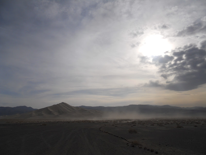
Pulled off onto some hard pack to help escape the blowing sand. Had a great view of the Last Chance Mountains.

By the next morning the wind had died to calm and the sand dunes were looking fresh.

Climbed up the dunes, not quite all the way to the very top but high enough for a great view. That's me looking small at the top with Wylie.

Great views to the south.

And to the north up Eureka Valley all the way to the White Mountains.

And back toward the east to the Last Chance Mountains.

Here are a couple shots of Wylie enjoying himself. He liked the dunes almost as much as snow.
 
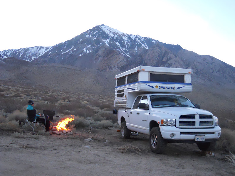
Here are a couple extra shots from the same trip. This is from a campsite at about 7,500' near the Buttermilks west of Bishop. That is Mt. Tom (13,652') behind the camper.
And finally here is the rig after getting gas in Independence with the Sierra in the background. It is going to be a dry year unless something magical happens soon.
 |
4/2/2013
Topic:
Indio Fish Traps and SSTB
hikerdmb
|
I have camped in the impact area "by accident" also. There are some great canyons out there and some nice ocotillo forests too. |
4/2/2013
Topic:
Anza Borrego Peak Wildflower Bloom For 2013
hikerdmb
|
That last pic is very cool. I don't ever remember seeing anything like that before. What is it? |
4/3/2013
Topic:
Eureka Sand Dunes
hikerdmb
|
We did not have the place to ourselves. There were probably 50 other people camped around the dunes area but pretty spread out. This was my third time there and on the first two trips only saw a total of one other person. He was a guy from Germany and his nickname was Sputnik. I traded him my DV map for his German map.
On my camper I have installed a solar panel and done a few mods inside to gain a bit more storage. On the truck I added airbags and a leveling kit to help with the load. Love my camper.
David |
4/9/2013
Topic:
Cougar Canyon and Boulder Alley
hikerdmb
|
That is an awesome canyon and your pics were great. Did Rusty have any troubles getting up there? Other than the heat. I haven't been up that canyon for probably 20 years but your pics brought back some good memories for me. Thanks! |
4/11/2013
Topic:
Nolina to Palo Verde and Spots in between
hikerdmb
|
I finally got back out to the local desert this past weekend. I am currently training for the John Muir Trail this summer and have not been out to the desert as much as usual. The weekend of April 6-7 though I made time for a quick road trip. We saw lots of cactus and Ocotillo blooms and a few shrubs blooming but not much in the areas we covered. We started our tour in Pinyon Wash and then headed up Nolina Wash.
From the lower part of Pinyon Wash, looking up toward Bighorn Canyon, there was a nice red line across the bajada made by all the blooming Ocotillo.

Went up to the end of the road in Nolina and then on the way back down stopped and explored a bit in a side canyon. Lots of Beavertail and Ocotillo blooming.

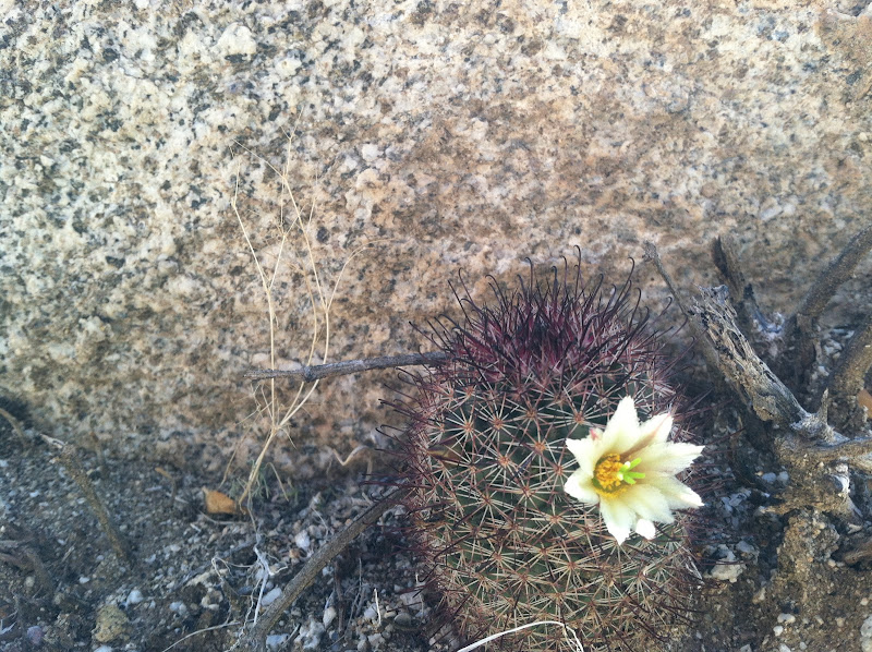
Saw a few of these pincushion type cactus blooming. These are very small. Not sure of the name.
After exploring a bit we headed back to the highway and then down to the bottom of the Texas Dip where we turned east in San Felipe Wash. Decided to head up into Hills of the "Moo" wash and check that out.

Found a little monument built up near the end of the road.

It is beautiful but stark up in those hills.

Took the Cut Across Trail over to Palo Verde Wash and headed up looking for a site to stay out of the wind. Found lots of blooming Palo Verde trees in the wash. Lots of bees around the flowers.

Found a protected site. It was suppose to be really windy Saturday night so we camped below a cliff that blocked the wind coming from the west. Our site was nice and calm but just out in the wash the wind howled for most of the night. We also had some nice shade which was good because it was quite warm on Saturday afternoon out there.
Up above our site there were a couple of Palo Verde Trees and some old tracks heading across the desert.


We went out for a little night hike and found this guy out in the wash. He had 8 legs and 2 giant feelers in front that just skimmed across the ground as he moved. Very cool looking creature. Anyone know what he could be? My friend was thinking it was something called a pseudoscorpion but not sure. He was about 2 inches long.

It was good to be back in ABDSP even for a short trip. Hopefully I will get back out again before it gets too hot. |
4/12/2013
Topic:
Nolina to Palo Verde and Spots in between
hikerdmb
|
dsefcik wrote:
Good luck on your JM trip, should be fun and beautiful. I have noticed mostly cactus blooms in all of my last few trips out and also the Creosote. Lots of great beetles in them. It looks like those roads/washes are not too bad, my big truck could cruise thru them? I have not been out in that area yet.
Your truck could make it all through there without any problem. In fact I saw something I have not seen in a long time... newly bladed road. The first part of the Cut Across Trail where it leaves San Felipe Wash was graded for about a mile.
edited by hikerdmb on 4/12/2013 |
4/14/2013
Topic:
Toyota 1HZ Diesel Motor Rebuild Complete
hikerdmb
|
Sounds great! Bet you can't wait to get it out in the desert again. |
4/14/2013
Topic:
Fish Creek Mts and Ancient Lake Cahuilla
hikerdmb
|
Great pics. That trail looks like it took you up to a nice area and some very interesting stuff. Good find. Red Rock and Barrett Canyons are great places. |
4/15/2013
Topic:
Fish Creek Mts and Ancient Lake Cahuilla
hikerdmb
|
tommy750 wrote:
hikerdmb wrote:
Great pics. That trail looks like it took you up to a nice area and some very interesting stuff. Good find. Red Rock and Barrett Canyons are great places.
The trail was still pretty intact with only a couple bad spots. Nice plateau on top which would make a nice camp spot. Started way too late to make it into any of the canyons. Care to elaborate on "Red Rock and Barrett Canyons are great places?" Thanks. Tom
Those canyons are beautiful, especially Red Rock. Can't legally go in there. I will see if I can find any old pics from the days before digital cameras. I haven't been there in many years. |
4/16/2013
Topic:
Weather Watch
hikerdmb
|
I have found the site that Daren posted to be the most accurate espcecially with wind. The map on the right side of that site is the key. You can move the map to anyplace you want and then click on the spot and it will give you the forecast for that spot. It is amazingly accurate since it takes into account elevation.
I also use this site to see more current conditions. Just click the place on the map you are interested in.
http://www.wrh.noaa.gov/mesowest/mwmap.php?map=sgx&limit=1&list=1 |
4/24/2013
Topic:
Inner Pasture Day Trip
hikerdmb
|
Awesome video Daren. Are you using a tripod? How old do you think the lambs are? I like the zoom on your camera. That is pretty amazing for a point and shoot. |
4/27/2013
Topic:
Dos Cabezas and Goat Canyon
hikerdmb
|
Great TR and the bighorn pic is spectacular. Nice job getting the kids out there too. |
5/8/2013
Topic:
Rockhouse Canyon / Toro Peak BackPack Trip
hikerdmb
|
Awesome trip Daren! |
5/14/2013
Topic:
Sheep & Lower Coyote Canyon Trip
hikerdmb
|
Nice trip. Lots of good pics and description. That is a great area. Hard to believe there are new pay sites up there.
edited by hikerdmb on 5/14/2013 |
6/30/2013
Topic:
Hot weather in Anza Borrego
hikerdmb
|
I saw that coming. I was thinking you would have gone up to Death Valley. I heard they were thinking they might break an all time record sometime this weekend. |
7/3/2013
Topic:
2013 Bighorn Sheep Count now accepting application
hikerdmb
|
Good luck Daren. With the moon coming up so late the next few days you should have some dark skies and great views of the Milky Way. Stay cool and count them all. |
8/11/2013
Topic:
John Muir Trail - definitely NOT related to AB
hikerdmb
|
On July 3, 2013 I finished a 21 day 214 mile hike on the John Muir Trail. Here is the link to the album with some of the pictures I took along the way. My wife did the first 3 days with me and a buddy did the last day summit of Mt. Whitney from Guitar Lake with me. The other 17 days I was solo. Hope you like some of the pics. It was an amazing experience!!!
https://picasaweb.google.com/108036747132863930068/JohnMuirTrailJuly11312013?authuser=0&feat=directlink
David |
8/18/2013
Topic:
Mt. Laguna Burn Area
hikerdmb
|
Drove up to Mt.Lguna last weekend to check out fire damage from last month's fire. I could not believe how green Blair Valley was and also the slope up up into Pinyon Mountain valley area. Here is one pic looking down on the desert and one north and then south from near Laguna Campground. 

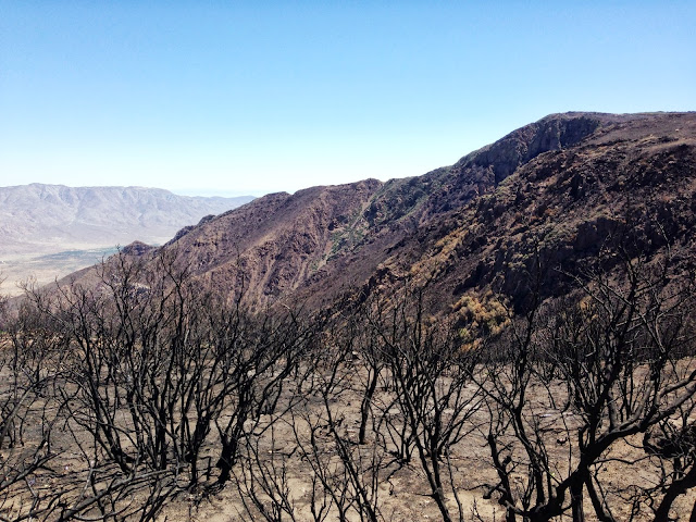 |
8/23/2013
Topic:
Bighorn Sheep Count 2013
hikerdmb
|
Nice pics Nolan. |
8/26/2013
Topic:
Flash Flood Chasing
hikerdmb
|
Nice pics and video. I need to get out there during one of these storms and see what it is like. Thanks for sharing. |
9/7/2013
Topic:
Flood damage around Borrego Springs
hikerdmb
|
Thanks for posting the pics. That is pretty amazing to see the green so late in summer. The ocotillo look pretty thick with green. Hope you had some way to stay cool. |
9/15/2013
Topic:
Quick Trip to Borrego Springs - 9/14-15/2013
hikerdmb
|
After all the rain recently and seeing the pictures on the forum, my curiosity was up, so I decided to take a quick trip out to Borrego Springs and see the area for myself. Driving down S-22 into town I was amazed at the green color on the desert floor southwest of town.

Looking the other direction the hillsides above me were just as beautiful.
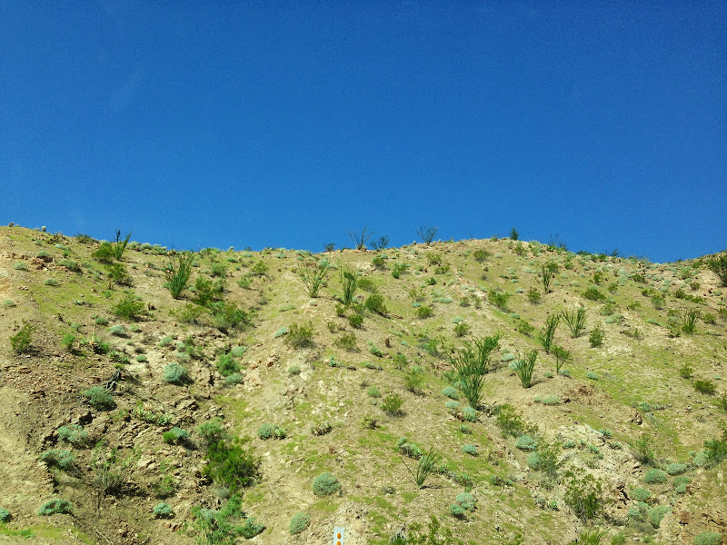
It looked more like springtime or late winter, not the middle of September. I wonder...do Brittlebush plants ever bloom in the fall? These looked like they could but I did not see any buds.

The ocotillo also looked very happy.

Found a nice little "pond" to swim in and relax beside all afternoon and into the evening.

It was a nice trip and I hope the desert gets lots more rain during the winter, just not all in a day. Looking forward to lots of trips this fall.
edited by hikerdmb on 9/15/2013 |
9/16/2013
Topic:
Quick Trip to Borrego Springs - 9/14-15/2013
hikerdmb
|
I zoomed in on the original photo and those are branches. |
9/18/2013
Topic:
Golden Trout Wilderness
hikerdmb
|
Looks like a nice part of the Sierra. Hard to believe some of the meadows are still that green. I've never backpacked in that area but skied out from the end of the plowed road up past Kennedy Meadow a few years back. On anther trip we drove from 395 through Kennedy Meadow and all the way west to the Central Valley. It was a windy road with lots of dirt roads leading off of it. A fun drive. Glad you got out of the desert this year. |
9/18/2013
Topic:
Golden Trout Wilderness
hikerdmb
|
And how is the truck? |
9/20/2013
Topic:
Forum Member Nolan in Truck Camper Magazine
hikerdmb
|
Here is the link to the article in the latest issue of Truck Camper Magazine. It has a great article on Nolan (anutami) , his rig and all the wonderful places he takes his family. Lots of great photos too.
http://www.truckcampermagazine.com/camper-lifestyle/four-season-truck-camping-in-southern-california |
10/9/2013
Topic:
Blair Valley & Cool Canyon
hikerdmb
|
Nice trip. I bet your truck could make it over that spot. That area is so green for fall. Sounds like you have a luxury camp. |
10/12/2013
Topic:
Davies Valley To BM Kirk
hikerdmb
|
I love that area. Spent lots of time out there before the road got gated. Thanks for the pics. |
10/25/2013
Topic:
San Felipe Wash to Old Kane Springs Road
hikerdmb
|
Looks like fun. Good trip and nice pics too. |
10/26/2013
Topic:
Pinyon Wash / Split Rock / Harper Flat
hikerdmb
|
Big hike planned? Are you doing the route from over off split mountain road? |
11/5/2013
Topic:
Harper Flat via Pinyon Wash
hikerdmb
|
Another nice trip for you and your family. Congrats on getting your photo in the 2014 Truck Camper calendar.
David |
11/6/2013
Topic:
Little Blair to Alma Wash Backpack Trip
hikerdmb
|
That is a lot of ground to cover in two days. That sheep body/skeleton is very cool but sad to see. Glad you finally got to do the trip. Nice old school camera. I can see doing some interesting double exposures on purpose with that set up.
David |
11/13/2013
Topic:
Big Spring and Galleta Meadows
hikerdmb
|
Kit fox tracks in the mud? Very cool photo. |
11/26/2013
Topic:
Orocopia Mountains
hikerdmb
|
My friend and I did the Bradshaw Trail a couple of years ago. When we did the trail we pretty much went straight through, west to east. While on that trip we saw lots of roads joining the trail and vowed to go back and check some of them out. This was our first trip back to that area. On this trip we circumnavigated the Orocopia Mountains. It was a beautiful loop. We were in a Toyota Tacoma and it was just the right size for the Red Canyon Jeep Trail section of this trip. My Dodge would have made it but there were a few spots that would have been way more difficult in a full size rig. Even though the majority of the trip was outside ABDSP, we did spend the first night of this trip in the park, so I posted the TR in this section of the forum.
School was out at 2:23 on Friday and I was out of the parking lot by 2:30. Is that wrong? We were on the road by 3:30. Stopped in Borrego Springs for a burrito and then off to find a spot to camp. Palo Verde Wash was a bit wet so we headed down the Truckhaven Trail to find a spot to spend the night. When we got to our campsite it was still raining but not too much. There was little to no wind on Friday night and once the rain stopped it was a very pleasant night. Here is the view down to Clark Dry Lake in the morning. If you look closely you can see snow covered Toro Peak just above the clouds on the right side of the picture.

On Saturday morning we headed east to the Salton Sea and then around its north end to Mecca. We took the road through Box Canyon and made our way to Interstate 10. The clouds were beautiful as we made our way through the canyon.
Once we reached I-10 we went a few miles to the east on the frontage road and then took off south on the Red Canyon Jeep Trail. We were headed toward the Bradshaw Trail. This was the first time I had been on this trail and the views were spectacular the entire length of the trail.

After a couple of hours and lots of stops to enjoy the scenery we finally got to the edge of Red Canyon. Here is a shot looking back up to the Orocopia Mountains from the rim of the canyon.

Here is a pic from the same spot, looking east to the Chuckwalla Mountains.

We found a nice place to camp at the junction of the Red Canyon Trail and the Bradshaw Trail. The Eagle Mountain Railroad goes right through here and we went over to check it out. There was a nice washout visible from our camp. The culvert that went under the tracks on the left was plugged with silt on the other side of the tracks. The water followed the path of least resistance and took out all the earth from under the tracks. Here is a shot of the tracks and then from on the tracks looking across the washout to the west.
A little bit west of our campsite was this incredible cliff. On the backside you could walk right up it. It is located on the northeast corner of the intersection of Red Canyon and Salt Creek Wash.

We enjoyed a nice sunset and another night with little to no wind.

Woke up Sunday morning to another beautiful day with no wind and warmer temps. My tent was totally wet from moisture in the air but it dried quickly.

After a slow morning around camp we headed west on the Bradshaw Trail and enjoyed great views to the south into the Chocolate Mountains. These mountains are closed because they are in the center of an aerial gunnery range. But they are very rugged and beautiful.

We saw a few smoke trees that were blooming and some nice green ocotillo but no blooms on them. Here is looking back to the north to the Orocopia Mountains.

As we neared the western end of the Bradshaw Trail we passed under the bridge for the Eagle Mountain Railroad. 
We stopped here for lunch and I took a little walk and found some nice bighorn tracks in the mud.
Once we went under the bridge, the Bradshaw Trail follows the Coachella Canal for about 10 miles back to highway 111.

Here is a picture of our route around the Orocopia Mountains. We went clockwise. The Red Canyon Jeep Trail is the section heading south from I-10 near Chiriaco Summit.
.
A great trip to start the Thanksgiving break. |
11/27/2013
Topic:
Inner Pasture - Searching for the spring
hikerdmb
|
Nice photos Daren. |
12/3/2013
Topic:
Sunset Mountain / Pinyon Wash / Harper Flat
hikerdmb
|
Looks like a good first trip for your buddy. Now he is going to think you find that great stuff and see a herd every time. Nice job Alex finding the remains and congrats on getting the tree hugger label.
David |
12/4/2013
Topic:
Mese Verde National Park
hikerdmb
|
Awesome trip. Beautiful photos. I love Utah with snow. What was the coldest night in the camper? |
12/6/2013
Topic:
Sunset Mountain / Pinyon Wash / Harper Flat
hikerdmb
|
I agree with Daren. Harper Flat is quite large. I have backpacked into there 6 or 7 times over the years and come into it from 3 different spots and still haven't seen all of it. I remember hearing there were sleeping circles out there somewhere but I have never been able to find them. One of the largest pottey pieces I have seen in ABDSP I spotted in the middle of the flat. It is usually a quiet area although on a couple occasions there was a large group of day hikers near Pinyon Wash. |
12/16/2013
Topic:
Found Camper Part in Sheep Canyon
hikerdmb
|
Oh no. Glad everyone is okay. That is a very sad picture. Is that your new camper? |
12/20/2013
Topic:
The Mud Palisades & Anicent Forest of Fish Creek
hikerdmb
|
The wood pics are incredible. Hard to believe it hasn't been picked clean. As a fellow truck camper I am feeling your pain. Hope you get a new one soon. |
12/31/2013
Topic:
Diablo Dropoff graded
hikerdmb
|
How about the narrow rocky section when you turn off Fish Creek and head toward going up the drop off? Graded? Also, are both sections of the drop off graded? Upper and lower? Last time I went up, the lower part was much more difficult than the upper part. |
1/6/2014
Topic:
Jamul Kiln Ruins
hikerdmb
|
Never knew about this. Looks like an interesting place to visit. Is that 30 feet tall overall or is just the smokestack part 30feet? |
1/10/2014
Topic:
Land Cruiser ARB Front Bumper Install
hikerdmb
|
Nice. Looks great. |
1/15/2014
Topic:
Sold my truck
hikerdmb
|
Nice truck Daren. It will get you way more places than the Dodge. |
1/23/2014
Topic:
Illegal camping
hikerdmb
|
Amazing that someone would want to camp right next to you when there I are so many places to camp. Nicely done trying to cover up the spot. Once we were backpacking in Organ Pipe and a couple started setting up really close. My buddy started making loud moaning and groaning sounds and the people moved on out of sight and out of sound range too. |
2/12/2014
Topic:
Night timelapse from the last few weeks
hikerdmb
|
Nice film. I like the racetrack shot. Welcome to the forum.
David |
2/12/2014
Topic:
Subject: Presidents Weekend
hikerdmb
|
I agree that Nolan's trips with his kids are the best camp/ hike reference you will find. No matter where you go you will have a great trip. Also DHheuschele, do the JMT. It is a life changing experience. |
2/20/2014
Topic:
Subject: Solar Recommendations
hikerdmb
|
I have the Goal Zero Guide 10 Plus Solar Kit which includes a Nomad 7 solar panel and the Guide 10 battery pack. It might be a little smaller than what you are looking for but I have had it for a couple of years and it has worked great. I carried it on the John Muir Trail last summer and never ran out of power for my phone, inReach, headlamp, or camera. I take it on most every trip, even car camping or in the truck camper. It will not charge a tablet but supposedly it will give it a boost of 25%. REI sells Goal Zero stuff and they have a great return policy if it does't fit your needs.
David |
2/25/2014
Topic:
Chuckwalla Mountains, The Bradshaw Trail
hikerdmb
|
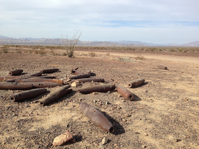
After our November trip out to the Orocopia Mountains we decided we needed to return to the same area east of the Salton Sea and north of The Chocolate Mountains. The trip started on Friday afternoon and we headed out to Borrego Springs to get a burrito at Los Jilbertos. After dinner we headed out to Font's Point to see the lights of town. There were lots of trucks and cars parked just off the highway at the turn off to Font's. We headed out to see what was up. They are filming a movie out there. It is called "Last Days in the Desert" and it stars Ewan McGregor as a holy man (Jesus) on a journey through the desert. While we are standing there talking to the location manager, who should walk by but Jesus himself. Well, finally after 40+ years of me roaming the desert, I finally saw Jesus. My life is now more complete. Can't wait to see the movie and see where all they have shot out there. The location manager, who we talked to for a while, said they were moving over by the air park to shoot later on. It was a pretty amazing sight to see all of the people it takes to make a "low budget" movie. That how it was described to me anyway.
After seeing all the people we headed east to Palo Verde Wash to wait for my brother to join us for the trip east. It was a great night in PV Wash with no wind and very nice temps. Saturday morning we got in the jeeps and headed toward the Salton Sea. We went through Mecca and out Box Canyon to I-10. Then east on 10 to Chuckwalla Valley Road. This road was closed but a friendly CHP officer told us to go ahead and go around the signs. Kept going east until we reached Graham Pass Road. Headed south a ways and turned off onto the Augustine Pass Road. Here is the view looking south to the Chuckwalla Mountains from the road heading to Augustine Pass.

This was a fun road in the jeeps but I would not want to take anything with a much longer wheelbase or wider track on this trail. There are lots of twists and turns that would be very difficult in a larger rig. Here is a pic of the squeeze just north of the pass.

Once over Augustine Pass we stopped for a late lunch break.

When we were down off of the pass we joined up with the Bradshaw Trail. This is my third time on this trail. Did it the first time west to east and then did the western most section in November. Each trip has been so different but incredible in its own way. After driving west for a ways we came upon the bomb exhibit. These are all practice bombs that are filled with cement. It seems that the less damaged duds must have landed on a soft surface while others were split wide open. The fins have all be removed from these but we did see some others that still had the fins.

We kept heading west and took a little side trip up the loop trail of Amy's Wash. Came upon the the Karen Kayla Mill Site and old cabin. It is pretty rough inside but I guess you could stay in there if you wanted. There were some supplies and a register to sign.

We backtracked away from the cabin a ways and found a nice campsite with a great view. Here are the jeeps at camp, resting and dusty.

And here is the sunset from camp on Saturday night

Again on this night we had no wind and nice temps. I didn't set up my tent again and just slept on the ground, some people call it cowboy camping. When I went to bed I set my shoes right next to me. So I wake up in the morning and find that my shoes are missing. I look over and see one shoe about 10 feet away, then a sock, then about 30 feet away I see the other shoe and sock. I looked close and saw some tracks. Here is a track right in the middle of the pic.

My buddy, who is sleeping on a cot, says, "Is that what that Kit Fox was chewing on last night? I thought it was trash." The little guy tried to steal my shoes and chewed up one lace. I'm sure glad he didn't get all the way off with them because I had no back up shoes to wear. I have never had anything like this happen before. Anyone else had items stolen or attempted to be stolen by desert critters?

After a slow morning in camp we headed on west to the cliff at the bottom of Red Canyon.

Then on to the end of the Bradshaw Trail. Here is the view to the Salton Sea from just before hitting highway 111. It was a beautiful afternoon even if it was a bit hazy to the south.

Finally here is the route we took. We went clockwise and the small loop we also did clockwise is Amy's Wash.

I am guessing we did close to 350 miles on this trip from home to home. Hope you enjoyed the TR.
David |
2/28/2014
Topic:
Ella Wash and Coyote mtn hike
hikerdmb
|
Nice trip. I like the pic looking down on Clark and also the pic with the trail. |
2/28/2014
Topic:
Peace and quiet, stars and pottery
hikerdmb
|
Good first effort on the night pic. Did you wave a flashlight to light up the ocotillo? Very interesting pottery piece too. |
3/14/2014
Topic:
Last Days in the Desert movie
hikerdmb
|
The article, and also the location manager I spoke with for this movie, said it was a low budget film. It is amazing how many people were around the set at Fonts Point the night we saw them filming. I wonder how many people it takes to make a big budget film. |
4/1/2014
Topic:
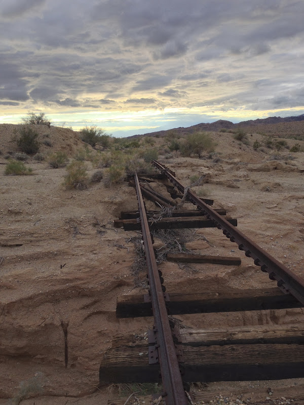
Campo RR
hikerdmb
|
I like the photo better than any part of the story. It all sounds a little suspicious. |
4/1/2014
Topic:
Mojave Desert
hikerdmb
|
Lots of good stuff out there. Glad you got to hike again. |
4/1/2014
Topic:
Another Journey Up Fish Creek with a Backpack trip
hikerdmb
|
Nice trip. Your kids are very lucky. Like your tent too. |
4/8/2014
Topic:
Carrizo Valley this week
hikerdmb
|
Looks quiet and peaceful. |
4/22/2014
Topic:
Blair Valley Meditation Retreat 4/11 - 4/20
hikerdmb
|
Nice TR. I have spent a day in the Sierra sitting and watching, listening, feeling and that was really great. Not sure I could do a week in one spot. Welcome to the forum. |
4/29/2014
Topic:
Cactus spring trail to Martinez Canyon Rock House
hikerdmb
|
Looks like a beautiful and rugged area. Thanks for the TR. |
5/5/2014
Topic:
Sombrero Overnight Backpack
hikerdmb
|
I've never been to Sombrero from that side. Looks like a nice campsite though. Did you go to the top? Sombrero was my first ever desert peak that I climbed solo. That was a long time ago. Thanks for the TR and good luck getting the weight of the pack down. |
5/10/2014
Topic:
Hike in the Grand Canyon
hikerdmb
|
That bridge is amazing. It ends right into the cliff? Three hours down. How long to get back up. Beautiful photos and video. Did you take a dip in the river?
David |
5/29/2014
Topic:
Memorial Day Hikes
hikerdmb
|
Did you enhance the green on the boulder? Does this mean your back is better? |
5/29/2014
Topic:
Memorial Day Hikes
hikerdmb
|
I thought you were taking the easy way up? |
6/5/2014
Topic:
First Trip Report with my new rig
hikerdmb
|
That is a beautiful part of the world. We've been up there a few times and camped in some of your spots. Love Fern Canyon too. |
6/18/2014
Topic:
Borrego Palm Canyon "Fannypack" Trip
hikerdmb
|
Glad you are able to get out there Daren. Sorry you are still having back troubles. But you are making the best of it. Way to adapt to an ultra ultra light weight pack. |
8/27/2014
Topic:
Racetrack Mystery Solved
hikerdmb
|
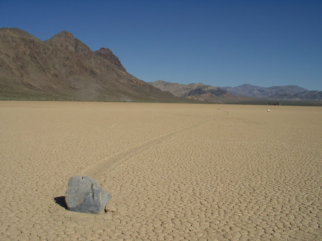
I was pretty sure it was UFOs moving the rocks on the Racetrack Playa in Death Valley, but apparently I was wrong. Who would have thought?
http://newswatch.nationalgeographic.com/2014/08/27/watch-death-valleys-rocks-walk-before-your-eyes/
 |
8/27/2014
Topic:
Racetrack Mystery Solved
hikerdmb
|
They said in the video they carried 70 rocks out onto the play and tracked them for 2 years before they finally got movement. |
9/9/2014
Topic:
September Rain?
hikerdmb
|
Anyone know rain amounts or locations around ABDSP that received rain over the last few days? |
9/15/2014
Topic:
Little Blair and Thomas Mountain
hikerdmb
|
Got out to the desert for the first time since late spring. Headed out Friday about 5:00 PM. Didn't want to get out there too soon since it was well over 100 degrees that day. Made it to Little Blair Valley just as the sun set. It was only about 88 degrees when we got there and it was perfect weather for shorts and t-shirt. There was no wind and the stars and the Milky Way were quite spectacular until the moon came up around 9:00. There was lots of evidence on the road and in the small washes we passed that it had rained recently but everything was very dry. The ocotillo in the area were covered in new growth and a few had blooms. It never got the least bit chilly during the night so pretty much slept without any covers most of the night. Woke early on Saturday and took a quick climb up to the Shake Benchmark near our camp before the sun hit our camp.
Here is a pano from on top with Little Blair Valley on the left and Earthquake Valley on the right.

Here is looking down on the campsite from the Shake BM.

This shows some of the ocotillo near camp.

Sat in the shade for a while after I climbed down and then packed and headed to higher elevations. Drove back up S-2 and around the east and north side of Palomar Mountain. Then turned toward Anza and Thomas Mountain. Found a nice campsite at about 6,500' and enjoyed the cool temps of the mountains. Took a couple short walks around the area and enjoyed a fantastic sunset.
Here are some of the bigger trees on Thomas Mountain. They are really hurting from the lack of rain and snow the last few years. I couldn't believe the amount of dead wood on the forest floor. You can see some of the large branches which have fallen off these trees.

Here is the view looking north to Tahquitz Peak, San Jacinto Peak, and San Gorgonio Mountain.

This is the view to the west with Diamond Valley Reservoir in the center of the pic.
Finally here is a pic of sunset from about the same spot.
 |
9/15/2014
Topic:
Little Blair and Thomas Mountain
hikerdmb
|
I didn't look for the register on Shake so can't help with that. I have also heard stories of missing registers all over the Sierra. I think the story I read came to the conclusion that they were being taken because of some of the names in the old ones and because some people felt the need to "save" them before they were "taken." Would love to see some pics and hear about the Sierra. This is the first summer in 25+ years I did not make it up there. |
9/23/2014
Topic:
Olancha, Sirretta Peaks and Monache Meadows Sierra
hikerdmb
|
Thanks for the photos Daren. It looks really dry. The low water at the crossing of the Kern is pretty sad. Looks like you had some clear skies while you were up there. I have been up that way a few times and it is a great area to explore. We went up one year and snow camped and skied around for a couple of days on some nice and easy terrain. Olanche Peak sure is different on the west side compared to what you see from 395. Let's hope for lots of rain and snow this year for our deserts and the Sierra. |
10/15/2014
Topic:
AB overnight 10/14/14
hikerdmb
|
Is the "where am i" photo the upper end of June Wash? |
10/20/2014
Topic:
Return to Ghost Mountain
hikerdmb
|
You get the cholla and the kids boulder hop barefoot. |
10/26/2014
Topic:
Driving The Mojave Road
hikerdmb
|
Love that road. So many spots with huge views and plenty of history too. A fun trip every time. |
11/7/2014
Topic:
Indian Valley / In-Koh-Pah Mountains Backpack
hikerdmb
|
Sorry your back is still hurtin. Glad you are still out there. Looked like a great trip. |
11/14/2014
Topic:
Rockhouse Canyon in Carrizo Gorge Backpack
hikerdmb
|
Great view from up high. Nice pics as always. I need to get out there. |
11/17/2014
Topic:
Carrizo Gorge Backpack
hikerdmb
|
Wow. The floor of the canyon looks so empty. Did they haul out all the tamarisk? Nice skull too. |
11/18/2014
Topic:
Whale Peak via the Pictograph Trail
hikerdmb
|
Nice trip and pics. Whale peak is a great trip. Welcome to the forum. What was your group? |
11/25/2014
Topic:
RockhouseValley (north) backpacking TRIP
hikerdmb
|
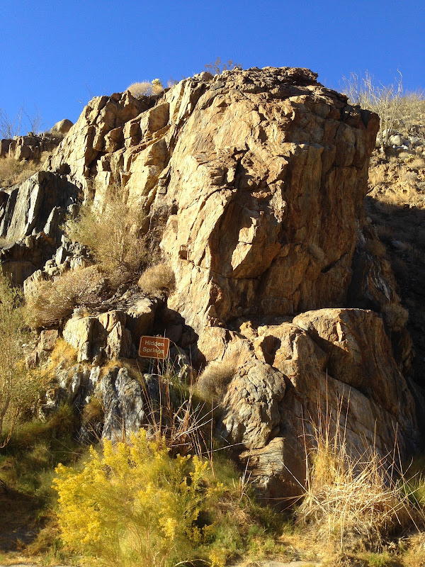
This was my third trip out to Rockhouse Valley. The first was about 20 years ago. The last time I was out there was March 2012. I have also been out that road to visit Jackass Flat a couple of times. I can say the road out to the trailhead is much worse than ever before. The last section from Butler Canyon to the end is definitely four wheel low. We didn't start hiking until a little before 3:00 PM and made it up through Rockhouse Canyon into the valley just as the sun was hitting the top of the Santa Rosa Mountains. It made for a nice sunset.
Here is a pano from our camp site near the lower rock houses.

I headed over to the lower rock houses for a couple of pics as soon as I dropped my pack.

The weather was forecast to be windy but it only blew off and on for part of the night. Since we were outside the park boundary we took the opportunity to have a small campfire. In all my trips to the far northern part of ABDSP I have never seen another person in this area so I was quite surprised to see some headlamps across the valley from our camp. It was a wonderful night to sleep under the stars

In the morning we had a quick breakfast and packed up our packs. Then we headed back over to the lower rock houses to take a couple of pics.
Here is one of the ruins looking north across the valley toward Toro Peak we would be hiking up that way to visit the old Santa Rosa Indian Village Ruins on this day.

We followed a wash most of the way across the valley and then picked up the old Indian trail the last bit of the hike up to the village site. When we were near the ruins we noticed some movement up on the hill above and saw three hikers. We figured these were the people whose lights we had seen the night before. Imagine my surprise when we got to the ruins and ran into Daren, who I had hiked with before, and Tom from this forum. They were with a group of six doing a multi night trip. It's a small world. Even in one of the most remote parts of ABDSP.
Here they are as they were leaving the village site.

Here are a few pics from around the largest ruin.


And here is some of the other ruins in the area.

After looking around the village site for a while we headed back to our camp and picked up our packs for the hike back down through Rockhouse Canyon.
Here is a parting shot looking back up toward Toro Peak.

The hike through the canyon is very nice with lots of interesting rock formations. Here is my buddy at the top of the 30' (estimated) dry fall. This gives a nice perspective on the canyon. Don't worry though, there is a nice bypass trail around the fall.
Stopped by Hidden Spring on the way out and found a nice bit of water at the base. Last time I was though here it was dry.
Got back to the jeep and had a nice ride out. Made it home around 7:00. This was a great hike and I got to take my brother and a buddy and show them a part of the desert they hadn't seen before. The hike was a little over 15 miles round trip with about 2,000' of elevation gain to reach the village site.
edited by hikerdmb on 11/25/2014 |
11/25/2014
Topic:
RockhouseValley (north) backpacking TRIP
hikerdmb
|
That looks like the Black Canyon of the Gunnison. Did you go through Pagosa Springs? |
11/26/2014
Topic:
RockhouseValley (north) backpacking TRIP
hikerdmb
|
Jim (ziphius) wrote:
Great trip and 'small world'. Still haven't been to that area. Enough water at Hidden Spring to yield a few liters for backpacking? Any other water / springs found? - Jim
You could get some water out of Hidden Spring. But it is only a quarter mile or so from the trailhead. Daren and Tom's group was relying on springs. Hopefully they will answer that question in their TR. |
11/26/2014
Topic:
RockhouseValley (north) backpacking TRIP
hikerdmb
|
tommy750 wrote:
Was nice to meet you Dave. Have to agree Rockhouse is pretty desolate and a very big coincidence our two groups met up. Don't think I saw another human footprint out there the entire trip. Great place to explore. Tom.
Nice meeting you too Tom. Always nice to run into forum members. Can't wait to see and read about the rest of your trip. |
11/30/2014
Topic:
Rockhouse Canyon / Buck Ridge / Jackass Flat 4 Day
hikerdmb
|
Hard to see but could the tracks be bear? It looks kind of long. I know there are bears in the San Bernardino NF. Nice trip report and pics too. Love the arrowhead. |
12/1/2014
Topic:
Carrizo Palms via East Fork Carrizo Gorge
hikerdmb
|
Looks like a great day. Let's hope for some rain in the next few days. |
12/2/2014
Topic:
Piedras Grandes / Indian Hill
hikerdmb
|
Is the hand in the sun cave at Indian Hill? I have not seen it. Is it visible without your stretch program? I used to go to that southern area all the time but not anymore. I guess as long as you don't look to the east... |
12/2/2014
Topic:
Rockhouse Canyon / Buck Ridge / Jackass Flat 4 Day
hikerdmb
|
There are still remains of the "road" on the west side of the canyon going around the fall. You can see some stacked rocks on the downhill side of the "road" when you look up at it from the canyon floor. My first trip up the canyon we didn't know there was a bypass up the falls and we actually climbed up and around that wall. On the way back down the canyon, when we came to the top of the falls, we looked at the bypass and decided we weren't as smart as we thought. I looked through old files but couldn't find any pictures that really showed the bypass. But here is one from March 2012 from the top of the falls. The bypass is in the dark rocks on the right side of the picture, below the white rock band. The bypass is much more like a road once you get over that off camber section you can see in the picture.
 |
12/4/2014
Topic:
Random photos from Borrego Springs and Culp Valley
hikerdmb
|
That water on the ground is impressive seeing as it was before this week's rain. I like the fall colors pic and the first two with the nice effects. |
12/8/2014
Topic:
Borrego Palm Canyon Backpack
hikerdmb
|
How deep was the pool in picture 5? Looks like you could take a soak in that one. |
12/10/2014
Topic:
Pepperwood Canyon to Canebrake Valley
hikerdmb
|
Excellent trip. |
12/15/2014
Topic:
Vallecito Valley overnight
hikerdmb
|
Every time I am on top of Whale Peak I look down in that valley, see how interesting it looks, and say I need to get out there. Thanks for the great pics. And I still need to get out into that area. |
12/24/2014
Topic:
Another Adventure: Arroyo Seco Diablo
hikerdmb
|
Nice trip Nolan. I am surprised you didn't head on over to the drop off and come out through Split Mountain. I think you will take that truck anywhere. I love that area, esopecially when you get up high and have a view. Merry Christmas. |
12/27/2014
Topic:
5 Day Backpacking Trip Indian Gorge/Canebrake-
hikerdmb
|
Great trip Daren. Does the tarp set up so it is more closed off? Looks like you could get wet if the wind changed directions. How far was this hike? Very beautiful area. |
1/5/2015
Topic:
Fish Creek Wash Fossil Beds
hikerdmb
|
Nice photos Nolan. |
1/5/2015
Topic:
6 Days in the Turtle and Orocopia Mountains
hikerdmb
|
Those are some rugged and amazing mountains. I love that part of the desert. |