1/18/2012
Topic:
Mojave Road
hikerdmb
|
My brother brought 10 gallons. There are so many side roads to explore it is good to have extra just in case. I didn't use any but the jeep used one can on the trail. |
1/18/2012
Topic:
Mojave Road
hikerdmb
|
I never thought $4.89 would seem like a good price but I guess you are right. I remember a bunch of years ago we were in DV and went up to Eureka Sand Dunes and then down through Steel Pass and Saline Valley. We came out to the south and headed straight to Panamint Springs to get some gas and couldn't believe it was $1.99. I had never seen anything close to that price back then. Never thought that would be the good old days, but I guess as far as gas prices it was.
David |
1/18/2012
Topic:
Front level kit
hikerdmb
|
I didn't bring it on this trip. I had not been on the western section of the Mojave Road and wasn't sure what to expect so decided to go without it.
Go to this thread and you can see a couple of pics of it.
http://forums.anzaborrego.net/travel/anzaborregoprevious/forum/topic186-truck-camper.aspx
David |
1/26/2012
Topic:
Round Mountain
hikerdmb
|
Daren,
Nice view from up there. I like the pano shot. I sent you a PM about this weekend.
David |
1/29/2012
Topic:
Little Blair with the 10" Meade Telescope
hikerdmb
|
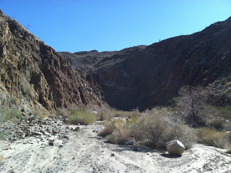
Went out to Little Blair Valley on Friday afternoon for a quick overnighter. The reason for this trip was to set up the Meade 10" LX2000 telescope and take advantage of the clear skies we have had for the last few nights. Got to our campsite and took a quick hike up to the end of the road and then up the canyon a little ways. There were quite a bit of new plants growing in shady areas along the wash.

There were also a few trees along the wash that were blooming. I am not sure of this tree but maybe someone can put a name to it.

Someone built some small stacks near the end of the road.

Wylie climbed up on some boulders for a better view.

As the sun set I got out the telescope and started setting it up for the night ahead.
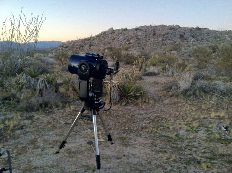
This scope has a 10" mirror so it gathers lots of light which makes for great viewing almost anywhere but this night was special for sure.

It turned out to be one of the best nights viewing I have ever had in the desert. We saw Venus, Mars, Jupiter (could see the Red Spot) and stayed up til 1:00 to see Saturn. The Great Nebula of Orion was amazing. I have never seen so much of the cloud no matter where I set up the scope. We also saw many, many open star clusters, the most impressive was the Double Cluster which is found near Cassiopeia. We also viewed the Andromeda Galaxy and a few other very faint galaxies. I saw the Crab Nebula for the first time ever on this trip. I wish I could take some photos through the scope to share but I lack a camera for that. I brought the bino-viewers and used them for a great deal of time (think binoculars hooked up to a telescope) to see the mountains and craters on the moon as well as many of the other objects we viewed. Using bino-viewers gives everyting a whole new perspective.
Here is a pic of the scope with the bino-viewers hooked up.

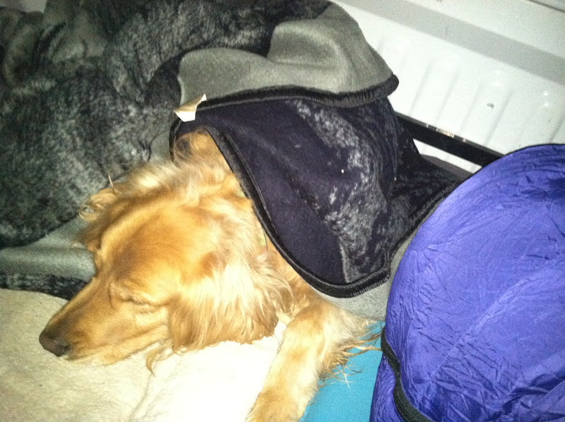
Finally got to bed about 1:30 AM and slept in the back of the truck with the best dog in the world. It got down to the high 30's during the night but we stayed warm.
My buddy Andy took a bunch of night sky pics with his camera and I will add some to the forum when he finishes working with them. |
1/30/2012
Topic:
Bighorn Sheep at Indian Hill Trailhead
hikerdmb
|
That is so great that you saw that herd. Those look like some big old rams.
David |
1/30/2012
Topic:
Little Blair with the 10" Meade Telescope
hikerdmb
|
I was a great night! I looked at those clips to hook my iPhone to the scope but haven't decided yet on getting one. I wish they made one that would attach to a 2" eye piece. All I have found so far attach only to the 1 1/4" eye piece. Thanks Bob for the tree name. Now that I look at it up close, it looks very close to the flowers my apricot trees at home get.
David |
1/31/2012
Topic:
Sombrero Peak
hikerdmb
|
Last time I was up Sombrero there were lots of ducks and it is easy to find your way. There is a false summit but just keep going up. There are a couple of huge boulders at the top that are fun to climb on also. The views are great the whole way up! Have a great time.
David |
2/7/2012
Topic:
Carrizo Gorge Canyon - DeAnza to Egg Mtn
hikerdmb
|
Daren,
Great trip. How did the cat claw armour work out? It looked like a good plan.
David |
2/15/2012
Topic:
Night Sky Photos from Little Blair
hikerdmb
|
Here are some of the photos my buddy Andy took on our trip to Little Blair Valley on January 27, 2012.
Star trails around the North Star and the flight path of jets.

Here you can see star trails around the north and south poles of earth merge together. I don't ever remember seeing anything like this before. Very cool!

Our ghosts as we use the 10" Meade telescope and the DEATH LASER we were trying out.

Orion and Canis Major

I think he said this was an infra red photo, not sure how he does this but I like the look. He took this photo about half an hour after sunset.

More infra red work with Granite Mountain in the distance.

Not the night sky but I thought this was a cool pic.
 |
2/20/2012
Topic:
ABDSP Via Helicopter
hikerdmb
|
That looks like an amazing day. Nice friend!!!! |
2/22/2012
Topic:
Truck Camper
hikerdmb
|
Nice camper and welcome to the forum. Can't wait to see where you take your rig. Indian Valley is definitely a great place. Did you go all the way up through the gorge with the camper? I know it is a bit narrow in a couple of spots.
David |
2/22/2012
Topic:
Truck Camper
hikerdmb
|
Daren,I think a little wax and elbow grease and those will buff right out. |
2/23/2012
Topic:
Eagle Cap 800 Lite
hikerdmb
|
I enjoyed the tour very much. I like your solar set up. Next to my Sun-lite pop up your camper looks like a class A. I have been thinking about switching my interior lights to LED. What kind did you go with? Are you happy with the color? I love showing off my camper. Whenever anyone comes into camp and shows the least bit of interest I offer them the full tour.
David |
2/28/2012
Topic:
Moan, Puff, Groan and Gasp
hikerdmb
|
They gave those benchmarks the right names. Great pics! |
3/4/2012
Topic:
Cougar Canyon Conditions?
hikerdmb
|
That looks beautiful. I have not been up there in a while. Thanks for sharing those great photos.
David |
3/5/2012
Topic:
Solo Backpacking in Rockhouse Valley
hikerdmb
|
My plan was to backpack into Rockhouse Valley and search for the remains of the Santa Rosa Indian Village. I found lots of conflicting information on its location so I decided I would head for one of the two areas I suspected held the remains. I looked on google earth and matched up what I thought was the remains of a circular house at about 4,000' at the base of Toro Peak. Everything seemed to match up when planning from home that I would find what I was lookiing for. But alas, I found nothing. However I had a great hike and night out in a very lonely corner of ABDSP (really I started the hike in ABDSP but most of the hike is outside the park boundary).
I woke up at 5:00AM and finished packing and had the DesertTJ on the road by 7:00. Once I left pavement near Clark Dry Lake it still took almost an hour to reach the end of the road in Rockhouse Canyon. I started hiking around 10:00 AM under clear skies with just a bit of a breeze.
I ran into 3 packers coming down by the dry fall right at the county line. These would be the only people I saw during my hike. Near the dry falls the walls of the canyon are very steep and colorful with lots of huge boulders on the floor.

Walking through the canyon the sand was hard like cement all the way into Rockhouse Valley. There must have been some rain in the area to make the sand hard like this but there wasn't much green in the area. After about 90 minutes I made it to the edge of the valley. Here is the first view of Toro Peak.

When you enter the valley you can find the 3 lower rock houses (not really houses, more like walls) on the right about half a mile or so up the wash on the west side of the valley. The lowest rock house is in bad shape but the middle and upper houses are in much better shape. There was lots of rodent droppings in the walls so I don't think I would stay in them. Here is the middle house. You can just see the upper rock house over the wall of the closer house.

After a nice long lunch break I started off up an un-named wash toward where I hoped I would find some ruins. The moon rose over the Santa Rosa Mountains as I clmbed the next 1000' up to a bench overlooking the valley.

Here is the view looking up the wash toward Toro Peak.

When I reached 4,000' I left the wash I climbed up to look for the ruins I was hoping I would find. The vegetation was pretty thick and I didn't see any signs of the circular house I was hoping to find. I did however come across and old trail with some ducks so I followed it up hoping it would lead me to the ruins. I climbed up to almost 4,600' before deciding this trail led over into the canyon where a seep is located. The pictures I had seen of the ruins show them much lower than where I was so I turned around and descended back to around 4,000' to look some more and camp. As the sun began to set I found a nice campsite and set up. Here is the view back down toward Rockhouse Canyon from my site. Once the sun set I could see the lights of El Centro through the low spot and the end of the valley.

Here is a photo looking east as the sun was setting. This is the other place in the valley where I plan to return and check out for ruins.
It was a very peaceful night with just a slight breeze. It did get down into the upper 30's but without any wind it was pretty good sleeping, although the moon was quite bright. But after the drive out and then hiking 8+ miles and gaining 2,600' of elevation I slept like a baby. I may have snored but there was nobody within miles of me to complain. Here is a pic of my spartan campsite with Buck Ridge in the distance.

I got up early on Sunday morning and spent about an hour searching one last time for the ruins still with no luck. So I packed up and was heading downhill by 7:15. It was going to be hot and I wanted to get back into the shade of the canyon before it got too hot. It was a pretty uneventful 3 hour hike back to the jeep. No mylar balloons to add to Daren's total but I did come across a regular balloon. It was not there the day before and it was still very bright purple.

Even though I did NOT find the ruins I was looking for it was a very great hike. And now I have a reason to go back and search in other parts of the valley. Here is a google earth of my route. You can see where I detoured off to visit the lower rock houses and also where I left the wash to climb up and search for the ruins up toward the top of the image.

<em>edited by hikerdmb on 3/5/2012</em> |
4/2/2012
Topic:
2012 Wildflowers are beginning to bloom
hikerdmb
|
I am glad you finally feel well enough to get back out there. Can't wait to see your TR.
David |
4/9/2012
Topic:
Indian Valley to Julian via the Mason Truck Trail
hikerdmb
|
Great pics Bob. How were the switchbacks on the trail up from the desert? I haven't been in the southern part for a while but it looks nice down that way. I really like the close up of the middle of the plant.
David |
4/9/2012
Topic:
Return to Pinyon Ridge
hikerdmb
|
The plan was to head back out into Rockhouse Valley but as the weekend got closer and the forecasted temps out there kept getting higher I decided for a cooler trip. Pinyon Ridge would be perfect. It is about a 5 mile hike out there and we could camp at about 4,400' elevation. The trail goes up and down the entire way so even though there is only about a 400' difference between the trailhead and the valley where we would camp, it is probably closer to 1,000' feet of gain to reach camp. That would be perfect. And the temperature here was in the mid 70's during the day and only got down to about 40 during the night.
We started the hike in in the early afternoon and ran into 7 people heading back out the trail on an "official ABDSP hike." We saw them in the first 1-2 miles and then there was no one the rest of the time. There were lots of small yellow flowers and big boulders for most of the hike.
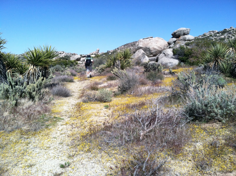
After a couple of miles we had gone up and down enough to be high enough to have a great view of the San Ysidro Mountains to the north.

Towards the end of the trail there is an old post that marks the beginning of the short section up to the valley just to the east of Wilson Peak. This is a beautiful part of the trail as you hike up into the Pinyon trees. It reminds me of parts of the hike up Whale Peak. But this section here only lasts a couple hundred yards.

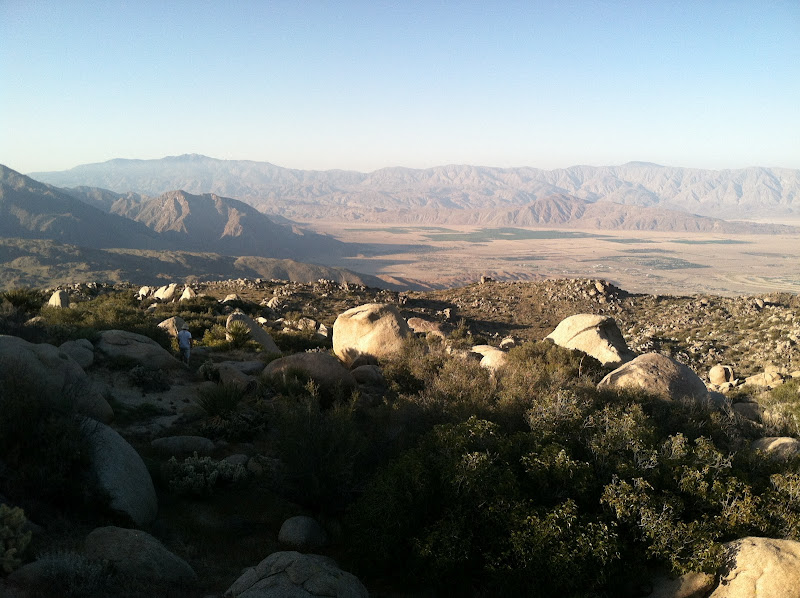
There are some great views from the top of Wilson Peak. This is the view down into Borrego Springs from our camp site.
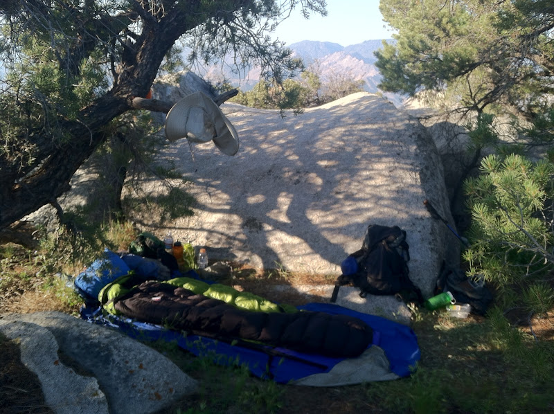
Here I am set up at my usual spot. This was my 7th trip on the Pinyon Ridge Trail, mostly I have been out here solo, but not this time. You can see my buddy's new tent in the background.

Here a pic looking out toward the Salton Sea after the sun go up a bit on Sunday morning.

For the most part the Pinyon trees up here are not as tall as on Whale Peak. The fact that this is about 1,000' feet lower has a lot to do with the smaller size. Here are a couple of healthy little trees. These were right near our camp.

It was a nice trip with no wind, perfect temps, a beautiful (almost) full moon rising in the east, and I still have a trip back to Rockhouse Valley to do another time.
I put together a short video of the trip that can be seen here.... (You may have to copy and paste the link to get there.)
<em>edited by hikerdmb on 4/9/2012</em> |
4/10/2012
Topic:
Where the wild flowers weren't.
hikerdmb
|
I must have missed the flowers in those pics. I only saw those beautiful sheep. Nice job!
David |
4/15/2012
Topic:
Exploring The Island and Myer Valley
hikerdmb
|
Nice place to explore. It is a very interesting area for sure. I am glad you found Paola's backpack. She is a student in my class. I will be sure to show her the picture so she can claim it. A few years back we drove the old 80 to where it ends at a cliff above I-8. I couldn't believe there were no markings or warnings back then to let you know the road was ending. |
4/23/2012
Topic:
Mason Valley Truck Trail /CRHT to abandoned mines
hikerdmb
|
Remember when this happened? Here is a short article from the LA times from 1989. Good reason to stay off someone's claim.
"After days of investigating in almost total silence a shoot-out between two bands of gold miners on the outskirts of Julian, authorities Friday released a detailed account--as told by the survivors--describing hostile exchanges between the groups that preceded a staccato burst of gunfire that left two men dead.
Sheriff's deputies investigating the Memorial Day shooting, which occurred 6 miles east of Julian, revealed that the dueling groups--an East County family and two Julian men--were both heavily armed with weapons, including an AK-47 semiautomatic assault rifle, shotguns and high-powered rifles."
The guy that shot and killed the two was not charged... self defense.
David |
5/1/2012
Topic:
Whale Peak - Backpacking
hikerdmb
|
The last weekend in April seemed like the perfect weekend to return to Whale Peak. The weather in the lower elevations would be hot but up in the sky island of Whale Peak it was perfect. We started the hike around 2:00 and it was just over 80 degrees. As we climbed higher the temperature lowered and it was a beautiful day, even if it was a bit hazy.

We took a little over an hour and a half to make it from Pinyon Mountain Road up to the top. Not bad for a couple of old guys hauling packs with everything needed for an overnight. The trail was so well marked with ducks and ducks and more ducks. Even though this was my 11th time up Whale Peak I never get tired of this hike. Here is the view up just before reaching the top.

A Boy Scout troop from Point Loma has put a nice new sign on the summit but I missed the old wooden sign. Anybody know what happened to it?

We were the only people on top this night so we chose our favorite campsite. This spot has saved us a couple of times when the wind was blowing so hard up there you could hardly stand. But it is always nice and peaceful and calm here.

Here is my bed for the night. We didn't have much wind on this trip. In fact it was so warm during the night that I spent part of the time on top of my sleeping bag instead on inside it.
We watched the sun set over the mountains and then stayed to watch a fly over of the space station. It was a nice 5 minute view that went pretty much straight overhead. I never get tired of watching it fly by. (I know it's a little weird.)

In the morning we had some great views to the west and north from right near our camp.


Unfortunately it was still hazy in the east on this morning so no good shots of the Salton Sea. We started our hike down and my buddy did a little duck hunting (or set them free if you like) on the way back to the truck. Don't worry you can still find your way up Whale Peak. I cannot believe how much of a trail has developed over the years since my first trip there 20 years or so ago. But a duck every 10 yards seemed like a bit too much. With all the duck hunting it took us about the same time to get back down the mountain. It was a great time and I am ready to go again. But it could be time to head north to the Mighty Sierra unless we get another cool down in the desert. |
5/2/2012
Topic:
Whale Peak - Backpacking
hikerdmb
|
Daren-
No photos of the space station, I only had my iPhone along on this trip and I don't think it would capture that. I saw your entry in the summit register and made a point of checking out your route. I know why there were no ducks going that way. Looking throught the register it amazed me how many different directions people climb this mountain from. I saw entries that said they started from Blair Valley, June Wash, Nolina Wash, but your entry was the only one I noticed from Bisnaga.
Bob-
11 times seems like a lot but remember it was spread out over 20 years or so.
David |
5/7/2012
Topic:
Coyote Mountains
hikerdmb
|
Nice pics. I especially like the last one. Great light on the badlands!
David |
5/15/2012
Topic:
Villager Peak
hikerdmb
|
Welcome to the forum and nice photos. I agree, the pic of the western edge is great. How much of the climb to the top of Villager is on a use trail? Did you have to use your hands or scramble at all? Any good camp spots up that way?
Thanks for sharing,
David |
5/15/2012
Topic:
3D Panoramic Virtual Tours
hikerdmb
|
Nice Daren. I did not see your backpack by the truck though. Did you use a tripod for those pics?
David |
5/15/2012
Topic:
3D Panoramic Virtual Tours
hikerdmb
|
There it is. I recognize that camo pack. |
6/22/2012
Topic:
Myer Valley / Rockhouse Cyn
hikerdmb
|
Daren,
Sorry I can't help with the stars, too many in too small an area. Just a guess though and judging by that fact that it looks like the leading edge of the Milky Way coming up, that it is the Trifid Nebula and the Lagoon Nebula just above the V of the mountains. And a little left and above that is the Eagle Nebula and the Wild Duck Cluster. The first 2 are pretty easy to find with good binoculars.
As far as tires, that looks terrible. Hopefully you are replacing those with something better. I got the BFG AT 285/70/17 for my Dodge. And I love them. Not sure if those have 3 ply sidewalls but there was an ad a few years ago referring to the 3 ply sidewall on BFG AT tires that went something like this... "The only thing you want out here that is two ply is your toilet paper." I too had a couple of flats in DV but mine were with Goodyear tires that came stock on my old Dodge.
Good job getting to the end of Rockhouse in your truck. That is tough and requires some patience and skill. I am assuming you did it solo with no spotter either. By comparison when I did my Rockhouse trip this spring it took me about an hour in my jeep to get to the end of the road. I did not see anything like your truck back in there. The other full size rigs I saw were parked at the split with Butler Canyon. A long time ago I took my old Dodge up that road but it did not have 4 doors or an 8' bed.
David |
6/22/2012
Topic:
Myer Valley / Rockhouse Cyn
hikerdmb
|
You are correct Daren. That is scorpius. The 2 stars close together just to the right of the V make the stinger at the end of scorpius. And the cloud just above and to the left are the Trifid and Lagoon Nebula. Good call. |
7/5/2012
Topic:
Catavina Pictographs in Central Baja
hikerdmb
|
Nice Bob. I would love to see some pics from Baja.
David |
7/13/2012
Topic:
2012 Bighorn Sheep Count
hikerdmb
|
Nice pics Daren, and video. I saw some cars and trucks parked along S-22 going down into Borrego Springs and I figured they were counting sheep too. It is great that you do this.
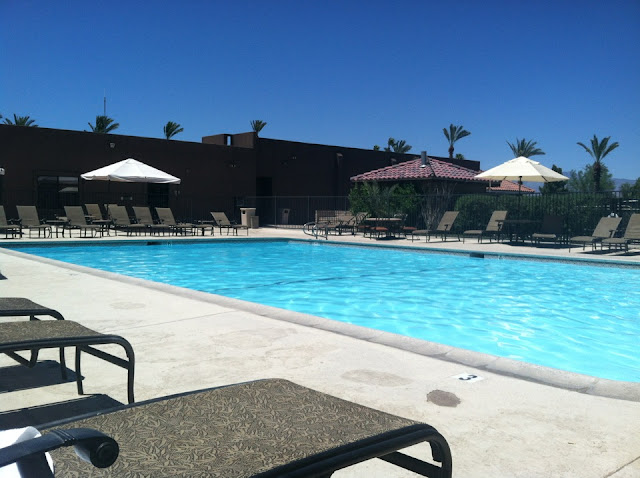
We were out there last weekend too but we were keeping cool by the pool. It was brutal but we managed.
David |
7/13/2012
Topic:
2012 Bighorn Sheep Count
hikerdmb
|
Bob,
That is the Borrego Springs Resort and Spa. It used to be Borrego Springs Resort and Country Club but they changed their name. Nice place and good summer rates. We got a king room for $79. Very relaxing place. We have been going there for many many years. Here's the link.
http://borregospringsresort.com/
David |
7/16/2012
Topic:
Dream Find!!!
hikerdmb
|
That is very cool! Bravo to you for your ethics!!!
David |
8/5/2012
Topic:
Looking for tinajas on San Clemente Island
hikerdmb
|
I read "Island of the Blue Dolphins" to my 4th graders every year. Great story! They love it! I would love to see some more pics from that island.
David |
8/5/2012
Topic:
Perseid meteor shower this weekend
hikerdmb
|
I'll be in the Sierra one more time before school starts. I am hoping it will be great viewing.
David |
8/5/2012
Topic:
Perseid meteor shower this weekend
hikerdmb
|
I just got back myself from 14 days in Yosemite, Nevada, Utah, Colorado, and Arizona. Great weather everywhere with cool thunderstorms in the Rockies. Spent most of the time in southwestern Colorado. I'll share some pics when I get them posted.
David |
8/13/2012
Topic:
Perseid Meteor Shower 2012
hikerdmb
|
Great photos Daren,
I like the fireworks pic.
I was at about 10,400' one night and 11,000' a couple other nights in the Sierra from Wednesday to Saturday and it was amazingly clear. With the moon coming up later each night I saw lots of meteors but by far the best that I saw was on Wednesday night. It was super bright with a long red tail and went most of the way across the southern sky. I wish I had a camera that would capture the night sky but not yet. Also saw a few fly overs of the Space Station.
Pretty amazing how many campers were in BV with the temps and heat.
David |
8/22/2012
Topic:
Bachelor Party in Early May Help...
hikerdmb
|
Great place to hike with the kids. That is also the first place we took our daughters backpacking when they were just about the age of your kids. They thought it was so cool to climb up to Morgan Pass. They still talk about that trip. Now they are in their early 20's and still love camping and hiking. Thanks for sharing the pics. We go to LLV a couple of times a year. Even skied up there and camped a couple of times in winter. Nice dog too.
Here's my goldern Wylie last February as we skied down the road after a daytrip up to the lakes.

On that trip we camped at Holiday Camp at the lower end of the canyon. Free and empty in the winter.
 |
9/7/2012
Topic:
Gettin the itch...
hikerdmb
|
I'm thinking for my first trip this fall... I will bring the fire pit, find a nice quiet place, build a fire, drink a beverage or two, listen to some music, and then look at the stars after the fire dies down. Relaxing all the way! While enjoying the fire I'll also try a rain dance to the desert gods in hopes of a wetter winter.
David |
9/27/2012
Topic:
Borrego Badlands
hikerdmb
|
Welcome fellow wrangler (mine is a '97 TJ) and good on you for starting your daughter camping at a young age. I started my oldest at 3 months (snow camping in a tent) and my youngest at 2 weeks (beach camping in the sand). Nothing like teaching them the joys of dirt early. Both my girls still love it now (21 and 23 years old). Looks like you know some good spots to camp. I also like the yellow post sites. A little bit of comfort but no neighbors. I checked out your blog, very nice job!
David |
10/2/2012
Topic:
My Jeeps (and past rides)
hikerdmb
|
I'm with Bob... I like this thread too so I went through the files of old pics and found some pics of my old rigs through the years.
This was my first four wheel drive vehicle. It is a 1980 Subaru hatchback. We bought this new before moving up to Gunnison, Colorado in the summer of 1980. It was less than $5000 new and I still remember our payments were $80.01 for 3 years. This doesn't look like much but it went on so many backroads in Colorado and never failed. We would take off from our home (that means a 10'x45' trailer) and head up into the mountains with no real map or idea where we were going. Of course we were only 19 and 21 years old at the time so we didn't need no stinkin' maps. In this pic the Subaru is on the road to Gothic with Mt. Crested Butte in the background.

When we returned to California we used the Subaru for a while to pull our Prindle 18' catamaran but wanted more room for gear so we traded it in a bought a 1984 Mazda B2000 truck, not 4 wheel drive. This truck also served us well for a few years. It went lots of places all over the west from So Cal to Idaho. It was also around $5000 brand new. We put the shell on it and camped in that often. Here it is a some trip somewhere but I am not really sure where.

When we decided we needed to have 4 wheel drive again we got our next truck. It was the mid 80s we both had good jobs so we got the fully loaded Mitsubishi pick up. This was a good truck too. It went up Coyote Canyon the first year I got it. Back then you went straight up the the willow lined tunnel of the creek for several miles with no room to maneuver. This truck lasted until we had our first daughter in 1989. Here it is in Sequoia NP in December of some year with our skis on the rack and lots of snow all around.

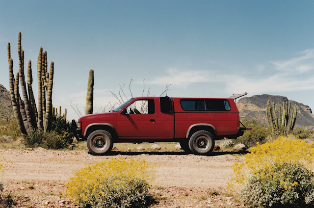
When the first child came we got the 1989 Nissan King Cab SE-V6. This was by far my favorite truck of all time. Again we put a shell on this truck and spent many nights sleeping in the back. During these years we also had a Coleman pop up camper trailer that we pulled if we were not heading into any rough areas. This truck went all over the USA including trips to Florida and Georgia, trips to Arkansas, trips to Montana, Oregon, Washington, Utah, Idaho, Arizona deserts, Colorado and all the places in between. I think the truck pretty much went on every road in ABDSP during the years we had it. This was also the first truck I did any modifications too. It had a mild lift and some nice shocks along with some lights and a brush guard. This truck would go anywhere. Here it is in Organ Pipe NM.
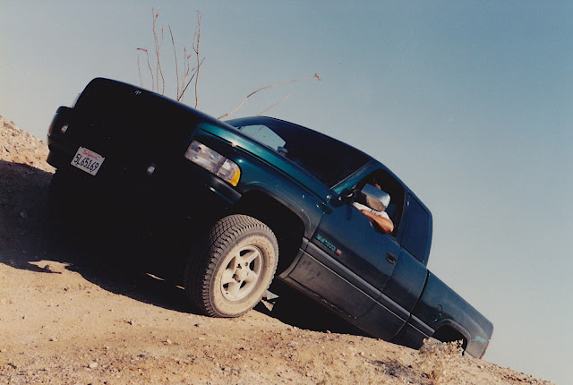
When the daughters got too big for the back of the Nissan (plus they faced each other in the rear jump seats, not a good thing) we moved up to our first Dodge. We got a 1997 Dodge Ram 1500 Sport edition with the 318 engine. This was also the first rig with automatic transmission. It took some getting used to the larger truck and I have to say I really missed the Nissan. But this truck did me well for a few years. It made the trip to Death Valley a few times, a couple of trips cross country, and lots of trips around ABDSP. Here it is on the Goat Trail out near Borrego Buttes.
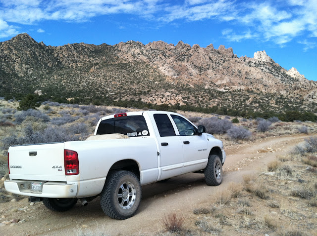
Once again as the girls grew we needed a full size back seat so in 2004 we got the Dodge we have now, 1500 with the 5.7 Hemi. This truck has about 120,000 miles on it now and makes lots of trips to the desert. It has also been to Death Valley a few times and to Colorado, and Utah on extended trips. Mostly it takes me back and forth to the Sierra for skiing, camping, backpacking throughout the year and carries our Sun-lite pop up camper. I love this truck and can't believe some of the places I have been able to get it. I just recently installed a Daystar leveling kit and Rancho Shocks along with trading in the factory 20' tires and wheels for some BFG 275/70 17 tires and rims. Here is a pic of it on Cumberland Pass in Colorado this summer.

And here it is all set up at a nice backroad campsite from the same trip. This pic is near Ophir, CO.

And this is how it looks without the camper. This is from the trip we did last fall on the Mojave Road. I highly recommend this trip if you have never done it.
A few years ago, my wife and kids say mid-life crisis time, I got the 1997 Jeep TJ, the Desert TJ. I have done lots of mods to it; 3" Teraflex lift, 4.56 gears, swaybar disconnect, KC lights, catback exhaust and Air Raid intake system, 33" BFG MT tires and rims,Warn bumbers, and a few other items here and there. This is my primary ABDSP explorer now. It doesn't hold much but it goes anywhere and it is a blast to drive. It only has the 4 cylinder engine so it doesn't stray too far from So Cal. It also does not have a top, although I do put on a Safari top a few weeks out of the year. Here is a nice shot of it from a few years ago near Carrizo Creek.

And here is a driveway shot with it all clean and shiny from a while back.

I'll end with one last pic. This is the same pic in my avatar. Heading down the dropoff near the slot.

I look forward to seeing rigs from others.
David |
10/21/2012
Topic:
Iphone in the backcountry somebody shoot me!
hikerdmb
|
Nice campsite? Very nice campsite!! |
10/23/2012
Topic:
Jeep lift questions
hikerdmb
|
I would definitely go for the suspension lift. Depending on how big you want to go with tires will determine how much lift you need. I have 33" tires and a 3" Teraflex lift. It fits great and I have never had any rubbing. I also got the quick disconnects for the sway bar for better articulation and a new track bar to properly locate the front axle under the jeep. I got new ring and pinion gears, 4.56, to compensate for the larger tires size.
David |
10/24/2012
Topic:
Rockhouse Cyn Road Conditions Report
hikerdmb
|
One and a half hours to the end is pretty amazing. It must have been slow going. Probably could have walked faster. Thanks for building the road back up and making the way. One good thing though is it sure is easy walking when it is like cement. Can't wait to see some pics and read the TR.
David |
10/30/2012
Topic:
Rockhouse Canyon 4 Day Backpack TR
hikerdmb
|
Thanks for sharing Daren. It is nice to have a buddy willing to show you the water holes and the great campsite under the trees. I have seen a couple other pics of that site and it looks great. Did you have a fire in that ring. I still am planning another trip out there again this year. Great photos as always.
David |
11/1/2012
Topic:
Rockhouse Canyon 4 Day Backpack TR
hikerdmb
|
Thanks Daren! I also never knew you could have beans like that. Now I can have a burrito instead of my usual tacos. Escondido is covered with markets that are sure to sell those beans!
David |
11/5/2012
Topic:
Goat Canyon Trestle Hike
hikerdmb
|
That is the way I did the hike on my first trip to stand on the trestle. It is a long way back around following the tracks. We got lucky and caught a ride on the tailgate of a truck for the last mile or so until we met up with Mortero Wash. Then hiked the last part back to the parking area below the palms. The guy that gave us the ride even gave us a beer to split for the ride. Best Coors Light I ever had. The last downhill before getting to the trestle was verr loose and slippery.
David |
11/14/2012
Topic:
Whale Peak, Pinyon Mountain Road
hikerdmb
|
Those rocks are definitely a problem. They are not that big but you need ground clearance. I had to pull a full size 4x4 chevy off there a few years ago. He was stock all the way and got high centered. It is an easy walk up the road from there to the start of the route up the peak. But you are right it would add a couple of miles to the trip. Once to the start of the climb it should take at least a couple hours if it is your first time. Route finding can be difficult but there are plenty of ducks to show the way as described in Afoot and Afield. Good luck.
David |
11/14/2012
Topic:
Combating bright sunlight and shadows
hikerdmb
|
My iPhone 4 has HDR. I usually take the pics so I get a regular and an HDR version of each shot and then keep the better of the two photos. |
11/15/2012
Topic:
Camping with your pet
hikerdmb
|
Bob, excellent post but you know I could fill pages with pics of my dog. Here are 3 to start.
Here is Wylie, my 105 lb hiking buddy. He is a 4 year old Golden Retriever. Here he is cooling off in the shade of a canyon wall on a desert backpack trip outside the park boundary. I carry a multi-tool with pliers to remove thorns, he has booties he wears sometimes to help his feet. He carries his own food and water when he backpacks with me. Sometimes I carry his pack for a while to give him a break but he NEVER offers to carry my pack.

Wylie would much rather hike in the Sierra than in the desert. He loves the mountains much more than the sand and cactus. Here he is smelling the flowers below Temple Crag along the North Fork of Big Pine Creek.

Of course his favorite thing to do is swim. Here he is swimming in one of the Wonder Lakes at 11,580' this past June. Notice most of the lake is frozen but it didn't seem to matter. If there is water he is going in. He will even go for a swim with his pack on.
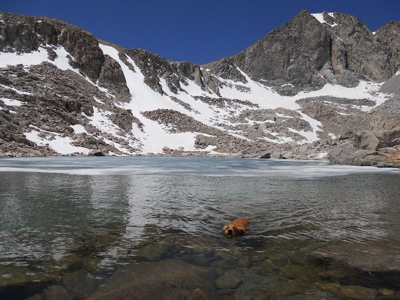
Can you tell yet that I LOVE this dog! |
11/15/2012
Topic:
Forum Layout Display Problem
hikerdmb
|
I had the same issue at school today on a Dell laptop, not a wide screen, using internet explorer. The right side was chopped off on pages with photos but I think it was good on pages without pics. I really like the new layout. Thanks Bob for all the hard work keeping this going.
David |
11/15/2012
Topic:
New Forum
hikerdmb
|
how did you do that Bob? ("This was sent from my iPHone.) I am still unable to get anything on my iPhone 4.
David |
11/16/2012
Topic:
Changed Post Thread Sorting
hikerdmb
|
I like oldest first for the same reason as herofix, like to see the pics first. But I am not going to stop posting if it goes the other way.
David |
11/18/2012
Topic:
Goat Canyon Trestle Hike Trip Report
hikerdmb
|
Great trip. Good call having another rig at the Indian Hill end of the hike.
David |
11/18/2012
Topic:
Changed Post Thread Sorting
hikerdmb
|
All is right in the forum world now. |
11/20/2012
Topic:
Torote Canyon Loop - Solo Backpacking TR
hikerdmb
|
I had a trip planned for Joshua Tree this week but my buddy got sick and couldn't make it so I decided to do this hike instead. This would allow me to get out still but not have to go so far. I have camped in Indian Valley too many times to count but had never taken the time to hike up Torote Canyon. A couple of years ago Daren did a TR on this area and I think I pretty much did the same route he did on that trip. The drive out in the jeep was very nice. The temps were in the mid 70s and there was hardly any wind at all. When I turned up into Indian Gorge the weather was still perfect. I pulled into the parking area for Torote Canyon, parked, and started hiking about 1:30. It wasn't long before I saw the first Elephant Trees above the canyon floor.


Most of the way up the canyon was easy walking but ever so often I would come to a spot like this that took a little more effort to get up and over.

I eventually made it to the upper reaches of the canyon and it started opening up a bit. Here was my first view of Sombrero Peak. Notice the tracks in the wash. These were mostly bighorn sheep tracks. There were plenty of human tracks the first mile, then only one or two sets of tracks, and after a couple of miles nothing but lots and lots of animal tracks.

The farther I went up past the end of the canyon the better the view became. This is looking south, I could see the Goat Canyon Trestle with my binoculars, from near the spot where I would camp for the night.

I awoke to a wonderful sunrise with Venus rising in the east. My iPhone does not take good low light pics.

Here is a pic I took from my sleeping bag. I always have called this mountain Little Sombrero but I think it's real name is Red Top. It is quite red in the morning light.

There wasn't much room on top of the hill where I made my camp but my sleeping pad and bag fit nicely between the rocks and plants. Not to mention there was a great view.
I had originally thought I would just backtrack the way I came in but decided instead to complete the loop by dropping down a small canyon just west of my campsite. Here is a pic about halfway down, looking up.

And this is the view of the entire drop from the floor of North Indian Valley. It was quite the rocky descent. Of course I have to say it never looks as steep in pics as in real life.

Once to the bottom it was a couple miles back to the jeep on nice easy washes and the hard packed road. This is the map of my route. I went in a counter clockwise direction from the parking area. Notice the tent symbol at my campsite.
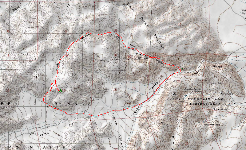
I didn't see another person on this hike until I was almost back to the jeep where I saw a couple of car campers. I think if one were to spend some time up in this area you would see some sheep. I didn't, but I did see lots of scat and tracks.
A good trip for starting Thanksgiving vacation. |
11/21/2012
Topic:
Torote Canyon Loop - Solo Backpacking TR
hikerdmb
|
Daren... I went back and looked at your old TR and I did indeed do the same loop. I figured my trip somewhere between 6-7 miles. That is exactly where that mountain is so it must be False Sombrero.
ziphius... I did NOT see any water or springs on this trip but I did see the palm grove that is above the north fork of Indian Valley and it might have water. It looked very green in there. Maybe someone else has been up there. It looked really rugged up there from the vantage point of my camp. I like going without a tent as long as there is no wind. Nothing like "camping high" in the desert.
rockhopper... There were plenty of side canyons/valleys and peaks and peaklets all over that area just begging to be explored and I couldn't believe the amount of animal tracks through there.
David |
11/21/2012
Topic:
Hapaha Flat, Dave Mcain Spring, Split Rock
hikerdmb
|
Another great trip for your family. I have to correct you though... you didn't get stuck, just temporarily delayed.
David |
11/21/2012
Topic:
Torote Canyon Loop - Solo Backpacking TR
hikerdmb
|
Took a couple PB&J sandwiches and some granola bars. It was a quickly planned trip. But I will definitely be trying the beans in a bag and making burritos on my next desert backpack trip.
David |
11/22/2012
Topic:
Torote Canyon Loop - Solo Backpacking TR
hikerdmb
|
tommy750 wrote:
Nice trip. Was in Torote Canyon on 12-11-10 and noted the Ocotillos were changing colors. There seemed to be two distinct groups, red and yellow. Not sure this was a transition they all went through or two different hybrids. Anything similar this year? Also noted our Torotes have nothing on the Baja Torotes! Tom
I saw several ocotillo changing from green to red but I only found one picture in my album that showed some red. It's mostly in the shadow in this pic. There were also some green ocotillo changing to yellow but no pics of those. I did not see anything as nice as the 2 pics you posted.
David
 |
11/26/2012
Topic:
Camping with your pet
hikerdmb
|
I think you are right Nolan. Here is Wylie a little farther up the same trail that Rusty is on, but as usual he is wet from swimming.
David
 |
11/26/2012
Topic:
Anza Borrego Thanksgiving
hikerdmb
|
Looks delicious! |
11/26/2012
Topic:
Great 2-day trip: Inner Pasture and BM Stage area
hikerdmb
|
Great TR. I like that campsite, perfect size, and the Freddy shot too. Looks like you had a fantastic time out there.
David |
11/28/2012
Topic:
Torote Canyon Video
hikerdmb
|
I put together a short video of my hike through Torote Canyon. I posted the TR in the Completed Trips section of the forum but thought I would put the movie in here. The movie was filmed on my iPhone 4 and edited together with music (Wilco) using iMovie on my Macbook Pro. Unfortunately the clarity is not that great on YouTube (no HD for me). I included the link if you want to watch the movie in a larger format than the version on this page.
Hope you like it.
David
http://www.youtube.com/watch?v=IJqbFUPRuf8
|
12/4/2012
Topic:
Little Petroglyph Canyon (AKA Renegade Canyon)
hikerdmb
|
Wow Daren. That is excellent. There is a bill lard on 395 that shows a picture of that area but I never imagined there would be many.
David |
12/4/2012
Topic:
Sombrero Peak Hike Report
hikerdmb
|
I wonder if there is a connection? Peak registers have been disappearing from Sierra peaks for a couple of years. Some of the ones taken have been old with some famous signatures in them. |
12/5/2012
Topic:
Vallecito Valley 3 Day Backpack Trip
hikerdmb
|
Another great trip for you Daren. You have found some cool things so far this season. I have been eyeing that area for a while. It always looks so cool down in there from the top of Whale Peak when the sun is setting or rising. Glad to see so much cool stuff in there.
edited by hikerdmb on 12/5/2012 |
12/7/2012
Topic:
Goat Canyon MTB Video
hikerdmb
|
Can't believe how much of a trail there is along the tracks. Those long tunnels are fun. Good choice of train music.
David |
12/10/2012
Topic:
Baja Desert
hikerdmb
|
I want to know how she kept it so steady.
David |
12/15/2012
Topic:
Lower Harper Canyon and New Tent
hikerdmb
|
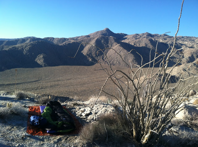
Went out last weekend to the lower part of Harper Canyon. No big hike, no big adventure... just a nice relaxing campfire, a couple of beers, lots of stars and satellites, and a short walk around the washes below Harper Canyon. I did however, get to use my new backpacking tent for the first time. I got the 2 man Big Agnes Copper Spur (anniversary gift, my wife is awesome). It is a mansion compared with my old one man Eureka Aurora tent which was almost impossible to sit up in. The new one weighs a little over 3 pounds, nothing compared to the weight of the Aurora which was almost double that. Can't wait to load the new tent in my pack.
Here is the new tent looking out toward East Borrego Butte and the Salton Sea.
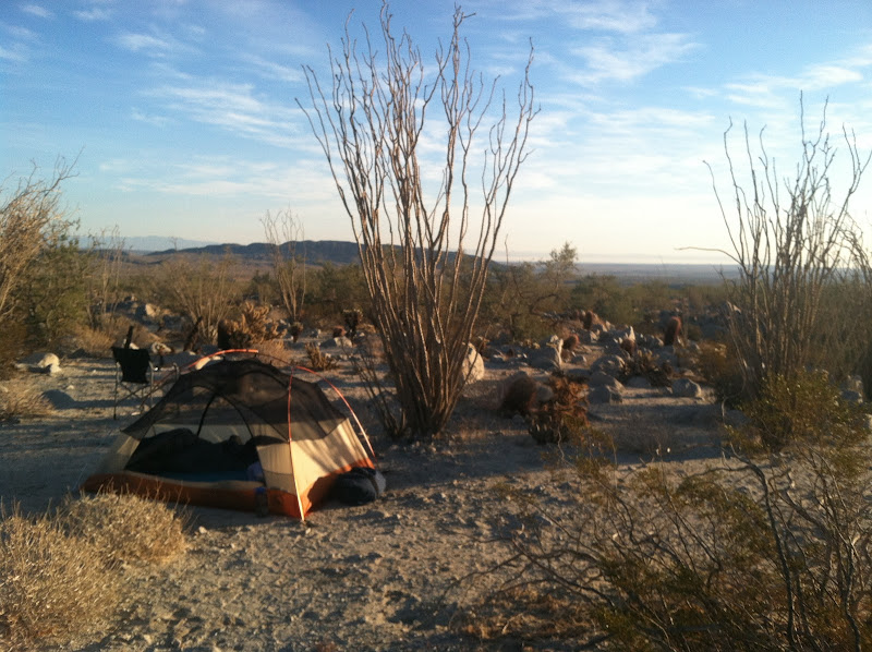
Here is the new tent from the end. You can also see the washer tub fire ring and the Santa Rosa Mountains in the distance.
Looking up toward the mouth of Harper Canyon. I did the hike from here up to Harper Flat last year and highly recommend it. That TR is on this forum if you want to see some pics from up in the canyon.

I am keeping the old Aurora tent though. It has been my solo backpacking tent for about 15 years and it is still solid as a rock in high winds and rain. It has been on ski trips and backpacking trips all over the Sierra and desert southwest and has never leaked or let me down.
Here is the old Aurora tent from Lake 11,200' looking up the north side of Glen Pass in the Sierra. I took this pic on day 4 of a 5 day solo trip last June into Sixty Lake Basin (Onion Valley - Kearsarge Pass - Glen Pass - Rae Lakes - Sixty Lake Basin and back) mostly in Kings Canyon NP.

Besides the weight savings with the new tent the best part is it is a 2 man tent so Wylie and I don't have to cram in like this anymore.

edited by hikerdmb on 12/15/2012 |
12/18/2012
Topic:
East Carrizo Canyon and June Wash
hikerdmb
|
I always carry a paper map and compass. That is how I learned to navigate so many years ago. I also carry my iPhone linked to my inReach which has turned my phone into a nice GPS and satellite communicator. My wife feels much better about me going solo now. However I still use the map way more than the GPS and I think I always will. But I have to say when in doubt of the map the GPS helps.
David |
12/19/2012
Topic:
East Carrizo Canyon and June Wash
hikerdmb
|
Tom,
That is my unit. I got it last spring from REI and used it on 3 backpacking trips to the Sierra this summer. Also used it on a 2 week trip to Colorado and every trip to the desert this fall. With inReach I was never out of contact with wife and kids. It connects to my iPhone4 (can sync with Android phones and they also make a unit that will link with a GPS). It tracks my path wherever I am, on a trail or in the truck or jeep. It is very easy to use. I can send e-mails and text messages to anyone in the world. I can also pre-set 3 messages and send those without being connected to the iPhone. It has turned my iPhone into a GPS with the map package that comes with it. I download the area where I will be (So Cal is one map for all the topo maps of the whole area). Since I put my phone in airplane mode when in the backcountry it does NOT eat through the phone battery. Basically it is blue tooth connected to the inReach and the inReach is using the Iridium Satellites to send and receive e-mails and SMS text messages. I have had a couple of issues with it not staying synced to the iPhone but it is easy to re-sync. They have different packages from $10/month up. I have the $25/month that lets me have 40 text/SMS messages a month and unlimited pre-set messages. With the inReach I can also give a link to my wife and buddies and they can follow my track on topo, satellite, or road maps on their computers while I am out. Basically they can see where I am on Google Earth. It updates every 10 to 60 minutes depending on how I set it up. Makes them jealous but that is okay. With my plan I also get unlimited tracks that I can share and I can see my trip when I return. When I got my inReach I got it for about half price with a sale and rebate. If you go solo a lot it is a good thing to have. |
12/27/2012
Topic:
Davies Valley and Pinto Canyon
hikerdmb
|
That looks like a great trip. We used to camp in Davies Valley all the time back in the days before the gate. On one trip we hiked up to the petroglyphs in Pinto Wash and as we approached I casually told my buddy, "If someone was way out here with a gun we would be easy targets." About a minute later we heard someone say, "You lookin' for these?" and there is a guy dressed all in camo sitting on top of the rocks where the glyphs were. He had a HUGE gun strapped to his leg. We checked out the glyphs and headed back down canyon walking in a serpentine manner. I don't know if anyone remembers or stayed in the campsites in Davies Valley but there were some sites with log books. The sites had names like Alpha Camp and Bravo Camp. Nice campsites but there were some interesting (strange) entries into those old log books.
David |
12/30/2012
Topic:
Gray Mountain
hikerdmb
|
I bet your heart skipped a beat when you first saw that pottery. I like the pic with the clouds reflecting in the tank.
David |
12/30/2012
Topic:
First Trips to ABDSP
hikerdmb
|
I like your old pics too. You were a stylish dresser for sure. No pics from the old days from me but my first trip was in 1969 or 1970 after we moved to California. We camped in Bow Willow, in the old part of the campground that has since washed away. I remember climbing all over the boulders going up behind our camp. We hiked up Bow Willow canyon a ways and it was HOT! I remember being somewhat pissed at my step father for making us walk when there were all types of rigs driving up and down the wash. It was shortly after this first trip that he bought a four-wheel drive International Travel-all. That thing was a beast but it went all over Baja and I even took my driving test in it a few years later. Just imagine having to parallel park that monster when you are 16 and taking the test. I passed!
David |
1/2/2013
Topic:
Nolina Wash
hikerdmb
|
Nolina Wash is a great little canyon. Daren and I did a loop a couple years ago where we went up Bighorn Canyon and crossed over to Nolina and headed back down to our start. Here is the link to that trip with some great night photos from my buddy.
http://www.anzaborrego.net/anzaborrego/forum/topic61-backpacking-in-bighorn-canyon.aspx |
1/2/2013
Topic:
June Wash, Torote Canyon, Indian Hill
hikerdmb
|
Does this mean you did not head to the Sierra?
David |
1/3/2013
Topic:
Bald Eagle Nest
hikerdmb
|
I saw that on the news last night. Pretty cool. Remember a few years back when they were nesting near Lake Henshaw. It was easy to see them every time driving by. There was even a nice large paved pullout off the highway. Some days there would be 25+ birders set up with scopes looking at the nest. |
1/7/2013
Topic:
7 Days in Anza Borrego Desert State Park
hikerdmb
|
Another great trip for you Daren. Great pics as usual. Lots of very nice finds.
David |
1/7/2013
Topic:
Pinyon Wash to Harper Flat and Cabin
hikerdmb
|
Took a overnight backpack trip out to Harper Flat this past weekend. We left midday Saturday and drove out to the end of Pinyon Wash off highway 78. Hiked in to Harper Flat and headed toward our usual campsite. I think we have spent about 10 nights in this area over the years. When we got close to our planned campsite we heard voices and saw a group of 4. We asked if they were spending the night and they were so we headed on looking for a site. This was the first time we saw anyone else camping in the flat and only the second time that we saw other people out there. It got down the the high 30's on Saturday night and then the wind picked up a bit just before sunrise. There were a few clouds blowing over the mountains but no rain fell while we were there.
After breakfast we packed our packs and headed southwest across Harper Flat headed to the old Harper Cabin. I visited this cabin in November 2011, but my buddy had not been there before. On earlier trips we have pretty much been all over the entire flat but this time we were mostly in the western part of it. Here we are about halfway across the flat looking up toward Whale Peak. There was a bit of snow left near the upper parts of the mountain from last weeks storm.

We made our way up to the wash where the Pinyon Mountain road comes down from the Drop Off and then headed up to the cabin. There is not much left of it. But it is still an interesting place with lots of old cans and an old bed in the corner. It looked to be only about 5 feet long. The Harper brothers must have been pretty small.

We found some very interesting writing on the wall just to the right of the "door." It is a little hard to read in the photo below but it says, "The assessment work has been done on this claim at a point 200 yards south west of here. For the period ending July 1, 1931. E. A. Harper, Witness L. B. Spaulding, Exemption years 1932-1933-1934-1935, Assessment work completed 1936."

Here is a nice close up of the signature.

Here is the large dam that is just up canyon from the old cabin. This dam is probably 12-15 feet tall, but completely filled with sand.

Just above this dam there is a smaller dam. I am not sure what the wires above the dam were used for. It is actually barbed wire and it is centered right over the dam.

After spending a half hour or so looking around we headed downhill to the truck. There is a fence blocking entrance into Harper Flat from the Pinyon Mountain to Fish Creek Road but even so there were lots of motorcycle tracks in Harper Flat.
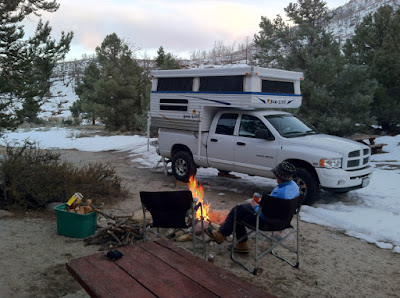
We finished our hike, about 8 miles with 2300' elevation gain all total and headed home. Since we didn't have lunch with us we stopped at the restaurant at Lake Henshaw and had some good food and enjoyed the view out to the lake. That is my truck and camper on the right of the picture. Didn't use the camper on this trip but it is still on the truck from the last trip.
 |
1/7/2013
Topic:
Pinyon Wash to Harper Flat and Cabin
hikerdmb
|
I know the Harpers ran cattle out there until the dams filled up with sand and the cattle got sick, I think anthrax is what I read somewhere. Maybe they had to stake a mining claim to have the cabin in there. Just a guess. I know that I have seen the same type of messages about assessments being completed in some old cabins in and around Death Valley. I think they have to do that to keep the claim active so the cabin can remain in use in the National Park. |
1/7/2013
Topic:
The Slot and The Wind Caves
hikerdmb
|
I like the music in your video. That is an unusual place for ABDSP. Looks more like Utah. I've been down that drop off a couple of times but never tried going up...that one, anyway. |
1/8/2013
Topic:
Pinyon Wash to Harper Flat and Cabin
hikerdmb
|
I was also amazed that it was written in pencil. At least that is sure what it looked like. Hard to believe that the writing could last 80 years. My first trip up there it took me a while to find the cabin. |
1/8/2013
Topic:
Subject: A few Winter Blooms
hikerdmb
|
I saw some chuparosa blooming in Pinyon Wash (no pics). The creosote bushes were very green in Harper Flat (no pics). There were a few brittle bush plants with some blooms in Pinyon Wash and in Harper Flat this weekend. I am hoping for some more rain and a huge bloom this spring. But I bet everyone is wishing for that.
David
 |
1/8/2013
Topic:
Travertine Palms Oasis and Caves
hikerdmb
|
Great trip. Looks like lots of history in all those places. I agree that there have been some good trip reports the last few days.
David |
1/25/2013
Topic:
Favorite Photos from 2012
hikerdmb
|
Remember I am using a point and shoot and/or iPhone4 for my pics. I dream of taking pics with a real camera one day.
Blooming cactus and PInyon trees on Whale Peak
Sunrise from upper Torote Canyon

Looking across Harper Flat
 |
1/26/2013
Topic:
Favorite Photos from 2012
hikerdmb
|
I really like the color in the tommy750's photos and the year 12 is other worldly. Nice pics and first post from abschmitt. Let's see more please. |
2/11/2013
Topic:
Subject: Grapevine Cyn Side Trip
hikerdmb
|
Nice pics. Sad to see it burned but it is a cycle. That is one fat sheep in the second to last pic. I am guessing that is one of the pregnant ewes.
David |
2/12/2013
Topic:
Storm Canyon view and Laguna Campground
hikerdmb
|
We were up there about 3 weeks ago and there was some snow then but nothing like your photos. I do a star party for my school at that campground every May/June, in the meadow by site 17. Who cleaned off the tops of the picnic tables? Beautiful pic looking down into the desert. |
2/17/2013
Topic:
Daren's Villager Peak Trek
hikerdmb
|
Will have to ask Daren about the elevation but it was right near that west drop offs picture that Rockhopper posted.
We hiked about 3 hours in and it took me 2 1/2 hours to get back to my car at S22 (Downhill  ) )
Maybe I am exaggerating the 70lbs. but it was t least 60
Bob,
At what elevation did you turn around? Nice pics looking down into Clark. I think 70 lbs is Daren's usual pack weight for every trip. Can't wait to see his TR when he returns.
edited by surfponto on 2/18/2013 |
2/19/2013
Topic:
SD mountains to get 18 inches of snow
hikerdmb
|
I would love to see this again! These 3 pics are from March 1993. We drove a couple miles up the wash from S-2 before we got worried that it was getting too deep. Then went back to the smoke tree forest about half a mile up the wash. We found a dry spot with water flowing all around it and my 2 daughters, both under 4 years old at the time, played in the water for a while. I have that picture hanging in the den at home. Good times for sure.
Carrizo Creek flowing across S-2.
Looking up Carrizo Wash from near the spot where the road from Bow Willow drops down into Carrizo. Check out the ocotillo on the right side of the pic.

Looking down Carrizo from the same spot. Look how green lower Carrizo is at this time.

edited by hikerdmb on 2/19/2013 |
2/20/2013
Topic:
Villager/Rabbit/Dawns Via Mojave & Rockhouse Cyn
hikerdmb
|
Daren,
You have done some tough trips in the couple years I have known you but this one may be the roughest. Great job setting your goal and making it. I love the pics from the top of the sunrise and the lights in Coachella Valley. Congrats! Sorry about your favorite pants and shirt.
David |
3/4/2013
Topic:
Galleta Meadows
hikerdmb
|
You would think they would last a long time with how dry it is out there. That truck looks in pretty good shape. |
3/4/2013
Topic:
Post your Anza Borrego Sunrise Photo
hikerdmb
|
I will add a few.
Sunrise with Venus from Rockhouse Valley.
Sunrise from Rainbow Wash (I think).

This one is definitely Rainbow Wash.

June Wash
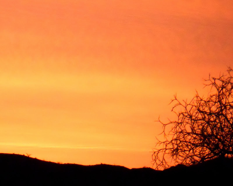
Sun coming up behind the Salton Sea from Pinyon Ridge.
 |
3/5/2013
Topic:
Rockhouse Canyon / Dawns Peak
hikerdmb
|
OUCH!!! |
3/6/2013
Topic:
Introduction...
hikerdmb
|
Welcome to the board Larry. Nice pics in your links above. |
3/6/2013
Topic:
ABDSP is just too vast
hikerdmb
|
Any of those would be great. Harper Flat is an interesting area and an easy hike from Pinyon Wash and a much more strenuous hike from Harper Canyon. Or go in Fish Creek like Daren suggested and go north over the ridge from near Split Rock into Harper Flat (I think I remember your truck being that far back there in a previous TR).
David |
3/11/2013
Topic:
Rebuilding the 1HZ Diesel Motor
hikerdmb
|
Looks shiny new! I bet you can't wait. |