12/31/2010
Topic:
New lights for Christmas
hikerdmb
|
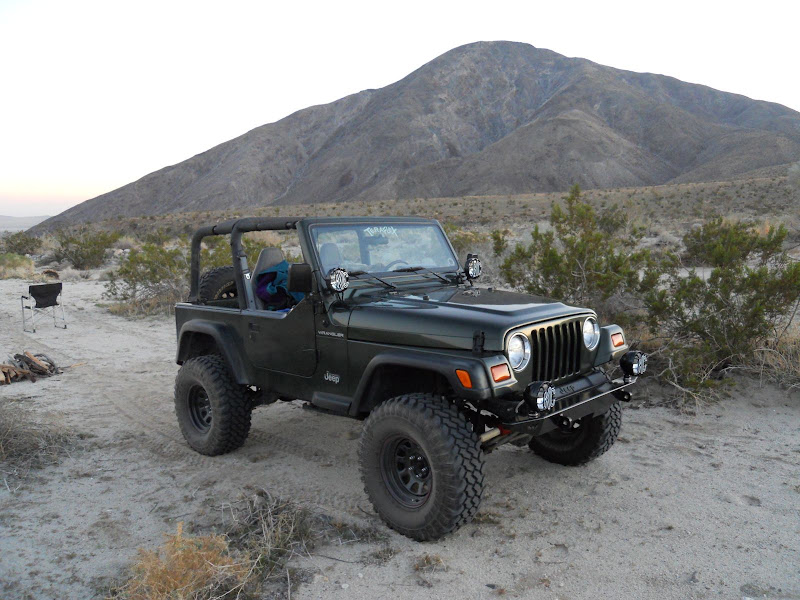
Only a few times in the past with the jeep but now I will. In my younger days I had a Nissan PU with a couple of lights on the front and they came in handy many many times. Leaving on a Friday night just got a lot easier for sure without having to worry about finding a place in the dark. |
1/6/2011
Topic:
Tule Mtn
hikerdmb
|
You say that like it's a bad thing to look like Edward Abbey. |
1/6/2011
Topic:
Tule Mtn
hikerdmb
|
Bob,
I agree! I have read pretty much everything he wrote and just reread for the third time The Monkey Wrench Gang last summer. I had not heard that there was going to be a documentary but I always thought it would make a great movie; explosives, beer, the desert southwest, sex, roadtrips, and on and on, what more could you ask for. At one time I thought they were already making a movie with Jack Nicholson, Matthew McConnahey (don't know about the spelling on both of those names) but I never heard it was finished or even filmed. And it definitely was NOT a documentary. The trailer looks like a good for the documentary film.
Here are three of my favorite quotes in no particular order( I have a few of these on my FB page),
The essence of true wilderness is big mammals that can eat you. ~Edward Abbey
Life without music would be an intolerable insult. ~Edward Abbey
Mountains complement desert as desert complements city, as wilderness complements and completes civilization. ~Edward Abbey
David |
1/9/2011
Topic:
New lights for Christmas
hikerdmb
|
Thanks Bob. Used the lights Friday and Saturday night this weekend. I will post a TR later.
The tires are Pro Comp 33 X 12.50 X 15. |
1/10/2011
Topic:
El Cajon Peak (AKA El Capitan Mtn) Hike
hikerdmb
|
Looks like a great hike? How long did it take? I've looked up that way many times but never knew there was a trail going up there. Good pics on your site too.
David |
1/10/2011
Topic:
Clark Valley Petroglyphs
hikerdmb
|
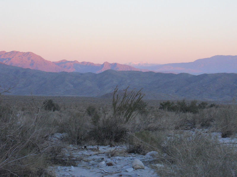
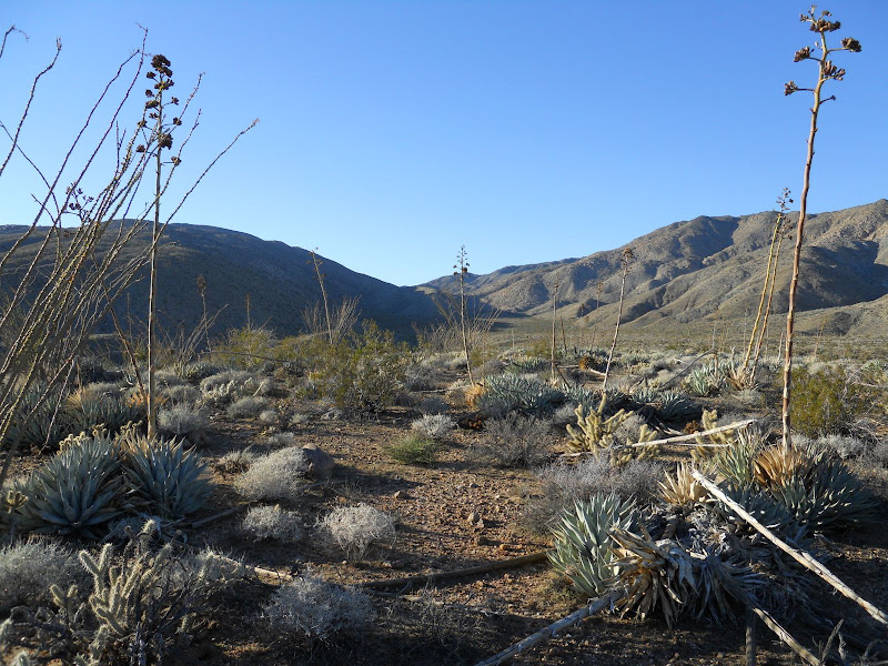
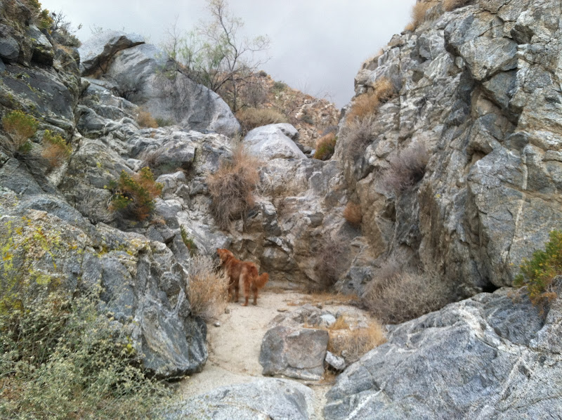
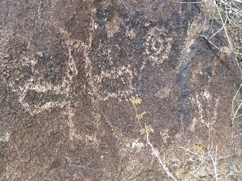
We took off on Friday afternoon and headed for Pinyon Wash off Highway 78. Then turned up Nolina Wash and headed for a campsite I had spotted at the end of Bighorn Canyon to Nolina Canyon hike from before Christmas. Unfortunately that spot was taken so we found another a half mile or so lower in the wash. We arrived after dark so it was good to see that the new lights on the Desert TJ worked great. We awoke on Saturday morning and could see the snow covered top of Mount San Jacinto off to the north.
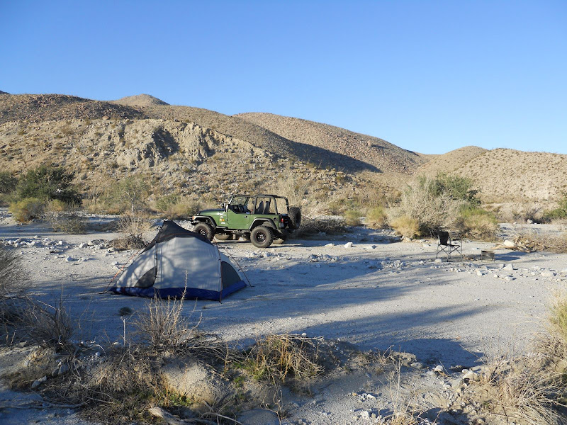
Our camp was in a nice level spot in Nolina Wash.
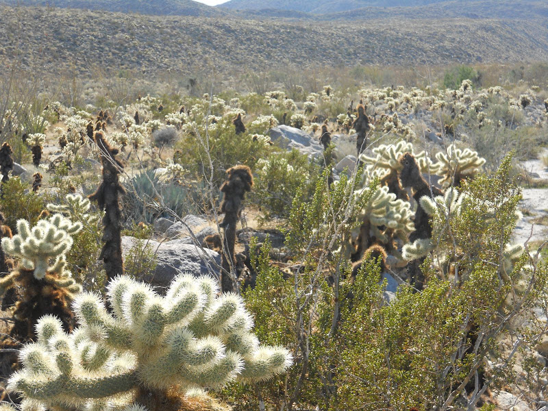
There was a Cholla garden just out of the wash.
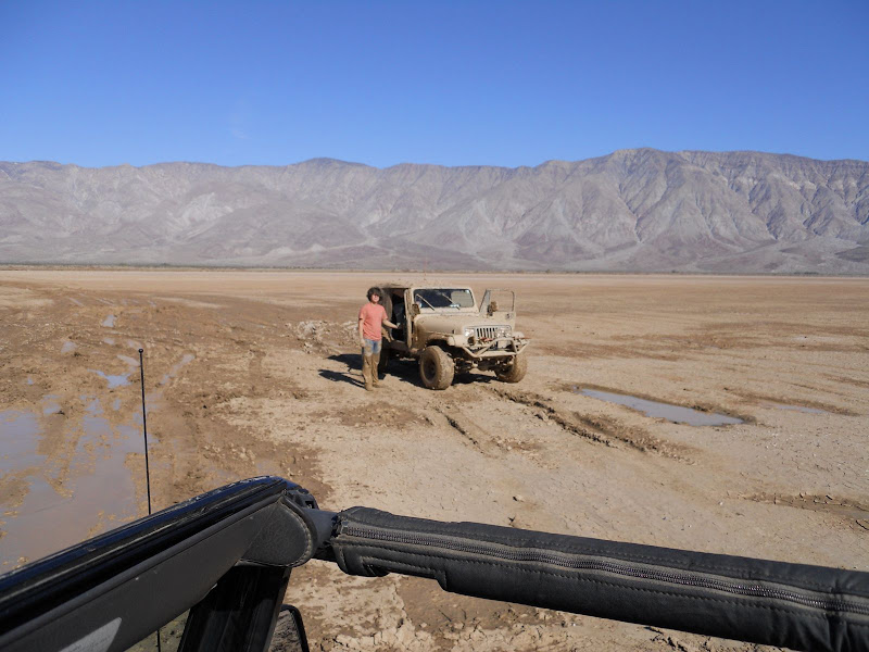
After we broke camp we headed toward Clark Dry Lake. It was not quite dry yet from the rain a couple of weeks ago. We found this guy, he looked to be about 16 years old with 3 other boys who were much younger, on the lake bed. He had been stuck for quite a while and had been digging when a group came by just before us and winched him out. Now he had to go back to the campground and face his folks. The jeep was buried to the frame and muddy inside and out.
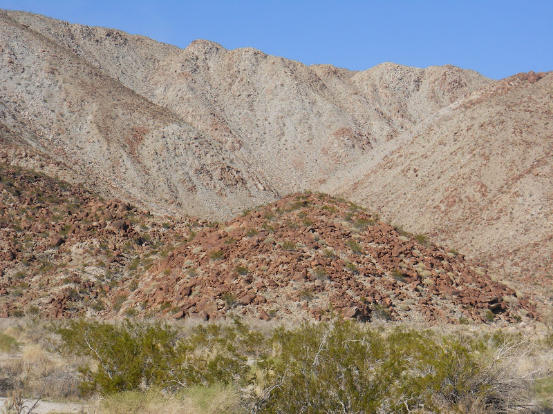
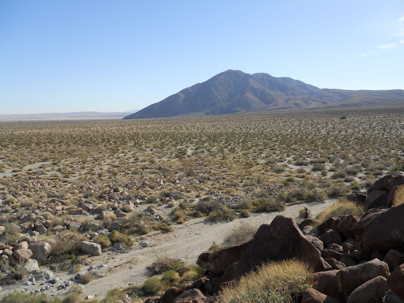
We made it across the lake very easily by staying to the far west shore. No mud and good traction. We went on up the road to just north and east of Coyote Mountain and found a place to park. Then we headed off to the north to cross Clark Valley. We found the "Corp" marked on the topo map and matched the lines on the map with the terrain to the north and picked our spot to head of toward.
As we crossed Clark Valley we saw lots of evidence that it had rained in this part of ABDSP.

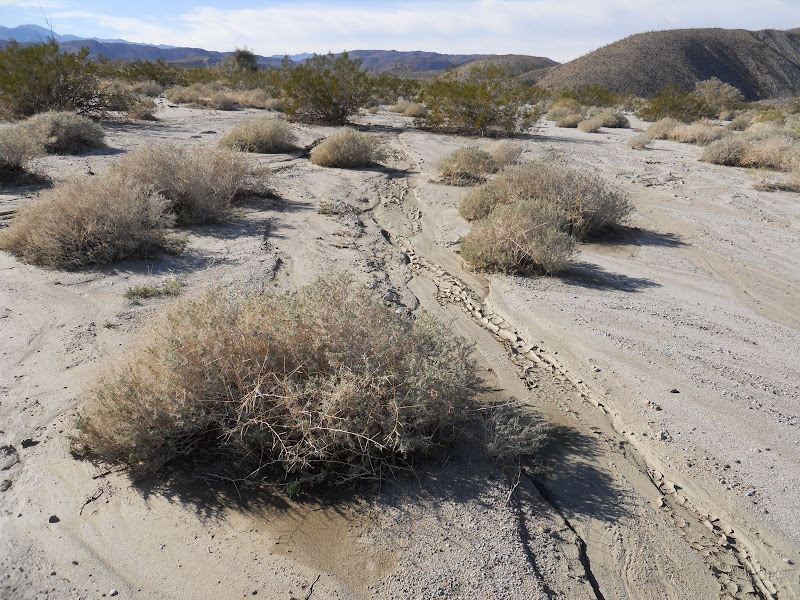
We eventually made it closer to the mound where we hoped to find the petroglyphs. It was probably less than 2 miles across the valley to this mound.
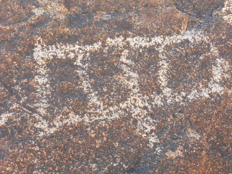
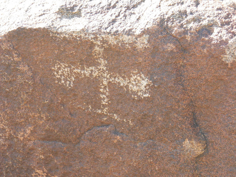
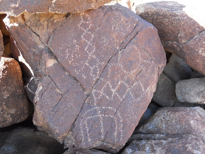
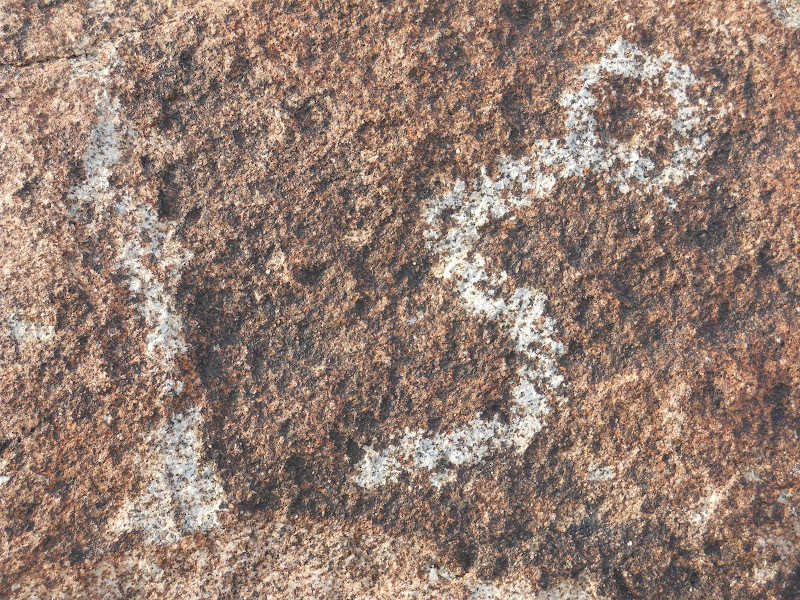
The first petroglyphs were a little faint, but it was right where we had expected.
Then after a little looking we found many more that were much easier to see.

I climbed up the little hill where the glyphs were and looked back toward Coyote Mountain. We had park close to there pretty much in a direct line with the summit. I made sure to take a compass reading before we left and then follow it back to the jeep, also since not many people come this way we could also easily follow our footprints.
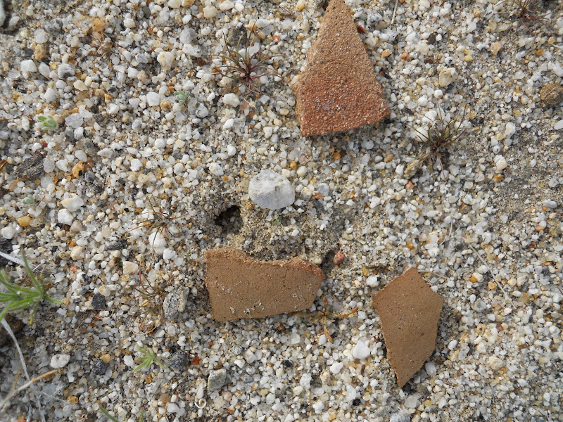
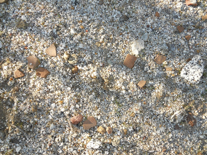
On the way back to the jeep I found some nice pottery pieces. These are still laying there so whoever goes this way next will be able to see them.
Started to make camp here in Clark Valley but a whacked out dude stopped in and wanted to camp with us. After he asked if we could see the two moons that were out tonight we started to wonder about him.
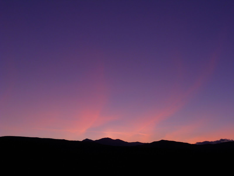
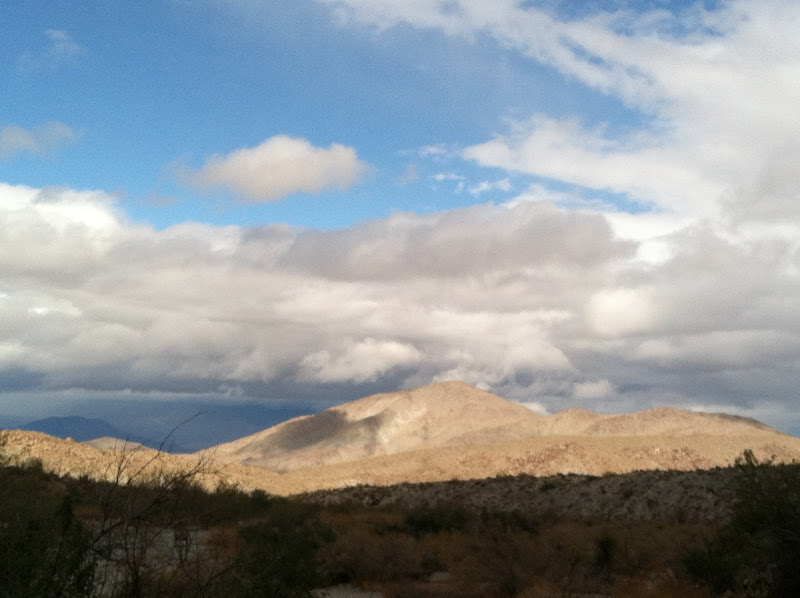
Then when we looked at the sunlight on the clouds after sunset and he asked if we could hear the Northern Lights that he saw we decided we would move on to another location. Does this look like the Northern Lights to anyone else? Can you hear them?
We ended up heading over to Palo Verde Wash and it gave me another chance to use the new lights. Again they worked great! Had a great night in Palo Verde Wash and headed home on Sunday morning. I had been up this way a few times but this was the first time I had made it out to the petroglyphs. Definitely worth the effort to see these and they are located right where the topo shows them.
edited by hikerdmb on 1/17/2011
edited by hikerdmb on 1/7/2013
edited by hikerdmb on 1/7/2013 |
1/11/2011
Topic:
Clark Valley Petroglyphs
hikerdmb
|
Daren,
That does look like the place where the young guy was stuck. In your pic there is a white sign just at the edge of the water. The jeep got stuck out there somewhere and he was to the right of that sign. We stayed to the just to the right of the fence and drove on fairly dry lake bed. Others had definitely been this way before us. We didn't go on the other side of the fence. As for the other artifacts around the petroglyphs, there was a nice ducked trail up into the hills to the north east of the rock art. We followed it about a quarter mile and it kind of petered out. We didn't see anything up there but maybe we just didn't go far enough up that way. I didn't see anything that would cause you to have trouble getting up there in your truck. My jeep is still mud free after this trip.
David |
1/11/2011
Topic:
Clark Valley Petroglyphs
hikerdmb
|
That is definitely the direction the ducks went off toward. I heard there were some other things in a small valley off to the east side of Rockhouse Canyon a half mile or so before you enter the main part of Rockhouse Valley where the 3 rock houses are located. Is that what you are thinking? Good luck if you try that climb. It is a long way up there and looked very rugged for sure.
David |
1/13/2011
Topic:
Clark Valley Petroglyphs
hikerdmb
|
6km
The lake is definitely passable, just stay to the left and you won't even get muddy. Also as we were climbing all over the boulder pile with the petroglyphs, we had a discussion about all the earthquakes in that area in the past few months and hoped we would not have one then. Some of the It was a great trip and we met two very interesting people, one young and learning and one total space cadet. It's always cool to find old artifacts no matter where you are. Kind of helps put things into perspective on our place in time.
David |
1/16/2011
Topic:
Indian Valley
hikerdmb
|
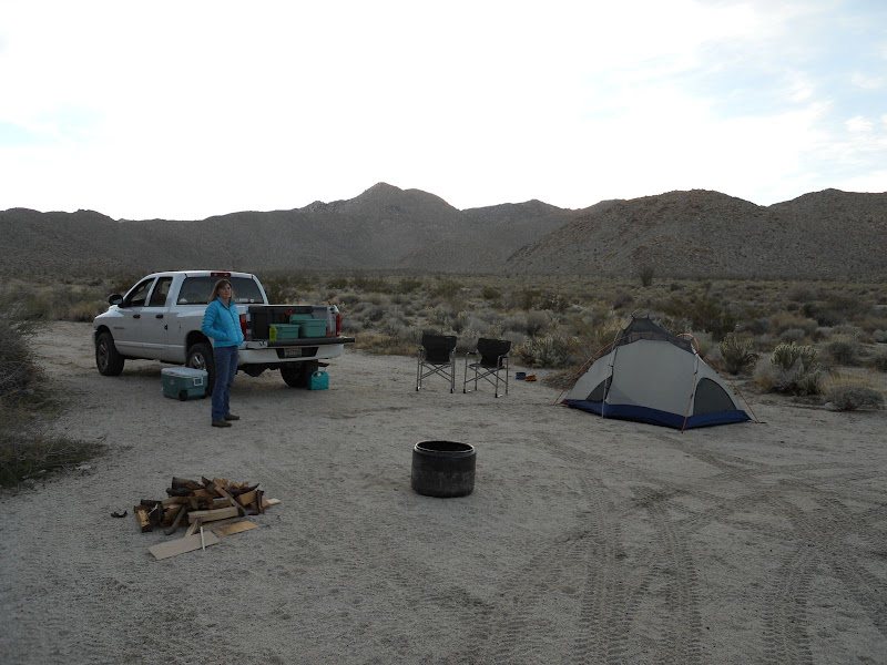
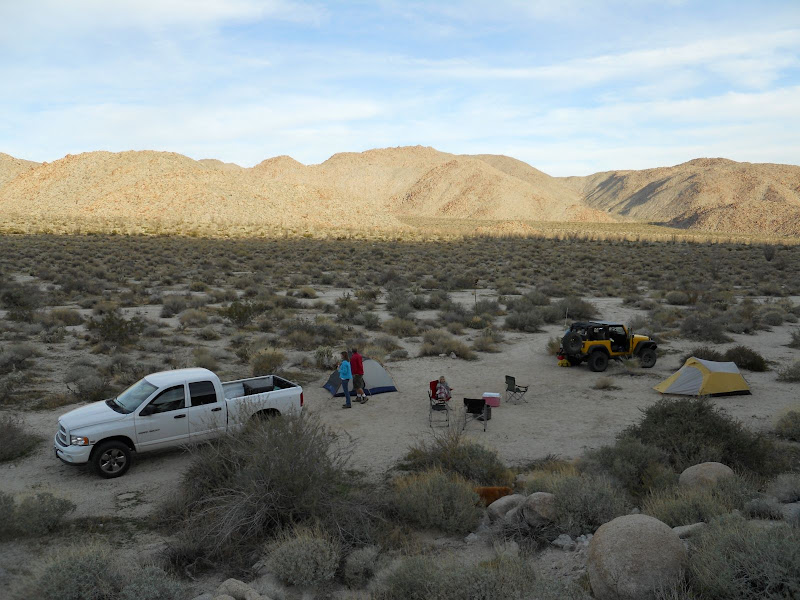
We took a quick trip out for one night this weekend. This would be my wife's first camping trip since she had shoulder surgery about 2 months ago. To lessen bouncing around we did not go in the Desert TJ. We took our truck, but did not bother to put the pop up camper on the back. This allowed us to bring the wash tub and plenty of gear plus our dog Wylie. We left home in the early afternoon and were in Indian Valley by 4:00 PM on Saturday. It was surprisingly empty of people considering it was a three day weekend. There were some people there but not too many. We found a nice spot to set up our tent on the southern edge of the valley about a mile or so up from the fork in the road.
My brother showed up at sunset with his jeep and wife and daughter. We had a nice campfire and a good night sleep. It was not too cold at night and never had to even zip up my sleeping bag. Got up early and took a walk up toward the top of the valley in the wash that is on the very southern edge of Indian Valley. Sombrero Peak looked nice in the morning light from this low ridge on our walk.
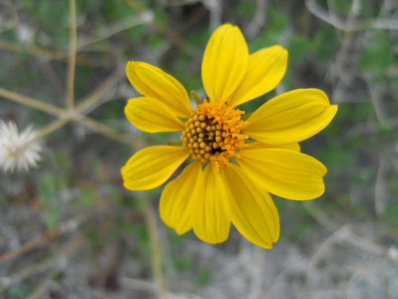
There were a quite a few chuparosa plants blooming and a few of these, which I think is Parish goldeneye, and is also known as Parish's viguiera. But overall not many flowers and a little bit of grass under some of the bushes. The sand was quite dry here compared with the soil in the northern part of the park where I was last weekend.
Here is another view of our camp from up on the side of the hill behind our camp.
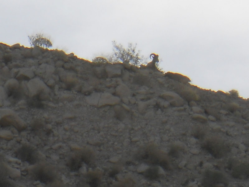
The best part of the trip was on the way out. We were about a quarter mile from leaving the gorge that leads into Indian Valley when we pulled up to some people looking through binoculars. Up on top of the ridge on the south side of the gorge, a few hundred feet above us was a bighorn ram. This is not a great pic since I had to zoom all the way in with my small point and shoot camera. But it was very cool to see him.
It was a nice trip, very low key. But a success first post op trip with some short hikes and sleeping on the ground for the first time in a long while for my wife. |
1/17/2011
Topic:
Indian Valley
hikerdmb
|
Bob,
That does look like the exact same spot. I have camped there 4 or 5 times in the past few years. However when my daughters were young, we camped on the north side road in Indian Valley. Our favorite spot was by a nice tree, unfortunately now dead, right across the road from the small hill of boulders that sits between the north side and south side roads. We must have camped in there 25+ times over the years. Indian Valley is definitely one of my favorite places out there, especially during the spring.
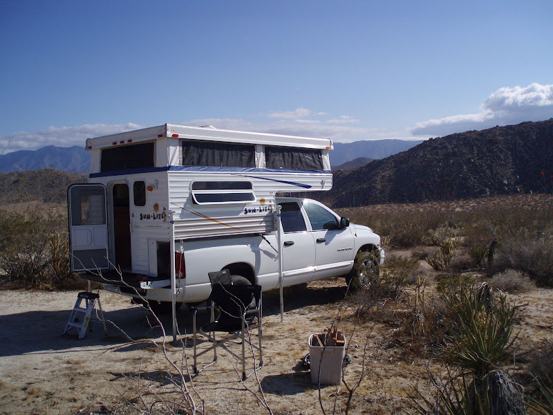
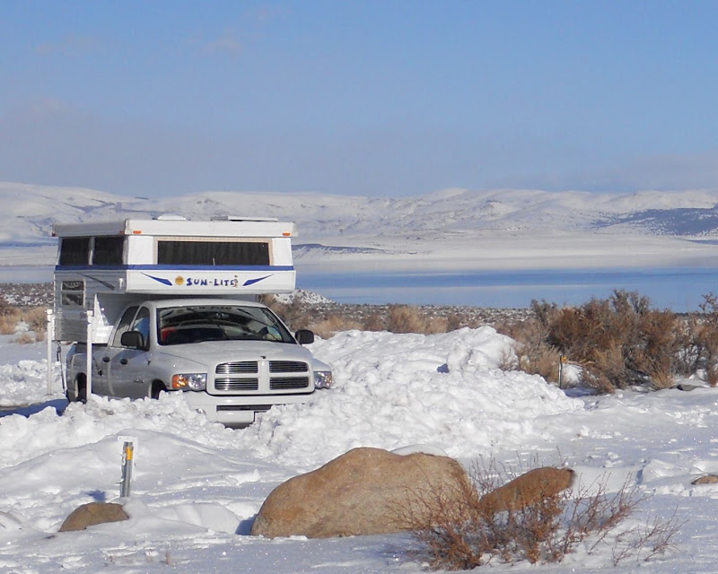
As far as getting a roof top tent, I don't see that happening. I do think they are very cool and if I had an FJ Cruiser or something that size I would love to have one. However, I think the Desert TJ is a bit small for that. When I want a little more comfort though, I do have a camper for my truck. It is a pop up and inside has a queen size bed over the cab, a three-way freezer and fridge, two burner stove, electric pump sink with 20+ gallons of water, a heater, 6'6" of standing head room, and a very very little bit of storage. I have added a 65 watt solar panel to keep the battery charged up. I love the solar power. We have used it in 17 degree night time temps with tons of snow at Mono Lake, many trips to the Sierra, Laguna Mountains, and ABDSP. It has been off road a few times too. It works great. Here are a couple of pics. The first is on the Bradshaw Trail, which is a dirt road that goes from the Salton Sea to the Colorado River. You can see how it looks when it is down for traveling. The next two are from a favorite campsite overlooking Little Blair Valley.


And here is one more from our trip to Mono Lake last January. Not the desert but I just love this photo!
 |
1/17/2011
Topic:
Indian Valley
hikerdmb
|
Bob,
No need to be jealous. I have seen your rigs on here and on your blog. I looked at the fourwheel campers and they are great for off roading but much pricier than mine and kind of plain inside. Plus it seems like everything is an extra cost with those. They are lighter and would be a great choice for a smaller truck like a Tacoma. My camper is definitely an "entry level" camper. We got a great deal on this one and since it is on my Dodge it doesn't get the serious off road action like a smaller rig would. It also does not have the aluminum frame of the fourwheel camper. It weighs about 1000 pounds and so it fits good on my half ton truck. I did get airbags to help out in the rear. It can get quite heavy when it is loaded for a week or longer trip. Every time we use it we are so glad we got it. It can go pretty much anyplace my truck can go. We try to stay out of campgrounds as much as possible and this lets us do that with some level of comfort. But I still do most of my camping, sleeping on the ground.
David |
1/18/2011
Topic:
Indian Valley
hikerdmb
|
Daren,
That must be one popular site in Indian Valley. I did see the mound of rocks but did not go over to look on top, thought about it though. It is right near our old campsite that I mentioned above.
The ram was alone that day. But I spoke with some Canadian snowbirds who said the day before they spotted 7 ewes and an even bigger ram just outside the gorge on the east facing hill just to the south of the entrance into Indian Gorge. (Does that make sense?) The ram in the picture was smaller. They said the ram the day before had about a one and a half curl. That would be great to see!
The snow pic is in fact the same trip where we got temporarily delayed. I learned something very important that day. When my wife says, "I don't think you should go up there we're going to get stuck," I am listening from now on.
Can't wait to hear where you went. |
1/23/2011
Topic:
Backpacking through Jackass Flat and Dry Wash
hikerdmb
|
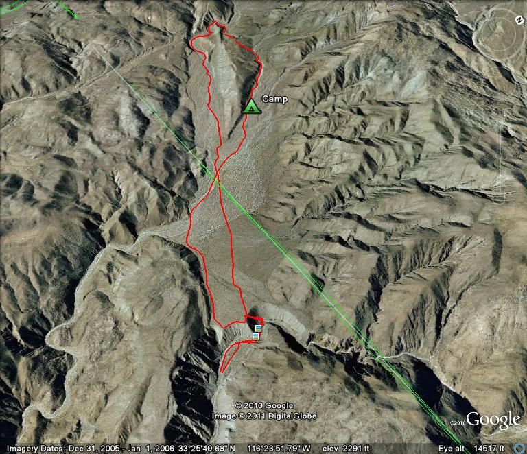
School was closed on Friday so I set out for a quick overnight trip in the northern part of ABDSP. Here is the Google Earth picture of the route I took on this two day trip. It was about a 9 to 10 mile hike through some beautiful and not often visited section of the desert.
It was a beautiful drive out to the desert even with no top on the DesertTJ. The hills around Borrego Springs are starting to show lots of green grass. The air so so calm and clear that the Salton Sea was very visible to the east.

The plan was to make my way back up past Clark Dry Lake, I had been up there two weeks ago to find the petroglyphs. There was still a little water here.
This time though I drove to the end of Rockhouse Canyon. Loaded my pack and headed up the canyon to Hidden Spring. The spring was dry, no standing water like last time I was here. Just down canyon from the spring I picked up the old Indian trail that led up the canyon wall to Jackass Flat, the site of an old Indian village. If you look close you can see the trail running diagonally down into Rockhouse Canyon. That is the Santa Rosa Mountains in the background on the left.
Once to the top of the ridge and on Jackass Flat I made a direct line northwest across the flat toward a large hill that comes down into the flat. After a mile or so I entered Dry Wash and proceeded up this was toward a twisty canyon. The hill is in the middle of this photo looking across the flat. I hiked up the wash to the left of this hill, around the backside, and then returned down the canyon/wash on the right.
I saw a few morteros and some pottery pieces as I crossed the flat in this direction. The weather was perfect, nice and warm and no wind. I made my way up the wash and into the canyon. Along the way I spotted lots of mountain lion scat and tracks, as well as coyote tracks, sheep and/or deer tracks, but not a single boot print. There were also lots of Pinyon Pine cones scattered along the wash but I could not see a Pinyon tree anywhere. They must have traveled a long way to end up here. This is probably one of the most unvisited places I have been in the park,although part of this hike was out of the park boundary.
Once I got through the canyon I left the wash and headed up to the top of the ridge. The view from up here was amazing. Looking farther up into Dry Wash was very interesting and I would love to go back and check out this area. On this part of the hike the ground was very rocky and there was lots of cholla. I had originally planned to camp in this area but decided I would continue on down the next canyon/wash to a lower elevation and a better camp site. I also found a few pieces of pottery in this part of the hike. Here is the view up into the upper part of Dry Wash from my high point of the hike.
As I descended the canyon/wash, un-named on my map, I again spotted lots of wildlife tracks so I continued on until the canyon opened up a bit and I could find a spot to set up camp out of the wash. After about a mile or so going down the wash I found a great place to set up my camp. The day ended with calm winds and clear skies and then the moon came up and lit up the desert. Here is my camp with Buck Ridge behind. This ridge runs along the north side of Jackass Flat. Rockhouse Valley, with the three rock house ruins, is on the north side of this ridge.
I got an early start on Saturday morning and hiked down the wash until I met back up with Dry Wash. Then I followed this wash past the entrance to Butler Canyon and over to the other side of Jackass Flat. In this part of the hike I passed several areas like this with pottery pieces scattered all over the ground.
I could see the Desert TJ down there waiting for me when I reached the edge. I then traversed along the edge of the flat where it looks down on Rockhouse Canyon until I got back to the top of the old Indian trail down into the canyon.
Here is the map of my route.
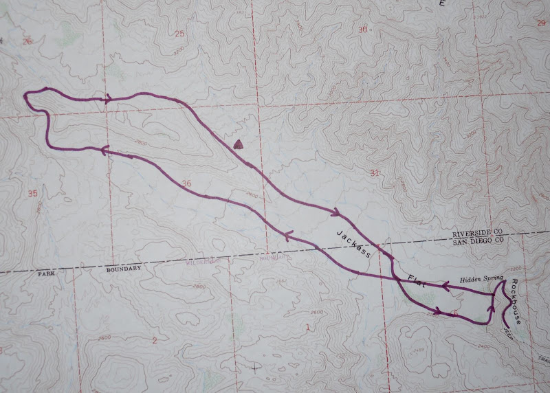
It was a great hike with perfect weather. Can't wait to go out again. |
1/24/2011
Topic:
Backpacking through Jackass Flat and Dry Wash
hikerdmb
|
I just can't believe the weather out there the last few times out. It has been a great January with so little wind and all that early rain has lasted. I hope it rains again soon to keep things growing. I don't know about this weekend yet.
David |
1/25/2011
Topic:
Backpacking through Jackass Flat and Dry Wash
hikerdmb
|
Daren,
The last three miles are rocky and there are 3 or 4 spots that are narrow with boulders on each side of the road. I would not try to take my truck out there and it is a short bed version of your truck. The rocks are not bad but the road just gets really thin and the rocks are probably too big to put your tires on unless you have a big lift. Even in my jeep it took me half an hour to drive that last part and the whole time I was thinking I could walk some of it faster than I was crawling. I did take my old Dodge out there but that was a much smaller truck. I think you could get a mile or so up into the canyon before you came to a possible blocking point. You could always go until you can't and stop. There were plenty of places to park and turn around. Also I think Bob took is Land Cruiser up there maybe he can let you know how it did since it is wider and longer than my TJ.
David |
1/25/2011
Topic:
Backpacking through Jackass Flat and Dry Wash
hikerdmb
|
Daren,
I don't have a GPS. I am a map and compass guy, plus I have an altimeter on my watch. Didn't really need that for this trip but it really comes in handy in the mountains when there is no trail. I just sketched in the trail on GE as close to where I went as possible. It is pretty accurate but not totally perfect. There were a lot of washes out there that split and rejoined again and again. Yeah Wylie went along. It was kind of hot on the way up the wash on Saturday afternoon so I even carried his pack for a few miles. So I guess it wasn't a completely solo trip.
David |
2/2/2011
Topic:
Bow Willow
hikerdmb
|
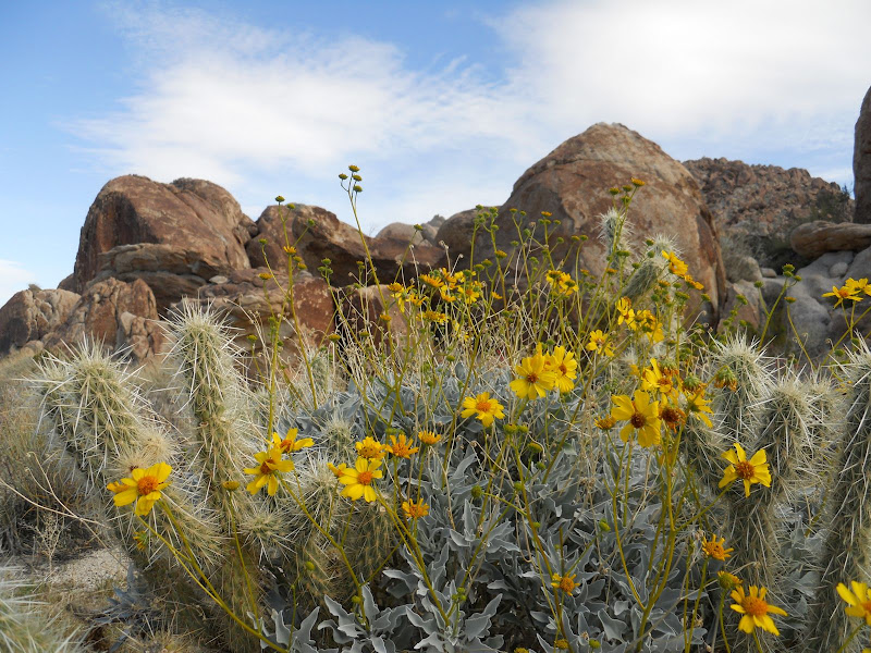
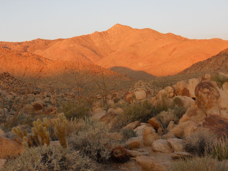
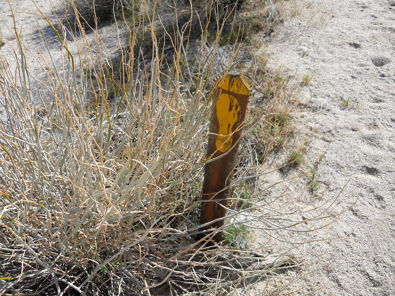
Didn't think I would be able to get out last weekend but I did. A last minute trip came up and so I went with my buddy for a one night backpack trip out near Bow Willow. It was only about 3 miles each way but the weather on Saturday was perfect, maybe even a little hot. It got really windy late Saturday night but was calm again by the time we hiked out Sunday morning. There were a few flowers along the way but this part of ABDSP definitely did not get as much rain as the northern area of the park.
Here are a few pics from the trip. The first two are my favorites.
Brittle bush, cactus, and rock
First light on Sombrero Peak
Very old hiking trail sign
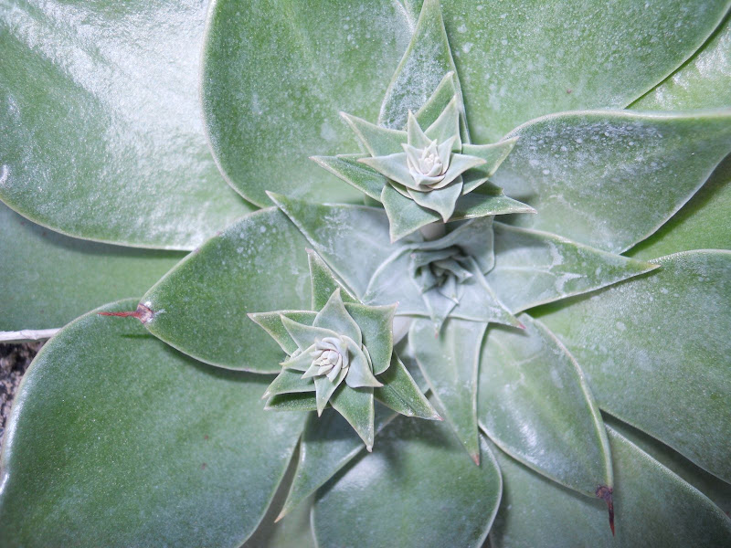
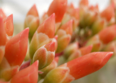
Saw a few of these succulents
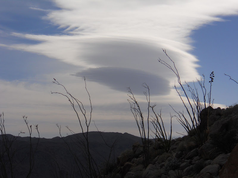
Lenticular clouds, a sign of high winds
After four weeks in a row I will be staying close to home for the next couple of weeks. |
2/2/2011
Topic:
Jacumba Mountains Area Day Trip
hikerdmb
|
Daren,
That looks like an interesting area with lots of native artifacts. I checked out the other pics on your site. The rock work on the possible hunting blind looks cool. You seem to find these features pretty regularly. What makes you say it was in Shaman's land? Good place to park the truck. That looks rough in the photo so it must look really rough in person. Sometimes the long wheel base is a bad thing.
David |
2/4/2011
Topic:
Bow Willow
hikerdmb
|
We did that loop a few years ago. It is a very nice hike. These pics are from that area but we did not do the whole loop this time. The little pass that goes from Rockhouse over into Bow Willow is very cool. Hiking on old Indian trails like that makes the hike. Also the views up into Bow Willow Canyon from there are fantastic. Tha old sign is on that trail.
David
<em>edited by hikerdmb on 2/4/2011</em> |
2/4/2011
Topic:
Attemp to find the old Carrizo Stage Station
hikerdmb
|
Here is a good picture of what is left. Or was left.
http://www.parks.ca.gov/?page_id=25584
And here is some interesting info
http://www.parks.ca.gov/pages/22491/files/carrizo_creek_historical_and_archaeological_investigations_june_2007.pdf
How thick was that ice?
David |
2/7/2011
Topic:
Bow Willow
hikerdmb
|
Bob,
You really should do the hike like it is described in Afoot and Afield in SD. Then you will go through the lovely valley with all the huge Joshua Tree type rock piles. And that is pretty much the best part of the loop. It seems like lots of people just day hike from Bow Willow up into that valley and then return the same way. You will also get a different view looking down into Rockhouse. I will add a few more pics with some of the valley rock formations later today.
David
<em>edited by hikerdmb on 2/7/2011</em> |
2/7/2011
Topic:
Carrizo Gorge Old Railway Train Parts
hikerdmb
|
Daren,
That does look like a great area. Can you send me your GPS track so I can see where you started? Looks like it was a perfect day too.
David |
2/7/2011
Topic:
Bow Willow
hikerdmb
|
Here are a couple more pics from the trip that show the valley between Bow Willow and Rockhouse Canyons.
Bear Paw Rock

Lots of big rocks
Mini Matterhorn

Sombrero Peak and more rocks
 |
2/9/2011
Topic:
Bighorn Pictures
hikerdmb
|
Great photo!!!! |
2/10/2011
Topic:
Bighorn Pictures
hikerdmb
|
That is interesting how all of them are standing with the front higher than their rear. Probably makes them ready to go up the slope as quickly as possible. |
2/21/2011
Topic:
Truck Camper on Truckhaven Trail
hikerdmb
|
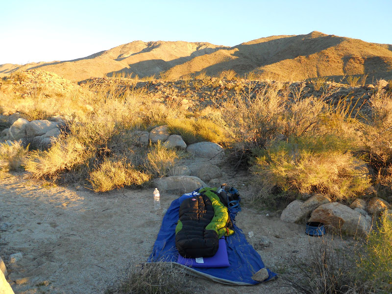
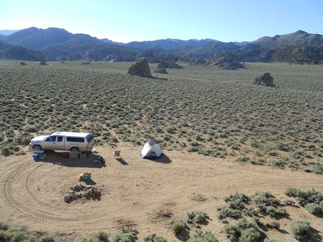
We had planned to backcountry ski in the Sierra this weekend but a huge storm with big winds led us to re-think that and head to the desert instead. We left early Friday morning and headed down to Borrego Springs. The forcast was for high winds but it was quite calm the entire drive out. We were looking for a campsite with a view and cell phone coverage, needed to be in range for a call. We had the camper on the truck and I knew of a couple of spots up past Clark Dry Lake. I had spotted them on my two trips earlier this year up into Rockhouse Canyon area. It is a slow ride up this road with the camper. We arrived at the first spot and parked to look around. From here I was hoping we could get a signal through Alcoholic Pass but no luck. Here is a pic of the site and I think that is Daren's mountain to the right.

There were lots of Desert Dandelions and Sand Verbena up this way.
 
There is also a nice view looking back into Clark Dry Lake.

Since we needed to move we headed for our second choice of campsite. It is on the Truckhaven Trail. We have camped there several times before. It has a great view of the Santa Rosa Mountain, Clark Dry Lake, and the area around Borrego Springs.

We took off for a short hike up toward the moutains and found the hidden dunes that lie to the east of Clark Lake.

Later in the day the wind kicked up and then as night fell the rain began. It rained all night long, sometimes quite heavy. We were thinking it was probably a good idea we came back to this side of Clark Dry Lake and when we looked out in the morning we were REALLY glad we made that choice. The lake bed was pretty much covered with water as you can see in this pic.

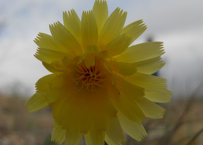
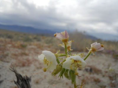
We had a nice breakfast and then the motorcylces started coming up the trail. Apparently it was the Dual Sport Desert Dash and we were parked next to their route. There must have been over one hundred of them coming by every few minutes until about 2:00. We decided to go for a walk and look for some flowers. We did not see any huge fields but there were plenty to be found if you look. Here are some of the blooms we saw. I tried my best with the names so let me know if I got any mis-named.
Ocotillo
Naked Stem Sunray

Yellow-head

Desert Marigold
Brown Eyed Primrose
Desert Pincushion

Dune Primrose

Arrow Leaf Balsam Root
It turned into a beautiful afternoon. I love the desert sky after a storm comes through the blue sky with the white clouds.

Toro Peak even tried to make an appearance. It was covered with snow.

We decided to head home late in the afternoon on Saturday since more rain was on the way and the wind had really begun to blow. As we passed by Font's Wash we saw why the lake had filled. Both Font's and Inspiration Washes had flowed across the highway and down to Clark Lake. Caltrans had been out in the morning to clear the road. This is the view down toward the lake.

As we headed up the hill from Borrego Springs we saw a wonderful rainbow over the desert. A good end to the trip.
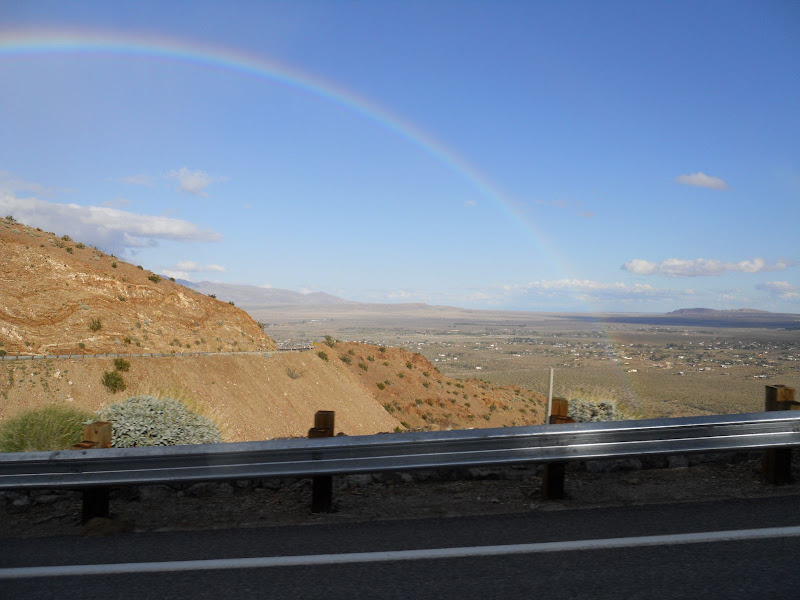
This was not quite like skiing in the Mighty Sierra but that can wait until the snow pack settles a bit. There are lots of flowers in the desert but you have to look for them, no fields of purple. The rain should help the bloom tremendously. |
2/22/2011
Topic:
Truck Camper on Truckhaven Trail
hikerdmb
|
Daren,
Some of them I know just from years going out there and learning a little bit at a time. I wish I new more.
I have an old book I use, "The Audubon Society Nature Guides - Deserts." It covers lots of plants and animals in the deserts of North America.
I also use this web-site which has a lot of info.
http://tchester.org/bd/species/gallery.html
No problem naming the mountain after you. I know how you have been planning to climb it for a while and I couldn't remember the elevation so I knew anyone who reads this would know what it was.
David |
2/22/2011
Topic:
Truck Camper on Truckhaven Trail
hikerdmb
|
Bob,
The camper stays nice and dry. We have had it in rain several times and also in snow a few times and never a problem. Snow on the solar panel keeps it from doing its job but that is the only problem. When it is really cold we do get some condensation inside but not too bad. The north end of the park was wet when we got there on Friday and after the rain it was really wet. I was surprised that Font's and Inspiration Washes both flowed across the road and down into Clark Lake. The official storm total over the weekend for Borrego Springs was 1.48". For Agua Caliente, it was 1.73". That should help the southern part a bit. Looks like more rain and snow this coming weekend too. I am hoping to get out this weekend but not sure yet and then the second weekend of March if possible. Those pictographs you found are very nice. I have never seen the hand images before. I would love to know where those are. Did you happen to go across from the Blue Sun Cave to the huge tank or were you not out that far? I bet after this last weekend it is full to the top.
David |
2/22/2011
Topic:
Clark Valley Petroglyphs
hikerdmb
|
Nice pics Missy. Those are much clearer than the ones I posted. We didn't look for the benchmark but I know there are people that like to hunt for those things.
David |
2/23/2011
Topic:
Torote Canyon / Indian Valley
hikerdmb
|
Daren,
Looks like a nice hike. How was the terrain getting from Torote over to Indian Valley? Did you see any nice campsites up that way? I have never been up Torote
Canyon. I have thought about it many times but there always seems to be lots of vehicles at the trailhead. Got any more pics?
David |
2/23/2011
Topic:
Torote Canyon / Indian Valley
hikerdmb
|
Thanks Daren. I like the first pic in your last post. Looks like a nice high place with a good view. Is that right before dropping into Indian Valley? I also like those fancy hiking shoes your son is wearing.
David |
3/8/2011
Topic:
Desert Wildflowers and the caves of Inner Pasture
hikerdmb
|
Bob,
Thanks for sharing. I haven't been out in about 3 weeks and I was kind of having withdrawals. You pics and TR helped. That cave looked very cool and I don't think I have ever seen pottery in ABDSP with a pattern in it like that. Looks like lots of flowers too. I especially like the ghost flower pics.
David |
3/15/2011
Topic:
California Bighorn Sheep in Canada
hikerdmb
|
Those are some nice pics. They look more like the sheep we would see up in Taylor Canyon when we lived in Gunnison, CO. |
3/18/2011
Topic:
Photo Albums using JQuery
hikerdmb
|
Hey Bob,
I think more tweaking may be in order. I saw a white window with a "Start Slide Show" button in the upper left corner. I did not see any pics. Since I haven't been to the desert in almost a month, I need to see some pics!
David |
3/19/2011
Topic:
Photo Albums using JQuery
hikerdmb
|
Much better. Nice palm grove too. Thanks for sharing. Hope you have a great trip. Looks like rain here in north county.
David |
3/23/2011
Topic:
Indian Valley / Inner Pasture Macro Tour
hikerdmb
|
Daren,
Great pics. I really like the caption, "Small flower in Anza Borrego." No GPS track for this hike? Did you go over and back the same route? Those macro pics are fantastic! I will be sure to let Andy know to have a look at them. You are getting better and better with the new camera. Thanks for sharing the pics. I have missed being out there the past few weeks but this made it a little better. I am heading to Joshua Tree for a few days next week and can't wait to get back to the desert.
David |
3/24/2011
Topic:
Henderson Canyon, Palm Mesa, Borrego Palm Canyon
hikerdmb
|
That looks like an excellent hike with lots of scrambling. Looked very rugged. I like the Every Trail with the slide show and the map. I have not seen that before. Thanks for sharing!
David |
3/24/2011
Topic:
Mine Peak - Slot Canyon - Canyon Sin Nombre. Loop.
hikerdmb
|
You really know how to get to those less visited areas. Just when you think you've been everywhere in ABDSP you see something new. Thanks for posting the TR.
David |
3/25/2011
Topic:
Indian Valley / Inner Pasture Macro Tour
hikerdmb
|
Daren,
That's pretty much what I pictured when I look at GE from your description but I thought you went around the peak to the west. That berm going across the middle of the Inner Pasture looks very interesting from the GE view you posted. Is it real noticable when you are there? Is it just the edge of the wash or something else?
David |
4/2/2011
Topic:
6582 redux
hikerdmb
|
Stewart,
Great pics and thanks for adding all the captions. Those grinding stones were a good find. It is amazing that so many were still there.
Thanks for sharing.
David |
4/2/2011
Topic:
Indian Valley and then some
hikerdmb
|
That is an amazing camera! |
4/14/2011
Topic:
Sacatone Overlook to Carrizo Gorge
hikerdmb
|
Daren,
Another great trip for you! That sunken hillside is very cool. Did you cross that? I was wondering if it was something fairly recent or not. Thanks for sharing.
David |
4/17/2011
Topic:
Carrizo Gorge Railway
hikerdmb
|
Thanks for the info Stewart. Sounds like a good book. Since the 1983 fires, the railroad was fixed and ran for a short time a few years ago. They made a big deal out of it when it reopened (stay off the tracks, we will prosecute trespassers, etc), but as of late it doesn't seem like much is running again.
David |
4/27/2011
Topic:
Galleta Meadows Sky Art Sculptures
hikerdmb
|
Daren,
I like the shot with your truck under the camel. I also looked through a bunch of you photos from your blog. The depth of field (I think that is what it is called) you get on some of your photographs is exceptional. I am guessing you are using all those manual settings on your camera to do that. You have some really great pics from the last few months. Well done!
David |
5/25/2011
Topic:
Little Blair Valley And My New Lens
hikerdmb
|
Daren,
I like the first one with the scratches on the truck. One of the joys of a full size rig. My truck looks just like that after every trip but they mostly buff out.
We planned a backpack trip to Harper Flat last weekend (5/21) but after it looked like it would be hot went to the mountains instead.
David |
5/27/2011
Topic:
Great Horned Owls
hikerdmb
|
I agree those are nice photos. You saw them while driving? Wow!
David |
5/27/2011
Topic:
Little Blair Valley And My New Lens
hikerdmb
|
I like that "overwhelming response" part.
David |
6/7/2011
Topic:
Snakes This Season
hikerdmb
|
surfponto wrote:
ON another note
The forum seems to have died a bit. This happened last year too about this time.
What noone likes to go out to the Desert in June- August?
What is up with that? 
I like to go out in the summer but I like to go to the Borrego Springs Resort and lounge by the pool and maybe play some golf. I try to have plenty of adventures during the summer, starting as soon as school gets out... tomorrow.
Nice pics Daren. I love the close up photos you take. You capture so much detail. Keep it up!
David |
6/28/2011
Topic:
Grapevine Canyon Road
hikerdmb
|
Daren,
You should not have any problems on that road. If you start on the Jasper Trail east of Ranchita and then join the Grapevine Road that could be difficult. There are a few tight spots on the Jasper Trail.
David |
6/30/2011
Topic:
Earthquake / Vallecito Valley - Part 3 - ABDSP
hikerdmb
|
Daren,
Glad to see you are keeping the southern desert company. I just got back from a trip through Panamint Valley, Hunter Mountain, Saline Valley, Inyo Mountains, and even a little time in the Sierra. I will post a few pics soon with a title like "Thinking of ABDSP in other deserts" so I can put it on here.
David |
7/1/2011
Topic:
Thinking of ABDSP while in DVNP
hikerdmb
|
Just returned from a 4 day trip around Death Valley and couldn't help but compare and contrast with earlier trips in ABDSP. We left 395 on the Trona Road and headed for the Panamint Valley. Here is the view into the valley from the south end.

On the descent down into the valley we looked for the army men and dolls but only found these two.

Our trip through Panamint Valley was amazing. It was quite green (the creosote bushes just like in ABDSP) and temp stayed around 107 - 108 degrees late into the afternoon.
Here are the sand dunes found at the north end of the valley.

We headed west on 190 and then turned north on the road to Hunter Mountain and the Saline Valley. We climbed up out of the heat to a bit over 6000 feet elevation and spent a somewhat windy night on Hunter Mountain. From our campsite we had views into Ulida Flat, Hidden Valley, the Racetrack, and over to Saline Valley.

The next day we retraced our route off Hunter Mountain and then turned north at South Pass for the descent down Grapevine Canyon (not the same Grapevine Canyon as in ABDSP). We had been on this road twice before, once after coming through Saline over Steel Pass from the Eureka Sand Dunes and once after dropping down Lippencott Road from the Racetrack. But this was the first time we saw the plants that give this canyon it's name.
We kept heading downhill for a long time always thinking we were getting close to the bottom of the valley but not getting any closer.

We finally made it to the salt flat at the bottom and it was spectacular. The temps here were about 104 degrees.
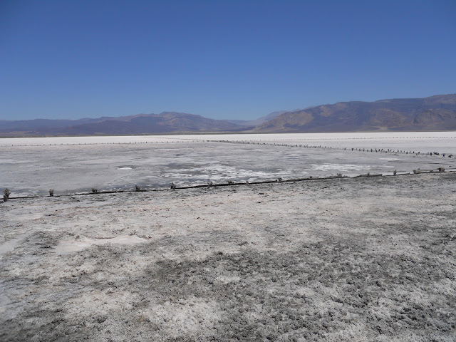
We then went past the marsh right near the road. That is Steel Pass off in the distance.

We headed for Willow Creek Camp for some shade and to have lunch but it was a private area with a locked gate. Too bad. It looked very cool under that canopy of trees.

We continued on up out of Saline Valley and it seemed to go on forever. By the way in about 80 miles of backroad driving this day we saw only one other rig, and that was in the first mile after South Pass. Looking downhill...

Looking uphill...
We finally made it out of Saline Valley and continued on toward Big Pine Road. There were lots of relics of mining days along this stretch. After hitting pavement we went into Big Pine for some gas and ice and then turned right around and headed out of town in the same direction. This time though we turned offf Big Pine Road and headed into the Inyo Mountains. Our camp for the night would be in Papoose Flat. Here is the view coming into the flat with the Sierra Nevada Mountains across the Owen's Valley.

We had a great campsite and another somewhat windy night but since we were over 8000 feet elevation it was nice and cool.
Hiked around the flat over to the edge where it drops about 5000 feet down to the floor of the Owen's Valley.
The third day we left the desert behind and drove down the the Very Long Array of dishes in the Owen's Valley. Then we took some dirt roads up to the base of the Sierra just explore some new areas. Finally we decided to head up the Onion Valley Road out of Independence and camped near the trailhead for Kearsarge Pass. Again we were over 8000 feet elevation so we had one last cool night.

Drove home the fourth day with no traffic, always a good way to end a trip north. Not exactly a ABDSP trip report but I did think about Borrego and we discussed it on this trip so I hope that counts enough to leave this TR.
David |
7/2/2011
Topic:
Thinking of ABDSP while in DVNP
hikerdmb
|
Bob,
I remember Daren's trip. We didn't hike like that, mostly offroad driving. Have a great time in Baja. Can't wait to see some pics. David |
7/5/2011
Topic:
Thinking of ABDSP while in DVNP
hikerdmb
|
Daren,
That looks like the same little cave. In fact the two dolls in my pic are in your pic too. The metal post by the cave in my pic was just a short piece of I-beam that was standing upright. It was moveable. I guess all the other dolls in that cave moved to a cooler home this summer.
David |
7/13/2011
Topic:
Bighorn Sheep Count 2011
hikerdmb
|
Great job Daren. I really like the last photo of the moon setting. That looks like some long days plus trying to keep all the sheep you counted from being counted again. A spotting scope would have been nice to have.
David |
8/28/2011
Topic:
Sunrise in Mortero Wash
hikerdmb
|
Looks like the beginning of a HOT day. How were the temps? Any sign of rain in that part of the desert?
David |
8/29/2011
Topic:
Indian Hill and June Wash
hikerdmb
|
Daren,
Look like you guys had a nice trip. That railroad camp area is very cool. We backpacked in there a few years back and had a great time exploring that area.
Did you make it up to the tank? Was there water in it? It looked like water in your bee video so there must have been some recent rains.
June Wash is a nice place. There are some good campsites up there and if you go way up to where the the road ends you can climb up and look down toward the upper reaches of Arroyo Seco, Sandstone, and those washes/canyons in that part of the park. I also think there are some interesting spire type rock formations up there but I can't find any pictures of them. Just going from memory. It is a fairly wide wash all the way up to the road end. Easy for your truck. I think you (not me) could probably reach Whale Peak from there. I don't know anyone who has gone that way but if anyone could make it go I think you would be that guy. From the top of Whale Peak it looks pretty rugged heading down in that direction.
David |
9/2/2011
Topic:
The Creation of the Anza Borrego Desert State Park
hikerdmb
|
Thanks Daren,
That was a good read. Who would have thought it would have been so difficult to make this park. I was surprised about the speculators buying up whatever they could to sell back to the park. I guess greed has been around a long time. We are lucky to live so close.
David |
9/7/2011
Topic:
Camping over Labor Day....too hot?
hikerdmb
|
How about some photos? |
9/8/2011
Topic:
Lights out
hikerdmb
|
It only took a few hours after the power went off to hear the sdg&e guy say if we had more lines coming into San Diego from the east then this wouldn't have happened. Nice spin! |
9/12/2011
Topic:
Lights out
hikerdmb
|
Thanks for that link Bob. I agree with your comment about saving us $100,000,000. That will never happen. Once it is built they will keep charging the same or more not only for the electricity but also to transmit that power on the new lines.
David |
9/20/2011
Topic:
Grapevine Mtn /Bitter Creek Canyon
hikerdmb
|
Nice hike Daren. Do you ever stay home on the weekend? That is a nice looking area. The marker sticks/poles are very similar to what is on top of Wilson Peak on Pinyon Ridge, which I believe is just to the north north east of your mountain, across Grapevine Canyon. Glad the temps are starting to cool off out there. Also nice to hear that it rained too. I saw that even the Fish Creek mountains got some rain from that last "storm" that came through.
David |
9/25/2011
Topic:
Grapevine Mtn /Bitter Creek Canyon
hikerdmb
|
I did my part to fill the backcountry this weekend by heading to the Lagunas. Saw a SAR operation on the east side of Sunrise Hwy where the hang gliders launch. |
9/26/2011
Topic:
Sad News about Jerry Schad
hikerdmb
|
Jerry Schad died last Thursday. I am sure most people on this site have used his books. Many of my hikes over the years came straight from Afoot and Afield in San Diego, starting with my first solo climb of Sombrero Peak so many years ago I don't even want to think about it. RIP Jerry. Your words will live on.
David
http://www.signonsandiego.com/news/2011/sep/22/hiking-writer-jerry-schad-dies/ |
9/26/2011
Topic:
Sad News about Jerry Schad
hikerdmb
|
Daren,
I have the top two from your pic and my oldest copy looks just as worn, filled with stickies and post-it notes. I have several other local hiking books but NONE even come close to Jerry's books.
David |
9/26/2011
Topic:
Sad News about Jerry Schad
hikerdmb
|
Thanks for the link Bob. I signed and also posted it on Facebook. |
9/29/2011
Topic:
The House Forgotten
hikerdmb
|
That is amazing indeed. Just the fact that someone could recognize such an old image and connect it with your photo. My memory is not that good. |
9/30/2011
Topic:
DesertUSA - Shaman Cave story
hikerdmb
|
I saw this on Desert USA and thought some might like to read it. It is a bit different that the usual trip report. Okay maybe it is a lot different.
http://www.desertusa.com/mag00/dec/stories/cave.html |
10/4/2011
Topic:
Whale Peak Backpack Possibility
hikerdmb
|
Have a great time. Looks like the weather will be terrific. It looks like it may rain up there (Whale Peak) this week which will make the views very nice after the storm passes through. Looks like almost exactly one year since you started this plan but I bet it will be worth it. If it is windy, there is a nice campsite on the western edge of the summit plateau that is protected from the wind by rocks and trees. We stayed there one night when it rained and the wind was howling over our heads but hardly a whisper in the campsite. It also has a nice large, somewhat flat rock for relaxing and enjoying the views to the west.
We are heading back to the Sierra for 5 days to check out the fall colors. Hopefully the snow will end in the Sierra on Thursday, then it is supposed to be cold but sunny for the next few days. Can't wait to get back up there. When we return it will definitely be time to get back out into the desert.
David |
10/5/2011
Topic:
Indian Hill and RR Camp area
hikerdmb
|
Looks like it was a great day. You are right not to worry about finding those things on your first trip out there because now you have a reason to return and give it another shot. Once you find one piece of pottery you can't help but find more. That is a great area to keep going back to visit. And now that the weather is changing it is even better.
David |
10/14/2011
Topic:
The *new* Desert Magazine online
hikerdmb
|
Sometimes I have NO IDEA what you two are saying. |
10/19/2011
Topic:
New Topo Maps App for the iPhone
hikerdmb
|
That was one of the first apps I got for my iPhone when I got it earlier this year. It is great because you can just load the maps you want and/or need. I still prefer to carry a paper map with me ( I like to see the bigger picture than what is visible on the phone screen) but I have used just my phone topo map on a few occassions. It comes in handy when plannning or prepping for a trip, or just dreaming while at work, and you don't have the map you need at hand. I really like the distance ring that will show a straight line distance from your location to some other spot on the map. There are many other features you will see when you play around with the app for a while.
David |
10/19/2011
Topic:
New Topo Maps App for the iPhone
hikerdmb
|
Daren,
I have the Topo app on my iPhone from the link that Bob posted. I also use GPS MotionX on my iPhone. But that is just to track hikes, mostly at Daley Ranch and Mt. Laguna, doesn't do too well in the Sierra. I am still an old school map and compass guy when off trail hiking. I have the National Geograpic Topo program on my Mac at home and can print maps of anywhere in California. I really like that program. You can add trails, get elevation profiles, and other things before printing. On my old PC I used a downloaded program called "ZTopo." It worked great for printing maps but you couldn't add anything to the map. It just would print like a USGS Topo map but it was seamless so you could get just the map you wanted.
And I would never laugh at you. I am trying to get to know and embrace some technology. I actually had a real GPS back in the late 1990s but when Y2K came around it died. It is still the only thing I have ever heard of that actually died after Y2K.
David
David |
10/30/2011
Topic:
Indian Valley to Inner Pasture - Need 2 Vehicles
hikerdmb
|
Daren,
I may be able to help you out if you are doing this hike this coming weekend. I will be heading out Thursday (11-3-2011) after school and staying until midday Saturday. I can't do the hike since I will have Wylie with me and that would not be a good hike for him. However, I could meet you at your end point and give you a lift to the start in Indian Valley either Friday morning or Saturday morning. I am planning some easy four wheelin' and some short hikes, nothing set in stone yet. Let me know.
David |
11/5/2011
Topic:
Harper Cabin
hikerdmb
|
It was a blustery day but that wasn't going to keep me from this hike. When I left home it was already raining and it continued to rain all the way over the mountains. As I drove down S-2 through the San Felipe Valley toward Scissors Crossing I notice something in my rear view mirror. It was a sign that this would be a good day.

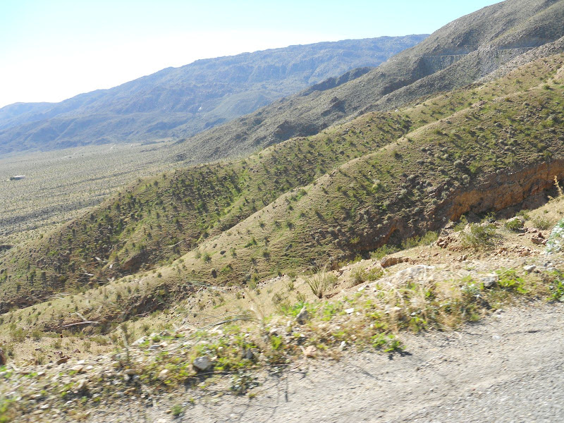
I drove on down to Highway 78 and then headed east to Pinyon Wash. I drove up to the end of Pinyon Wash and parked at the usual spot. I started the hike up the narrow canyon and the clouds, which followed me over the mountains, were getting closer. You can see them trying to come across the Pinyon Mountains and over the narrowest part of Pinyon Wash. But I was still in the sun, at least for a while.
As I entered Harper Flat I stuck close to the western edge and followed the wash up toward the south and the canyon where I knew I would find the cabin. The rain clouds kept getting closer and starting to sprinkle a little bit. I had packed my rain gear so I wasn't too worried. The wind blew off and on the entire way across Harper Flat. Sometimes it was soft but mostly it was very blustery.

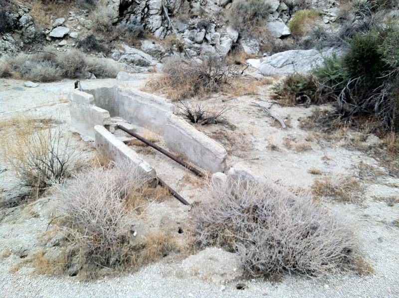
After reaching the junction with the Pinyon Mountain Road I followed it a short way and then left it to head up the canyon where the cabin is located. I spotted this old watering trough and knew I had to be close.
I wasn't exactly sure where the cabin was so I kept to the south side of the wash/canyon to see if I could find it. When I reached a fairly large dry fall I thought for sure that I had missed the cabin, so I backtracked down the wash along the north wall. Still didn't see anything so I headed back up the wash and climbed out of it a couple of times along the way to see what I could find. I eventually made it back to the dry fall and decided to go up and over it to see what was above it.
Once over the dry fall I found some ruins but it didn't look like the cabin pics I had seen before.
I spotted some roofing materials and other objects and they led me to the cabin ruins. There is not much left of this old place. The old bed springs and some rusted out cans are still inside and there is some wood and lots of roofing tin.

A bit farther up the canyon past the cabin is the dam. I learned that this dam filled up with sand pretty quickly after it was built and this played a huge part in ending the Harper brothers ranching operation in Harper Flat. It's difficult to judge in this picture, but the dam is about 12' high. There are supposed to be two dams but it was raining pretty hard now and I still had to get back down the dry fall, which was now wet and most likely slippery.

I started the return hike back to the truck the rain continued fairly heavy for few minutes. When I got back down to where the Pinyon Mountain Road meets Harper Flat, the heavy rain stopped. Here I was rewarded with a beautiful view down across Harper Flat to Sunset Mountain.
Once back to the truck I headed down Pinyon Wash and over to Mine Wash to visit the old Indian village site there. Here is a pic looking back across the bajada toward Sunset Mountain in the east. Lots of morteros around this part of the desert.

It turned out to be a great day. I had planned to camp in Little Blair Valley but by the time I got over there the rain was coming down more and more often. It looked like it was going to be a very windy and very wet night and I really didn't want to spend that many hours in the tent with Wylie, so I headed on home around 5:30. That turned out to be a good call since it rained all the way home and the radar showed it raining back in the desert for several hours after the sun went down.
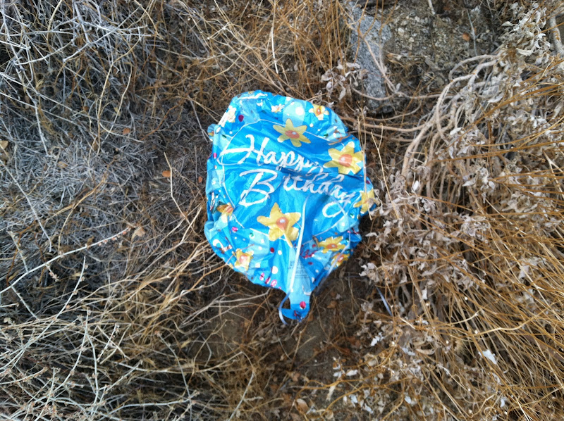
One more thing...Mylar balloon count from this trip - 1.
The hike, as I did it, was about 5 miles round trip with almost 800' of elevation gain. If you have a capable 4x4, you could take the Split Mountain Road and follow it all the way to the base of the Pinyon Mountains. The hike to the cabin from this road would only be about half a mile each way.
David |
11/5/2011
Topic:
New tires
hikerdmb
|
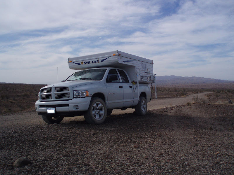
After 7 years driving with 20" rims I finally got rid of them. I have had this truck since new and have not really liked the 20" wheels since I got it. I have been through a couple sets of tires and wanted to get back to BF Goodrich All-Terrain tires. I have had BF Goodrich on other trucks in the past and knew they were the tires I wanted again. Since they don't make them in a size for my wheels I decided I would get some 17" wheels.
I watched the prices for a few months and a couple weeks ago Discount Tire had a good price and a nice rebate, so I paid them a visit. I decided on 285/70/17 for the tires (these are almost exactly the same size as the 275/60/20 tires I have had since buying the truck new). I opted for the E load range version of these tires since I use the truck to carry a pop-up camper. These tires have a total of 10 ply and should be more than strong enough for my camper. For wheels I went with V-Tec Off-Road rims in 17"X8.5". These wheels are black but with a machined face.
I just got back from my first trip with the new tires and wheels and so far so good. I didn't do anything too rough on this first trip, but I sure felt confident I wasn't going to get a flat from going over sharp rocks.
Here are a couple of pics of the new tires and wheels.

Close up of the new tires and wheels.

Love this tread!
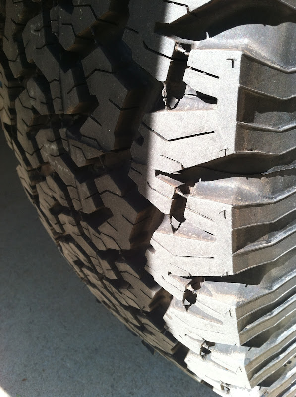
Next step will be new shocks and a front end leveling kit. |
11/5/2011
Topic:
Harper Cabin
hikerdmb
|
Okay Daren, here is the link to the video.
http://youtu.be/r2Y2QtyuHpI |
11/10/2011
Topic:
Canebrake Wash / Indian Valley
hikerdmb
|
Nice pics Daren. Is the picture looking out to Red Top taken from the top of the sand berm? That berm is quite amazing. It looks kind of like a longer version of Egg Mountain. That does look like a very cool place to explore. Lots of old history. How close can you get to the ranch at the mouth of the canyon? Is someone living there now? Also is there an old runway between the berm and the ranch? On google earth there is something long and straight there.
David |
11/12/2011
Topic:
Rain
hikerdmb
|
It looks like the ABDSP got some nice rain today with more possible tonight. Here are the totals through 5:40 tonight.
SAN DIEGO COUNTY DESERTS
SAN FELIPE 0.83"
BORREGO SPRINGS 0.35"
OCOTILLO WELLS 0.16"
AGUA CALIENTE 0.39"
FISH CREEK MOUNTAINS 0.05"
<em>edited by hikerdmb on 11/12/2011</em> |
11/14/2011
Topic:
Yet again, Indian Hill
hikerdmb
|
Did you find the cave? |
11/14/2011
Topic:
Indian Hill Trip
hikerdmb
|
Nice first TR and welcome to the forum. What makes you think there is a spring at the tank? Did you see some sign of that? I've been there a few times in winter and spring and it has always had some water in it. The Indian Hill area is very worthy of lots of trips with lots to explore. Thanks for sharing.
David |
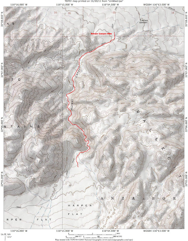
11/20/2011
Topic:
Harper Canyon to Harper Flat
hikerdmb
|
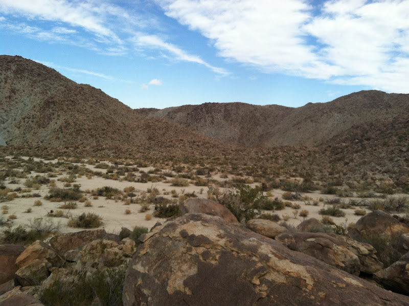
I have been to Harper Flat many times over the years, but never this way. When I did the hike to the Harper Cabin a couple of weeks ago, I looked across the flat to the top of Harper Canyon. That is when I decided to try this trip, since I had never hiked into the flat from that canyon. I started near the Cactus Garden south of Highway 78. The turn off to the Cactus Garden is on the opposite side of the highway and just east of the turn off to Butte Pass. There was lots of traffic on the way out to this part of the desert but once I turned off the highway I did not see another person until I got back to the highway about 5 hours later.
Here is the view up toward the entrance of Harper Canyon from just off Highway 78.

I had to park right near the point where the road drops down into the wash coming out of Harper Canyon. The road gets pretty rough after this and I knew my big truck wouldn't be able to get much closer than this point.
My hike started in the wide wash and I walked quite a way until I got to the entrance to the canyon.

Harper Canyon starts out pretty wide and full of ironwood trees.

After a couple of miles the canyon begins to narrow and the walls steepen.

There are also some pretty rugged side canyons coming into the main canyon.
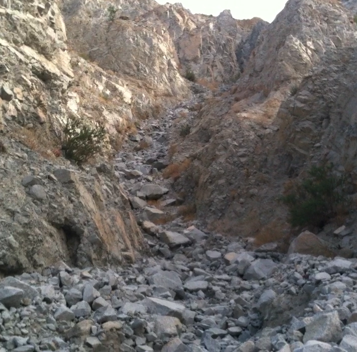
The canyon continues to narrow and becomes more and more scenic.

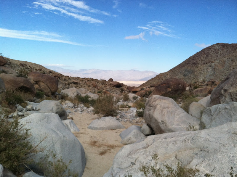
Most of this hike is easy walking on a sandy wash but there are several places along the way where it get steeper and some scrambling is neccessary to make your way farther up the canyon. There are also some areas with evidence of recent rockfall. A huge boulder has fallen and blocked the canyon floor except for an 18 inch wide crack on the east side that you can squeeze through.
Here is the boulder looking down the canyon.
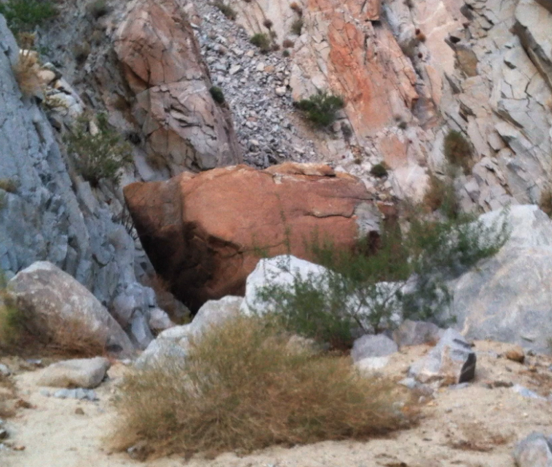
This is an up close view of the way through. Notice the different colors where chips were broken off when the rock fell.

The areas just before and after the huge boulder are some of the roughest sections of this hike. Once passed the choke stone though you will know you are just about to Harper Flat.
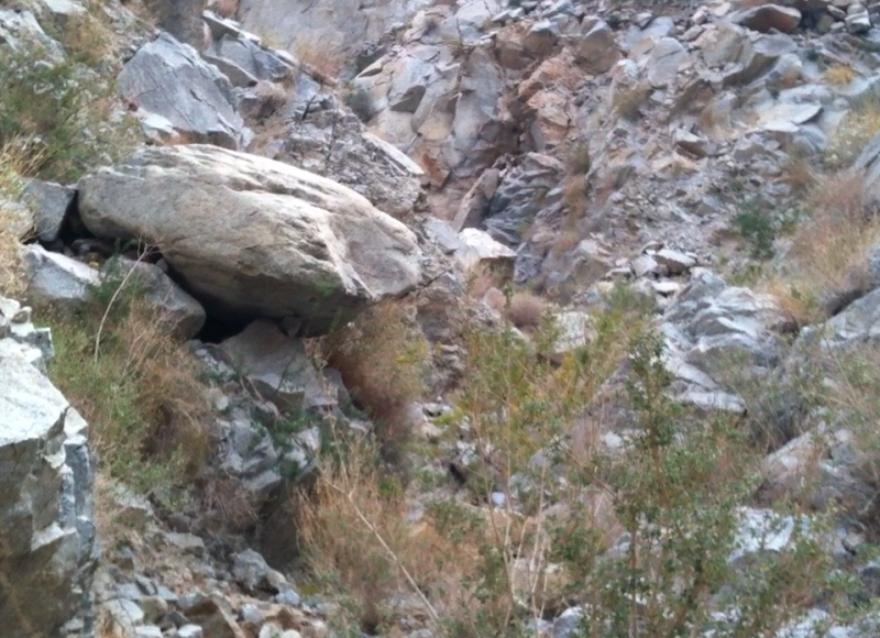
After almost 2 hours of hiking, climbing, and scrambling I made it to Harper Flat. This is the view from the top of a rock outcropping in the flat looking across to Whale Peak.

I spent a few minutes snacking and enjoying the view before turning around and heading back down the canyon. Here is the view looking back towards the top of Harper Canyon.
Heading down the canyon was much easier and also there were some great views looking north toward the Santa Rosa Mountains.

Finally here is a map of my route. It turned out to be a little over 4 miles in each direction with an elevation gain of about 1,300 feet.
edited by hikerdmb on 11/20/2011
edited by hikerdmb on 11/20/2011
<em>edited by hikerdmb on 11/21/2011</em> |
11/26/2011
Topic:
Harper Canyon to Harper Flat
hikerdmb
|
Are you thinking of something like this?

<em>edited by hikerdmb on 11/26/2011</em> |
11/27/2011
Topic:
Harper Canyon to Harper Flat
hikerdmb
|
Daren,
When are you thinking for rhis trip? How about late winter or early spring? Looking at google earth it looks like a few rough parts. Do you have some pics or a TR from Srarfish Cove? I am interested in how that canyon looks.
David |
11/28/2011
Topic:
Alma Wash
hikerdmb
|
Why did you make your son carry all his stuff and all of your gear too in that huge pack? How much climbing/scrambling to get up to Starfish Cove? How much hiking/walking?
You are getting good at the night sky pics. The stars and constellations are, from top right to lower middle; the Pleiades or Seven Sisters, then Taurus, looks like a V on its side, with the star Aldebaran, then comes Orion the Hunter, with the 3 stars in the belt, you can make out the Great Nebula of Orion just below the belt, and finally there is Canis Major with the star Sirius, the brightest star (not counting the sun) in the sky, it is just above the branch and a little to the left in the lower middle of the photo. The second picture really shows these objects better even though it is a shorter exposure. And you are right about Jupiter being the planet you saw all night.
David |
11/30/2011
Topic:
Harper Canyon to Harper Flat
hikerdmb
|
I am not sure when recent was but if I had to guess I would say in the last 10 years or so. But that is just a guess. I wish I had stopped and spent a bit more time looking around to see what was growing from under the rock but I didn't want to stay too long. When I am solo in a place like this I always think of the Aron Ralston and his book "Between a Rock and a Hard Place." In this book he carves into the canyon wall where he is trapped, and I think he is quoting Edward Abbey, something like "geologic time includes now." There was also a couple other areas that showed some recent rockfall in Harper Canyon, but much smaller rocks, about 2-3 feet diameter. But there were lots of them this size. Again I moved pretty quickly through those areas because geologic time includes now. |
12/8/2011
Topic:
From the Unpublished Series
hikerdmb
|
Thanks for that link. I will be sure to check it out regularly. I use Starry Night Pro 6 on my mac and GoSkyWatch Planetarium and SkySafari Lite on my iPhone. In the old days of mac I used a program called Voyager II that was great with the elementary kids at my school. Technology sure makes it easier to pick out objects in the night sky. We had a star party last week (set up telescopes so parents and kids could look at things) and I used my iPhone to show them a preview of what they would see through the scope. It really helped the smaller viewers.
David |
12/15/2011
Topic:
Truck Camper
hikerdmb
|
I agree about the truck camper. We really love our camper.
Here we are camped above Clark Lake last December. It was much wetter last year at this time as you can tell from the water on the lake bed. We are just off the Truckhaven Trail at a somewhat level spot.

Here we are camped above Little Blair Valley on Memorial Day weekend a couple of years ago. That was a great trip, very cool weather for the end of May.

I also have taken the truck and camper through some other places in the desert. We went the full distance of the Bradshaw Trail a few years back. That trail goes from the Salton Sea to the Colorado River. It's not very rough but it is a long all dirt trail. Here is a pic from that trip.
Welcome to the forum. I look forward to some trip reports to see where your camper goes. How far up Pinyon Mountain Road have you been with your camper? There is a fairly rough and rocky section as you get up toward the wide area where the Whale Peak trail starts. I once pulled a full size truck off those rocks after he had high centered.
David |
12/15/2011
Topic:
Truck Camper
hikerdmb
|
Hey Daren,
Do you have a pic of the hand built camper you saw? |
12/16/2011
Topic:
Truck Camper
hikerdmb
|
That is amazing that you made it up that far. Good driving skills! I bet that last part where the road is one huge rut was pretty sketchy. I am surprised that didn't get the kids' attention with the off camber stuff in there. I think it is great your kids made it up Whale Peak. I have been up there many times and have never seen anyone even close to that age. They must be great kids. |
12/19/2011
Topic:
Whale Peak Via Pinyon MTN Road
hikerdmb
|
Great job getting the kids up there. I like the "hero shot" pose on the summit and the signing in the register pics. You picked a good campsite on top.
David |
12/20/2011
Topic:
New user-New Years Options
hikerdmb
|
There are lots of great places in the southern part of ABDSP to see. If you haven't been up through Indian Gorge into Indian Valley, you should definitely try that. I saw a bighorn ram in the gorge last year and they lurk all around there. Once in Indian Valley there are some nice old trails to the palm groves to the south toward Mountain Palm Spring. If you want to do some climbing, the climb up Sombrero Peak is wonderful with great views the whole way up from Indian Valley. There are morteros, caves, and artwork around the Indian Valley area too, not to mention wonderful campsites scattered all about. It is much better to primitive camp than stay in campgrounds, just my opinion. If you go across the highway to the east side of S-2, there are the mud caves and lots of interesting washes and canyons to explore between June Wash and Canyon Sin Nombre. Finally, the Indian Hill area has enough stuff to keep you busy for a long time. I hope this gives you a few new places to see and welcome to the forum.
David |
12/21/2011
Topic:
ABDSP vs death valley NP
hikerdmb
|
Death Valley would be my pick too. If you go you should definitely check out the Eureka Sand Dunes in the north part of the park. And the Racetrack Playa is a must. That is where the rocks move across the playa and leave trails behind. Of course there are many many other spots to see but I think those are two of my favorites. We did Eureka Sand Dunes to Saline Valley through Steel Pass a few years back and it was spectacular. Only one rough section back then. Be sure to check the Morning Report before heading up there. You can find it on the main DVNP page--- http://www.nps.gov/deva/index.htm It does get pretty cold there this time of year so be prepared. There are plenty of places where there could be snow. Also there is a pretty active forum for Death Valley where you can get plenty of info--- http://death-valley.net/forum/
David |
12/30/2011
Topic:
McCain Valley Stars
hikerdmb
|
Daren,
Nice pic of the Northern Cross and Vega. You are right about the Milky Way going right in line with the cross. I had my little 4.5" Meade out the other night and it was great viewing even with that scope. Maybe next new moon I can get the big scope (10") out there and show you some of the cool things visible this time of year. What do you think? It is a beast to take out but it is amazing to look through.
David |
1/1/2012
Topic:
ABDSP vs death valley NP
hikerdmb
|
Looks like you covered a lot of ground. Glad you made it to the Racetrack and had a great trip. Thanks for sharing the pics.
David |
1/9/2012
Topic:
Eureka, I have found it!
hikerdmb
|
Glad you made it to the cave. Great pics too.
David |
1/16/2012
Topic:
Hidden gem Lycium Wash
hikerdmb
|
Great pics. That is one lucky boy you are raising, getting to explore the way he does.
David |
1/17/2012
Topic:
Mojave Road
hikerdmb
|
This is not a ABDSP trip but I thought some of you might like to see it. The Mojave Road goes from the Colorado River to just north of Barstow along the Mojave River. This was one of the original wagon routes across the desert. It goes from spring to spring as it makes its way across what is now the Mojave National Preserve. The road is nice for most of its length although it can be hard to follow with all the side roads along the way.
We went a couple of years ago and did the eastern section and the middle section. This trip we did the central part and the western part. We left late Saturday afternoon from north county and headed out through Joshua Tree and 20 Palms toward Amboy. We reached our camp at about 9:00 PM near Cadiz. Slept under the stars that night. It got down to 34 degrees but there was no wind at all. Sunday morning we continued east along the old Route 66 and headed north toward Fenner, the only gas along that stretch of I-40. Topped the tank at $4.89 a gallon to be sure to have enough to get through about 150 miles off road before we hit the I-15 freeway at Afton Road.
Our first detour was into the New York Mountains just north of the Mojave Road. We had spotted these mountains on our first trip on the road a few years ago and really wanted to explore them a bit this trip. We went up into Caruther's Canyon and it was spectacular. Lots of great rock formations and Pinyon Pine trees.
Here is the view into the upper reaches of Caruther's Canyon.

This balance rock is also in Caruther's Canyon.
After exploring to the end of the road in this canyon we head back toward the Mojave Road and continued to the west. We visited Rock Spring, the location of the army that kept the road safe in the old days. There were no ruins there from the army but there were lots of petroglyphs near the spring.
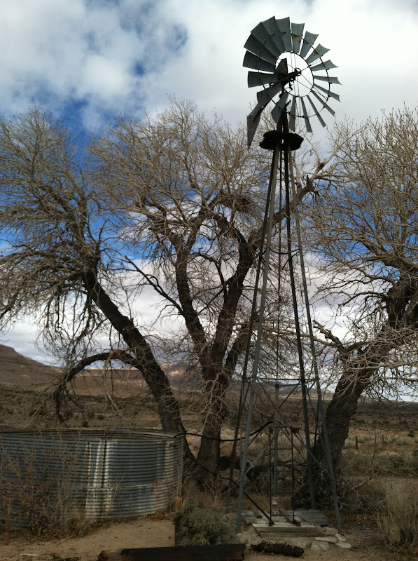
Next stop west was the Government Holes. There are a couple of storage tanks here and an old windmill. This time the windmill was actually hooked up and pumping water.
We spent our second night just off the Mojave Road with a great view of the Kelso Valley and the Providence Mountains.

Again I slept under the stars this night and it got down to 36 degrees with a little wind. But it was a beautiful night with a great campfire to keep us warm. We headed out early in the morning to cover the last third of the Mojave Road. We rounded 17 Mile Point and headed toward the Soda Dry Lake. This part of the road is about 7 miles as it goes across the dry lake. Here we are getting ready to start across the lake bed.

When you get almost across the lake there is a pile of rocks. It is customary to put a rock onto the pile that you picked up along the road. There are a lot of rocks in the pile and some of them are quite large.

From here the road goes through some deep sand and then enters Afton Canyon and crosses the Mojave River a couple of times. When we finally reached I-15 we aired up the tires and headed south with all the Vegas traffic. Made it a long drive home but it was well worth it. We have been twice and will definitely go back again.
You can see a few more pics from the trip from this address.
https://picasaweb.google.com/hikerdmb/MojaveRoad?authuser=0&feat=directlink |
1/17/2012
Topic:
Front level kit
hikerdmb
|
I got a Daystar level kit for my 2004 Dadge Ram for Christmas. I also got Rancho 5000 shocks to replace the origanal shocks that had about 105,000 miles on them. What a difference. I just got back from the maiden off road voyage with the new lift and it was nice to be off road with the new shocks and the new tires and rims I put on late last year. I did drive the truck to the Sierra and visited Tuolumne Meadow and Bodie right after New Years but this was the first real off road trip. We did about 150 miles off pavement and it was successful. Here is a pic of my truck with the front leveled. I am on the Soda Dry Lake near the west end of the Mojave Road.
 |
1/17/2012
Topic:
Exploring Torote Canyon
hikerdmb
|
Glad to see the green on the Ocotillo. Hopefully some of the rain forecast for this week will make it over the mountains. |