|
tommy750 Posts: 1086
11/29/2015
|
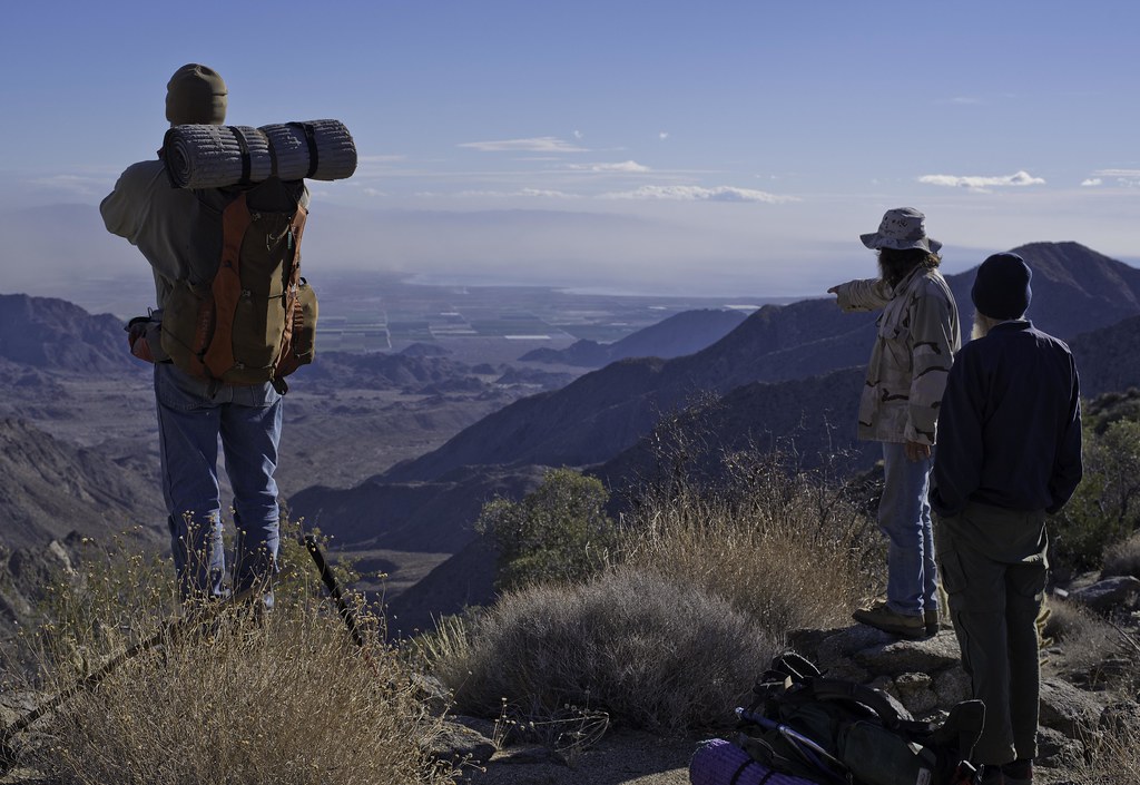
Was able to accompany Daren, Gary and Joel on a four day backpack loop through Martinez and Agua Alta Canyons before Thanksgiving. Met up at the mouth of Martinez Canyon Saturday afternoon which is somewhat of a challenge just getting to because of blocked access roads.
Heading out Sunday morning.
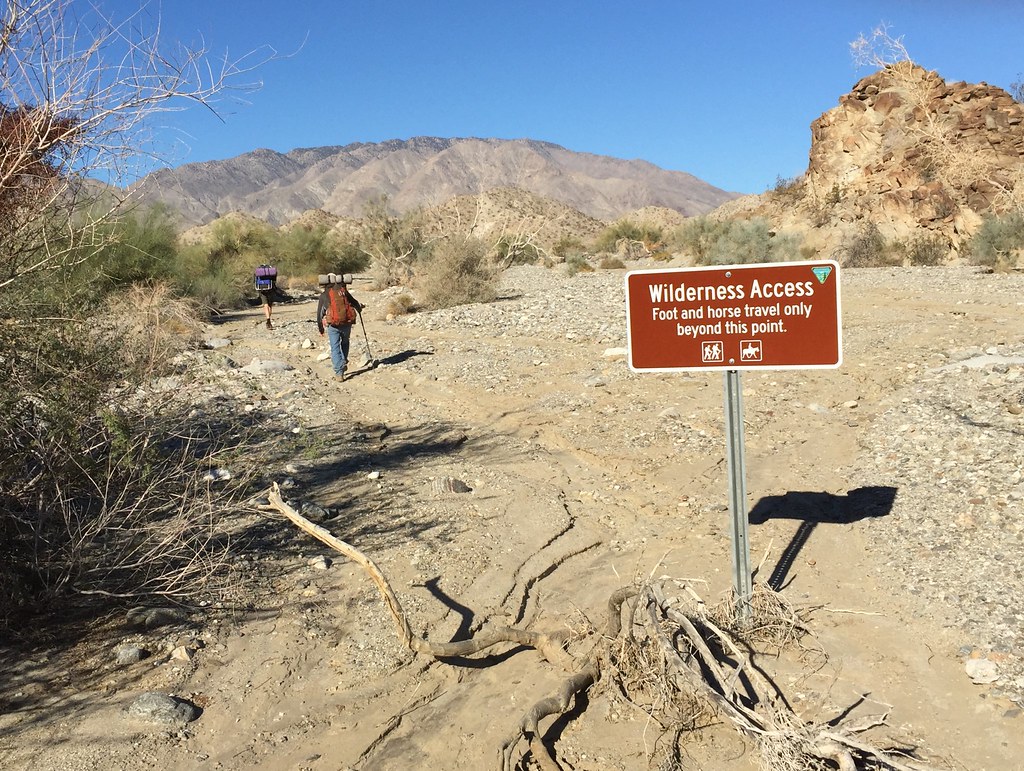 IMG_0955 by tomteske, on Flickr IMG_0955 by tomteske, on Flickr
A few miles up the trail, Daren spotted seven sheep clustered together on the side of the canyon. We watched them for about fifteen minutes and they barely moved. One has a blue collar.
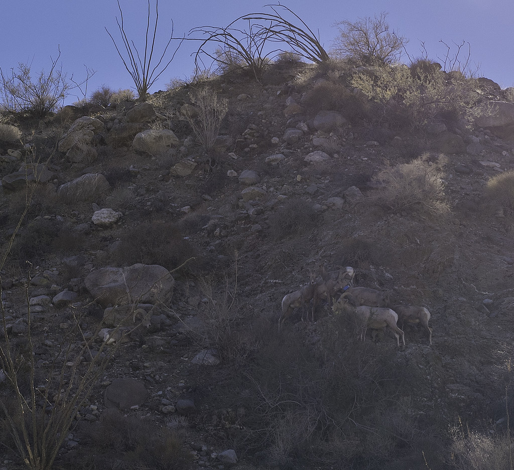 Seven Sheep by tomteske, on Flickr Seven Sheep by tomteske, on Flickr
Spent the night at the mouth of Taquitz Canyon where the Cactus Spring Trails climbs out of Martinez Canyon. There's a nearby spring that amazingly had a little water. We cleaned it out somewhat the next morning before moving on to the most reliable source at The Narrows. Unfortunately, obtaining water there consisted of picking the least putrid green pool and hoping your filter did the rest. Here's Daren enjoying some after throwing in a few Iodide tablets for good measure.
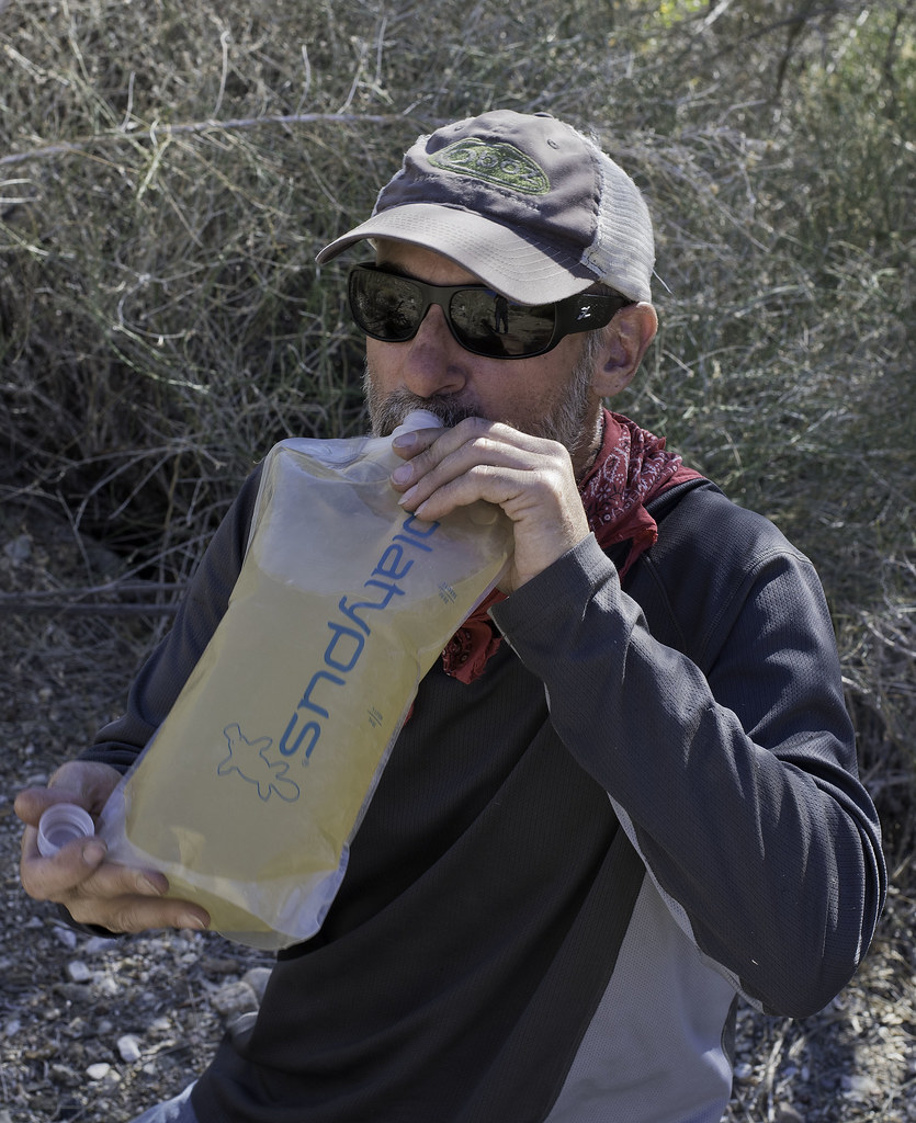 Water by tomteske, on Flickr Water by tomteske, on Flickr
Spent the night at Jack Miller Cabin, a old miner's dwelling from early last century. Apparently he accidentally built it on BLM land and now belongs to the govt.
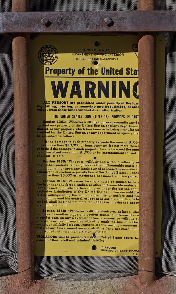 Property of the United States by tomteske, on Flickr Property of the United States by tomteske, on Flickr
 Old Glory by tomteske, on Flickr Old Glory by tomteske, on Flickr
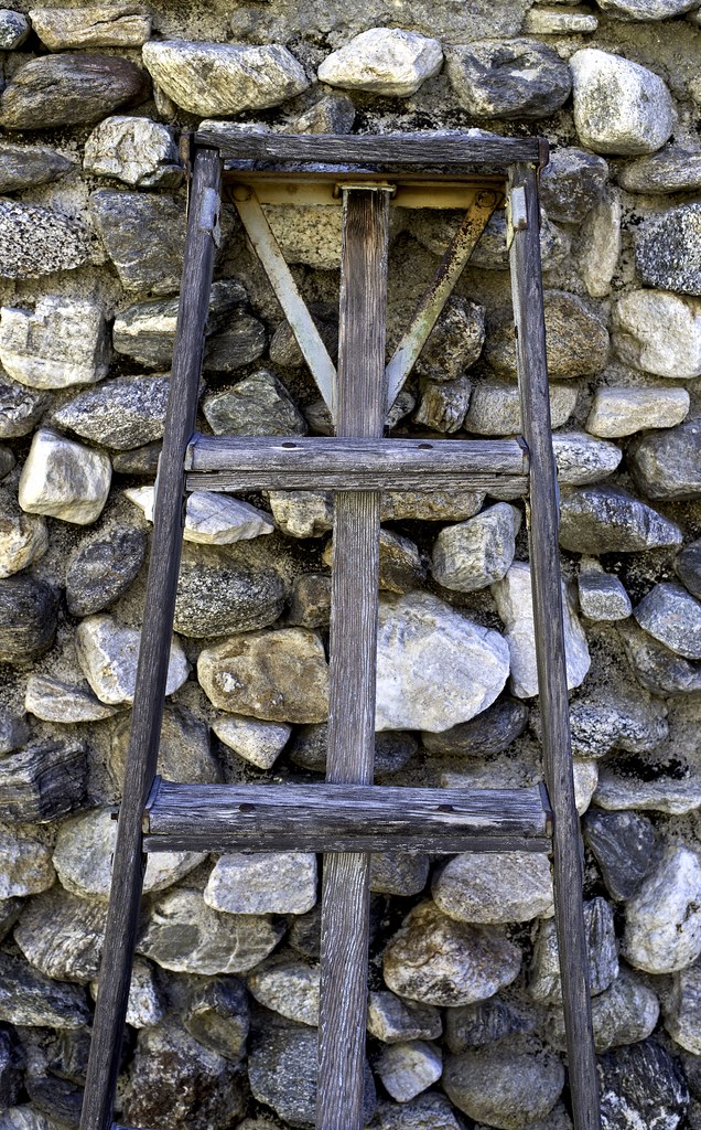 Ladder by tomteske, on Flickr Ladder by tomteske, on Flickr
We did some exploring upstream from the cabin. A dead Red Tailed Hawk and a few frogs.
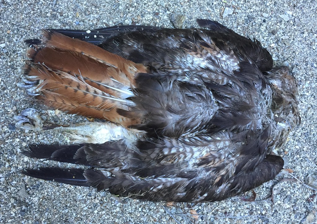 Jack Miller Redtail by tomteske, on Flickr Jack Miller Redtail by tomteske, on Flickr
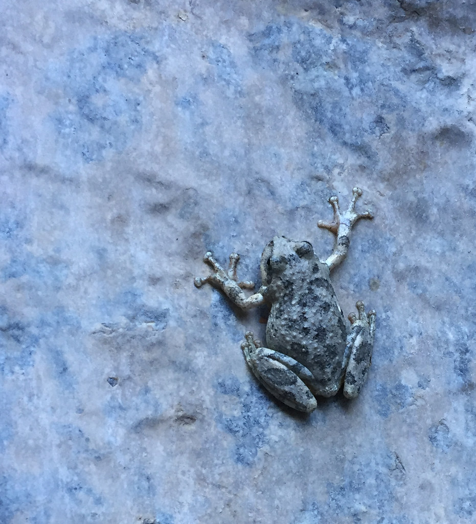 Jack Miller Frog by tomteske, on Flickr Jack Miller Frog by tomteske, on Flickr
The cabin the next morning.
 Jack Miller by tomteske, on Flickr Jack Miller by tomteske, on Flickr
We headed back downstream to catch the Cactus Spring trail up to Agua Alta Spring and then over to Agua Alta Canyon. First, we stopped and filled up at the spring in Taquitz.
Here's Gary doing a little "spring cleaning" after we filled our containers.
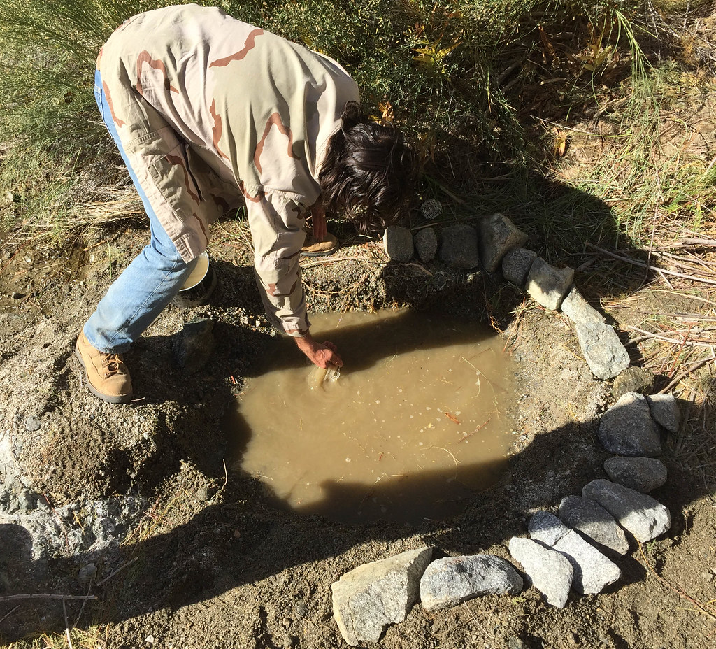 Taquitz Canyon Spring by tomteske, on Flickr Taquitz Canyon Spring by tomteske, on Flickr
A large tamarisk tree was choking the spring and was given a little encouragement to just die but apparently they're rather immortal.
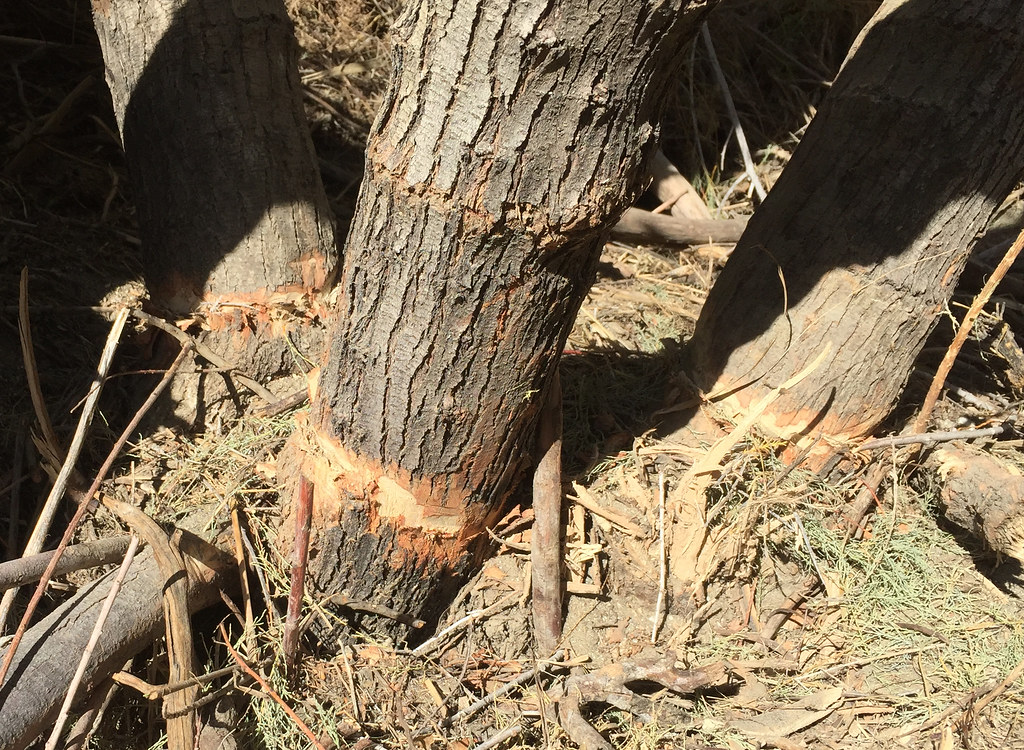 Tamarisk Trim by tomteske, on Flickr Tamarisk Trim by tomteske, on Flickr
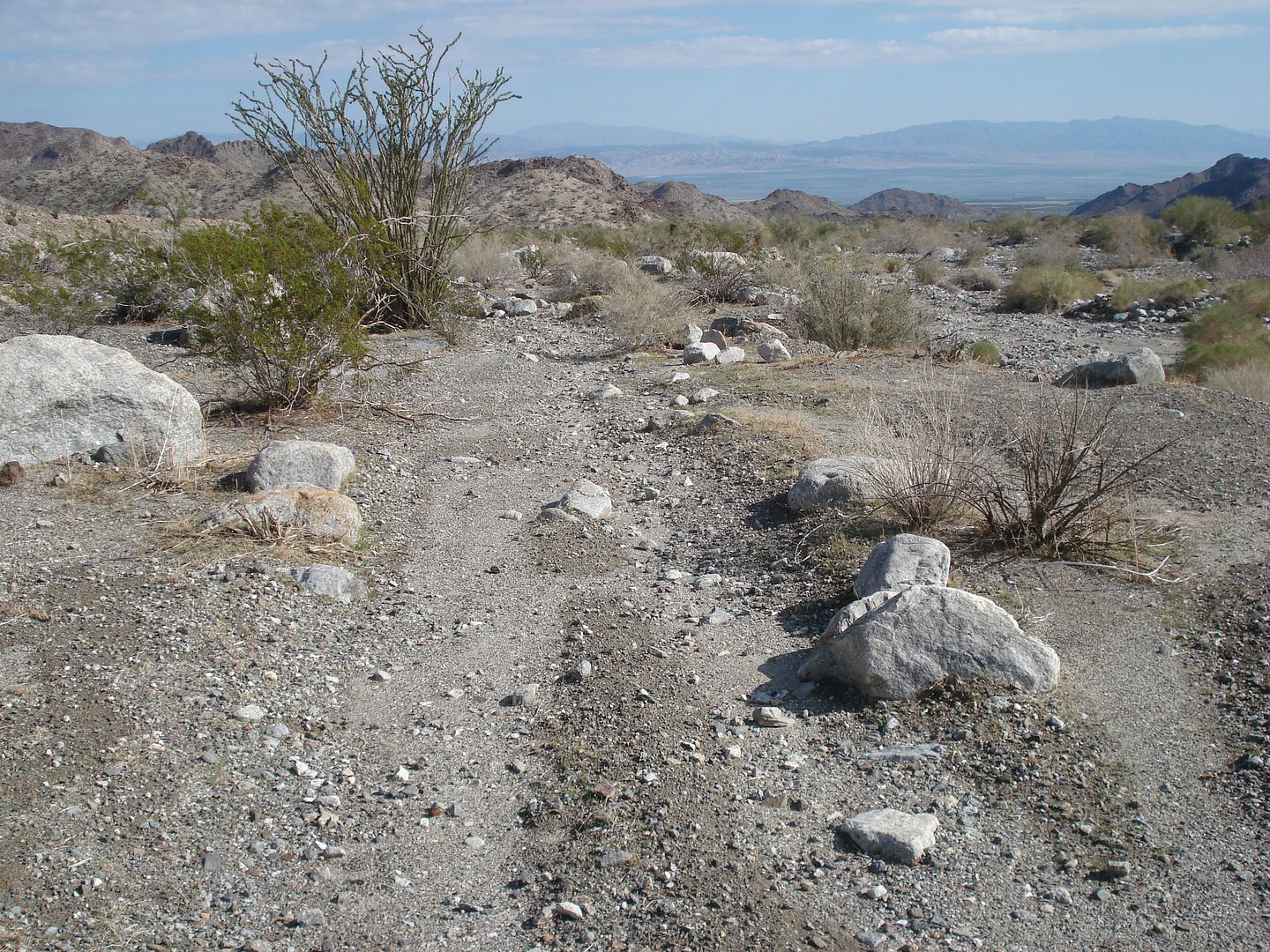
The Cactus Spring Trail on the east side was not well worn at all and barely looked like it had had any recent use. Here's the view south toward the ridge with the old Indian trail heading out of Martinez to Rockhouse Canyon.
 Ridge To Rockhouse by tomteske, on Flickr Ridge To Rockhouse by tomteske, on Flickr
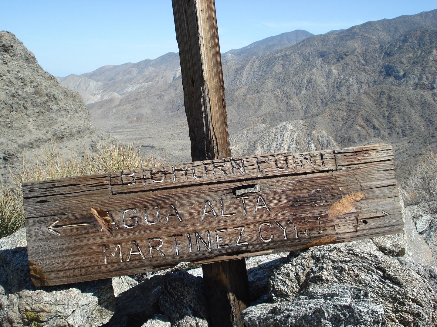
The sign before the trail makes it's steep descent into Martinez.
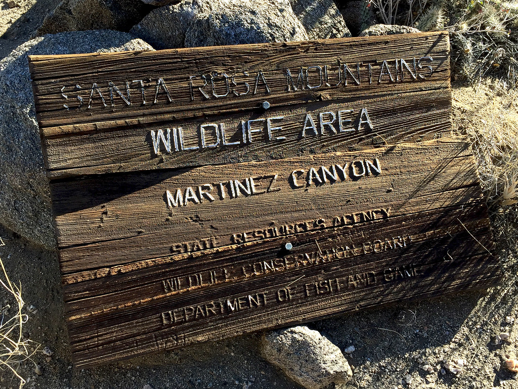 Santa Rosa Sign by tomteske, on Flickr Santa Rosa Sign by tomteske, on Flickr
We decided to camp just shy of Agua Alta spring on a nice sandy saddle that must have been an old inhabitation site. We hiked over to the spring and found the old water tank badly overgrown but containing some water. Daren did more "spring cleaning" but looks like a lot more work would be needed to get functional again.
 Agua Alta Spring by tomteske, on Flickr Agua Alta Spring by tomteske, on Flickr
 Agua Alta Spring Cleaning by tomteske, on Flickr Agua Alta Spring Cleaning by tomteske, on Flickr
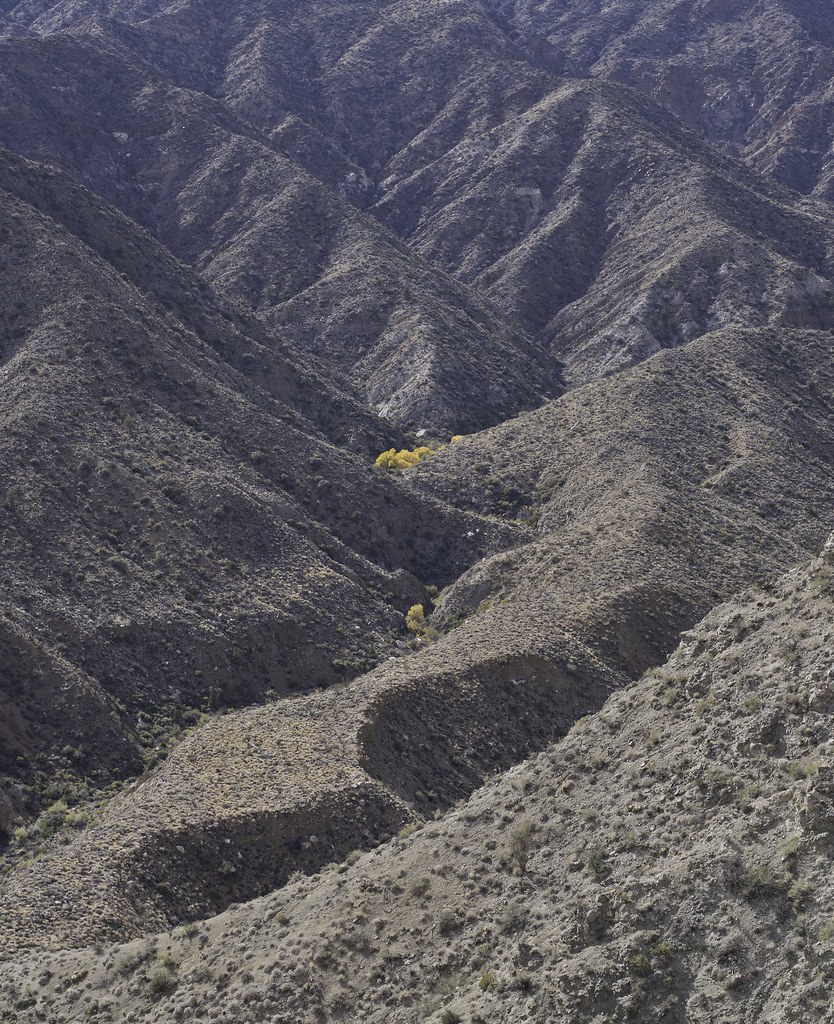
The next day we descended into Agua Alta Canyon on an old essentially nonexistent Indian trail Daren noted on an old topo. Only about 3,000 ft left to descend.
 Above Agua Alta Canyon by tomteske, on Flickr Above Agua Alta Canyon by tomteske, on Flickr
Old abandoned guzzler further down the ridge.
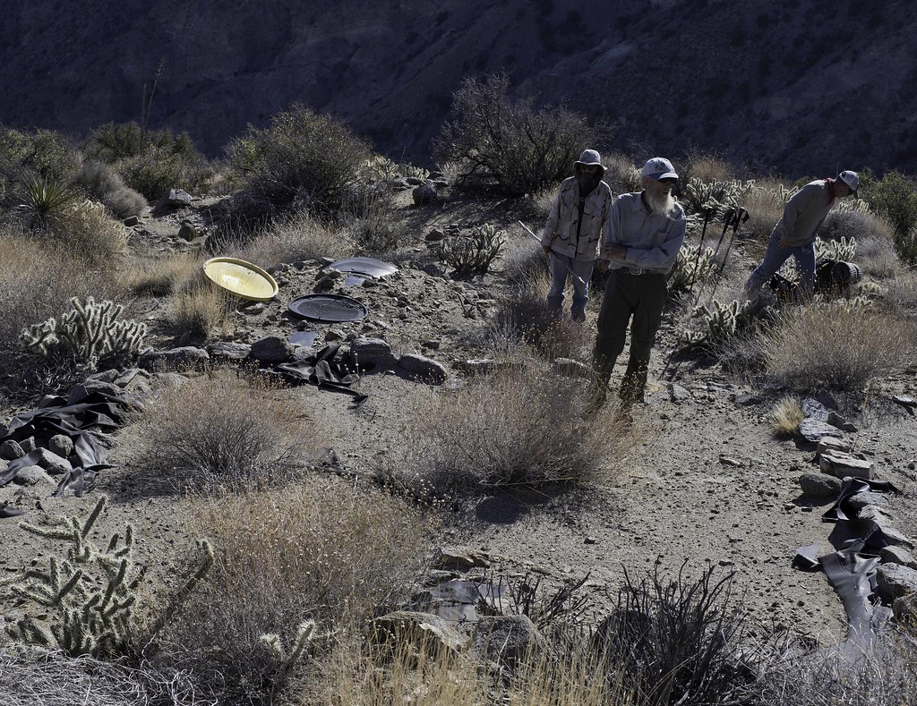 Guzzler by tomteske, on Flickr Guzzler by tomteske, on Flickr
Finally made it back to the vehicles in the late afternoon. About 25 miles and 5k gain/loss. I headed home to a hot shower and Thanksgiving dinner while those guys headed toward the Orocopias for more fun. Enjoy. Tom
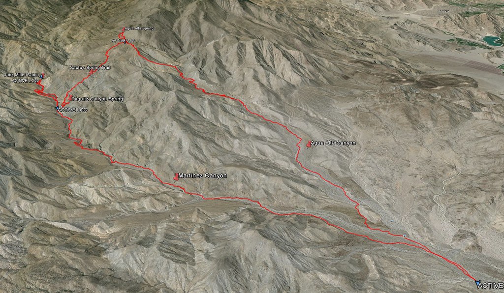 Track by tomteske, on Flickr Track by tomteske, on Flickr
|
|
|
link
|
|
dsefcik Administrator Posts: 2634
11/29/2015
|
Nice Tom...yeah, I got home last night and am just getting caught up with things...here are a couple of shots inside the cabin....I'll post up some more after my negatives finishing drying.
Here is the main living room

Here is the kitchen area

--
--
http://www.sefcik.com
http://www.darensefcik.com
http://www.carrizogorge.com
|
|
|
link
|
|
ziphius Posts: 911
11/30/2015
|
Looks like a great area and fun time. Love the cabin-in-the-morning and frog photos. Whenever I hear of a pool of water being 'putrid green', my immediate thought is blue-green algae, which can contain some deadly toxins or at least stuff that won't make you feel good. Any photos of the putrid green pools? You guys obviously made it back alive!
--
http://www.coyotelearning.org
|
|
|
link
|
|
rockhopper Posts: 678
11/30/2015
|
Great loop trek! Please post more photos. Did you find the sections of the Indian trial heading down from Agua Alta trail? I have an old topo showing that trail also. I tried going up to Agua Alta spring from the bottom on that route years ago but was low on water and had to turn back. Good to see you guys using the cactus spring trail. It needs more traffic to keep it recognizable. I was just there last season, Cactus Spring trail / Jack miller cabin / Auga Alta spring. The trail they say is over 1000 years old and is cut wast deep as it heads over the pass towards Pinyon valley.
btw Jack Miller built a road to his cabin up the canyon in the 1920's with a Buick with additional wheels bolted on the back! The road was in constant need of repair after the floods. Also, it was his second Cabin. The first one was down stream a bit and was washed away. You could still see remenets of the old cabin about 20 years ago as I remember.
Sign off the trail on a ridge on my last hike
edited by rockhopper on 11/30/2015
edited by rockhopper on 11/30/2015
edited by rockhopper on 11/30/2015
|
|
|
link
|
|
tommy750 Posts: 1086
11/30/2015
|
Jim (ziphius) wrote:
Looks like a great area and fun time. Love the cabin-in-the-morning and frog photos. Whenever I hear of a pool of water being 'putrid green', my immediate thought is blue-green algae, which can contain some deadly toxins or at least stuff that won't make you feel good. Any photos of the putrid green pools? You guys obviously made it back alive!
I didn't take any but maybe Daren did. Yeah, the water was a bit sketchy in my opinion but Daren, Gary and Joel kinda shrugged it off. Always thought it would be interesting to take samples of all these remote springs to see what's in the water.
|
|
|
link
|
|
tommy750 Posts: 1086
11/30/2015
|
rockhopper wrote:
Great loop trek! Please post more photos. Did you find the sections of the Indian trial heading down from Agua Alta trail? I have an old topo showing that trail also. I tried going up to Agua Alta spring from the bottom on that route years ago but was low on water and had to turn back. Good to see you guys using the cactus spring trail. It needs more traffic to keep it recognizable. I was just there last season, Cactus Spring trail / Jack miller cabin / Auga Alta spring. The trail they say is over 1000 years old and is cut wast deep as it heads over the pass towards Pinyon valley.
btw Jack Miller built a road to his cabin up the canyon in the 1920's with a Buick with additional wheels bolted on the back! The road was in constant need of repair after the floods. Also, it was his second Cabin. The first one was down stream a bit and was washed away. You could still see remenets of the old cabin about 20 years ago as I remember.
Sign off the trail on a ridge on my last hike
edited by rockhopper on 11/30/2015
edited by rockhopper on 11/30/2015
edited by rockhopper on 11/30/2015
Definitely took a few looks at your posts Rockhopper before our trip out there. We could still see some ot the old road to Jack Miller in places but most of it was washed out. Couldn't figure out how he got throught The Narrows but the topo map and GE seems to indicate he went over the ridge to the north. Definitely looks like it would be a challenge to maintain. The Cactus Springs trail we traveled had a few parts where it was quite obvious but for the most part we just headed in the same general direction or used the gps. The trail down from Agua Alta Spring area to the canyon was nonexistent except at the top and as Daren said it was probably a game trail to the abandoned guzzler. Not much noticeable after that. Daren found a few large cairns north of the canyon but unclear if they were mining or Indian.
|
|
|
link
|
|
surfponto Administrator Posts: 1369
11/30/2015
|
What a great trip report!! Looks like an amazing area.
Thanks for posting the pics Tom.
Bob
--
https://www.anzaborrego.net/


|
|
|
link
|
|
Florian Posts: 129
11/30/2015
|
tommy750 wrote:
We could still see some ot the old road to Jack Miller in places but most of it was washed out. Couldn't figure out how he got throught The Narrows but the topo map and GE seems to indicate he went over the ridge to the north. Definitely looks like it would be a challenge to maintain.
Yes, the road goes around the narrows on the north side. You can still see parts of it on the mesa above the drainage NE of the narrows. At least you could a few years ago.
-Florian
|
|
|
link
|
|
rockhopper Posts: 678
11/30/2015
|
Daren, how did that water taste? Hope you are ok. Thanks for maintaining the "springs". Future travelers will be grateful. I will be heading out there again this season. Probably after the new year / rains?
Here's a pic of Jack Millers road heading toward Martinez canyon taken a few years back. This shot is aimed down toward the Coachella valley.
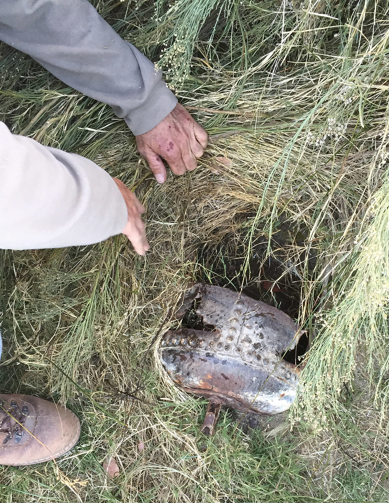
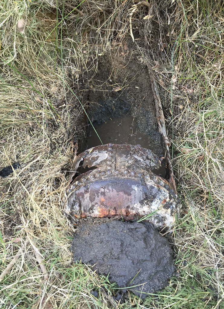
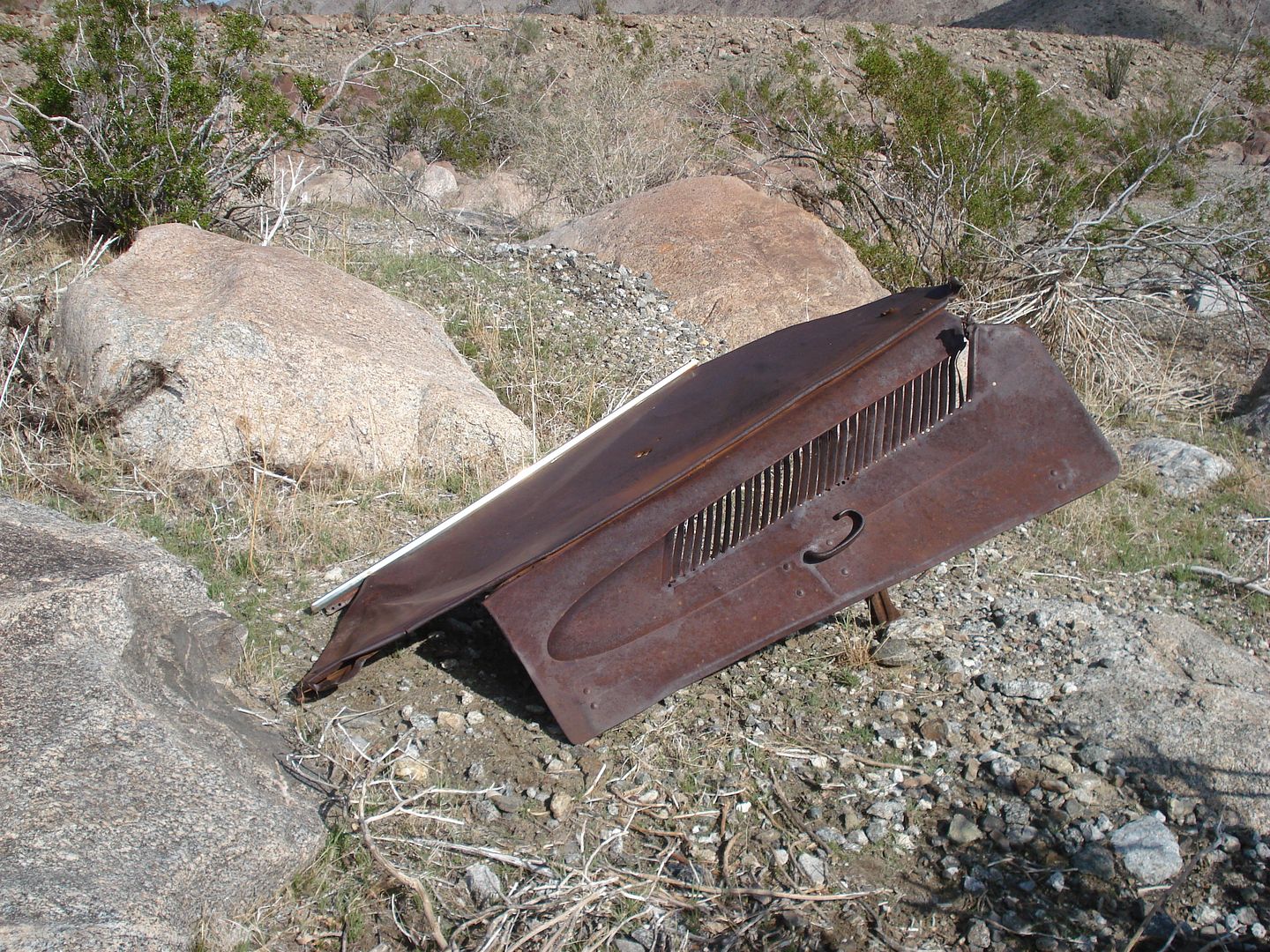
This might be part of Jack Millers car? Can anyone I.D? He supposedly drove a modified Buick up and down the "road"
edited by rockhopper on 11/30/2015
edited by rockhopper on 11/30/2015
|
|
|
link
|
|
dsefcik Administrator Posts: 2634
12/2/2015
|
Got a few pics finally ready...all the B/W are from my 1937 Zeiss Ikon Nettar 515/2 folding "pocket" camera, HP4 film, Rodinal 1:100 @90 minutes stand development.
Tom and Gary at the Narrows

Tahquitz Canyon Sunset

Smoke Tree

Jack Miller's Cabin

Gary & Joel amongst the Tamarisk Forest that is now in Martinez Canyon

Read All About It

Beautiful and damn cold sunrise up on the Agua Alta bench, clouds, rain and eventually snow moved in on the Santa Rosa range


Old, abandoned guzzler that overlooks the Alta Agua Canyon

Dried up bee hive in the water box


Total Mylar Balloons this trip - about 2 bags full between us

--
--
http://www.sefcik.com
http://www.darensefcik.com
http://www.carrizogorge.com
|
|
|
link
|
|
dsefcik Administrator Posts: 2634
12/2/2015
|
rockhopper wrote:
Daren, how did that water taste? Hope you are ok. Nothing like burping up algae iodine water all day....yummm, made my coffee and oatmeal have some added trail flavor. By the last day it was tasting good, kinda missed it....
--
http://www.sefcik.com
http://www.darensefcik.com
http://www.carrizogorge.com
|
|
|
link
|
|
tommy750 Posts: 1086
12/2/2015
|
dsefcik wrote:
rockhopper wrote:
Daren, how did that water taste? Hope you are ok. Nothing like burping up algae iodine water all day....yummm, made my coffee and oatmeal have some added trail flavor. By the last day it was tasting good, kinda missed it....
Think I still have a half liter or so of the "good stuff" I can send you for Christmas, Daren  Nice pics. Nice pics.
|
|
|
link
|
|
AdventureGraham Posts: 170
12/7/2015
|
Awesome trip! I'd love to find my to to that cabin one of these days. Maybe pack in a broom to help clean it out?
|
|
|
link
|