|
X EAGLE 23 X Posts: 16
10/14/2013
|
Well it must be that time of year again; weather is finally cooling down and it's bearable (dare I say nice) to be outside and out wandering in the desert again. This past summer I came across a program which "stitches" photographs together and I was eager to take some photos and test the program out. So last week I decided to hike out to Indian Hill to take some new pictures specifically to run through the program and see how well it works and I'm quite pleased with it. The program is called "Hugin Panorama Stitcher" and can be downloaded from the internet for free.
As some of you may be beginning to think, Indian is one of my favorite spots due to it's easy access (except for that one part just past Dos Cabeza's), quick hike, and tons of stuff to explore.
Here's a stitched photo:
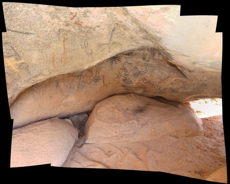
While the image doesn't appear to be anything special at first look, but it allows a person to take multiple detailed photo's ( the above is actually 11 photos) of an object and then put them all together and view the entire object, while being able to zoom in and see details which you normally wouldn't be able to see if you just took one photo of it. The most photo's I've stitched so far is 38, but couldn't get it to upload to photobucket (maybe too big?) to post here.
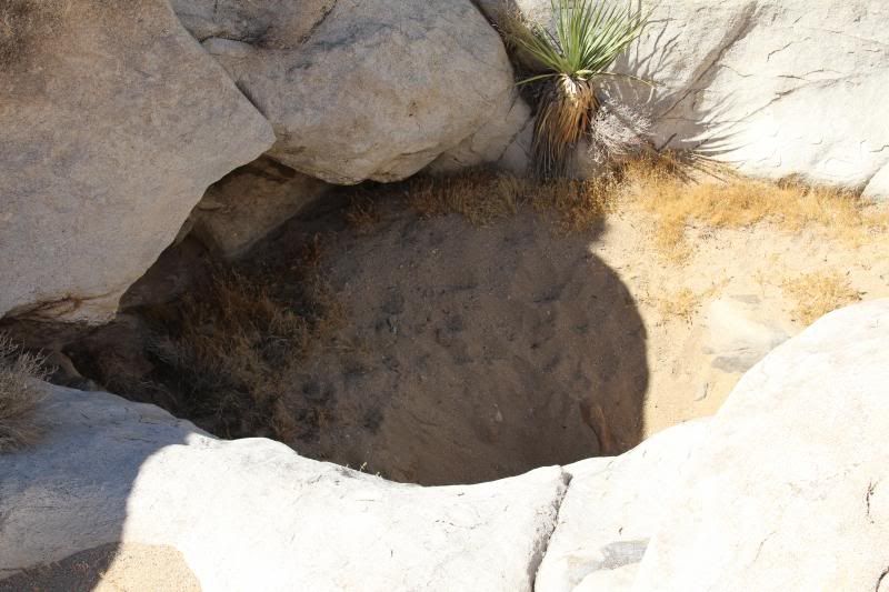
While out there I swung by the "water tank" and was surprised to see it bone dry. Figured with all the rain we had gotten last month there would be at least a little water left in it, but there was nothing. I hiked a little further up and couldn't find any traces of recent water.
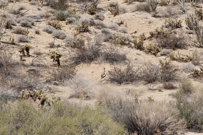
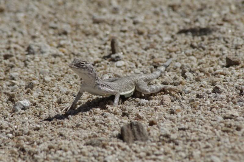
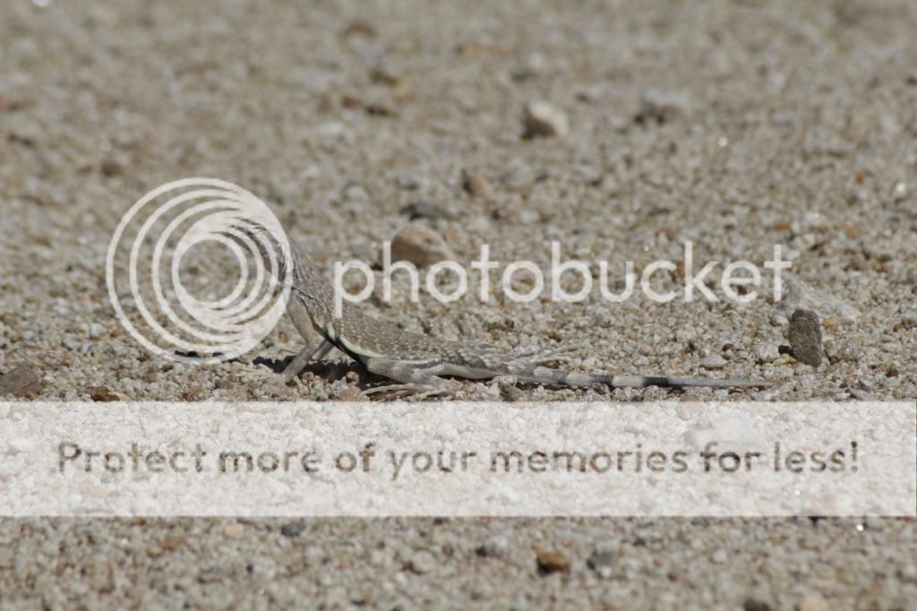
While hiking around the area, lots of jack rabbits and little zebra tailed lizards running all over the place. Couldn't get a good shot of a jack rabbit, but finally got in close enough for a few decent photo's of a lizard.
All-in-all it was a great trip, weather was pretty nice for the most part except for a few times when the slight breeze stopped blowing. Only spent around 3 hours out there and the only people I saw were a group of bikers who must have followed the train tracks down through the mountains.
|
|
|
link
|
|
dsefcik Administrator Posts: 2634
10/15/2013
|
Hugin is a great program and is what I use, I have stitched 89 photos total for a 3D panorama virtual tour. Your lizard looks like a desert iguana. Thanks for the post, good to see people getting back out again.
--
http://www.sefcik.com
http://www.darensefcik.com
http://www.carrizogorge.com
|
|
|
link
|
|
ziphius Posts: 911
10/15/2013
|
Looks like good stitching software... nice trip. Too bad there wasn't any water at that tank, heh? I've never been to the tank area, where is it relative to the pictographs?
--
http://www.coyotelearning.org
|
|
|
link
|
|
anutami Posts: 491
10/15/2013
|
Awesome! What route did you take in and how was the road? Is it washed out/need 4wd?
|
|
|
link
|
|
X EAGLE 23 X Posts: 16
10/16/2013
|
I figured the lizard was a zebra tailed lizard because of the striped tail. Here's a picture taken from a different angle which shows it better:
89 photos?! Did it automatically align them all, or did you have to add some control points manually?
The tank is just to the south of the pictographs. There are more motero's and broken pottery around it and I had read about a water source in the area so thought this was it, but either it's no longer reliable or the water source is just somewhere else.
I turn off S2 just past the border patrol checkpoint outside of Ocotillo and took Mortero Wash Rd. all the way down to Dos Cabeza's train loading area. The first stretch of Mortero Wash is quite bumpy, but it's a solid rd and even when in the wash it's not too soft. I didn't use 4wd at any point on that road. And the road from Dos Cabeza's to where I park wasn't bad except for the one part where you have to climb up out of the wash. It seems the summer rain made this steep climb a little worse and the holes are deeper so it's harder to navigate up it. I tried once without 4wd and couldn't do it so just threw it in 4wd and then didn't have a problem (but it sure was bumpy). I've seen people park at the bottom and just hike all the way in from there and it only adds an extra 2 miles roundtrip so it's not too bad.
|
|
|
link
|
|
dsefcik Administrator Posts: 2634
10/16/2013
|
X EAGLE 23 X wrote:
I figured the lizard was a zebra tailed lizard because of the striped tail. Here's a picture taken from a different angle which shows it better:
89 photos?! Did it automatically align them all, or did you have to add some control points manually?
It could be, I am no expert for sure...you are most likely correct....
Here is the 89 photo stitch, if you zoom in you can see the stitch errors http://www.hightechhigh.org/schools/HTMNC/virtual/inside/ use the arrow keys and ctrl/shift to zoom in/out, it works better. It auto stitched everything, I used a tri-pod and a home made 360 pano head, I think I used a 10mm lens for everything, never have been able to get a fish eye to work well.
For the Dos Cabeza rd, do you not take the bypass rd by the mine? You can skip the big holes if you go around.
--
http://www.sefcik.com
http://www.darensefcik.com
http://www.carrizogorge.com
|
|
|
link
|
|
X EAGLE 23 X Posts: 16
10/18/2013
|
That stitched panorama looks really good, it's pretty neat how it's a full 360 view from top to bottom!
Is the bypass road the one that leads to the north then somehow turns back around and meets back up with the main road just above the big holes? I've always wondered where that road went but never found the time to explore and follow it. Good to know there's a way to bypass ugly part!
|
|
|
link
|
|
dsefcik Administrator Posts: 2634
10/18/2013
|
Yeah, the road goes right around it, you can see it on the map http://caltopo.com/map?id=427J
--
http://www.sefcik.com
http://www.darensefcik.com
http://www.carrizogorge.com
|
|
|
link
|
|
surfponto Administrator Posts: 1369
10/20/2013
|
Great trip report.
That section is a bit tricky for a long wheel base truck. My friend had a little wheel spin in his Tundra when we were out there a while back.
Once saw a lady in a Saturn Vue get stuck trying to get up that.

--
https://www.anzaborrego.net/


|
|
|
link
|