|
dsefcik Administrator Posts: 2634
12/30/2010
|
So the first week of winter break was a disaster with the weather but the Sunday after Christmas I packed up and got out of dodge as fast as I could. I was gonna backpack into Rockhouse canyon but as my luck seems to be I could not. Clark "Dry" Lake was flooded and the road was not passable beyond the rock crushing machine. It was getting dark and I needed to camp out somewhere so I kept driving east. I did not camp near CDL because there were already a ton of people, mostly RV's out there. Most of the washes east of CDL were also all muddy and not car friendly looking, there was a jeep stuck floorboard deep on the shoulder at Fonts Point, 2 other jeeps were winching him up and trying to pull him out...3 feet from the road. Goes to show you that anyone can get stuck anywhere, doesn't need to be way off in the back country roads somewhere. I rolled into Arroyo Salado campground and made camp just as it was getting dark. I ended up camping here for 3 nights before driving home Wed morning just as it started to rain heavily.
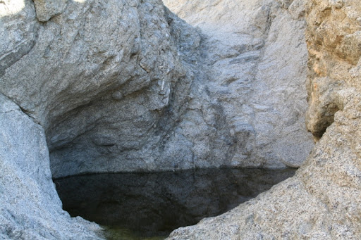
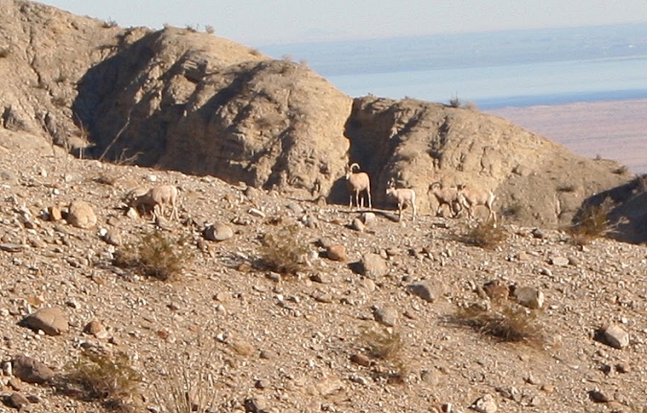
Monday I hiked hiked up Smoke Tree Canyon to check out the Natural Water Tanks (or "Tinaja" as some say) and then free styled it up an unknown peak and back down thru Coachwhip Canyon. This was a great hike of about 10 miles and as a bonus I saw a herd of Bighorn Sheep. It looked like 3 adults and 2 younger ones. The views were awesome from the peak (which I believe was right next to Pyramid Peak). Tuesday I hiked out near the Calcite Mine area and thru one of the slot canyons. I returned back down thru Palm Wash and more slot canyons.
This was the most time I have spent in the north half of ABDSP and 2 things I noticed immediately:
1. No Border Patrol
2. A lot more people, especially the RV and OHV crowd
It was a great trip and I can see tons of great hiking possibilities all thru the Santa Rosa Mtn areas. I also decided to borrow a Canon DSLR from a friend on this trip, while I do not have anywhere near the talent Andy has I tried my best to snap off a few good photos. Without this camera I would not have been able to photograph the Bighorn sheep.
Here are a few pics from the trip;
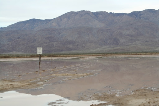
Clark "Dry" Lake road
Tinaja in Smoke Tree Canyon
Bighorn Sheep on the ridge across from where I was, there are 5, 3 adults and 2 young ones
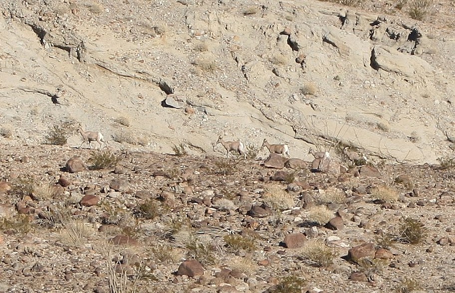
Bighorn Sheep as they mosied off up the hill
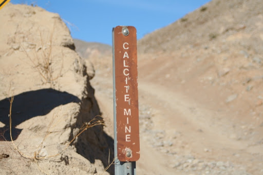
Calcite Mine Rd sign
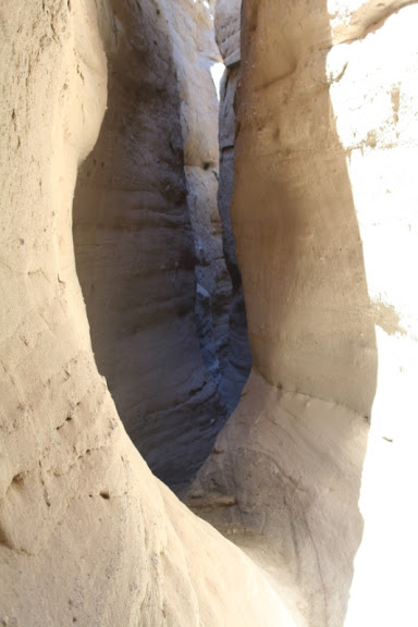
Slot Canyon near Calcite Mine
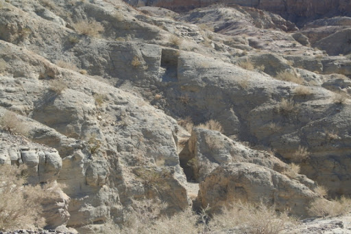
Deep gouges in the earth from the Calcite mining operations during WWII
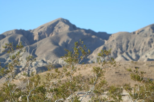
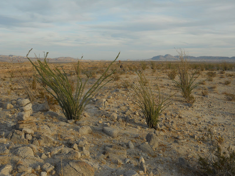
Some Creosote and a view of Travelers Peak from the Calcite Mine road
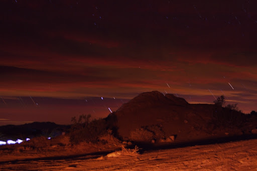
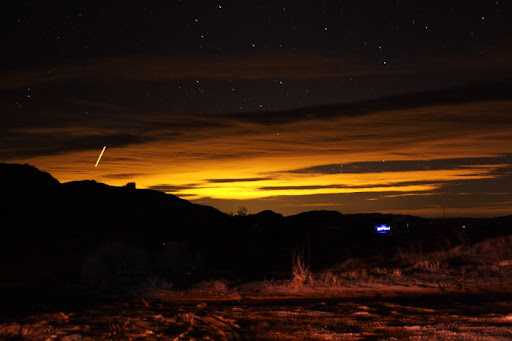
My feeble attempt at star trails from the campground, I had to use 30 second exposures and then then stack them together in a photo editor program. The bright amber lighting is from my campfire blazing behind me and the bright light on the lower left is from a late night camper driving thru camp
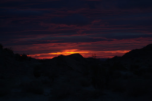
Sunrise Wed morning, the clouds were rolling in all night and it started raining by early AM
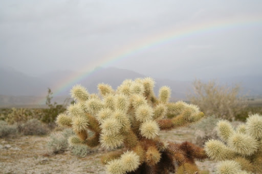
A little cactus and rainbow near the Vallecito Mtns on my drive home
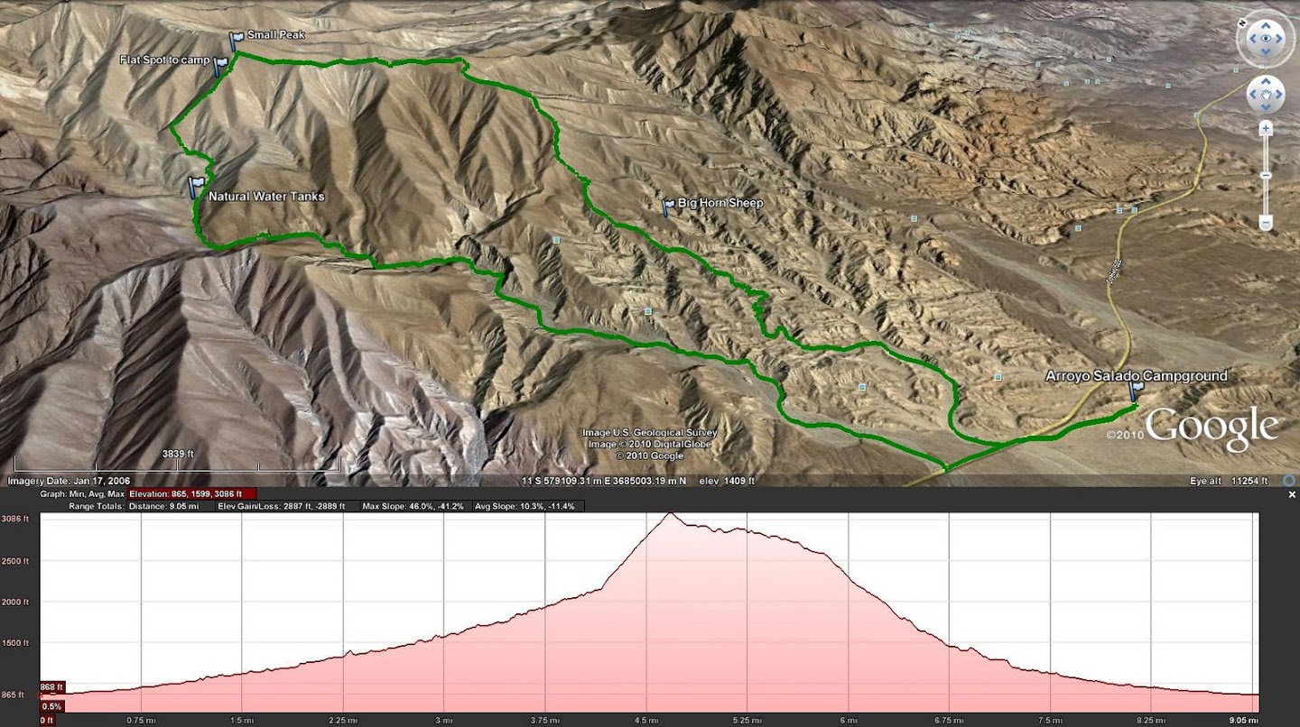
GPS route of the Smoke Tree Canyon Hike
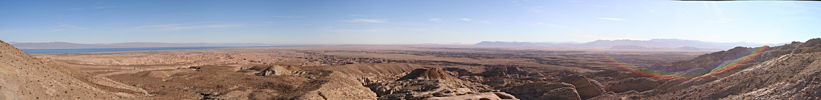
Panorama of the Salton Sea and Borrego Valley from the "Locomotive" rock near the Calcite Mine
--
<em>edited by dsefcik on 12/30/2010</em>
--
http://www.sefcik.com
http://www.darensefcik.com
http://www.carrizogorge.com
|
|
|
link
|
|
hikerdmb Posts: 423
12/30/2010
|
Daren,
That sounds like an excellent trip and nice pics. How many tanks did you find? Glad to hear it rained hard on Wednesday morning because it didn't look like it rained much out that way from looking at the radar. How close were you to the sheep? That area on the rise between the highway and CDL is ALWAYS filled with RVs this time of the year and some OHV folks congregate on the other side of the road nearby. There is a small area where they can ride there and I have mostly seen young families with young riders staying there since it has to be safer than Ocotillo Wells. Were you solo for this trip? That is pretty wild seeing someone stuck so close to the highway. Was water flowing across the road at Font's Wash? I am hoping to get out next weekend. Maybe some of the mud will be gone.
David
|
|
|
link
|
|
surfponto Administrator Posts: 1369
12/31/2010
|
Looks like a great adventure Daren,
Really cool that you saw the Bighorn family.
Your pictures really capture your trip. Makes me want to do a trip out there.
I like the Clark "Dry" Lake picture. I have heard that it is impassable during rainstorms and now I have the evidence.

Bob
--
https://www.anzaborrego.net/


|
|
|
link
|
|
dsefcik Administrator Posts: 2634
12/31/2010
|
There were many tanks of varied sizes, probably at least 8-10 or so. I wanted to try and get over to the sheep tanks east of the calcite mine but it was late in the day and I did not see an immediately obvious or easy way to get over to the Palm Wash side of the canyon from the mine area. I will do that on another trip. The bighorn sheep were probably at least a couple hundred yards away, you can see in the gps route they were across a ridge. I had just stood up from taking pictures of sheep scat (a lot of it) and saw them. They stared at me for awhile and then slowly walked away and up the mountainside. I think next weekend will be fine if there is no more rain, pretty much every single wash that crossed the highway had a "Flooded" sign and Caltrans was out Wed morning scraping the highway clean. It definitely flash flooded that whole area but there was no running water, just lots of mud and large standing water mud pits (like the one the jeep got stuck in).
Here are a few more pics
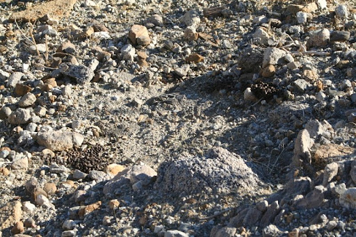
Bighorn Sheep scat and bedding area
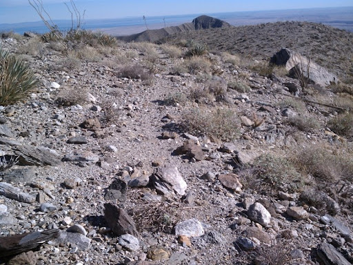
What I believe to be possibly part of the old native american trail system that I have read about in numerous publications. I happend upon this descending into Coachwhip Canyon and I could see it heading off towards Travelers Peak and the Calcite mine area. I saw no signs of humans anywhere up in this hillside, it was only until I got down in the canyon area did I see human tracks.
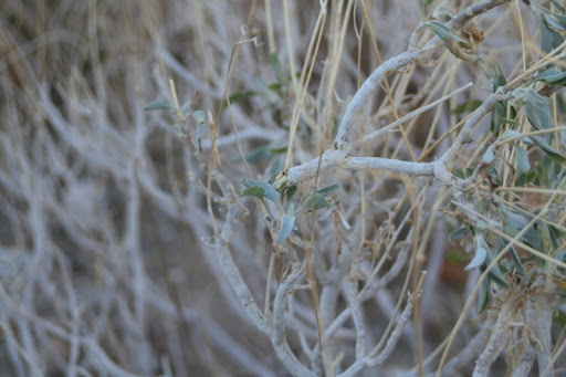
Sheep tracks leading up this plant shows they were munching on it
Lots of sheep tracks down in the wash

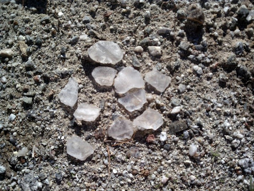
Calcite minerals near the Calcite mine area
--
http://www.sefcik.com
http://www.darensefcik.com
http://www.carrizogorge.com
|
|
|
link
|
|
hikerdmb Posts: 423
12/31/2010
|
That definitely looks like an old Indian trail. Here is a pic of an old trail we came across above the upper part of Arroyo Tapiada. It had some huge rock cairns every hundred yards or so. Did the trail you found have any cairns like this? You can see one of the cairns to the left of the ocotillo and the trail runs on into the center of the pic.
|
|
|
link
|
|
dsefcik Administrator Posts: 2634
12/31/2010
|
hikerdmb wrote:
That definitely looks like an old Indian trail. Here is a pic of an old trail we came across above the upper part of Arroyo Tapiada. It had some huge rock cairns every hundred yards or so. Did the trail you found have any cairns like this? You can see one of the cairns to the left of the ocotillo and the trail runs on into the center of the pic.
No, I did not see any cairns. I read there were native american trails all across the santa rosa mtns, some going to/around travelers peak and pyramid peak and I think this may be part of that. I could see from far up what looked like a faint animal path and as I followed a natural course down the mtn I ended up on this trail. I only followed it briefly as it headed east and I was going south, down the mtn.
Here are a couple more pics from the trip, I took probably 800 or so just messing around with the camera I borrowed so I have been sorting thru them all the last couple of days.
Another sunset shot from Arroyo Salado Campground. The blue light is the glow from inside an RV parked across the way and the streak in the upper left I believe was an airplane. This was a single 30 second exposure shot.
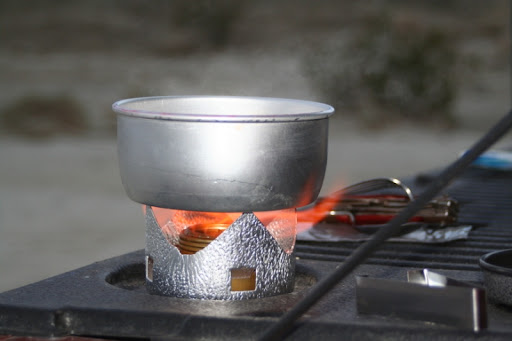
Here is a shot of my newly purchased Trangia backpack stove. I have used it a few times and it is an amazing little stove. If you are looking for a small, inexpensive and easy to use stove you should check one out.
--
<em>edited by dsefcik on 12/31/2010</em>
--
http://www.sefcik.com
http://www.darensefcik.com
http://www.carrizogorge.com
|
|
|
link
|
|
surfponto Administrator Posts: 1369
1/1/2011
|
Hey Daren
Great night shot. Looks like you are figuring it out. What camera is that?
Also what is the detail on the stove? Looks pretty cool.
Bob
--
https://www.anzaborrego.net/
|
|
|
link
|
|
dsefcik Administrator Posts: 2634
1/1/2011
|
surfponto wrote:
Hey Daren
Great night shot. Looks like you are figuring it out. What camera is that?
Also what is the detail on the stove? Looks pretty cool.
Bob
It is a Canon Rebel XT with a cheapo Tamron lens. In skilled hands I am sure it can produce great photos..I am just trying to understand it. The Trangia I bought with mucho skepticism but for $40 at REI and nothing but positive reviews online I bought it..no regrets so far. My needs are simple, boil water and heat canned food..it does both of these without flinching.
More info here:
http://www.rei.com/product/657906
--
--
http://www.sefcik.com
http://www.darensefcik.com
http://www.carrizogorge.com
|
|
|
link
|
|
surfponto Administrator Posts: 1369
1/3/2011
|
Great thanks.
Camera looks like it takes great pics.
Bob
--
https://www.anzaborrego.net/
|
|
|
link
|