1/31/2020
Topic:
June Wash and Hapaha Flat saddle
Brian
|
Hello, I'm new here. I've enjoyed reading trip reports and finally have something to contribute of my own.
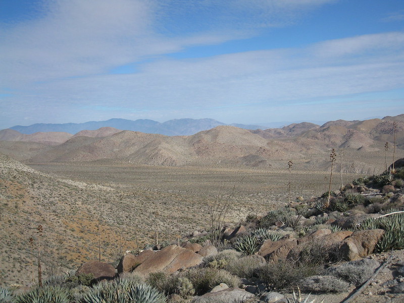
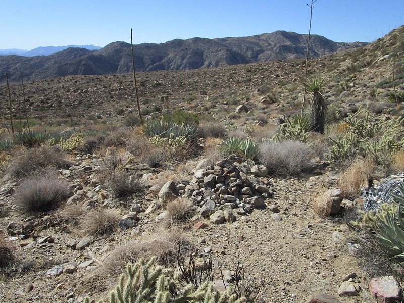
I used to do a lot of trips to June Wash. It was a way for me to get to Sandstone Canyon back when I didn't have a car that could get there from the other side. At one point I was looking online for info about June Wash and found an article that Frank Colver wrote on DesertUSA (it looks like it's since been removed). He talked about hiking up to the head of June Wash and how there was a saddle between that and Hapaha flat that had a sheep guzzler. He also mentioned that it would be a challenge to get to the saddle from the June side because of a dry fall. I hiked to that point one day and found the fall. I think I could have climbed it, but I didn't want to take the risk since I was alone.
Now it's 4 years later and I finally hiked to the guzzler from the other side. It's a 17.5 mile drive from the pavement of Split Mountain Road to the area of Hapaha Flat where a wash heads SW toward the saddle (the guzzler can be seen on Google Earth). It was only a 2 mile hike and was a nice change of pace from hikes I've done that had a lot of obstacles. On this one, every time it looked like the canyon was about to become choked with brush, it would suddenly clear out to an easy path. The one dry fall had an easy and obvious bypass on the right side. It ended up with great views for minimal effort.

edited by Brian on 1/31/2020 |
1/31/2020
Topic:
June Wash and Hapaha Flat saddle
Brian
|
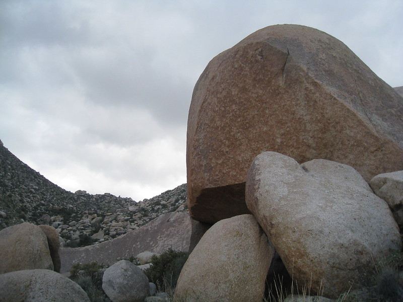
More pics of the guzzler.


edited by Brian on 1/31/2020 |
1/31/2020
Topic:
June Wash and Hapaha Flat saddle
Brian
|
Looking down toward the upper reaches of June Wash, with Agua Caliente in the distance


View toward Hapaha Flat and Fish Creek drainage from the hill just S of the saddle
 |
1/31/2020
Topic:
June Wash and Hapaha Flat saddle
Brian
|
Scooter wrote:
Welcome to the forum Brian, great trip report.
Thanks! |
1/31/2020
Topic:
June Wash and Hapaha Flat saddle
Brian
|
Thanks for the welcome Deborah. Sunday was the day I did my hike too. I drove to Hapaha flat on Saturday and spent the night near Dave McCain spring, then did the hike in the morning. |
2/1/2020
Topic:
June Wash and Hapaha Flat saddle
Brian
|
Thanks ziphius. |
2/1/2020
Topic:
June Wash and Hapaha Flat saddle
Brian
|
Thanks Britain. |
2/2/2020
Topic:
June Wash and Hapaha Flat saddle
Brian
|
Thanks rockhopper, tommy750 and Buford.
tommy750: an ascent of Whale from that side sounds interesting. I've had it in the back of my mind for a long time that it would be interesting to do a trip that makes the connection from June to Hapaha. The Lindsay book mentions that Native Americans who lived on the edge of the Laguna mountains would gather in Hapaha Flat each spring. I wonder if this is the route they took. |
2/3/2020
Topic:
June Wash and Hapaha Flat saddle
Brian
|
Rocko1, yes I think so. Even without the short/technical final climb to the guzzler (which I haven't done from that side) it's worth seeing the upper part of June wash where the walls pinch in, almost like a slot canyon. |
2/3/2020
Topic:
PCT North of Scissors Crossing
Brian
|
I used to explore the desert in a Nissan Sentra and took it all sorts of places it had no business going. One thing I always took was an air pump so if I needed to air down to get unstuck, I would have a way to bring it back up before driving on pavement. I took a hand operated floor pump like you would use for a bicycle. It was time consuming to bring up 4 aired down car tires with it, but it does work. The point being that you don't need anything fancy. Just don't go below 10 psi or the bead might separate from the wheel. |
2/27/2020
Topic:
Martinez Mtn. Snow
Brian
|
rockhopper, is the reliable water source Agua Alta? I did a day hike to Cactus Spring a few years ago and didn't find water there. I wasn't looking very hard though as I had plenty with me. |
2/27/2020
Topic:
Martinez Mtn. Snow
Brian
|
rockhopper, thanks for the info. I've camped by Horsethief creek, it's a nice area. I wish there was another water source further along the trail, but having reliable info on the state of the springs is half the battle. |
3/2/2020
Topic:
Martinez Mtn. Snow
Brian
|
I'm sure I'll do it again from the top end at some point, but next thing I want to try is visiting the Jack Miller cabin from the bottom end. I've never explored that area. |
3/10/2020
Topic:
Granite Mountain Overnight
Brian
|
I was camping in the Carrizo Creek area near Canyon Sin Nombre Saturday night. There was some wind in the evening but it stopped about 8PM. Seems like it was a popular weekend to go to the desert. Lots of cars at all the trailheads (but thankfully not where I was). |
3/18/2020
Topic:
Solstice Cave and Goat Canyon
Brian
|
Last weekend seemed like a good time to head for the desert. I wanted to revisit Rockhouse Canyon, but I'm assuming it won't be possible to drive over Clark Lake for a while, so I headed for a couple locations in the southern end of the park.
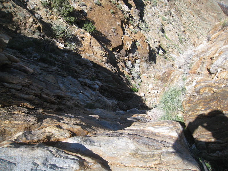
On Saturday I visited the Solstice Cave above Indian Valley. I had only found vague descriptions of the location (and I will follow that convention here also). Suffice it to say I had a pre-conceived notion of the location and I was totally wrong. After over an hour of searching at what turned out to be 300' too high, I gave up and was headed back in defeat when I ran right into it. Strange that other accounts I've read seem similar to mine in the sense that it's difficult but not impossible to find. I also realized that my initial mistake was actually lucky as my route up was fairly easy. On the way down I tried to take a more direct route, which suuucked.
On Sunday I set my sights on the Goat Canyon trestle by way of Mortero Palms. I have been to and over the trestle by other routes (always legally, strangely enough) but this was my first encounter with the dry fall on this route. When I got to the fall, a combination of no rope, being alone and not being sure of the safest way down made me decide to turn back at that point.
Inside the Solstice Cave


Outside the Solstice Cave
If you see me on the trail say hi
The dry fall and the view from there

edited by Brian on 3/18/2020
edited by Brian on 3/18/2020 |
3/18/2020
Topic:
Three Saturdays in Canebrake
Brian
|
Seeing artifacts - even relatively recent ones like the ejection strap - always makes me think of the event that caused that object to be there and how it has been undisturbed and mostly unobserved since. It gives a sense of the scale of time. It's one of the things I love about the desert. |
4/16/2020
Topic:
Pepperwood and Bow Willow
Brian
|
Great trip report. I've done hikes leaving from Cottonwood campground, but have never driven the road beyond there. Always meant to some day. It's on my very long list of places I want to explore some day. |
4/20/2020
Topic:
Domeland/Wind Caves
Brian
|
Nice pics. My first trip to Domelands was before they had the sign at the turnoff. I mistakenly took a road that was maybe a quarter mile S of the correct one and promptly got stuck in the sand. That was about the time I started to seriously consider that I needed a car with AWD if I was going to continue doing the desert thing. |
4/26/2020
Topic:
Solstice Cave and Goat Canyon
Brian
|
rockhopper wrote:
deborah wrote:
Nice trip report and pictures! I'm catching up on all the activity, been oddly busy with work this past month or so. These posts are a great reminder that the desert will still be there. 
It is comforting to know that desert will still be there. Ready for another expedition.
Yep, I suspect it will be October before I check to make sure the desert is still there. I usually do a few trips in May after a cold front goes through, but I don't think I'll bother this year. I hiked to the playa above Box Canyon on the day the state ended up issuing the stay at home order and when I came back out the next day it was a different world. It was a fitting end of the season for me. |
5/11/2020
Topic:
Cleveland NF
Brian
|
I used to do a lot of mountain biking and I had always heard that Noble Canyon was one of the best spots. When I rode it, I had to keep the speed up to outrun the gnats, but every time I had to slow down for a technical section they would be swarming around my head and I had to be careful not to inhale them. I never went back. |
5/12/2020
Topic:
Cleveland NF
Brian
|
Rocko1 wrote:
Did you ever try a bug net? I used my buff to cover my mouth but they still swarm near my eyes-even with having my shirt/pants/hat treated with permethrin.
I bought one a couple years ago for backpacking in the Sierras. That's a good idea to use it for biking in buggy areas. The helmet would probably keep it the perfect distance away from the face.
edited by Brian on 5/12/2020 |
6/8/2020
Topic:
Diablo BM
Brian
|
I've done several trips to Sandstone Canyon by way of June before I had a car that could get there the usual way. It was always fun to run into people in Jeeps who weren't expecting to see anyone without a vehicle and couldn't figure out how I got there. The route goes by the base of Diablo but I've never gone up to the summit. I should add it to my list. |
9/27/2020
Topic:
Lookout Knob
Brian
|
Nice pics. I don't like exposed climbs so this one isn't going on my todo list. But I can appreciate it vicariously. |
10/30/2020
Topic:
Rockhouse Valley
Brian
|
I wanted to do this trip last March but there was a problem with the part of the road that goes over Clark "dry" lake

My first night at Jackass Flat. My car won't do the last 3 miles from the Butler Canyon split, so I use this as a first stop after hiking that part. I had read that Rockhouse Road had become very sandy from non-use during the shutdown. There was even a vehicle fire over the summer during at attempt to extract a stuck vehicle. I found the road to be more sandy than usual, but nothing my Subaru couldn't handle. The final section that I didn't drive had a few more random boulders in the middle of the road compared to what I remember in years past.

"Sand Buggies 8 VWs 1969"

This is the shelf road the VWs would have driven to bypass the dry fall. I like to imagine what it would have been like to drive all the way to Rockhouse Valley. And it happened during my lifetime.

The dry fall

A photo taken from Old Santa Rosa on a previous trip. This gives a good sense of the elevation looking down toward the desert floor.

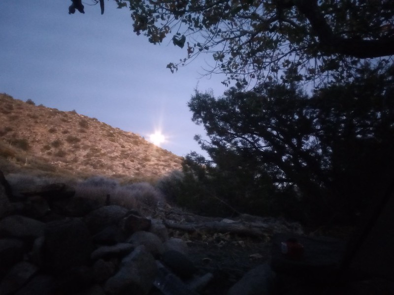
Moonrise over Villager, taken during my last night camped near my car.

This was my 4th trip to the valley. My goal this time was to reach the spring at Nicholias Canyon so that I could stay an extra night and explore more of the area. Unfortunately I didn't choose a very good route. I started up the drainage that branches left just below the area called Cottonwood spring on the topo. This worked well for about a mile until the drainage because too choked and I climbed up the bank to the left and started going cross country toward the hill spur that Schad mentions. At this point the going was too slow and I had gone through half my water supply, so I had to turn back.
After reviewing Google Earth, for my next attempt I plan to take Alder Canyon to 33 27 59 -116 24 02 and work north from there. I welcome any suggestions about whether that's a good route.
Happy Haloween
 |
10/31/2020
Topic:
Photography
Brian
|
Great pics, Buford. I'm overdue for a new camera. My Canon point and shoot has served me well since 2009, but it took a spill a couple weeks ago when it was in my pocket and I slipped on a trail in Death Valley. Hasn't been the same since. |
11/1/2020
Topic:
Rockhouse Valley
Brian
|
rockhopper, yes the idea of doing the trail to Martinez is fascinating to me as well. Honestly it's probably beyond my capability at this point. I wish I had started doing this stuff when I was younger. |
11/1/2020
Topic:
Rockhouse Valley
Brian
|
thanks for the info, Scooter. I'm planning on another attempt in late Feb or early March, but now you've got me wanting to go back right away! |
11/2/2020
Topic:
Rockhouse Valley
Brian
|
Rocko1 wrote:
Thanks. I was considering a couple day solo trip but will prob. wait to find someone to go with.
I will be going back, just not sure when. I'm up for discussing it with you if you're interested. |
11/3/2020
Topic:
Rockhouse Valley
Brian
|
dsefcik wrote:
Great TR, thanks for sharing. You can drive around the lake now where the quarry used to be so you can bypass any lake water. All of the mentioned routes will work and using the old maps on caltopo will work for sure. Really, just head out towards the base of the 'Rosa mtns and you should run into ducked trails and the route up Alder/Nicolias via the wash will also work. Yes, there is a dry fall to climb but not hard. There are many posts here on RHC so be sure to check them out also!
Thanks for the info. I have read the previous posts about the area and that's definitely one of the things that has made me want to explore it more.
As for the lake, when I was there in March I was returning from a trip to Box Canyon and decided to swing by there to take some pics. I wasn't making a serious attempt to get up Rockhouse Road, but I did explore that area to the left and ended up at a dead end. Now that I look at it on GE I see the bypass you're talking about. I have a feeling I ended up at 33 20 14 -116 18 03.5 and somehow missed the spot where I should have branched right. |
11/8/2020
Topic:
Election Week 2020 Hiding In The Desert
Brian
|
Great trip report. I would do the same thing on election week if I didn't have a birthday in the family that I can't miss. |
11/17/2020
Topic:
Rockhouse Canyon 2 Days
Brian
|
This was my first time successfully making it to the cottonwoods. Couldn't have done it without Rocko1's motivation (not to mention excellent route finding through the tough stuff).
Thanks to Scooter also for the advice. |
11/18/2020
Topic:
Rockhouse Canyon 2 Days
Brian
|
dsefcik wrote:
Not saying this is what voices you heard but there are many illegal grow sites in that area. They should be dormant at this time of year but not so much a couple of months ago.
Are illegal grow sites still happening since legalization? I assumed they weren't, but if I was wrong it's something I would definitely keep in mind for future trips. |
11/18/2020
Topic:
Rockhouse Canyon 2 Days
Brian
|
Buford wrote:
Cool report. Definitely a good area to explore. Was the bucket still at Nicholias Spring for water gathering?
Anywhere there is water or a spring is a potential grow site. I have run into a couple in various places.
The Cottonwoods sure get cold as they are in a frost pocket. My trip up there a couple years ago our sleeping bags were covered in frost and ice.
Hidden Spring had standing water a couple weeks ago if you poked around in the brush. Not enough for human consumption and pretty muddy.
Yes, the bucket is still there!
The frost pocket thing might explain why the low was about 10 degrees less than what my point forecast from weather.gov had suggested it would be. |
11/19/2020
Topic:
Martinez Mtn. Snow
Brian
|
Question for rockhopper or anyone else who visits Martinez Canyon:
Is there a source of info to find out if the gate at 68th and Van Buren is open or closed?
And if it's closed, is there any other access point for a vehicle to drive into the canyon?
Thanks. |
11/20/2020
Topic:
Martinez Mtn. Snow
Brian
|
update: BLM says the gate is closed but not locked. |
11/21/2020
Topic:
Martinez Mtn. Snow
Brian
|
thank you for the details rockhopper! |
11/23/2020
Topic:
Roost Benchmark
Brian
|
Nice trip report! I'd never heard of Roost. |
12/7/2020
Topic:
Cactus Spring trail
Brian
|
My plan this weekend was to do an overnight to the Jack Miller cabin in Martinez Canyon. I had emailed BLM to ask if the gate at 68th/Van Buren would be unlocked and they told me it would be. I got there and it was locked. I don't think this was in response to the recent shutdown. The lock looked like someone had tried to pry it open, so I imagine it's been there a while.
Plan B was the Cactus Spring trail. I has done it as a dayhike 5 years ago. This time I had my tent and decided to see how far in I would get. That turned out to be not very far. I had forgotten about the steep section climbing out of Horsethief Creek. That plus my late start meant I ended up camping in Little Pinyon Flat near Cactus Spring. Still a great trip and I was glad to revisit the area.
Toro Peak was visible from my campsite but I managed to block it behind a tree in this shot

Several sections of trail are deeply worn


As near as I could tell, this is Cactus Spring

A couple more views of the trail


Looking down on Horsethief Creek and a pic at the creek. There was better water at the trail crossing but I was glad I didn't need to fill up as there was a group letting their dog play in the water.


edited by Brian on 12/7/2020 |
12/8/2020
Topic:
Carrizo Creek
Brian
|
Nice trip report. I visited the old stage station for the first time last year (didn't seem like any of it is original - and I think I read somewhere that it isn't). I've also camped at the bottom of Canyon Sin Nombre. Nice area but I've learned to expect a ton of condensation in the tent. |
12/10/2020
Topic:
Whale Peak Via Little Blair Valley North
Brian
|
I remember scoping out a similar route on a map 10 years ago, back when I had to figure out alternate ways of doing hikes that required 4WD/AWD to get to the trailhead. But then I ended up doing Whale the usual way with a friend who had an outback. Never got around to doing any of the alternate routes, but that looks like a good one. |
1/6/2021
Topic:
Fish Benchmark and Eagle Benchmark
Brian
|
Here's a trip report from a guy who did Eagle in November. I haven't done anything in that area but it's now on my (very long) todo list.
https://evanquarnstrom.com/2020/11/11/socal-desert-explorations-fish-creek-mountains/ |
1/10/2021
Topic:
Death Valley Trip 12-2020
Brian
|
Great pics. I went to Death Valley in October. Managed to pick a weather window that wasn't too cold for Telescope Peak nor too warm for the Racetrack. Right now it definitely looks to be on the cold side for a fair weather camper like me. I'm going to be watching the forecast for another window this spring.
edited by Brian on 1/10/2021 |
1/11/2021
Topic:
Death Valley Trip 12-2020
Brian
|
Scooter, that sounds amazing. There were a lot of people on the trail to Telescope in October. Probably a lot less in August. |
1/24/2021
Topic:
Villager Peak
Brian
|
Great pics. Is that Rockhouse Valley that's visible in the 5th one? |
1/24/2021
Topic:
Villager Peak
Brian
|
rockhopper: yes I meant the thing on the right. After looking at Google Earth I think it's the flat at the base of Dawn's Peak. Not sure if that's considered part of Rockhouse or not. |
1/24/2021
Topic:
Villager Peak
Brian
|
Scooter: I did Granite a couple weekends ago with Rocko and that nearly killed me.
(OK that's an exaggeration. But I'm still not ready for Villager) |
2/2/2021
Topic:
Rockhouse Canyon 2 Days
Brian
|
Zegna140 wrote:
Cahuilla trails run throughout RHV, to the Nicolias village then west down to the creek, past the funeral site and then further west towards the Santa Rosa Indian Reservation. Last week, I wanted to get into the middle of the storm so I hiked up to Old Santa Rosa, 5 hours from Hidden Spring, and spent the night in the snow. Beautiful. The trail from the first set of ruins to OSR follows a wash just past the last rockhouse. Or you can head over to the "Pottery Making Camp" which is at the base of the Santa Rosas where the old trail goes up and over the mountain to Martinez Canyon. There's a year round spring and nice little campsite at the PMC. Used by Indians, cattlemen, miners, hikers for centuries. Morteros nearby. Pottery shards. The descent into Martinez is rather un-Indian like-- it basically follows an arroyo that is, miraculously, for the east side of the Santa Rosas, pretty gentle. Found some painted pottery pieces along that route a few years back. From the PMC, the trail heads to Old Santa Rosa and from there it's about an hour to Nicolias, all on deeply rutted, well marked Indian trail. Mortero sites along the way as well as an occasional shard. That waterfall section you guys ran into is one of the most difficult parts of RHV! Ahhh, just thinking about RHV, I think I'll head back again this weekend.
Zegna140 thanks for all the good info! That must have been amazing to be in OSR in the snow.
I had been unsuccessful in a previous attempt to get to Nicholias when I followed the route in Schad's book (basically cross country from the lower ruins to the point he calls the knob which forms the eastern boundary of Nicholias). That stretch was very overgrown and I found it much more difficult to deal with than the waterfalls. Glad to know that's as bad as it gets though!
We had planned to visit the spring that I'm pretty sure is the PMC site you mention. Didn't get there for lack of time, but I definitely want to check it out on a future trip. The route from there to Martinez has always intrigued me but is probably beyond my ability. I was in Martinez canyon yesterday and just the hike to the cabin was hard for me.
edited by Brian on 2/2/2021 |
2/2/2021
Topic:
Martinez Canyon to Jack Miller cabin
Brian
|
I hiked Martinez Canyon to the Jack Miller cabin Sunday and Monday. As with a previous attempt, the gate at 68th and Van Buren was locked. I had emailed the BLM about this and they told me it should be unlocked. So I didn't feel too bad when I found a way to drive around it this time.
The section where the canyon narrows and it's choked with reeds took me longer than expected and my pics suffered as a result. I reached the cabin just after dark and planned to take pics in the morning. But I woke up to the sound of rain on my tent at 3:30 AM. That was NOT in the forecast and the fact I was in a narrow canyon and would have to downclimb a waterfall to get out had me worried. So I packed up and left before dawn and was only able to take some pics of the cabin with my headlamp.

Looking back at Valerie from the road

Most of the hike was over this type of rocky ground which was unpleasant and slowed me down. This is the number one thing that would make me hesitant to do this hike again. On the way out I met a couple ladies riding horses on the road and they told me they couldn't bring their horses very far into the canyon because of the rocks.

Tire tracks went a mile past what is supposed to be the wilderness closure to this spot, which seems to be someone's favored party location.

Snow on the 'Rosas, more rocks, and bones


My best attempts to take some pics of the cabin and surrounding implements in the dark


 |
2/3/2021
Topic:
Martinez Canyon to Jack Miller cabin
Brian
|
dsefcik wrote:
Bummer you had to leave in the dark..! It has been awhile since I have been out there, good to see some photos of the canyon and cabin. Thanks for posting...
When I found out about Martinez Canyon a few years ago, one of the few sources of info I could find was this: https://kathywing.smugmug.com/CaliforniaHikesandScrambles/California-Desert-Hikes-and/Martinez-Canyon-Jack-Miller/
It was interesting to see what had and had not changed in the 5 years since she did her hike. The road and the section with the reeds were both worse than she described (she suggests the road could be driven with 2WD which I think is no longer the case considering my AWD Subaru was losing traction). Also the area around the cabin is much more overgrown now. She has a pic showing a clear path to the door, which is now completely surrounded by brush.
The thing that hasn't changed is the inside of the cabin. I was amazed to look at her pics after having been there. Every coffee jar is in the same place. The same remnants of a blanket is on the bed springs. Even the same pair of shoes hanging from the rafters. It's like the outside world has changed but the inside of the cabin is frozen in time. Kind of eerie really. |
2/9/2021
Topic:
Summit Registers
Brian
|
I usually forget to look for registers. But I just got back from Warm Springs camp in Death Valley where I signed one. Not a summit but it has a register I couldn't miss as it's in a big metal box right outside the house. I only had to look back a couple pages to find an interesting entry. Not sure how legible this will be on a computer screen, but it's a guy talking about the time he stayed at Barker Ranch. In 1969 😳
 |
2/9/2021
Topic:
Martinez Canyon to Jack Miller cabin
Brian
|
tommy750 the spot where I think you found water (where it pools at the falls) was just a puddle that wouldn't have even been enough to fill a bottle. Thankfully I had plenty. There also wasn't any near the cabin that I saw. I noticed a couple spigots outside the cabin and I tried turning one of them on, but it was dry. Not sure if those ever work. |
2/11/2021
Topic:
book recommendations?
Brian
|
In a recent thread about Rockhouse Valley, Zegna140 mentioned the book Old Time Cattlemen by Lester Reed. I've seen this mentioned a few places and have been meaning to check it out. I'm wondering what other books people here would recommend. I'm especially interested in the intersection of geography and history. Basically how people have used the remote sections of land we like to visit.
Books I already have include Afoot and Afield by Schad (several editions over the years), Anza Borrego Desert Region by Lindsay, Marshal South and the Ghost Mountain Chronicles, and The Historic Backcountry by Wray. |
2/13/2021
Topic:
book recommendations?
Brian
|
Thanks for the recommendations rockhopper. I remember seeing an announcement about a hike with one of Marshall South's sons that may have been the one you encountered. It was advertised as the last time he would go to Ghost Mountain (probably true since I think he has since passed on). I could have gone to that and I regret that I didn't. |
2/14/2021
Topic:
book recommendations?
Brian
|
rockhopper wrote:
Brian, I remember it was about 10 years ago or so that I met Rider South on Ghost Mountain. Every one there was given a chance to talk with him after the talk. I was talking with him about the freedom and ability to explore the vast wilderness. Marshall Souths book is one of my favorites too. one of my favorite stories is "The lost Emerald mine of Rockhouse Valley". One of my favorite quotes is "Man struggles to grow beyond the primitive, and once he obtains all, he seeks the primitive in his leisure"
edited by rockhopper on 2/14/2021
10 years ago sounds right. That's about the time I started going to the desert after I had run out of new hikes to do from Schad's book that were closer to town. I knew enough about Anza Borrego then to know who Rider South was, but not enough to recognize what a unique experience it would be to meet him. |
2/15/2021
Topic:
Pyramid, Rosa Pt., Mile High Loop
Brian
|
Great pics. Another thing to add to my list. I could probably make it to Pyramid, if not the others. |
2/16/2021
Topic:
Martinez Canyon to Jack Miller cabin
Brian
|
tekewin wrote:
Thanks for the report and all the info. I want to get out to Martinez in the spring but I really need to study the roads and maps around there.
I knew from a previous attempt that the gate would probably be locked. After looking at Google Earth for a way in, my plan was to go to this point and then parallel the berm until it intersects with the road: 33.554738°N 116.192662°W
When I walked over to that point, it's no longer in the condition that GE shows. It's been filled in with dirt and boulders. There was some evidence of vehicles driving over it, but that would require a hefty jeep. I found a different way in that was more suitable for my Crosstrek. At 68th and Van Buren there are 2 gates at right angles to each other. The gate straight ahead blocks the road into Martinez. The gate on the right blocks a small section of road on the top of the berm. It's possible to drive around the gate on the right, and after only a few feet of driving on top of the berm there's a ramp that goes down the other side. The part that goes around the gate was no problem for my Crosstrek but might be too narrow for a full sized truck.
One other thing. On my hike out I encountered 2 ladies riding horses who said they ride there regularly. I later saw they had parked their horse trailers at the spot where I gave coordinates above. So I'm assuming that's the best place to leave a car for someone who doesn't want to drive in. It would be a 10 mile hike from that spot to the cabin. |
2/17/2021
Topic:
Canebrake Valley and The Santa Rosas
Brian
|
Is the Pepperwood Hiking and Dirt Bike Trail the one that starts in Cottonwood Campground? I haven't hiked it in years, but I remember it being too steep and slippery for a bike. Is it an official route for bikes now or was the group using it illegally? |
3/9/2021
Topic:
Chariot Mountain
Brian
|
I did a mountain biking route one time that went up Rodriguez Canyon, connected to Chariot Canyon Road, then down MVTT to close the loop. Looks like I basically made a big circle around the thing. Never been to the top though. |
3/10/2021
Topic:
Cougar and Sheep Canyons
Brian
|
Hi Scooter. Rocko and I just walked over the bypass road last week. Maybe he'll chime in too. The bypass isn't nearly as bad as it was years ago. At some point the park had it graded (and coincidentally started charging $10/night at Sheep Camp right after that happened). After it was graded I was able to drive it with a stock Crosstrek. But when we walked over it last week there are now some spots where I didn't think I would have enough clearance. Also 3rd crossing has a healthy amount of water at the moment. Not necessarily deep, but a long stretch.
Bottom line, it depends on the specific vehicle. The best advice I could give would be to walk it when you show up and have an alternate plan if it doesn't seem feasible. The rocky part starts about halfway up. When I drove it I parked in a turnout just before that and walked to the top of the hill to check the condition (this is also good to check if there's anyone about to come down - it gets a lot more traffic now than it used to). |
3/10/2021
Topic:
Cougar and Sheep Canyons
Brian
|
More specifically...
the stock Crosstrek has 8" of clearance. That might be enough if it was a vehicle with a lot of low end power that could always choose a perfect line around obstacles. I know from my previous trip up the hill that the Subaru doesn't have that sort of power. I had to keep my momentum up, which meant I couldn't always choose the perfect line. |
3/11/2021
Topic:
Coyote Canyon
Brian
|
Thanks for the trip report Rocko. One other note. We encountered 4 different vehicles driving in what should have been the closure area between middle and upper willows. When we reached upper willows we found the fence was completely gone and a roadway had been cleared through the willows in an area that used to be overgrown. Obviously someone has put in a lot of work undoing the park's work. And with no signage, it's possible that many who are driving in the closure area don't even know they aren't supposed to be there.
I sent the park a PM about this through Facebook and they told me they would inform the ranger. I'm hoping they take the opportunity of the June-September closure period to put up a new fence. If they don't, I think it's only a matter of time before people start trying to clear a path through middle willows. |
3/11/2021
Topic:
book recommendations?
Brian
|
Thanks for the suggestions dsefcik, I'm definitely into checking out the old radio programs.
And thank you ziphius for the link to the other thread. |
3/11/2021
Topic:
Coyote Canyon
Brian
|
Here are some older pics from some of my previous trips.
The fence at upper willows (RIP) 2016

The path through middle willows was well defined and marked with ribbon trail markers this time. It wasn't that way in 2017.

Catarina spring (2017). We couldn't get anywhere near it this time because of growth.

Back when Boulder Alley was bouldery (2009)
 |
3/12/2021
Topic:
Coyote Canyon
Brian
|
Buford wrote:
That is definitely a cool area. Thanks for the pictures. I too have had unfortunate experiences with drunk off roaders in the area.
There used to be a trail through Lower Willows but it has been closed for a while. Is it still closed? Or did the Willows take it over during the closure?
The trail through Middle Willows is supposed to be open to hikers, equestrian and mountain bike. Last I heard not much of a trail was left. Good to know it is marked if brushy.
Last time I was in this area was 2017. At that time there was a clear path through lower willows. Middle willows was passable but overgrown. Now the reverse is true. An easy path had been cleared through middle willows, though it still requires hiking in the middle of the stream. As for lower willows, google earth shows a clear path going through and Rocko had a GPS route that someone else had taken that agreed with the GE route. But the brush had welded itself together at several points, forcing us to go around the whole thing on the hillside. |
3/13/2021
Topic:
Sheep Hole Mountains High Point
Brian
|
I love hearing about areas like this that are new to me. |
3/15/2021
Topic:
Coyote Canyon
Brian
|
Scooter wrote:
Ok, one more question. Going to Cougar Canyon soon, I googled Cougar Canyon just to see if anything was new. Anza Borrego State Park in November of 2020 said the canyon was closed due to mountain lion activity !! Does anyone know anything about the details of the closure. Not a big fan of the big cats.
I remember seeing something about that on facebook at the time. Sorry I don't have any current info. |
3/21/2021
Topic:
Coyote Canyon
Brian
|
epolomsk, thanks for the info about lower willows. That explains a lot! |
4/1/2021
Topic:
some pics from Wednesday
Brian
|
That feeling when your waypoint is only a half mile away but you realize it's on the other side of a canyon that looks like this. "You descend the ridge you have, not the ridge you wish you had." I may be slightly misquoting someone.


 |
4/2/2021
Topic:
some pics from Wednesday
Brian
|
deborah: the bottom is BM "Corp" in Clark Valley. The far ridge in the pics (the one I had intended to go down but didn't) is the ridge that Schad recommends for an approach to Dawn's Peak.
There were probably better ways to descend the ridge I was on, but I started seeing cairns, so I figured at least someone had done my route before. |
4/2/2021
Topic:
some pics from Wednesday
Brian
|
That's basically what I was doing, but in reverse. I need to work on my cardio before I can attempt anything like Dawn's. |
4/2/2021
Topic:
some pics from Wednesday
Brian
|
dsefcik wrote:
Gary and I took the finger to the right in this photo and then stayed way right to come down almost straight in line with the trucks parked at Butler junction.
So that's how you beat me back to the car! When I looked at google earth after I got home I could see that would have been a better route than what I did. I saw some cairns leading down toward the deep canyon and followed them. It was a wild ride.
It was great meeting you and Gary too. The best part of my day in fact. |
4/2/2021
Topic:
some pics from Wednesday
Brian
|
Buford wrote:
Did you actually find the Corp BM? When I did 6582 a couple years ago we couldn't find the BM but didn't spend too much time looking. The rock art was easy enough to find.
The ridges in that area sure are steep.
I went right by the waypoint I had saved for Corp but I didn't look for it either. I was running low on water and ready to be done at that point. |
4/3/2021
Topic:
Box canyon to nicholias loop
Brian
|
epolomsk wrote:
Meant to say siphoned water at hidden, NOT box canyob
That was going to be my first question. I didn't think there was any water in Box Canyon. I've done parts of the route you describe, but not the part from the playas above Box to Butler.
Did you start at 3rd crossing? How did you close the loop? Or did you retrace through Box? |
4/3/2021
Topic:
Box canyon to nicholias loop
Brian
|
epolomsk wrote:
Btw, there is an old indian trail from playas to hidden. Its faint, and sometimes disappears,BUT the way down into Butler is very well worn and very well cairned.
I went down Butler about a month ago and saw the cairn at the bottom for that trail. I think some time I'll do that section starting from Butler just to see the section I haven't seen.
I have a hunch that the backpackers staying at Stifferino were much better prepared than the ones you encountered at Box. |
4/5/2021
Topic:
some pics from Wednesday
Brian
|
dsefcik wrote:
Unfortunately there are too many misc cairns out there, many of them only indicate someone else has gone that direction *at least once*. While they can be helpful in many routes I would not suggest following them if they do not seem like they are taking you in the right direction. One of the things I like about the desert is you can generally just head the direction you want to go and find a route.
I also chose the route I did because I could see from where I was that it was a viable route all the way to the bottom. Ironically, this means that by trying to play it safe I was going down a steeper route than if I had trusted the topo map. I'm still pretty new to going places that aren't well-used routes and this trip was a good reminder that I need to get better at topo map skills. |
4/13/2021
Topic:
Rabbit Peak Overnight
Brian
|
Impressive hike and impressive elevation gain! In all my years of hiking I've never paid much attention to the question of how much elevation gain is reasonable for me to attempt in a day. Now I'm starting to pay attention out of necessity. When we did Granite, that was reasonable for me. This one wouldn't be. |
4/13/2021
Topic:
Martinez Mountain and Sheep Mountain
Brian
|
I really like this area but have never gone further than Cactus Spring. |
4/19/2021
Topic:
Three days of Petroglyphs in the Santa Rosas
Brian
|
Great pics and report. I love hearing about the areas where most people don't go. 3 days is a tough one with no water source. |
4/21/2021
Topic:
Three days of Petroglyphs in the Santa Rosas
Brian
|
Is the beginning of your route the same trail that would be used for the Barton Canyon approach to Rabbit? |
5/3/2021
Topic:
Rattler
Brian
|
I used to hike with an iPod when they first came out in the early 2000s. Can't remember why I stopped but I agree it wasn't a good idea in retrospect.
Great pics!
edited by Brian on 5/3/2021 |
5/23/2021
Topic:
Coyote Canyon
Brian
|
Hi Scallopdiver. Sorry for the late response, you may have already done your trip. A couple general things: the canyon is closed N of 3rd crossing during the summer months (I believe starting June 1) and camping isn't allowed near Lower Willows or in the vehicle closure area between Middle and Upper Willows.
For a trip up the length of the canyon, the most reliable water would be at Middle Willows. There was water in Alder Canyon when we were there, but that's seasonal and may be dry by now. The route we took up the canyon followed the wash which is shown as a road on older topo maps. Following the present route of the road would add quite a bit of distance.
There is usually water in Cougar and Sheep canyons, but I haven't been to either in a few years so my info isn't current. For a weekend backpacking trip, an alternative to the trip we did would be a sort of loop around Collins Valley, hitting Cougar, Sheep and Salvador canyons and Middle Willows (where there is a good spot to camp right outside the closure fence). |
5/25/2021
Topic:
Coyote Canyon
Brian
|
I once tried to do that loop hike in the opposite direction, starting in Salvador Canyon and going up to the saddle. I could see some signs of where there had been a trail at one time but it was very overgrown and difficult to weave through all the spiky plants. I turned back before making it to the top. |
6/5/2021
Topic:
Carrizo Gorge 3 Day Backpack
Brian
|
Great pics. I have a second edition of Schad's book that describes a hike down the length of the gorge. It's not in later editions. My first desert hike was 30 years ago and I wanted to see the trestle. I knew about it since my grandfather worked for the SDandAE. Since the hike down the length of the gorge looked a little too ambitious, I did the Mortero Palms route and drove to the TH with my VW Beetle. Dos Cabezas road was in much better shape then. |
6/21/2021
Topic:
Fire in Upper Canebrake Canyon
Brian
|
tommy750 wrote:
Caltopo has a couple nice map overlays that help show what's going on with active fires. Here's a link centered on the Overland Fire: https://caltopo.com/m/GLS2 You may need to zoom out.
The aqua, terra and viirs labels are satellite names. Looks like the 20-30 mph west wind is driving it down the valley.
edited by tommy750 on 6/20/2021
Wow, that's a great map. I notice it shows past fires in the surrounding area too. |
7/4/2021
Topic:
North McCain Valley
Brian
|
Great pics. Now you're tempting me to do some high desert stuff. I've been concentrating on El Cajon MTN and other local hikes to try to get in shape for next desert season. |
9/17/2021
Topic:
Chubascos, Bees and Coyotes
Brian
|
I remember when the beach at Cabo looked like that and I remember thinking "it won't be like this for long."
Nice rig! |
10/10/2021
Topic:
Wind tower collapses in Ocotillo
Brian
|
I drove under a couple of them on Dos Cabezas road just a couple weeks ago. Glad it didn't fall on me. I wonder if the failure was in the structure or the foundation. |
11/19/2021
Topic:
Rockhouse 3 day
Brian
|
It has long been my goal to spend more than one night in Rockhouse Valley. Last season I made progress finding water sources. This was my first time combining them into a longer trip.
I did a couple day hikes in October, but this was my first backpacking trip this season. People who don't do this sort of thing often ask me if it bothers me to go alone and I have some stock answers (I carry a PLB, etc). While I usually don't feel a lot of anxiety, for some reason this time I did. But it worked out well and gave my confidence a boost, even if I am still worried about throwing out my back some day when I'm setting up my tent.
There was a mud flow down the entire length of Rockhouse Canyon that wasn't there last March. Must have been a wild ride during one of those summer thunderstorms.

This was at the mouth of one of the canyons. Not sure what this was used for.
I've always taken this pic facing toward the valley before. I think the rockhouse shows up much better with the hills as a backdrop.

The granny flat


This spring wasn't covered with as much brush as it was when Rocko and I visited last year.
Trail shrine?
Moon rise taken from inside my tent
My tent is strategically placed between the 2 branches that might squish me if they came down


I wonder what was in the little bottle


I had never noticed this before on a rock right across from Hidden Spring. Most of it seems to be names and the date 1936 and also (just out of frame) 1937
 |
11/19/2021
Topic:
Rockhouse 3 day
Brian
|
I didn't notice animal tracks in the mud but there were plenty in the sand. The cottonwoods area looked like a mountain lion highway, just as it did last year when Rocko and I were there.
On another note, I found a pair of glasses near 33.483192°N 116.403909°W (not that exact location, just that vicinity). If anyone here lost them, I've got them.
 |
11/20/2021
Topic:
Rockhouse 3 day
Brian
|
I've always parked 9 miles in, where Rockhouse Road bends to the right after the split with Butler. There was one time I tried to go further with my Subaru Crosstrek and that was a mistake. It would be nicer if I could visit the valley without doing that extra hour and a half of road walking, but it's not enough to make me buy a different vehicle. Probably. |
11/21/2021
Topic:
Rockhouse 3 day
Brian
|
rockhopper wrote:
Looks like you made first tracks into Rock house valley this season.
Someone else wasn't far behind. When I came out there was a truck parked at the road closure and no one camping there. I thought about the fact I hadn't seen anyone at the lower rock houses or while hiking out the canyon, and came to the conclusion someone must have come into the upper part of the valley the day after me.
Thanks for the info about the burial mounds. Super interesting! |
11/22/2021
Topic:
Rockhouse 3 day
Brian
|
Rocko1 wrote:
Great trip report Brian. I'd really like to get back out there. How well were the springs flowing? Also, did you hear any strange voices at the Cottonwood camp?-lol.
Even though I didn't include pics of it, my first night was at Stifferino. It was a slow but constant trickle and took me a half hour to full 2 1.5 liter bottles. So I guess 6 liters/hour. The one closer to Old Santa Rosa looked about the same as last year. It would work in a pinch but you'd need something to filter the algae. The spring by the cottonwoods was flowing well.
I didn't hear any voices at the cottonwoods (and I was listening for them!). There were tons of mountain lion tracks going past, around and through the campsite, so that had me feeling hyper-vigilant. |
11/22/2021
Topic:
Surf1div1 intro
Brian
|
Welcome to the forum.
I haven't been to Pinto myself, but I'm interested enough that I looked into the routes. With the exception of Valley of the Moon (which is probably the most difficult approach) you won't need any special vehicle because you'll be stopped by a locked gate before you get anywhere close to the area. |
11/22/2021
Topic:
Rockhouse 3 day
Brian
|
dsefcik wrote:
Cowboy camp spring (AKA stifferino) usually requires some maintenance, do you have any pictures of it?
I took pics when I was there in February (just before your trip) and didn't take new pics this time. In Feb the PVC pipe was clogged with mud and I did clear it out. This time there was a steady drip from the pipe. It's what I used to fill my mug. The pool above that is now covered with branches but seemed to be doing OK underneath that. I didn't stick my hand in because there were bees swarming all around. |
11/22/2021
Topic:
M. Miller's Boots
Brian
|
Very cool find. Did you start out from the Elephant Tree area, or Hapaha Flat? |
11/23/2021
Topic:
Surf1div1 intro
Brian
|
surf1div1 wrote:
Which gate are you referencing?
Both Myer and Davies are gated before you get into the valleys. This includes all the various roads into Davies. You can usually find the gates on Google Earth. Here's one 32.699341°N 116.006744°W (paste the coordinates into the search box of Goggle Earth).
I have been told the approach from Myer is shorter but involves some scrambling down a dry fall. The approach from Davies is longer but a straight road-walk.
edited by Brian on 11/23/2021 |
11/23/2021
Topic:
Surf1div1 intro
Brian
|
tommy750 wrote:
If anyone wants to head out there for a day hike, would be happy to join you. Parking on old Hwy 80 and crossing under I-8, heading up Boulder/Myer, it's probably in the 14 mile range rt
Tommy, if you're ever planning on doing it I would love to go. I've done that route from Old Hwy 80 to Myer Valley and looped back - doing a slightly longer variation of the route from Schad's book. So I know the area. Just haven't gone as far as Pinto. I didn't want to do that part alone. |
11/30/2021
Topic:
Jacumba hikers calendar
Brian
|
I'm not one of the organizers of this group, but I go on their hikes sometimes. Their schedule is public, so I think it's OK for me to post it here in case anyone is interested and doesn't use Facebook. I plan to go on next Saturday's hike. The description is vague, but based on what they've done in the past I think it's a plateau between Davies and Myer valleys.
 |
12/6/2021
Topic:
Jacumba hikers calendar
Brian
|
Some pics from Saturday's hike.


 |
12/6/2021
Topic:
Jacumba hikers calendar
Brian
|
32.710278°N 116.040343°W
It might be part of the Jacumba Wilderness. |